
It took four months for us to return to Cuxton, this time to attempt the majority of the leg from there to Detling, some 12.5 miles distant.
I knew we would be unable to complete the full distance, especially since we had a further mile from Cuxton Station to the beginning of the walk proper. So I was looking for an ‘out’ three miles or so before Detling, giving a walk of roughly ten miles in all.
There were no other stations nearby. We were walking on a Saturday but, unfortunately, many of the local buses seem to run only on weekdays. (The Arriva Bus website promised a service that Google Maps insisted was weekday-only but, as it turned out, Google Maps was correct.)
To be on the safe side, I had selected a potential early ‘out’, in the form of a bus stop on the A229, south of Bluebell Hill, holding a later bus stop, near the Cobtree Manor Park Golf Course, near Sandling, as fallback. The former would enable us to reach Maidstone; the latter, Gravesend.
Getting there was simpler. We travelled out via the fast train from St Pancras to Strood, followed by a short hop to Cuxton. We arrived shortly after 10:00, giving plenty of daylight in which to complete the walk.
There was blue sky and surprisingly strong sun, causing me to administer some of Tracy’s Factor 30. The heat faded in the afternoon, as the clouds on the horizon finally rolled in. There was a brief shower at lunchtime, but the afternoon was otherwise fine.
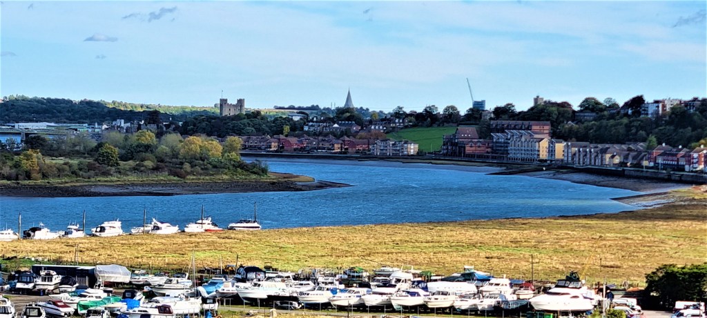
Because we were in such a hurry to finish the previous leg, we hadn’t appreciated that Cuxton Station lies adjacent to the Medway.
Although we were quite close to the Medway Bridge, which we would have to cross later, we first had to walk a mile back from the River, to reach the point where we finished last time. This was beside the garage of the last house on Bush Road, out of Cuxton, just shy of Lower Bush.

A footpath here took us up into Mill Hill Wood, above the railway line and then through Ranscombe Farm Reserve, behind Cuxton. Soon we were looking down on to the Medway Valley and the Medway Bridge below. We stopped on a bench for coffee before heading downhill.

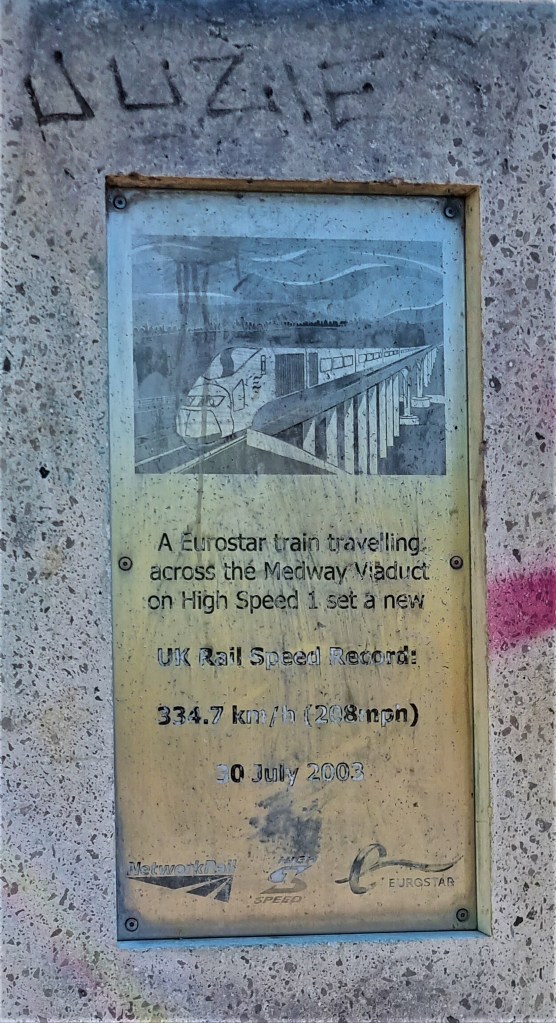
The approach to the Bridge is through scrubby land with little to draw or please the eye. We spotted this defaced memorial, recording a UK rail speed record, but little else besides.
The section across the Bridge itself is also quite disappointing. There is, of course, the constant flow of speeding traffic on one one side; there is also a fairly high wire fence on the other. I felt encouraged to complete the crossing quickly.
Borstal awaits on the other bank, though one merely sees the sign, before passing underneath the motorway, away from the prison and youth custody centre.
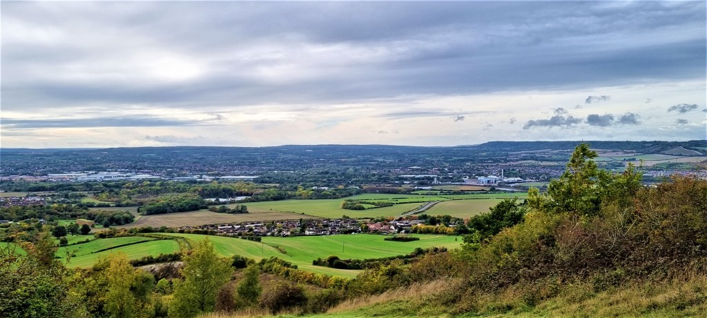
After reaching a cluster of buildings at Nashenden Farm, the route heads steeply uphill, into Nashenden Down Nature Reserve. Soon it is running roughly parallel with the Pilgrims’ Way, through a muddy woodland trail, disfigured here and there by flytipping.
We had earmarked as a likely lunch spot a picnic table promised by our guide book at Wouldham Common viewpoint.
But we found neither table nor viewpoint, so continued, plodding along the track, now called Hill Road, past Keeper’s Lodge and on to Burham Hill Farm.
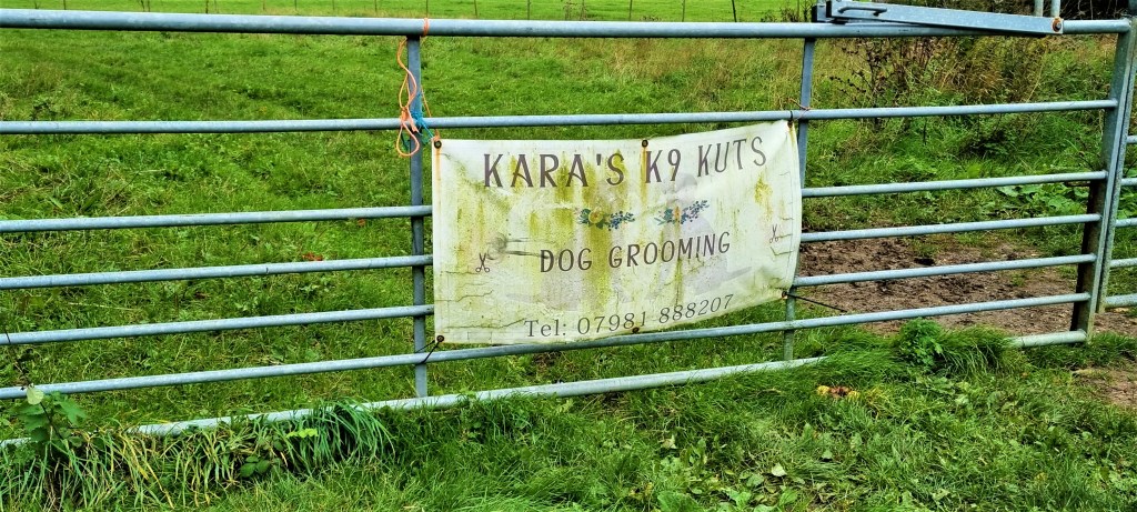
Lunch was now essential. We had begun to settle on a small triangle of grass when I spotted an old bench in the small field behind us. Since there were no signs declaring ‘private’, merely an advertisement for ‘Kara’s K9 Kuts’, we opened the gate, sat down three abreast and began to eat…
…Only to be interrupted by a woman, accompanied by a horse and two girls, who promptly asked us to leave.
This seemed unnecessarily harsh, as we were neither in the way nor causing a nuisance, but we nevertheless complied.
They stuck their horse in a neighbouring paddock, unsaddled it and then drove off in a big red car.
Eventually Hill Road became Common Road and we passed a pub – The Robin Hood – before reaching the village of Blue Bell Hill. Here we turned on to a footpath that took us round the side of the hill and on beside a picnic area.
We stopped to complete our interrupted lunch. Small aeroplanes buzzed overhead and, in the distance we could see a man wearing orange apparently balanced on a trapeze!

We eventually emerged on to a tarmac path beside the A229.
Our first bus stop, Salisbury Road, was on this busy dual carriageway, though on the other side, across a footbridge. It was evident, from the timetable posted there, that no buses ran on a Saturday, just as Google Maps had predicted.
So we retraced our steps, before continuing down Chatham Road and then taking the footpath that runs past Kit’s Coty’s House.
This is a door made of four huge stones, thought to be the opening of a Neolithic burial chamber.

The name derives from the completely erroneous belief that this was the burial place of Catigern, son of Vortigern, killed in battle against the Saxons around 455 AD.
The footpath continues for a while through countryside, before joining a road and then making its way back to the A229.
A subway gives access to the White Horse Stone on the other side, but we decided to save that for next time, following a path south for a few hundred metres to reach the Cobtree Golf Course stop.
Here we were more fortunate. A 101 Sapphire bus arrived after ten minutes and took us speedily to Gravesend Station.
We had to alight to buy train tickets through to Rochester, then climb aboard a rail replacement bus service.
From Rochester we picked up the high-speed train back to St Pancras and from there, via tube and train connections, reached home.
TD
October 2022


Leave a comment