In September we made it a hat-trick of Coast Path visits during 2022.
This time we began at Helford Passage, on the opposite side of the Helford ferry crossing from where we’d left off in June, and finished beside the industrial wasteland abutting Par Docks.
Our base on this occasion was the splendid harbour town of Falmouth. Our visit coincided with Falmouth University’s Freshers Week, which made the experience all the more lively.
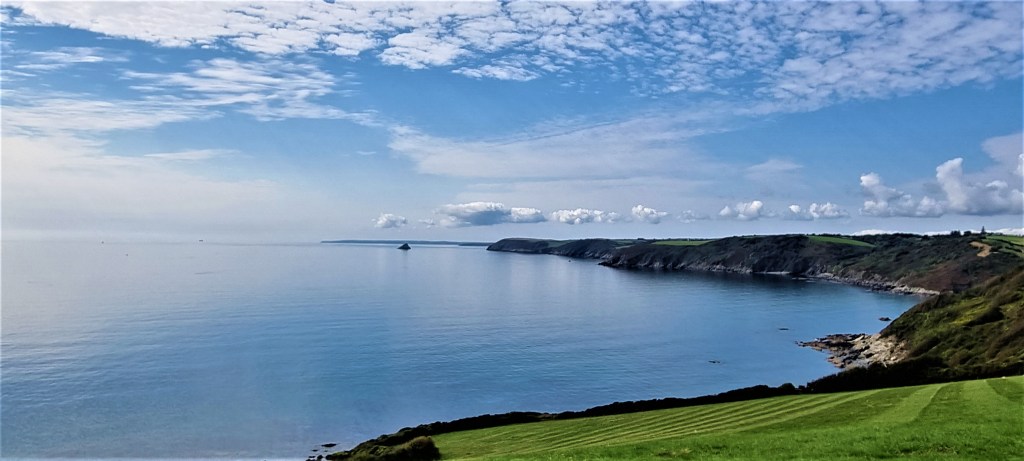
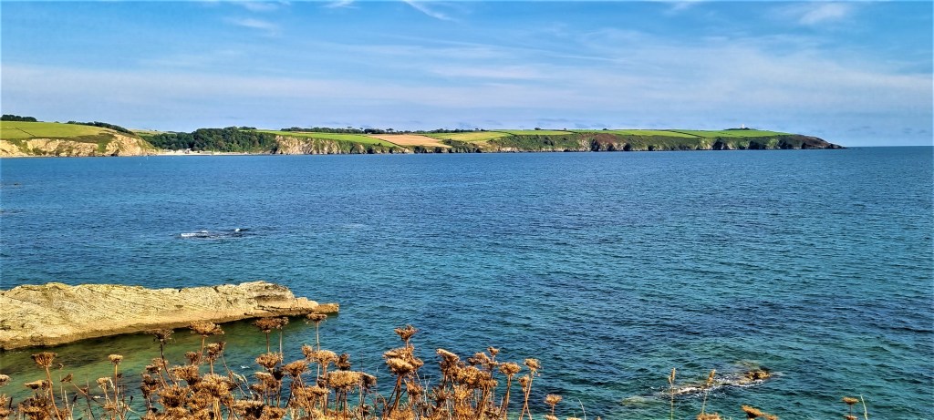
The contrast between quirky, youthful, bustling Falmouth and the beautiful scenic solitude of the coastline was profound, but I enjoyed both greatly. The sections around the Helford Estuary and St Anthony’s Head were particularly stunning. The weather was mostly excellent too.
Although there were, perhaps, rather fewer points of interest on this section of the coast path, I rate this our best trip yet.
Preamble
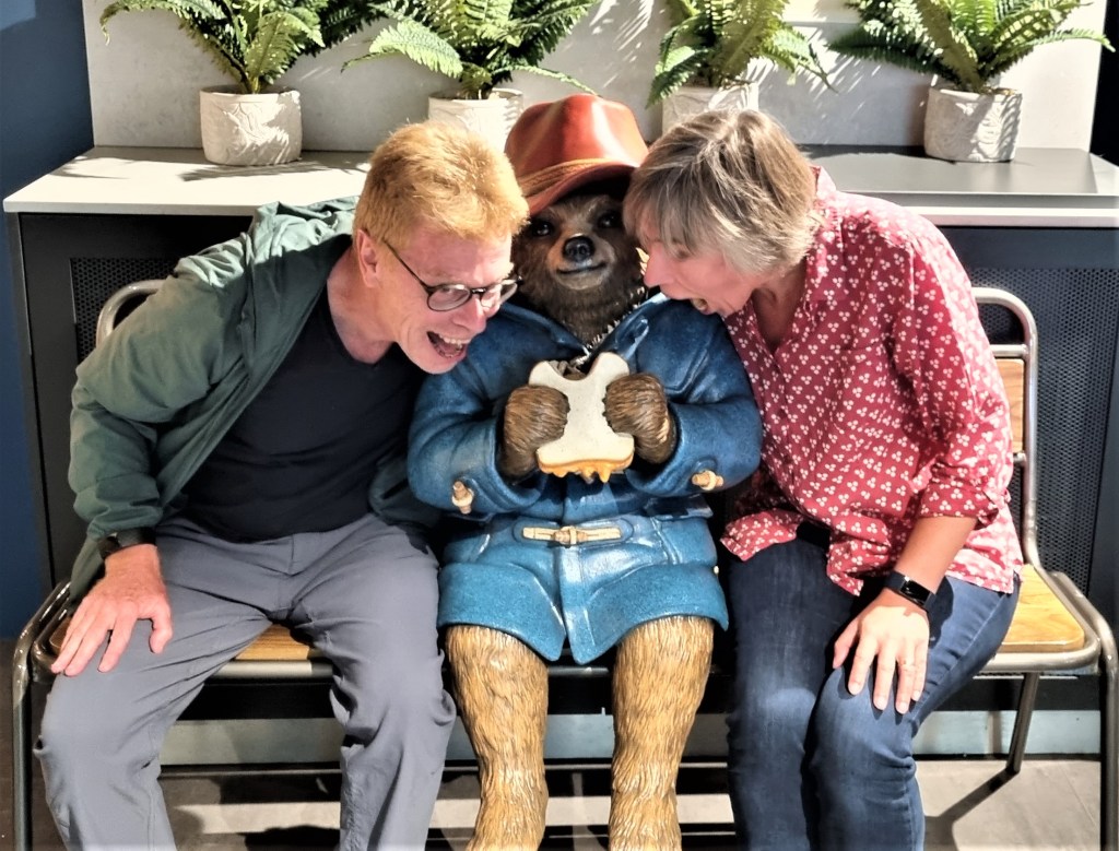
We departed for Paddington Station rather earlier than usual, heeding the warnings about crowds flocking to join the late Queen’s funeral queue.
Our Tubes were unusually quiet, however.
Paddington was far busier, but we found a corner in a new cafe, dedicated to the eponymous bear, and enjoyed a belated breakfast of coffee and pastries.
Another obliging tourist kindly took this photo!
We had considered deploying Seatfrog, to secure cheap first class upgrades on the train, but the reserve price was way above what we were prepared to pay.
Seatfrog has been a big disappointment thus far.
Arriving into Truro at around 14:20, we waited a while for the busy two-coach branch line service down to Falmouth.
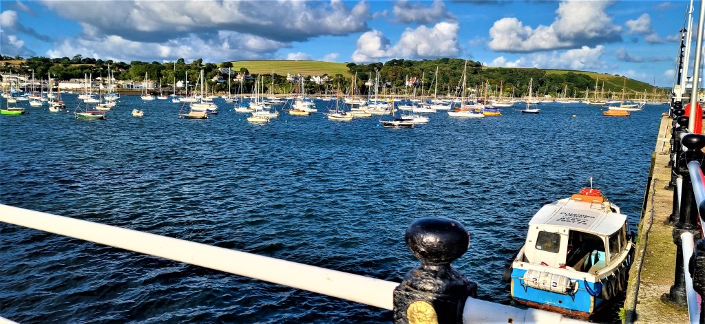
An hour later we had found our Air B&B in the upper part of town, roughly midway between the Prince of Wales Pier and Custom House Quay.
This cottage had just one bedroom and one reception, but was roomy and provided almost everything we needed, including a good supply of strong ground coffee and a bath for our aching limbs. There was even underfloor heating in the kitchen, and a tiny yard where we ate our breakfast.
We paid £635 to stay here, which we considered good value for this time of year.
But the decision to base ourselves in Falmouth complicated our transport arrangements, because most of our route lay on the opposite side of the Fal Estuary.
We were heavily reliant on the ferry service, so invested in money-saving Fal Mussel Cards, valid on ferries, buses and trains (but discovered that few bus drivers knew what they were).
Towards the latter stages, we found ourselves using the mainline rail service to return westwards because the buses were so scarce. And twice we had to resort to a taxi.
Our walking programme turned out this way:
- Saturday: Helford Passage to Falmouth (9.9m)
- Sunday: Place to Portscatho (6.2m)
- Monday: Portscatho to Portloe (7.4m)
- Tuesday: Portloe to Mevagissey (12.2m)
- Wednesday: Mevagissey to Par (officially 10.7m but, with the diversion, about 12.2m).
The official distance we progressed along the coast path is 46.4 miles. We have now completed 372 miles, leaving 260 miles outstanding.
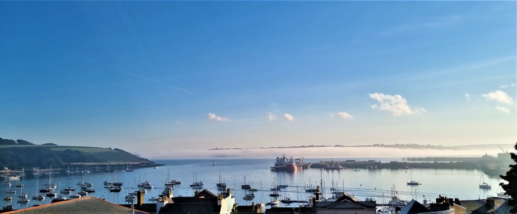
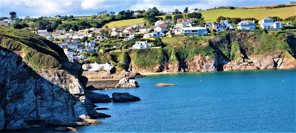
Falmouth
The name ‘Falmouth’ accurately describes the Town’s position, at the mouth of the Fal’s estuary, on the westernmost side.
On the opposite, eastern side there are two headlands, one containing the village of St Mawes, the other, further seaward, St Anthony’s Head. These are separated by the Percuil River.
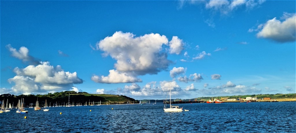
The lower part of the estuary is better known as Carrick Roads and forms the third largest natural harbour in the world.
There are no bridges for miles inland, though there are several extremely reliable ferry services.
The coast path, on reaching Falmouth, relies on two of these ferry crossings. The first goes to St Mawes; the second from St Mawes to a location simply called ‘Place’ on the northernmost side of St Anthony’s Head.
The path then continues around this headland and on up the coast.
The peninsula on which Falmouth is built is shaped something like a horse’s head. The nose is Pendennis Point, the location of Pendennis Castle, built by Henry VIII in 1540.
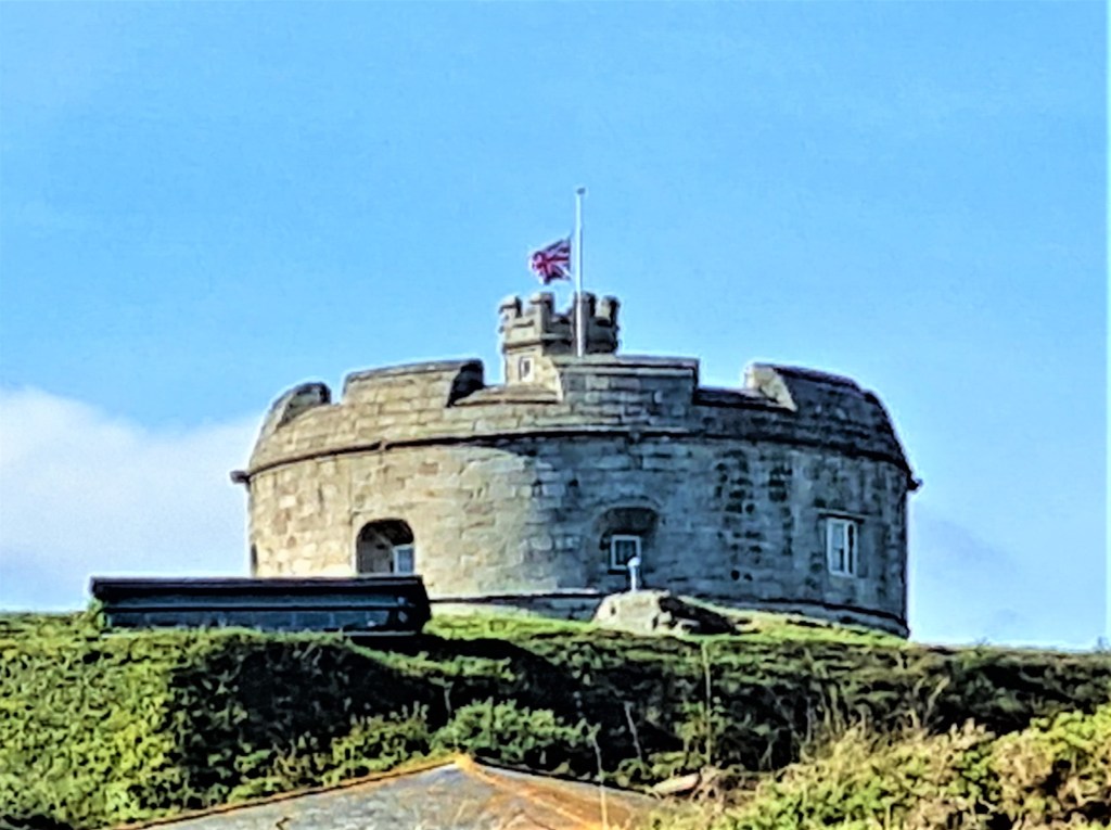
St Mawes also has its own castle, built at the same time, these twin fortifications defending the two sides of Carrick Roads.
Falmouth began to develop early in the Seventeenth Century, under the patronage of the Killigrew Family. During the Civil War they were staunch Royalists and Falmouth was given its charter by Charles II in 1661.
It became an important naval station, especially during the Napoleonic era, though the docks were not built until Victorian times. The railway reached Falmouth in 1863, bringing tourism and a degree of prosperity.
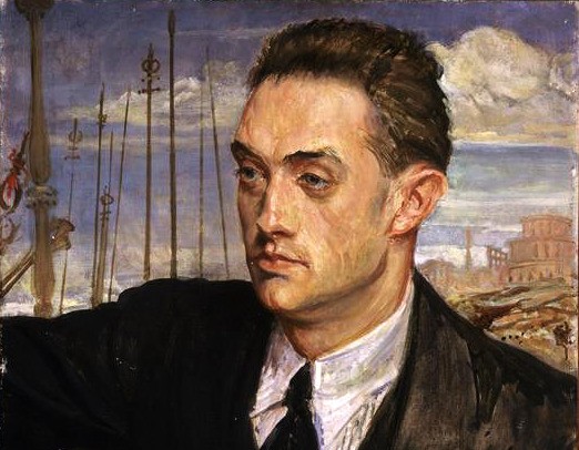
The young Joseph Conrad was stranded here for much of 1882, waiting for repairs to his ship, ‘Palestine’. He later used this experience in the short story ‘Youth’ (1898):
‘They towed us back to the inner harbour, and we became a fixture, a feature, an institution of the place. People pointed us out to visitors as ‘That ‘ere bark that’s going to Bangkok—has been here six months—put back three times.’ On holidays the small boys pulling about in boats would hail, ‘Judea, ahoy!’ and if a head showed above the rail shouted, ‘Where you bound to?—Bangkok?’ and jeered. We were only three on board. The poor old skipper mooned in the cabin. Mahon undertook the cooking, and unexpectedly developed all a Frenchman’s genius for preparing nice little messes. I looked languidly after the rigging. We became citizens of Falmouth. Every shopkeeper knew us. At the barber’s or tobacconist’s they asked familiarly, ‘Do you think you will ever get to Bangkok?’ Meantime the owner, the underwriters, and the charterers squabbled amongst themselves in London, and our pay went on…. Pass the bottle.’
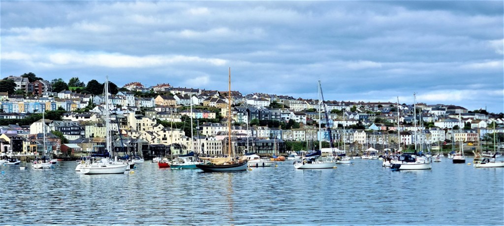
The Town is built along the steep slopes that rise up from the harbour and virtually adjoins neighbouring Penryn. The population was 23,000 in 2017.
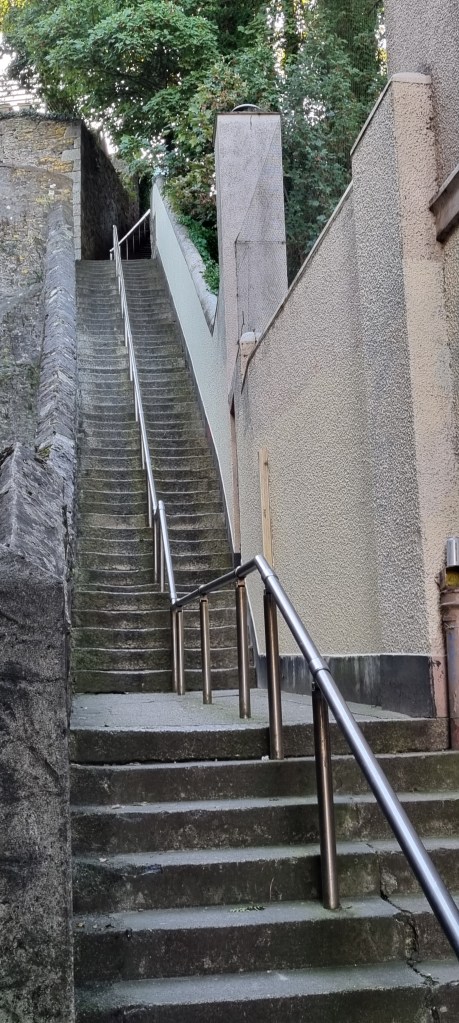
We often had cause to curse Jacob’s Ladder, all 111 steps of it, first built by one Jacob Hamblyn in 1791.
Falmouth University emerged out of the Falmouth School of Art, first established here in 1902. In 2008 it merged with Dartington College of Arts, becoming a fully-fledged university in 2012.
The student population helps to ensure that Falmouth has several interesting establishments in which to eat and drink.
Amongst those we visited were:
- Harbour Lights Fish and Chips, which supplied us with dinner on our first night in Falmouth;
- The Moth and the Moon, a pub with a decent range of beers and a rooftop beer garden.
- Beerwolf Books, a unique pub-cum-bookshop, with an equally fine range of beers;
- The Windjammer Cafe and Bar, where we had a tasty brunch while overlooking the Harbour;
- Amanzi African Restaurant, which we had pre-booked to visit on a busy Saturday evening. We had to wait ages even for menus to become available but the food, when it eventually arrived, was tasty and filling;
- The Orgia, where we had tapas and wine one evening, while listening to a playlist of largely unfamiliar funk which I greatly enjoyed; and, last but not least,
- Restaurant Four, which supplied our now traditional end-of-walk treat, in the form of their superb tasting menu with matching flight of wines.
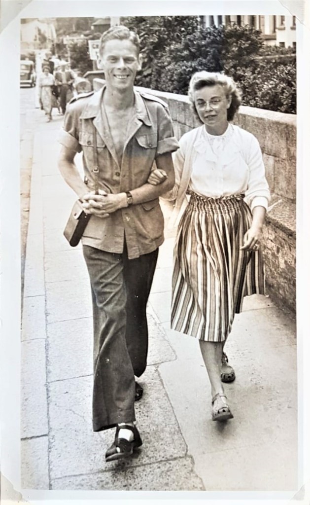
My brother set us the challenge of trying to find the exact spot where my parents were photographed when they visited Falmouth in July 1950. Mum had written ‘Arwenack Street’ in the album beside their snap.
We did our best, though much has changed in those 70 years.
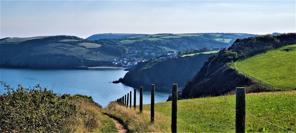
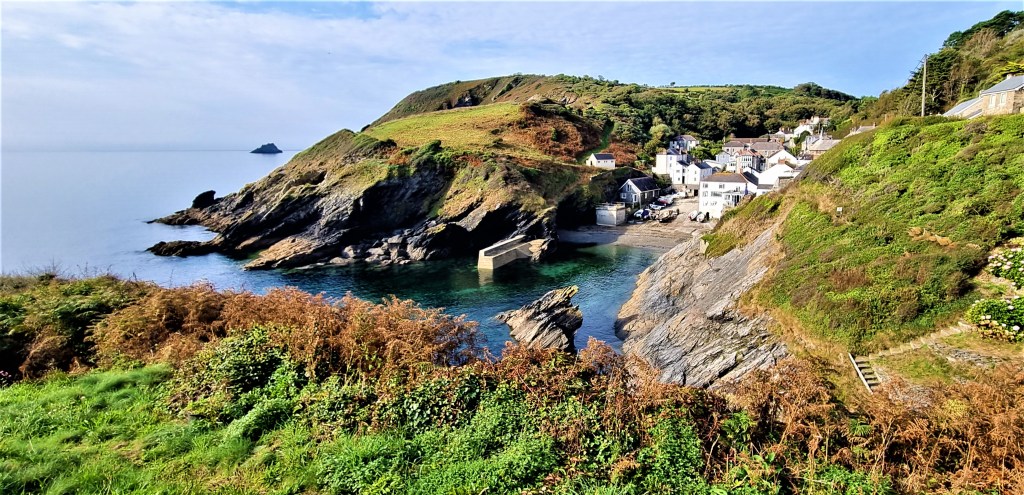
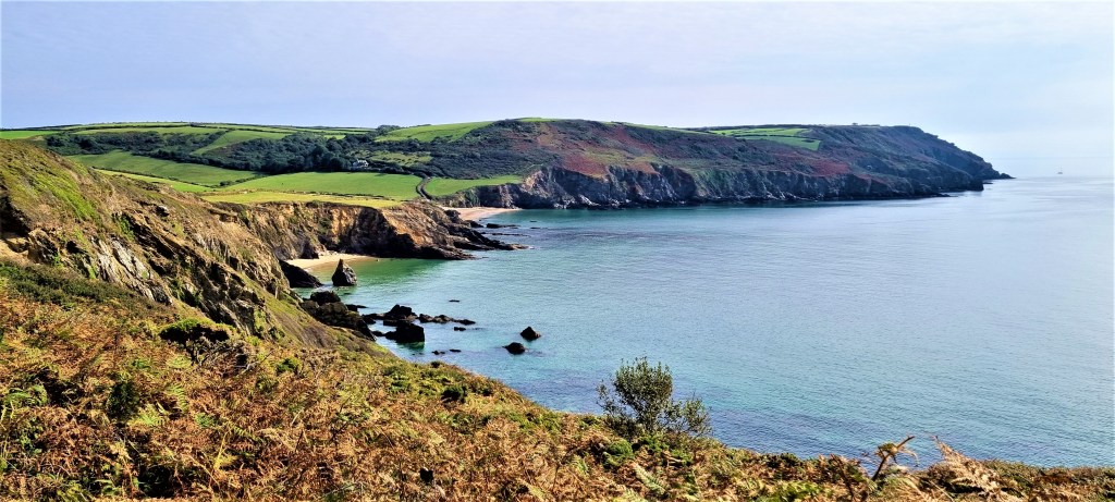
Saturday: Helford Passage to Falmouth
We descended Jacob’s Ladder in good time to join a small 35 bus. This transported us through beautiful sun-dappled country lanes, eventually depositing us at Helford Passage Turn some twenty minutes later.
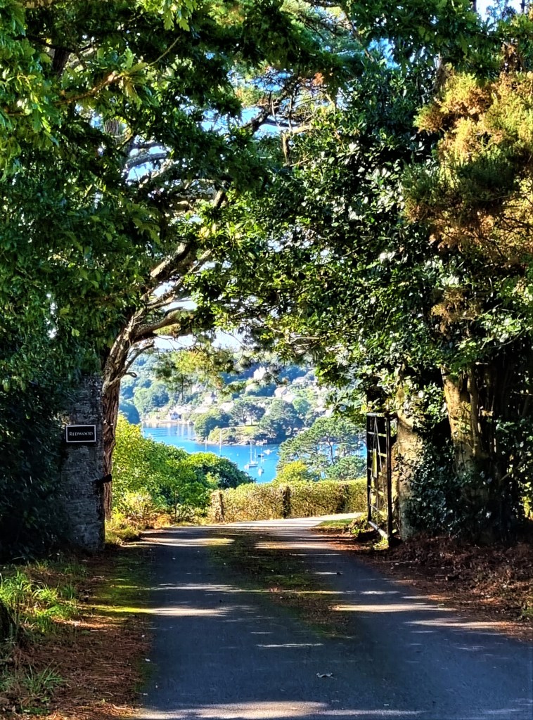
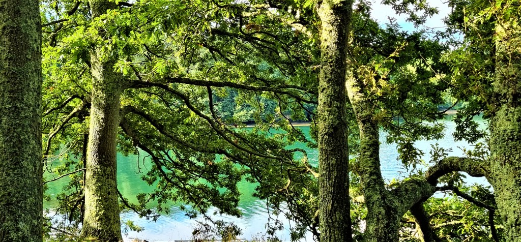
I took this photograph along a tree-lined avenue as we strode down the hill towards the Ferry Boat Inn and Helford Passage Beach.
Tracy, the arbiter on all points of contention, had ruled it unnecessary for us actually to catch the ferry across the Estuary, so touching the point on the other side where we finished last time.
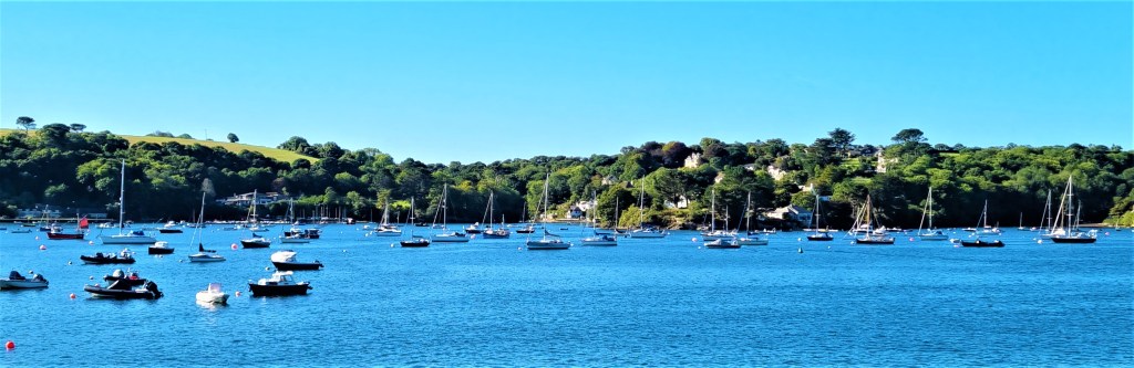
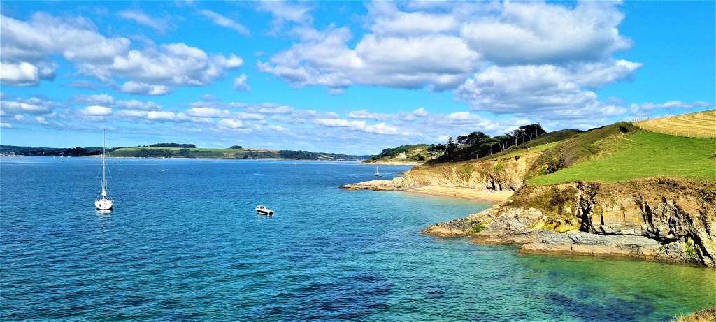
So we walked on, past the Inn, the ferry’s landing point on this side and a small line of cottages, to photograph the multitude of small boats, bobbing at their moorings below.
Then we reversed our steps, round behind the beach, heading towards Durgan.
Soon we were passing the rear of Trebah Garden and, on the other side, its private beach at Polgwidden Cove.
Both are fenced off from the coast path but, through the fence, we could see a light aircraft apparently crash-landed on the beach.
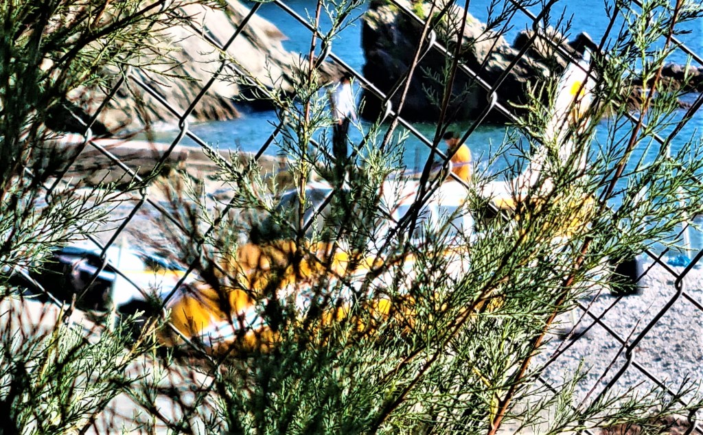
We speculated that it might be a prop associated with an imminent performance of The Tempest, a poster for which we had spotted while waiting for the bus in Falmouth.
By the time we reached the tiny hamlet of Durgan, we found ourselves discussing the ‘crash’ with several passers-by, some of whom weren’t entirely convinced by our theory, though it turned out to be correct.
On 1 June 1944, American troops from the 29th Infantry Division set off from Polgwidden Cove to take part in the Normandy Landings.
Durgan has some vague connection with Captain George Vancouver (1757-1798) who gave his name to the City and Island in British Columbia. He later retired to Petersham, near Richmond-on-Thames, where he is buried.
We continued towards Rosemullion Head, passing close by the graveyard of St Mawnan and St Stephen’s Church, parts of which are Thirteenth Century. The church tower is still used as a landmark by sailors.
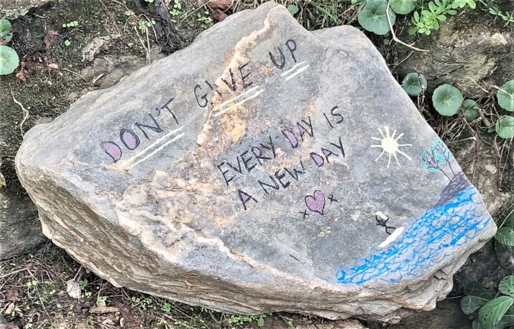
We passed a small stone, counselling us wisely:
‘Don’t give up. Every day is a new day.’
Rosemullion Head hosts twin shipwrecks, The Endeavour (in 1804) and The Alma (in 1895).
We stopped at Bream Cove, where the local hotel was operating a welcome coffee hut, the Bream Box. Here we secured a bench in prime position, looking seawards. It was not far short of lunchtime but my need for caffeine was more urgent.
Soon after resuming we reached Maenporth, a fine beach backed by an estate of holiday homes. A Scottish trawler, the Ben Asdale, was wrecked off here in December 1978, but today the sea was calm and tranquil.
We sat on an extremely low bench that had sunk into the sand just behind the beach, eating our sandwiches while admiring the view across to the Carrick Roads.
On the other side of Maenporth, advancing towards Pennance Point, we could see the squat round towers of Pendennis Castle in the distance.
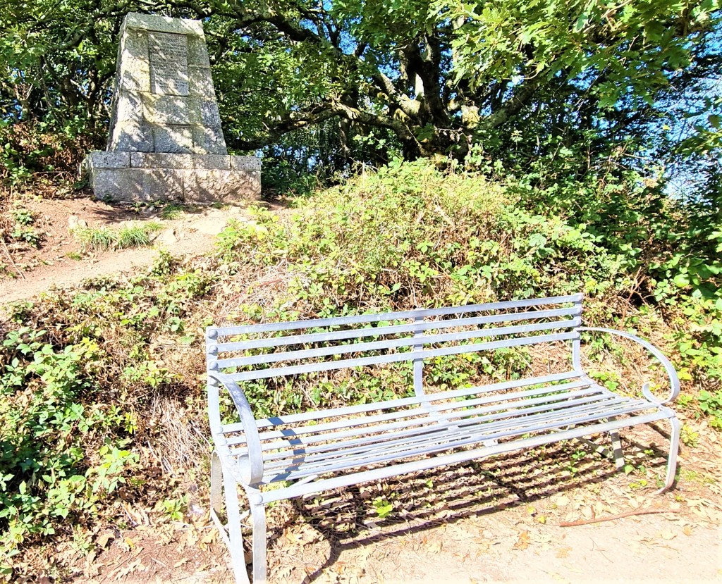
At Pennance Point there is a metal bench and a memorial to the men of Number 1 (Falmouth) Company of the Home Guard who:
‘…nightly patrolled this coast, armed and vigilant against German landings. Thus they watched 1000 dawns appear across these great waters which form our country’s moat.’
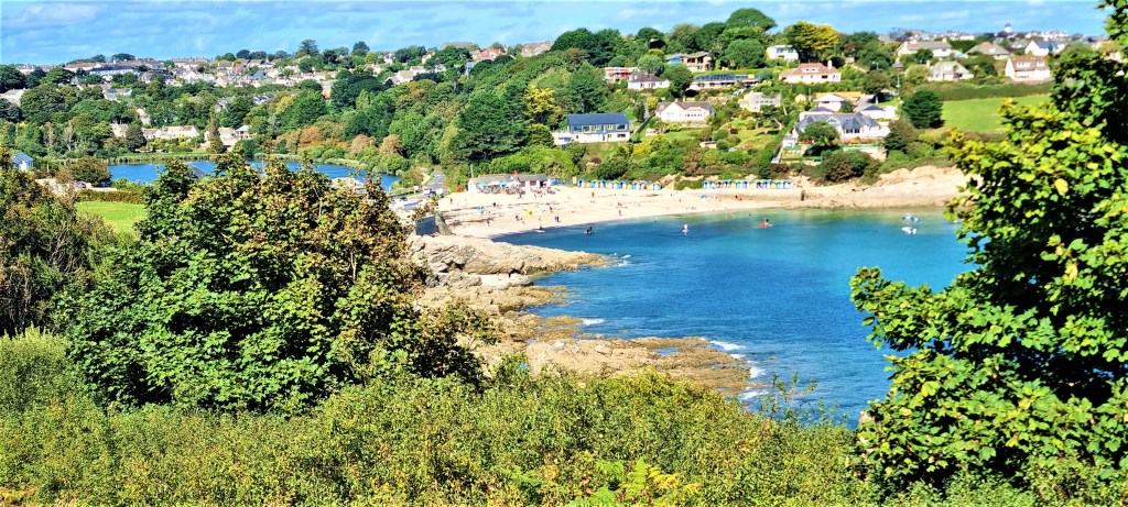
Before long we were emerging on to the road just above Falmouth’s Swanpool Beach. Immediately behind lies Swan Pool itself, a small coastal lagoon, separated from the beach by a shingle bar (as well as Swanpool Road).
Swanpool was basking in the mid-afternoon heat as we passed behind it, continuing past the beach huts and then on round to Gyllyngvase Beach (from the Cornish for ‘the shallow inlet’). This was busy with tourists and newly-arrived students, congregated in large groups.
The route now follows the length of Cliff Road, lined with hotels and holiday flats, until the turning into Castle Drive, which takes one round Pendennis Point, beneath the Castle and its grounds.
At one stage we decided to explore whether there was a path beneath the road, accidentally stumbling on what seemed a small camp of homeless people and hastily retracing our steps.
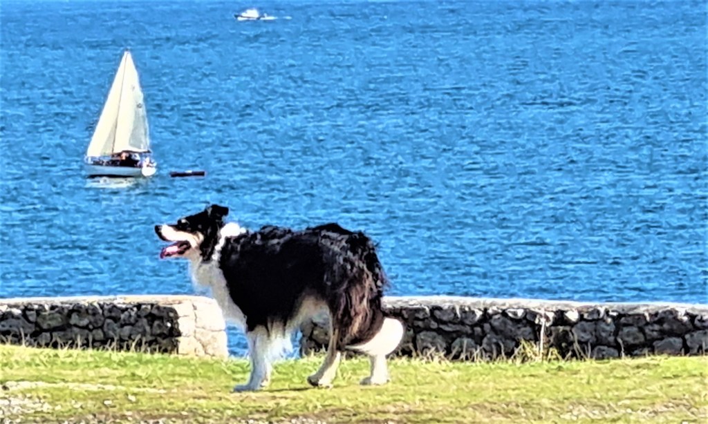
At Pendennis Point we decided it was high time for ice-cream. We watched the yachts scudding through the water, the antics of a dog nearby and a tug towing in what looked like a wreck with a digger perched on top.
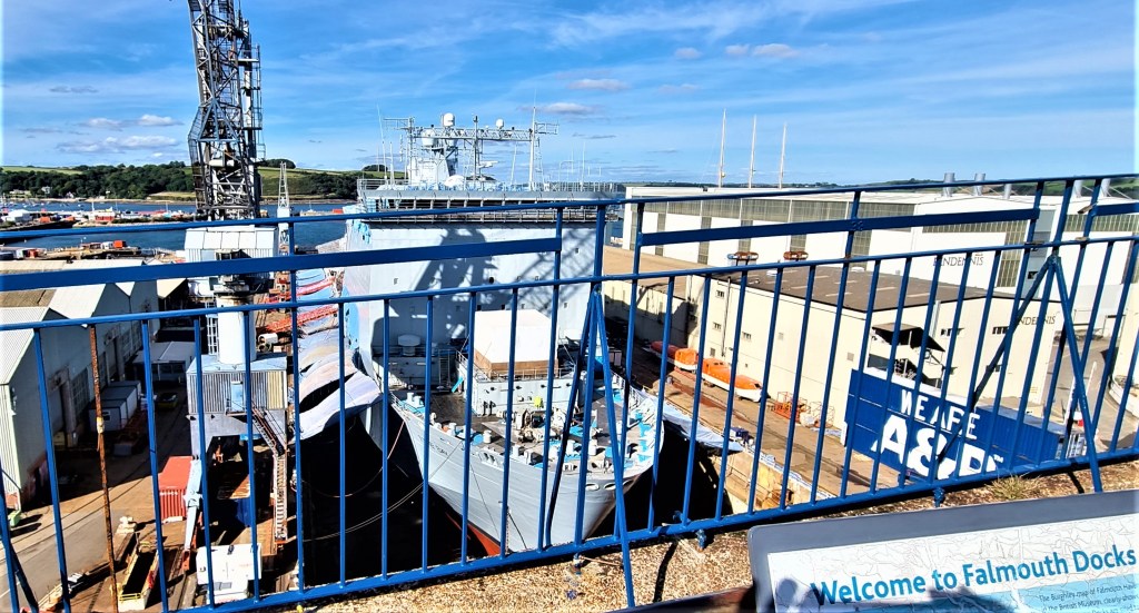
We followed Castle Drive round to Falmouth Docks and the Pendennis Shipyard, allowing this sign to dissuade us from following the most seaward route.
We paused to admire RFA Lyme Bay in dry dock – a coincidence, since the same ship is shown in the same place in our guide book, published in 2018!
Lyme Bay is a Bay-class landing ship dock of 16,160 tonnes. According to the Royal Navy, she completed her refit in 2018 but, four years on, she already requires a second refurbishment.
We concluded this leg by walking along the High Street, ending at the Prince of Wales Pier Landing.
Then it was back up Jacob’s Ladder for a well-deserved rest before dinner.
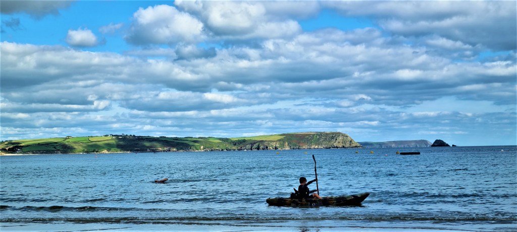
Sunday: Place to Portscatho
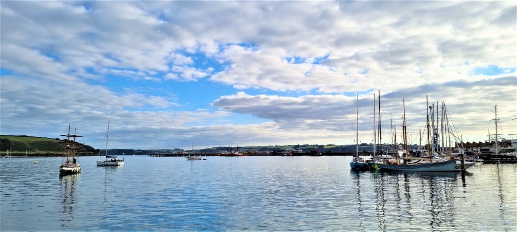
We arrived early at the alternative Custom House Quay pier, in order to ‘redeem’ our online Fal Mussel Cards, then travelled across to St Mawes on the 09:45 ferry.
It was a fine morning, but the cloud was still breaking over the Carrick Roads, which were glassy and still. Most of the yachts were firmly at anchor, only a handful already venturing out to sea.
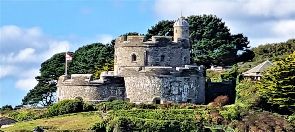
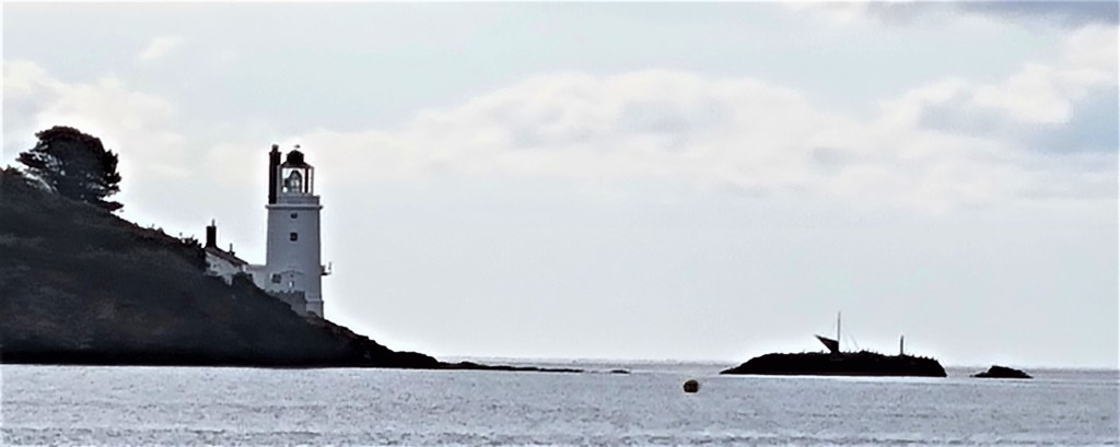
Drawing closer to St Mawes, we had an excellent view of its Castle and, a little later, St Anthony Lighthouse at the tip of St Anthony Head. First built in 1835, it wasn’t electrified until 1954, but is now automated.
Fans may recognise it as the Fraggle Rock lighthouse, at least in the UK version of that series. A cottage attached to the lighthouse is now available as a holiday rental.
There was only just time to order coffee from Cafe Chandlers on the quayside before joining the queue for the tiny 12-person Place Ferry, which took us the short hop from the harbour over to Place Creek, across the Percuil River.
The ferry was full to capacity, the young ferryman promising to return for a second crossing. He mentioned that he had been expecting a quiet day!
We were soon ashore beside Place Creek, sitting for a while on a bench in a wooded glade beside the jetty, enjoying the contrast between the green leaves of the trees and the green waters behind.
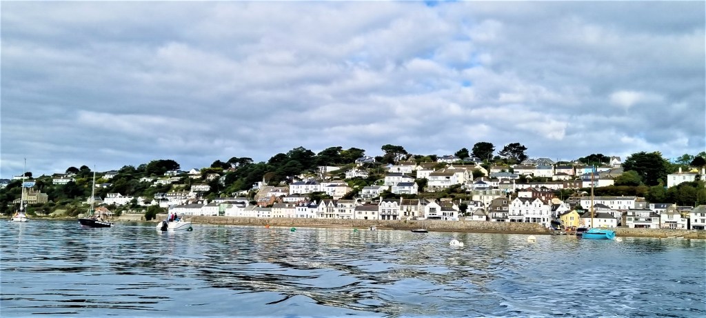
As we began walking, we could see St Mawes nestled on the opposite shore. Named after another Celtic saint, possibly Breton, possibly Irish, it was once a Parliamentary borough in its own right, though lost its MP in 1832.
I often confuse St Mawes with St Mawr, DH Lawrence’s 1925 novella about a woman who encounters a stallion of that name. They’re presumably named after the same saint.
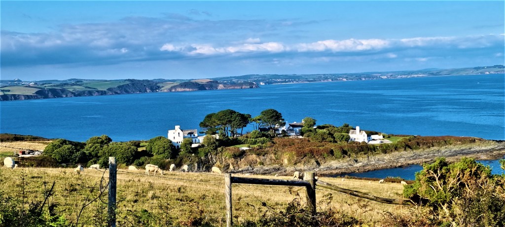
Soon our attention was drawn by Place House, an imitation French chateau painted pale yellow. It was built – possibly in the 1840s, or possibly the 1860s, depending which source one consults – for Sir Thomas Spry (1804-68).
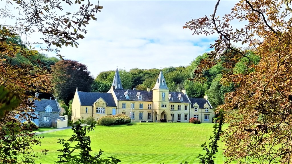
He was a Whig politician, scion of a long-established Cornish landowning family who had inherited the previous manor house from his father, Admiral Thomas Spry.
Place House was requisitioned during the War and later became a hotel. It seems now to be rented.
As we skirted round behind the House and its extensive gardens, the remaining clouds cleared from the sky leaving behind a beautiful morning.
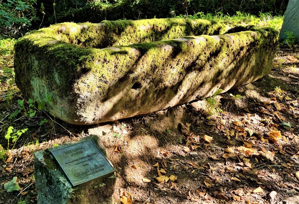
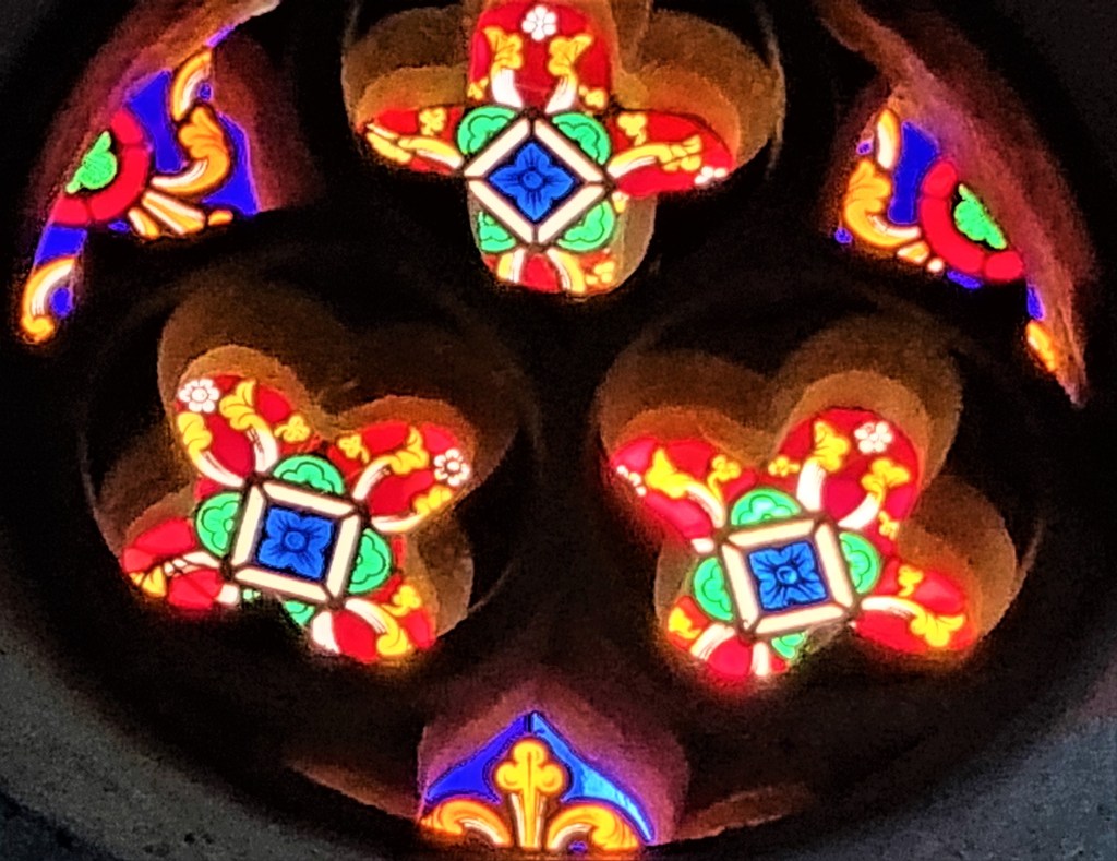
Entering St Anthony’s churchyard, we paused beside what is, allegedly, a medieval stone coffin, then admired the arch of the church doorway before entering the cool interior.
Parts date from the Twelfth and Thirteenth Centuries, though it was extensively restored by Sir Thomas Spry.
I was particularly struck by these quatrefoils.
We continued, passing behind Cellars Beach, where the Sprys once had their pilchard cellar, and out on to grassland, dotted with occasional groves of fir trees.
Soon we were above Great and Little Mollunan Beaches, where a few morning swimmers were enjoying their dips, framed picturesquely between the lighthouse to one side and St Mawes Castle to the other.
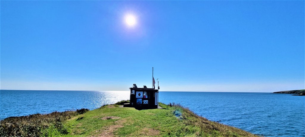
At St Anthony’s Head there are the remains of a gun battery. There were cannons placed here as early as 1796, but the firepower was enhanced in 1885 and again in 1904. In November 1939, two 6-inch guns were added and the battery remained operational until 1956.
It was acquired by the National Trust three years later. Some of the buildings have been repurposed as cottages, and there are also some handy toilets
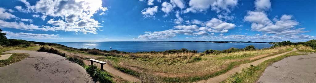
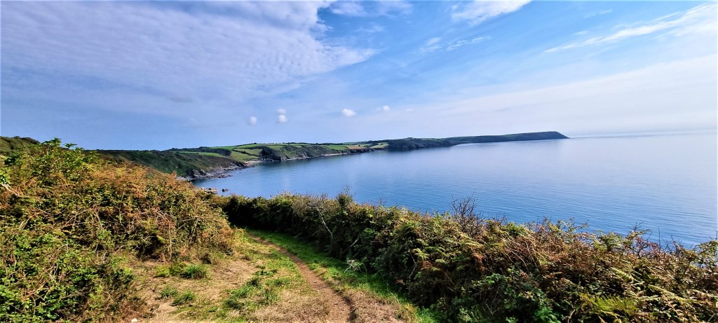
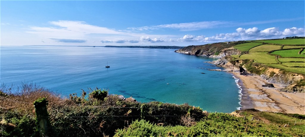
Rounding Zone Point, we continued in a north-easterly direction, enjoying the beautiful scenery unfolding ahead.
We took our lunch overlooking Porthbeor Beach, hoping in vain to see the seals and seabirds promised by the guide book.
After lunch we passed Kilgerran Head, Towan Beach and Greeb Point in rapid succession, arriving in Portscatho (apparently pronounced ‘port-scath-a’) some 75 minutes too soon for the next bus.
But we put this time to good use.
A friend had asked us to seek out a property called Scath that she and her late husband had holidayed in many years before. This we did, sending a photograph to prompt her nostalgia.
Then we went to sit on the beach, where I had a paddle while the local lifesaving club went through its paces. We were fortunate indeed to spot the discreet public conveniences behind the seafront coffee bar.
Then we hastened to the bus stop.
But here confusion reigned, since Google Maps had apparently invented a second, phantom bus stop, a few hundred metres up the road. I went in search of it, but failed to find anything resembling another bus stop.
We were back in St Mawes by 16:00, having time for a short stroll along Marine Parade before catching the 16:15 ferry across to Falmouth.
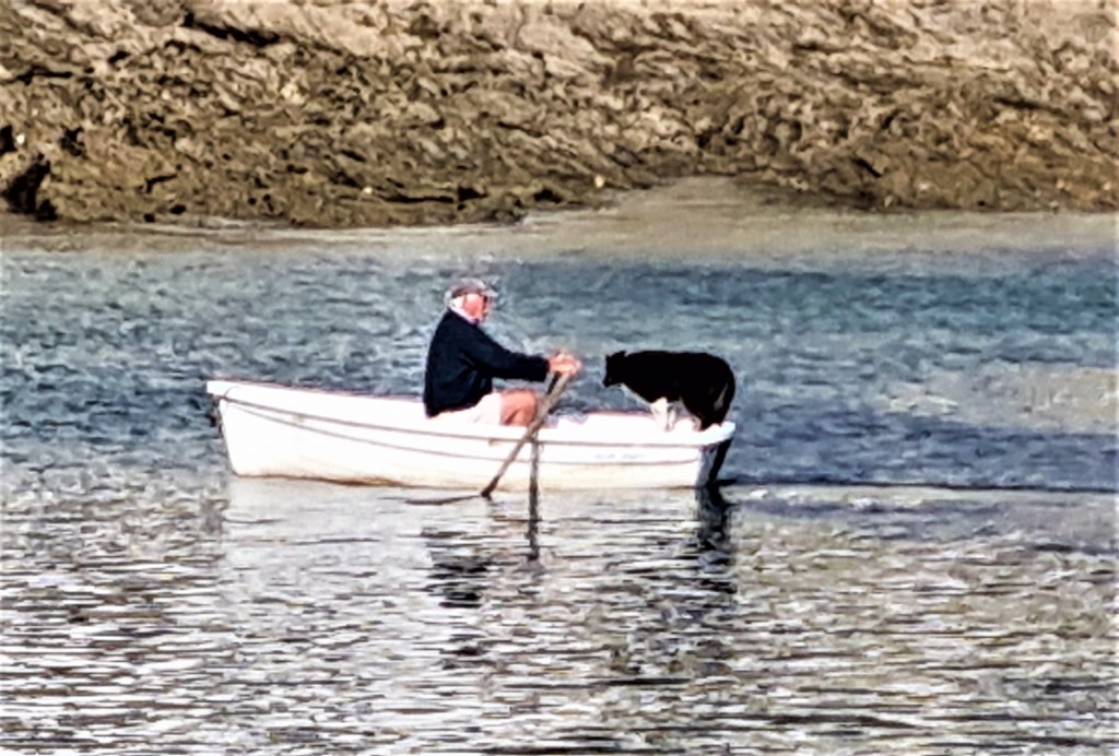
An elderly man rowed his dog across the Harbour as we left it.
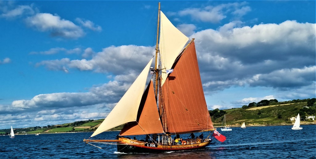
And, later on, we admired the beautiful Danish gaff cutter Eda Frandsen as she raced us into Falmouth.
Monday: Portscatho to Portloe
This was a particularly difficult day to plan, since an extra Bank Holiday had been declared to mark the Queen’s funeral and, consequently, most public transport was operating a second successive Sunday service. Most shops and cafes were also closed.
We managed to find a morning bus out to Portscatho from St Mawes, but there was no service returning from anywhere further up the coast within reasonable walking distance.
We weren’t at all confident that local taxi services would be available either.
The least worst option was to finish at Portloe, a walk of about seven miles.
If we could reach there by 14:00 or so, it would then be possible to route march inland for a couple more miles, catching a bus passing along the A3078. We identified a stop at a place intriguingly called ‘Bessy Beneath’.
This might refer to a witch buried at a crossroads or, more likely, it is a corruption of ‘bosveneth’, meaning a hillside dwelling.
So, after another ferry trip, we caught the morning bus from St Mawes. The weather was pristine again.
Arriving near Portscatho around 10:15, we were unsure whether our bus would descend down towards the beach, so got off at the top of the village to head down on foot.
We revisited the hidden toilets, though the Cafe next door was closed.
Climbing out of Portscatho, once more past ‘Scath’, we were soon abreast of Porthcurnick Beach.
We had high hopes of the cafe here, but sadly it too was closed. So we continued on round the headland, past the Pednvadan National Coastwatch lookout.
The team of 30 volunteer watch-keepers can see the radio masts of Plymouth on a clear day – some 30 nautical miles distant.
Soon we were crossing Porthbean Beach, almost deserted, before catching a brief glimpse of the hind-quarters of a Dartmoor pony.
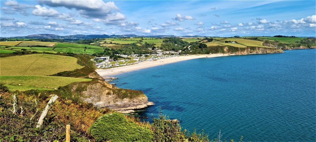
Then it was on down to the more populous Pendower Beach, where we were relieved to find an open cafe, the Shallikabooky Beach Hut.
We treated ourselves to a millionaire’s shortbread which we had with our coffee, sitting in welcome shade while overlooking the beach below.
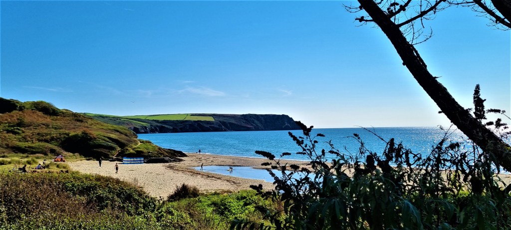
We next rounded the very posh-looking Nare Hotel (bed and breakfast for two in a double room with sea view will set you back more than £600 in high season) and then we were on the approaches to Nare Head.
The jagged rocks at Paradoe Cove proved particularly photogenic, so we lingered here a while before pressing on.
This is the location of Mallet’s Cottage, a ruined fisherman’s lair, probably uninhabited since the mid-19th Century. The final inhabitant is said to have emigrated to Australia, leaving his wife behind.
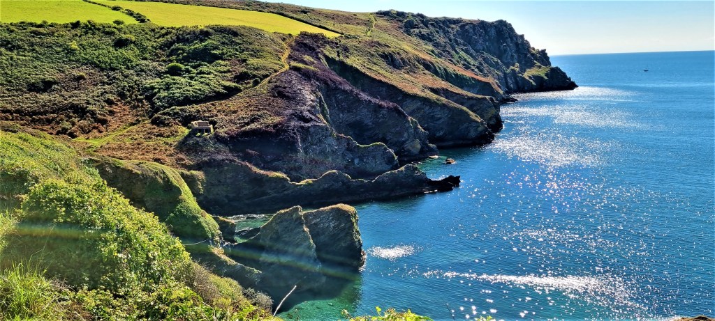
Lunch was taken perched on top of Nare Head, looking back across our morning’s walk, a truly vertiginous experience.
We could see distant yachts passing behind the solid lump of Gull Rock, a few hundred metres off shore. Far below us a tiny fishing boat looked like a toy. At first I enjoyed the view, then grew increasingly uncomfortable, so it was a relief to set off again.
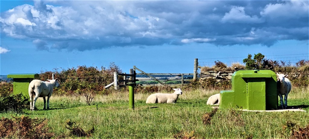
Immediately after lunch we came across the green-painted extremities of a bunker built in the early 60s for the Royal Observer Corps to monitor radiation in the event of a nuclear war.
A handful of sheep were posing around these ventilator shafts, looking dazed in the hot afternoon sun.
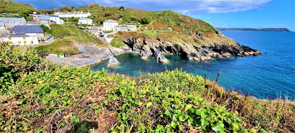
After rounding Kiberick Cove we were soon within sight of Portloe, its jagged shark-fins of rock protruding from the sea just offshore.
We passed beneath Broom Parc, used to film Channel 4’s adaptation of Mary Wesley’s ‘The Camomile Lawn’, and were soon descending into Portloe itself.
Betjeman described it as: ‘one of the least spoiled and most impressive of Cornish fishing villages’ and we would have liked to have sauntered round it for a while.
But we were very pressed for time, so instead began navigating inland to Bessy Beneath.
A local couple out walking confirmed we were on the right road, but claimed never to have heard our destination called ‘Bessy Beneath’, although that is what it says in the bus timetables.
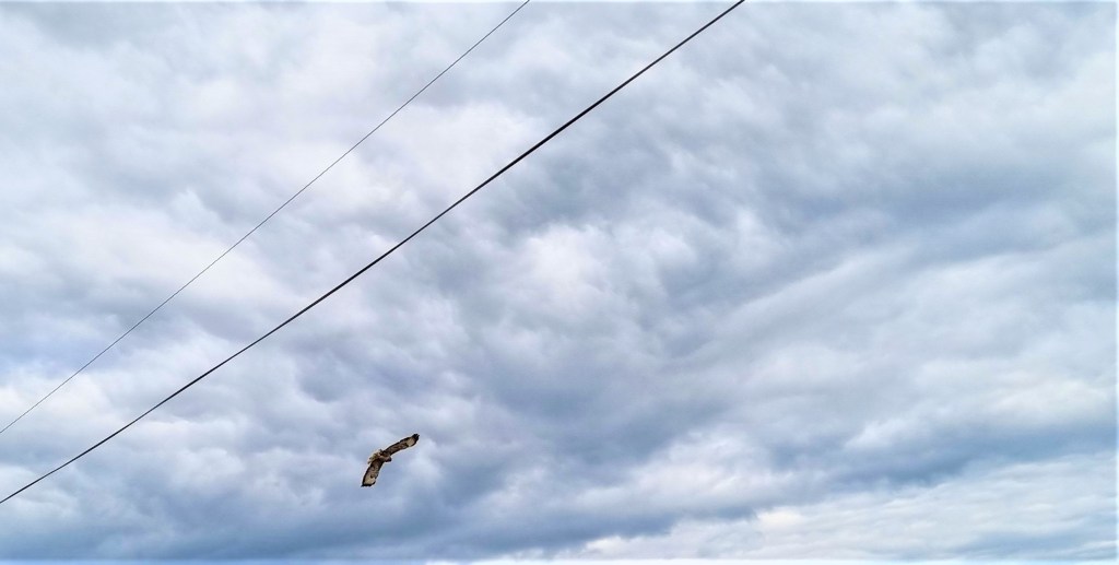
On the way we passed a Buzzard patrolling the edge of a field, but the journey was otherwise tedious and occasionally dangerous, as cars sped towards us, hurtling along the country roads.
Arriving tired, stressed and footsore, we enquired in the shop attached to the garage where exactly the unmarked bus stop was located. Amazingly, this shop was open on the day of the Queen’s funeral!
The assistant wasn’t too optimistic that a bus would arrive, but eventually it did, driven by the very same man that had taken us out that morning. His familiarity with our Fal Mussel cards was an added relief.
Arriving back in St Mawes, we were just in time for the 15:45 ferry. The cloud had thickened since we left Portloe and the sky above threatened rain.
We stopped for a beer, toasting Her Late Majesty, before returning home.
Tuesday: Portloe to Mevagissey
This being a weekday, we had hoped for a decent bus connection to Portloe, but none was heading there early enough to permit a full day’s walking.
Realising that a taxi from Falmouth would cost an arm and a leg, because of the long journey round the estuary, we booked Castle Cars to pick us up from St Mawes Harbour.
All went to plan, and we were deposited in Portloe shortly after 10:00.
It was overcast at first but the cloud soon cleared to give another bright, warm day.
We admired the Harbour behind us as we left the village, then climbed upwards, round Portloe Point, advancing along the quiet clifftop path.
It continues north-eastwards for some distance, with few distinguishing features, apart from Shag Rock, below.
Just before joining the road near Portholland, we frightened some noisy pheasants.
And here, by the toilets, we met a man scouting for his son-in-law, who was walking the whole of the Cornish part of the coast path for charity.
We stopped for a coffee at the wonderfully quirky Pebbles Cafe and Crafts sitting outside, close by the mounted teapot!
Two middle-aged ladies behind me discussed a family feud, while a bald-headed man swam straight out to sea and another fished from a kayak.
Soon we were walking over grassland, past the coastguards’ lookout (licensed for weddings) and on round to the road behind Porthluney Bay, Caerhays Castle just behind us.
It is a picturesque spot.
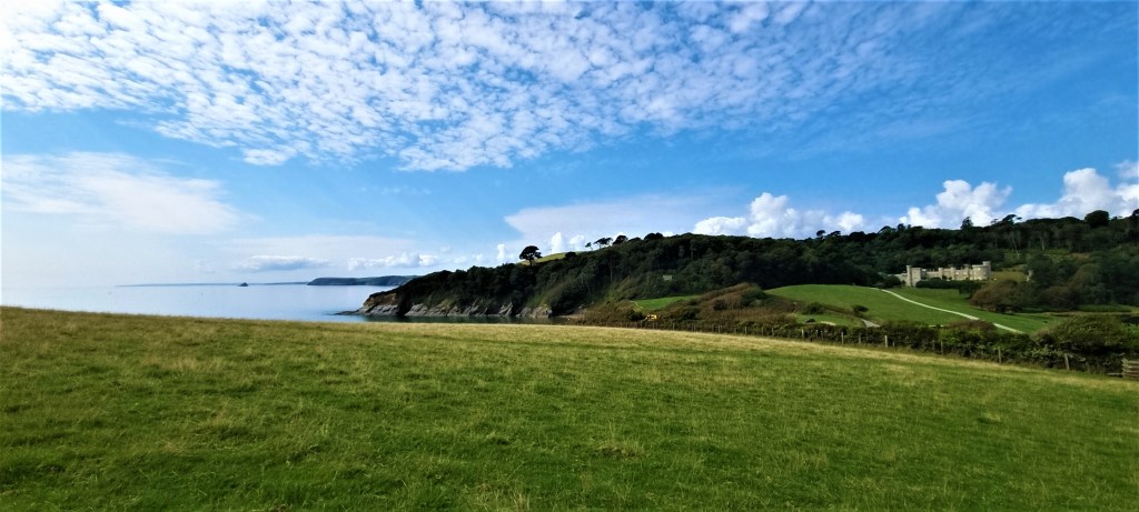
There was a manor house here as early as the Thirteenth Century.
For several centuries the land was owned by the Trevanion family and one John Bettesworth-Trevanion commissioned John Nash to design the present Castle, which was completed in 1810.
But, by 1840, Bettesworth-Trevanion had fled to the Continent to escape his debts and died soon afterwards in Brussels. Caerhays fell into the hands of bailiffs.
It wasn’t purchased until 1853, by Michael Williams, MP for West Cornwall from that year until 1858.
The Estate has remained in the possession of his descendants, the present incumbent being one Charles Henry Williams, formerly a merchant banker. During the summer months the Estate is open to the public.
The exit from Porthluney proved quite difficult to follow, entering woodland before emerging onto the clifftop above Greeb Point.
We could see two beaches ahead, and decided to have our lunch on one of them.
The first, at Porthear, seemed difficult to reach but the second, Hemmick Beach, was easily accessible and almost deserted.
Then, as we enjoyed our sandwiches, there was a sudden influx of paddle boarders and swimmers – some twenty all told. We left, perhaps a little earlier than we had originally intended.
On the way off the beach we paused to help an older man who was trying to manoeuvre his kayak and trailer over a kerb.
As we began the steep climb up towards Dodman Point, we could still see the group frolicking far below.
Nearing the summit, we encountered a roadblock in the form of four Dartmoor ponies who, at first, seemed disinclined to move.
We were wary of squeezing past them in case they kicked out, so tried the art of gentle persuasion instead. I addressed them in soothing tones, as if they were troublesome small children.
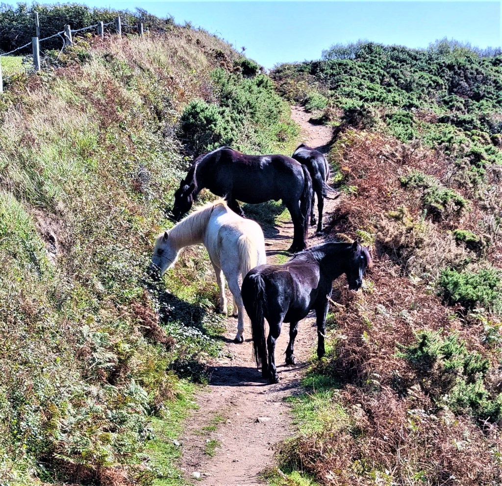
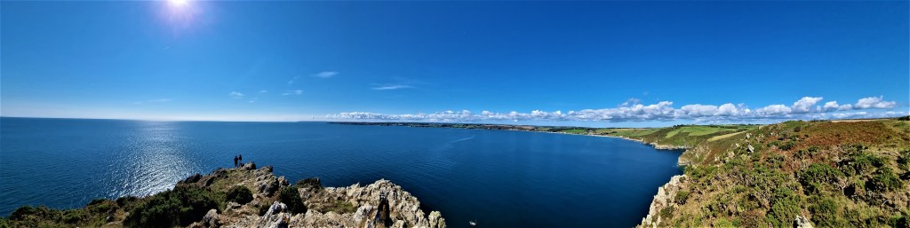
Eventually they shifted themselves, and we reached the large granite cross at the top of Dodman Point. Standing at 114 metres, this is the highest spot on the South Cornwall coast.
The cross – sometimes known as Parson Martin’s Cross – was the work of the Reverend George Martin of Caerhayes.
It is about seven metres high and carries the inscription:
‘In the firm hope of the second coming of our lord Jesus Christ and for the encouragement of those who strive to serve him this cross is erected AD 1896’
But it is said to have been intended primarily as a navigation point for mariners.
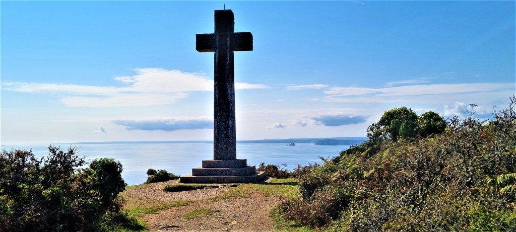
The headland also hosts an Iron Age hill fort, Bronze Age burial mounds and an Admiralty signal station dating from 1795.
Exiting Dodman Point, we could see ahead the long narrow stretch of Vault Beach. It is reputed to harbour naturists but was too far away to tell!
The path runs behind the beach and then around Maenease Point before beginning the run-in to Gorran Haven.
This has long been a fishing village and several quays have been built, only to be washed away by storms and heavy seas. Novelist Colin Wilson (1931-2013) also lived here from 1957 until his death.
We stopped for an ice cream.
As we passed by, we noticed the tiny church of St Just, once a chapel of ease and then a storing place for fishing nets before it was revived as a place of worship, first by local Congregationalists and then by the Church of England.
Climbing out of Gorran Haven, we enjoyed the rise and fall of the clifftop path basking in the late afternoon sun.
Before long, we were descending towards the peninsula of Chapel Point, which is not accessible to the coast path. It contains three houses designed and built in the 1930s by John Archibald Campbell, an architect with ‘arts and crafts’ leanings.
He bought the land in 1932, and planned 20 houses here, but the Second World War intervened. Shortly after he resumed work in 1948, he fell from a cliff and was killed. The guide book says he was Scottish, but he was born in Wolverhampton! They’ve confused him with another, earlier architect.
Chapel Point also features in Daphne Du Maurier’s novel ‘The House on the Strand’ (1969).
We passed inland of Chapel Point, but around many fields before drawing close to the interlinked settlements of Portmellon and Mevagissey.
A convention of BT Outreach engineers seemed to be drinking at Portmellon’s Rising Sun Inn as we passed, somewhat footsore again, on the way in to Mevagissey.
We finally arrived at around 17:20 and, fortunately, found a place to eat right on the front, in the shape of the Harbour Tavern. My blue cheese, mushroom and pepperoni pizza was very tasty indeed.
Afterwards we strolled inland to the bus stop, where we waited for a service to St Austell Station. The locals were sceptical that it would turn up, as it the buses had been particularly unreliable of late.
However it did eventually arrive, the bus driver assuring us that the recent problems were attributable to a major hack of the company’s website!
From St Austell we caught the mainline GWR service to Truro and then the branch line back to Falmouth Town.

Wednesday: Mevagissey to Par
This turned out the least satisfactory of our walking days.
Our first task was to negotiate the return trip to Mevagissey. The two legs by train were completed without mishap, but the Go Cornwall buses down to Mevagissey were completely and utterly…fucked. Must have been that hack…
One driver said he had to call somewhere else first and never returned; a second said he had come to the end of his shift so couldn’t drive on. This was completely unlike the normally brilliant service provided by Cornish bus drivers.
After 30 minutes of fruitless waiting, with no reliable information about when a bus might eventually deign to turn up, we recruited a small group to share a taxi: an elderly couple visiting from New York and a young guy working in one of Mevagissey’s eateries.
We were five, but I had spotted there was a large ‘people carrier’ waiting at the taxi rank.
Unfortunately, though, the driver was only licensed for four passengers. He kindly called another taxi to come to our aid, which materialised ten minutes later. We paid £4 apiece for the journey, so not much more than the bus fare.
Before starting out we had to buy our picnic lunches. These we found at Olivia’s Sandwich Hut, on Church Street. They proved very nice indeed – and we also gleaned useful information about how long our walk might take us, given that it was already past 11:00.
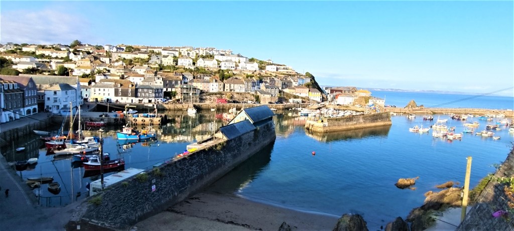
At last we were under way, initially walking round Mevagissey’s Harbour.
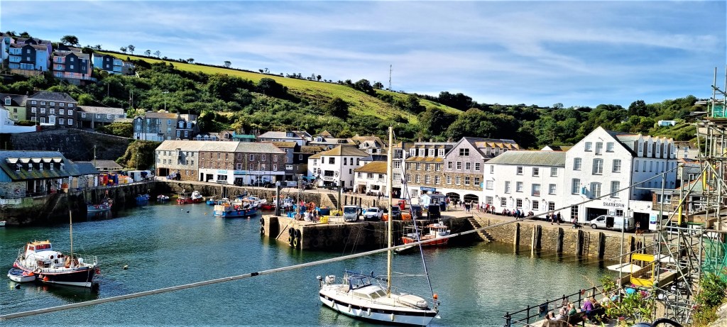
Mevagissey is the second largest fishing port in Cornwall, after Newlyn, and owes its name to two saints: Mevan and Issey.
The inner harbour was constructed in the late Eighteenth Century; the outer harbour in the late Nineteenth Century. By this point there were thriving mackerel, pilchard and herring fisheries here. Today, some sixty fishing vessels are registered.
Our route took us past a hand-painted sign saying ‘Will you be our GP?’
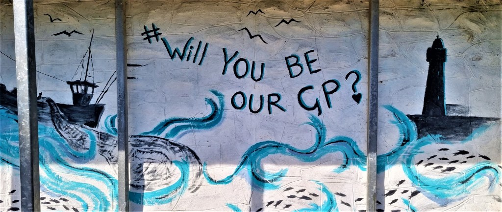
Apparently, the local surgery was under threat of closure after the sole GP pulled out in 2019. Following a strenuous local campaign, a Camborne practice took over the contract.
Then we were out on the clifftop, encountering some surprisingly stiff climbs and descents as we watched a kestrel hunting just ahead.
We met a couple ascending from Pentewan Sands Caravan Park below, who warned us that we would eventually encounter ‘the staircase of doom’!
The path joins the road which runs behind the caravan park. This we followed, though it seemed that we could have taken a short-cut through the caravans and across the beach had we wished.
Turning right, we took a side road into Pentewan itself, but stopped for a coffee at Into the Woods. The coffee was OK, but we soon discovered that there were potentially better options, with added cake, a little further on!
Pentewan was once a fishing harbour in its own right, a significant centre for transporting china clay, but it fell into decline and has now completely silted up, though there is still a lake of sorts and a redundant quay.
The village was bombed on 28 August 1942 in a low-level attack that destroyed a Methodist chapel.
Pentewan Hill is a long, steep climb, but, fortunately, the coast path turns off at a side road called The Terrace. This features a somewhat incongruous row of white, verandahed cottages, culminating in All Saints Church, constructed out of local Pentewan Stone.
It was built in 1821 by Sir Christopher Hawkins, a local mine-owner and Tory MP who embarked on several projects to improve Pentewan. There were to have been cottages on both sides of the road, but only one side was completed.
After navigating several more steep ascents and descents, including the staircase of doom, we were on the lookout for a suitable lunch spot. The beach at Polgwyn looked inviting, but we couldn’t see how to reach it.
Then, after entering woodland, we discovered the hidden access to Haldane Beach, beside a cottage. We perched on boulders, near a small waterfall, and ate the baps that Olivia had prepared for us.
Afterwards we continued on towards another Black Head, arriving at a granite memorial stone to A L Rowse, inscribed with the words ‘This was the land of my content’.
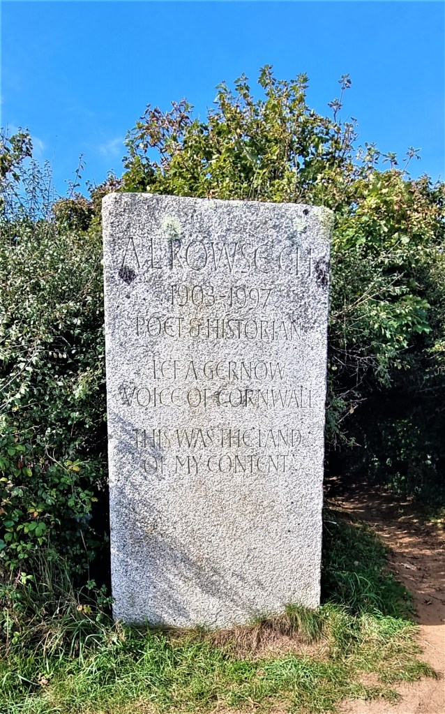
Rowse was born near St Austell in 1903, the son of a china clay worker. He won a scholarship to Oxford and pursued an academic career, specialising in Elizabethan history.
He died in 1997, at his home, Trenarren House, nearby.
Surprisingly this was deemed ‘the best and most imposing site’ for a public memorial. It was unveiled in 1999.
We headed out on to Black Head by mistake, rather than turning at the memorial but, as a consequence, discovered the overgrown, rusting remains of a Victorian rifle range constructed in the 1880s.

Retracing our steps, we must have taken a wrong turn in the woodland, but eventually found our way out, past a car park and on towards Porthpean.
We rested awhile on a bench near the Sailing Club, then followed the route through behind the beach, back up the cliff. Very soon afterwards, we found our way blocked.
Part of the coast path was closed between Porthpean Beach Road and Duporth Beach.
It seems that the closure was enacted in January 2021. The sign said:
‘We are working towards reinstating the route to be open in 2022.’
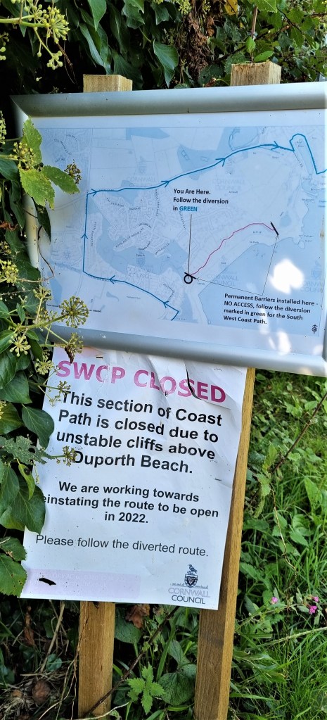
but that looks like wishful thinking.
Irritatingly, the official guide refers to the path hereabouts having been closed for some time due to erosion.
‘However, since 2018 it is now clear, after careful negotiation has restored a way through below a series of private gardens.’
One wonders whether the owners of those gardens are the obstacle to faster progress this time round!
Just as we were reacting to this news, we encountered again the man scouting for his son and exchanged a few words.
Unfortunately the diversion is extensive, perhaps a mile and a half in length, and the route is extremely tedious. By the time we reached Charlestown, we were in a much less fit state to appreciate its charms.
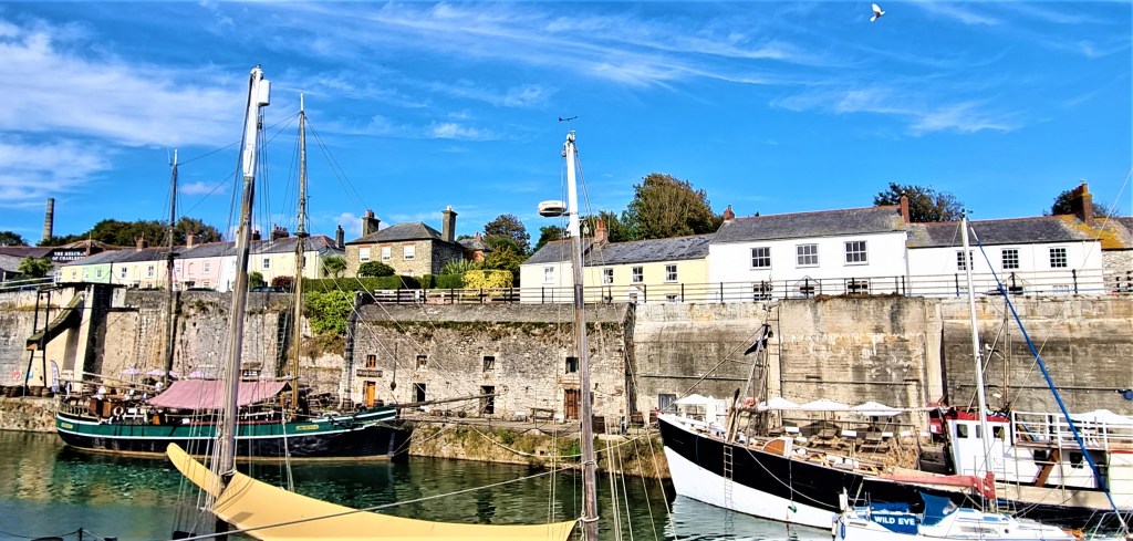
Charlestown was once a small fishing settlement but, in 1791, Charles Rashleigh began the construction of a harbour, dock and surrounding village. In 1799 the inhabitants renamed it Charles’s Town.
Rashleigh ran into financial difficulties and, following his death, Charlestown was taken over by a private company. It thrived, shipping out copper and then china clay. By 1911 its population was over 3,000 strong.
But it began to decline as ships grew too large for the harbour. In 1994 it was bought by Square Sail, a company that owns and operates tall ships and provides film sets.
Consequently, it doesn’t feel like an authentic village, more a theme park. I was happy to leave fairly promptly.
Owing to our late start and the diversion, we were now pressed for time. (We had booked a restaurant in Falmouth for 19:45 that evening.)
We found our way round the harbour and up above the desolate expanse of Carlyon Bay, which actually comprises three beaches, largely constructed from china clay waste.
In the 1920s and 1930s, the New Cornish Riviera Lido stood here. Later the Cornwall Coliseum was an important musical venue, with a standing capacity of 3,400.
There have long been plans for a beachfront housing development and a protective sea wall, still as yet unrealised.
Passing the Carlyon Bay Hotel, we found ourselves beside the Golf Club, whose fairways seemed to continue endlessly. Finally we reached Spit Point, where a few women were swimming, the beach set against an increasingly industrial backdrop.
At this point we realised we had next to no time to reach the station, still some way distant, so we abandoned photography and put on a spurt. To be fair, the area round Par Docks is not hugely photogenic, so you’re not missing a great deal.
I couldn’t get a signal, but Tracy managed to raise Google Maps so I navigated to the Station on her phone. She said she thought we would be lucky to make it and didn’t want the added stress of pointing the way!
Miraculously, we arrived at the station with three minutes to spare.
We hope to see the nicer side of Par next time!
Postscript
Thursday was a much-deserved rest day spent in and around Falmouth. In the afternoon we rendezvoused with some of Tracy’s family who were staying in St Ives and had driven across to see us.
The weather had finally broken so we had to evade the incoming showers.
Our journey home on Friday morning was uneventful. Unusually, even the GWR service into Paddington arrived on time, and we were home by late afternoon.
It had been a memorable holiday.
.
TD
October 2022


Leave a comment