Towards the end of October 2019 we booked onto HF Holidays’ Channel Islands walking tour, scheduled for April 2020.
Then Covid arrived and our holiday was postponed for two years in succession.
So, as the date of the 2022 trip approached, we couldn’t quite believe it would go ahead.
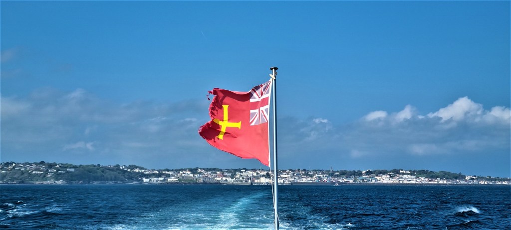
It was quite a shock to find ourselves on the way to Gatwick Airport, preparing to catch a Saturday morning Aurigny Airline flight to Guernsey.
This was my second visit to the Channel Islands, having holidayed in Jersey some 20 years ago, but Tracy had never visited before.
The three largest islands – Jersey, Guernsey and Alderney – form a triangle some miles west of Normandy’s Cotentin Peninsula. Herm and Sark are smaller and lie east of Guernsey, much closer to it than the Peninsula.
During this holiday we would be walking around the coastlines of Guernsey, Alderney, Sark and Herm.

Our schedule, leaving aside the arrival and departure days, was as follows:
Day 1: Guernsey, from St Peter Port to Le Gouffre.
Day 2: Sark
Day 3: Herm
Day 4: Guernsey, from Le Gouffre to Vazon Bay.
Day 5: Alderney
Day 6: Guernsey, from Vazon Bay to St Peter Port.
But in this post I have grouped the three Guernsey days together, then covered our walks on Sark, Herm and Alderney respectively, following the order in which we visited them. There is a background section on each island before each walk description.

Our Hotel
The Aurigny flight from Gatwick was on time and uneventful, though we had to wait an eternity for our luggage at Guernsey Airport, probably because unloading was almost entirely a manual, unmechanised process.
We were met at the Airport by our walking guide, who rode with us aboard an Island Coachways minibus to our base, the Best Western Moores Hotel in St Peter Port.
Island Coachways ferried us round Guernsey throughout our stay: one of the drivers was faultlessly excellent, one regaled us endlessly with tales of his illustrious forbears and one insisted on playing us Radio Guernsey, which leaves much to be desired.
The building that houses Moores Hotel was once owned by the prominent De Saumarez family, which has been connected with Guernsey since the Twelfth Century. It became a hotel in 1896 and has been run by the same family since 1956.

There is a mural on an external wall depicting a line-up of famous Guernseyans, amongst them Victor Hugo, who lived here from 1855 to 1870, using the Island as the setting of his 1866 novel, Toilers of the Sea. Matt Le Tissier looked most unlike himself.
Our room was at the rear of the Hotel, on the third floor. It had no view at all, but was quiet and well-appointed, with a huge bed, ample wardrobe and cupboard space, and a fully equipped bathroom.
We were a group of nine in all: three women and three couples, all white, in our fifties, sixties and seventies, drawn from various parts of south-east England. A single male had pulled out at the last moment.
All of us were experienced walkers.
After an initial orientation tour round parts of St Peter Port, we convened in a Hotel bar for prosecco and canapés before heading into the dining room, where we took all our meals at one long table.
The food and service proved outstanding.
At breakfast we were offered the usual range of continental fare as well as a comprehensive menu of cooked dishes.
There was a three course dinner menu, typically offering a minimum of four choices per course, followed by coffee and homemade biscuits. We were served, expertly yet unobtrusively, by a team of young waiters from a variety of international backgrounds.
Each morning we chose our packed lunches for the following day, selecting a sandwich, a piece of fruit, a sweet item and a drink. We left our completed order forms for collection from the breakfast table before picking up that day’s lunch from a side table.
Guernsey
Guernsey is the next largest of the Channel Islands, after Jersey. It is divided into ten parishes, has a total area of some 25 square miles and a resident population of some 60,000.
The Channel Islands are not collectively a constitutional or political entity in their own right. They are neither part of the United Kingdom nor of the EU.
Guernsey officially comprises four inhabited islands – Guernsey itself plus Herm, Jethou and Lihou. Along with Alderney and Sark it forms the Bailiwick of Guernsey, a British Crown Dependency.

A bailiwick is so called because it is administered by a bailiff. The Bailiff of Guernsey is the civil head of the islands comprising Guernsey, but not of Alderney or Sark. The present Bailiff is one Richard McMahon, an English barrister who moved here in 1995.
Guernsey has its own parliament, containing 38 People’s Deputies, two of whom represent the interests of Alderney, and governs itself through a committee system. Some of its laws also apply to Alderney and Sark.
Guernsey is also a tax haven. Almost 40% of its economy is derived from banking and financial services, attracted by the beneficial tax regime (no corporation tax for most companies; no capital gains tax, inheritance tax or VAT). Income tax is generally 20%.
We heard that Guernsey’s 60,000 people own approximately 90,000 motor vehicles between them. There is often frequent congestion in and around the capital, St Peter Port, but seemingly no consensus on how to tackle it.
However, several roads outside the capital are designated ‘ruettes tranquilles’, where a 15mph speed limit is advised and, in theory at least, drivers give priority to walkers, cyclists and horse riders.
There is longstanding rivalry between Guernsey and its larger, more populous neighbour, encapsulated in the annual football match for the Muratti Vase.
The game is hosted alternately by the two islands. Alderney also participates, playing a semi-final against the non-hosting team, but it has won the competition only once.
On the day we arrived, Guernsey defeated Alderney 2-0 in the 2022 semi-final, and was set to face Jersey, away, on 21 May. (Jersey won again.)
Guernseyans are fond of calling Jerseyans ‘crapauds’ (toads), while Jersey’s term of endearment for Guernsey people is ‘donkeys’. There are various theories to explain how these epithets originated.

The Channel Islands were once part of the Duchy of Normandy. After 1066, the Duke was often also the King of England. King Philip II of France seized the Islands in 1204 but, in 1259, they were recognised as belonging to King Henry III.
Later, in 1483, they were declared neutral territory by Pope Sixtus IV, but continued to thrive as a base for sundry pirates and privateers.
Guernsey was under German occupation from 30 June 1940 until the Second World War ended.
For some reason, Hitler decided it needed exceptional fortification, so a small army of volunteers, conscripted and forced labour built endless monuments to his folly, which still fester, like boils, upon the beautiful landscape.

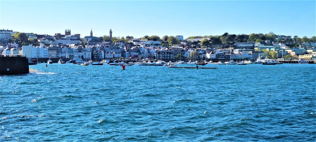
St Peter Port
Guernsey’s capital sits on the east coast, opposite Herm and Sark, and has some 20,000 residents.
The seafront is dominated by the extensive harbour, one arm of which culminates in the imposing Castle Cornet, which dates back to the early Thirteenth Century.
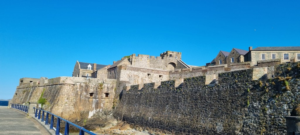
It has enjoyed a colourful history. During the English Civil War it was a Royalist stronghold, surviving independently of Parliamentarian Guernsey from 1642 until its garrison finally surrendered in December 1651.
A busy road stretches along much of the east coast, towards an unprepossessing industrial complex. Little effort has been made to preserve the character of the buildings, which include several modern blocks housing financial companies and high-spec flats for their employees.

The streets behind are rather more characterful, though one has to climb above the shopping precinct to see the best of the Town.
Our orientation walk took us up Constitution Steps and along towards Hautville, not quite past where Victor Hugo once lived, with his family at Number 38 and his mistress-cum-secretary a little way down the road at Number 20.
Later I very much enjoyed the contemporary bronze sculpture of Hugo on the sea front, immediately before the Town Church. He is sitting on a granite bench, accompanied by a large green octopus (a reference to Toilers of the Sea).

Our attention was also drawn to the Albion House Tavern, adjacent, which was built in 1780 and is alleged to be the closest pub to a church in the British Isles. But I digress.
Back on our orientation, we circled past Elizabeth College, the local independent school, founded in 1563. PG Wodehouse was briefly a student here, transferred from Croydon for the benefit of his ‘weak chest’. Other famous alumni are not quite household names.
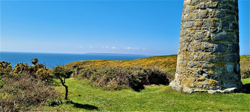
We also admired from a distance the somewhat unprepossessing Victoria Tower, built in 1848 to commemorate the Queen’s visit. It was designed by William Colling, is 100 feet high and cost £2,000 to build.

Guernsey: St Peter Port to Le Gouffre (Day 1)
It was Sunday morning and I had slept poorly, as I often do on a first night away, finding our room far too warm.
Having breakfasted, we emerged at 09:00 into an overcast morning. Strolling down to the Harbour, we continued past Castle Cornet and on to La Vallette Promenade.
Morning swimmers were scuttling to and fro between a changing room in an old shipping container and the Victorian bathing pools below, once patronised by the likes of Hugo and Pierre-Auguste Renoir.
We passed the entrance to the Underground Military Museum, located in an unfinished U-boat fuel storage depot, and on towards the Clarence Battery, part of a 1780’s fort.
Unfortunately though, the way was blocked by metal fences and we had to retrace our steps to find the higher path.

Light rain was falling, which turned into a heavier, drenching drizzle as we reached the bluebell woods near the Fort George military cemetery. The masses of bluebells were in their prime, but the weather severely dampened their impact.

I zipped up my waterproof but kept my hood off, in the hope that the rain playing on my face would help to wash away my fatigue and sleepiness.
We passed the Ozanne Steps – a concrete walkway down to a former lieutenant-governor’s bathing spot – in unrelenting rain but, by the time we’d descended to Fermain Bay, it had almost stopped and the sky was slowly clearing.

There is a café here, toilets and a tower that has been converted into tourist accommodation, rentable by ‘able-bodied travellers’.
The man in the café was still spooked by covid and not keen to touch our reusable Stojo cups: Tracy had to lean into his booth to hold them while he poured in the coffee!
We drank sitting on a sodden picnic bench, looking out over the Bay.
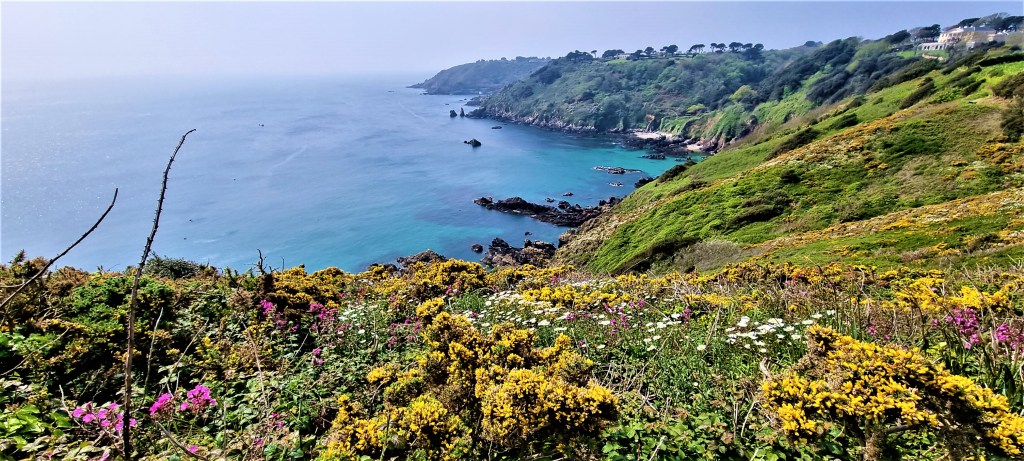
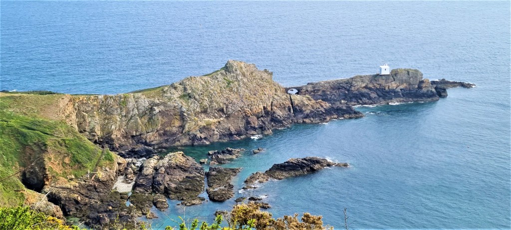
Not for the last time, we received our marching orders somewhat prematurely and were soon climbing up towards the Jerbourg Peninsula, the south-east corner of the Island.
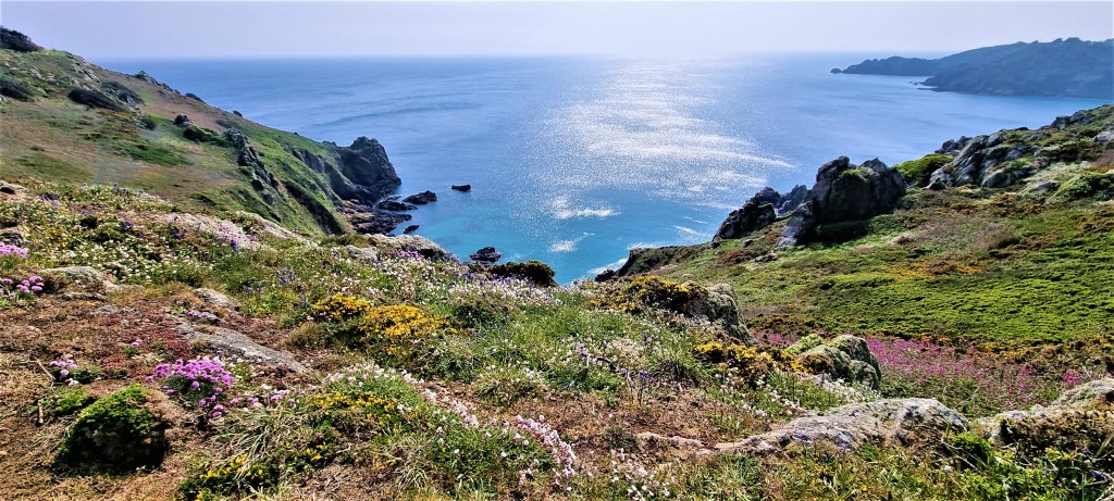
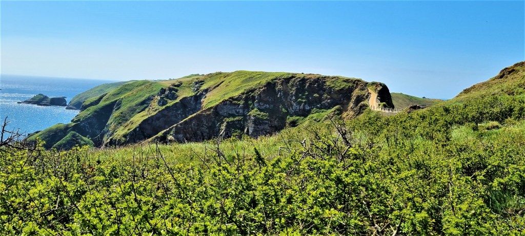
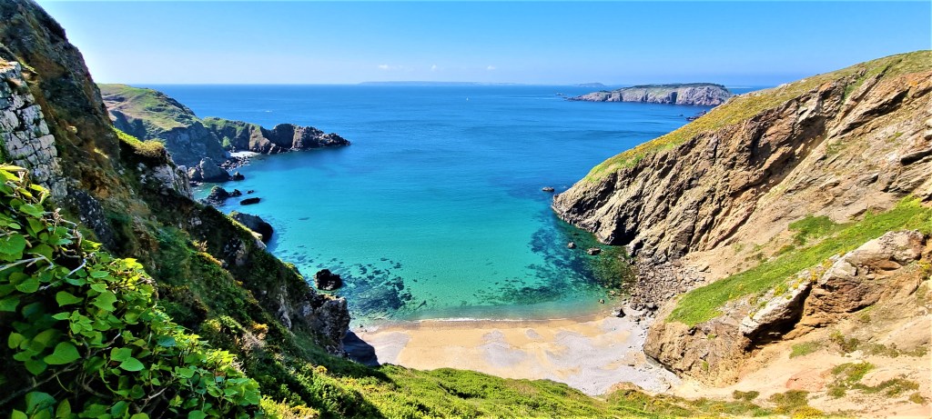
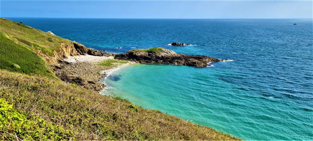
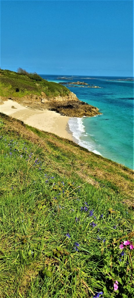
The stretch round this headland and into Moulin Huet Bay is quite difficult walking, with several sequences of steep steps up and down, but I also thought it the most beautiful stretch of Guernsey’s coastline.
Spring flowers grow here in profusion and, by lunchtime, the sky was azure, the sea had turned cobalt and the sun was blazing down.

We stopped for lunch near some ruined fortifications close to the Hotel Jerbourg, choosing a bench overlooking the cliffs below.
Later, as we looked down upon stunning Moulin Huet Bay, we were excited to see what looked like a small school of porpoise way below. But binoculars revealed only the arms of human swimmers working their way across.
Renoir spent six weeks here in the late summer of 1883 and produced some 15 works, including several views of the Bay.
In one of his letters he writes:
‘What a pretty little place! What pretty paths! Superb rocks, beaches such as Robinson must have had on his island, as well as rump steak and ale at manageable prices – up to now, everything is fine. All I have to do is to take advantage of the admirable weather and bring you back some nice things so that you can forgive my infidelity to beautiful Normandy.’

Five steel frames have been erected so that visitors can see the same views that Renoir painted almost 140 years ago.
We dropped down the steep descent into Saints Bay, where the café served us much-needed ice creams.
After ascending the other side, we found round the next headland a stone commemorating Lt Hubert Nicolle:
‘The first commando, who landed on Guernsey by submarine at night at La Jaonnet Bay, July 8th 1940’.
Nicolle, who hailed from Guernsey, was conducting a reconnaissance mission for Operation Ambassador, the second raid by the newly-formed British Commandos.
This became a catalogue of disasters.
When one group realised they would have to swim out to their boats, they belatedly discovered that three of them couldn’t swim, so they had to be left behind.
This episode so embarrassed the top brass that, for several months, the entire commando force was at risk of being disbanded.

Nicolle later landed on Guernsey again, with another Guernsey-born man, but they failed to rendezvous with their boat. They had to be hidden by friends and relatives while two uniforms were stolen so they could surrender as servicemen rather than as spies, and so be sent to a prisoner of war camp instead of being shot.
We were soon approaching Petit Bot Bay, navigating another steep descent and pausing to look out over the busy beach. One of our number had wanted to bail out at this point, but eventually decided to soldier on.
Fortunately, the ascent on the other side was rather more comfortable and we were soon at our finishing point, Le Gouffre Café, on the Rue Du Gouffre.
Unfortunately it had decided to close early, so we sprawled on the seating outside, waiting for our bus to arrive.
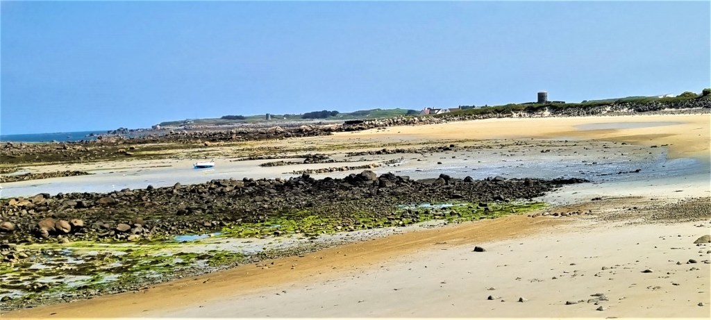
It did so promptly, at 17:00 and we all climbed gratefully aboard, having completed some 780 metres of ascent and 720 metres of descent during this 11-mile walk.
Guernsey: Le Gouffre to Vazon Bay (Day 4)
By this stage, my cold was rampant, which rather detracted from my enjoyment, especially later in the afternoon.
The coach picked us up at 09:30, conveying us quickly back to Le Gouffre.
The first half of the day was devoted to completing the south coast of Guernsey, the landscape similar to the day before.

But we soon found ourselves flirting with the village of La Corbiere, where we passed a sign:
‘This Well is possibly a Holy Well. Horses and cattle would drink from the Abreuvoir alongside.’
This delightful French word simply means ‘trough’.
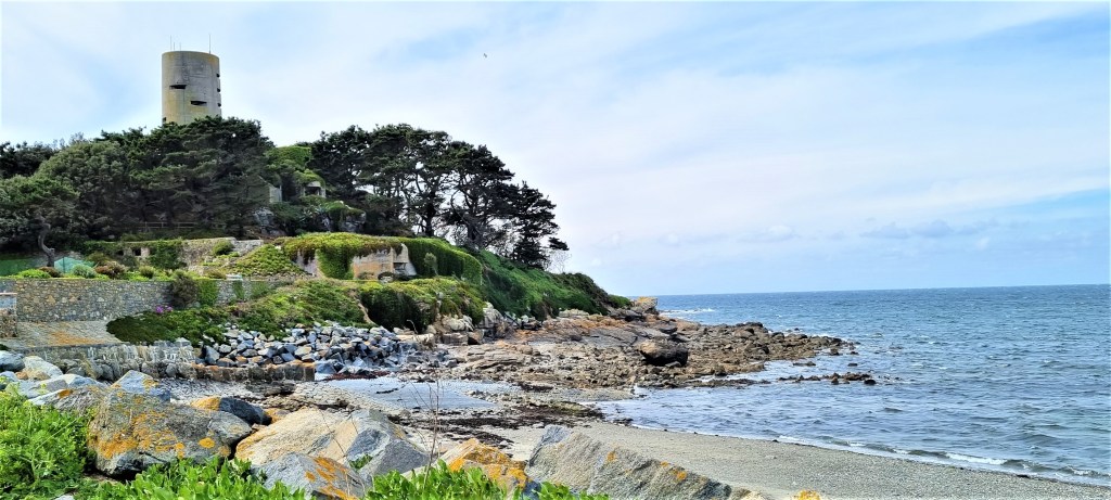
Returning to the coast path, we found ourselves much closer to the Prevote Tower (M5), a two-storey German army artillery observation post. It was formerly cladded with granite, to disguise it as a Napoleonic fortification.

The route continued along the cliff-top, with the sea to our left and fields to our right, often through drifts of wild flowers. Every so often one would see two small red flags planted in the ground beside the path, denoting an ants’ nest.
Feeling rather anti-social with my cold, I pushed a little ahead of the group, wanting to maximise the length of my rest over the lunch break.

I arrived a couple of minutes ahead at the designated spot, beside the Mont Herault watch house, a genuinely Napoleonic observation post this time.
It was just midday and the breeze had grown much colder and keener. There was some shelter in the lee of the watch house, which is where we had our lunch; others preferred to cluster by the edge of the coast path.
One of us had not walked that morning and was meeting the remainder for the afternoon, having caught a bus to our location. Our guide stayed behind to rendezvous with her, while we continued towards the imposing bulk of the German observation tower at L’Angle.

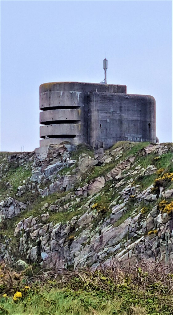
This is one of six naval range-finding towers – Marinepeilstande – built on high points around the Island. The towers have varying numbers of observation decks, denoted by the slits in the concrete structure.
Each deck calculated the range for a different battery: originally the plan had been for two decks in different towers to triangulate on a specific target but, later, single decks used stereoscopic range-finding equipment.
We explored inside. It was impossible not to think of the forced labourers who had to work endless 12- or 16-hour shifts to construct these monstrosities.

We were now approaching the peninsula of Pleinmont, which is infested with yet more fortifications.
We stopped at the Batterie Generaloberst Dollmann, a coastal artillery battery once equipped with four repurposed French WW1 guns. One of the gun pits and the associated trenches have been restored.
Further on is another Marinepeilstande – MP3 – this one, five storeys high, is now a museum.

We had some discussion of the brutalist design of these towers and of what they reminded us.
For me they conjure up complex nightmarish recollections that draw on Easter Island statues, 1950s science fiction comics and Ned Kelly’s armour.
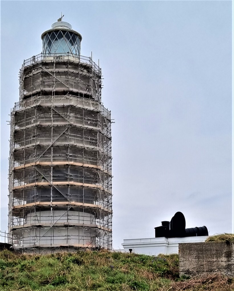
As we reached the tip of the headland, Hanois Lighthouse came into view offshore.
This 33-metre tower was built between 1860 and 1862 following numerous wrecks on the Hanois Reef below. A helicopter deck was constructed above the light in 1979, but the lighthouse has been fully automated since 1996.

At our feet was La Table de Pions, a small circular ditch. According to the adjacent notice board, there used to be tri-annual processions round Guernsey to check the condition of the roads. The gentry would ride on horseback but their footmen – the pions – would sit here, their feet in the ditch, to take refreshment. The last such procession took place in 1837.

We directed our weary feet down from the Pleinmont headland, next to Portelet Beach, now on Guernsey’s much flatter west coast.
We stopped at the well-appointed kiosk where we couldn’t resist a shared slice of Guernsey Gâche, a kind of bready cake, alongside our coffees.
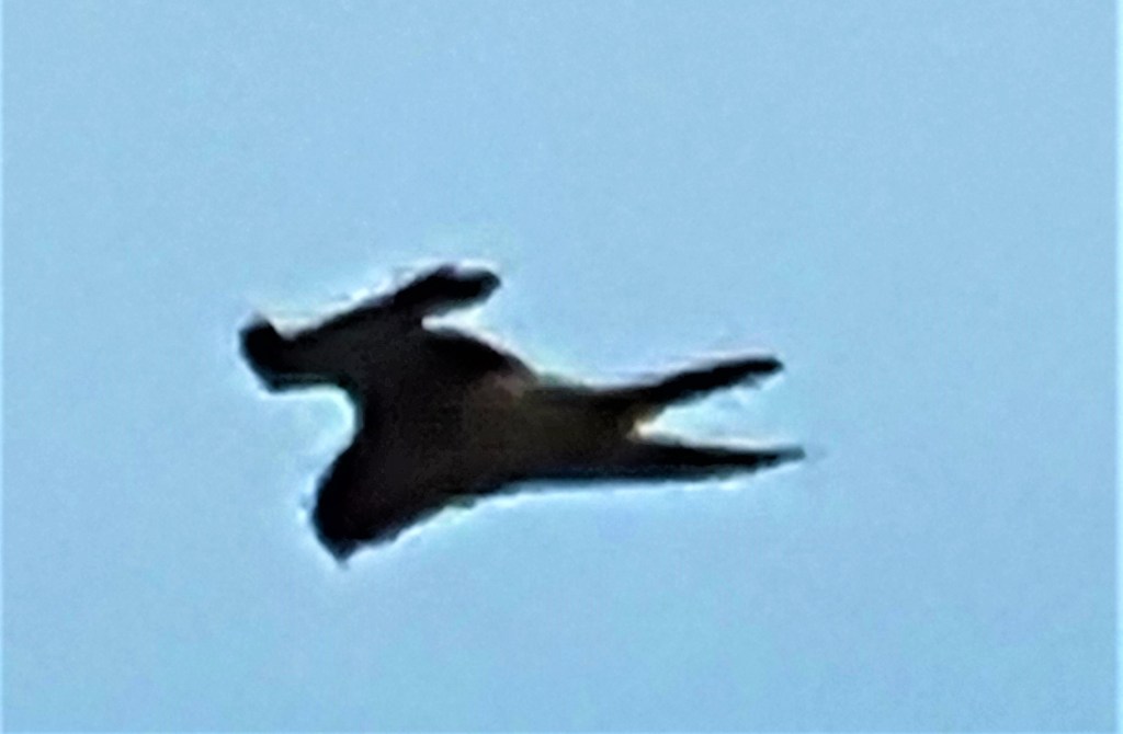
While we supped, a local kestrel performed amazing aerobatic feats just above our heads.
Resuming our walk, we followed the broad sweep of Portelet Bay round towards the Fort Grey Maritime Museum. Fort Grey is a Martello Tower, connected to the shore by a raised causeway, built in 1804.

We were obliged to continue along the road towards L’Eree headland, with Lihou Island offshore, the westernmost part of Guernsey. After a while though, we were able to take to the beach, though it was tough walking into the wind.
We made it back to the road close to Fort Saumarez, where the Germans built a 4-storey observation tower on top of an existing Martello Tower, constructed in 1804. This is now privately owned.
We didn’t stop to see the Neolithic tomb, Le Creux es Faies, which is also on the headland, but continued on round, past Shingle Bank, until we reached Le Trepied, a slightly smaller Neolithic grave from the same period, on the headland called Le Catioroc.
This was alleged to be a meeting place of witches and wizards according to the testimony given in early Seventeenth Century witchcraft trials.
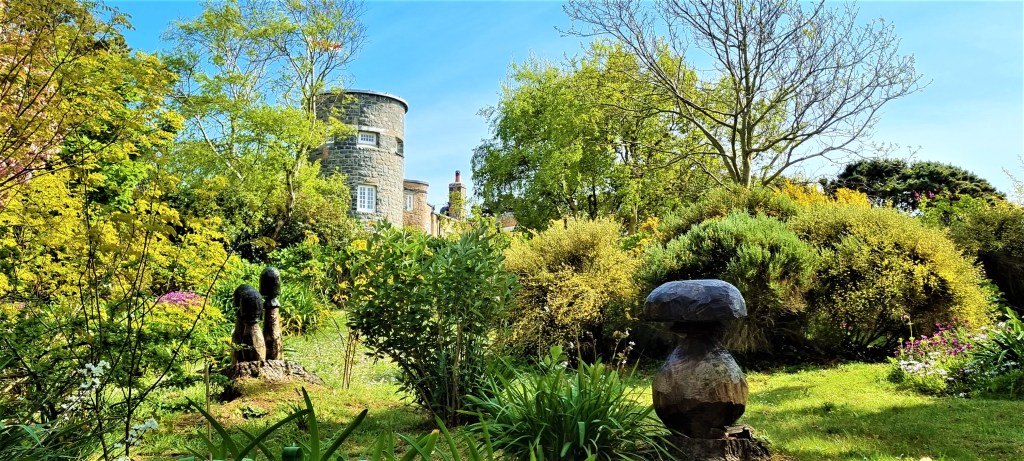
We continued slightly inland, along a woodland path, passing a beautiful house, incorporating a round stone tower, standing in a beautiful garden.
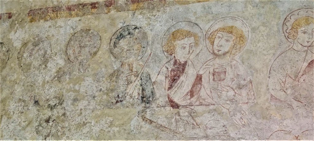
After negotiating a few streets, we came to the tiny Chapel of St Apolline, most likely built in the late Fourteenth Century.
St Apolline is the patron saint of dentists, since she was punished for her faith by having her teeth knocked out.
The chapel is renowned for its medieval wall paintings, most notably this rendition of the Last Supper.
Returning to the coast, we rounded the next headland, reaching the gentle sweep of Vazon Bay. On the far side we rendezvoused with our bus and travelled back to the Hotel, via the toilet where our guide had forgotten her walking pole.

Guernsey: Vazon Bay to St Peter Port (Day 6)
On the final day of our holiday, we completed the circuit of Guernsey.
We were once more picked up at 09:30 and dropped adjacent to a busy café called Crabby Jacks. There were noticeably more people on this part of the coast.
We paused a while, looking out over the pristine sand towards Fort Hommet on the headland at the eastern end of the Bay. There were fortifications here as early as 1680, but this is essentially a third Martello Tower, like those at Fort Saumarez and Fort Grey.

Additional building was undertaken in 1852 and then, more extensively, under the German Occupation. Part of the Fort has been restored and the entirety is designated a protected monument.
We rounded the headland, shaped like a fishtail and continued past a rocky foreshore, with a reef jutting out of the sea a little way offshore.
The landscape stretching ahead of us was almost completely flat, in sharp distinction to much of the territory we had already covered. There was also much more evidence of human habitation.
Some of the rocks hereabouts are said to resemble animals: there is apparently a lion, a monkey and a camel. It is probable that the resemblance was greater before wave erosion took its toll!
At Cobo Beach we took to the sand, keeping an eye open for attractive shells. Shortly afterwards, we stopped for coffee at the Port Soif Kiosk, sharing a very tasty piece of millionaire’s shortbread.
Continuing round the series of small, horseshoe-shaped bays, we drew closer to Rousse Tower on Rousse Point.
This loop-holed tower, replete with replica cannon, is one of a pair, the other being Chouet Tower on the opposite headland, which can be seen in the distance behind. Together they protect the entrance to Grand Havre Bay.
A chain of 15 such towers were built on Guernsey between 1778 and 1779, the majority on relatively exposed beaches to the north of the Island.
Coming level with a playground near Ladies Bay, we struck out across the golf course, which occupies a substantial chunk of L’Ancresse Common. Two golf clubs – the Royal Guernsey, founded in 1890, and L’Ancresse, founded in 1895 – apparently share the course.
We were looking for La Varde, a passage grave, or burial chamber some 10 metres long, probably constructed around 4000 BC and in use until at least 2000 BC but not rediscovered until 1811. This is Guernsey’s largest surviving prehistoric structure.

Finally we found it – and clambered inside to poke around before returning to the bright sunlight. We descended from the golf course with several more loop-holed towers in our sights.
One of them – L’Ancresse Tower No. 7 – was selected by the group as a suitably sheltered spot at which to eat our lunch, but Tracy and I preferred to sit on the beach of L’Ancresse Bay instead, in the lee of a small rock, from where we enjoyed the performance of two sailboard enthusiasts.

After lunch we continued briefly along the coast before heading inland, broadly level with Fort Le Marchant.
We now entered a more populated area, passing two small lakes and a blue plaque commemorating the home of Major Marie Ozanne, of the Salvation Army, who died of peritonitis while placed under house arrest by the Germans in 1943.

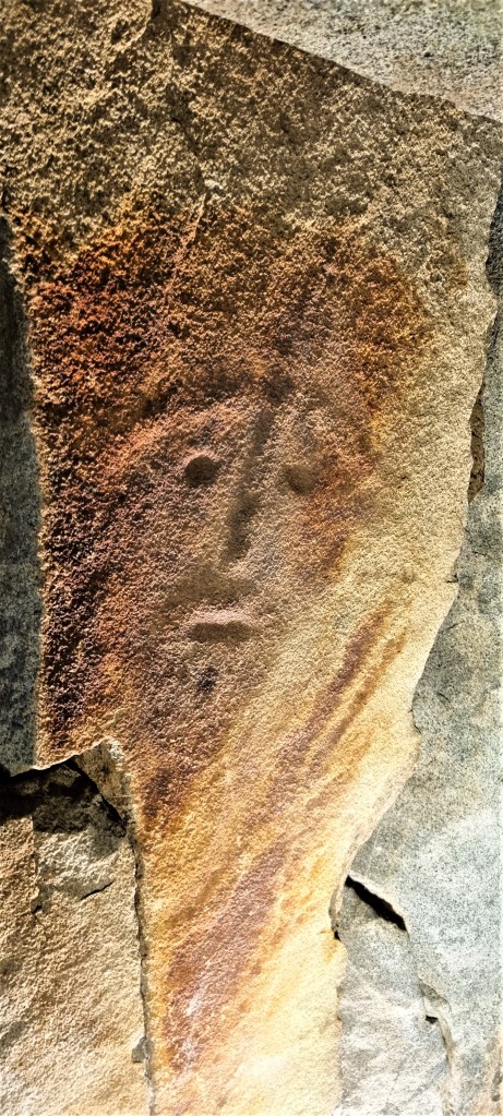
Shortly afterwards we encountered the Dehus Dolmen, incongruously located opposite a small tool shop. This second passage grave features a capstone with a carved face upon it, the carving not discovered until 1916.
We returned to the coast opposite a small island, having missed out the north-east tip of the Island, from Fontenelle Bay, past Fort Doyle and Beaucette Marina.
Rounding Blake’s Beach and Bordeaux Harbour, we paused for a welcome ice cream at Woody’s Kiosk before skirting Vale Castle, parts of which date from the 14th Century, though it has been ‘improved’ many times over the years, most recently by the Germans.
After walking round one side of St Sampson Harbour, we again diverted inland, this time to avoid the industrial complex beyond, following Grandes Maisons Road until we arrived back at the coast road.
From here it was something of a yomp back to our Hotel, past the Friday evening rush hour traffic streaming out of St Peter Port in the opposite direction. We were just beaten back by a Condor Ferry, arriving around 16.15.

Sark
Sark is part of the Bailiwick of Guernsey. It consists of a larger mass to the north, known as Greater Sark, and a smaller mass to the south, Little Sark, connected by a narrow isthmus.
A smaller island, Brecqhou, sits just off the west coast of Greater Sark.
Sark is roughly three miles long and one-and-a-half miles wide. The normal population is about 500, but this can double during tourist season.
In 1565, Queen Elizabeth I granted the Island as ‘a fief in perpetuity’ to one Helier de Carteret, the Seigneur of St Ouen in Jersey, on condition that he rid it of pirates and populate it with at least 40 men who were either English subjects or swore allegiance to the Crown.
De Carteret, who assumed the role of Seigneur of Sark, duly divided much of the Island between some 40 men and their families, specifying that each family must build and maintain a home on their land, and also provide a man to help defend the fiefdom. De Carteret retained one-sixth of the land for himself.
These 40 ‘tenements’ remain broadly unchanged to this day.

But, in 1720, the Carteret family sold the fief to Colonel John Johnson, a former Commander of the Guernsey Garrison. He sold it in turn to James Milner, whose heir sold it to Susanne Le Pelley.
She had been born into the Le Gros family, wealthy Guernsey landowners. She had married a Guernsey privateer but was widowed before becoming the 10th Seigneur of Sark from 1730 to 1733.
The Le Pelley family passed down the Seigneurship through several generations, until they were forced to sell to clear debts incurred while running the Island’s silver mine.
It was bought by Marie Collings, nee Allaire, daughter of another Guernsey privateer, who had married Thomas Collings, the Constable of St Peter Port. It now remained with the Collings family, passing in 1927 to Sibyl Collings, whose second husband was Robert Hathaway, an American who became a British citizen.
On her death, the Seigneurship passed to the descendants of her children by her first husband, Dudley Beaumont, a British army officer. The current Seigneur is Christopher Beaumont, also a former British army officer.
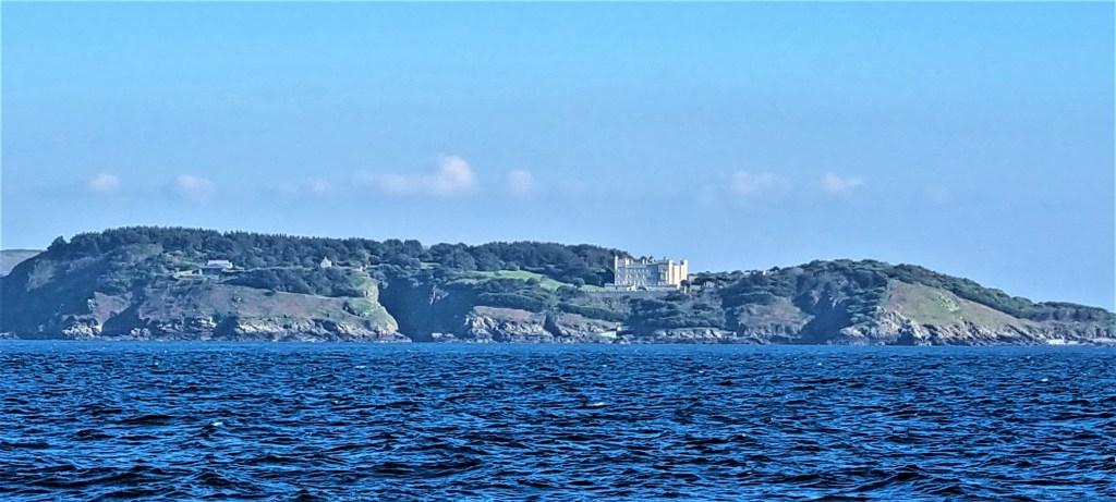
In 1993, the lease of neighbouring Brecqhou was bought by the Barclay Brothers, David and Frederick, who promptly built a castle there. It is fair to say their relationship with the Sark authorities has been rocky.
Sark has long been governed by a body called the Chief Pleas, with representation from each of the Island’s 40 tenements plus 12 deputies selected by the population. But in 2008, Chief Pleas voted to reduce themselves to a 30-member body, all but two of them elected.
Most of the candidates chosen by the electorate did not find favour with the Barclays, who promptly closed down most of their businesses on Sark. The relationship remains strained, although David Barclay died in 2021.
More recently, the number of elected politicians has been reduced again, to just 18, nine to be elected one year, nine the next, all to serve a four-year term.
But in 2020, too few candidates stood for election and only six of the nine seats were taken up. A by-election was held in 2021 to fill the vacancies, but only two seats were filled.
There are also several official roles to fill, including: the President of Chief Pleas; the Seneschal or judge; the Prevot or sheriff; the Greffier, or clerk; the Treasurer; the Constable, or the senior police officer; and the Vingtenier, his assistant.
In 2021, the UK Ministry of Justice wrote to Sark expressing concern about its governance.

Sark is fiscally autonomous. There is no income, capital gains or inheritance tax. There is a capital tax, a property tax and a poll tax, the latter imposed on those landing at the harbour.
There is no unemployment benefit, maternity benefit or state pension, but there is a ‘procureur service’ that administers limited hardship funding.
Electricity is supplied by a private company, but there is no mains gas or water supply. Each family must provide its own water and manage its own sewage. Broadband, landline and mobile telephone services are available, there is a postal service and refuse is collected.
No cars are allowed on Sark, so transport is confined to horses, horse-drawn vehicles, tractors and bicycles.
Half of the population is aged over 60 but there is no NHS and no hospital. Visits to the doctor cost £40 apiece.
There is a small school, but older children must commute to and from Guernsey, or board there. The housing supply is limited and prices are out of the reach of many.
Sark pretends to be an idyllic utopia, though it is actually beset by difficulties.

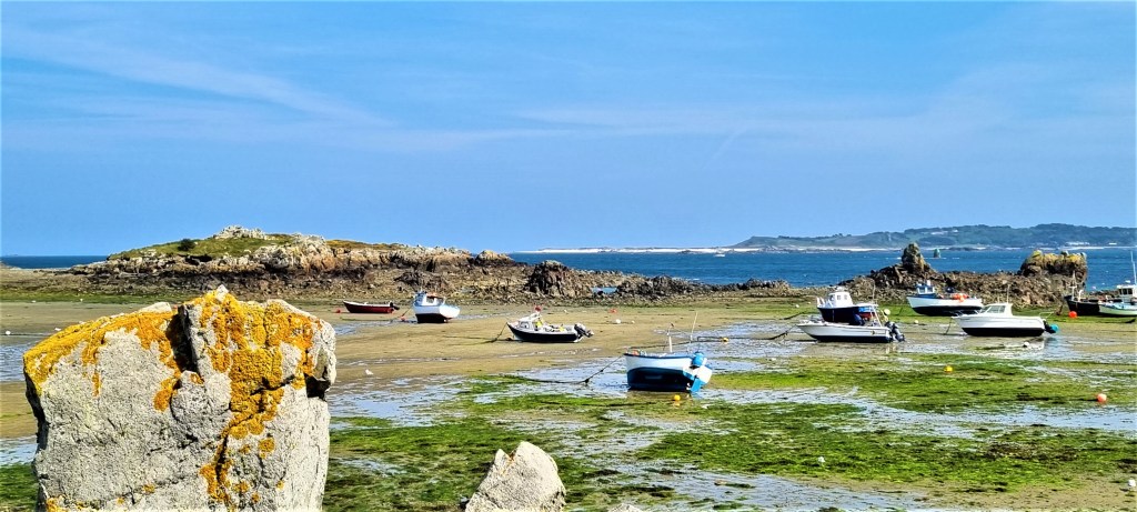
Our walk on Sark (Day 2)
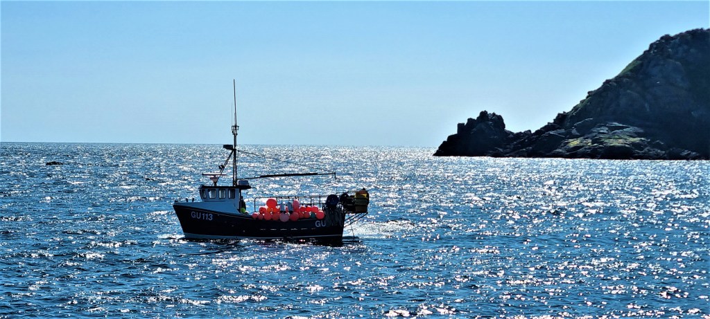
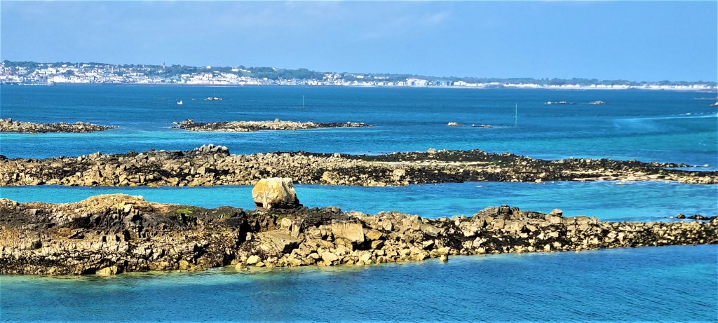
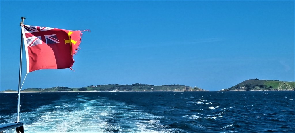
We headed down to St Peter Port’s Harbour in good time for the 10:15 crossing, aboard the Corsaire de Sercq, a 23-metre ferry with capacity for 157 passengers operated by the Isle of Sark Shipping Company.

Fortunately the weather was perfect and the sea calm. We climbed on to the top deck, with the hardier members of the group, to enjoy the beautiful scenery, including splendid views of Castle Cornet from the seaward side.

Our outward journey passed to the south of Sark, round Little Sark, between it and the small rocky islet of L’Etac, then along the west coast up to La Maseline, essentially Sark’s westernmost point.
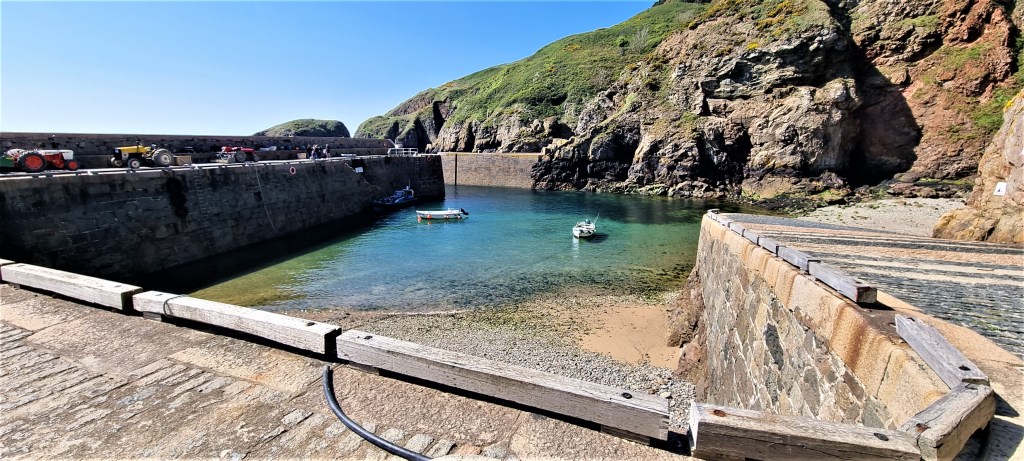
La Maseline is not really a harbour, more a small pier. The decision to build it, at a cost of £45,000, was taken in 1936, but it wasn’t used until 1948.
There was already a harbour, Creux, adjacent, built in the 1860s. But Maseline enables larger vessels to access the Island. Creux is now only used if weather conditions are particularly adverse, by fishing boats, or as the Island’s swimming pool.
It took us some time to moor, the delay seemingly connected with a large patch of seaweed and the freshness of the breeze.

When we did finally step from the boat to the pier, there were fortunately two burly crew members to steady us.
We had a look at Creux Harbour while making use of the toilets there, before passing through a tunnel to reach the rest of the Island.
After climbing a little way up the road, we took a path on the left that climbed steadily upwards. After a short while we encountered a pair of Sark’s horses, who seemed keen to say hello.

Leaving them behind, we followed a path over the cliff-top to Sarkhenge, constructed in 2015 to mark the 450th anniversary of Elizabeth I’s grant of the fief to Helier de Carteret. There are nine stones.
According to one authority:
‘Nine is the number of medieval ‘territories’ in which Helier’s 40 tenements were sited: Fort, Moinerie, Ville, Valette, Avant le Creux, Dixcart, Bourel, Beauregard, Petit Sercq. The circle divides by 40, giving 9 degrees of arc to each of the 40 men (quarantaine) gathered about their lord. His central disc stone is a pilotin, formerly used to support a granary or hayrick. Each of the group of nine (‘Ennead’) is aligned with a landmark (St Ouen’s, L’Etac, La Coupee, the Seigneurs Mill, Alderney) or by the sun. The solstice line SE/NW marks winter sunrise/summer sunset; orientation E/W is to the spring/autumn equinox. Many secret meanings of Sark Henge remain to be discovered.’

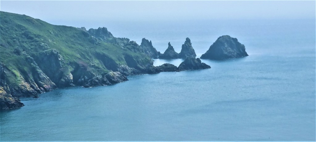
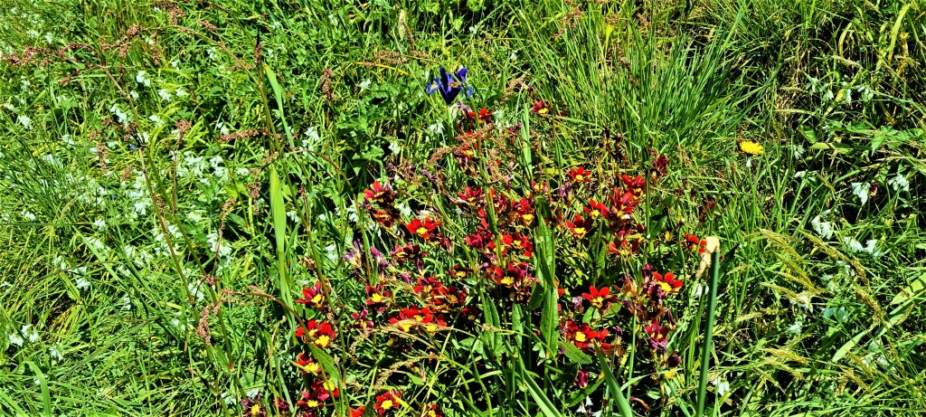
We paused here for morning coffee, overlooking the sea glinting far below. Then we continued round the coast above Derrible Bay and along a path through spring flowers and lush undergrowth that took us to Dixcart Bay.
In October 1942, the Commandos conducted a small-scale raid hereabouts, known as Operation Basalt. Twelve men crossed to Sark on a motor torpedo boat, climbing up the cliff on to the Hogsback, between the two bays.
They broke into a house whose owner told them there were 20 Germans in the annex to Dixcart Hotel. They killed a guard and took five prisoner, but could only get one back to England.
This led to the deportation, to Germany, of 48 inhabitants and is said to have influenced Hitler’s subsequent order that all captured commandos should be executed.
The following year, at Christmas, a mixed group of English and French commandos tried to attack Sark via the Hogsback again. But they initially failed to scale the cliffs and, on their second attempt, lost two men in the minefield sown by the Germans. The remainder escaped by canoe.

We went on, southwards, along the clifftop path until we reached a seating area with toilet just above the narrow neck of land that joins Great and Little Sark, known as La Coupee. Here we took our lunch.
Immediately afterwards we traversed La Coupee, which is 90 metres long with a drop of 100 metres on both sides. Railings were not installed until 1900, the road being added in 1945 by German PoWs.
A horse-drawn cart struggled up the incline towards us before we crossed in our turn.

The bay below us, known as La Grand Greve, was beautiful and almost deserted, save for a single sunbather. Looking behind us, we could see Brecqheu, with its fort, basking in the afternoon sun.

We went on through Little Sark, past the La Sablonnerie Tea Garden, which was unfortunately closed, though we did have a quick look at the flowers.
Eventually we arrived at the silver mine, located near Port Gorey. Under the terms of the fiefdom, all mining rights had been vested in the Seigneur, but it was not until 1833 that a mining engineer discovered a vein of copper and silver.
The Seigneur of that time, Peter Le Pelley contracted with the engineer, called Hunt, who paid him £1 per year plus 6% of the value of the ore mined. In 1834 some 250 Cornish miners were imported to undertake the bulk of the work.
Little had been recovered before Peter Le Pelley was drowned at sea, whereupon his brother Ernest became Seigneur. More silver was found, so Ernest mortgaged the Seigneur’s rights for £4,000, which he spent on additional mining equipment.
Hunt formed the Guernsey and Sark Mining Company, issuing 200 shares at £5 apiece. But then one of the three shafts was flooded by seawater. By 1844, the operation had cost £34,000, but only £4,000-worth of silver and lead had been mined.
The machinery had to be sold and the mine closed. Ernest Le Pelley was unable to redeem his mortgage and had to sell the Seigneurship – to Marie Collings.
We decided against continuing down to the sea’s edge, to study the Venus rock pool at close quarters, and somehow got waylaid by an over-large pink deckchair, stuck, pointlessly, in the middle of a field.
Then we returned back the way we had come, over La Coupee and along the road to Caragh Chocolates, where we sat in the garden, having bought tea and souvenirs.
Continuing along the road, we eventually reached the Methodist Church, built in 1797. It was moved from its previous position in 1926 because the singing was too loud for one neighbour to stomach. There is also an Anglican Church on the Island, built in 1820.
We strolled northwards to take a closer look at the Seigneurie House and Gardens. The oldest parts date from 1675, but the building has acquired many additions over the centuries.

Here we heard rather more about the life of Dame Sibyl Hathaway, nee Collings. Her father was a notorious eccentric who treated her like a boy, teaching her how to shoot, sail and rock-climb.
But, in 1899, at the age of 15, she fell hopelessly in love with British painter and army officer Dudley Beaumont.
Her father disapproved and, in 1901, threw her out of the house after a nocturnal argument. She left Sark and, shortly afterwards, married Beaumont in London. They had seven children.
The family returned to Sark in 1912, but Beaumont soon died in the 1918 flu epidemic. Sibyl had to support her large family, since neither her father nor her father-in-law was prepared to contribute. In doing so, she became fluent in German.
Her father dying in 1927, she succeeded him. In 1929 she met Robert Hathaway and quickly married him, he still completely unaware that this made him Seigneur.
When the Germans arrived in July 1940, Sibyl insisted on staying on Sark, and urged the remainder of the population to do likewise. She commanded the respect of the German officers. Meanwhile, her eldest son was killed in the Blitz and her husband was deported to a prison camp in February 1943, remaining there for the duration.
Hathaway died in 1954. In 1965 Sibyl was made a Dame, on the 400th Anniversary of the award of Sark’s fiefdom. She herself died in 1974, aged 90.
Looping round beyond the Seigneurie, we made our way back to the centre of town, taking a tour along the main shopping thoroughfare, where almost all of the shops were closed.

We sat awhile at the top of Harbour Hill, while a few of our group sampled the beer at the Bel Air Inn. Then we strode back down the footpath in good time for the 17:45 ferry back to Guernsey.
On the way back we sat once more on the top deck as, this time, we sailed round the Island in the opposite direction.
This gave us a chance to see the coastline of that northern section of Sark we had missed and, later, a splendid view of the Barclay castle on Brecqhou.
Sark was a fascinating place, with much beautiful scenery, charmingly anachronistic perhaps, but also more than a little bit ‘chocolate boxy’.
I was quite happy to be spending only a day there.

Herm
The following day we visited Herm, much closer to Guernsey and rather smaller: one-and-a-half miles long, half a mile wide and about four miles around.
The permanent population is 65 or so, but that increases to 100 in high season, and the Island can have as many as 100,000 visitors each summer.
The States of Guernsey bought Herm and neighbouring Jethou in 1949, but let them to tenants.
The present tenant, Herm Island Limited, is a subsidiary of a charitable trust, Starboard Settlement, which supports developing countries. Jethou is presently leased to Sir Peter Ogden and is closed to the public.
Tourism is the mainstay of Herm’s economy: there is a hotel, perhaps 20 holiday cottages and two campsites.
Cars and bicycles are banned, though quad bikes and tractors are permitted, to transport staff and luggage.
There is a primary school, typically with between five and ten children. The Island generates its own electricity, but supplies are limited, so electric cookers and dishwashers are frowned upon, though washing machines are permitted!
There were Neolithic and Bronze Age settlements here and much of the north of Herm is believed to have been a dedicated burial site. An obelisk, located on the common, marks the site of a Neolithic grave.
Possibly as early as the Sixth Century, followers of St Tugual (or Tudwal) arrived. He was one of the seven founder saints of Brittany, but it is not known whether he visited Herm.
The present Chapel is Eleventh Century, though enlarged in the Thirteenth Century, and was built by Norman monks. During the Sixteenth Century it was still used by the Augustinian and Franciscan orders, but then fell into disuse.
From the Sixteenth to the Eighteenth Century, Herm was mostly uninhabited, used predominantly, by successive governors of Guernsey, as a hunting ground.
But, early in the Nineteenth Century, a local population was established, built around employment in the Island’s granite quarries. This quarrying was extensive and disturbed some of the ancient burial sites.

In 1889, Herm was leased by the British Government to German Prince Blucher and his English-born wife. They stayed until the outbreak of the First World War, and are principally remembered today for introducing red-necked wallabies here, none of which survive.
By 1920, the lease had passed to novelist Compton Mackenzie, who moved here from Capri but stayed only three years.
During the Second World War the Germans displayed little interest in Herm, though they were said to have used it to make a propaganda film called ‘The Invasion of the Isle of Wight’. Herm escaped the fortifications that blight most of the other islands.
But that didn’t stop those redoubtable British commandos from staging another abortive raid, called Operation Huckaback, in February 1943.
Our Walk on Herm (Day 3)
We crossed to Herm on the 10:30 Travel Trident ferry service, which has operated since 1969. The Island also runs its own ferry, Isle of Herm.
On the way over I discussed the merits of Dr Feelgood with another group member, while taking photographs of the Martello Tower and various rocky islets. Tracy is too young to recall the original Dr Feelgood.
The trip took only 20 minutes and we landed at Rosaire Steps, since Herm’s Harbour is only accessible for three hours either side of high tide.

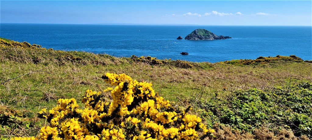
We walked south, round the coast path in an anti-clockwise direction. The spring flowers do not grow in quite such abundance here as on Sark, but are still striking. The scenery was equally beautiful, though perhaps a little wilder.
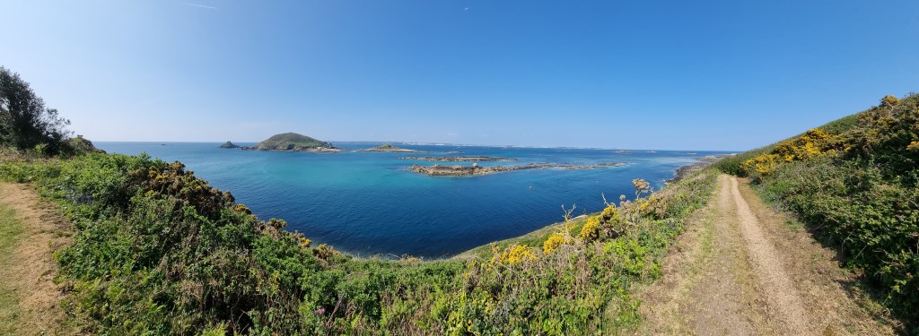
As we walked, our view shifted from Guernsey, with Herm’s close neighbour Jethou in the foreground, to more distant views of Sark and Brecqhou.
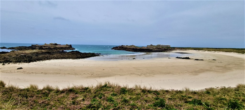
We passed snug Belvoir Bay before eventually arriving above the long stretch of Shell Beach which lies to the north of Island and continues for almost three-quarters of a mile.
Here we stopped for coffee at the Beach Café. I had been contemplating a paddle, despite my cold, but the skies were clouding over and a biting wind was rampaging fiercely across the sand, so I thought better of it.
We continued along the beach, into the stiffening gale, while trying to keep an eye out for the prettiest shells.

Once we reached the top end, shortly after Oyster Point, rather than complete our circuit, we elected to go inland. We climbed up, through the dunes and across the common, towards the ‘village’.
Here we admired the Manor House, built by the Bluchers, as well as St Tugual’s Chapel and its peaceful garden.

Continuing down to the Harbour, we strolled up to the newly-appointed toilets then ate our lunch close by, on Fisherman’s Beach, before wandering back down again. We cast an eye over the White House Hotel, which opened in 1949 and has no clocks, telephones or televisions in the rooms, to give guests peace and quiet.

You will find wall-to-wall wi-fi though, which rather defeats the object.
We returned to Guernsey on the 14:35 sailing, initially confusing the Isle of Herm ferry for our own.
After buying up a generous stock of tissues and lemsip from the local Co-op, we strolled a little more around St Peter Port, eventually heading along Castle Pier to have a closer look at Castle Cornet. From across the Harbour, the Town looked beautiful in the late afternoon sun.
Alderney
Alderney is the third largest of the Channel Islands, after Jersey and Guernsey, but significantly smaller than either of those. It is approximately three miles long and one-and-a-half miles wide. The population is a little over 2,000, many of whom live in the ‘town’ of St Anne.
Like the other islands, Alderney has its share of Neolithic remains but, uniquely, there is also Fourth Century Roman fortification. It too became part of the Duchy of Normandy.
In the mid-Sixteenth Century the Tudors engaged in some half-hearted fortification of their own. In 1559, one George Chamberlain purchased the Governorship. The role seems to have passed briefly to the Earl of Essex, who bought it for £1,000, but then went back to the Chamberlain family following his execution in 1601.
Cromwell appointed Nicholas Ling Lieutenant Governor then, in 1660, Charles II gave the title of Governor to Edward de Carteret, Ling remaining Lieutenant-Governor.
The de Carterets sold the Governorship to Sir Edmund Andros, who was granted a 99-year lease which cost him 13 shillings a year.
It then passed down, through marriage, to the Le Mesurier family, who had become prosperous through privateering, But, in 1825, they returned the Governorship to the Crown in return for an annual pension of £700. The Judge of Alderney, as the most senior Crown appointee, assumed leadership and this tradition persisted until 1949.
In the 1850s, the British, worried about the French naval and military threat, built extensive fortifications at a cost of £250,000.
A large body of workers was imported to construct these buildings and a garrison of 7,000 soldiers to man them. French defeat in the Franco-Russian War rendered them almost completely redundant.
Before the Germans arrived in 1940, virtually the entire population of Alderney evacuated, in stark contrast to what happened on Sark.
The Germans were also seized with an urgent need to over-fortify. By 1942 they had established four labour camps for construction workers – a mixture of volunteer and slave labour. More than 700 deaths were recorded before the camps were closed in 1944, when the workers transferred to France.
Some of the population of Alderney returned from December 1945, though more than half chose to stay away. Many of the buildings were derelict or destroyed. For two years, the Island operated as a communal farm, with profits put towards rebuilding the infrastructure.
A legislature was established – The States of Alderney, comprising a President and ten States Members – but a number of responsibilities (such as policing, the airport, health, education and social services) were transferred to Guernsey. Alderney also has its two representatives in Guernsey’s parliament.
There is an Alderney Railway, the only working rail service in the Channel Islands, which opened in 1847 and runs along the coast for two miles. It was originally built to carry quarried stone. Queen Victoria and Prince Albert, who visited the Island three times, were the first human passengers in 1854.
Alderney people – officially known as Ridunians, unofficially ‘lapins’ – are said to have a reputation for excessive drinking. Novelist TH White lived here from 1946 until his death. Other one-time inhabitants include John Arlott, Ian Botham, Julie Andrews and Duncan Goodhew.
Alderney is known for its blonde hedgehogs, descended from a pair released in the 1960s. A distinct though small breed of Alderney cows sadly became extinct in 1944.

Our Walk on Alderney (Day 5)
For some strange reason we were booked on the 07:25 flight from Guernsey to Alderney, which meant we had to be up in time to snatch breakfast at 05:30, before climbing aboard our coach at 06:00.
We arrived at the Airport to find lengthy queues for security, because one of the X-ray machines had broken. Those on earlier flights were called to the front of the queue, delaying us still further.
We had to remove our walking boots and I was asked to take off my belt. When I responded, ‘fine, but that may take a few minutes’, they relented.
Quite why such intense security is necessary for a brief trip from Guernsey to Alderney – especially when the corresponding security for the return journey is so much more relaxed – entirely escapes me.
Fortunately we were able to recuperate with mugs of strong coffee from the Airport café, and there was also a handy fountain from which to fill our water bottles.
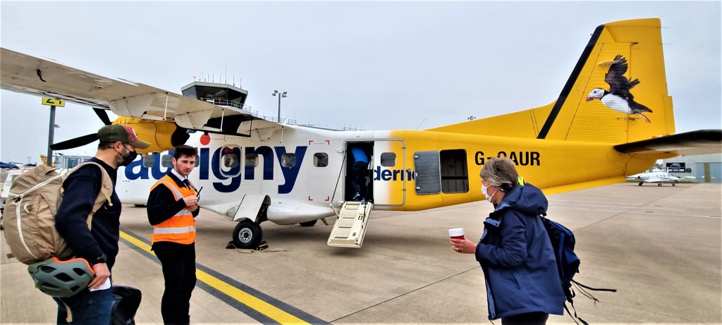
We flew aboard a tiny, cramped Dornier with capacity for 19 passengers. The journey took 20 minutes. We heard that we were fortunate: both Aurigny’s Dornier aircraft had been out of action for several days the previous week. I took a few photos on the way over.
‘Arrivals’ at Alderney proved to be a small tea room, so we stopped for more refreshments before getting under way.
Here we met and chatted with the two Alderney representatives in Guernsey’s parliament, who seemed very friendly and down to earth.
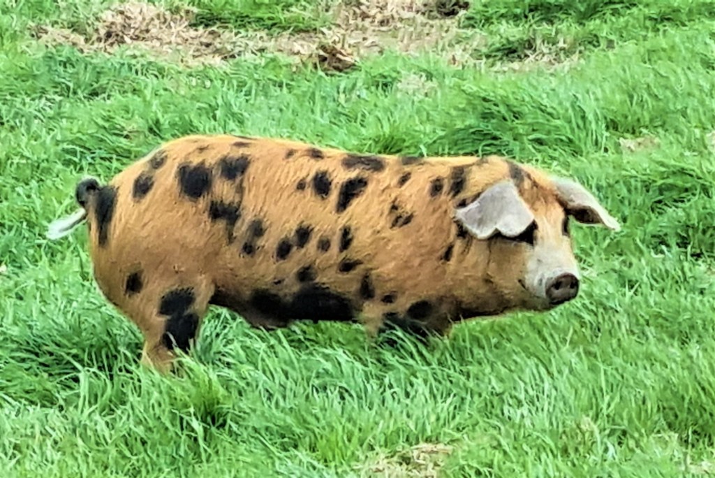
Finally we departed, heading past a small piggery containing several Oxford Sandy and Blacks. The weather was bitterly cold and cloudy, which didn’t present Alderney in its best light.
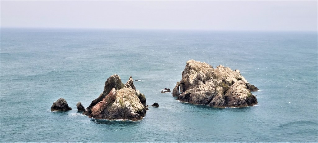
Before long we were standing at the cliff edge, overlooking the huge Gannet colony on Les Etacs, a group of rocky islets just offshore. Some 12,000 birds reside here from March to September.
They first arrived during the Second World War. Les Etacs and nearby Ortac are thought to account for some 2% of the global population, up to 70% of which nest round the British Isles. Outside the breeding season they migrate as far as North-west Africa and the Middle East.
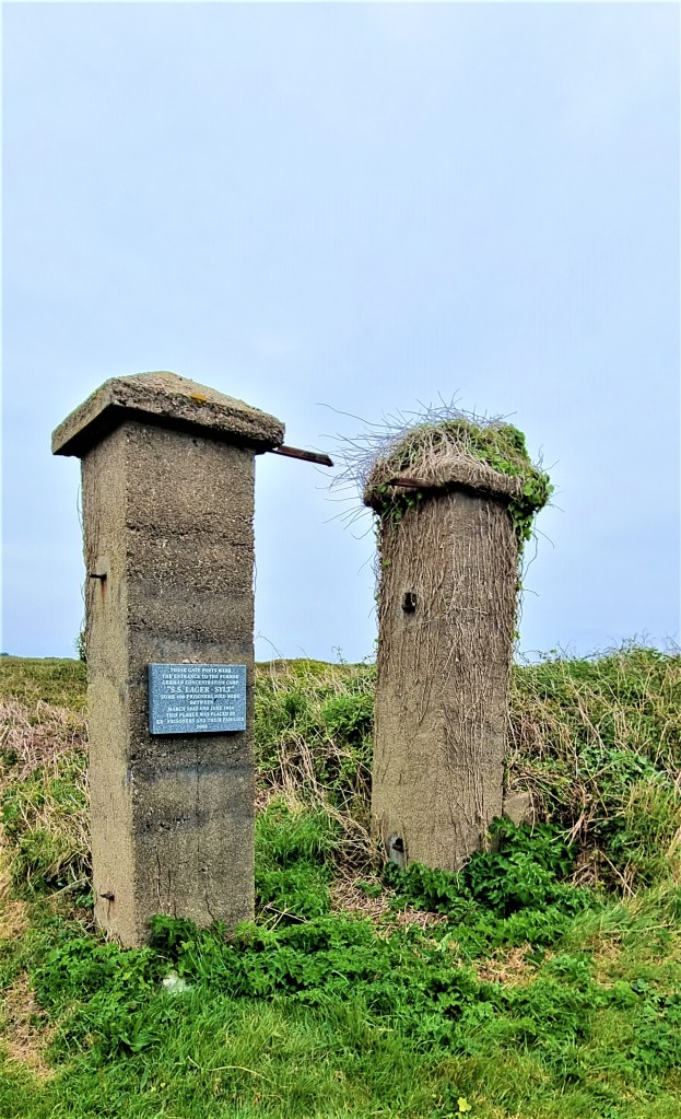
Retracing our steps, we skirted the Airport, passing the remains of Lager Sylt, a wartime concentration camp which housed slave labourers. It was originally built in 1942 to accommodate up to 200 prisoners, some 20% of which had died within a year. In 1943 a further 1,000 prisoners arrived and camp management was transferred to the SS.
The gateposts at the entrance are still standing, and a plaque has been attached by former prisoners and their families, recording that some 400 inmates died between March 1943 and June 1944.
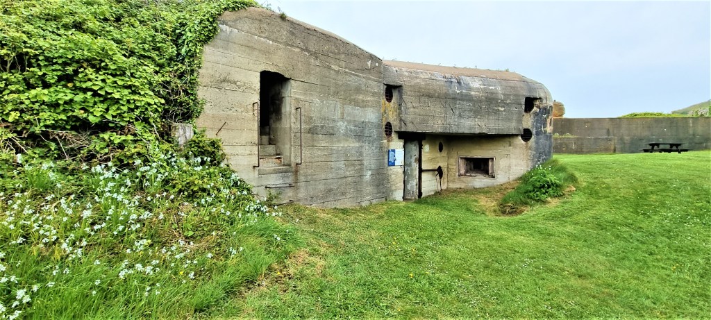
The horror of this recent history hangs like a pall over Alderney. There is relatively little commemoration of the people who lost their lives, but every single surviving pile of Nazi concrete speaks eloquently of the suffering of those forced to construct it.
Continuing round the coast in an anti-clockwise direction, we reached the Alderney Wildlife Trust bunker, once a Luftwaffe VHF radio communications station. It is located on the edge of a nature reserve and was restored by the Trust in 2002, to serve as an information point about the Island’s natural history.
We climbed through the gloomy compartments and peered out of the observation post before emerging out into the wind and rain.

Somewhere hereabouts we lost the coast path, drifting into the outskirts of St Anne before emerging on a road containing a series of large sheds and a cemetery for rusty vehicles. We were soon passing the Alderney waste disposal and recycling centre, heading speedily in the direction of Essex Castle.
This was the site of an incomplete Sixteenth Century fortification known as Les Murs de Haut, later rebuilt in the 1850s as one of 18 Victorian forts and batteries, designed to protect against French invasion.
In 1869, part of Essex Barracks became a military hospital and, during the Second World War, the Germans repurposed it, continuing to call it Burg Essex.
Down below, we could see the imposing bulk of Fort Ile de Raz, lying at the end of a causeway stretching out from the far end of Longis Beach.

We descended to a garden centre, with a café where we ordered coffee that took an eternity to arrive. Tracy and I filled our reusable mugs from the cafetieres provided and walked down to the benches above the Beach, where we found a pair of binoculars left on the seat beside us.
Eventually everyone finished their coffee and we reunited before entering The Nunnery, which also lies just above Longis Beach.
This astonishing hotch-potch of buildings is branded ‘the best-preserved Roman fort in Britain’. It was subsequently ‘improved’ in the 1790s, with the construction of a barracks – later converted into a private residence – and other buildings within the original walled fort.
Then the Germans added machine gun positions and a bunker, with walls two metres thick, called ‘Piratenschloss’.
Just outside there is another anti-tank bunker, and the back of the beach is protected by a lipped anti-tank wall, six metres high and punctuated by anti-tank gun positions.
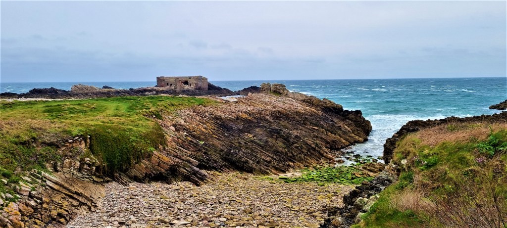
The north-eastern extremity of Alderney is crowded with fortifications. Fort Houmet Herbe, built on an island, was one of three left unimproved by the Germans. A little beyond lies Fort Quesnard.

Quesnard Lighthouse, built from granite in 1912, is sandwiched between Fort Quesnard and Fort Corblets, beside Corblets Beach. When we passed, it was almost entirely shrouded in scaffolding and plastic sheeting, a huge black metal foghorn squatting atop a low white building alongside.
Inland we could see the forbidding profile of The Odeon, built as a range-finding position for the German navy, with three observation slits, each linked to a different battery. It was intended to form part of a network of six towers around the Island, but the other five were never built.
Fort Corblets was completed in 1855 and was also modified by the Germans, who called it Strandfeste. Since then, it has undergone extensive refurbishment and seems recently to have been converted into living and rental accommodation.
Across on the other side of Corblets Beach is Chateau a L’Etoc, also completed in 1855, which the Germans used as an anti-aircraft battery. Just behind it we could see a yacht, its sails furled, struggling to make headway through the choppy seas.

We turned inland, to Saye Campsite (allegedly pronounced ‘soy’), where some benches in the lee of the closed café gave protection from the biting wind. Here we stopped for lunch.
This was formerly the site of Norderney Camp, where the Germans kept up to 1,500 forced labourers, mainly from Ukraine and Russia, but also Spanish Republicans and French Jews. The inhospitable conditions brought them more vividly to mind.
Soon we could see Fort Albert and, beyond it, the enormous breakwater, stretching out across Braye Bay from Fort Grosnez on the other side.

This 910 metre monstrosity was built between 1847 and 1864. It was originally almost 1,500 metres long, but 540 metres has been lost to the sea. An eastern arm was planned but never built.
We passed Fort Albert and Alderney Football Club, following the Rue de Beaumont around Braye Beach until we reached the Braye Road railway station at the far end.

At this point, rather than continue round the remainder of the west coast, with its windswept beaches and ubiquitous fortifications, we opted to turn inland to see St Anne.
Climbing steeply up Rue de Braye, we eventually reached Victoria Street, walking along to St Anne’s Churchyard. By this stage, the early start and my cold were beginning to wear me down, so we sat for a while before touring up and down the street. As on Sark, most of the shops seemed closed.
The present church is a large Victorian edifice which replaced most of its medieval predecessor, excepting only the clock tower. The Germans removed the bells, to be melted down, replacing them with a machine gun post in the belfry.
Four bells were rescued from Cherbourg after the War, where they had survived intact. The Seventeenth Century Bible was also ‘borrowed’ by the German Chaplain, but belatedly returned by his widow in 1998.
Victoria Street held little to entertain us. Eventually we reassembled in the Churchyard and walked along the High Street, past the entrance to the Museum, before heading out along the road back to the Airport.

We arrived there shortly after 15:00, in more than good time for the 16:05 flight back to Guernsey.
Back in the tearoom, we chatted to two women who were moving to Alderney from Guernsey. They felt that the former had become far too busy, especially with traffic, while the latter was much how Guernsey used to be.
When I asked about the effect of all those fortifications (and, by implication, the oppressive wartime history of the place) they claimed not to be affected by it. I suppose it fades with increasing familiarity.
We had to don masks to pass through security – a body scan and a swift peak in our bags – and were seated in a shipping container while we watched a safety video on a permanent loop until, hearing my pleas, someone finally put it on ‘pause’.
Once aboard the Dornier, the poor pilot seemed to be undergoing an assessment. A rather more senior pilot, in the front passenger seat, gave an officious address, telling us to switch off our phones.
He hadn’t heard of ‘airplane mode’. Not that the conditions outside were at all conducive to photography.
It was a relief to be off that plane, on the coach and back to our Hotel. Somehow that humourless pilot had succeeded in channelling the gloom-laden atmosphere of Alderney.
But perhaps a warmer, sunnier day – and being cold-free – would have helped to dispel these overwhelmingly negative vibes.

Afterword
It had been an intensive week of walking and eating. We had covered around 65 miles over six days, consuming seven substantial breakfasts and seven hefty three-course dinners.
Our group had managed to hang together without any serious arguments, even though we counted amongst our number a few ‘strong personalities’. I discovered that I was seriously out of practice when it comes to walking sociably while conversing politely.
Of the islands we visited, I enjoyed Herm most of all, because of its unspoilt, unforted and unpretentious nature.
The first section around Guernsey – the south-eastern corner – was exceptionally beautiful; the remainder variously scenic.
Sark was lush and beautiful in places, but somehow not quite real, while Alderney was steeped in history, but thoroughly over-fortified and still haunted by the sad ghosts of the many who died there.
After our final breakfast we were transported back to the Airport where, miraculously, the broken X-ray machine was mended.
The flight to Gatwick proved uneventful, though the journey from there back home was more than usually problematic, thanks to unhelpful timetable modifications.
I very much needed a rest.
.
TD
May 2022


Leave a comment