.
The second stage of the North Downs Way is roughly 13 miles.
We began with the intention of completing the stage in one go, but gave ourselves the option of finishing early at Gomshall and completing the walk at a later date.
In the event, this is what happened. We walked from Shalford to Gomshall on the first Saturday in June and then from Gomshall to Westhumble a fortnight later.
On both occasions we caught a relatively early SWR train to Guildford and, having breakfasted on the platform, courtesy of FCB Coffee, changed on to the GWR service to Redhill.
We returned from Gomshall the same way but from Westhumble we caught a train to Wimbledon and changed there.
.
Shalford to Gomshall
It promised to be a warm, sunny day so I hastily applied factor 50 before alighting at Shalford Station.
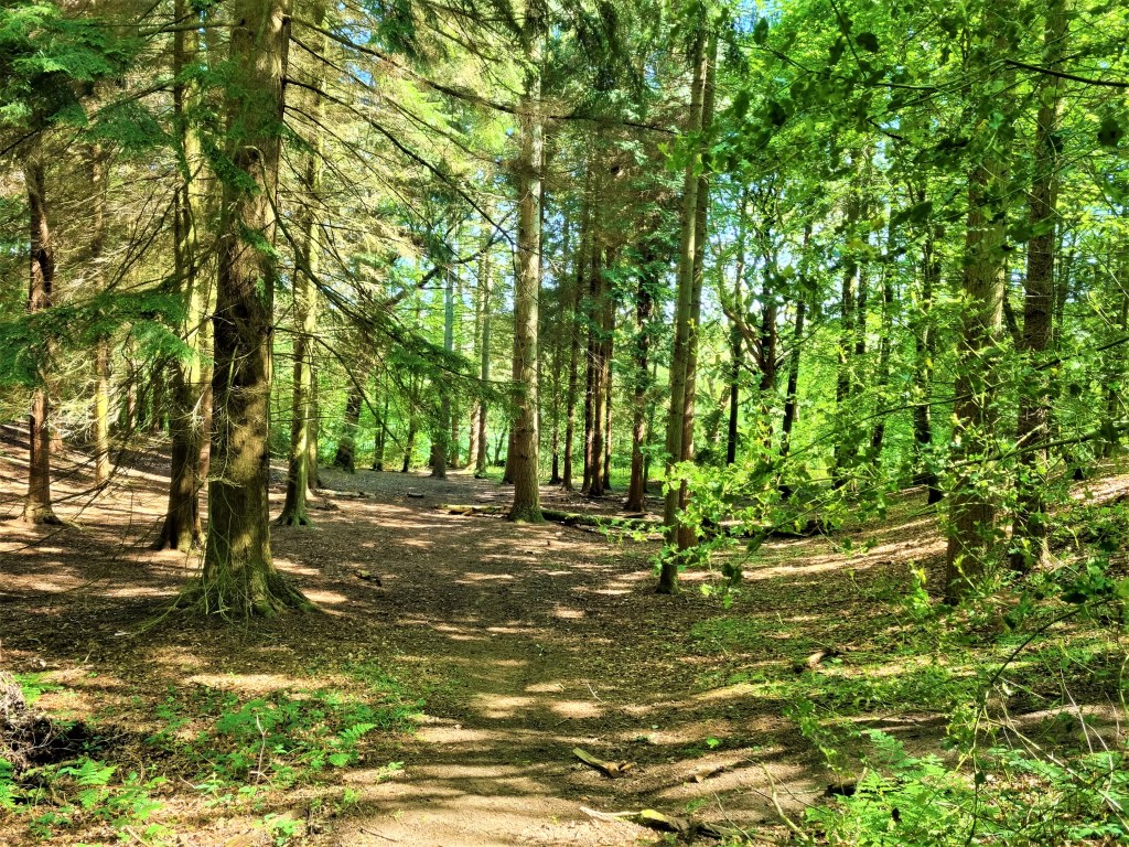
We had to trek a mile or so along the busy A281 before reaching the start, turning right into Pilgrim’s Way which took us to the edge of Chantry Wood.
Part of this land once belonged to Henry Norbridge, Mayor of Guildford, who was buried in Holy Trinity Church in 1512. He bequeathed the rents to pay for a chantry, where prayers would be said for his soul.
We were soon climbing steeply along a sandy track, eventually arriving at St Martha’s Church atop St Martha’s Hill. There may have been a Saxon chapel here. The subsequent church, built between 1189 and 1204, was soon afterwards adopted by Augustinian monks.

But it was badly damaged in 1745 by an explosion at a nearby gunpowder works which caused the tower to collapse. The ruined church was used for a century but eventually fell into disuse.
Then the landowner, the Duke of Northumberland, had it rebuilt. The new church was completed in 1850, the designer – Edward Woodyer – paying homage to the features of its predecessor.
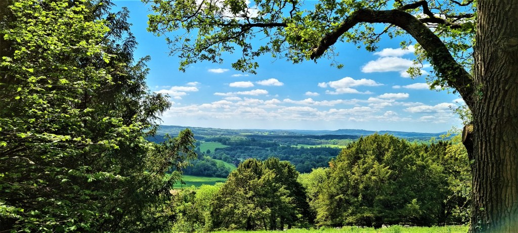
We sat for a while in the shade of a tree, drinking coffee and looking out over the panorama below. Some say you can see seven or eight counties from here.
The churchyard brought back memories of a Ramblers walk which paused here, only for an elderly Rambler to practice his press-ups on a gravestone.
Leaving by the eastern end, we passed the memorial to Yvonne Arnaud (1890-1958), the pianist, singer and actress who gives her name to Guildford’s theatre.
Eventually the sandy surface gave way to limestone as the path climbed up on to Albury Downs and then along towards Newlands Corner, giving views of the Greensand Ridge to the south.
We stopped briefly to use the facilities at Newlands Corner, which was bustling with visitors.
It was here that Agatha Christie briefly disappeared in December 1926, provoking a huge search and much frenzied press coverage. Her husband had asked her for a divorce so he could marry his mistress, causing a bitter row.
Christie was discovered eleven days later, having checked into a hotel in Harrogate under the name of the mistress, claiming to have no recollection of intervening events.
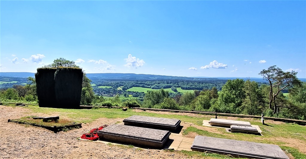
Shortly afterwards we passed the Optohedron, a sculpture by Will Nash placed in a small clearing on the hillside, set against the trees and fields below.

In this section we saw many butterflies, especially yellow ones.
Towards the end I noticed what seemed to be two conjoined trees. Tracy later researched the rare phenomenon of inosculation or self-grafting.

Ever since leaving St Martha’s we had encountered numerous mountain bikers. I think this must have been the Bramley Trail Ride, which had been shifted to the summer as a consequence of lockdown.
By the south-east corner of West Hanger we came across the finishing line – and a handy coffee van. Here we paused for lunch, making use of a shady bench and table hidden under the trees.
On resuming we took a wrong turning initially, but soon found ourselves on the so-called Canadian Road, running north of Netley Park and on to Netley Heath. Canadian forces were based in the run up to the Normandy Landings.
Arriving on Hackhurst Down, we rendezvoused with Public Byway 515, also known as Beggars Lane, which took us safely down to Gomshall.
According to the National Trust, it is called Beggars Lane because medieval pilgrims would often head down from the Pilgrims’ Way to beg for food. This seems unlikely.
Gomshall has strong connections with E M Forster, who lived in the nextdoor village of Abinger Hammer from 1925 to 1945. He owned a wood called Piney Copse that adjoins Beggars Lane, donating it to the National Trust when he died in 1970.
.
Gomshall to Westhumble
This was a cooler, cloudier day following a night of heavy rainfall, but we encountered little mud and few significant puddles.
Emerging from Gomshall Station, we strode purposefully along the A25 towards Abinger Hammer before starting the ascent of Beggars Lane.
Thinking to distract Jacqui, I launched into a vigorous discussion of Gender Critical and Trans Exclusionary Radical Feminist beliefs. (I can’t be the only male savouring the irony of ardent feminists engaged in gender-based oppression and transmisogyny.)
This worked a treat, but now I must find another controversy to power her up Box Hill!
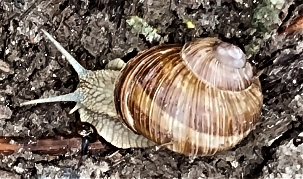
On the way up we encountered our first Roman Snail, which apparently thrives on chalk soil. It is a protected species in England, making it a criminal offence to step on one.
After pausing for coffee on the first available bench, we transferred from Hackhurst Down to Blatchford Down and began to pass a series of pillboxes.
In the summer of 1940 the Germans were preparing Operation Sea Lion – the invasion of the British Isles – and part of the War Office was busy designing defensive fortifications. There were seven basic pillbox designs, but these were often adapted by the companies that built them.
I believe these are Type 24 pillboxes, redbrick, broadly hexagonal with extra-thick shellproof walls. They were once part of a sophisticated Outer London Defence Ring, and were primarily intended to stop advancing tanks.
We climbed into a couple of the best-preserved, experiencing the perspective of the soldiers once stationed here.

Following a brief descent to White Down Lane, passing north to south, we found ourselves following a well-defined woodland path, broadly parallel with Ranmore Common Road, looking down to our right on the railway line running into Dorking.
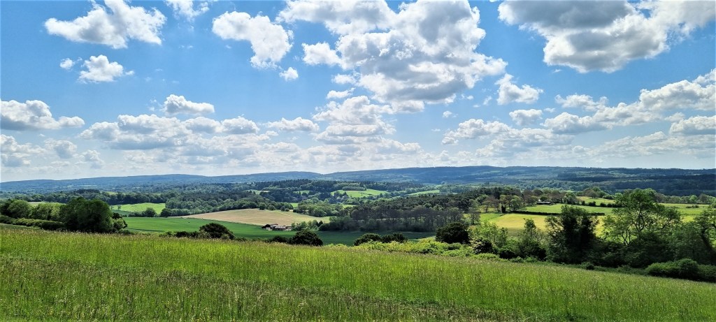
Arriving on Ranmore Common, we were fortunate to find an empty bench where we ate lunch looking out across at Westcott, which only just avoids being a Dorking suburb.

Afterwards we crossed Ranmore Common Road, then on past St Barnabas Church and its accompanying school, built in 1859 to serve the workers on the Denbies Estate.
Back in the Sixteenth Century the farmhouse here was owned by one John Denby. Later there was a Georgian House built as a weekend retreat by Jonathan Tyers in the mid Eighteenth Century.
Then, a century later, the land was bought by Thomas Cubitt, a builder who was completing Osborne House for Queen Victoria. He had a new mansion constructed to his own design but died soon afterwards.
The Estate was inherited by his eldest son George Cubitt, a politician and peer, who expanded it to the point where it employed some 400 workers. But it subsequently fell into decline, as succeeding generations of Cubitts struggled to pay death duties.

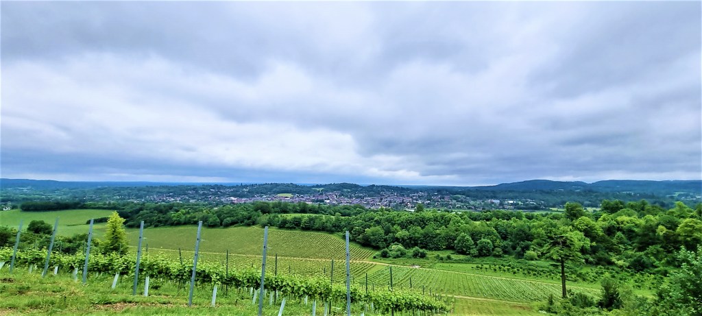
Eventually in 1986, Denbies Wine Estate was established, now the largest vineyard in England.
The route now skirts the Estate, descending slowly towards Westhumble. This name is said to derive from the Old English for ‘Wych Elm’ and the Middle English for ‘tree stump’.
Fanny Burney built a house here in 1797, Camilla Cottage, paid for with the proceeds of her novel of that name, published the preceding year.
We headed on to Westhumble Station, disappointed to find the small café hosted by Pilgrim Cycles still closed.
.
TD
July 2021


Leave a comment