.
Covid restrictions meant another eight months had elapsed since we were last able to walk the Coast Path, so this trip was eagerly anticipated.
We based ourselves in Padstow this time round, intending to walk at least to Newquay and ideally beyond.
We had a full week, from Friday to Friday, though both Fridays were taken up with travelling. We decided that our last full day, Thursday, would be a rest day, giving five walking days in all.
The weather was good at the start and end of the week, but mixed in between, with several sharp downpours and one particularly soggy afternoon of persistent rain.
We tailored our schedule accordingly, cutting short some of our walks rather than struggling on to target destinations through unpleasant conditions. We were supported in this by the more helpful bus routes along this stretch of coastline.
Our full itinerary eventually turned out as follows:
- Saturday – Port Isaac to Padstow (11.7m)
- Sunday – Padstow to Harlyn Bridge (7.1m)
- Monday – Harlyn Bridge to Porthcothen Bay (6.5m)
- Tuesday – Porthcothan Bay to Porth (7.5m)
- Wednesday: Porth to Holywell Bay (10.8m)
That gives a creditable total distance of 43.6 miles. By my calculation, it leaves us just short of the 200 mile mark, so not quite one-third of the way round, and it has taken us more than three-and-a-half years to reach this point.
.

Travel and Accommodation
Our travelling arrangements were virtually identical to those for our last trip – see Bude to Port Isaac (October 2020).
We caught a suburban train into London Waterloo, the Bakerloo Line to Paddington and then the 12:04 GWR departure to Penzance, alighting at Bodmin Parkway.
The service was relatively quiet, though one loud man informed the entire carriage of his plans for cycling from Lands End to John O’Groats. After a while I managed to tune him out.
On reaching Bodmin, just before 16:00, we rendezvoused with a Parnells taxi driven by Kevin, who deposited us in Padstow roughly half-an-hour later.
A week later we would return the same way we had come, Parnells picking us up at 08:30 (we had to vacate the cottage by 09:00) and dropping us at Bodmin Parkway in good time for the 09:30 service back to London Paddington.
Though due in at 13:29, it didn’t arrive until 13:45. My ‘delay repay’ claim was successful, netting us a 25% discount on the fares we paid for the homeward journey.
On arriving in Padstow we found our way – with some initial difficulty – to our cottage, at 6 St Saviour’s Lane. It was on the northern edge of town, perched some way up the hill, above the Harbour.
We had rented this through Cornish Horizons at a cost of £738 for the week, including a £40 booking fee and a £20 ‘Non-refundable accidental damage deposit waiver’.
That’s rather more than we have been used to paying, but we decided we wanted a garden and a quiet but relatively convenient location.
The property comprises a sitting room, dining room and small kitchen on the ground floor, with a master bedroom, bathroom and small second bedroom above. There is also a drying room accessed via the garden.
It had everything we needed, though the bath – essential after a long, wet walk – proved disappointingly small.

Amazingly we needed a taxi on just one other occasion, when we missed our last bus out of Newquay. But, though bus services exist hereabouts, they run infrequently, often way behind schedule, and stop very early in the evenings.
But they are still far cheaper than taxis. The drivers are also invariably friendly and relaxed, despite having to pilot their full-sized double deckers along dangerously narrow country lanes.
I have mentioned below the services we used each day. We were mostly reliant on the new Atlantic Coaster route (replacing the old A4/A5), operated by First Kernow between Padstow and St Ives.
This was introduced just days before we arrived and is promised ‘until further notice’, so hopefully will still be in place next time we need it.
.
Padstow
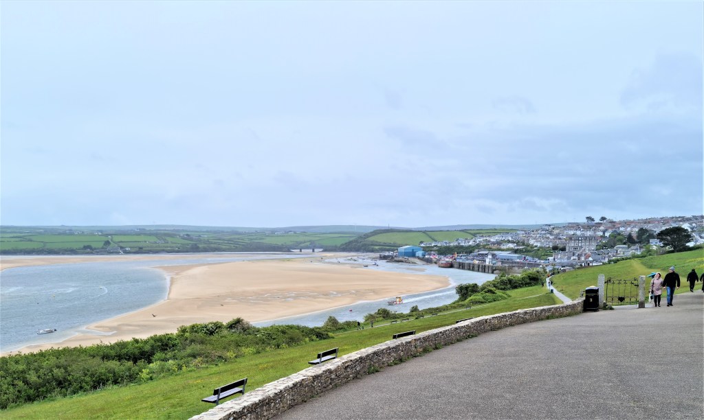
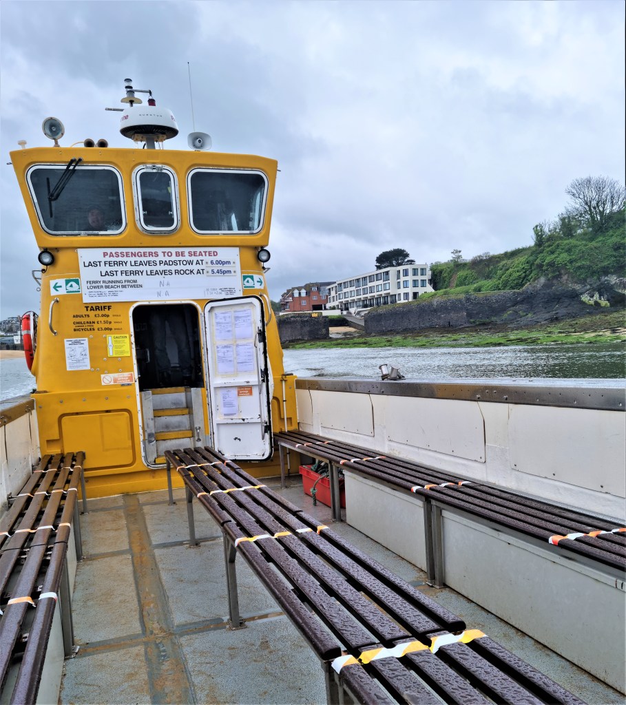
Padstow is a small town located on the west bank of the Camel Estuary, facing Rock on the other side. A small ferry plies between them during working hours, picking its way through the sandbanks when the tide is out.
The most infamous of these is Doom Bar, a corruption of ‘Dunbar’, which is itself derived from ‘dune bar’.
This was once a considerable obstacle to shipping hereabouts. It used to stretch almost across the mouth of the Camel, leaving only a small channel hard by the cliffs at Stepper Point. The prevalent wind gusted over the Point, threatening to blow incoming ships aground.
Mooring rings were installed and, by 1830, capstans were added so those ashore could pull vessels towards the safety of the Harbour. In 1848, part of Stepper Point was quarried away, to try to give incoming boats a fair wind. Dredging was also undertaken.
Then, around 1930, the channel round Doom Bar began shifting significantly to the east, so reducing the problem.

But there have been hundreds of shipwrecks here, notably HMS Whiting, a Royal Navy schooner wrecked in 1816 and the 1,118 ton barque Antoinette, which sank in 1895 as she was being towed to safety after an earlier incident off Lundy Island.
Local myth has it that Doom Bar was the result of a mermaid’s dying curse, but it is today best known as the beefy signature ale from Sharp’s Brewery, founded in Rock but now part of the Molson Coors empire.
The name ‘Padstow’ is a corruption of ‘Petroc-stow’, after St Petroc (c. 468 to c. 568) who landed on this coast around 500 and founded a monastery which later moved inland when threatened by Viking raiders. The present St Petroc’s Church dates largely from the 14th Century.
Medieval Padstow was a prosperous fishing port, trading with other towns along the Bristol Channel. The manor house belonged to Bodmin Priory but was leased to the Prideaux family before the Dissolution.
The present house was built in 1592 by Sir Nicholas Prideaux (1550-1627) and remains in the family.
Padstow is best known for its ‘Obby ‘Oss celebrations: a May Day festival with overtones of an ancient fertility rite. It is quintessentially Cornish…but can only be traced back reliably to 1803.

Nowadays Padstow is also something of a gourmet magnet: Rick Stein seems to own half the eateries; Paul Ainsworth most of the remainder.
On our last night we celebrated in style at St Petroc’s Bistro, opened by Stein in 1997. Conquering my aversion to seafood, I joined Tracy in sampling the Lobster Thermidor, said to be named after a controversial play, written in 1891 by French dramatist Victorien Sardou.
I have always been attracted by that name…It tasted perfectly fine, but it didn’t deserve the price we paid for it.
We also sampled takeaway fish and chips from Chip Ahoy – tasty but not the cheapest either – plus pie, crumble and a couple of pints at the Harbour Inn. The food here was good but it was strangely unsettling sitting in a pub for the first time in more than a year.

I should also declare that on Sunday morning we began with a full Cornish breakfast at Green’s, looking out over the harbour below. We enjoyed a tame robin begging – unsuccessfully – for food at our inside table. I would have preferred my eggs scrambled, but nothing doing.
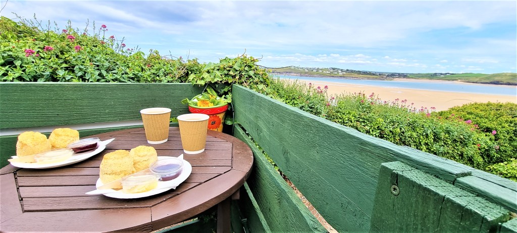
Perhaps the highlight of our culinary experience came at the delightfully unpretentious Rest Awhile Tea Garden a couple of miles along the coast path at Hawker’s Cove.
We visited on our rest day to savour beautiful cream teas, served on paper plates, while gazing down at the sun-drenched bay below. As usual I cut my scone into three thin slices and spread the jam atop the cream, Devon-fashion. Tracy prefers the Cornish way round. In time-honoured fashion we discussed preferences with fellow customers.
There is a small Spar supermarket in Padstow and a much larger Tesco’s on the outskirts. But we had pre-ordered a delivery from Sainsbury’s to cover our remaining breakfasts, dinners and picnic lunches.
We were extremely fortunate to catch the delivery though: the driver was very early since two other households hadn’t arrived in time to pick up their groceries.
.
Port Isaac to Padstow
We rose early on Saturday morning, planning to catch one of the first ferries over to Rock before walking inland to the Clock Garage to pick up the 09:41 number 10 service to Port Isaac.
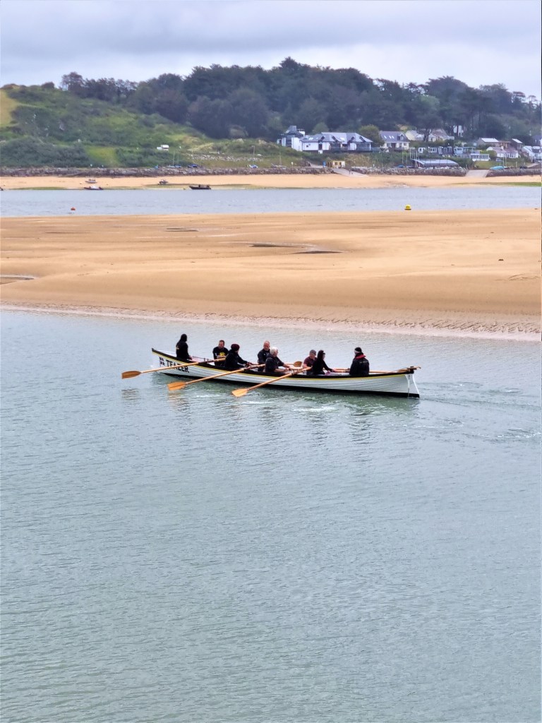
Conditions were initially overcast with rain in the air. Drawing up to the ferry landing stage, we watched a crew from Padstow Rowing Club launch their gig, Teazer, gliding it smoothly across the still waters of the Estuary.
Then the ferry approached from an unexpected direction. It had been ‘borrowed’ by some volunteers to help bring ashore a dead dolphin which they carried up the slope in a tarpaulin.
I felt this might be an inauspicious omen for our week!
We were soon underway – the only passengers heading over to Rock at this early hour – and we made it to the bus stop with at least 20 minutes to spare.
The ferryman had recommended the pasties sold just up the road – better than anything in Padstow, he said. But we resisted the temptation, our generous packed lunches already stowed in our rucksacks.
The bus arrived promptly and we were soon dropped off in Port Isaac, which looked completely different when almost bereft of tourists.
We soon found our way back to the top of Rosecarrock Hill, where we’d sat looking down on the crush around the harbour some eight months previously. I always find ‘starting from the place we last finished’ quite an emotional experience.
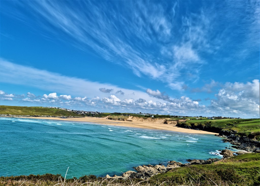
By 10:30 we were climbing up to Lobber Point, with blue sky beginning to emerge above. Soon we were descending down to the inlet of Pine Haven, before ascending steeply again towards Varley Head. This is a fairly testing section.

Then on round Kellan Head until we were above Port Quin, with Doyden Point jutting into the sea ahead. We stopped for coffee here, but were soon diverted by a group of men walking past us wearing helmets and small backpacks.
As we walked down towards Port Quin and rounded the turn, we could see them jumping into the sea and then swimming across the narrow bay.

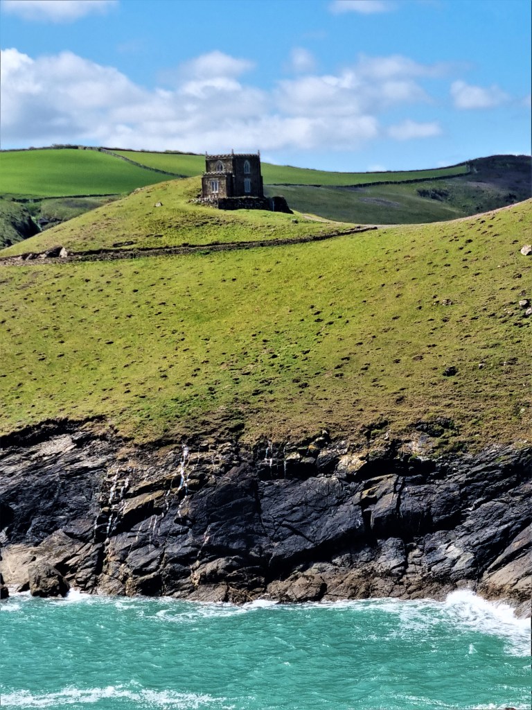
Set a little way back from the end of Doyden Point is Doyden Castle, a squat Gothic tower built in 1830 by a local businessman, Samuel Symons, who used it for gambling and carousing purposes! It is now a popular National Trust property.
A little way behind is the more imposing Doyden House, built by Captain Herbert Latimer Conor, a former prison governor, who is said to have spotted the location while sailing round the coast in search of a plot for his retirement home.
Port Quin itself was once a prosperous pilchard fishing centre. Various local myths suggest that all the local fishermen were drowned at sea, possibly in 1697, leaving some 20 widows behind them. The pilchard business survived this calamity, but was already in decline by early Victorian times.
Otherwise, this is Poldark country…
On leaving Port Quin the path passes the remains of lead and antimony mines, also of some importance during the Seventeenth and Eighteenth Centuries. It continues above a series of small coves and a collapsed cave called Lundy Hole.
Soon one is heading out on to a headland called The Rumps, which juts out towards a small circular island, The Mouls, just offshore.
An Iron Age fort was located on The Rumps, most likely settled between the Second Century BC and the First Century AD. Archaeological research has shown that, like many others along this stretch of coastline, it was engaged in trade with Mediterranean seaports.
In 1995, a brig called Maria Assumpta was wrecked here. At one time the oldest surviving commercial sailing ship, she had been launched in 1858. Three of the crew died and the captain was found guilty of manslaughter.
Somewhere along the path there is a plaque commemorating the fact that Laurence Binyon (1869-1943) composed his poem ‘For the Fallen’ here in 1914.
It contains this oft-quoted stanza:
‘They shall grow not old, as we that are left grow old;
Age shall not weary them, nor the years condemn.
At the going down of the sun and in the morning
We will remember them.’
We missed it though, perhaps because the landscape here is so beautiful!

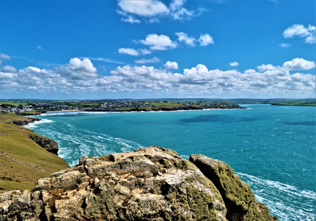
Looking behind us, we could see all the way back to Tintagel. And, on rounding Pentire Point on the other side of the headland, the majestic sweep of Padstow Bay is revealed.
Descending first to Pentireglaze Haven – a deep, narrow beach – we paused for cooling ginger beers bought from Gypsy Kitchen, a café converted from a horsebox we found drawn up on the sand.
Much refreshed, we continued past the far bigger beach at Polzeath, past Trebetherick, and on to Daymer Bay. This area has strong connections with John Betjeman, who died here in 1984 and who is buried in St Enodoc’s Church nearby.
One poem, ‘Greenaway’, describes this very path:
‘I know so well this turfy mile,
These clumps of sea-pink withered brown,
The breezy cliff, the awkward stile,
The sandy path that takes me down.
To crackling layers of broken slate
Where black and flat sea-woodlice crawl
And isolated rock pools wait
Wash from the highest tides of all.
I know the roughly blasted track
That skirts a small and smelly bay
And over squelching bladderwrack
Leads to the beach at Greenaway.’
Enodoc was another Welsh hermit who once lived in a cave near the golf course, set behind the sand dunes, that now bears his name. I should clarify that the golf course bears his name, not the cave or the sand dunes, and it wasn’t here at the time!
The path continues some distance through these dunes before one finally emerges into Rock, close to the ferry point.
We joined the queue and just made it onto the crowded boat. The queue on the Padstow side was far bigger, stretching back round the corner of North Quay Parade.

.
Padstow to Harlyn Bridge
Sunday morning was cool and cloudy, again with rain in the air.
Having completed Part One of the Official National Trails Guide to the Coast Path, I had finally replaced that trusty, dog-eared and much weather-stained volume with the pristine Padstow to Falmouth Guide, a Christmas present from Tracy.
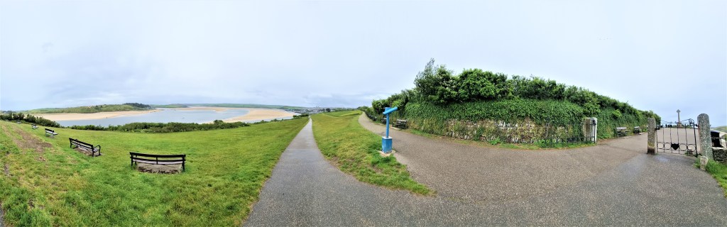
Finishing our breakfast at Green’s, we were under way by 11.00. Light drizzle began to fall as we climbed towards the War Memorial above Padstow.
This granite Celtic cross set on a tapering square column overlooks St Saviour’s Point. The area round about is heavily overpopulated by benches.
We hoped they hadn’t all crowded into that tiny space, so denuding the rest of the coast path!
We wound our way past Gun Point. There was a gun battery here in Victorian times, replacing earlier Napoleonic emplacements, and possibly even Tudor defences against the Armada.
Two naval guns were also located here in 1940, along with a garrison of some 100 men billeted at Prideaux Place.
We soon found ourselves adjacent to Tregirls Beach, facing onto the Camel Estuary. Negotiating a marshy area between the beach and neighbouring farmland we lost our way and were easily disorientated, failing to spot a critical signpost until the third attempt.
Continuing on to Hawker’s Cove, we admired an abundance of spring flowers in the vicinity of the old Lifeboat House, formerly occupied by actor Edward Woodward.
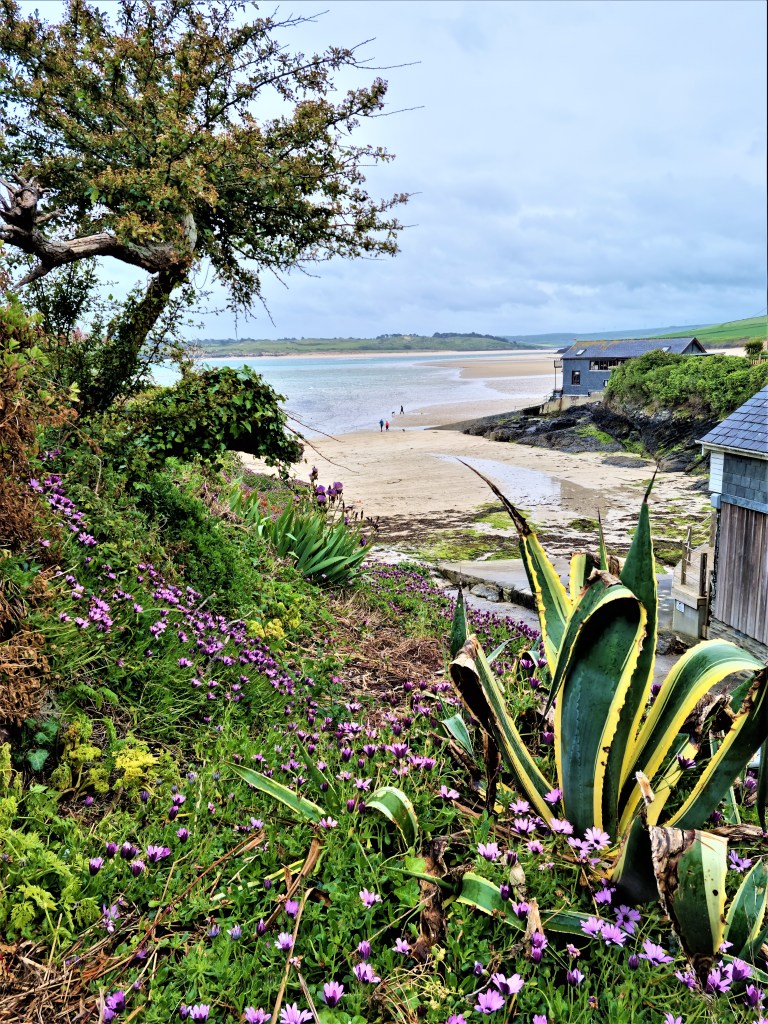
On this occasion the Rest Awhile Tearoom was closed owing to the inclement weather.
As we continued on up to Stepper Point, at the head of the Estuary, we came to realize just how much shelter it had been affording us.
Exposed to the full strength of the wind, the relatively benign drizzle was suddenly transformed into fiercely driven rain.
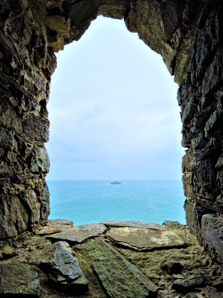
Passing the coastguard station, barely visible above, we were forced to take refuge for a while in a 40 foot stone tower constructed here in 1830.
This so-called ‘daymark’ was a navigation aid for those at sea, and is said to be visible some 30 miles from land.
We drank our coffee and feasted on our Tunnocks Bars while the elements battered away outside. Some other poor unfortunates arrived after a while, but seemed strangely reluctant to share our dry space, even though we invited them in.
Tempting though it was to remain until the wind had abated, we eventually forced ourselves to brave the elements once more.
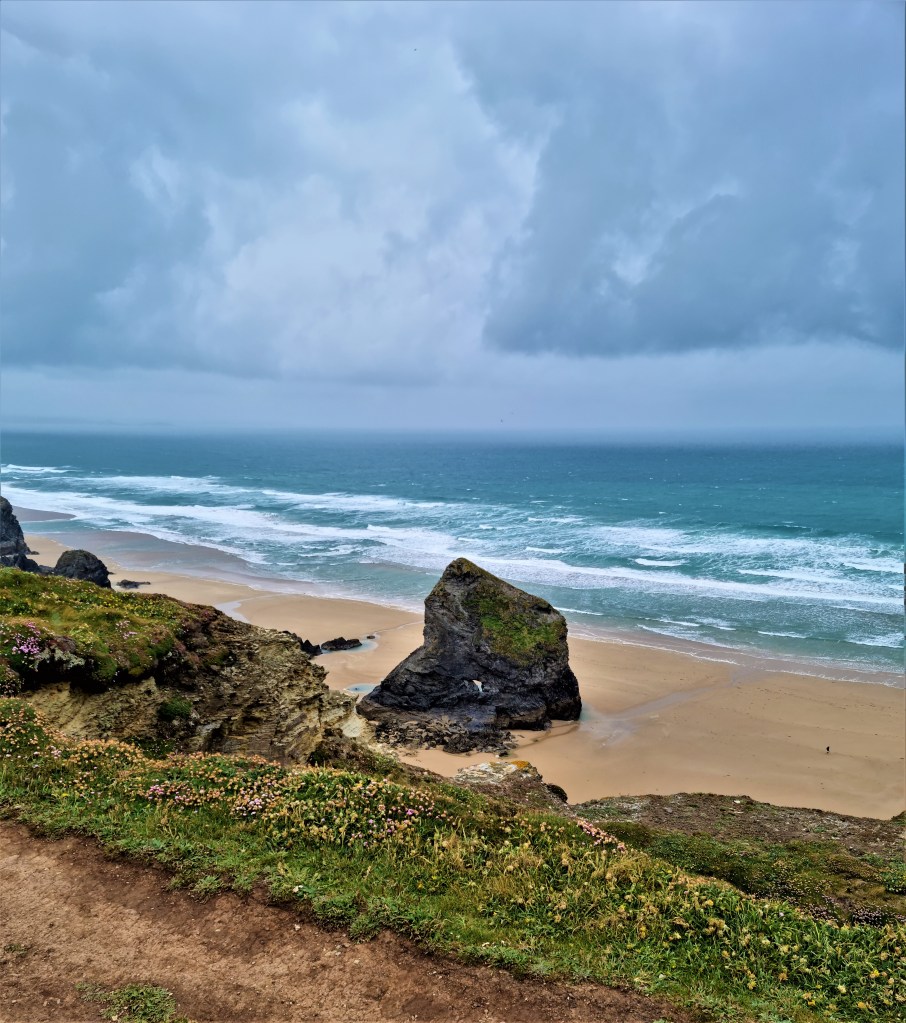
We battled our way on, up and round, past Butter Hole, the Merope Islands and Round Hole, but saw relatively little and could photograph even less.
Conditions had improved only slightly by the time we arrived at Harlyn Bridge, a surfing beach and the site of several Iron Age burials.
According to the Padstow Museum, in 1866 a local labourer began sporting ‘shiny trouser ties’ which he had found in a pot.
They turned out to be rare gold lunulae, shaped like the crescent horns of the moon, probably from an early Bronze Age grave, and the labourer lost them to treasure trove.
We were mightily relieved that the 56 bus arrived, almost exactly on time on this occasion and, climbing damply aboard, we were returned to Padstow by mid-afternoon.
We bought ourselves pasties to recuperate.
.
Harlyn Bridge to Porthcothen Bay
Next morning we weren’t quite so fortunate with the buses. The ATLA 09:30 departure from Padstow was some 20 minutes late. That said it took just 10 minutes to deposit us back at Harlyn Bridge.
The weather was fine as we sauntered past the sandy beach and on to Cataclews Point, site of an ancient quarry. The stone, a form of dolerite known locally as ‘blue elvan’ features in local church fonts carved in the Fourteenth Century by a mystery mason known only as ‘the Master of St Endellion’.
We stopped for coffee on one of a pair of benches overlooking Padstow lifeboat station on the other side of Mother Ivey’s Bay, chatting to a lady with a bobble hat who seemed to be walking our way.
Mother Ivy [sic] was allegedly a local white witch who lived hereabouts in the Sixteenth Century. A wealthy local family, the Hellyers, owned a pilchard fishing business and, when one cargo was returned unsold, Mother Ivy called on them to donate it to the starving villagers.
Instead they used it as fertilizer in their fields, prompting her to lay a curse that, if ever the soil was broken, death would follow.
And of course it has done, several times, starting with the Hellyers’ eldest son, who was thrown from his horse…
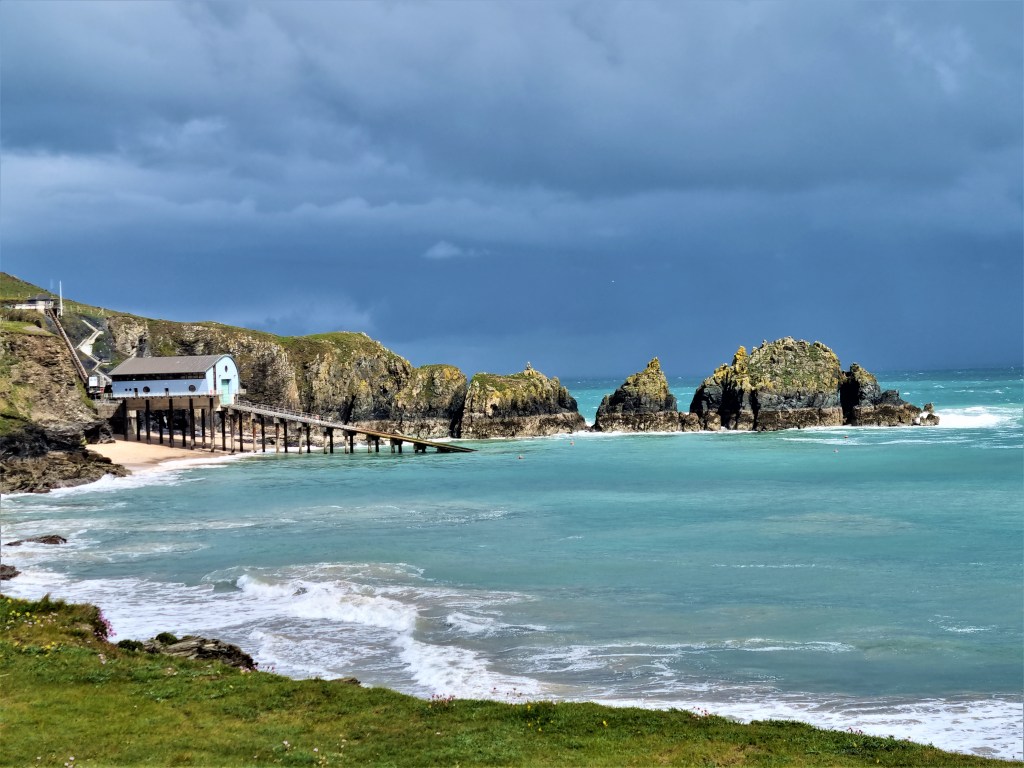
The lifeboat station moved here in 1967 from Hawker’s Cove, after that side of the Camel Estuary began to silt up. The present building was opened in 2006, to house a new lifeboat, the 16-metre Tamar Class ‘Spirit of Padstow’.
As we drained our coffees, soft rain began to fall again, while ominous clouds rolled up over the Merope Rocks beyond. So we began the long circuit round Trevose Head, down to Constantine Bay, which is not much more than a mile from Mother Ivey’s Bay as the crow flies.
Trevose Head Lighthouse squats at the foot of the cliffs, some way below the level of the path. It was built in 1847, the tower is 27 metres high and it became fully automated in 1995.

Much of the land behind Constantine Bay is taken up by the Trevose Golf and Country Club. The ruins of medieval St Constantine’s Church and St Constantine’s Well are on Club land.
Heading on to the sand of Constantine Bay, we were greeted by the return of blue skies above. We strode on, past a Victorian lady looking out to sea, stationed in a cottage window.

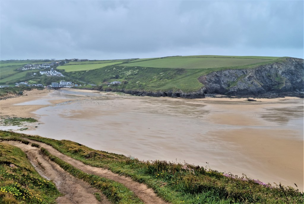
Rounding neighbouring Treyarnon Bay we reached the home straight, descending down to Porthcothan with its v-shaped beach, split by a mini-estuary and backed by dunes.
We debated making use of the good weather to head on a few miles, to Mawgan Porth, but ultimately decided to finish here.
Porthcothan itself is nondescript but Porthcothan Bay Stores, just behind the bus stop, is perfectly placed for celebratory coffee and cake – in my case delicious Millionaire’s Shortbread.
Apparently D H Lawrence once took up residence in Porthcothan, staying for two months in fellow novelist J D Beresford’s holiday home in early 1916, before moving on to Zennor. His freshly-published novel ‘The Rainbow’ had just been the subject of an obscenity trial.
Our good fortune returned in the afternoon as the 14:35 ATLA service arrived on time.
.

Porthcothan Bay to Porth
But, on Tuesday morning, the 09:30 ATLA service was again 20 minutes late at Station Road in Padstow. Moreover, a diversion was being established on the coast road and it took us an hour to reach Porthcothan.
By the time we set out the morning sun had already disappeared. The Trescore Islands spiked, jaggedly from a grey sea as we walked more or less due south.
Diverting inland at Porth Mear, we encountered large banks of pink Sea Thrift and smaller patches of yellow Dyers’ Broom. An artist had positioned her easel in the midst of bluebells and was busy painting a miniature landscape, her canvas protected by a small black umbrella.

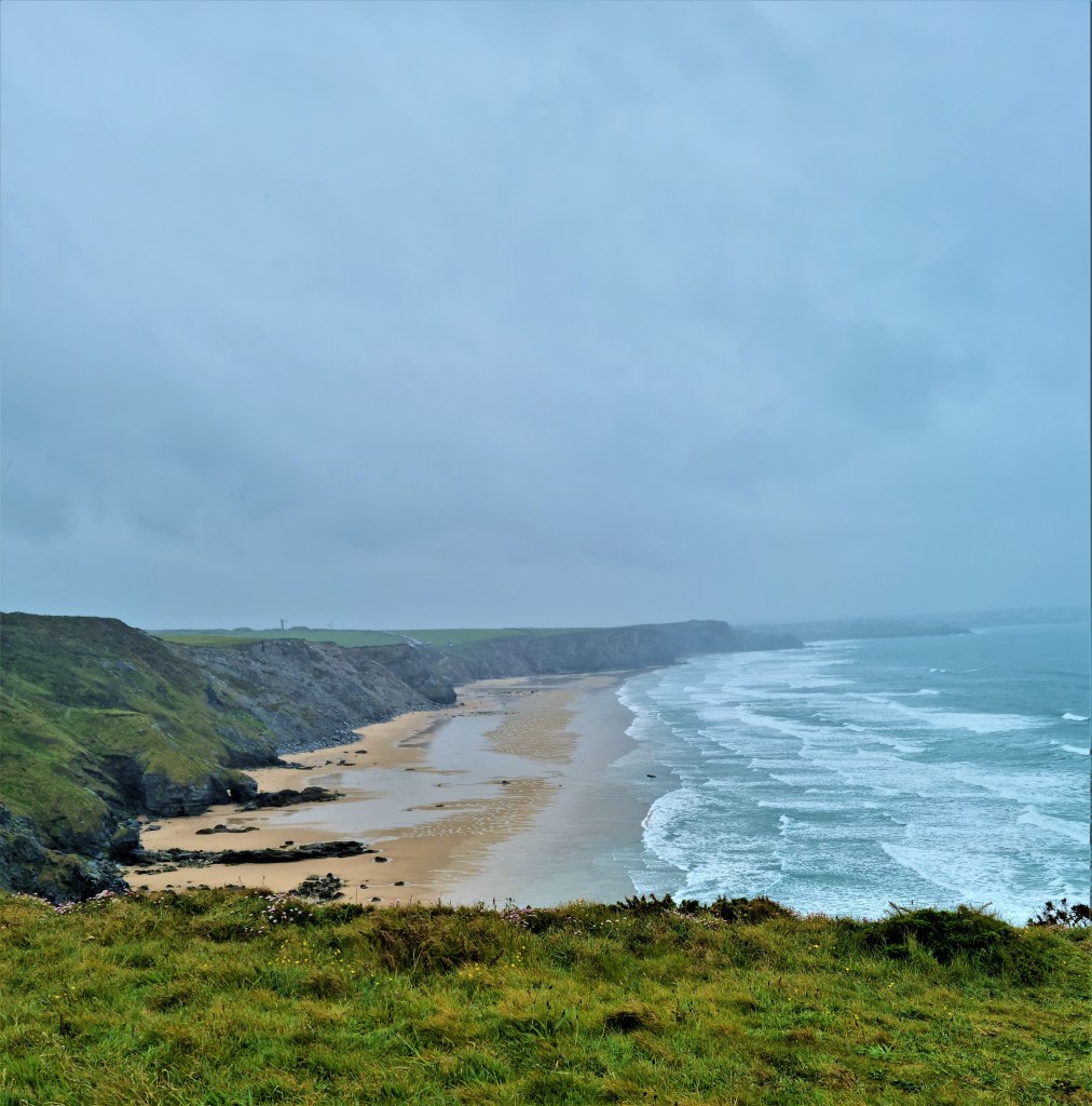
Passing the Iron Age cliff castle at Park Head, we drew closer to Bedruthan Steps, described in our guide as ‘a tourist honeypot’ though – now veiled by insistent drizzle – we were hard-pressed to understand why.
It isn’t entirely clear whether the Steps are a geological feature and, if so, which one. My more prosaic mind assumed they were the stone stairs one has to climb to reach the tearoom!
A second route, down to Bedruthan Beach, remains closed after recent rockfalls and there is no alternative access.
This was once the location of Carnewas Mine, intermittently active from the 1850s to the 1870s. The tearoom occupies the old mine buildings.
The Steps were probably originally the ‘cliff staircases’ that miners used to reach the mine workings, but they were reimagined to support late Victorian tourism. Bedruthan was a mythical giant, said to walk along the coastline using the cliffs as stepping stones, but there is considerable doubt whether this myth existed before the 1840s!
Having reached the top of the real steps, I diverted with some urgency towards the tearoom, in search of a bench on which to drink our coffee. It was already past midday! We drank while being rained on and, after a brief toilet stop, rejoined the path.
Forging onwards, past Trenance Point, we found ourselves descending towards the deserted triangular beach at Mawgan Porth, but had first to negotiate a detour where repairs were being undertaken.
Mawgan Porth is the beach of St Mawgan, a mile or so inland along the River Menalhyl. It wasn’t developed until the 1920s, but St Mawgan is far older.
Mawgan was another of those Welsh missionaries who may or may not have arrived in the Sixth Century, but there were previously Bronze Age and Iron Age settlements here.
The Domesday Book records Lanherne, the local manor house, as belonging to the Bishop of Exeter, but there is thought to have been a monastery here beforehand. In 1794 the manor house became a Carmelite convent.
The Church probably replaced the original monastery chapel in the Twelfth or Thirteenth Century, but has been extensively remodeled since.
This area features in my own family history, as my maternal great-great grandfather was born in St Mawgan in 1838, son of Elezear Ball, a carpenter from St Columb Major.
Seeing little shelter amongst the scattered buildings behind the beach, we found a convenient overhang amongst the rocks near the lifeguard’s hut, and opted to eat our lunch there.
This was possibly a mistake as in such damp conditions it is hard to prevent wet sand from getting everywhere it shouldn’t.
As we climbed up and around the headland on the other side of the beach, visibility deteriorated to a few metres and we were severely lashed by the rain as we plodded doggedly on above the vast expanse of Watergate Beach.
The path descends briefly, near the Watergate Bay Hotel, into an ugly confluence of concrete. We were briefly tempted by a café in a car park, but could see no shelter so continued, for what seemed an eternity in possibly the worst conditions we’ve experienced thus far.
A friend had told us that this stretch has a reputation as a breeding ground for adders, but fortunately the rain kept them safely hidden.
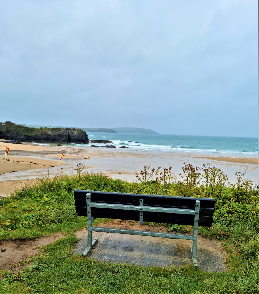
Finally we saw ahead the hotels and apartments at Whipsiderry, above Porth and, on gaining the main road, decided to cut short our walk. We had intended originally to finish in Newquay.
We waited here for the 59 bus, which the timetable said was imminent.
It never came, but we were picked up eventually, dripping and steaming, by an ATLA service. The new Padstow to Falmouth Guide was no longer looking quite so pristine!
We discovered next day that, had we continued for a hundred metres or so, the next bus stop had a shelter.
.
Porth to Holywell Bay
The weather had improved dramatically by Wednesday morning, and it looked set to last all day.
But the 09:30 departure was once again badly delayed and we didn’t start out from Porth until gone 11:00, having swapped buses at Newquay Airport on the way. The diversion was now in operation and, at one point, we pulled aside to allow a cavalcade of Morgans to pass by.
Porth was once a harbour serving St Columb Minor, just inland, and initially more prominent than next-door Newquay, which has now absorbed it.
The northern side of the beach is protected by Trevelgue Head which once supported another substantial Iron Age promontory fort.
In 1855 a shipbuilding yard was established on the beach below, though only five substantial ships were launched here, sideways on to the incoming tide, before the yard began to decline in the 1880s.

We strolled across the beach to pick up the coast path on the other side, before continuing above Lusty Glaze Beach. This is a corruption of the Cornish ‘lostyn glas’, which means ‘a place to watch blue boats’!
Soon the path loses itself completely in the urban sprawl of Newquay, eventually emerging above the harbour. Once a small fishing village, tourism arrived with the trains and several large hotels had been built here by the 1880s.
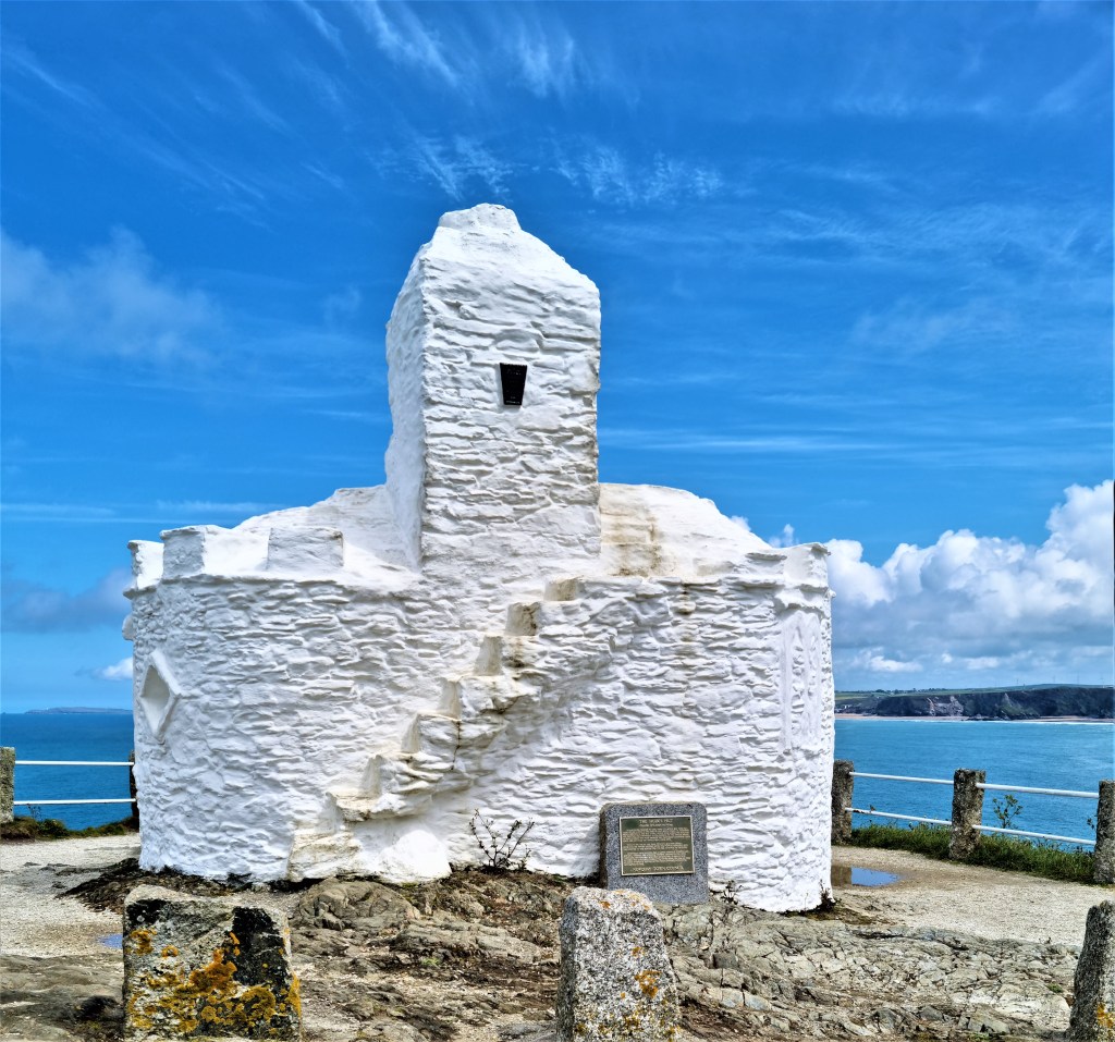
The path passes alongside the whitewashed Huer’s Hut, a lookout point from where a ‘huer’ would await the annual arrival of the pilchards. Vast schools would dye the sea a reddish-brown, while flocks of seagulls would dance and hover above. The huer signaled to the fishermen, who promptly cast their nets.
After skirting the nearby war memorial, the path emerges on Towan Headland, passing before the Headland Hotel, a terracotta monstrosity built by local architect and entrepreneur Silvanus Trevail in 1900 at a cost of some £50,000.
Future Kings Edward VIII and George VI recuperated here together in 1911 from measles caught at Dartmouth Naval College.
We stopped for coffee on a bench above Fistral Beach, just past another golf course, before finding our way through the roads on the Pentire Headland and on down to the Gannel Estuary, where natural beauty is at last restored.
Our Guide proposed a bewildering variety of crossing points depending on the tide. We opted for a narrow wooden causeway, perhaps 50 metres long, that took us across a relatively shallow section to Penpol Creek.

The path along the far bank of the Gannel is pleasantly wooded, eventually emerging above Crantock Beach, at the mouth of the estuary. Passing a cliff studded with nesting seabirds, we paused for lunch on a bench, overlooking an island called The Goose at the tip of Pentire Point East.
A cave here features a female profile carved into the rock face and beside it the verse:
‘Mar not my face but let me be,
Secure in this lone cavern by the sea.
Let the wild waves around me roar,
Kissing my lips for evermore.’
It is reputed to have been the work of one Joseph Prater, but his precise identity, whether his work commemorates a real woman who drowned here and, if so, which woman, are all the source of much conjecture.
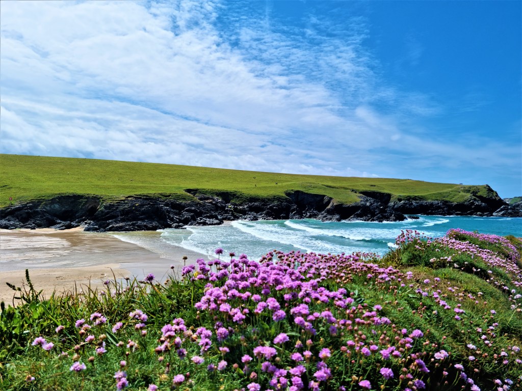
Continuing on to the sun-drenched grassy slopes of Pentire Point West, we slowly worked our way round to a beautiful, deep-cut, flower-fringed cove called Porth Joke, alternatively Polly or Poly Joke.
This name is believed to be derived from the Cornish for ‘jackdaw cove’.
The weather was perfect making this, for me, a strong contender for the most beautiful spot we have seen along the coast path to date.
It was with some regret that we left it behind, rounding Kelsey Head and then dropping down towards the dunes at Holywell Bay, passing a family of sheep asleep in the afternoon sun.
The dunes here are substantial and the beach is extensive at low tide. Twin crags spike out of the sea just a little way off shore, making it another picturesque spot.
We bought celebratory ice creams from the Gull Rock Café. But a bus drew away just as we reached the stop and we knew the next one would be too late into Newquay to catch our connection out again.
After waiting some 45 minutes, spent chatting idly with a vaping couple and their friendly dog, we climbed aboard, only to see our much-delayed connection only just departing Newquay!
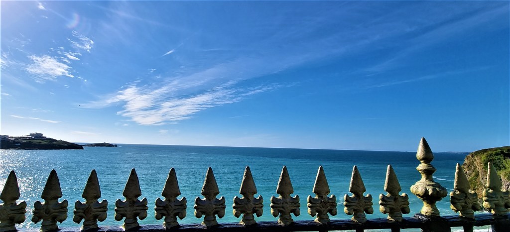
Finding a taxi company close to the Station, we were told demand was such that we would have another hour to kill. So we bought drinks from a nearby supermarket and sat on a bench nearby looking out, across railings, onto the beach below.

Once back in Padstow we lingered a while beside the harbour, enjoying the warmth of the early evening sun.
It had been a week of contrasts, in the landscape as well as the weather, but we had made strong progress after our enforced lay-off.
Now, for the first time, I’m approaching sections of the coast path that I have walked before, with Kate, and that I remember as being exceedingly beautiful.
.
TD
June 2021


Leave a comment