.
We have decided to walk the 184 miles of the Thames Path, alongside our parallel and much longer project: the South-West Coast Path.
Our journey began on a cloudy August morning, travelling by train and tube into Paddington to catch the 12:45 GWR departure for Swansea – and alighting at Swindon less than an hour later.
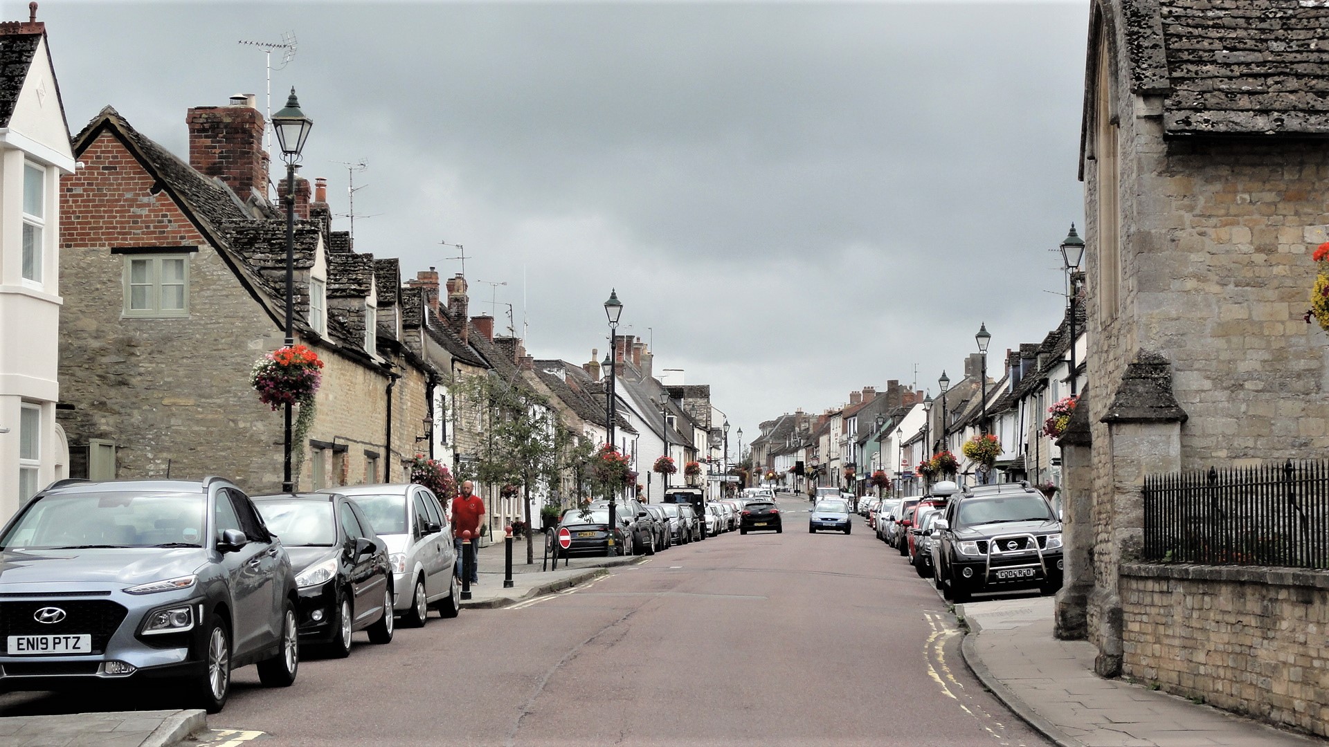
A taxi from the station rank took us the few miles to Cricklade, depositing us in the High Street at 14:00, exactly when our accommodation became available.
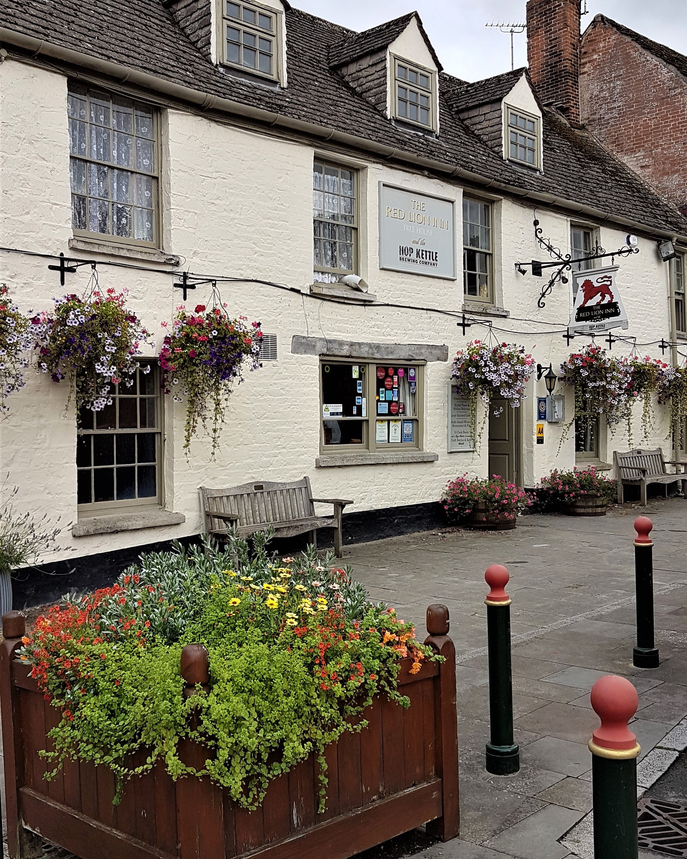
We had selected the Red Lion as easily the best place to stay, though it has recently been taken over by St Austell Brewery from the previous owner while retaining the same managers.
.
.
Confusingly, these managers operate as the Thames Path Pub Company Limited and the pub also has its own independent microbrewery, The Hop Kettle Brewery, founded by the pub’s former owner who remains a brewery director.
There are five rooms, and these are popular – we were unable to stay from Wednesday to Friday as originally planned, so opted for Thursday to Saturday instead. It cost us £90 per night, including breakfast.
The rooms are spacious, comfortable, ensuite and ours looked out on the beer garden with the microbrewery and pub kitchen opposite. Unfortunately the kitchen had a noisy fan, so windows could not be thrown wide open at night.
.
.
But this was the only fault. Breakfasts were excellent and plentiful, perfectly designed for walkers. I opted for Eggs Benedict both mornings because I had insufficient space for the Full English options; my companion was less abstemious!
With only two nights away, I had managed to get everything I needed into my walking rucksack. After unpacking we investigated Cricklade.
.
.
Orientation
The Red Lion is midway along the High Street, with all the shops and hostelries to the south of it. We began by turning north, passing the war memorial outside the Eighteenth Century Old Manor House, presently on sale for £695,000, and its Seventeenth Century neighbour, available for a cool £1.75 million.
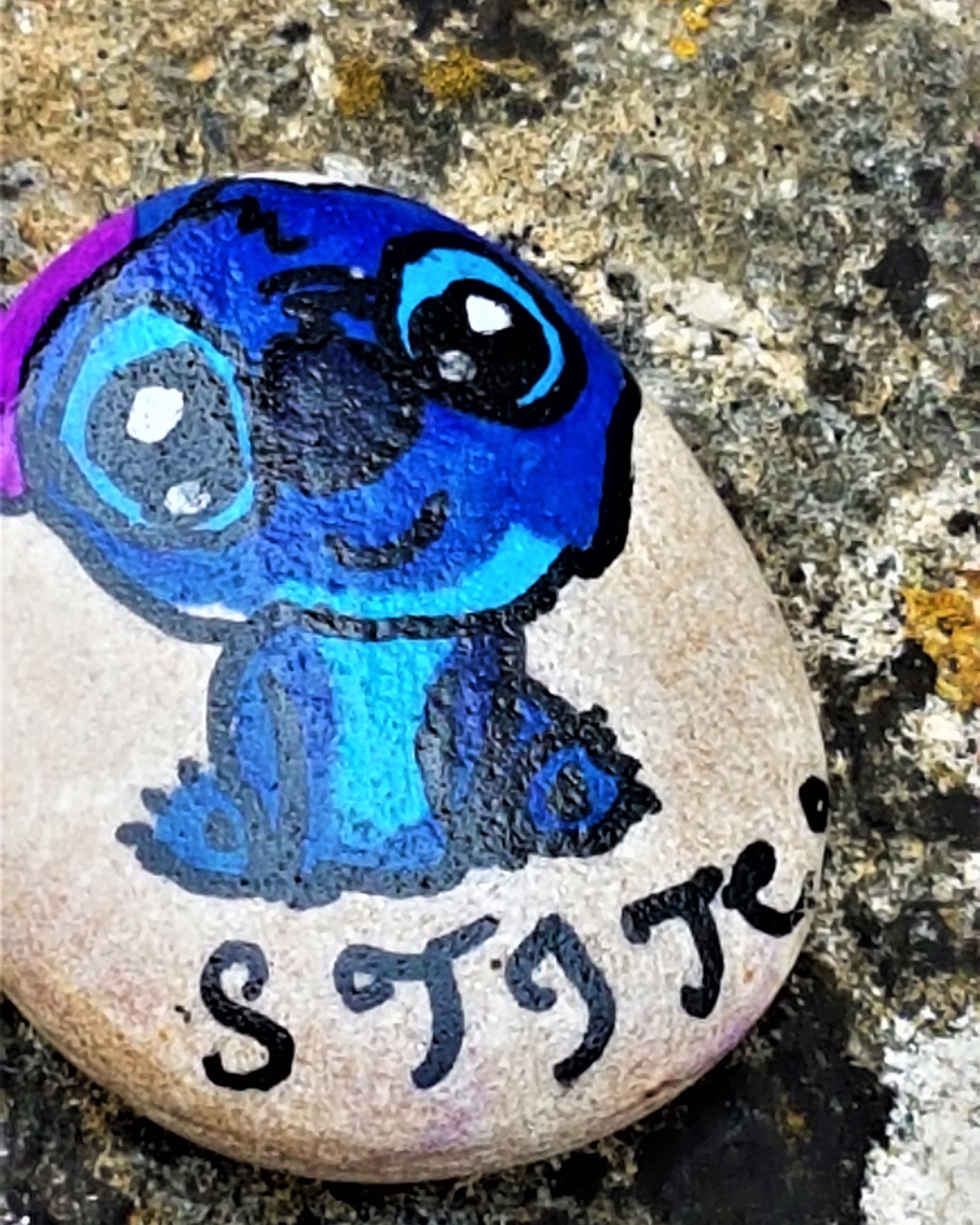
We crossed the Town Bridge over the Thames beside which I noticed a beautifully painted rock nestling in a corner near a bench.
.
.
This is not the first stone I have found while walking. It had been made and hidden under the aegis of Rocks of Swindon. I duly pocketed it, to deposit on our walk the next day.
We continued past the Priory, also Seventeenth Century, though with traces of The Hospital of St John the Baptist, dating from the Thirteenth Century or earlier. Local tradition has it that wounded Crusaders were treated here.
We made a brief foray into the North Meadow National Nature Reserve, renowned for its snake’s head fritillaries, before retracing our steps up the High Street and pausing at St Mary’s Church, which most probably began as a late Saxon chapel, the churchyard boasting a Fourteenth Century cross, now severely weathered.
.

.
Our next stop was the Jubilee Clock (1897), marking Queen Victoria’s Diamond Jubilee, before exploring St Sampson’s Church, first mentioned in the late Tenth Century.
The present building dates mainly from the Twelfth and Thirteenth Centuries though the tower wasn’t completed until the 1550s.
.

.
Whereas St Mary’s was locked, St Sampson’s was open, and we were fortunate enough to find inside a churchwarden who pointed out some of the finer features.
.

.

This churchyard also contains a Fourteenth Century cross, in this case the former town cross, removed from the High Street in the early Nineteenth Century.
We also looked briefly at nearby Jenner Hall, bequeathed to the town as a school by Robert Jenner, Cricklade’s MP, on his death in 1651. The building has also been used as a poorhouse and a brewery.
We continued to the Town Hall where we picked up information about local taxis before heading back to the Red Lion for a drink. I sampled Hop Kettle’s Element, a tasty pale ale, described by the brewery website as a:
‘Triple hopped session pale. Late and dry hop additions of Mandarina Bavaria, Mosaic and Cascade hop varieties bring fresh, bright orange citrus and soft fruit flavours, with a smooth and clean bitterness in the finish.’
We dined on Thursday evening at the White Hart Hotel, just up the road. It had a longer, more catholic menu than the Red Lion, although the Arkells beer was not quite to the same standard. The food was good, however, and very filling.
.

..
The Walk
After breakfast we bought sandwiches from The Barista on the High Street and picked up our taxi at 10:00.
The weather forecast was not at all promising, threatening persistent rain, but there was a stiff breeze, so we hoped that we might encounter only fleeting showers and this proved to be the case.
Our taxi driver, Michael, proved a valuable source of information. He dropped us, not at Kemble Station as the guidebook dictates, but closer to the source, adjacent to the Thames Head Inn.
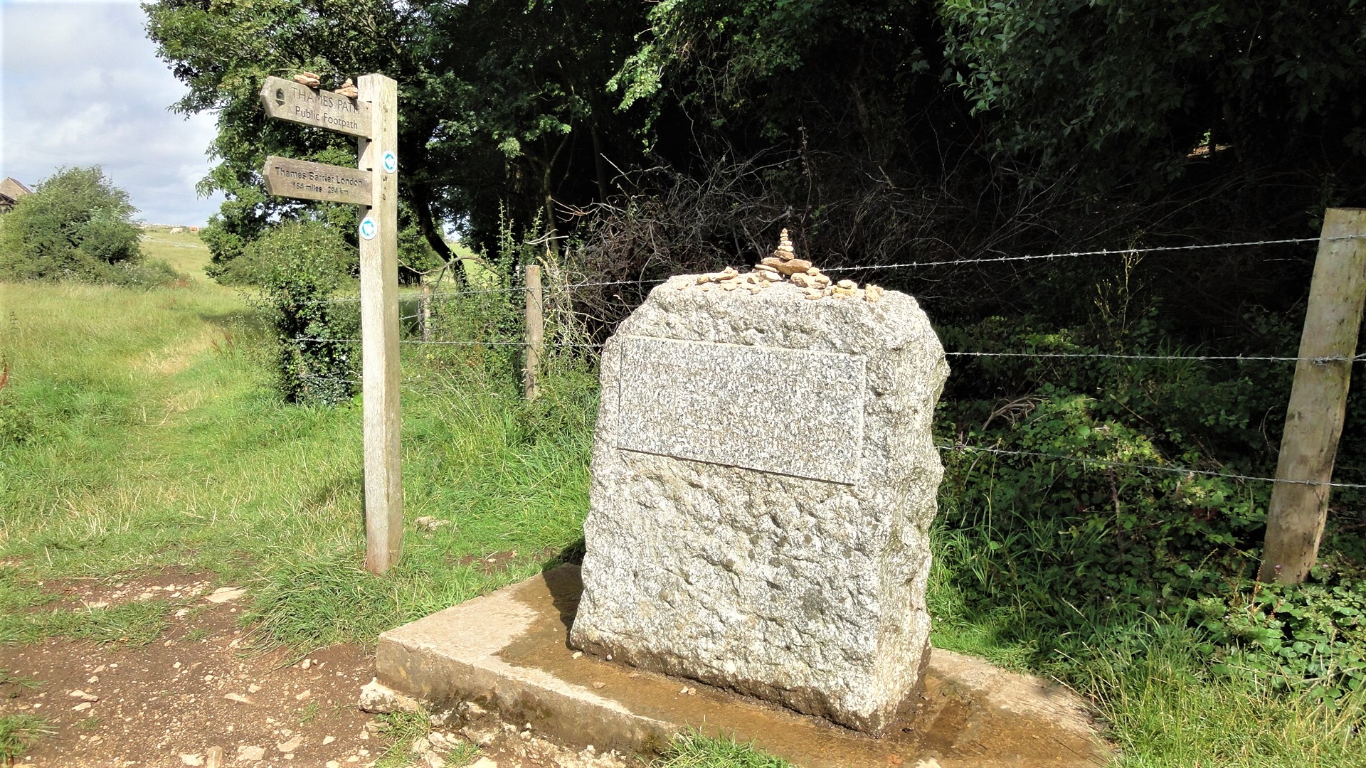
We crossed the railway line and found our way to Trewsbury Mead where the source is located, taking the obligatory photographs and each placing a stone on the small cairn atop the commemorative pillar. The basin of stones beneath the pillar was bone dry, as normal.
.
.
A statue of Old Father Thames once graced this spot, but was moved further down the River, to St John’s Lock, in 1974. Prior to 1958 he sat in Crystal Palace, having been commissioned originally for the 1851 Great Exhibition.
We were unaware of the rival claims of Seven Springs as the source of the Thames, it marking the origins of the River Churn, a tributary joining the Thames at Cricklade. Most authorities recognise Trewsbury Mead as the rightful source however.
We followed the path back to the A433 – in Roman times the Fosse Way – and then across the fields to the two-arched bridge near Kemble that carries the A429 over the tiny river, at the confluence with a dismantled railway line.
.

.
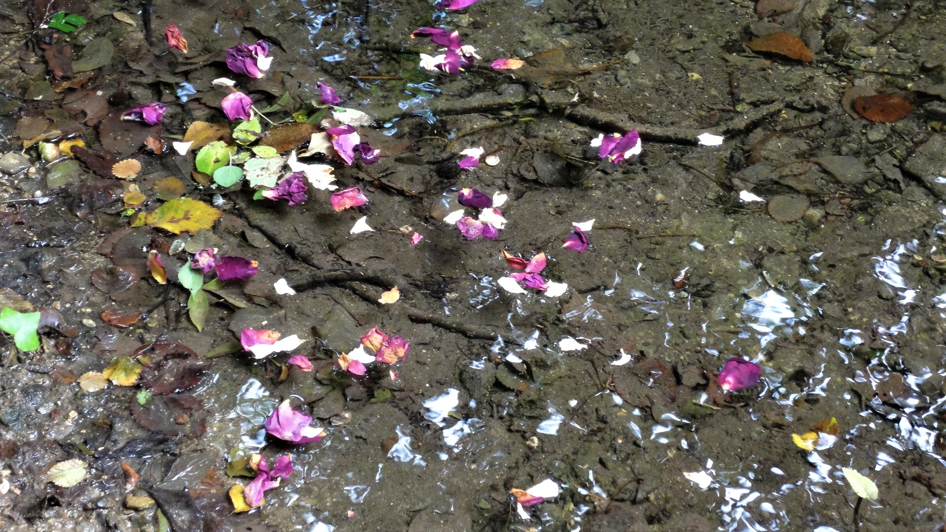
Here I placed my Swindon Rocks stone atop a Thames Path sign and helped my companion to clamber down the riverbank to float some memorial petals towards the sea.
Unfortunately most of them joined a ‘traffic jam’ of other plant-life and will struggle with the several banks of weeds downriver.
.
.
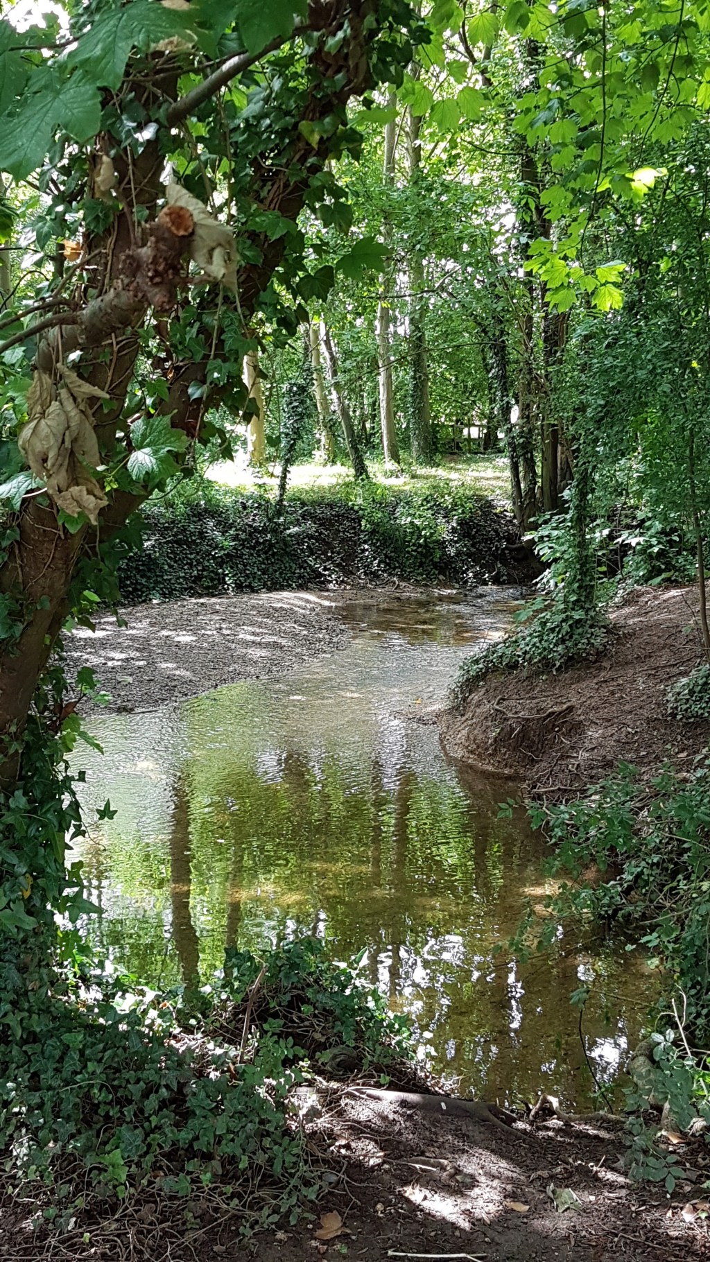
From Kemble our route bent gently south-eastwards towards Cricklade, flattening rather as it passed through dozens of man-made lakes, formerly gravel pits.
Initially the infant Thames passes underneath Parker’s Bridge, midway between Kemble and Ewen, but the path then heads into Ewen itself before rejoining the River as it floats past the bottoms of back gardens and on to Upper Mill Farm.
.

.
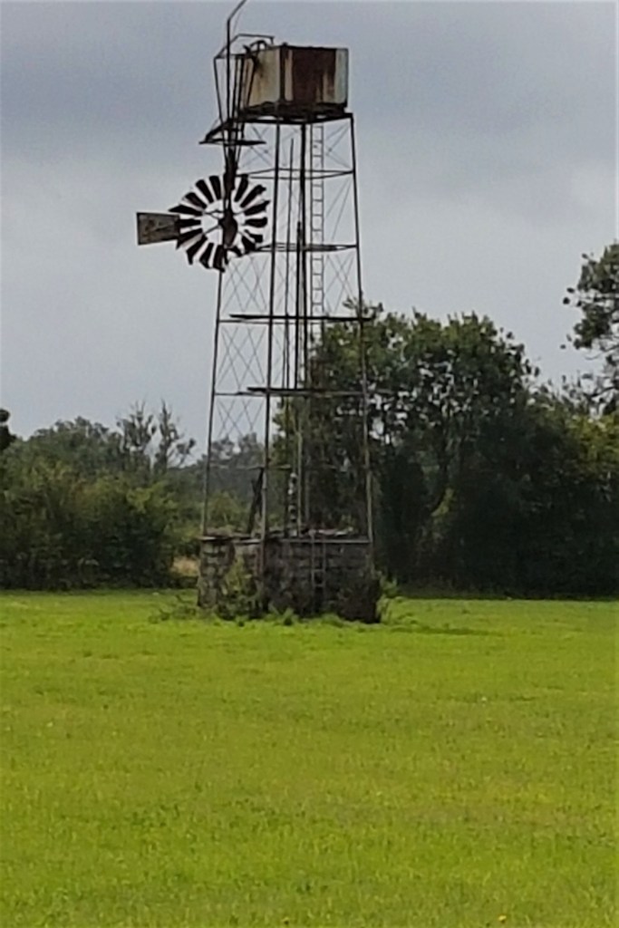
Here there was once a working mill – the British Museum holds an impression of the Mill as it was in 1793 taken from a contemporary history of the River. A far more recent mill pump rusts away in a nearby field.
.
.
The route passes between Poole Keynes and Somerford Keynes. Keynes is derived from the surname of William de Cahaignes who held the Manor at the time of King John. Poole is most likely attributable to the family of that name, while Somerford is simply that – a ford only useable in the summer months.
After Upper Mill and Old Mill comes Kemble Mill, probably dating from the late Seventeenth or early Eighteenth Century. Then the path passes through Neigh Bridge Country Park.
.

.
Neigh is probably derived from the Middle English for ‘at the river’ or ‘at the island’ and Neigh Bridge is effectively the beginning of the Cotswold Water Park, Britain’s largest, containing 133, 147 or 150 lakes (depending on which source one consults). This spreads over some 40 square miles, courtesy of the extensive excavation in this area, predominantly in the last century.
The guidebook shows a public convenience at this location but it is no longer there. We stopped for lunch on a bench next to the children’s playground, munching our sandwiches as the next swift downpour threatened.
Many of the lakes are apparently privately owned, though often have some degree of public access. On occasion, the number of boards marked ‘private’ can become irritating, as in the vicinity of the Lower Mill Estate, where there are parallel paths for the elect and the hoi polloi.
.

.
After crossing the border between Gloucestershire and Wiltshire, apparently unmarked but somewhere in the vicinity of Freeth’s Wood, it is a pleasure to come into the shady walk through Flood Hatches Copse. This follows the meandering river, until the path emerges into the third Keynes…Ashton Keynes.
.

.
Ashton Keynes was called Aesctun in the Ninth Century and Essitone in the Eleventh Century Domesday Book. The addition of ‘Keynes’ is first recorded in 1490. Throughout its history it has been heavily prone to flooding. There are four headless preaching crosses in the village, probably decapitated following the Reformation.
.

.
More recently, Ashton Keynes was the location of the Cotswold Bruderhof, a Mennoninte community formed in 1936 containing many German refugees.
They emigrated to Paraguay in 1940 because of hostility sparked by their nationality and pacifist beliefs. The buildings were subsequently taken over by the Cotswold Community, for emotionally disturbed boys.
We followed the path along the full length of Back Street and Kent End, but missed the turning into the drive leading to Kent End Farm, our one ‘false move’ during the entire day.
Both routes yield a surprise. On the correct path there is a large gated property, apparently equipped with its own small public house. Further along the road there is a scary front garden full of gnomes!
.

.
On reaching Rixon Gate we retraced our steps to ensure we had covered the full route.
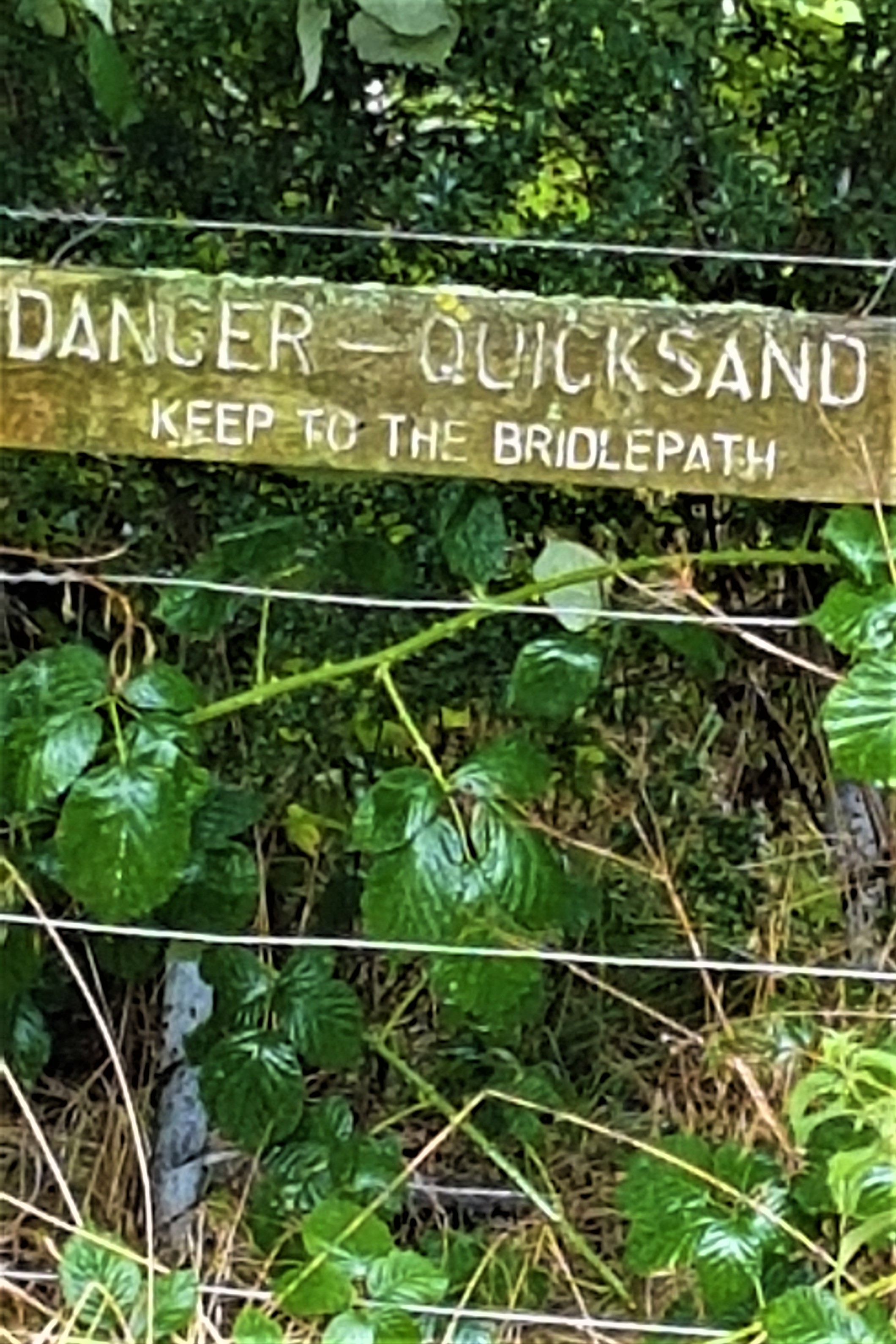
Before too long one is back once more amongst the lakes, faced with this rather intimidating sign.
.
.
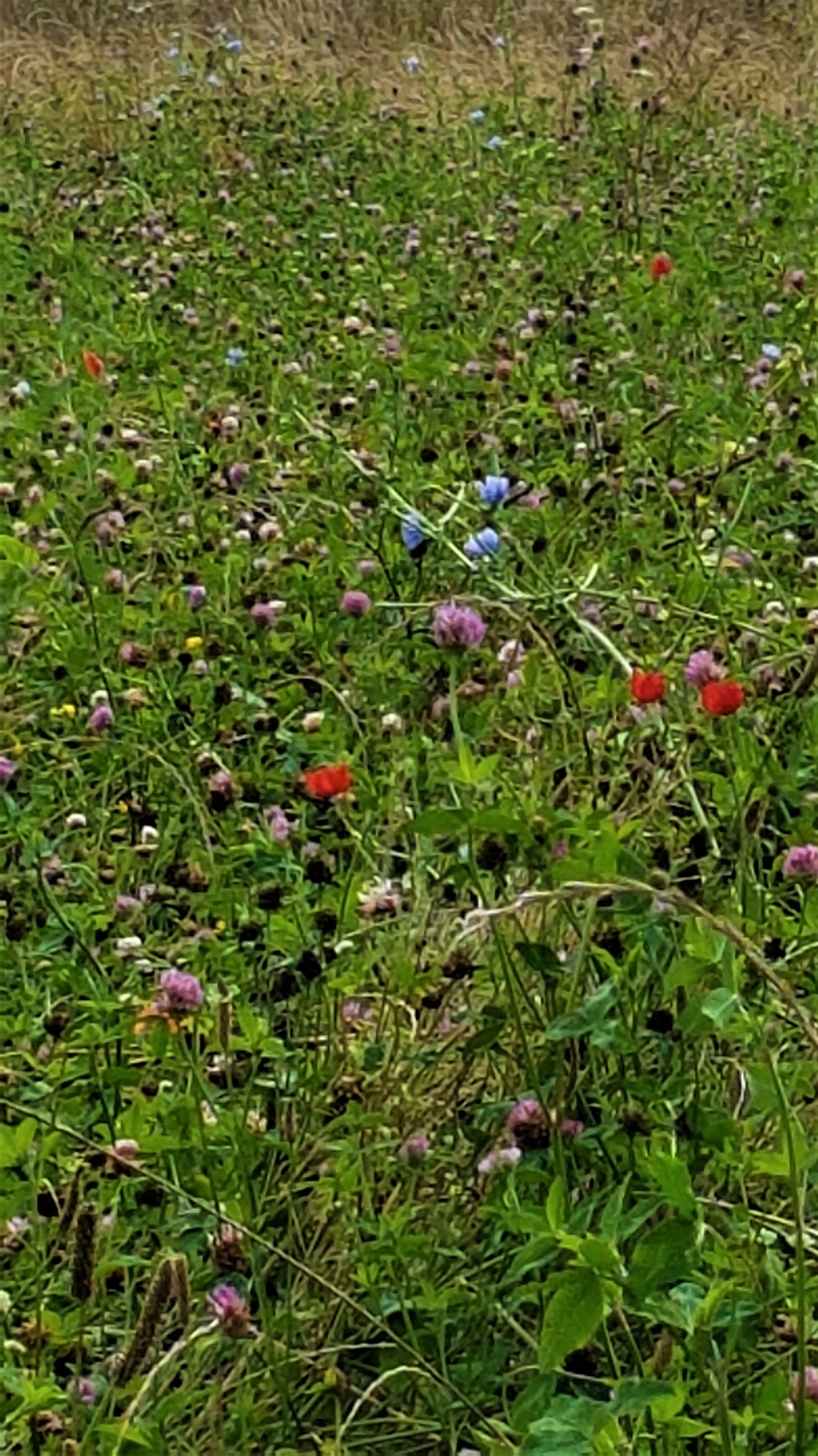
I was attracted by the turquoise waters of one lake, but it is a relief finally to leave the last of them behind, as one circumnavigates the marvellously-named Hailstone House on top of Hailstone Hill.
After which there is a bridge across the Thames that once also carried the 8-mile North Wiltshire Canal by means of a low aquaduct. Further on, a tunnel took it through Cricklade. The Canal subsequently fell into disuse, though there have been plans – as yet unfulfilled – to restore it.
.

.
Soon the path joins the North Meadow National Nature Reserve before entering Cricklade, first at Bailiff’s Piece and subsequently at North Wall, which joins the High Street by the Town Bridge, having passed a riverside meadow intriguingly called The Stank.
The present Town Bridge dates from 1854 and a panel records that the former bridge was replaced by ‘the feoffees of the Wayland Estates’.
.

.
The Wayland Estates charity was established in 1566 to maintain the roads in Cricklade and survives to this day.
Fortunately the Town Bridge is only a stone’s-throw from the Red Lion and, since the sun was almost over the yardarm, we adjourned there for a celebratory drink. This time I tried a pint of Hop Kettle’s North Wall Best Bitter, good, but not quite so good as the Element. I was in my element with the Element.
.
.
Later we had our evening meal at the quirkily eccentric Cricklade Club. We particularly enjoyed the fish-shaped vases used as water jugs.
My chorizo with beans was followed by a knickerbocker glory and washed down by a pint of Big Wave Golden Ale. It was extremely tasty but I suffered bad indigestion while struggling to sleep later!
Next morning our post-breakfast journey home was quick and uneventful. Michael drove us to Swindon Station, telling us the while of his family and pets, and we were very soon in London.
.
TD/TK-S
August 2019
.
,


Leave a comment