.
The first in a series of occasional short extracts describing my experiences walking the 630 mile South West Coast Path, in systematic fashion, hopefully from start to finish.
This was originally envisaged as a joint retirement project, linked to our future relocation to the West Country.
But now I intend to pursue it from here, typically taking a stage or two at a time, hopefully enlisting friends and acquaintances to accompany me whenever possible. (All volunteers welcome – they will be anonymised for the purposes of these posts.)
.
Preliminaries
I decided to begin in Minehead rather than Poole because most of the one-off stages I have already walked are on the south coast. They are typically more accessible by train.
That said, the connection to Minehead is straightforward. We caught an afternoon service out of Paddington, reaching Taunton in one hour and 40 minutes. The number 28 bus to Minehead stops right next to the Station. The journey time is around 80 minutes, the route including a diversion to Watchet on the coast.
We were delayed somewhat by a large branch on the road out of Watchet, but the journey was otherwise uneventful.
A decision to stay in Minehead’s Premier Inn backfired since the entire computerised check-in system was down and there is, apparently, no manual back-up! So we strolled into town, remaining for drinks and dinner.
Wetherspoons was running a beer festival, but mine didn’t taste brilliant. After some deliberation we opted for an Italian at Fausto’s Restaurant. The portions were large and the quality good.
The check-in problem was reportedly resolved by around 21:00, shortly before we returned to the Hotel.
The Premier Inn is cheap (£56 per night) and in a quiet location, helpfully close to Tesco and Lidl supermarkets. But the windows don’t open, so one is heavily reliant on air conditioning for overnight comfort. The ‘good night’s sleep’ guarantee might well come into play…
It is also some way from the seafront and about a mile from the start of the Coast Path.
We avoided the Brewers Fayre breakfasts, opting instead for a café close to the start of the Path. The website said it opened at 08:00 daily. Reconnaissance revealed a blackboard saying it opened at 09:00. It did neither.
Somerset’s approach to timekeeping is…relaxed. Earlier I had arrived at Lidl at its scheduled opening time to buy a packed lunch but, on finding it still closed, opted instead for Tesco.
A second breakfast outlet nearby eventually opened, again rather later than advertised. It served a decent bacon bap, though the coffee was more anaemic than I’m used to.
We started the walk later than anticipated. Fortunately the weather was good, remaining clear and sunny during the morning, but clouding over in the afternoon.
.
The route
The official beginning of the Coast Path is on the seafront, some way before the harbour. It is marked by a suitable sculpture.
.

.
The route continues along the seafront, past the harbour and the lifeboat station, taking a path up to the top of the cliffs and then through woodland, offering occasional glimpses of the sea.
Eventually one emerges to the view across the Bristol Channel at Greenaleigh Point.
.

.
Shortly afterwards there is an option to pursue an ‘alternative rugged coast path’ slightly nearer the sea which adds about an hour to the journey.
We continued along the standard route, passing initially through farmland (and cows), then into uncultivated moorland, skirting Selworthy Beacon.
This section is rather tedious in places until, rejoined by the rugged alternative track, one climbs the cliffs above Bossington, heading for Hurlstone Point.
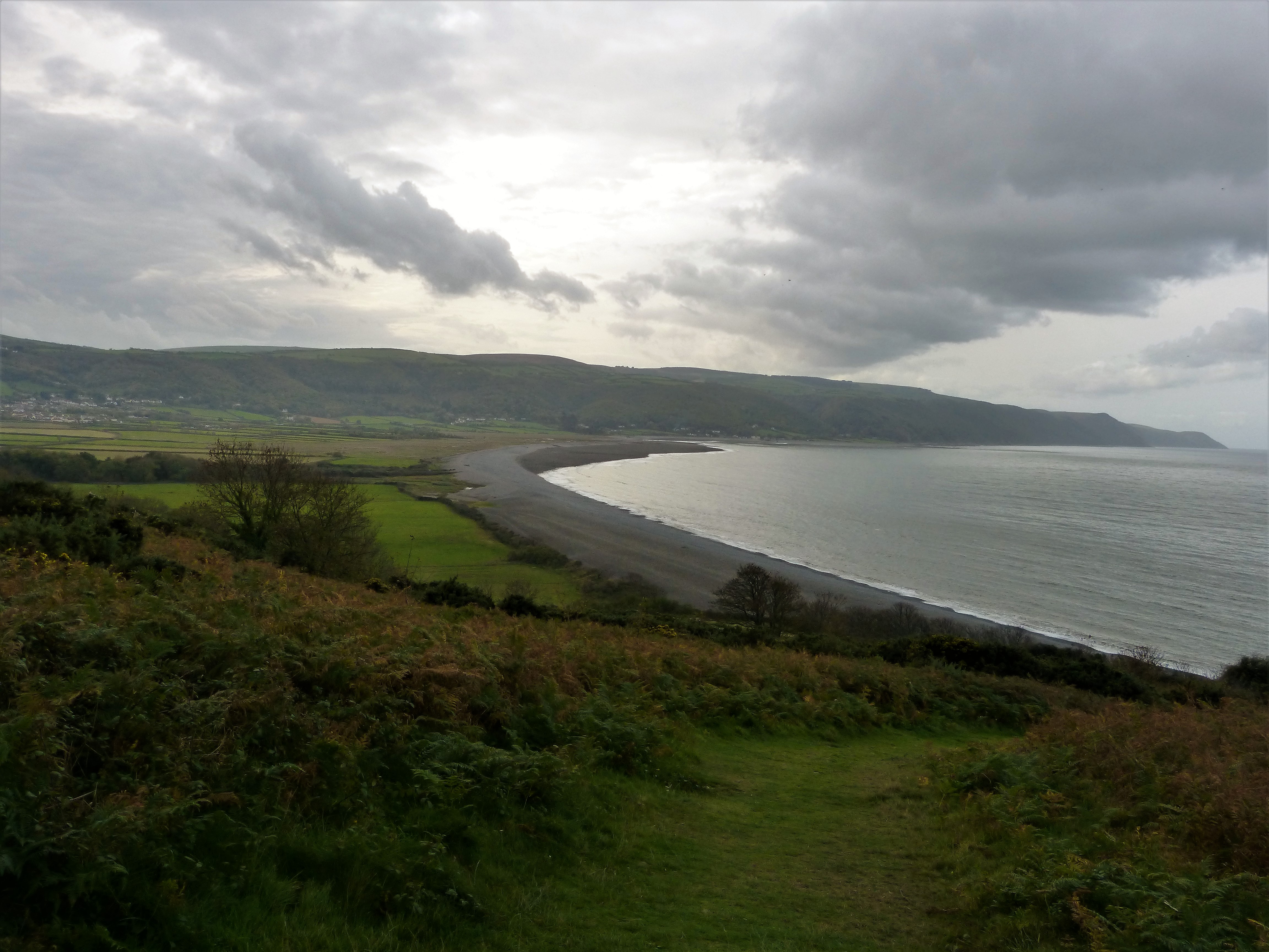
Lunch was taken on a bench above the Point. Then we trudged down the relatively steep descent, probably the most strenuous part of the walk.
At this point the full stretch of Porlock Bay can be seen, giving the impression that the end is relatively close at hand.
.
.
But, whereas the route used to pass along the beach, the fields behind it now flood at high tide and it is thought too dangerous. Instead one must head inland to circumnavigate the flood plain, some of which is marshland.
A wide woodland track leads directly into the picturesque village of Bossington, past a substantial part-thatched National Trust cottage.
Thereafter one follows the network of hedges and fields for a few miles until reaching Porlock Beach, shortly before Porlock Weir. Fortunately the route is well-marked.
One passes a memorial to a US Liberator bomber that crashed here in October 1942, having hit Porlock Hill in poor visibility. The tail gunner was the sole survivor from a crew of twelve.
The carcases of trees nearby serve as a natural monument.
.

.
Porlock Beach is windswept shingle, divided by splintered wooden groynes which thrust from between the stones or lie partly submerged in the sea.
.

.
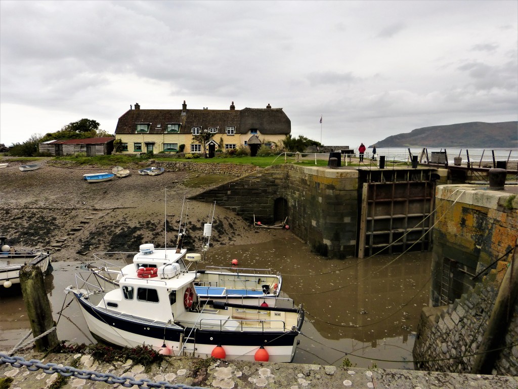
The slow walk along the shingle beach is the final physical challenge before one reaches the roadside at Porlock Weir, having completed a total distance of some 9.5 miles.
Here there is a small harbour, a clutch of cottages, cafes and souvenir shops, a hotel and the Ship Inn (aka The Bottom Ship, since there is also a Ship Inn in Porlock).
I drank a celebratory pint outside while waiting for the number 10 bus back to Minehead, which stops just across the road.
.
Afterword
I ate that evening in The Old Ship Aground, next to Minehead Harbour. It offers a good selection of beers and a varied gastropub menu, all in a relaxed atmosphere.
There’s a striking picture on the wall of the Minehead Hobby Horse.
There is also reasonable accommodation, right on the coast path, although rather more expensive than the Premier Inn.
I strolled back round the curve of the seafront, past the Butlins holiday camp, turning at the golf club. It was raining and the mood had changed. The tell-tale smell of weed drifted from a shelter and the whole place assumed a slightly woebegone, end of season air.
Next morning the drizzle and dullness persisted, dissuading me from exploring further through the town. I beat a hasty retreat to the bus stop, reaching home by mid-afternoon.
A successful taster for what is to come, although the immediate next stages are harder, longer and pose some awkward transport problems.
No hurry.
.
TD
October 2017


Leave a comment