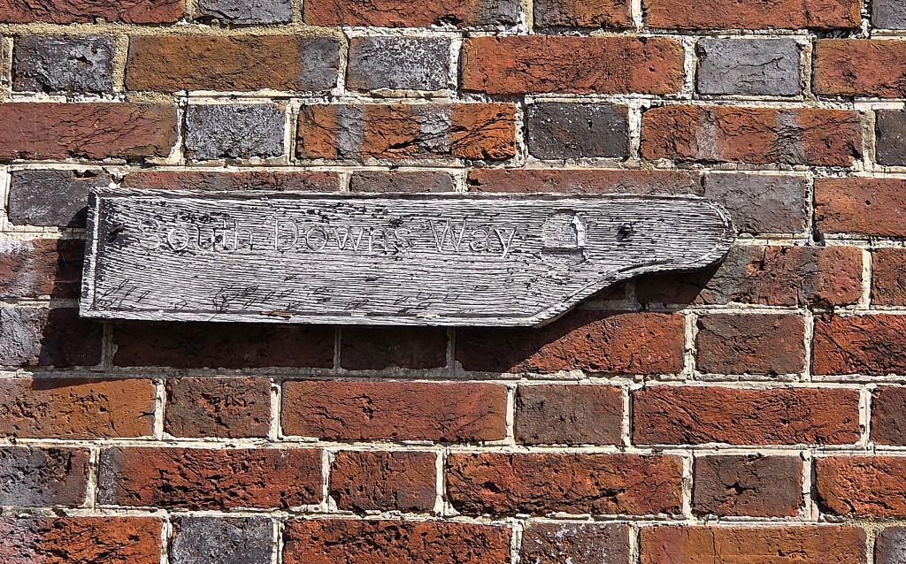
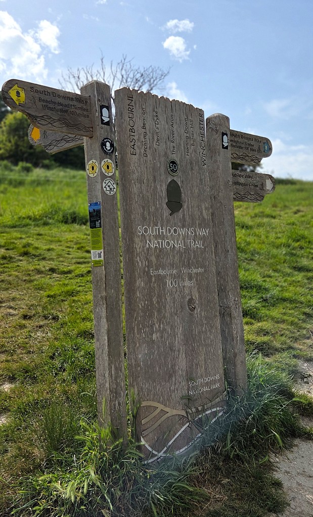
We were finally ready to complete the South Downs Way in the final days of May 2026, having reached Alfriston in sad circumstances at the end of January.
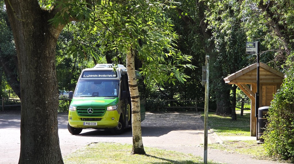
Our journey involved an early train to Clapham Junction, followed by the 08:01 service to Polegate and a 25 community bus service to Alfriston. We arrived at our destination at 09:30, exactly on time.
We were accompanied on this occasion by Tracy’s younger sister, Tara, who lives in Eastbourne. She met us at Polegate and very much enjoyed the (for her) unique experience of travelling by bus!
Our good fortune continued as we found open an Alfriston café, Chalk Coffee, that is normally closed on Thursdays.
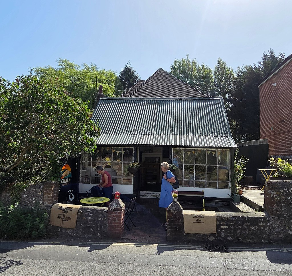
I enjoyed a large cinnamon bun with my black Americano, while we chatted at some length with the very confident young sixth former who served us – who turned out to be the owner’s daughter.
It was 10:15 before we were properly underway, walking to the High Street to pick up by the Market Cross, where we left off last time round.
The temperature was already increasing markedly.
We were in the closing days of a May heatwave and the maximum temperature inland would have been too high for us to walk.
But we were banking on a sea breeze to keep the coastal temperature in the mid-twenties, uncomfortable, but allowing us to complete the SDW successfully.
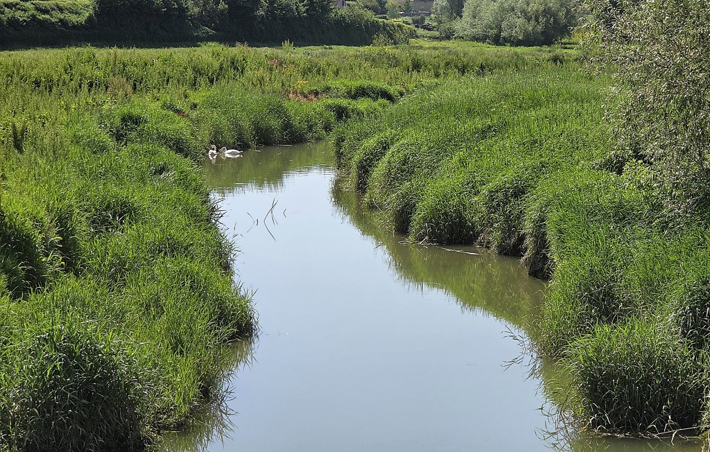
We followed River Lane until the sign led us across the Cuckmere River, responsible for the flooding we had encountered when last in Alfriston. The name ‘Cuckmere’ probably denotes the river’s fast-flowing character.
We followed the walker’s route south, beside the River, while the alternative bridleway and cyclist’s route headed eastwards.
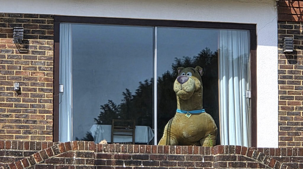
Shortly afterwards we came abreast of a large, stuffed Scooby-Doo, staring bemusedly out of a ground floor window.
Further down, a pair of swans glided along, foraging in the bankside grass as we passed behind St Andrew’s Church and Alfriston Clergy.
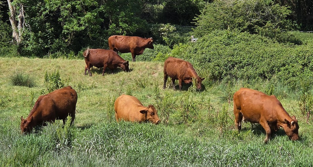
We passed a herd of chocolate brown cows, grazing the meadows beside the River and seeming likely to wade in before too long.
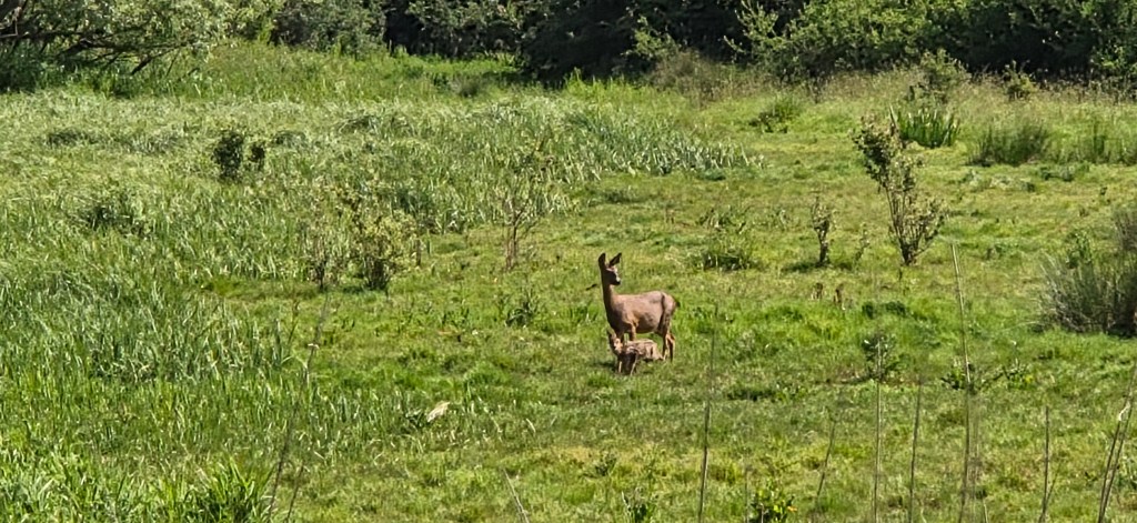
On the approaches to Littlington, we noticed what we thought might have been a female muntjac deer with a fawn but, on closer inspection of the photograph, they more closely resemble roe deer.
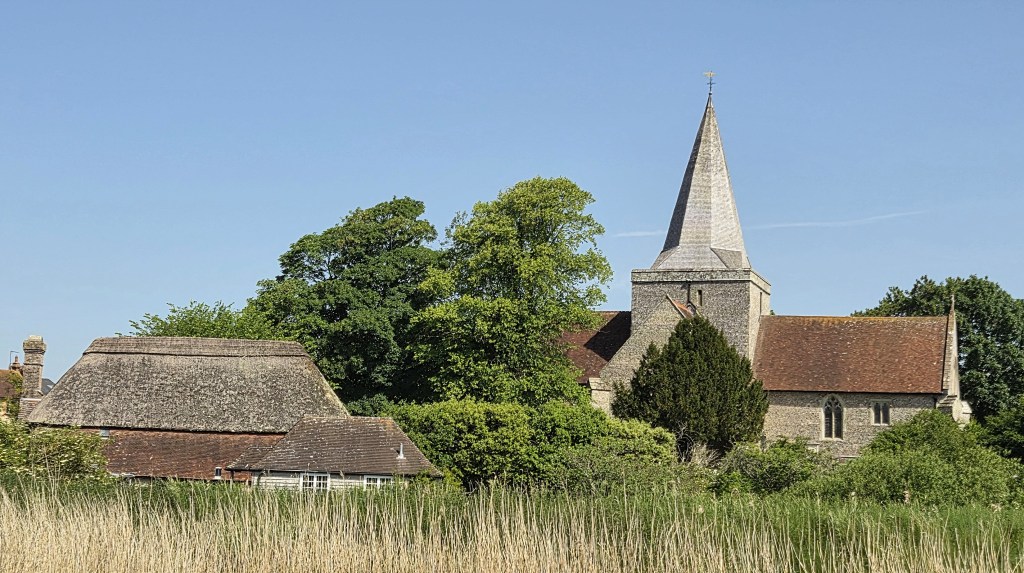
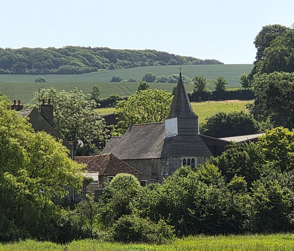
The Church at Litlington is St Michael The Archangel, thought to date from the mid-Twelfth Century, though the building was extensively renovated in 1863.
From here one can see the Litlington White Horse, carved into the downland on the western slope of Hindover Hill.
It is approximately 28 metres long and 20 metres tall and was cut in 1924 by three local men in a single night. It is believed to have replaced a predecessor dating from 1838, most probably cut to celebrate Queen Victoria’s Coronation.
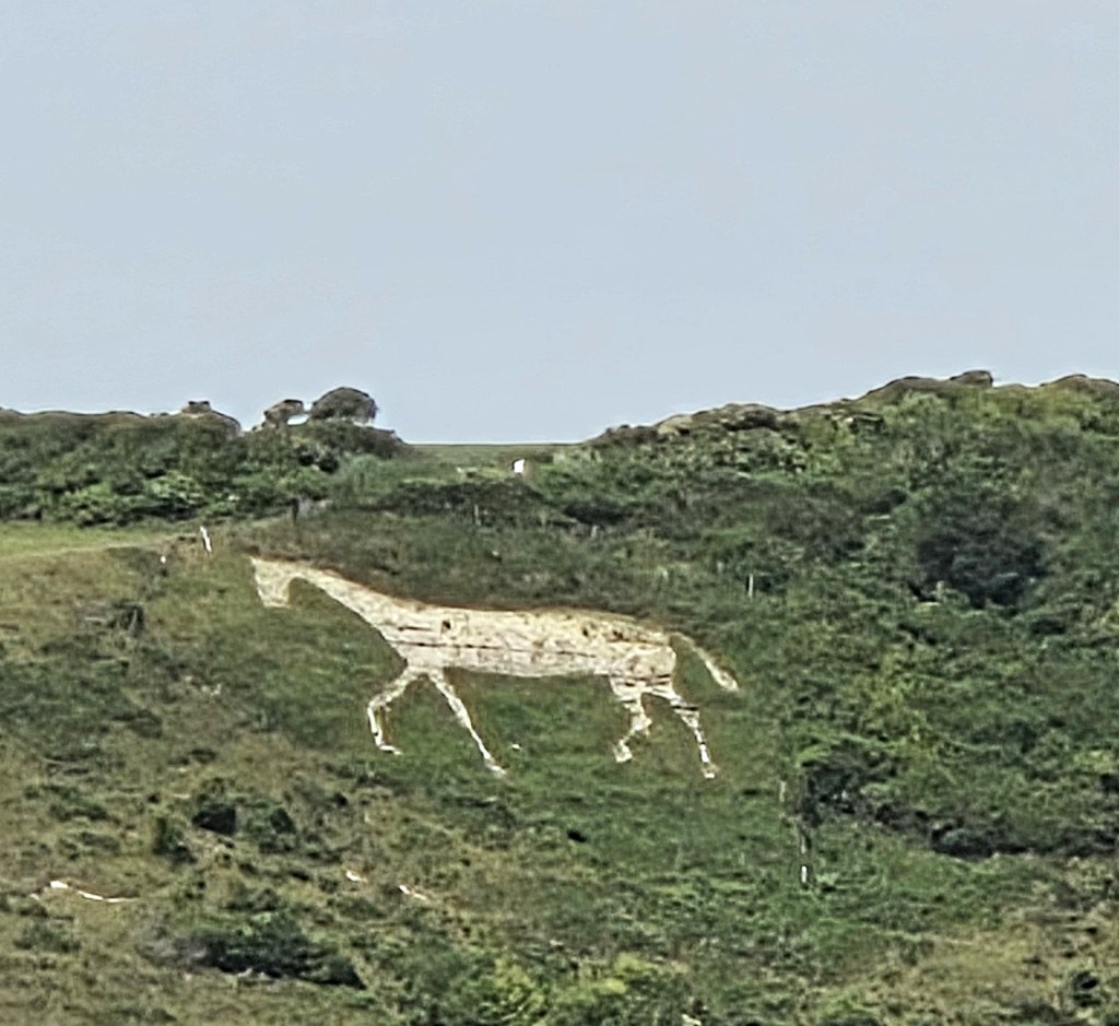
The horse was covered during the Second World War, in case German aircrew used it as a location marker. In 2017 some enterprising individual added a unicorn’s horn, only to have it swiftly removed.
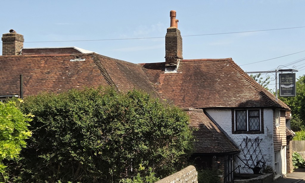
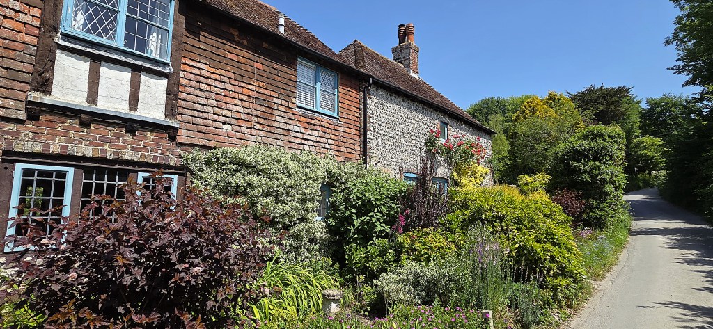
We passed through Litlington, noting the Plough and Harrow, an Eighteenth Century listed building.
At the end of the Village we joined a footpath on the left-hand side of the road. A notice began by stating that we were entering ‘private property’ which ‘was not open access land’.
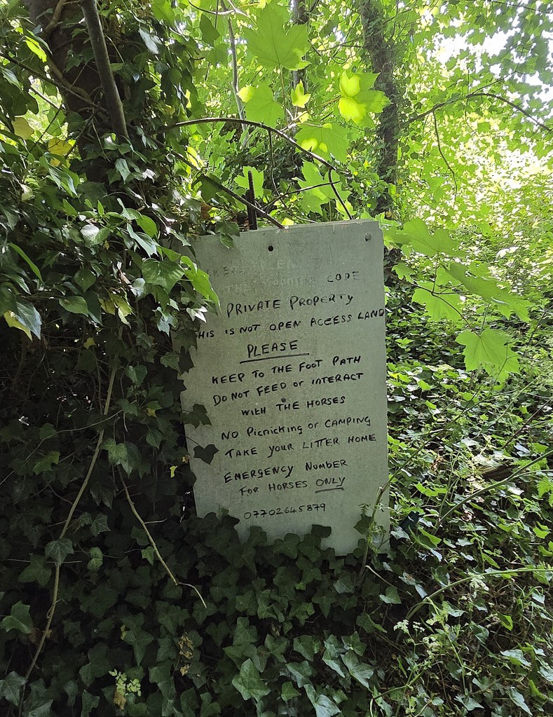
What it fails to state is that there is a legal right of access to the footpath.
The path rises steeply and, by the time we had reached the top, all of us were in need of a long drink.
Tracy and I were both carrying 1.25 litres of water, so these initial ascents were energy-sapping.
We were now level with the White Horse, which pranced along beside us for a while.
Our next encounter was with a small herd of goats, feeding on a steep slope beside a fallen tree. As we approached, one lost his footing and slipped.
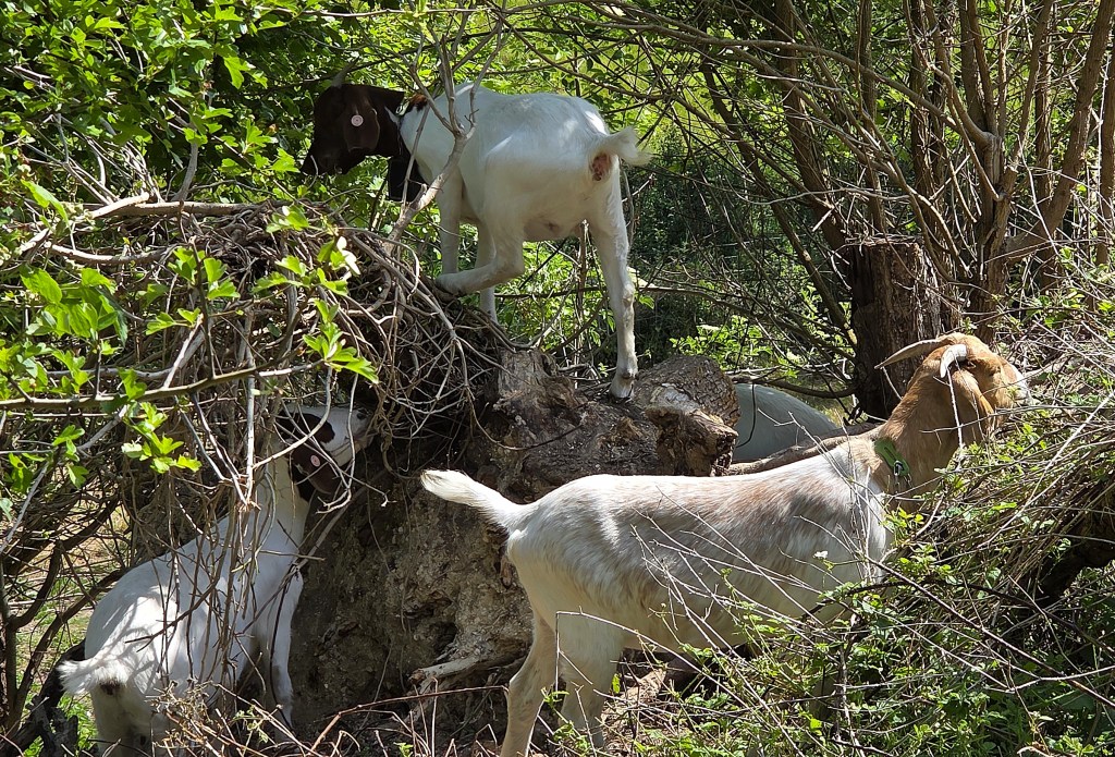
Obviously embarrassed, he fought hard to display nonchalance when we expressed our concern for his wellbeing.
The path was now flirting with Friston Forest, first planted in the 1930s. We admired a row of cottages in the hamlet of Westdean, but bypassed its centre, including All Saints Church.
We paused beside a notice board which was advertising an event on Bank Holiday Monday, just passed, called ‘beating the bounds’.
This ancient custom demands that the inhabitants of an area undertake a ceremonial walk around its boundary, typically beating all boundary markers with switches.
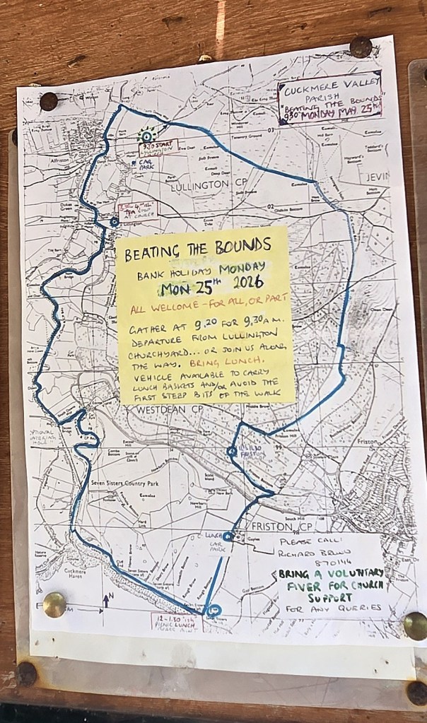
It has been in operation since Anglo-Saxon times, and might have developed from a Roman festival known as Terminalia.
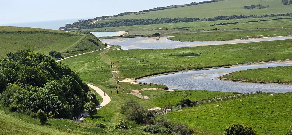
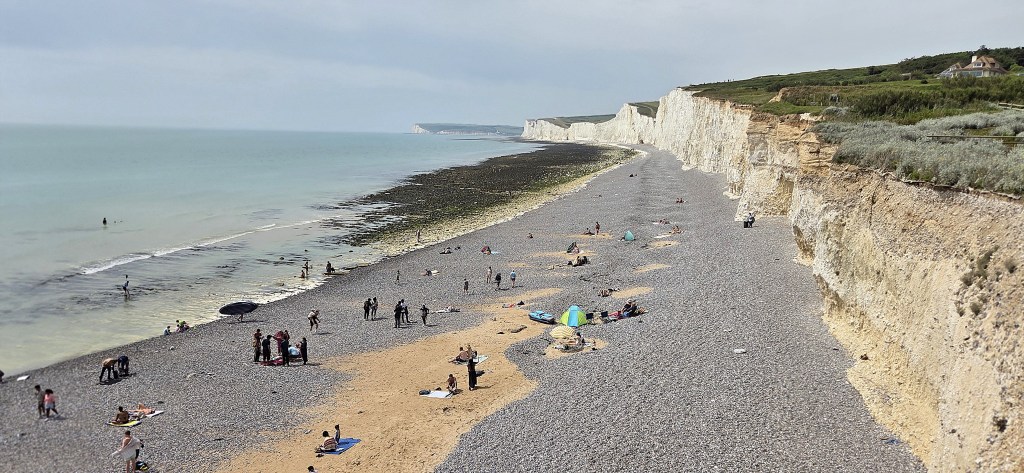
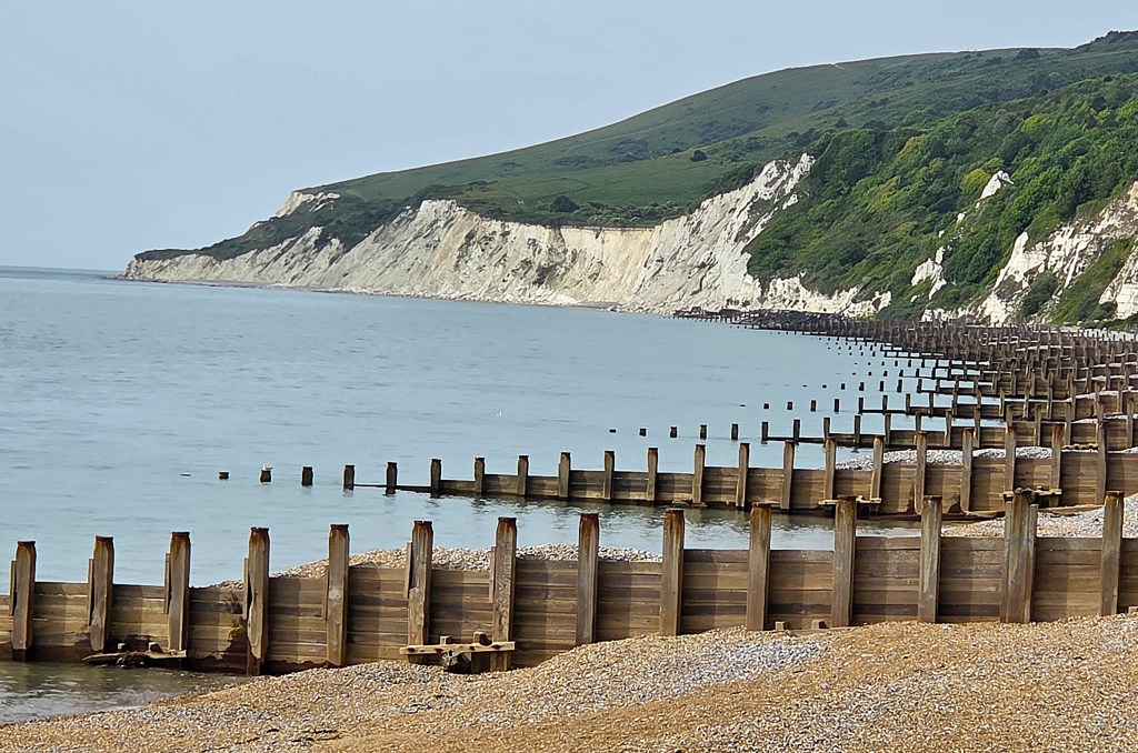
We were soon within sight of the estuary of the Cuckmere River, passing Exceat, then snaking back and forth towards the sea, across what is known as Cuckmere Haven..
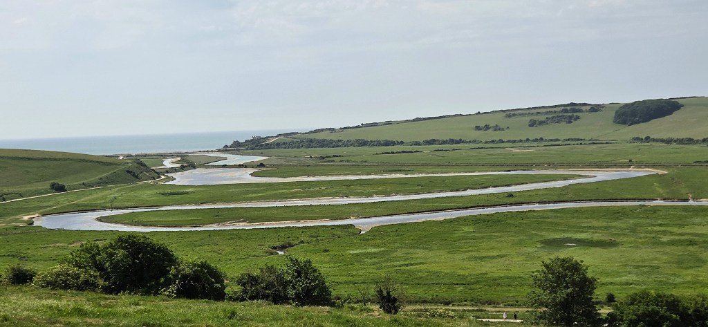
The etymology of ‘Exceat’ is uncertain, but its existence was recorded in the Domesday Book. The land was owned by the family of Robert, Count of Mortain (c.1031-c.1095), a half-brother of William the Conqueror.
Exceat remained a significant village into the Fourteenth Century, but its population was ravaged by the Black Death and it was abandoned by the Fifteenth Century.
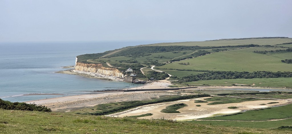
Cuckmere Haven is said to have been a centre for smuggling along this stretch of coast. The row of coastguard cottages was built soon after the Coastguard was established in 1822.
At low tide one can still see the wreck of the Polynesia, a three-masted German barque of about 1000 tons. It ran aground near the mouth of the Cuckmere in April 1890.
During the Second World War, the area was heavily fortified, since it was considered of potential interest to the Germans as a site for a land invasion.
From the 1930s until the 1960s, gravel was removed from the beach and transported to the road at Exceat via a tramway.
The area is popular with people learning to use paddleboards but, while we were there, the water was empty owing to the presence of blue-green algae.
Some can produce toxins. Human exposure can lead to diarrhoea, nausea and vomiting, while canine exposure can result in death.
Our path took us above the floodplain, on its eastern side.
On the western side, near the coastguard cottages, there is a memorial to a company of Canadian soldiers who allegedly died here in a Messerschmitt raid.
The cairn was erected in 2006, on the strength of testimony from a man who said he witnessed the event. However, researchers have been unable to substantiate his claim.
An attack was mounted in July 1942, but there were no fatalities.
As we climbed, following a well-established path, we arrived in the midst of a bunch of Shetland ponies. A group of young people were photographing them as we arrived.
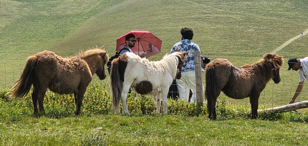
They began climbing the steep slope immediately beyond, clearly expecting to beat us to the top, but soon found they wouldn’t manage it.
The bench at the summit had just been vacated, so we sat down to regain our breath while the young people trailed up behind us.
Upon leaving we offered the bench to them.
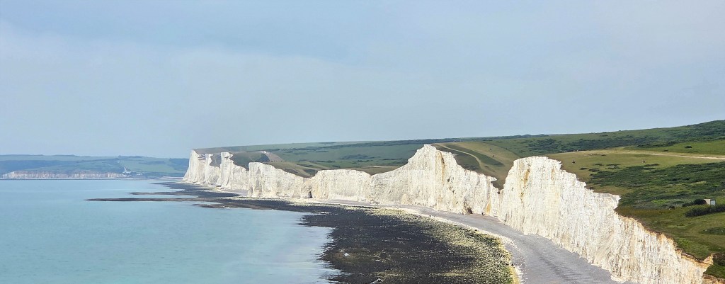
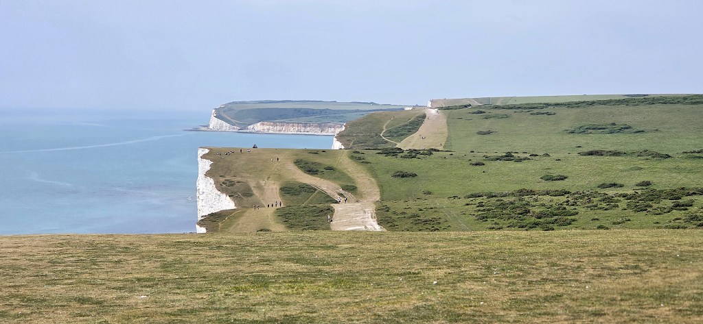
At this point we must have taken a slightly wrong path, for we found ourselves inside a field containing cows, and heading away from the westernmost of the Seven Sisters.
Having climbed an incline, we eventually found a gate and could reach the cliff top.
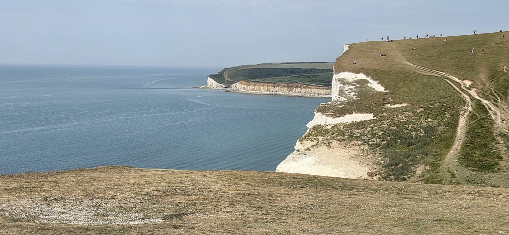
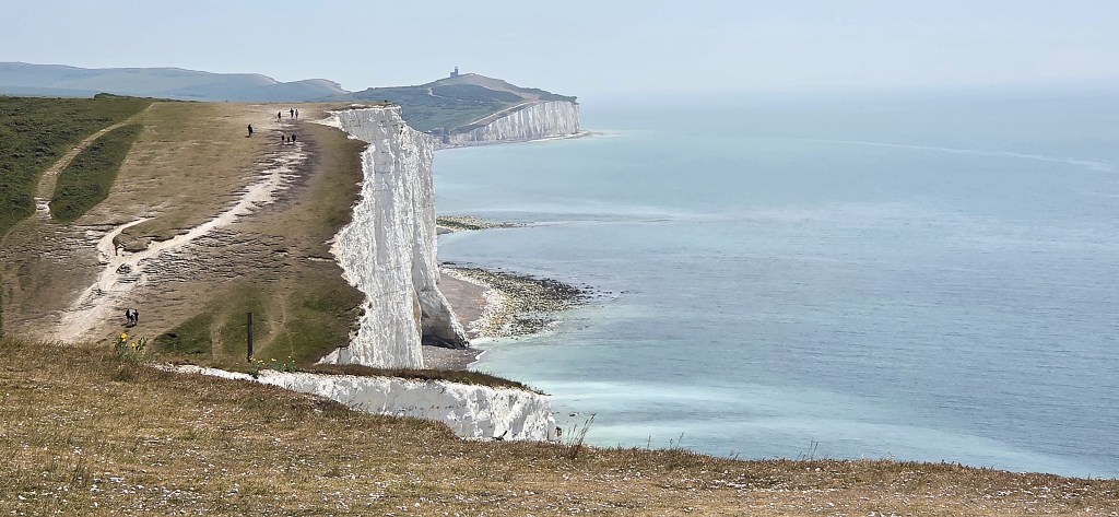
The Seven Sisters are Haven Brow, Short Brow, Rough Brow, Brass Point, Flagstaff Point, Flat Hill, Baily’s Hill and Went Hill Brow.
Yes, that’s eight.
Near Brass Point there was formerly another coastguard station, Crowlink Gap. It was opened in the 1830s, but was abandoned owing to coastal erosion. Previously, the shore was accessible by pathway and much used by the smuggling fraternity.
Exactly a century ago, in 1926, a group of property developers were hoping to create a new town up here. The syndicate bought up 600 acres of downland with the intention of dividing it into building plots, while also laying out a golf course.
The land had originally belonged to the Dean and Chapter of Chichester, who sold it to a private investor, who sold it on to the developers, known as ‘East Dean Estate, Eastbourne Co. Ltd.’
Efforts were made to persuade the Government to intervene, but they claimed they had no powers to do so. Similarly, neither Eastbourne Corporation nor the local rural district councils were able to buy the land from its new owners, though both were offered 345 acres of the 600.
A Seven Sisters Preservation Fund was established, under the control of a committee chaired by the Mayor of Eastbourne. John Galsworthy and Ramsay McDonald were also involved, and Rudyard Kipling was a prominent supporter.
They had exactly one month in which to raise £17,000.
Towards the end of the period, star aviator Sir Alan Cobham (1894-1973) landed his aeroplane on the cliffs to support the Fund, and addressed the waiting crowd.
He had just flown from Britain to Australia and back again, and been knighted as a consequence.
We were aiming for the William Charles Campbell Monument, which turned out to be at the top of Flagstaff Point. We had decided to break here for lunch.
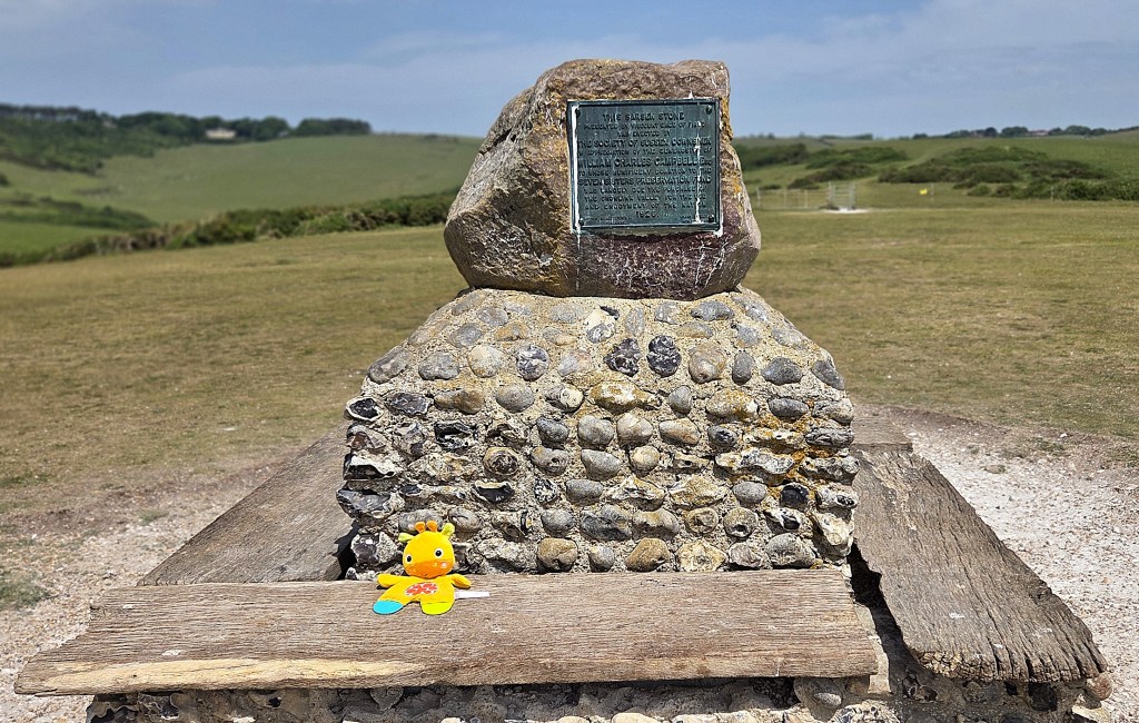
The Monument, adorned by a bright yellow cuddly toy, is topped by a sarsen stone:
‘…erected by the Society of Sussex Downsmen in appreciation of the generosity of William Charles Campbell Esq. To whose munificent donation to the Seven Sisters Preservation Fund was largely due the purchase of the Crowlink Valley for the use and enjoyment of the Nation. 1926’
Mr Campbell, a resident of Eastbourne and a member of Lloyds of London, made two £1,000 donations to the Fund.
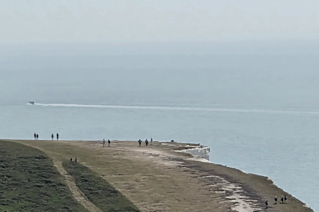
In recent years the Seven Sisters have ‘gone viral’, attracting up to 900,000 visitors annually, many of them international tourists.
I was surprised at the huge numbers of young people hiking up here, the majority female, all of them seemingly searching for the perfect Instagrammable selfie.
On 19 March 2026, the Seven Sisters area became a National Nature Reserve. It is the 13th in a series of 25 National Nature Reserves that are being created or extended between now and 2028.
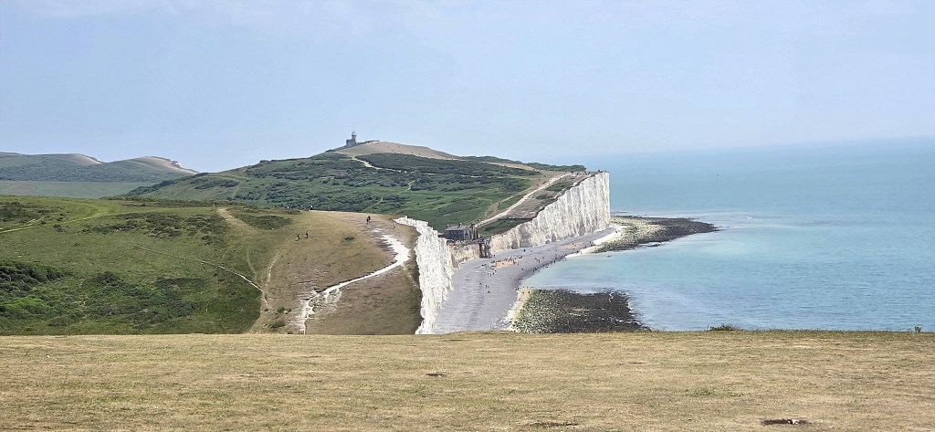
We sat facing eastwards, looking towards the Belle Tout lighthouse, carefully protecting our packed lunches from potentially marauding gulls.
As we were polishing off our sandwiches, we were briefly joined by a group from an HF holiday. They seemed about to stop for lunch too, only to change their minds at the last minute.
A little while later, we were passed by a motley crew of teenaged boys, most likely Year 10 from a minor independent school. They were clearly undertaking some sort of character-building outdoor activity.
Having resumed, we began to overtake small groups of these youths. One rather tubby individual was on the verge of giving up, so Tara ‘gave him a good talking to’, which seemed to have the required effect.
The heat was now intense, as we veered off our route to get a closer look at the Robertson War Memorial Bequest Obelisk.
It records that:
‘Michel Dene was bequeathed to the National Trust by W. A. Robertson in memory of his brothers Norman Cairns Robertson, Captain 2nd Battalion, Hampshire Regiment, who died 20th June 1917 at Hanover, Germany, and of Laurence Grant Robertson, 2nd Lieutenant King’s Own Scottish Borderers who was killed in action in France during the Battle of the Somme, in or near Delville Wood 30th July 1916.’
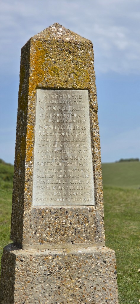
William Alexander Robertson (1871-1937) was a barrister resident in Redhill, Surrey. He had three younger brothers.
The eldest was Reginald James Robertson (1873-1936) who, before the War, was a stockbroker. The two younger brothers were a solicitor and a chartered accountant respectively.
By the start of the War, all four were in their mid-thirties to early forties and, unusually, all four were single. The two eldest presumably avoided War service.
William Robertson left a bequest of £50,000 to the National Trust to acquire property incorporating high ground and ‘within reasonably easy access of London’, as a memorial to his two brothers.
Nine properties were purchased with the bequest. All but one incorporates an obelisk, and that has a wall plaque instead.
Michel Dene incorporates an area of cliff, downland and farmland covering some 70 hectares and was purchased in 1940. The obelisk was moved back and westwards from its previous location in 1972, since it was at risk from erosion.
Arriving at Birling Gap, we found large crowds occupying all the facilities.
While Tracy and Tara queued for the Ladies, I went to refill our water bottles, only to find the area entirely dominated by an unruly gaggle of testosterone-fuelled teenagers, several with attitude and a sense of entitlement. The same bunch we had encountered already.
Whoever was supposed to be controlling them had sensibly gone AWOL.
The rest of the queue waited with heroic patience while they repeatedly filled and refilled their bottles, sorting themselves out as slowly as possible, knowing that they were trying to provoke a response and determined not to give them the pleasure.
Tracy and I purchased iced lattes from the National Trust Café, while Tara had a Coke. We sat on a bench just above the beach and gradually restored our body temperatures to normality.
On the ascent towards Belle Tout Lighthouse, we encountered several groups of Chinese or South Koreans, most of them posing for photographs of one kind or another.
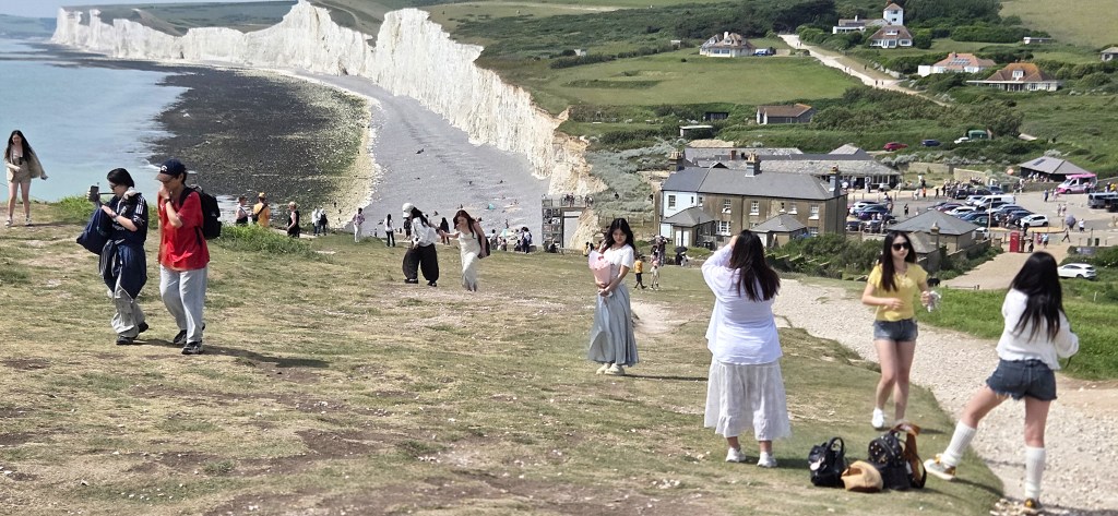
It seems that this popularity originally derived from Asian popular culture in the 2010s.
A Korean reality TV programme ‘One Night Sleepover Trip’, paid a visit that year, as did actress Seo Hyo Rim (b.1985).
A Taiwanese singer called Jay Chou (b. 1979) has also featured the location in the video for his song ‘What’s Wrong’ (2014), a staple of Mandopop!
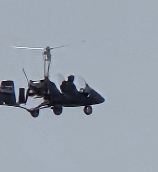
As we marvelled at this strange scene, a gyrocopter swooped past, just over the sea.
Belle Tout was built between 1829 and 1834. It continued in service until 1902, when the Beachy Head Lighthouse was built (see below).
During the Second World War it was badly damaged by Canadian artillery fire, though not itself a target.
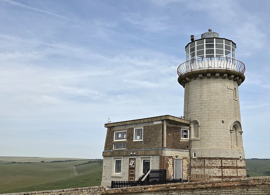
From 1948 onwards the building was restored. In 1986 it was used as a filming location for the BBC television series ‘The Life and Loves of a She Devil’ starring Julie T Wallace, Dennis Waterman and Patricia Hodge. It also appeared in the 1987 Bond film ‘The Living Daylights’.
Owing to erosion, the 850-ton lighthouse was moved 17 metres inland in March 1999. It is now a bed&breakfast.
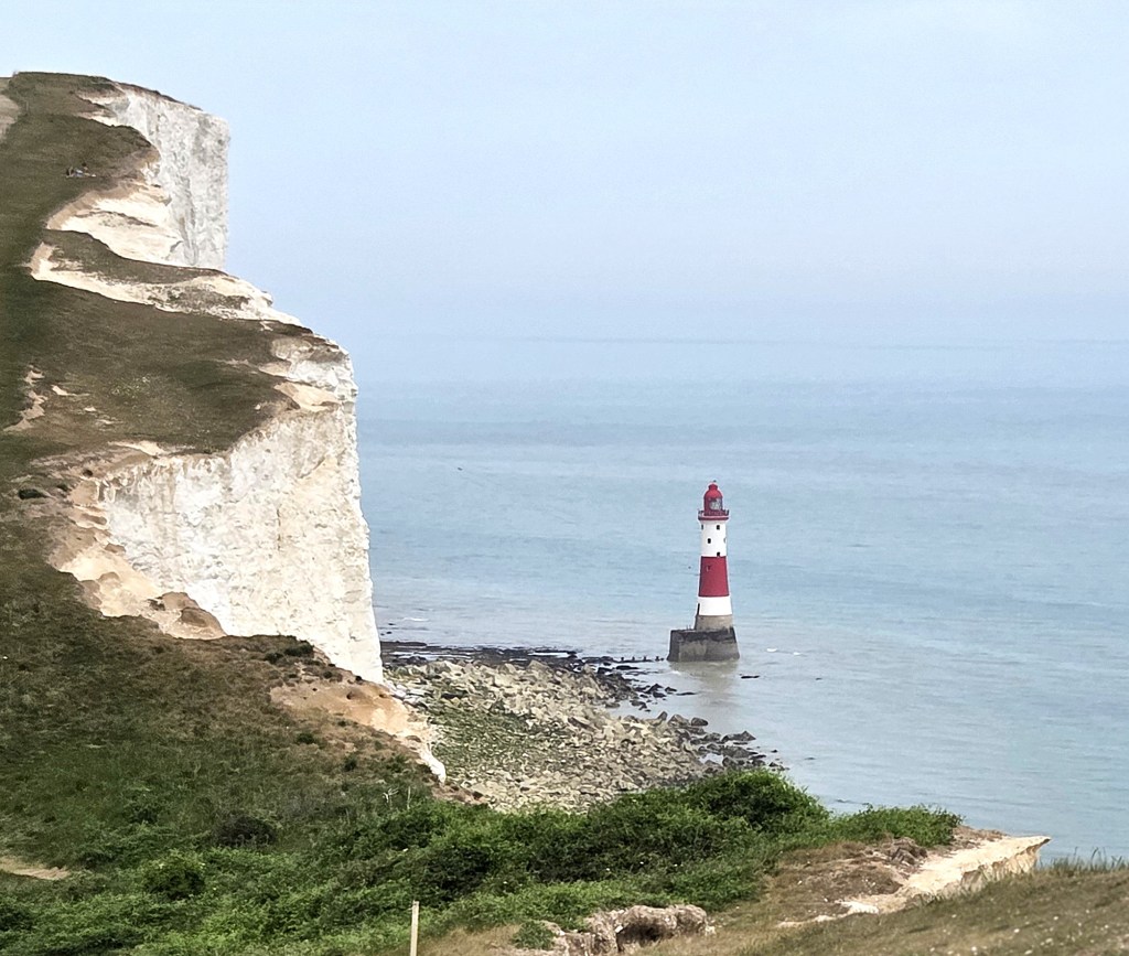
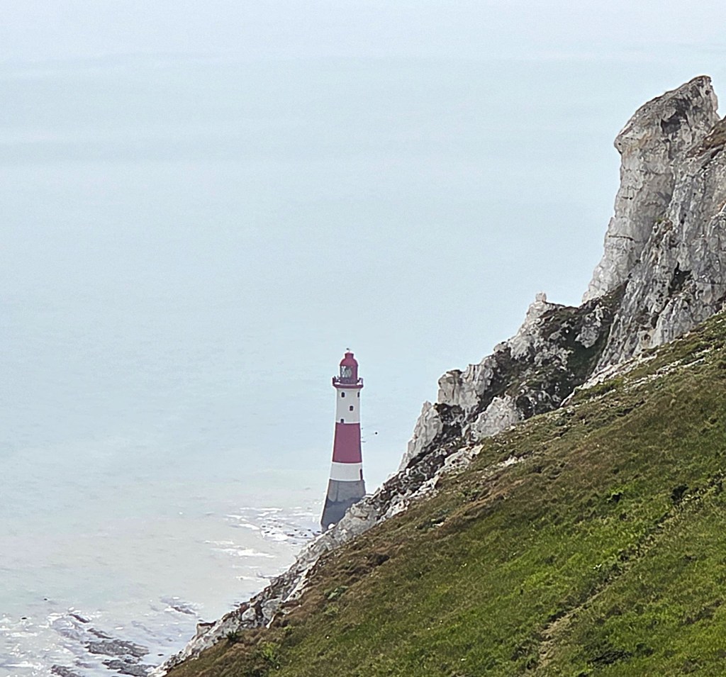
Almost immediately we were within sight of Beachy Head Lighthouse, looking extremely photogenic next to the strikingly white cliff.
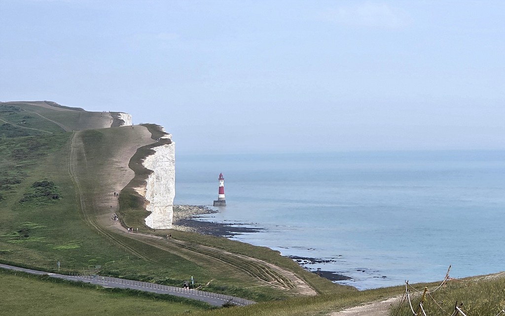
Built between 1900 and 1902, it became operational in October 1902. The granite tower is 33 metres tall. Originally painted black and white, it became red and white in 1951. Until 1983 it was operated by a team of three lighthouse keepers.
Beachy Head lighthouse featured in two episodes of ‘The Prisoner’ (1967).
I walked over for a closer look at the ‘Beachy Head Watch Tower’ which carries two plaques: one recording the gratitude of the Mayor and people of Eastbourne for the efforts of the men and women who served here during the War; the other from the town of Fort Mahon Plage which:
‘…commemorates the heroic crossing of the Channel in canoes on September 16th 1941 by 5 young men from Picardie in order to continue their fight against Nazism…Reynold Lefebvre, Christian et Guy Richard, Jean-Paul et Pierre Lavoix.’
The five men, all under 20 at the time, made the crossing from France to England in two canoes, taking over 30 hours.
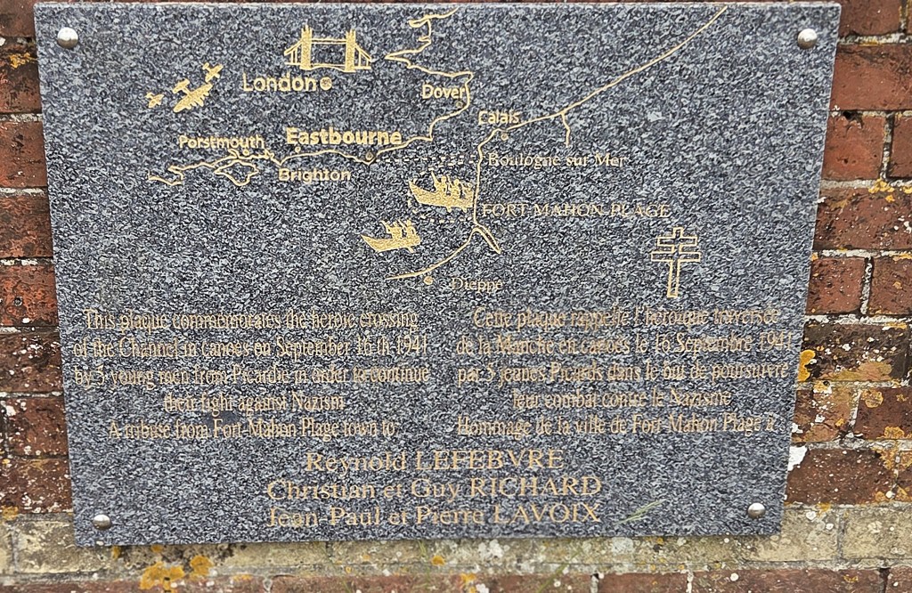
Having met Churchill and De Gaulle, four of them enrolled in a Free French cadet programme and subsequently served in the Free French Army; the fifth joined the Free French Navy.
Serving as a second Lieutenant, Reynold Lefebvre was killed in January 1945. His father had earlier been deported to Auschwitz where he died in August 1942. His son’s exploit probably counted against him, though he was also suspected of having communist sympathies. It seems that his mother took her own life.
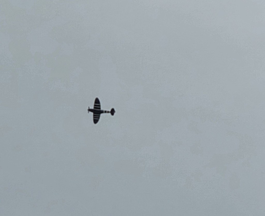
A little further on we came to the equally moving memorial to RAF Bomber Command. I thought of my father-in-law, who served as a youthful Lancaster pilot in the latter days of the War, and fortunately survived it.

As if to cement that thought, a plane that looked and sounded suspiciously like a Spitfire flew almost directly overhead.
While photographing the memorial, I was approached by a young woman who asked the distance to Eastbourne Station.
It turned out that she was a Neapolitan on her fourth holiday to England. We discussed possible activities for her remaining days in the country, before saying goodbye at the end of our walk.
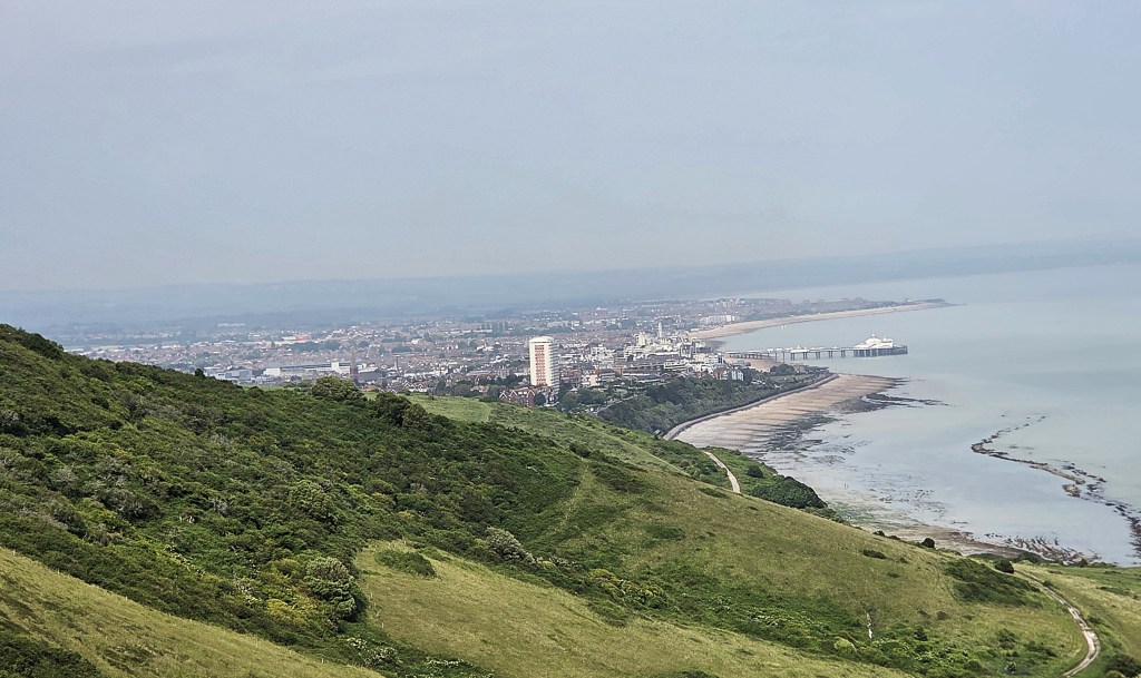
Eastbourne now seemed close, but we faced a final steep drag up a long hill before the final descent to the official end of the South Downs Way, adjacent to Foyle Way. It seems that the King Charles III Coast Path takes an easier route.
Postscript
We forced our tired legs a little further along, into Helen Garden, named after Mrs Helen Reid Stewart Hornby Lewis (1854-1930), who owned the land before it was transferred to the Council and opened as a public garden in 1935.
Clearly exceedingly wealthy, she lived in the manor house at Medmenham in Buckinghamshire and died at her London home in Park Lane.
We stopped at the Cadence Clubhouse. Here I had my second iced latte of the day, while waiting for Tracy’s niece (Tara’s daughter) and her two small children.
Tracy duly presented me with the South Downs Way badge, in what has now become a compulsory closing ceremony.
We watched the children play for a while before departing for the Hydro Hotel, which can best be described as a blast from the past.
Having swiftly unpacked our rucksacks, containing the bare minimum for an overnight stop, we hastened to the small swimming pool in the grounds for a post-walk unwind. For we had both found space for swimming costumes.
As we did so, the clouds drew over Eastbourne and it began to spot with rain.
We decided on pre-dinner drinks in the Hotel, only to discover that our two single Seven Sisters gin and tonics cost an eye-watering £23.
That evening we dined at the Pilot Inn with Tara and her son, Tracy’s nephew.
Unfortunately, after a prawn cocktail starter, my main course of pork belly was so immense that I had little space left for dessert.
I managed to squeeze in a scoop of ice cream, but didn’t miss out too badly. Our main courses took so long to arrive that, by the time we’d finished them, ‘the ovens had been switched off’, meaning that hot desserts were no longer available.
They did, however, knock off the price of the fish and chips that they’d wrongly served in place of fish pie. And, as an added bonus, Tracy’s nephew kindly picked up the bill!
Our room at the Hydro was exceptionally warm overnight, so we slept with the fan whirring.
Breakfast was a formal affair with hordes of black-clad waiting staff moving at speed between the closely packed tables. Stomach space was still at a premium, so I limited my cooked breakfast to scrambled egg.
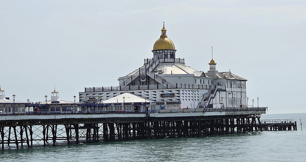
Having checked out, we walked along the Promenade to a cafe close to the Pier, where I had my third iced latte in 24 hours! We waited for Tracy’s niece and her children, who were late because they had a completely different café in mind!
Around midday we said goodbye and walked to the Station, catching the train back via Clapham Junction.
As is now so often the case, the service was disrupted.
We were advised to catch a service into Waterloo and then another out again but our own train, having arrived on the platform at Waterloo, magically changed itself into the very service we required.
TD
June 2026


Leave a comment