Tracy selected our next HF walking holiday, this time in Liguria, North West Italy.
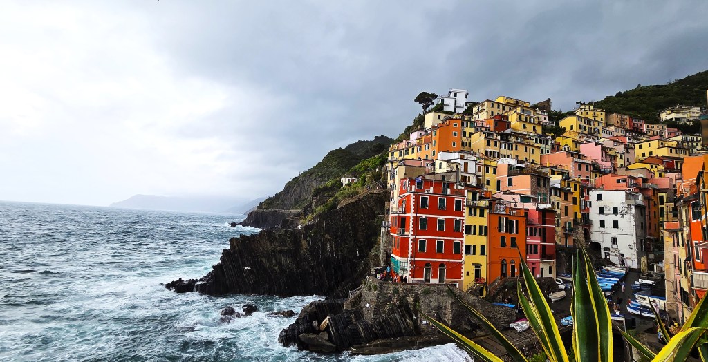
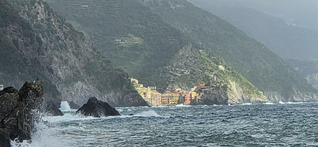
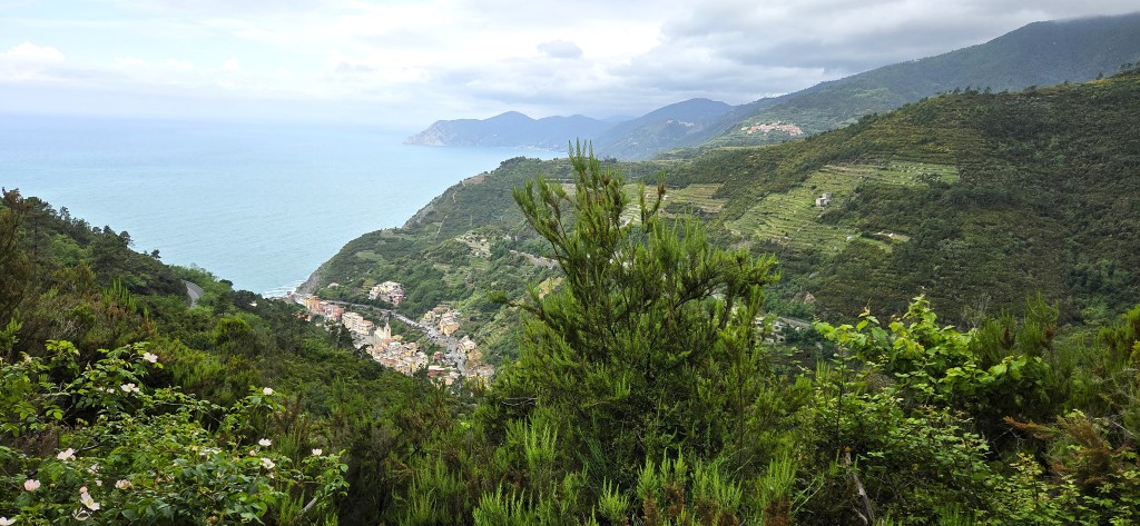
‘Cinque Terre’ refers to five coastal villages located in the province of La Spezia.
The surrounding area forms the Cinque Terre National Park.
This part of the Ligurian coastline, extending to Portovenere with its three neighbouring islands, just south of the Cinque Terre, is also a UNESCO World Heritage Site.
The holiday posed a particular challenge for me: a problem with my ear had rendered me temporarily but severely hearing-impaired.
I gained real insight into how those who struggle with their hearing can feel isolated in social settings; how easy it is for the deaf to appear taciturn and grumpy.
One is forced to ration polite requests for repetition, which would otherwise prove intensely annoying.
My deafness has definitely affected my assessment of the sociability of our group. But, even after allowing for my disability, it feels that we did not ‘gel’ quite as well as on previous HF holidays.
There were 23 of us – a larger group than I have been used to, including several from North America.
There was little interchangeability between the two walking groups. There were also fewer ‘serious’ walkers than usual, while a handful found even the easier walks beyond them.
For this is not a destination for those who like to stick to flatter ground. Regular ascents and descents are guaranteed. Both can be steep, lengthy, uneven and occasionally technical in nature. A good basic level of fitness is essential.
We would invariably try to circulate at dinner, talking to those we did not walk with but, while there were a few interesting characters, I found myself warming to relatively few.
I’m sure they felt exactly the same about me.
Getting there
As we climbed into our taxi at 04:30 on Saturday morning, a heron, disturbed, flew directly overhead.
Half an hour later the taxi delivered us to Heathrow Terminal 5.
Despite assurances to the contrary, we had been unable to check-in online via the British Airways app.
Several of our fellow guests experienced the same problem, though one said that, while they had been unsuccessful with their mobile phone, swapping to a laptop had resolved the issue.
We successfully navigated BA’s automated check-in and baggage drop, but found ourselves sitting apart on the plane. The machine refused to accommodate us, although we can’t have been the last to check in.
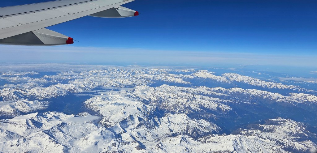
We took off ten minutes after our 07:00 slot but, with a faster than advertised flying time, arrived at Pisa International Airport more or less on schedule.
Forming an orderly queue behind the remnants of a Ryanair flight, we advanced slowly towards a bank of eight EES biometric checking machines. We entertained ourselves by trying to spot our fellow walkers.
But, with another flight about to land, we were eventually waved through to a second queue for passports to be stamped.
By the time we reached baggage reclaim our flight had disappeared from the screen. Tracy found her case standing to one side with a few others, while mine was still whizzing around Carousel 1 in splendid isolation.
We discovered the rest of our group already in the Arrivals hall, where the tour manager (who had just arrived with us from the UK) had apparently lost one guest and our driver.
Communication was scant, or perhaps my hearing was to blame.
The guest never materialised (they were apparently booked on to the following week’s holiday) but the driver did, eventually.
With the aid of a guest who translated, he told us he was worried that the coach would be too big for the narrow roads close to our destination.
After further self-communion, he ultimately decided it would have to do (it was somewhat smaller than another we used later in the holiday) but insisted on packing the cases in accordance with his own strict formula.
It was 11:30 Italian time before we finally left the coach park.
Shortly after we did so, a (different) heron overflew the coach.
The transfer took approximately 90 minutes, mostly along the E80, before dropping down to Levanto and then across to Bonnasola, our destination.
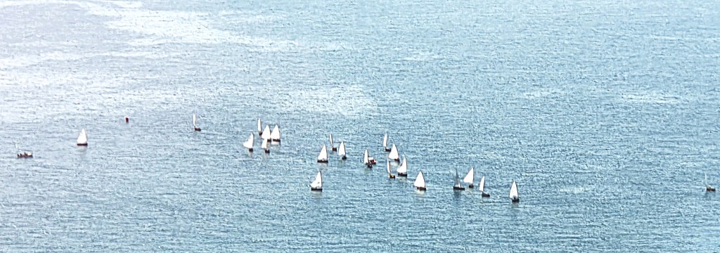
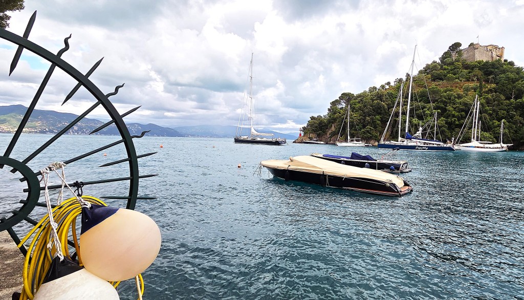
Passing above Levanto, we looked down upon a host of small yachts racing across the bay.
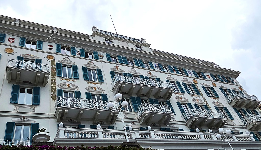
Our Hotel
We alighted at the Hotel Delle Rose, part of the Logis Hotel chain, which specialises in small independent establishments.
It is a three-star hotel spread over four floors, its 25 ensuite rooms located on the second and third floors. The top floor contains a rooftop breakfast and lounge bar. There is also a library and an unused dining room on the ground floor.
Until recently the Hotel was run by brothers Roberto and Enrico Bernardin, but they have recently retired and it has since been sold to a new owner.
It was founded in 1955 by their father, Giorgio Bernardin (1928-2011).
His claim to fame was that he played for Inter Milan and Roma during the 1950s, making six appearances all told.
He also played once for the Italian national team, in 1954, but his international career was shortened by injury, as well as a fear of flying.
Giorgio’s brothers ran the Hotel until 1972, when his sons took over.
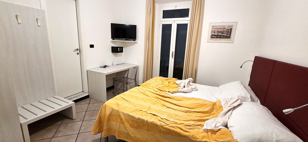
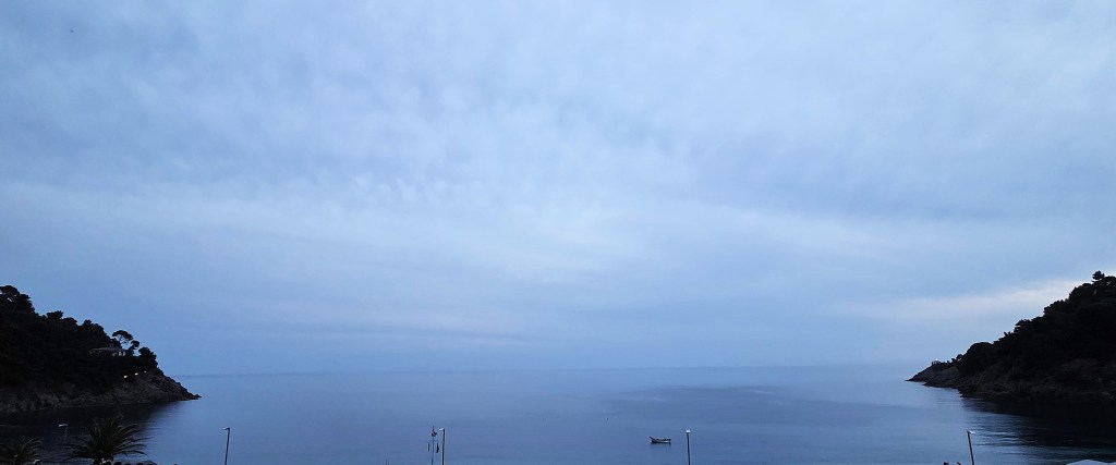
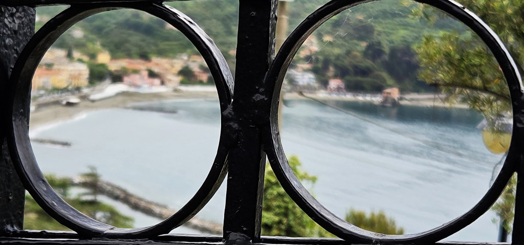
We found ourselves allocated Room 16, on the second floor, almost above the entrance, facing onto the pedestrianised road. We were luck to have a narrow balcony giving a view of the sea.
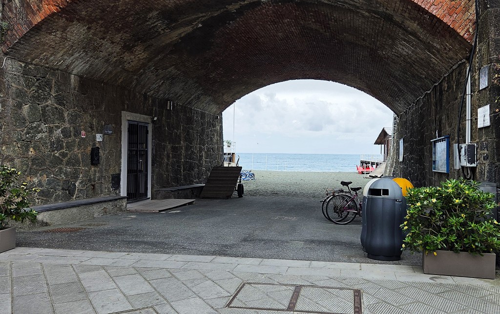
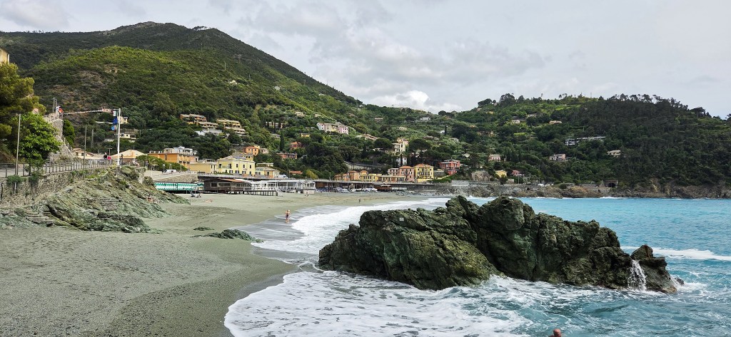
The beach was only some 50 metres from the Hotel, though behind the walled tunnel formerly used by the railway.
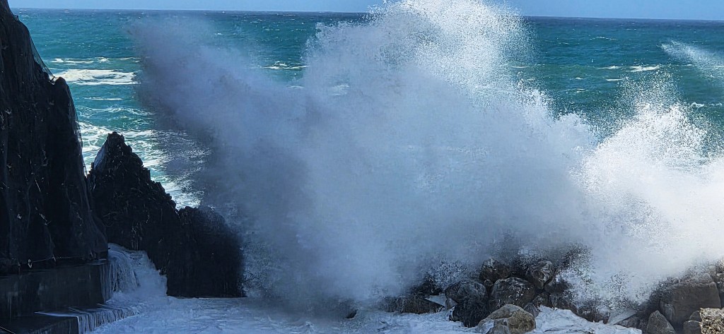
When the wind was high, as it often was, the waves smashed on to the shore with considerable force.
My blocked ear proved a blessing in disguise, blotting out the noise whenever it threatened to disturb me during the night.
For we preferred to sleep with the balcony doors slightly open; the slatted metal shutters behind them closed
Waves aren’t the only nocturnal disturbance in Bonnasola: a bell chimes hourly throughout the night and, just in case you missed this first rendition, a second bell echoes the first roughly three minutes later!
Though relatively modest in size, the room had ample storage space, a desk, chair, safe and fridge. The ensuite bathroom was comparatively spacious, with a large and powerful walk-in shower.
Breakfast was taken in the rooftop bar, normally served from 08:00, but occasionally at 07:15 or 07:30, to accommodate our walking timetable. If the weather permitted, it was possible to sit on the open terrace.
Coffee was served only from a machine, but the Americano was reasonably strong and tasted acceptable. On a standard breakfast day I needed three cups to set me up properly, though reduced this to two when we were under time pressure.
My breakfast invariably consisted of: muesli with milk and an apple, pear or orange from the fruit bowl; a small croissant with butter and jam; and two slices of bread with salami and cheese.
Just occasionally a few delicious custard-filled doughnuts would also appear, but never for long!
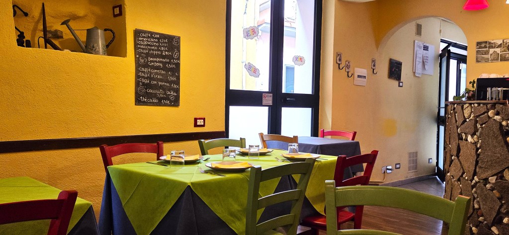
Dinner was taken, not in the Hotel, but in the nearby SiVa’ Restaurant, where we were accommodated on several tables on the left hand side. The right hand side continued to operate normally.
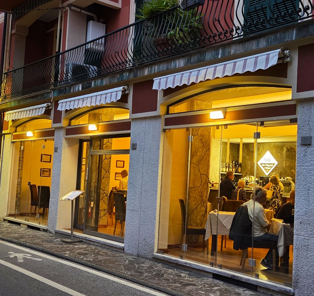
Our meals were clearly constrained by the budget allocated to the Restaurant but, for the most part, were filling and tasty.
Each morning, at breakfast, we would be asked to state our preferences for the evening meal. This involved choosing between soup or a pasta dish to start, and between a meat dish and a fish/vegetarian dish for the main course.
Vegetarians were catered for separately.
Everyone had the same dessert. Bread, salad, fruit and water were also provided.
We invariably shared a half-litre carafe of the local house red, normally excellent and extremely good value at seven euros.
Before dinner we would assemble in the rooftop bar for a drink and our daily walking brief. After dinner some of us would return to the rooftop bar for coffee (handmade but stewing) and a chat before turning in for the night.
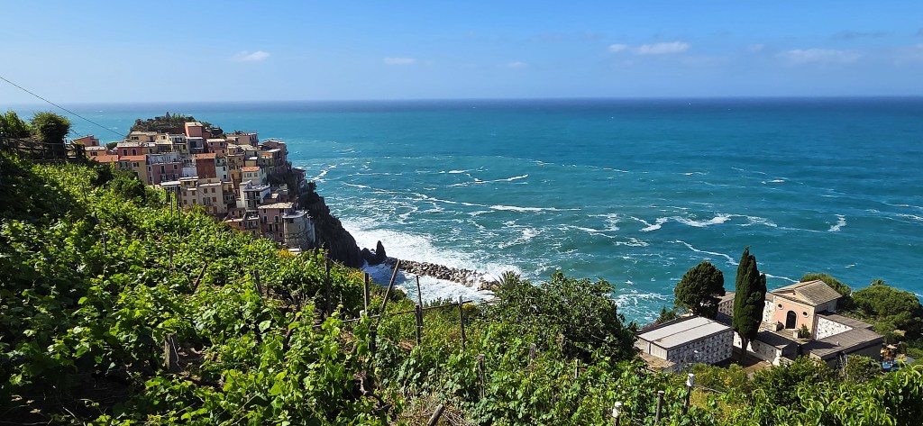
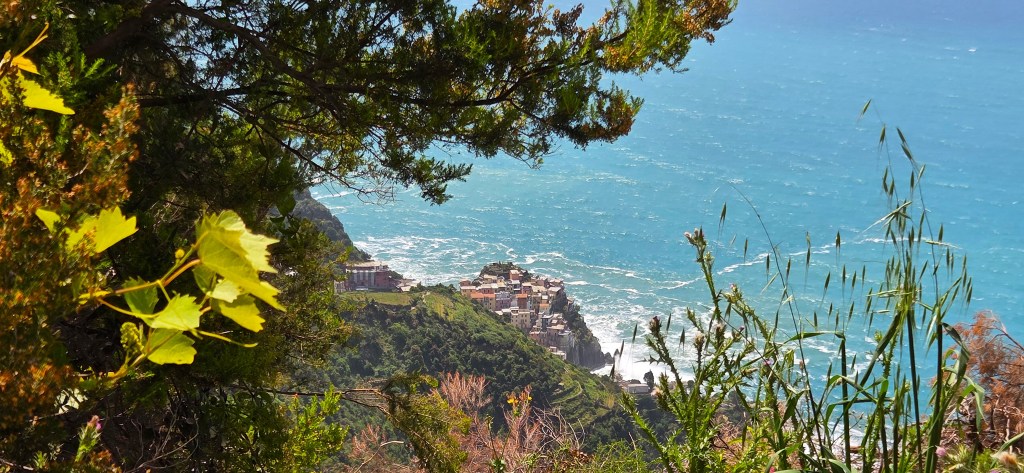
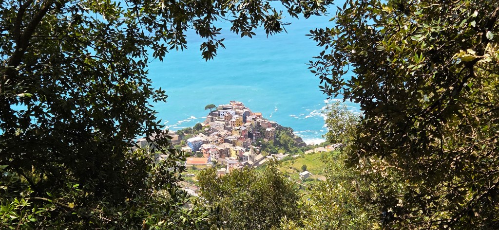
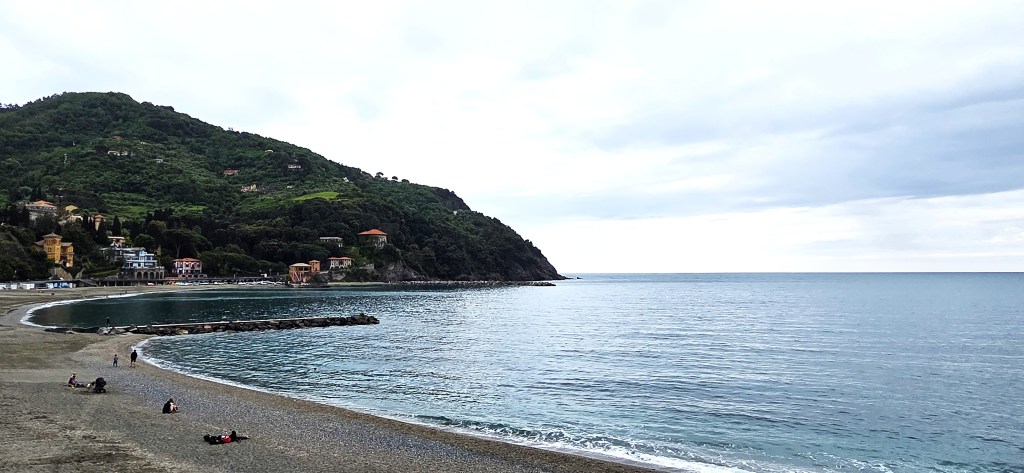
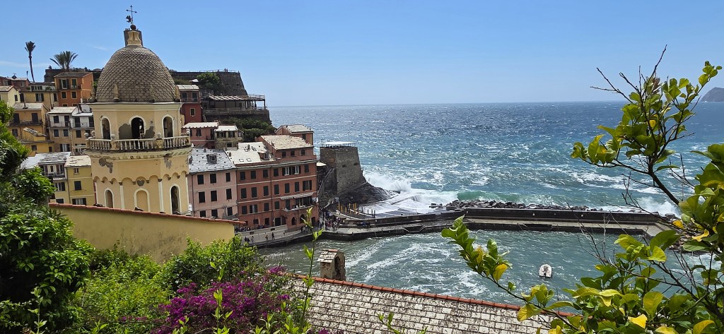
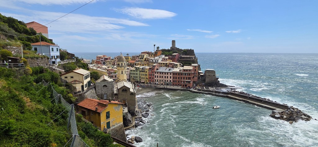
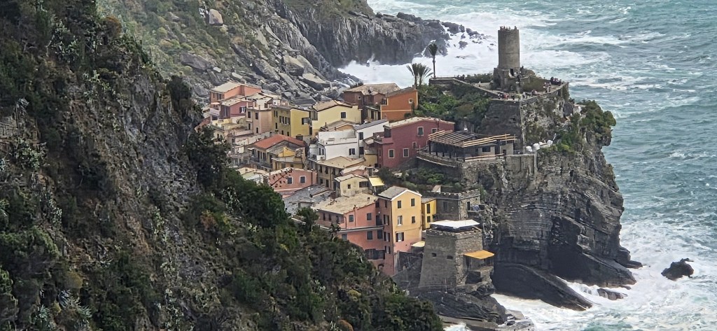
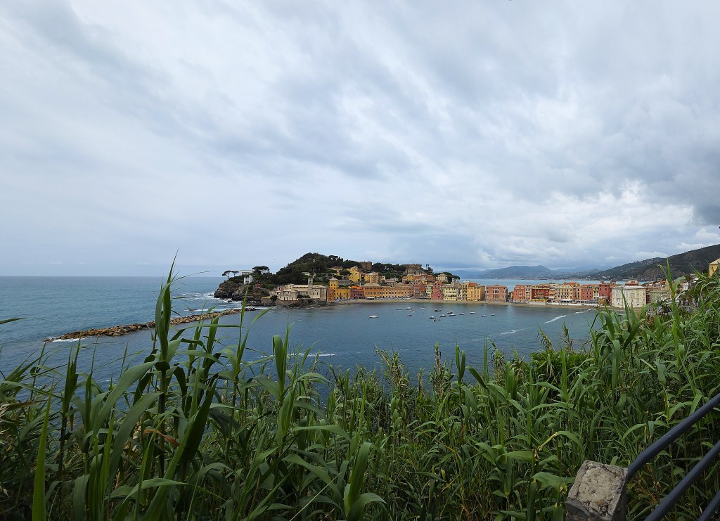
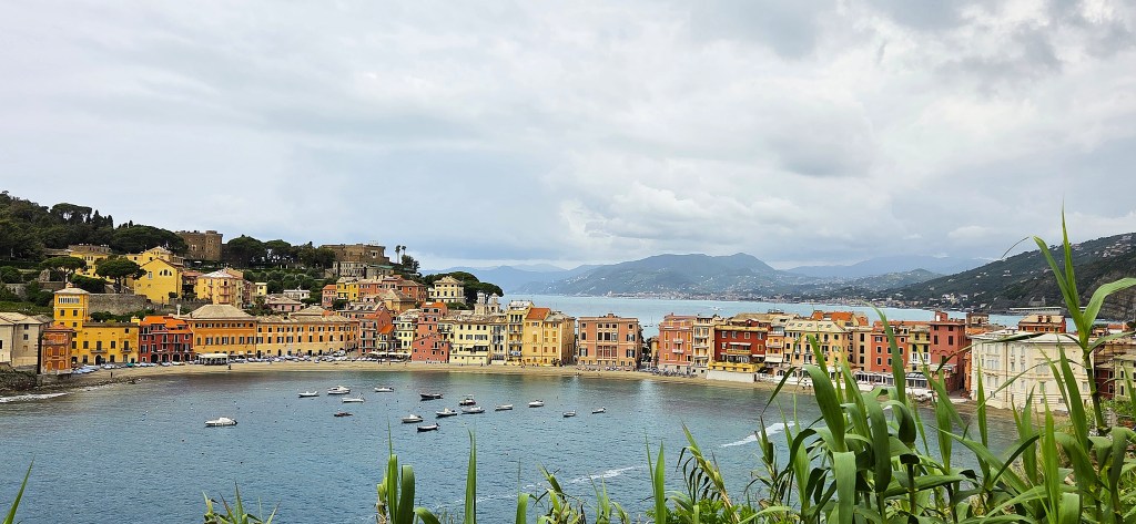
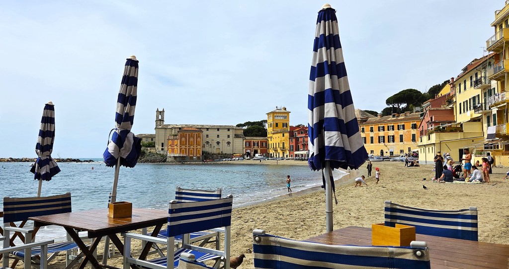
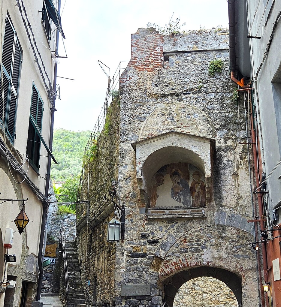
Bonnasola
Having quickly unpacked we went straight to the neighbouring Café for lunch – the Caffe delle Rose – where we both opted for a toasted foccaccia.
Then we bought our first ice creams from the gelato counter, taking them down to the beach.
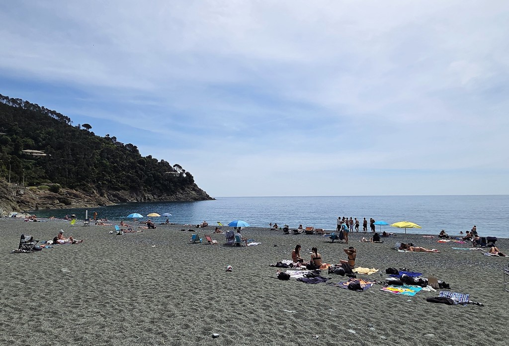
It was a calm, warm, sunny day. A dozen or so teenaged boys were sitting together on the beach, heavily outnumbering three teenaged girls.
The girls went everywhere as a tight-knit group; so did the boys!
We wandered around a little.
At the Osteria Antica Guetta we stumbled on a wedding reception. The newly married couple were expected to advance out to the verandah as triumphal music played, but were apparently delayed inside by some more urgent business.
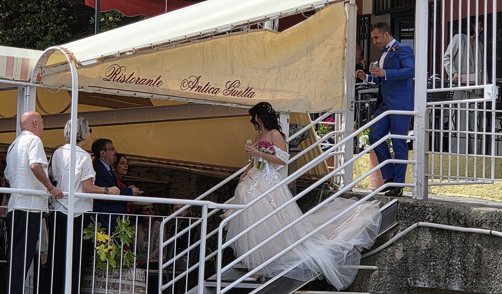
Finally they emerged and, suddenly overcome by fatigue, we made our way back to the Hotel for an afternoon nap.
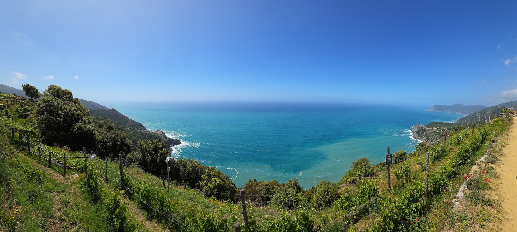
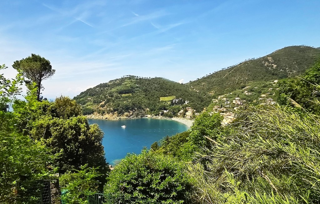
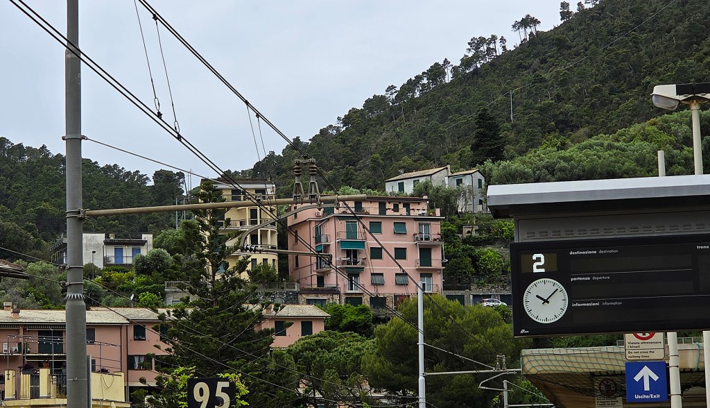
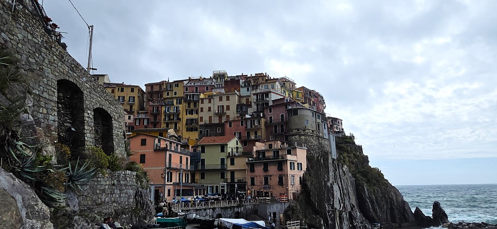
Bonnasola is a small laid-back town with roughly 1,000 permanent inhabitants, some 60km to the south-east of Genoa.
It sits on a sheltered bay sandwiched between two headlands, Punta del Carlino and Maddonina della Punta.
The municipality includes Bonnasola itself and seven surrounding villages: Montaretto, Reggimonti, San Giorgio, Costella, Serra, Poggio and Scernio.
It was first documented in 1269, a port under the control of the feudal lords of the de Passano family. The document in question related to a particular church in Reggimonti.
It became part of the Republic of Genoa in the first half of the Fifteenth Century but, following the Turkish conquest of Constantinople, grew increasingly vulnerable to attacks by Saracen pirates.
There was a particularly vicious attack in 1560 when ten vessels landed, sacking the village and capturing 53 residents.
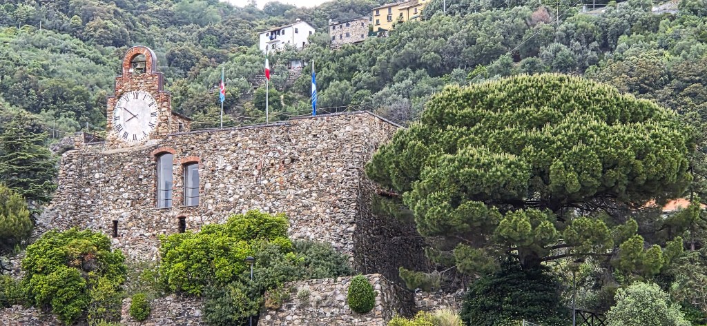
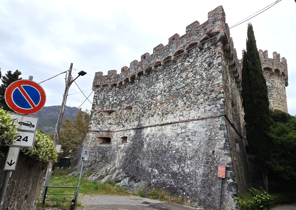
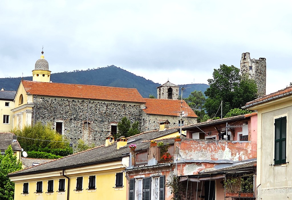
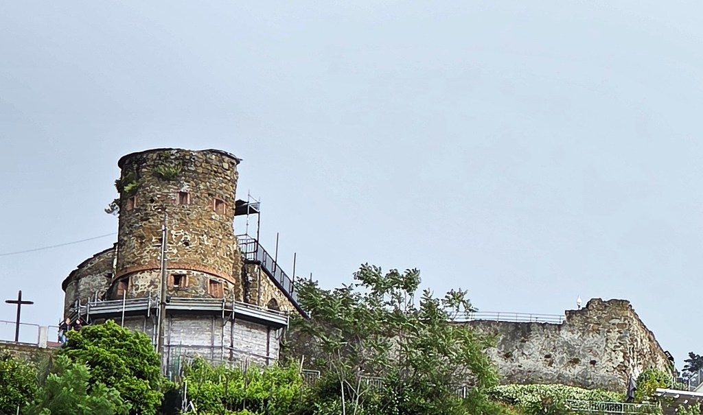
In 1561 the inhabitants decided to build a seaside castle to protect themselves, but the Genoese authorities intervened, ordering it to be built on a hill behind the village. Some sections were demolished in 1963 during the relocation of the railway, but part remains, now housing a relatively modern clock.
In March 1569, the ‘Instrumento della Cumpagnia di Bonassolla’ was signed, setting out a process for the ransom of citizens captured by pirates.
Other significant buildings include:
- The Church of Santa Maria Assunta in Reggimonti, possibly founded at the beginning of the Fourteenth Century (and replacing the predecessor mentioned in the 1269 document);
- The Sixteenth Century Oratory of Sant’Erasmo, subsequently deconsecrated;
- The Church of Santa Caterina d’Alessandria, which probably also dates from the first half of the Sixteenth Century but which was given a new Baroque interior and consecrated in 1668.
- The late Sixteenth Century Palazzo Vinzoni, home of the cartographers Panfilio Vinzoni and his son Matteo Vinzoni (1690-1773);
- The Chapel of the Madonnina da Punta, originally commissioned in the late Seventeenth Century but restored in 1932.
From 1797 the area came under the control of the Napoleonic Empire, becoming part of the Kingdom of Sardinia in 1815 and then the Kingdom of Italy in 1861.
This is true of all the locations that we visited.
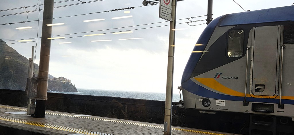
The construction of the Genoa-Pisa railway, which reached Bonnasola in 1874, meant that this group of coastal villages was no longer isolated from the rest of Italy.
The relatively short stretch between Sestri Levante and La Spezia required 51 tunnels and 23 bridges.
Between 1930 and 1970 the track was redirected when the line was doubled. The new Bonnasola Station was opened in January 1970.
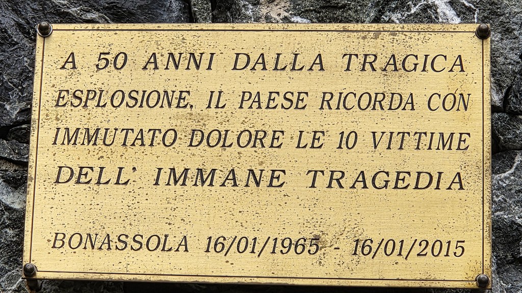
In March 1961, a rail tunnel fire killed five people and, in January 1965, a freight train exploded at Bonnasola Station while explosives were being unloaded for use in creating the new railway line. Ten people died and almost fifty were injured.
There is a plaque near the seafront commemorating 50 years since the later accident.
Sections of the former line between Levanto, Bonnasola and Framura now constitute the 5.5km Maremonti pedestrian and cycle path, completed in 2010/2011.
In June 1943 the steamship Bolzaneto was sunk off Bonnasola by HMS Sportsman, a British submarine.
In March 1944, 15 American commandos, mostly of Italian descent, landed in a cove between Bonnasola and Framura with the objective of destroying the railway tunnel.
All were captured by the Germans and summarily shot.
Upon waking from our recuperative nap, we joined our tour guide for an orientation walk around the village.
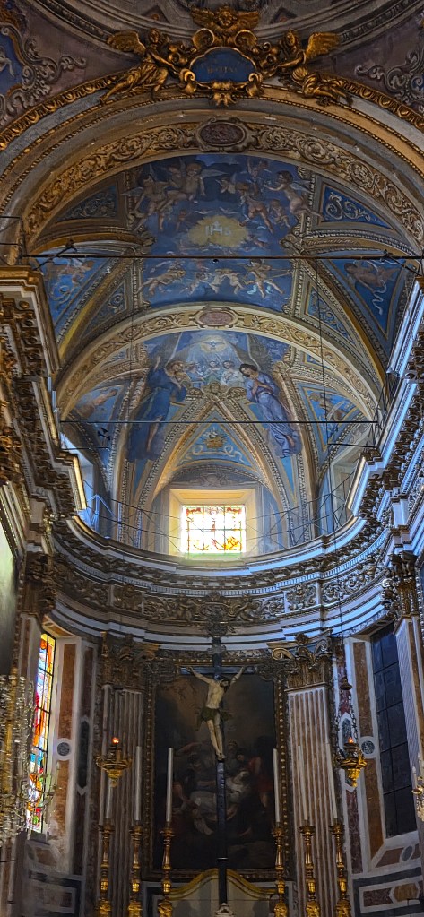
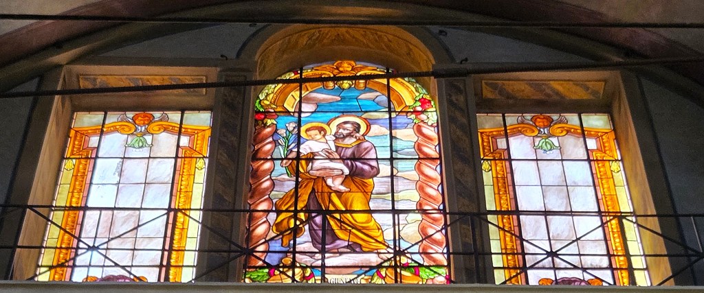
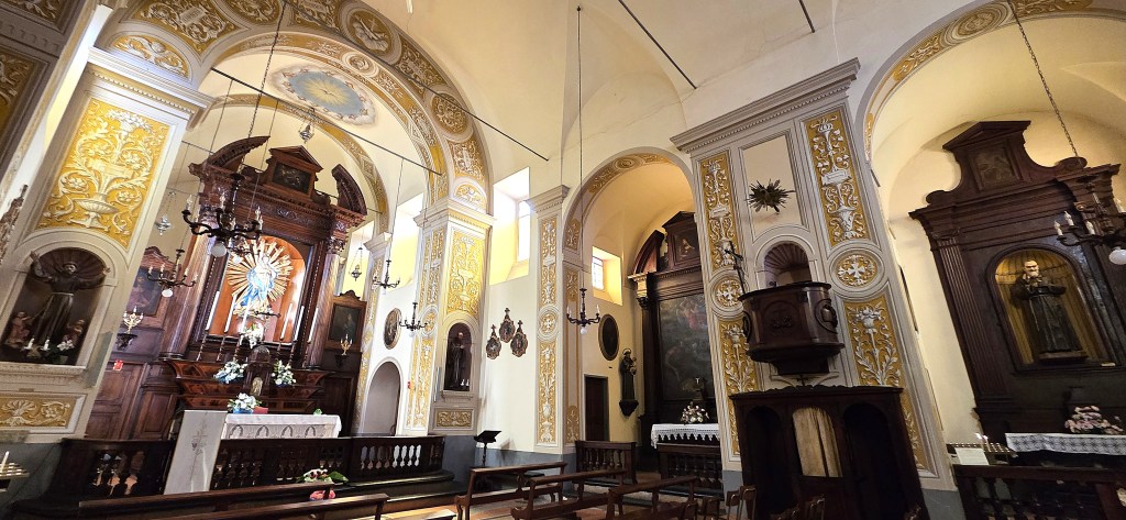
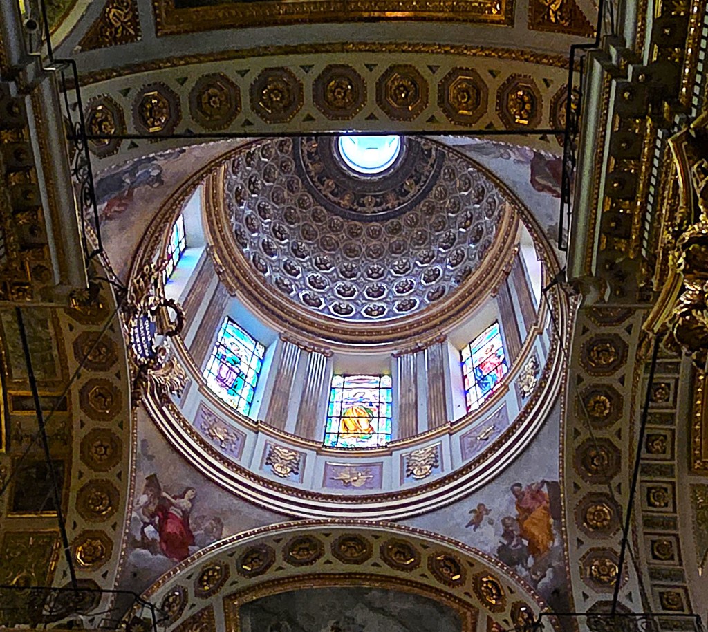
We poked our heads into the Church of Santa Caterina, photographing parts of the ornate interior.
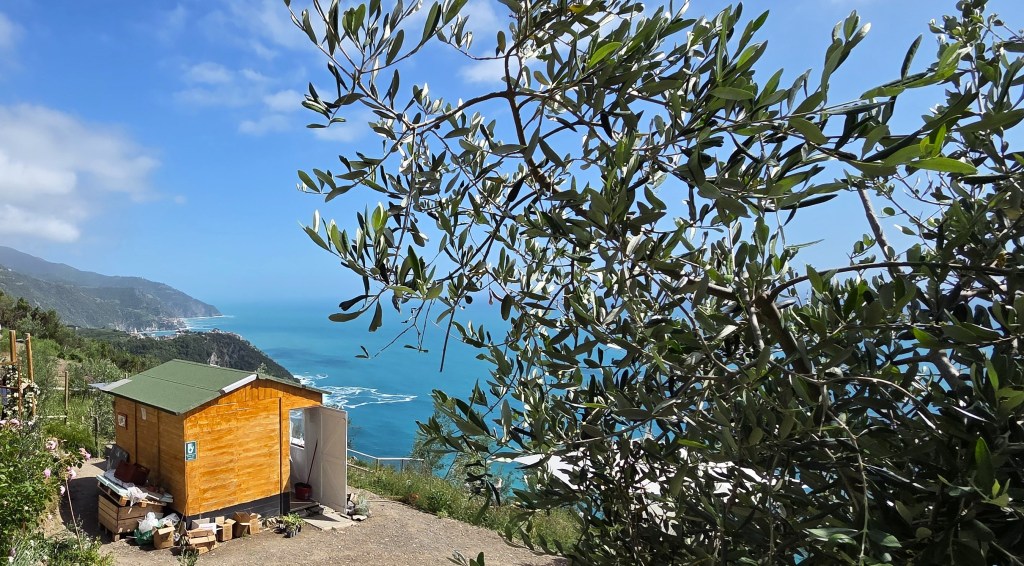
Understanding that we would need a picnic lunch the following day, we bought some slices of focaccia and some fruit, storing the foccaccia in our fridge overnight.
At 18:00 we ascended to the rooftop bar for our inaugural walks briefing. Here we met our two hiking guides, Rebecca, Enrico Bernadin’s wife, originally from Lancashire, and her friend and colleague, Paola.
Returning from our first dinner at the restaurant, we found Paula cradling a baby seagull that had fallen from its nest. Given the number of cats around, she was reluctant to leave it for its mother.
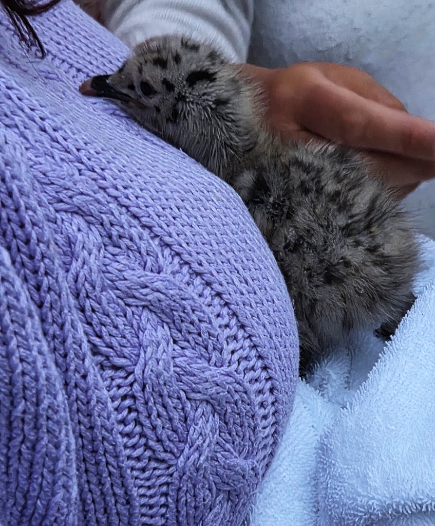
Later we heard that she had transferred it to a volunteer from a nearby bird refuge.
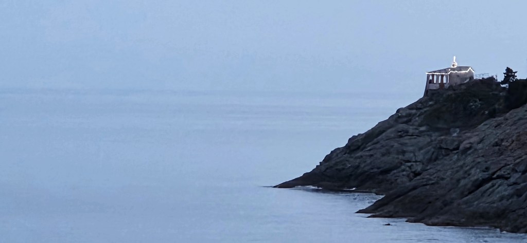
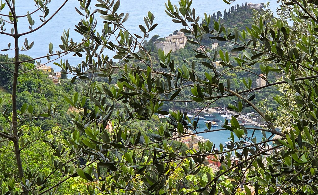
From the rooftop bar we could see the Chapel at Madonnina da Punta, now illuminated.
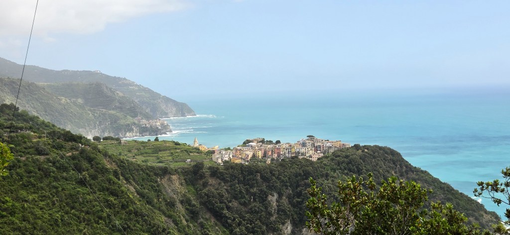
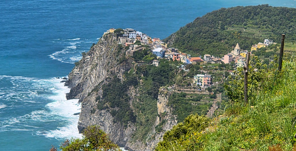
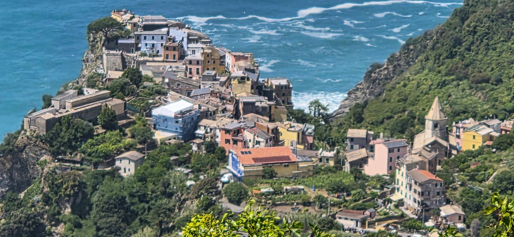
The Cinque Terre
The five villages that comprise the Cinque Terre are, from west to east: Monterosso, Vernazza, Corniglia, Manarola and Riomaggiore.
Further details of each are included in the sections covering our various walks, below.
Though, to be frank, the five villages have a great deal in common, especially when it comes to their history and significant buildings so, unless this is a particular interest, you may wish to skip those bits.
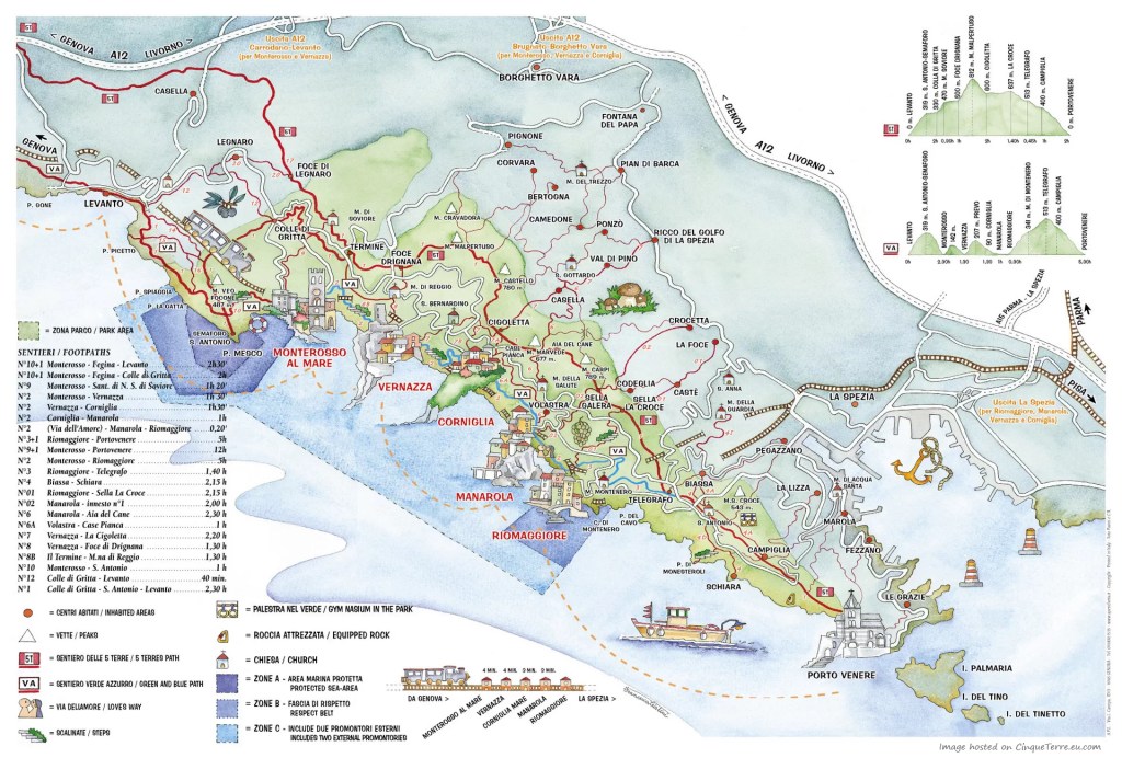
The national park is criss-crossed by 48 hiking trails, totalling 120km (some sources calculate 130km), which are open all year round.
However, one needs to buy a ticket to walk the 3.6km between Monterosso and Vernazza, the 3.5km between Vernazza and Corniglia and the 1.0km between Riomaggiore and Manarola.
In the off-season, which runs from 2 November to 12 March, all trails are free except that final kilometre between Riomaggiore and Manarola.
A full guide to all the trails in the National Park is available online. There is also a free app which provides directions for the different hiking routes, as well as a map.
The paths are normally well-signposted, but the signposts only give an estimated time for completion (which is often unreliable) rather than a distance.
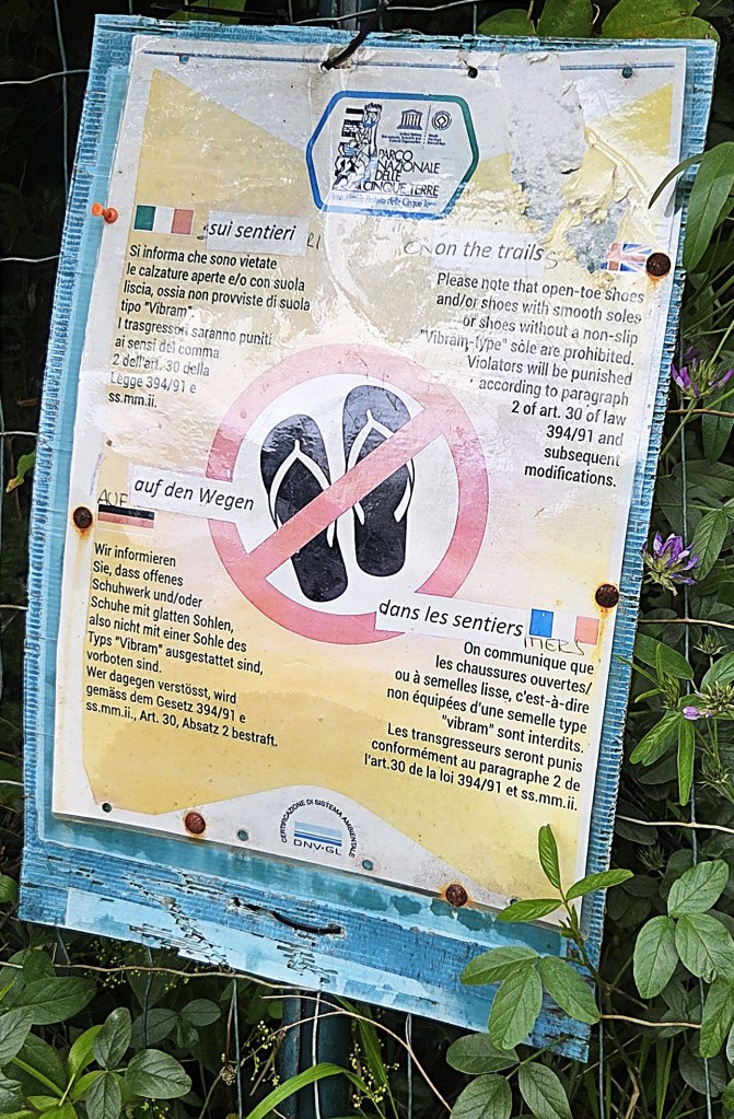
In theory, one can be fined for not wearing appropriate footwear on the trails within the Park. Open toes and smooth soles are supposedly prohibited.
But this seems to be honoured more in the breach.
Dogs are also supposed to be kept on leads.
After rain, the rocky sections of the trails can become slippery. If the Ligurian Region Civil Protection Service issues a warning, the authorities may deem them impassable.
One can either purchase:
- A ‘Cinque Terre Treno Card’, which includes unlimited regional 2nd class rail fares between Levanto and La Spezia and free use of station toilets (as well as free use of local buses and reduced admission to certain museums). One can pay for a one, two or three day pass, and the cost also varies according to whether it is Low, Medium or Peak Season. There are discounted prices for children aged 4 to 11 and adults aged 70 plus. Children aged 3 or less go free. We were in Low Season (weekdays in May) and our two-day cards were included in the price of our holiday. For someone under 70, they would normally have cost Euros 36.50. Fares for 2026.
- A ‘Cinque Terre Trekking Card’ including only free use of local buses and station toilets, plus reduced admission to certain museums. These are also available as one, two or three-day passes, but the only timing distinction is between Standard and Peak season. Prices are also discounted for children aged 4 to 11 and adults aged 70 plus. Children aged 3 or less again go free. A 2-day pass at Standard season for an adult under 70 would presently cost Euros 17.
Cards may be purchased at railway stations in the Cinque Terre, as well as at Levanto and La Spezia stations, or at Reception Centres in the National Park.
One can also buy them online.
The Cinque Terre National Park is one of 24 in Italy. Together they cover an area of 1.5 million hectares.
At just 3,860 hectares (around 9,500 acres), this is the smallest but, owing to the presence of the five villages, also the most densely populated. Uniquely, it is celebrated as a natural environment that has been adapted and modified by man.
It was first designated in October 1999, two years after the area became a UNESCO World Heritage Site.
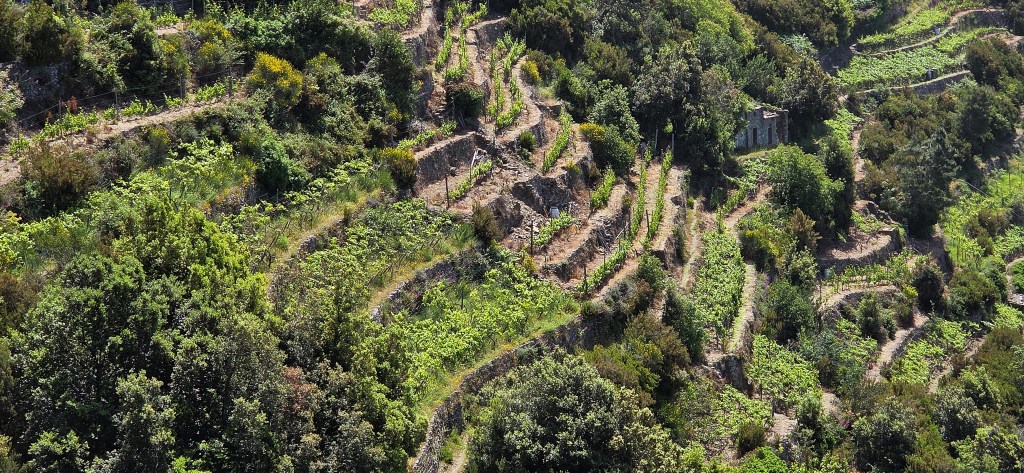
For a millennium or more, man has created steps or terraces upon the steep slopes, planting crops such as vines, olives, citrus fruit and vegetables – and protecting them with dry stone walling.
Over time, these terraces have covered the area from the shore up to a height of 500 metres above sea level, extending over approximately 2,000 hectares, surrounded by some 6,700km of dry stone wall.
This landscape has also been shaped by its weather, protected as it is from northerly winds, while the proximity of the sea causes frequent rain at higher altitudes.
That said, the area is divided into microclimates which impact the natural vegetation.
Much of the area was previously covered by holm oak forests, while man has introduced pine, cork and chestnut trees. A rich variety of flowers, shrubs and heathers thrives.
Some of the woodland is populated by larger mammals such as the fox, badger and wild boar.
Wild boar can be dangerous to humans if they feel cornered or are protecting their young. Advice is to back away slowly, or else climb a tree! The Park culls them to prevent over-population, typically authorising night hunts.
There are also lizards and even snakes, including a few adders, the non-venomous aesculapian snake and the masticophis, or whip snake.
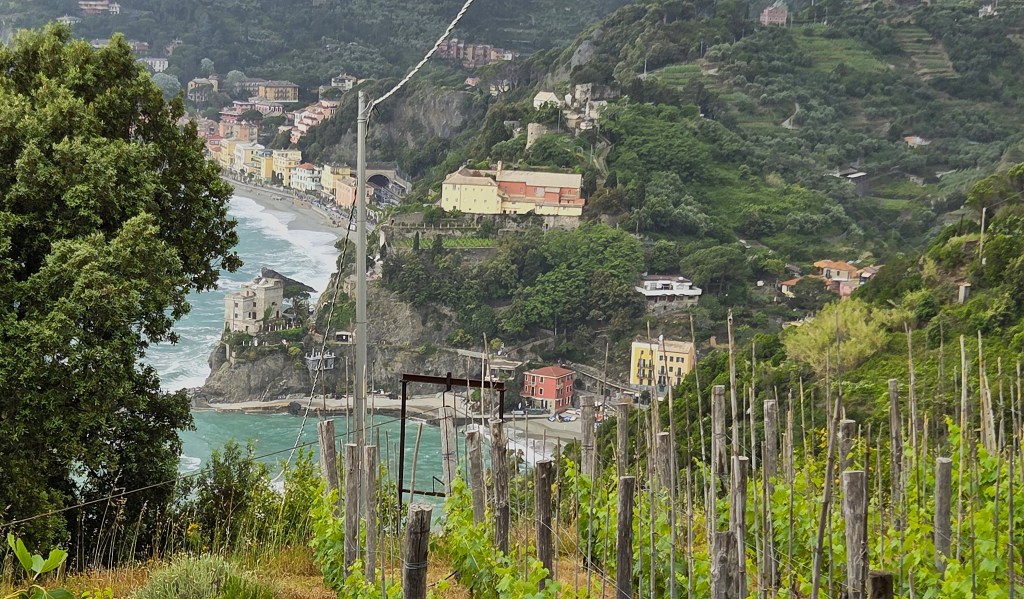
Sunday: Monterosso to Bonnasola
The shorter walk toured the municipality of Bonnasola, climbing to the hamlet of Montaretto via the viewpoint at Salto della Lepre (named after a myth in which a hare jumped in the sea to escape capture by the hunters pursuing it) and returning to the Hotel via San Giorgio.
The distance was given as 5.1 miles with 425m of ascent/descent.
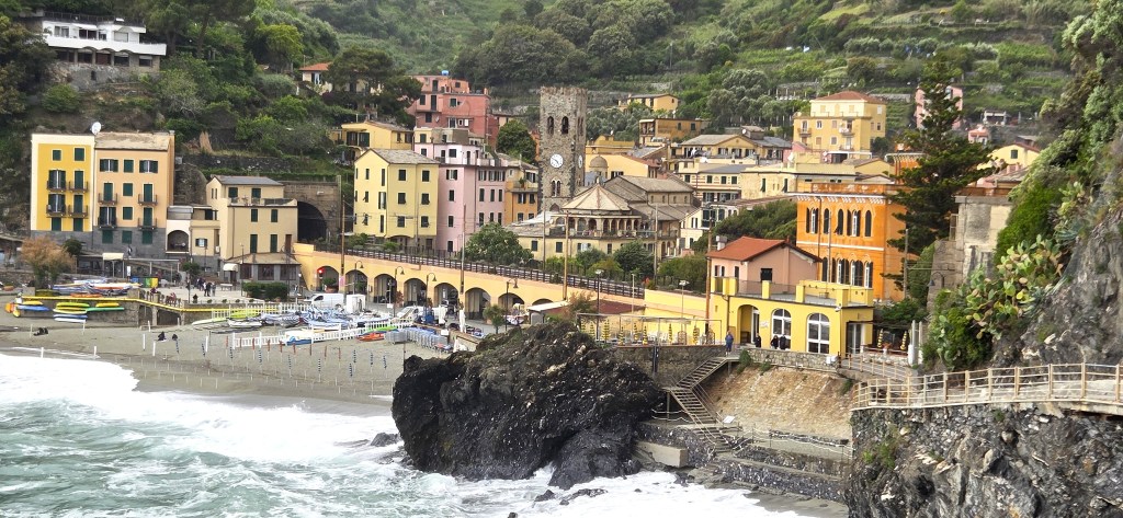
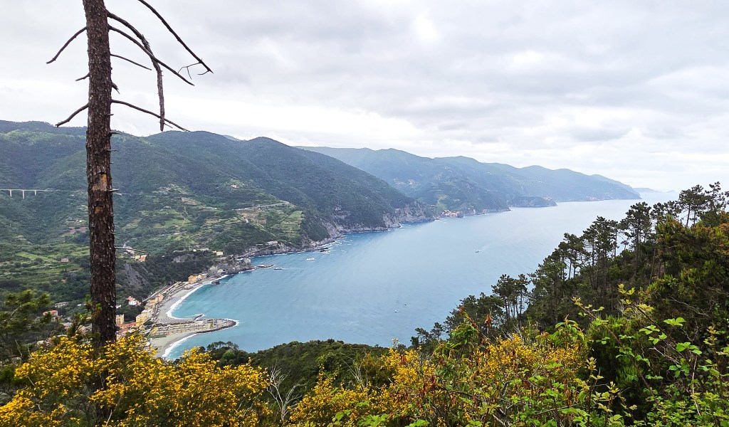
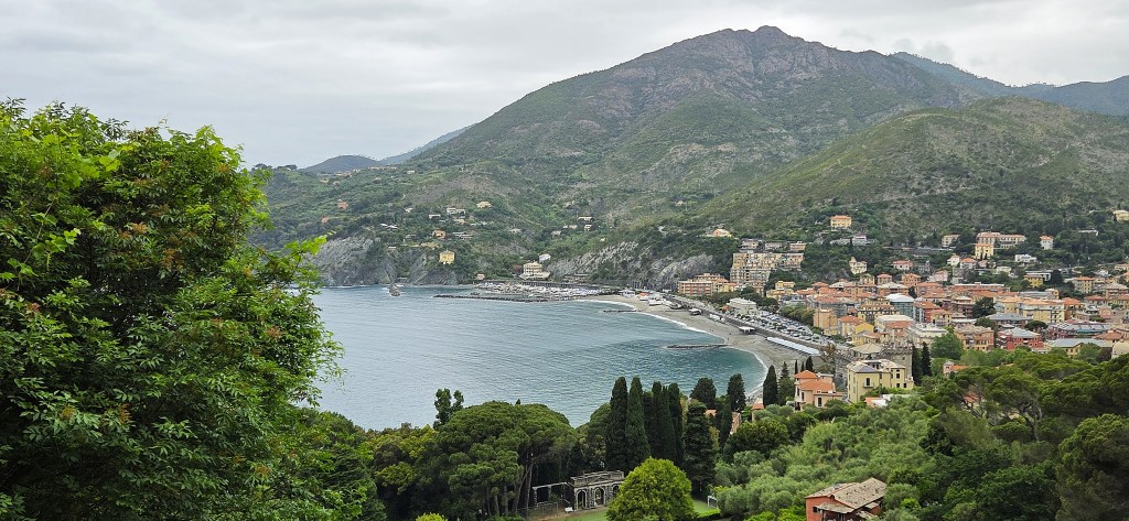
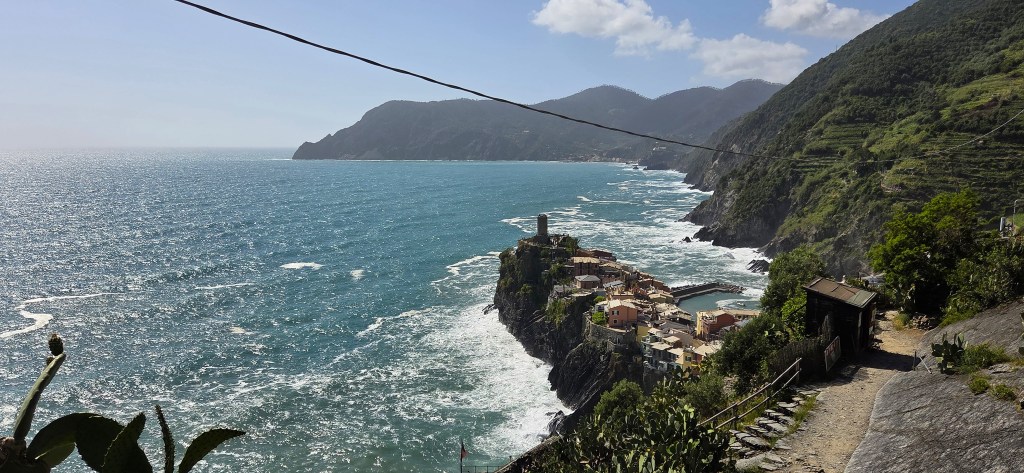
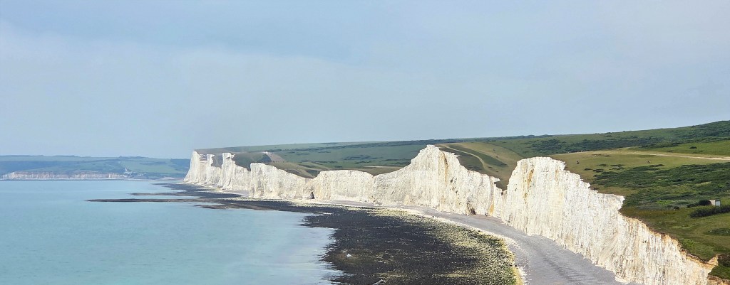
Our longer walk involved catching a train to Monterosso, the westernmost of the five Cinque Terre villages. After walking to the end of the beach, we would ascend steeply to the headland known as the Punta Mesco.
From here we would follow part of the Cinque Terre high level route, stopping for lunch at Podere Lovara, a 45 hectare farm operated by Fondo per l’Ambiente Italiano (FAI), the Italian National Trust.
Then we would complete the descent into Levanto, from where we could choose to walk through the old rail tunnel back to Bonnasola, or else ascend over the headland, via Scernio, before descending down to the Hotel.
The total distance was 7.2 miles with 570m of ascent/descent.
We assembled at 09:45, following a leisurely breakfast, and walked the short distance to the station, from where we caught the 10:10 service to Monterosso, two stations down the line.
Monterosso, strictly ‘Monterosso al Mare’, is the largest of the Cinque Terre with almost 1,300 inhabitants.
It is twin-centred, the original village located to the east and a newer village, once known as Fegina, to the west. They are separated by the Cappuccini Hill, but linked by a short tunnel beneath it.
The original settlement was probably founded in the Ninth Century, probably under the control of the Obertenghi family, though at the extreme of its territory.
A document dated 1056 confirms the Monterosso interests of one of the Obertenghi clan, but the area was soon to pass under the control of other families.
In 1201, the controlling family signed an agreement with Genoa but, subsequently, Genoa and Pisa contested ownership until Genoa ultimately triumphed.
The village began to develop on the banks of the Buranco Stream, beneath the castle walls.
The original fortifications dated from the Obertenghi period. A later Genoese construction was built upon the ruins.
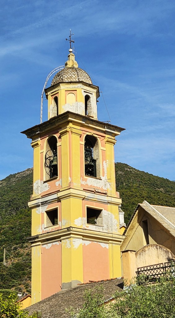
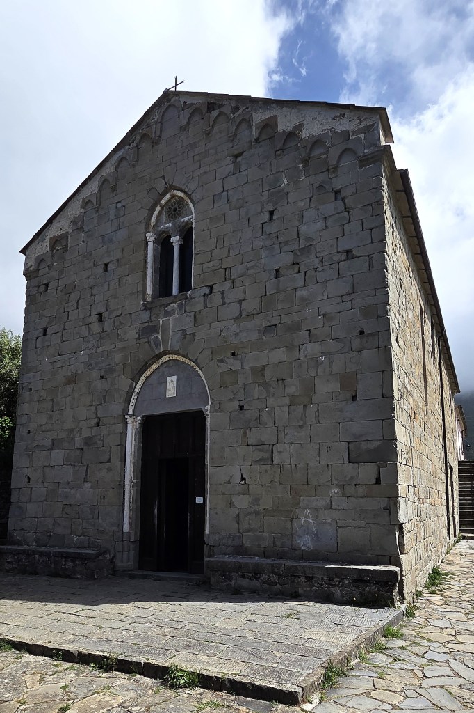
The Chiesa di San Giovanni Batista was built between 1282 and 1307 but later extensively renovated in the Baroque style. Its bell tower was originally a watchtower erected as part of the Genoese fortifications.
Another Genoese fortification sits on the Colle di San Cristoforo, between the two sides of the Village and is known as the Aurora Tower. It is now a private residence.
In July 1545 Monterosso was sacked by Saracen pirates, under the command of Dragut (1485-1565), who went on to attack both Corniglia and Manarola. Many women and children were kidnapped for ransom, under threat of being sold as slaves.
A Convent of Capuchin Friars is also located on the hill between the old and new sections of Monterosso. It was built between 1620 and 1640, its incorporated Church consecrated in 1623.
While under Napoleonic control, the Convent was closed, becoming a garrison. It was partially returned in 1816, only to be closed again in 1867, but was ultimately purchased by a local churchman who left it to the Friars upon his death in 1895.
Outside there is a prominent statue of St Francis of Assisi with the Wolf of Gubbio sculpted by Silvio Monfrini (1894-1969) in 1962.
The Italian National Trust runs an annual poll, ‘I luoghi de cuore’ (‘places of the heart’). In the 2014 edition, this Convent was voted the most beloved place in Italy, receiving around 7% of all the votes cast and, consequently, was awarded a grant to support its restoration.
Following extensive flooding in 1966, additional defences were built, but these were swept away in the floods of 2011. One person died and 238 were evacuated. The cost of repairing the damage was estimated at 37 million euros.
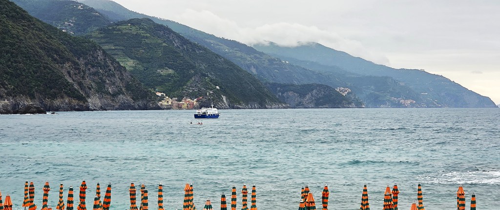
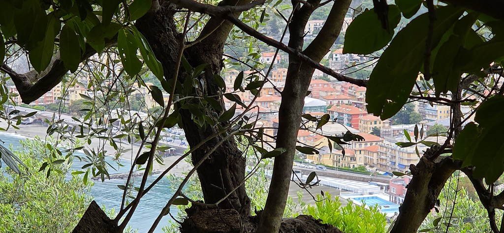
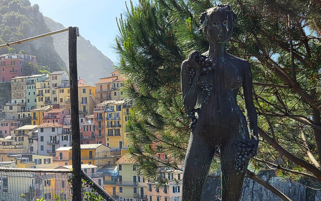
Having emerged from the station, we began to walk along the promenade, beside the newer part of town.
A small blue vessel, possibly a tour boat or a ferry from Rapallo, was pulling into the Harbour. Vernazza and Corniglia were visible behind.
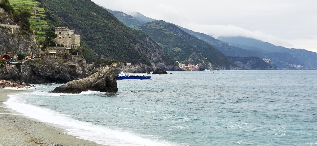
The beach was festooned with serried ranks of striped umbrellas, first blue and white, then orange and green.
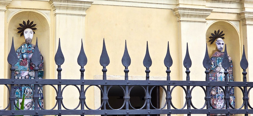
We passed the Chiesa di Santa Maria Nascente, decorated by beautiful twin statues, the work of Emanuele Luzzati (1921-2007).
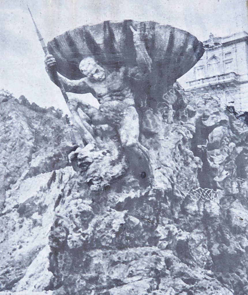
Finally we came upon Il Gigante, a statue representing Neptune.
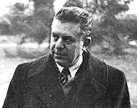
This 14 metre giant, weighing 170 tons, was created from reinforced concrete in 1910. It was sculpted by Arrigo Minerbi (1881-1960) who worked with the architect Francesco Levacher.
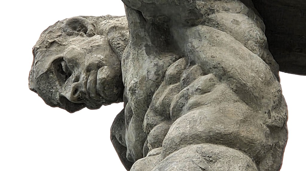
It was originally part of a large art nouveau house, the Villa Pastine, built for a wealthy lawyer who had returned home after working in Argentina.
Neptune was originally armed with a trident. The shell-shaped terrace he supported could comfortably accommodate several dancing couples.
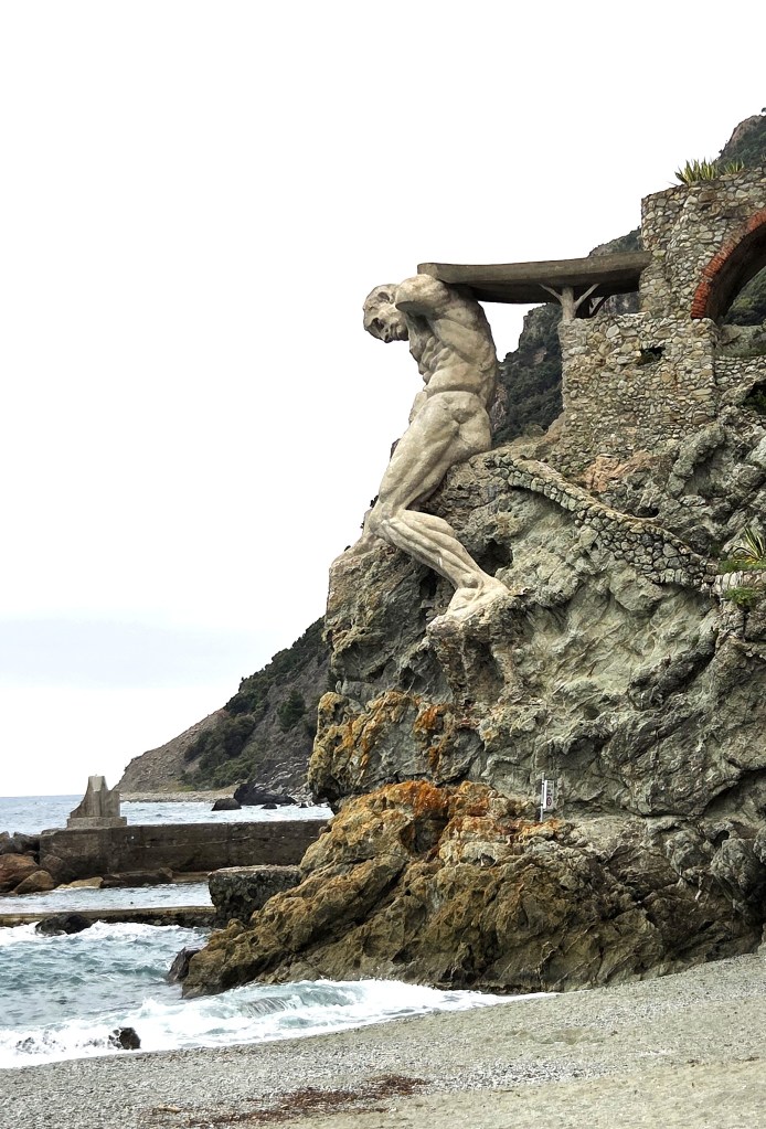
But he has been damaged by storms and wartime bombing, because the Villa was thought to be a German command post. It was demolished in the 1960s.
A poster nearby shows how Neptune once looked, the handsome villa immediately behind.
Having admired Neptune, we began our ascent of the Via Privata Montale, though without passing the villa where Nobel Prize winning poet Eugenio Montale (1896-1981) spent several youthful summer holidays.
He composed here several of the poems that formed his first collection ‘Ossi di Sepia’ (1925).
This is from a poem entitled ‘Punta del Mesco’:
‘Vedo il sentiero che percorsi un giorno come un cane inquieto;
lambe il fiotto, s’inerpica tra i massi e rado strame a tratti lo
scancella. E tutto è uguale.
Nella ghiaia bagnata s’arrovella un’eco degli scrosci. Umido brilla
il sole sulle membra affaticate dei curvi spaccapietre che
martellano.’
‘I see the path I once walked like a restless dog;
it laps at the stream, clambers between the boulders, and a sparse layer of straw occasionally obscures it. And everything is the same.
An echo of the downpours lingers in the wet gravel.
The damp sun shines on the tired limbs of the bent stone breakers who hammer’.
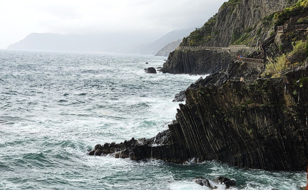
Following route 590, we had soon transferred on to a steep boulder-strewn path. Paola gave me permission to push on ahead, which I did most gratefully, relishing the comparative solitude as I left the others in my wake.
From time to time I stopped to admire the spectacular view below, whenever it emerged from the trees, the buildings steadily shrinking in size.
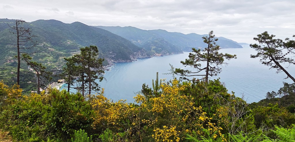
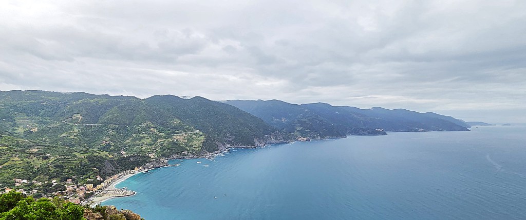
Ultimately one can see all five of the villages stretched along the coastline.
Then I found I had a missed call from Tracy. She followed up with a message saying that one of the company was struggling, and that they were delayed while she recovered.
I waited some 20 minutes or so at a crossroads, marking the intersection with route 591 and the SVA trail to Levanto.
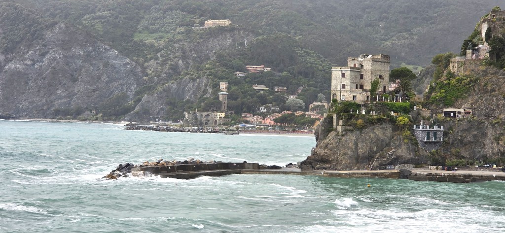
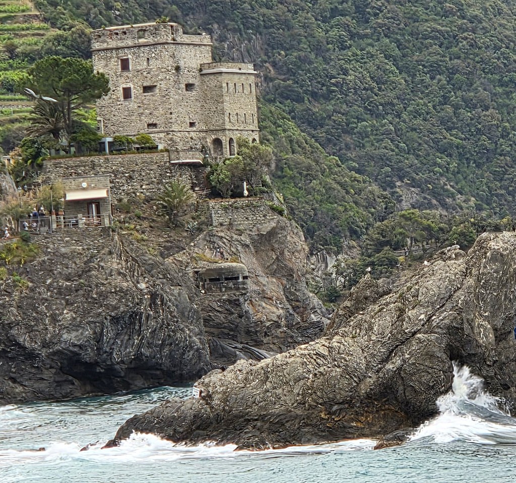
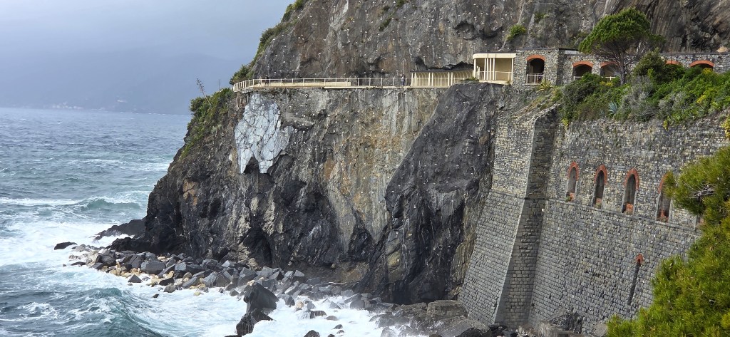
Finally reunited, we descended the short distance along Punta Mesco to the Hermitage of Sant’Antonio del Mesco, located at 311 metres above sea level.
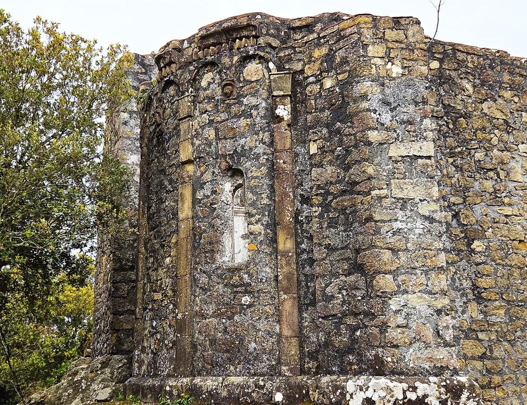
This was first documented late in the Fourteenth Century, but has two distinct sections, one is probably an Eleventh Century church, the other a Fifteenth Century hermitage.
A secondary purpose was to keep watch for Saracen pirates: the remains of a small watchtower are located nearby.
The Hermitage was abandoned in 1610 in favour of a monastery in Levanto.
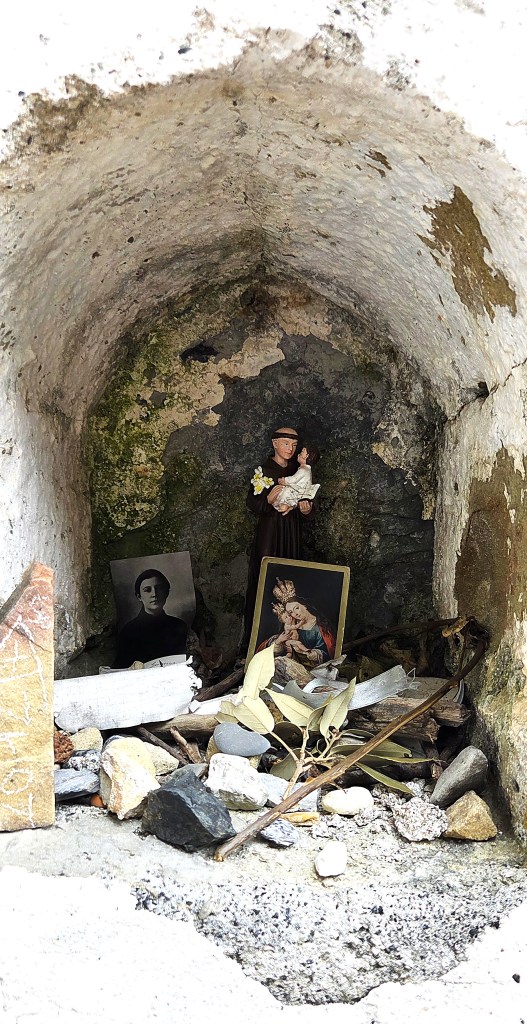
This small makeshift shrine is located in a surviving wall.
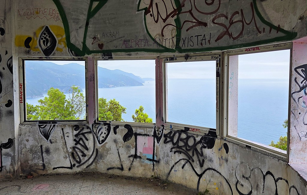
When the Italian navy built a semaphore station here in the early part of the Twentieth Century, they used stone from the older building. This was prior to the first archaeological survey in 1925.
The remains of the semaphore station sit a little further along the headland. It was used until the Second World War.
We retraced our steps, following the high level route which was busy with groups from France, Italy and Germany. Most were fairly relaxed but a few seemed in a great hurry. One woman in particular was determined that her foursome should overtake us.
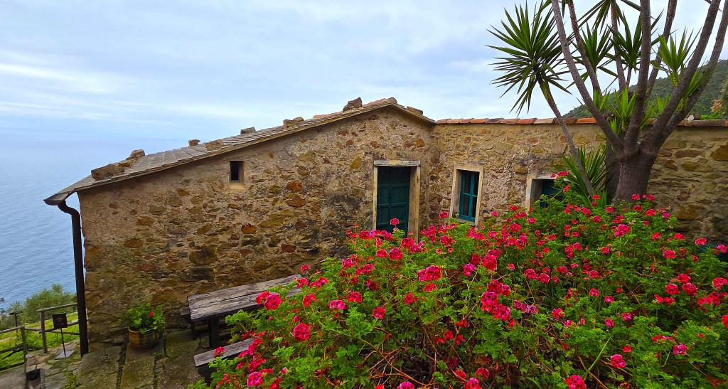
We reached Podere Lovara about half-an-hour later. Located above the Punta la Gatta, this restored farm was donated to the FAI in 2009. It comprises three buildings and 45 hectares of land.
We were delighted to discover that the three euro entry price is not chargeable to members of the English National Trust. Tracy had her card with her and I was excused, even though mine was in the Hotel safe.
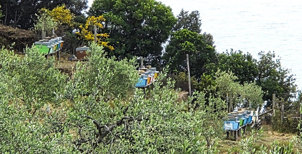
We found a vacant bench in the gardens where we consumed our foccaccia. Even I could hear the relentless buzzing from the hives nearby.
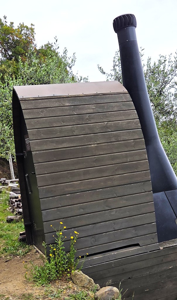
Before leaving, we both bought Nespressos, and subsequently visited the curiously shaped dry toilet.
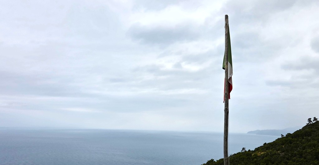
Il Tricolore hung limply from its pole as we departed, but the bougainvillea was in vivid bloom.
We resumed our descent towards Levanto, passing this stele statue.
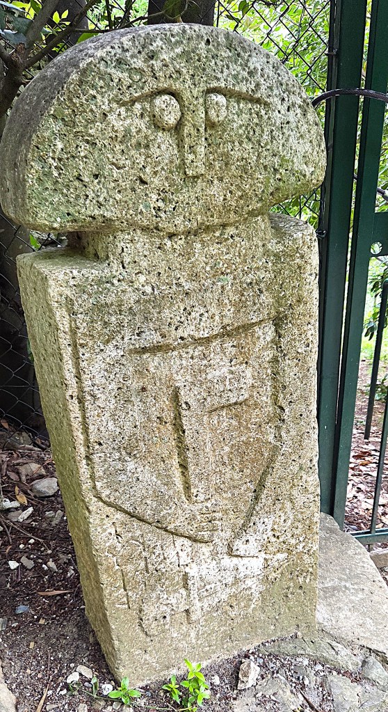
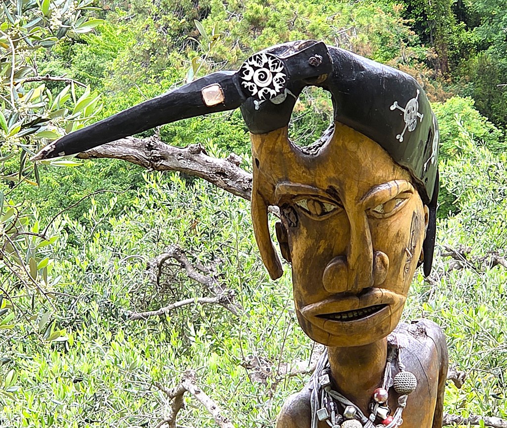
The degree of sophistication indicates that this is a modern copy. A little further on we found the B&B Maremesco, full of artistic curios, so the sculptor is probably to be found there.
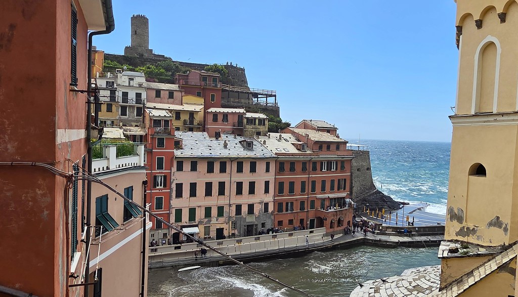
Levanto is a town of some 5,000 people set on a wide bay at the mouth of a river valley. It belonged to the Malaspina and then the Da Passano family before becoming part of the Genoan Republic in 1229.
We arrived beside the Castle of Levanto, now a private house. There was a castle in Levanto as early as 1165, under the Malsapina. This one dates from the Thirteenth Century, but was partially rebuilt in the second half of the Sixteenth Century.
When the Genoans stationed a ‘capitano’ in Levanto in 1637, this was his nominal headquarters. Later it became a prison.
A few minutes later we arrived at the stripy Chiesa di Santa Andrea, sporting an ornate rose window. This also dates from the Thirteenth Century.
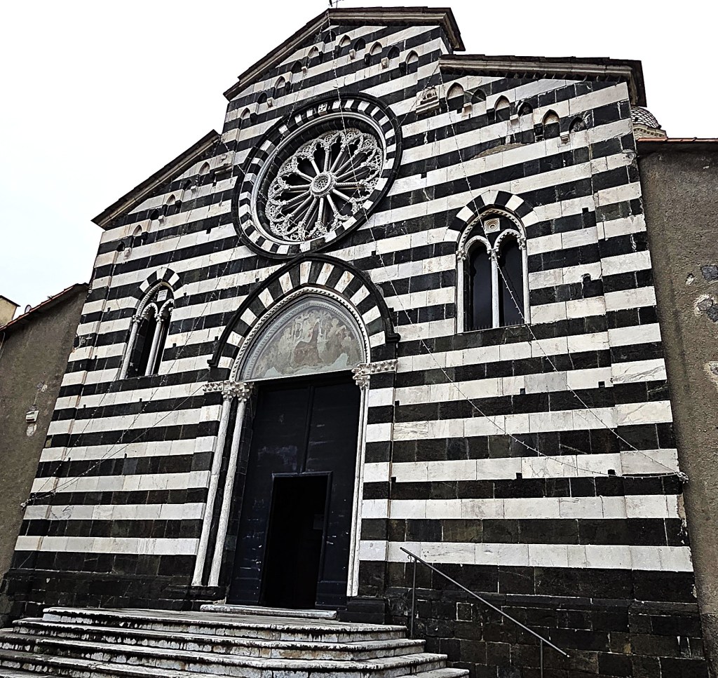
It is said to contain the chalice of Henry of Luxembourg (c.1275-1313), latterly the Holy Roman Emperor, but that is only displayed on special occasions.
We could see the Chiesa della Madonna della Costa from a distance. Its history is uncertain, but there is some suggestion that it was consecrated in 1334.
We also visited the Thirteenth Century Loggia, ‘a civilian structure used to control the arrival and departure of goods in the port canal’.
Then it was time for gelato. On the way we passed the La Picea Pizzeria, which has an amazing display of all the trophies it has won, including the Best Classic Pizza in the 2019 World Pizza Championships.
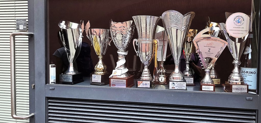
The winning dish ‘Ligurian Perfumes’ featured a blend of datterino and yellow tomatoes, pesto, toasted pine nuts and parmiggiano.
Arriving at the sea-front we divided ourselves between those returning through the tunnel and close climbing over the headland.
The path over the headland was initially through a rather scrubby landscape.
On the approaches to Scernio we met a man, a woman and a dog. The man seemed uncertain of his route and listened gratefully to Paola’s description of our way back to Bonnasola.
After Scernio, this wound through residential areas and, once again, I found myself alone.
I pulled up outside the Hotel at around 17:00.
Monday: Riomaggiore to Manarola; Vernazza to Monterosso
At the previous evening’s briefing, we had been advised that thunderstorms were incoming next morning.
It was decided that we would broadly follow Tuesday’s agenda instead of Monday’s, beginning at 10:50am, after the worst of the rain had passed.
We would travel by train to Riomaggiore, walking along the trail between there and Manarola.
Lunch would be in Manarola.
Then we would catch the train to Vernazza, walking from there along the coastal path back to Monterosso.
The harder walk had been scheduled to follow the Monastery Trail from Vernazza, taking in the Sanctuary of the Madonna di Reggio and the Sanctuary of Soviore, but this was thought potentially too slippery after the rain.
So both groups would follow the same route, one travelling more quickly than the other.
Our morning was unusually leisurely. We eventually assembled and caught the train through to Riomaggiore where we arrived around 11:45.
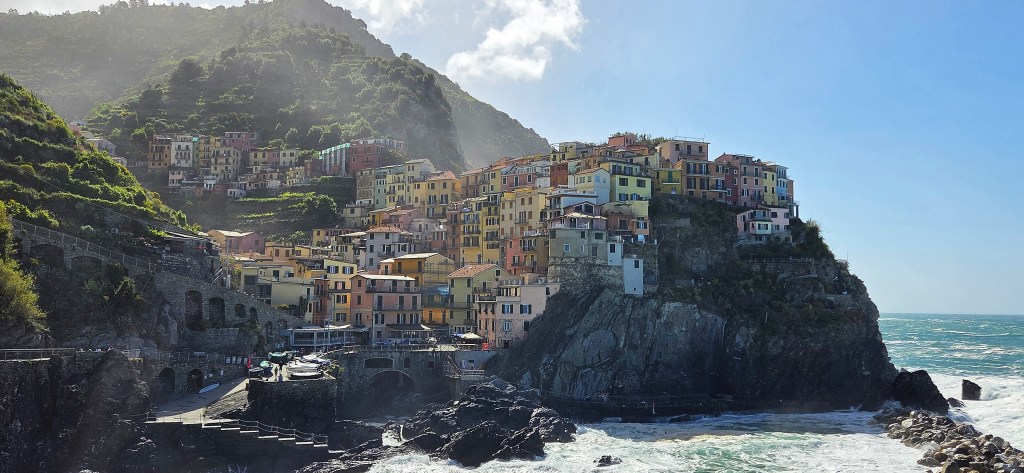
Riomaggiore is not documented as early as some of the other villages, and it seems that its inhabitants did not descend from the neighbouring hill villages until the middle of the Thirteenth Century.
In 1251 these earliest villagers swore allegiance to the Republic of Genoa, though remained under the control of the Ripalta family and then the Fieschi family until Riomaggiore was finally sold to Genoa in 1276.
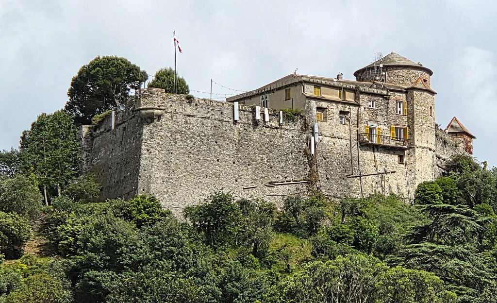
Construction of the Castle had already begun in 1260 under Ripalta control. But the present day fortress – small and square, incorporating two circular towers, one on either side of the entrance – was not built until the Sixteenth Century.
During the Nineteenth Century it was used as a cemetery but has recently been extensively renovated and is now a cultural centre.
The Chiesa San Giovanni Battista was built in 1340, in Gothic style, under the orders of Antonio Fieschi.
He is said to have employed the Antelami, itinerant masons and carpenters, originally from Lombardy, who were active from the Tenth to the Sixteenth Centuries.
It had to be renovated extensively in the Nineteenth Century after part collapsed.
There is also an Oratory, dedicated to Saints Rocco and Sebastiano, built in 1480 as an offering following an outbreak of bubonic plague.
The Sanctuary of Our Lady of Montenero overlooks Riomaggiore and is reputed to have been founded to house a Byzantine icon brought here by Greek refugees fleeing religious persecution.
It was first documented in 1335, but has been rebuilt several times since then, particularly in 1740 and 1847.
We would see it at closer quarters later in the week.
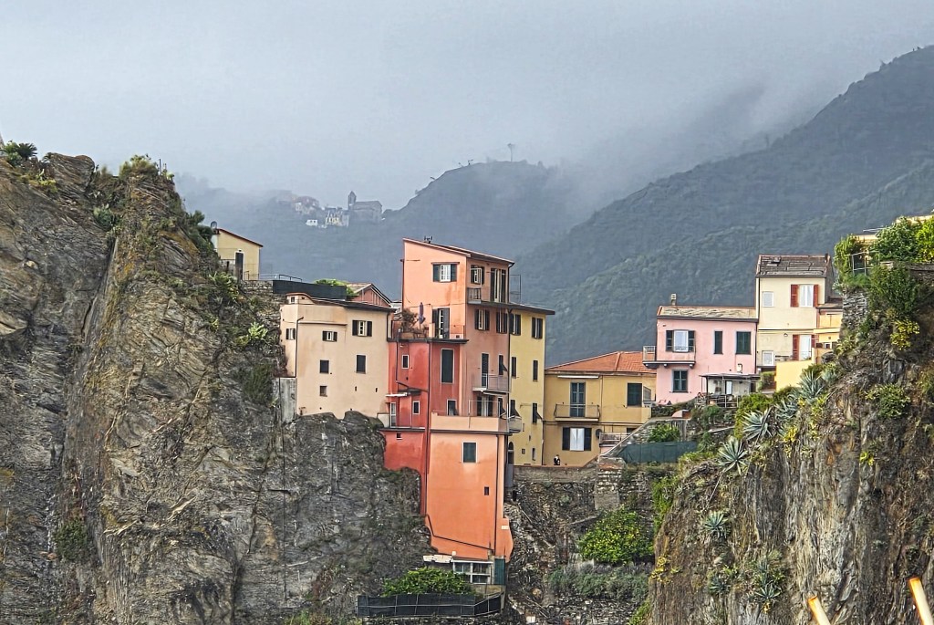
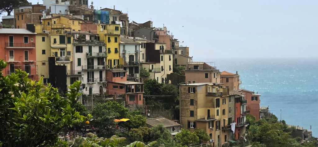
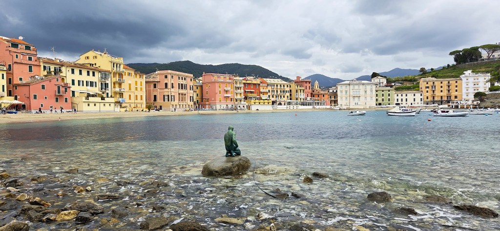
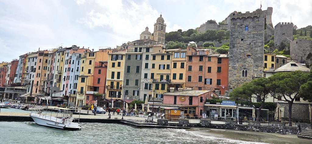
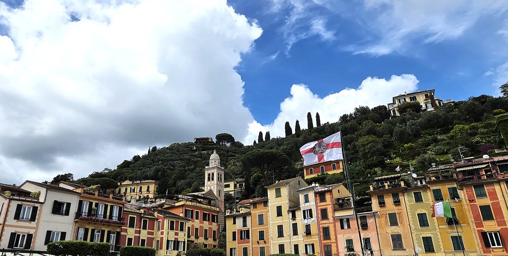
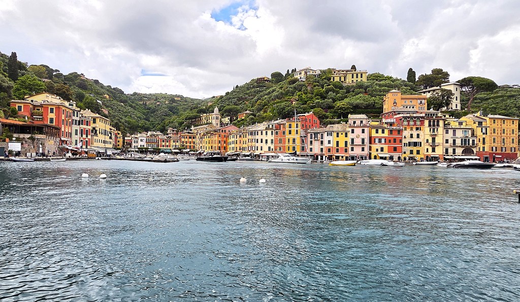
We began by walking down to the Harbour, surrounded by closely packed, multi-storey houses in various shades of red, orange, yellow and pink.
The sea was vaguely threatening, the sky still dark after the rain.
At 12:05 we waited beside the small white gate protecting the Via Dell’Amore, for such is the branding of the newly reopened path between Riomaggiore and Manarola.
It is a flat, paved, one-way trail, 810 metres long and forms part of the Verde Azzurro, also known as route 592, a 12-kilometre path connecting all five villages.
This section was first constructed in the 1920s, when railway workers were building the tunnel between the two villages on the La Spezia-Genoa line.
Local villagers had made the footpath permanent by 1930, since the only alternative involved a steep ascent and descent over the headland.
The route became increasingly popular with tourists because it was so easily accessible.
It acquired its romantic nickname from an inscription left on a rock in the 1950s, subsequently adopted by a visiting journalist.
It remained open for almost a century and, latterly, there were some 870,000 visitors every year. But, on 24 September 2012, a landslide injured four female Australian tourists, two seriously, after they were nearly swept over the cliffs and into the sea.
The accident caused the path’s initial closure, further compounded by wave damage in 2018.
There was a lengthy dispute over who would pay for its repair, with much political machination. Meanwhile, the cost ballooned to almost double the original estimate.
Restoration work finally began in January 2022. An initial stage was reopened in summer 2023, followed by the entire route in July 2024.
The restoration cost 23 million euros, 12 million of which were provided by the Liguria regional government. The remainder came from the Italian central government.
I imagine (but have been unable to substantiate) that EU funding was sought and denied.
The project involved the installation of 28,000 square feet of steel netting, to hold back the unstable cliffs.
A 574-foot breakwater has been added at the foot of the cliffs, an artificial tunnel built along the most dangerous stretch and a geotechnical monitoring system installed to predict future landslides.
To combat overtourism, even after having purchased the Cinque Terre Card, visitors must pre-book a 30-minute time slot in which to complete their walk.
We made our group booking at the entrance to the path, since demand was relatively low.
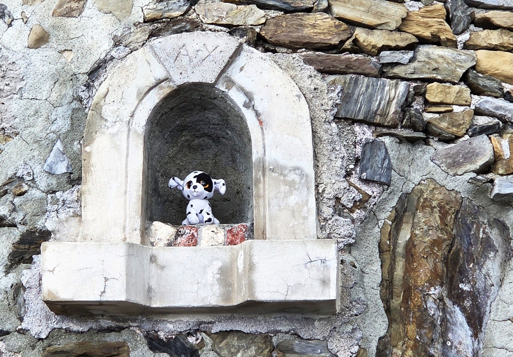
Shortly after the entrance, we found a shrine to a small, stuffed dalmatian who, one assumes, had elbowed the Mother of God out of the niche he now occupied.
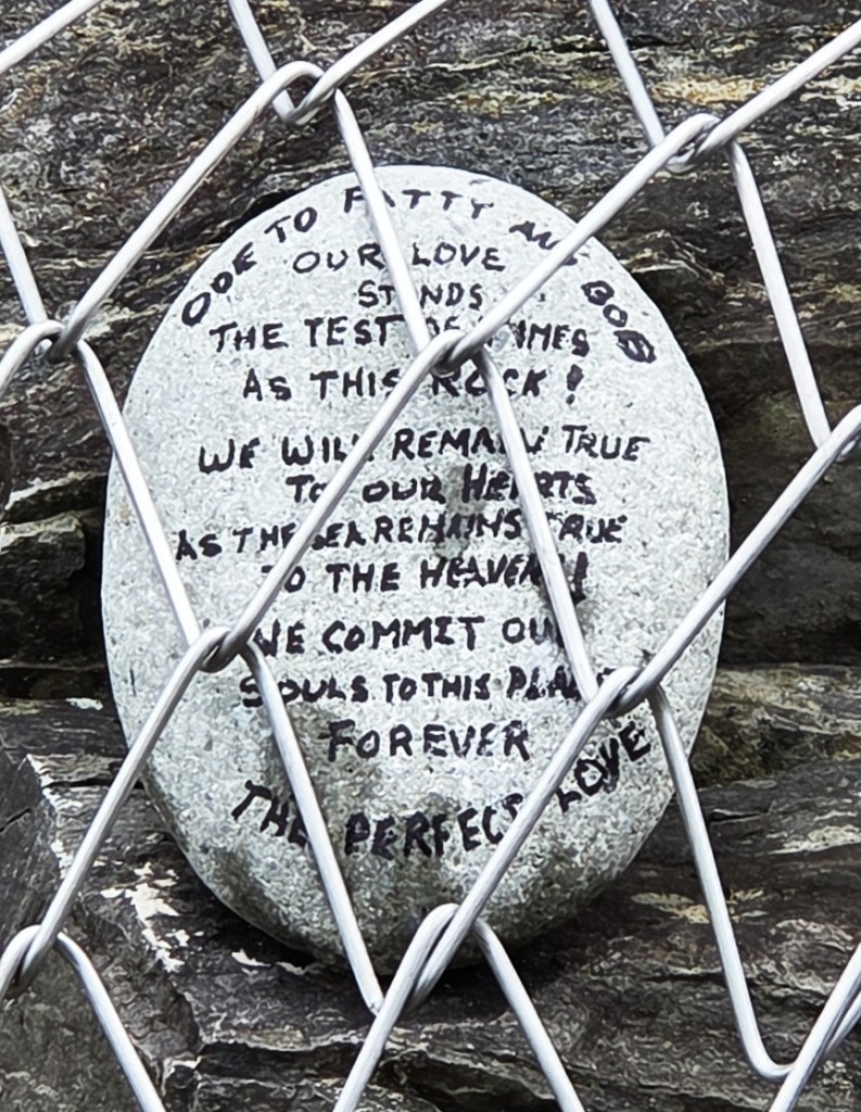
Some way further on there is an ‘Ode to Fatty and Bob’, which isn’t an ode at all.
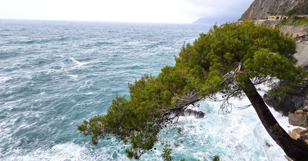
I was much taken by the symbolism of this small tree, growing persistently out of the cliff face and, presumably, destined one day to lose its footing and crash into the sea below.
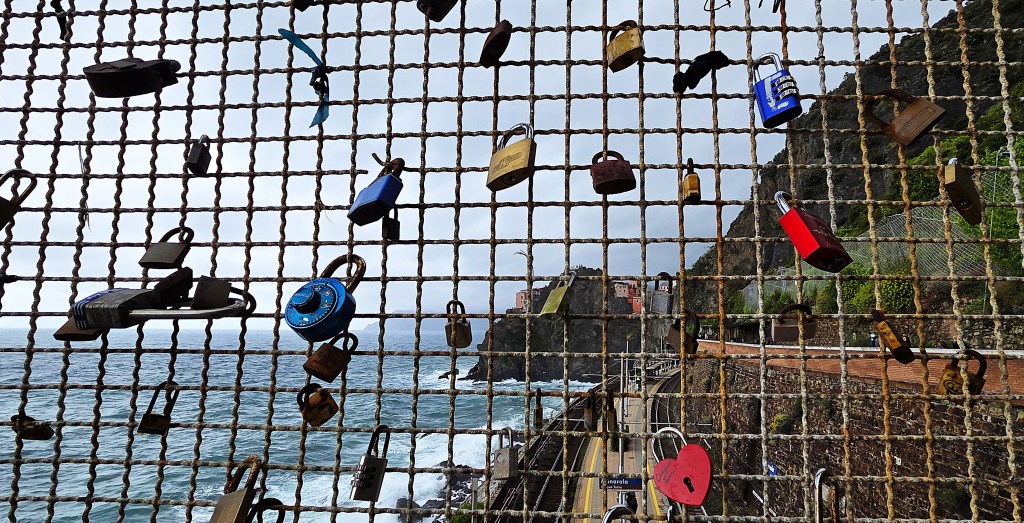
The Via Dell’Amore is undoubtedly picturesque, even on a relatively dull day, but it comes with a large dollop of schmaltz.
It is ready packaged for the less physically mobile tourist but has comparatively little to offer those with the capacity to climb the more challenging paths. For us, it served as a useful stopgap while the rain died away.
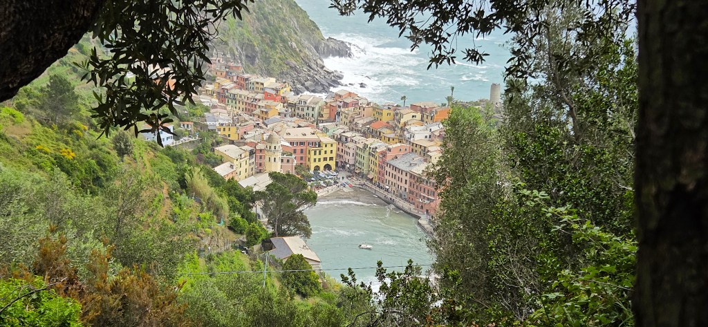
Arriving in Manarola, the majority found space in the same café, ten of us grouped around a single large table. Tracy and I had foccaccia named after the Cinque Terre villages: Corniglia in my case; Vernazza in hers.
We formed a long queue for the single toilet before leaving.
Manarola is little more than a single street and a harbour, the second smallest of the villages, with approximately 350 inhabitants.
The first documentary evidence dates from the second half of the Thirteenth Century when it was under the control of the Fieschi family, who were defeated by the Genoese Republic in 1273.
The Chiesa di San Lorenzo was built in 1338, its rose window completed in 1375. The bell tower just opposite the Church, known as the Campanile Bianco, also dates from the Fourteenth Century.
The Fifteenth Century Oratory dei Disciplinati della Santissima Annunziata is nearby.
There is no castle to speak of in Manarola, since the building became a private house as early as the Eighteenth Century.
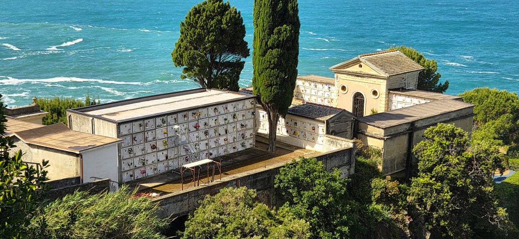
We walked to the harbour for some photographs.
The cemetery, which looks down upon the Harbour, displays the final words of a poem called ‘Liguria’ by Vincenzo Cardarelli (1887-1959), written in 1923:
‘O aperti ai venti e all’onde liguri cimiteri!
Una rosea tristezza vi colora
Quando di sera, simile ad un fiore
Che sfiorisce, la grande luce
Si scompone e muore.’
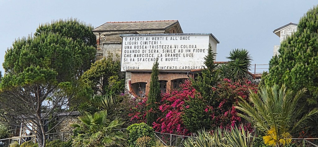
‘O cemeteries of Liguria, open to the winds and the waves!
A rosy sadness colours you
When, at eventide, the great light,
Like a wilting flower,
Breaks apart and dies.’
Then it was time to catch the train to Vernazza.
By the time we alighted, the clouds had retreated and the sky was once again mostly blue.
Vernazza, which has a population of 700, was first documented in 1080, when it was already a significant harbour belonging to the Obertenghi family.
During the Twelfth Century it passed to the Bishops of Luni, then the Passano family, then the Fieschi, who ceded it to Venice.
The Harbour provided a base from which the Genoan Republic could conquer this part of Liguria. Many Vernazza families had pledged their allegiance to Genoa as early as 1209.
The Chiesa di Santa Margherita d’Antiochia is first documented in 1318, though some believe it is possibly Twelfth Century in origin. It was also built by the Antelami, but extensively renovated in the Sixteenth and Seventeenth Centuries.
The octagonal bell tower, 40 metres high, is more recent still.
The fortifications, built on the cliff, some 70 metres above the harbour, are known as the Doria Castle. The first iteration was probably Eleventh Century, but the Castle was first documented in the Thirteenth. The tower, known as the Belforte, was restored in the Twentieth Century.
During WW2 the Germans used the Castle as an anti-aircraft post.
Vernazza was badly damaged by the floods of 25 October 2011, costed at more than 100 million euros, while three residents died. Buried in mud and debris up to 4m deep, the Village had to be evacuated. A state of emergency was imposed for several months.
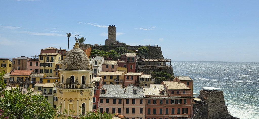
Having admired this photogenic spot from just above the level of the Church’s belfry, we began to climb up along the Sentiero Verde Azzuro.
It was necessary to halt from time to time, to enjoy the view back towards Vernazza. Unfortunately, though, this meant that we were at risk of being caught by the faster members of the ‘slower’ group.
As we climbed, walking broadly north-west towards Monterosso, the clouds blew in once more, making the dramatic landscape still more dramatic.
We approached Monterosso on its older side, passing a prominent notice about the prohibition of open-toed sandals.
It was about 17:00 when we reached sea level. Walking through the tunnel to the newer part of town, I enjoyed some of the displays.
We paused for the obligatory gelato.
As we neared the Station, a bright ray of sunlight momentarily lit up Vernazza, behind us.
Our train was delayed, then mysteriously turned up on a different platform, unannounced. We managed to clamber aboard and were back at the Hotel shortly after 18:00.
Tuesday: Manarola to Volastre, Corniglia and Vernazza
This was Monday’s programme rescheduled.
It was an early start, with breakfast at 07:30 and departure at 08:30, in time to catch the 08:49 train.
The easier walk was from Vernazza to Corniglia and then on by train to Manarola, for a walk through vineyards to the Harbour.
The harder walk was from Manarola, inland to Volastra in the hills, then descending to Corniglia before taking the coastal path from Corniglia to Vernazza. The distance was 7.5 miles, with 580m of ascent.
Our group reached Manarola a little later than expected, owing to delays on the trains.
As we arrived at the seafront it was sunny and fairly mild, but there was enough wind to agitate the sea, causing big showers of spray.
We walked around to the viewpoint before ascending behind the Cemetery. A helicopter was already at work dropping bags of rocks on the terraced hillside, above.
Rebecca remarked that this statue had forgotten to place her bunches of grapes more strategically.
The cemetery resembled a bank of left luggage lockers, with small bunches of flowers adorning each ‘door’.
Soon afterwards we began our first ascent of the day and, once again, I found myself in front.
Eventually I found a shaded spot from where I could look down upon the helicopter, still depositing rocks on the hillside.
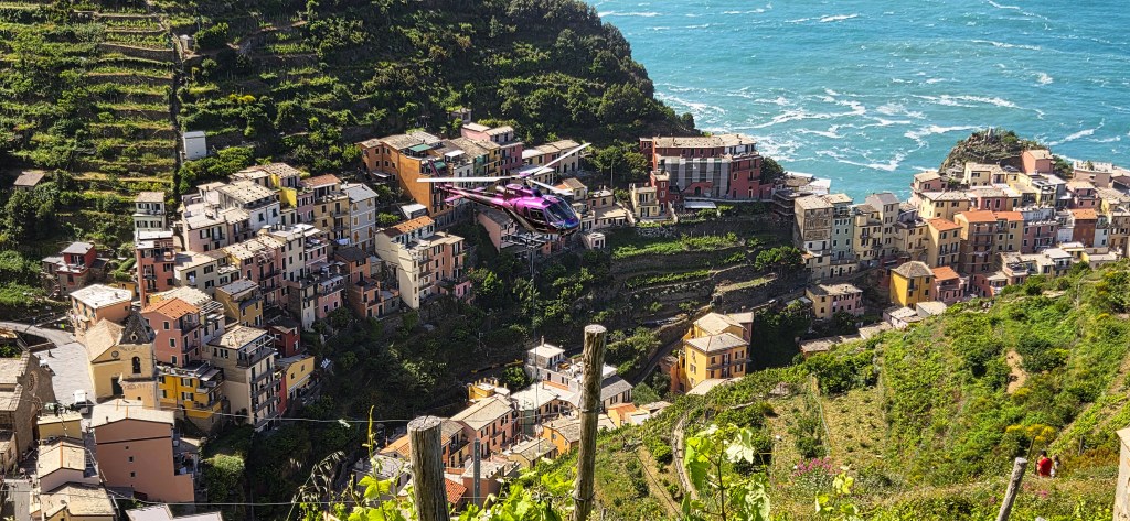
I moved on a little further, to where there was a fork in the path. But, meanwhile, unknown to me, the rest of the group had come to a halt in the very spot I had just vacated!
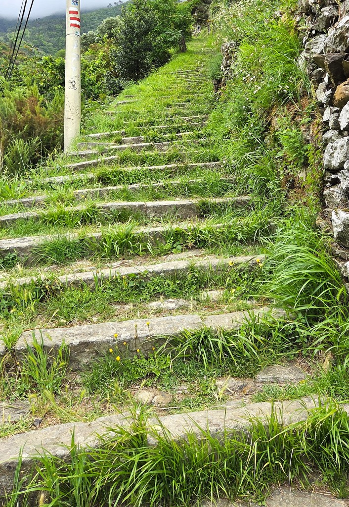
Our route lay above and behind Manarola, now following the contours of the hill, until we reached the first of an extended sequence of shallow steps.
I think I counted 809 of them, all-told.
Arriving at the top, one finds oneself on the Via Montello, just opposite a a handily placed water refill station.
Having refilled my bottle, I explored, first in one direction and then the other, before eventually pulling in to a charming cafe, L’Arcobaleno.
I ordered an Americano while waiting for the rest of my group and, once they had arrived, followed up with a small tub of vanilla ice cream.
Volastra has fewer than 200 inhabitants. It was built on the Roman coast road, known as the Via Aurelia, its named derived from ‘vicus oleaster’ meaning ‘the place of the olive trees’.
The Romanesque church, known as the Santuario di Nostra Signora della Salute, is thought to date from the Twelfth Century, but is first documented in 1240.
It previously housed a Fifteenth Century triptych attributed to ‘The Master of the Cinque Terre’, a mysterious artist who was active in the late Fifteenth and early Sixteenth Centuries.
Some have suggested that he was Giovanni Maria da Carpena, father of the better-known Antonio da Carpena (d. 1552-1564).
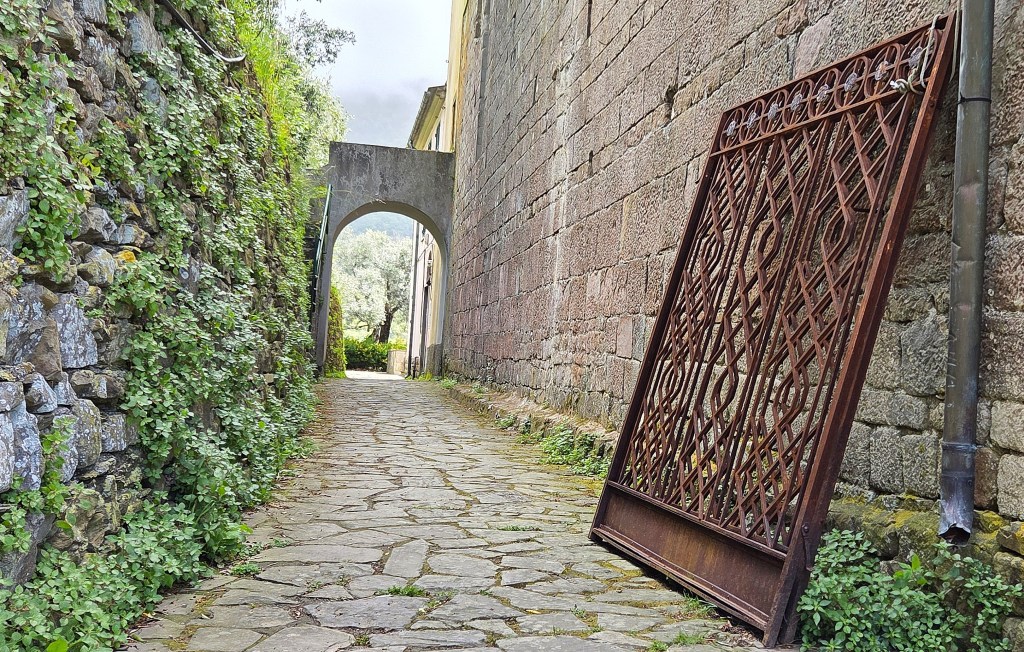
I enjoyed this simple archway on the left-hand side of the Church, a rusting iron gate propped against the outer wall.
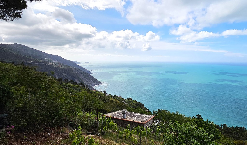
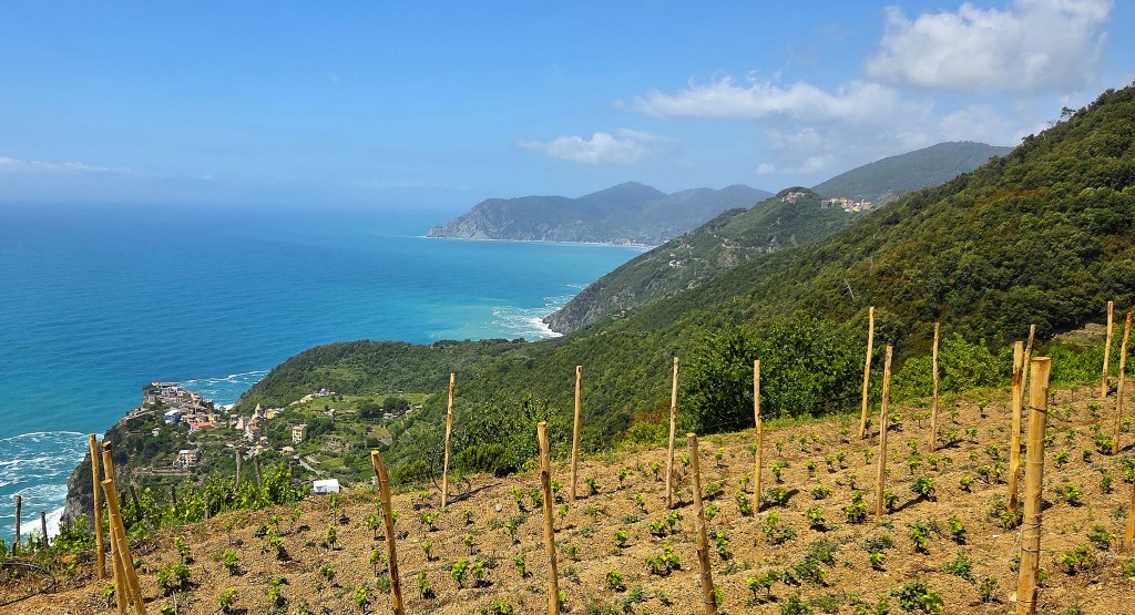
After a pause we continued along the path to Corniglia, through a sequence of vineyards and olive groves. There were beautiful views throughout.
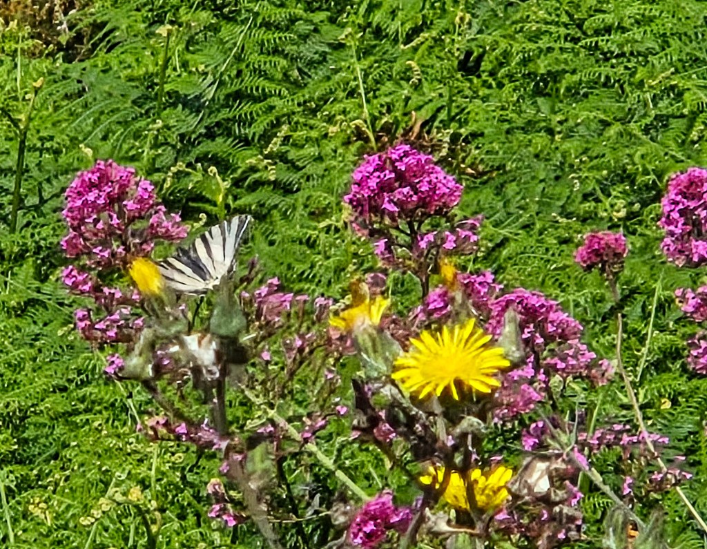
Approaching Corniglia, we came upon groves of wild flowers which were attracting large numbers of butterflies, including this Swallowtail.
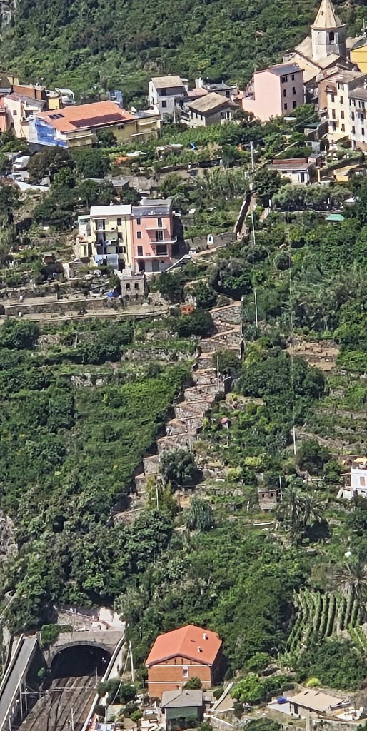
Soon we could see Corniglia, perched upon its cliff, ahead. The station lies below and those wishing to reach the centre of the village must climb a stone staircase, the Lardarina, with 33 segments and a total of 382 steps.
A Castle is documented here in 1276, when Corniglia became part of the Genoese Republic, but there is no longer any evidence of its existence. Corniglia was previously owned by the Fieschi family, and remained one of their favoured residences.
The Chiesa di San Pietro was built between 1334 and 1351 for the Fieschi family, but contains a Twelfth Century baptismal font which probably belonged to an earlier church on this site.
There are also the remains of fortifications dating from the mid-Sixteenth Century, and a naturist beach, called Guvano, that is now considered unsafe to approach by land!
Arriving in Corniglia around 14:15, we visited a shop, ‘Lisa Market’ that made ham and cheese sandwiches on the spot. We had our lunch in a small shady piazza nearby.
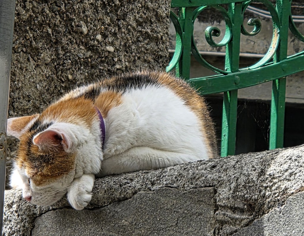
A cat dozed on the wall above.
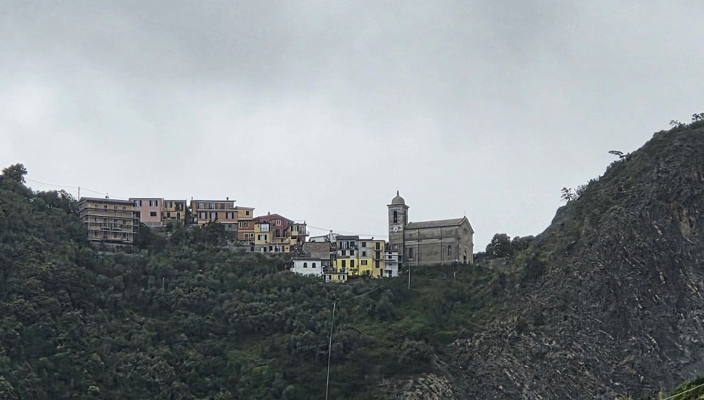
Continuing on our way, we could see the village of San Bernardino higher up, its Nineteenth Century church prominent.
Soon we came to an outburst of art. First, a totem pole resembling a barbecue skewer, then stones set in a pattern on the ground.
There is also a notice explaining ‘Third Paradise’:
‘A line, crossing itself twice, creates three consecutive circles. The two external ones represent the opposite polarities, ie all the elements that are different, contrary, antithetical and adverse to each other, such as, for example, the man-made world juxtaposed to the natural world. The central circle hosts their conjunction, union, fecundation, fusion; thus peace, balance, harmony, beauty and love are created. We enter a new world, the third stage of humanity, the Third Paradise.’
The artist responsible for this concept is Michelangelo Pistoletto (b 1933), who came up with the idea in 2003 and has been developing it with a variety of partners ever since.
A handful of bars and cafes is set between the vineyards and olive groves.
The first is at Prevo, which the bar itself describes as a small hamlet, founded circa 1000AD by ‘shepherd families from the mountains’.
Arriving above Vernazza, we began the steep, staired descent, ultimately emerging on to the Via Ennio Quirino Visconti.
By 16:30 we were on the crowded train back to Bonnasola.
We bought ice creams from the cafe beside the Hotel and sat with them on the beach, having to adjust our seats because of the violence of the incoming tide.
It was too rough to attempt a paddle.
Wednesday: Rest Day – Sestri Levante
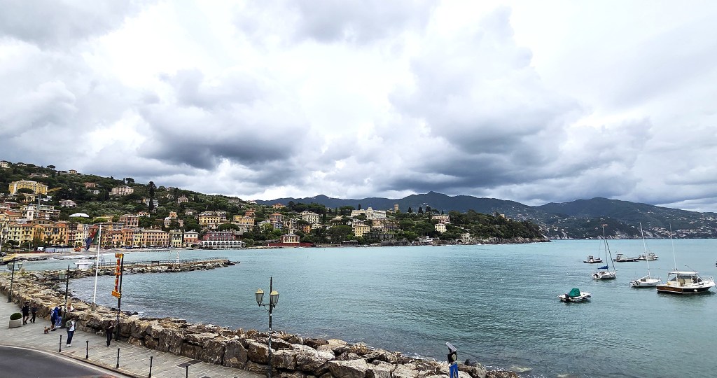
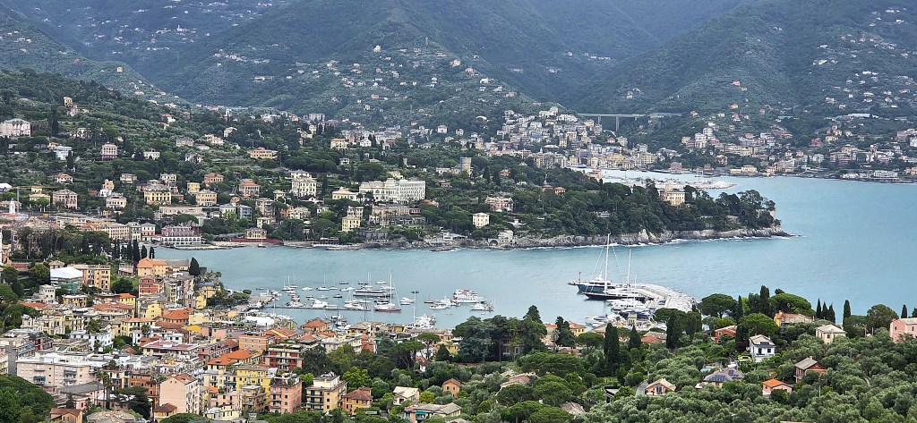
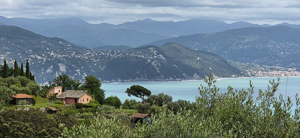
We opted for a relatively relaxed day but, deciding that we didn’t want to spend it entirely in the immediate locality, opted instead for a trip to Sestri Levante, a seaside town to the north, midway between Bonnasola and Portofino.
This proved an inspired choice. Sestri Levante is both elegant and laid-back, far quieter than the Cinque Terre; less chic than Portofino.
It was just before the start of the summer season, for workers were still preparing the beach clubs, whose gates remained locked.
Sestri Levante began as a small settlement on an island, but this was later connected with the mainland.
In Roman times it was called Segesta Tigullorum, after the Tigulli people who lived here.
It was documented in 909, during the reign of King Berengar I, when part of the land was transferred to the basilica di San Giovanni di Pavia.
The Fieschi family attacked the area in 1133, causing the settlement to place itself under the protection of the Genoese Republic. An attack by sea from Pisa was fought off in 1170.
There is a brief reference in Canto 19 of Dante’s ‘Purgatorio’:
‘Intra Sïestri e Chiaveri s’adima
una fiumana bella, e del suo nome
lo titol del mio sangue fa sua cima.’
‘Between Sestri and Chiavari descends
a handsome river; and its name is set
upon the upper portion of my crest.’
By the Thirteenth Century, Sestri Volante had become an administrative centre for the hinterland and, over the succeeding period, various interests tried to seize it from Genoa, including the Castracani family in 1327, the Visconti family in 1365 and, ultimately, the Republic of Venice.
It was sacked by Saracen pirates in 1542 and 1607.
Both Lord Byron and Goethe are said to have visited, but there is no hard evidence that they did so.
The large sweeping bay to the north has become known as Baia del Favole (the Bay of Fables); the smaller, tighter curve to the south is called Baia del Silenzio.
The first was named in honour of Hans Chrstian Anderson (1805-1875) who definitely did visit Sestre Levante in 1833, renting a room here for a while.
The second was allegedly named by local poet Giovanni Descalzo (1902-1951) though not, apparently, in a poem.
E F Benson (1867-1940) wrote a macabre short story ‘Caterpillars’ set in the Villa Cascana, located on a hill near Sestri Volante.
Having arrived at the rather unprepossessing railway station, we quickly cut through to Baia de Favole, from where we could see Portofino across the Bay.
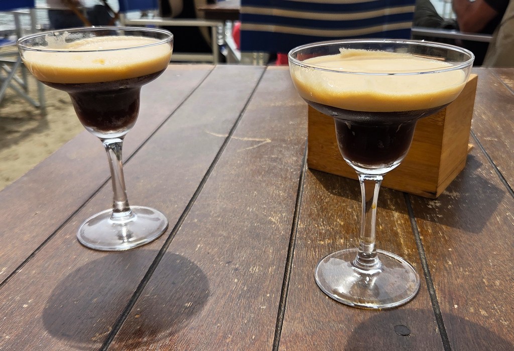
Reaching the Piazza Giacomo Matteotti, we found our way to the Baia del Silenzio, where we spontaneously decided to stop for refreshment at Bistromare, attracted by its blue and white striped directors’ chairs and beach umbrellas.
We each had a delicious Caffé Shakerato while we watched a slice of everyday seaside life on the beach – children chasing seagulls and seagulls snatching food from unguarded plates.
After a while we took off our shoes and paddled along to the end of the beach, where a naked green man was kneeling upon the rocks. This bronze statue of a fisherman, placed here in 2000, was sculpted by Leonardo Lustig (b. 1969).
We visited the Convento Frati Capuccini, admiring the interior of the Chiesa Santa Maria Immacolata, including a large scene full of animated wooden automata.
Then we paddled back along to the other end of the beach before walking around the headland, from where we could get a much clearer idea of the Town’s location, surrounded by water on both sides with mountains inland.
The Capuccin arrived here in 1609 but completed this building in 1688.
On returning outside, we glanced over the terrace and found ourselves witnessing the filming of an advertisement, featuring yellow and white stripes and many lemons!
Passing round to the opposite headland, we found the ruins of the Oratorio di Santa Caterina d’Alessandria, documented in the latter part of the Sixteenth Century, but destroyed in an air raid in December 1944.
The Chiesa di San Nicolo dell’Isola is nearby. Though originally built in 1151, it was substantively rebuilt during the late Fifteenth Century.
Returning to the Station, we transferred back to Bonnasola, intending to eat lunch in the cafe we had visited on our first day, only to find it closed.
So we repaired to Lungomare, a little further along, where we shared a very tasty Quattro Stagione pizza.
Afterwards we ventured along the headland to the Chiesetta della Madonnina della Punta, which we found in the possession of three English tourists.
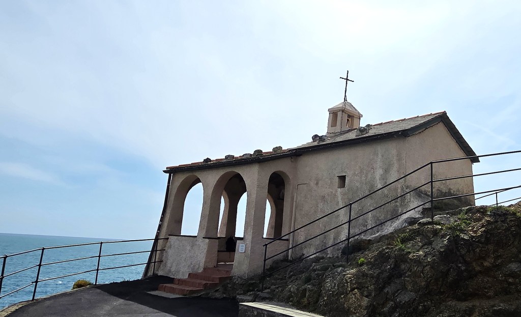
Some goats were feeding on the precipitous slope just behind.
There was time for a siesta before dinner.
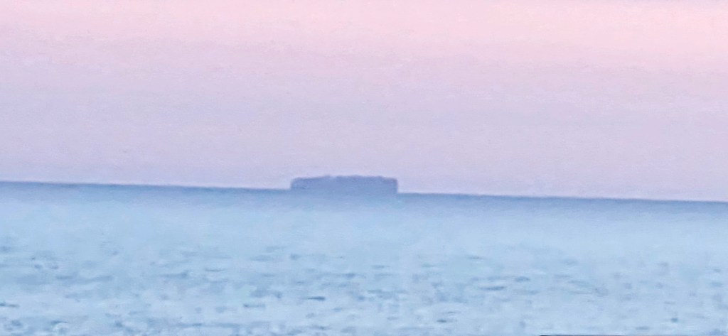
That evening, a small yacht put into the Bay, but it had gone by early morning.
A large container ship also hove into view against the pink of the horizon.
Our two guides were preoccupied with bedding new plants and re-bedding an existing collection. We watched from the rooftop bar with some amusement as they deposited the old soil on the public flower beds.
Thursday: Riomaggiore to Campiglia and Portovenere
While the easier walk undertook the second half of this programme, walking from Campiglia to Portovenere, the more difficult option also featured an initial ascent via the Sanctuary of the Madonna di Montenero to Telegrafo.
The easier walk was 6 miles with a total ascent of 210m; the harder was 8.4 miles with 540m of ascent.
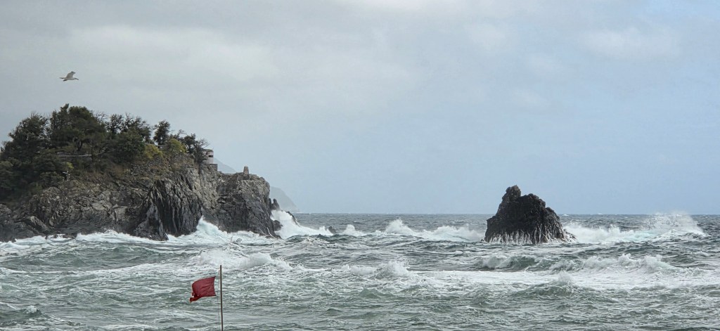
The advertised return by sea from Portovenere was cancelled since the waves were projected to be almost five metres high.
We also discovered overnight that our planned lunch stop in Campiglia was no longer possible, since the restaurant had closed for a daughter’s birthday.
It was another early start, as we again caught the 08:49 train, arriving in Riomaggiore just as it was preparing for a new influx of tourists.
We bought picnics in a small shop near the station before walking along the Via Santuario to the top of the village.
Soon we were climbing up steps through farmland towards the Sanctuary. A sense of peace and calm permeated the landscape.
Finally we arrived at the Madonna di Montenero, 340 metres above sea level. To be honest, the view down was more spectacular than the Sanctuary itself.
Continuing upon our way, we enjoyed a chance encounter with a monorail in use.
We had several times noticed these rails on the steeper sections of our walks, used by farmers and growers to transport materials up and down, but had yet to see a ‘trenino’ in action.
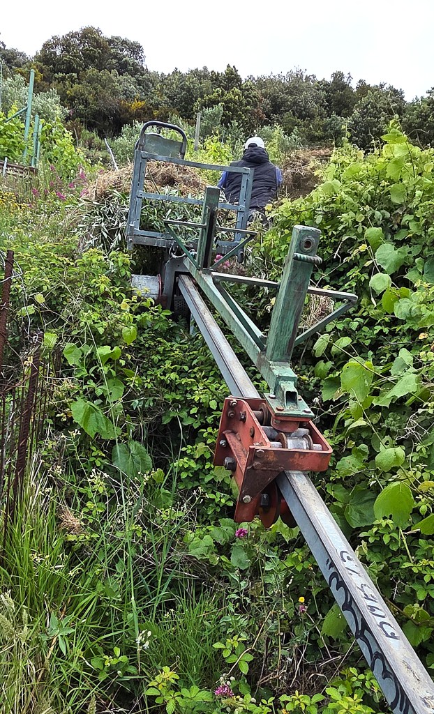
Strictly speaking, these are rack-and-pinion trains, with a toothed rail that is engaged by a cog suspended beneath the wagon. A small gas-powered engine propels the vehicle up and down.
The first tracks were installed at Volastre in 1980, an idea borrowed from the Swiss. There are now said to be 50 rails with a combined length of 16km.
Our next stop was the tiny Chiesa di San Bernardo di Chairavalle, with its fantly creepy portrayal of the saint in question.
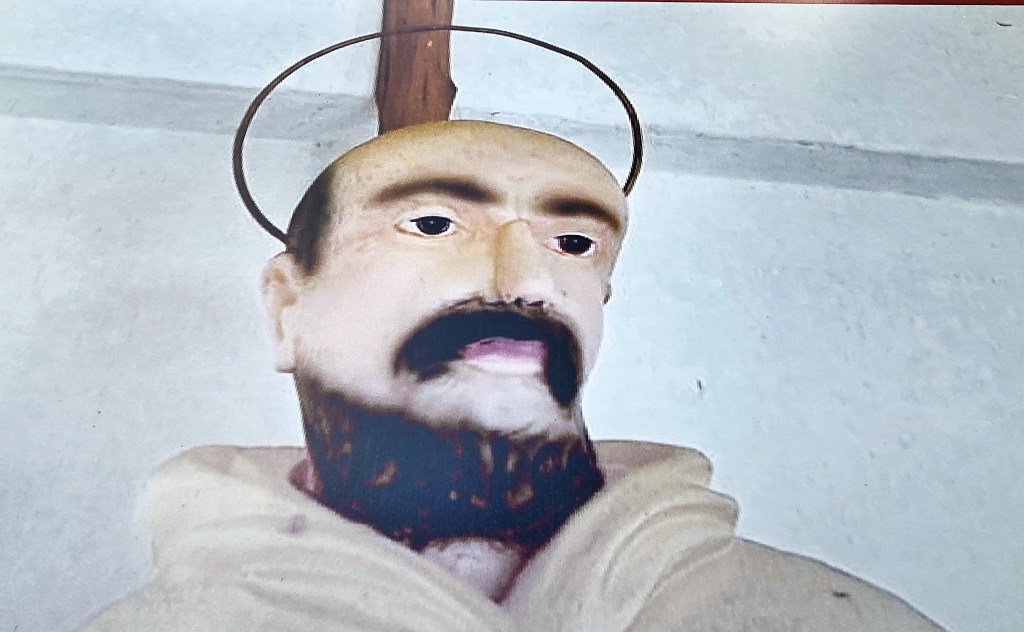
This is in a tiny hamlet called Lemmen, 400 metres above sea level.
Bernard (1090-1153) was Abbot of Clairvaux Abbey and co-founded the Knights Templar. Strangely, the plaque on the side of the church claims that he died in 1174 rather than in 1153.
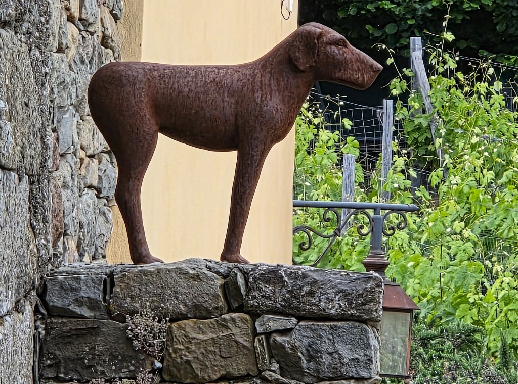
Round the corner, a stylised bronze dog seemed to belong to the farm and vineyard just behind the Church.
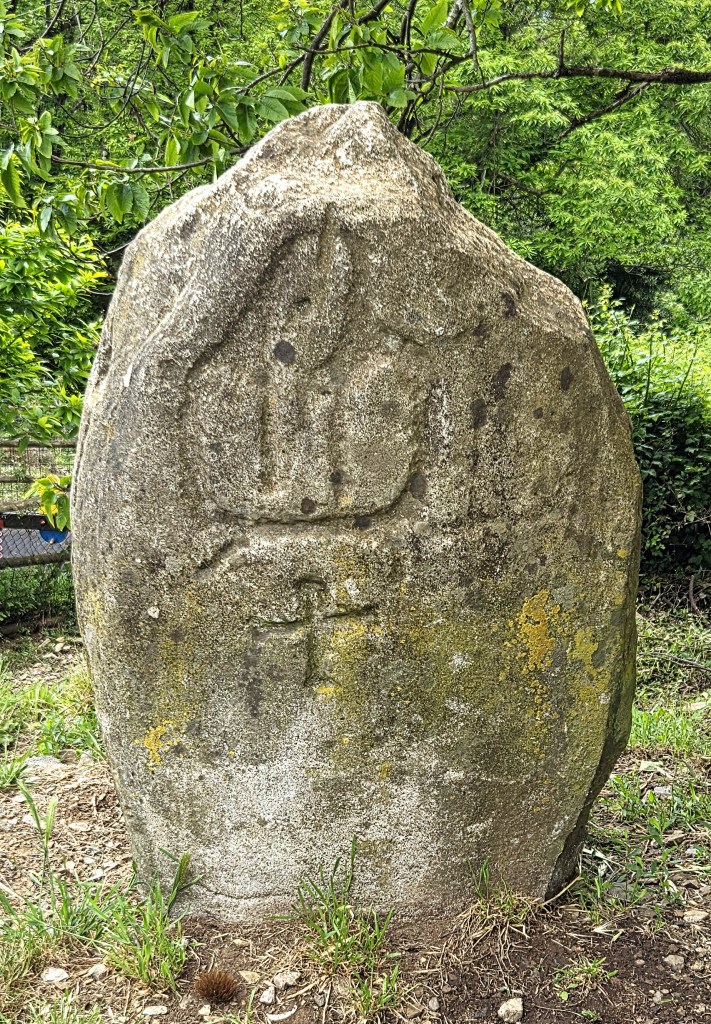
At Telegrafo we found what seems at first sight a more authentic edition of a stele, but this is in fact a duplicate of the sandstone original discovered here in 1923, which is now in a La Spezia museum.
It probably dates from between the Bronze Age and the Iron Age and was basically a boundary marker between two settlements.
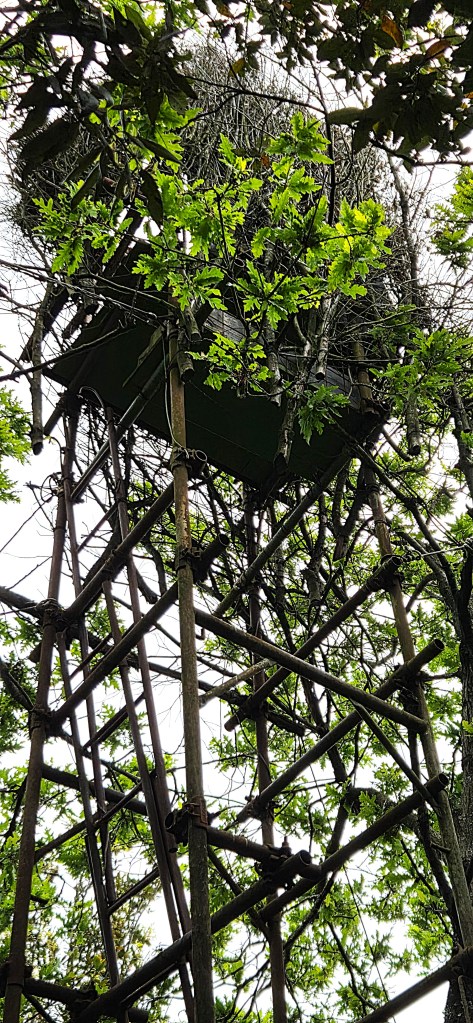
Continuing through woodland on the approaches to Campiglia, we passed through a section used to shoot woodpigeon, but only from September 25 to November 10 each year. Several laddered towers stood between the trees.
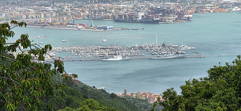
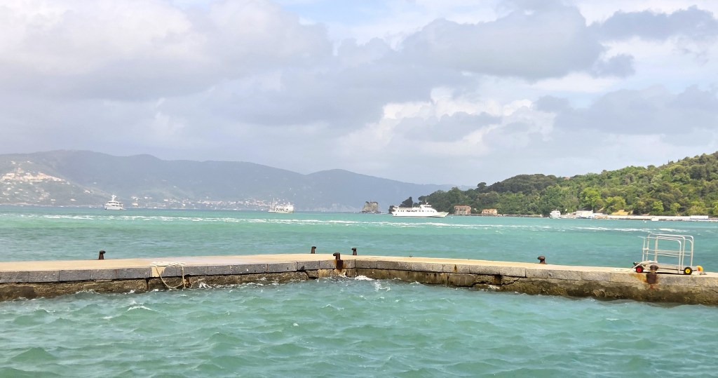
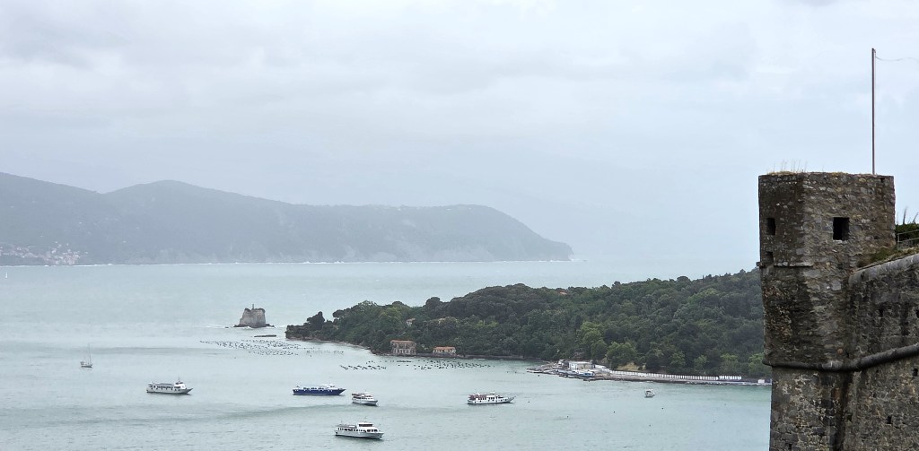
We came in sight of the three islands off Portovenere and, soon afterwards, the port of La Spezia, which contains a large Italian naval base.
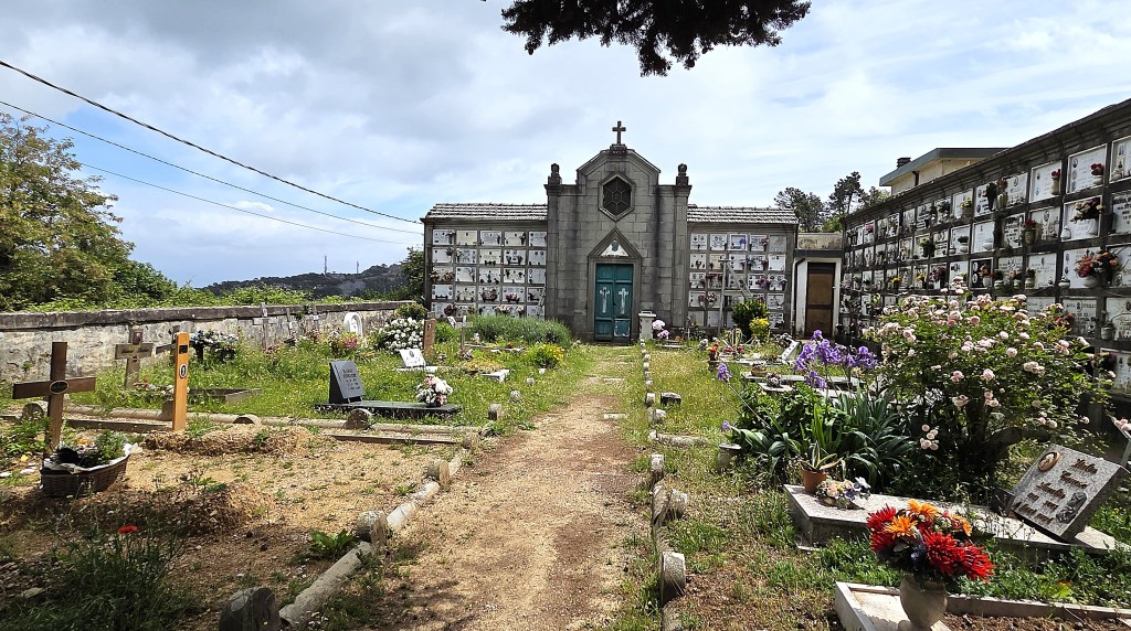
Arriving at Campiglia, we found a stiff breeze and most of the sheltered picnic positions already taken. So we settled down to lunch inside the cemetery.
Campiglia is a crossroads for hiking trails, standing at 400 metres above sea level.
The Chiesa di Santa Caterina Vergine e Martire was originally built in the early Fourteenth Century.
Within the cemetery, many of the graves belonged to the members of the Sturlese family.
One grave commemorated:
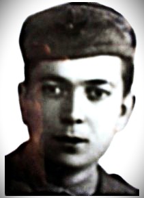
‘Patriota Martire Aristide Galantini (n 6/1/921 m 12/4/944)
Fervente idealista caduto
Per la liberta in combatimento
Contro forze NAZI-fasciste
A Rossano Apuania
Lasciando I genitori il fratello
E la sorella inconsolabili
QMP’
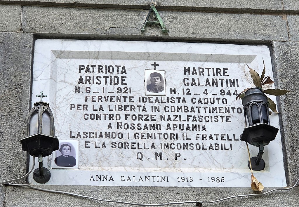
Aristide Galantini was born in Campiglia. Though exempt from military service, he joined the resistance group known as ‘Justice and Freedom’. They operated initially as couriers in the La Spezia area before moving up into the mountains.
In the Spring of 1944 Galantini joined the Lunigiana Assault Brigade, which enjoyed initial success in the Zignago and Zerasco areas.
But, when one of their leaders was shot, he and two others went in search of a doctor. He was shot, wounded, then ‘finished off’ by soldiers from the garrison at Coloretta.
There is a fuller history of resistance in this area on the website of the ETS Foundation, which promotes academic study of the period.
Leaving the cemetery in a thoughtful mood, we resumed our progress towards Portovenere, following the AV5T path, which hugs the cliff edge.
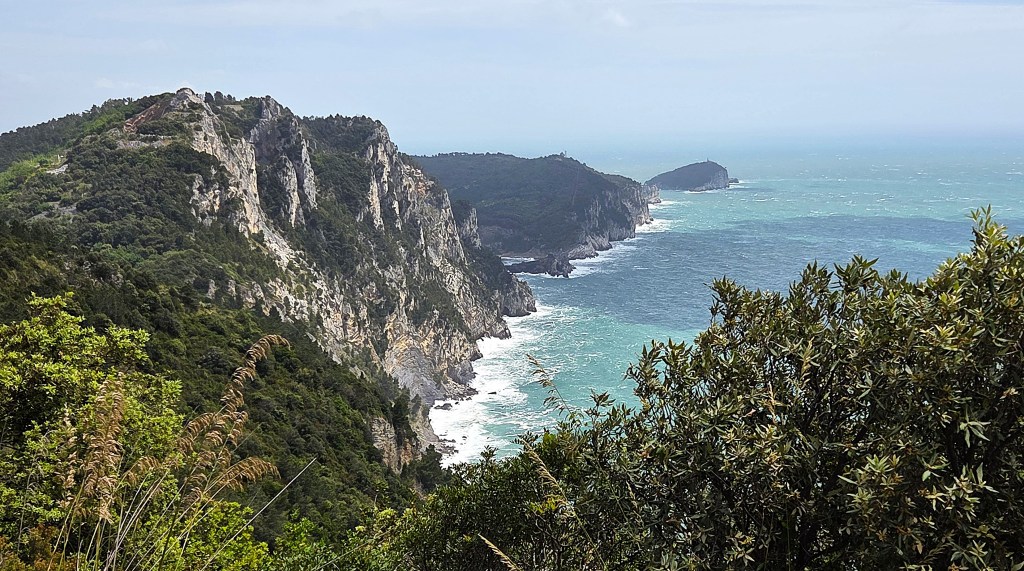
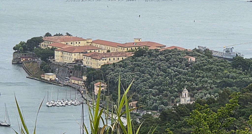
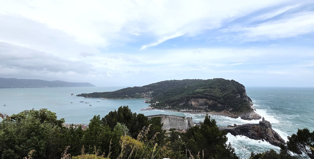
Soon we could see the dramatic black cliff promontary at the tip of Portovenere, guarding the narrow channel between itself and the island of Palmaria.
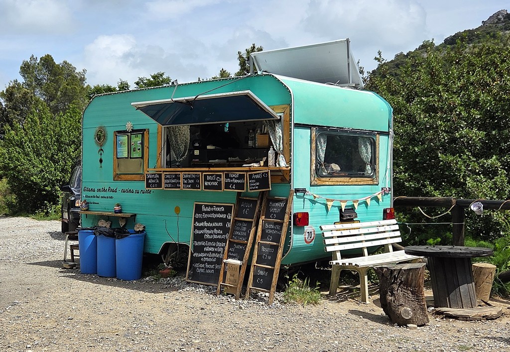
We stopped in a clearing beside a turquoise caravan selling refreshments, enjoying al fresco coffees and a shared Tunnocks.
Shortly afterwards we passed a quarry which produces a black marble peculiar to the area. Quarrying has been undertaken here since Roman times. By 1862, 30 quarries were active, whereas today only three are left.
Below we could now see the port of La Spezia, now much closer. That building is apparently the headquarters of an Italian Navy special operations unit specialising in underwater reconnaissance, combat and demolition.
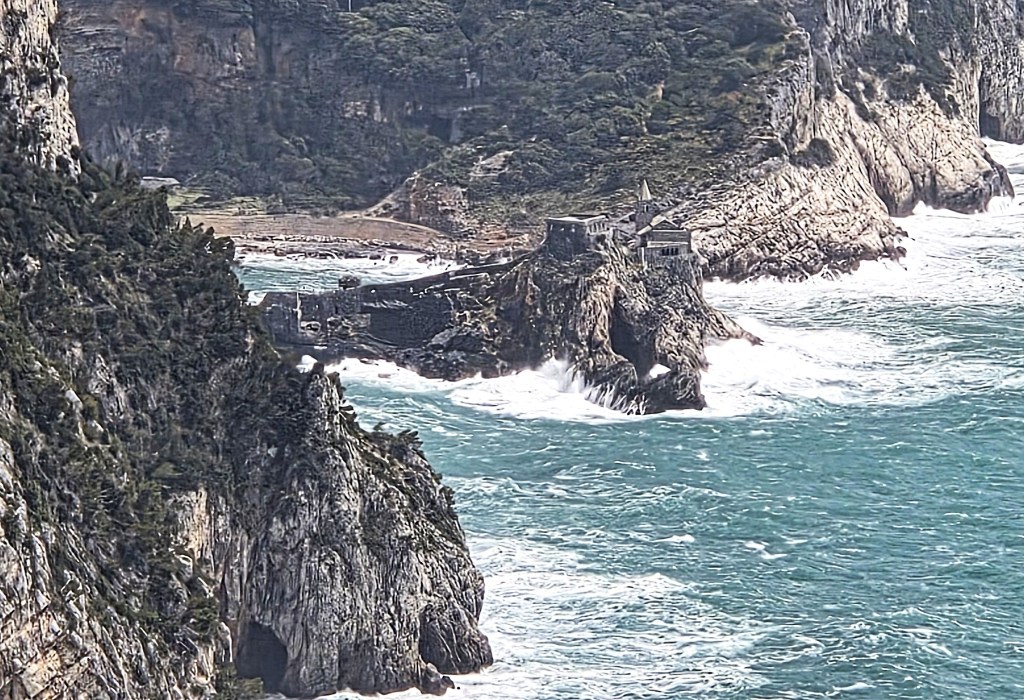
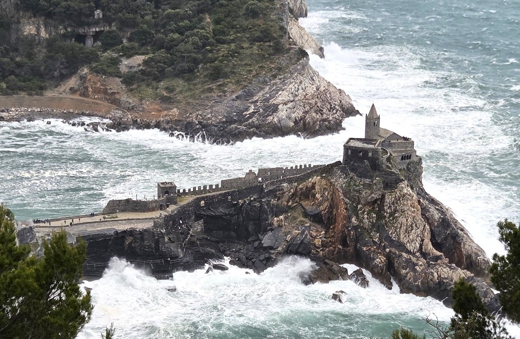
Half an hour later we were closing in on the black cliff promontary we had seen from a distance.
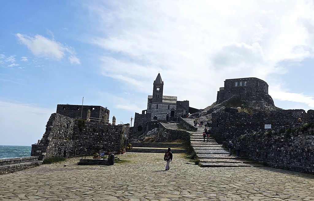
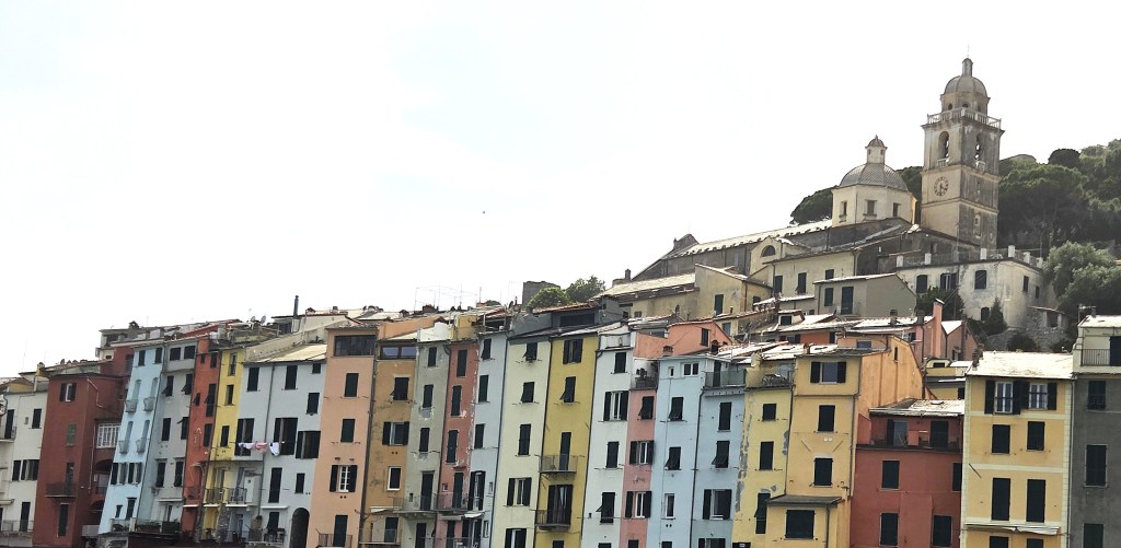
It was a strikingly melodramatic scene, with the narrow fortified promontory culminating in a pyramidal cliff, upon which perches the Chiesa di San Pietro.
The municipality of Portovenere comprises three villages, one of which is Portovenere, as well as the three islands: Palmaria, Tino and Tinetto. Only Palmaria is inhabited.
Its name, Portus Venerus, derives from the temple of Venus which originally sat on the promontory.
After the fall of the Roman Empire, Portovenere was used as a base by the Byzantine navy, but was attacked and destroyed by the Lombards in 643AD.
The first church upon the promontory is thought to have been built in the Fifth Century, upon the remains of Venus’s temple.
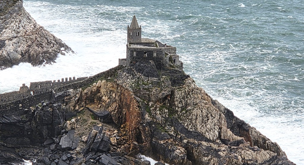
In 1118 the Church then standing was dedicated to St Peter by Pope Gelasius II. It was considerably enlarged under Genoese rule, probably between 1256 and 1270, replacing a Benedictine monastery that had been built alongside, connected by a narrow cloister.
It operated as the parish church of Portovenere until the end of the Fourteenth Century, when it was supplanted by the Chiesa di San Lorenzo.
That had originally been built in 1098, by the Antelami, probably on the site of another pagan temple, but had been damaged by fire in 1340.
During the early Medieval period, Portovenere was frequently raided by Saracen pirates. It became part of the Genoese Republic early in the Twelfth Century.
There is documentary evidence of a castle here as early as 1139, while the Town’s walls were constructed in 1161.
The Castle today consists of two sections: the upper part is Fifteenth Century; the lower section was added in the Sixteenth and Seventeenth Centuries.
In 1494, the settlement was seriously damaged, notably during the Battle of Portovenere, when its inhabitants defended themselves from attack by an Aragonese fleet commanded by Frederick of Aragon (1451-1504).
That same year it was also attacked by the fleet of Charles VIII of France (1470-1498).
San Lorenzo was heavily restored in 1582. Much later, extensive conservation work was undertaken on San Pietro, from 1929 to 1934.
During the Napoleonic period Portovenere was used as a base by both Austro-Russian and French forces. From 1807 onwards the castle was used as a political prison.
A little further inland, in the curve of the bay created by the promontory, sits Grotta Arpaia, otherwise known as ‘Byron’s Grotto’, a collapsed sea cave which the poet is said to have frequented, and from where he is said to have swum across to visit Shelley in San Terenzo, allegedly in 1822.
While Byron was an accomplished swimmer, there is no evidence that he ever visited Portovenere, let alone meditated in this cave, or that he swam the five miles across to San Terenzo.
However, he did own a boat, the ‘Bolivar’, and a few months after Shelley’s death in a boating accident, he challenged Edward John Trelawny (1792-1881), who he had appointed captain of the ‘Bolivar’, to swim from it to San Terenzo and back again.
Byron lost.
Eugenio Montale wrote a poem about Portovenere in 1925:
‘Là fuoresce il tritone
dai flutti che lambiscono
le soglie d’un cristiano
tempio, ed ogni ora prossima
è antica. Ogni dubbiezza
si conduce per mano
come una fanciulletta amica.
Là non è chi si guardi
o stia di sé in ascolto.
Quivi sei alle origini
e decidere è stolto:
ripartirai più tardi per assumere un volto.’
Having descended into the town, we had little time in which to look around, especially after waiting in a queue for gelatos.
We advanced along the Via Vittoria as far as the steps up to the Chiesa di San Pietro, then doubled back to the harbour. Here we caught the taxis that transferred us to the station in La Spezia, from where we returned to Bonnasola.
We arrived on the correct platform only just in time, so had to travel without validating our tickets!
Friday: Santa Margharita to Portofino
Unfortunately the waves at sea were still substantial, and this forced an equally substantial change to our programme on this final day.
The scheduled walk had involved travelling by coach to the fishing village of Camogli, not far from Genoa, from where we would have departed by boat for San Frutuoso.
Here we would have disembarked and walked to Portofino, visiting its lighthouse before continuing along the coast to Santa Margherita, from where we would have caught a coach home.
The shorter programme was similar, except that it excluded the walk to the lighthouse.
Instead, we would be taken by coach to Santa Margherita, from where both groups would walk to Portofino. The longer walk, involving a picnic lunch, would be via a coast path, much of it through woodland, including a steep ascent.
Breakfast was 45 minutes early, at 07:15, since we were to be on board the coach for departure at 08:00.
We were driven to Santa Margherita, where there was an opportunity for a second breakfast. It was at this point that we realised we had left two of the group behind.
They had not arrived in time to board the coach, but were falsely counted as present.
They had to catch the train from Bonnasola to Santa Margherita.
We began at the Caravaggio Café, though we confined ourselves to coffee, resisting the almond croissants. I also bought two large square pizza slices for our later picnic lunch.
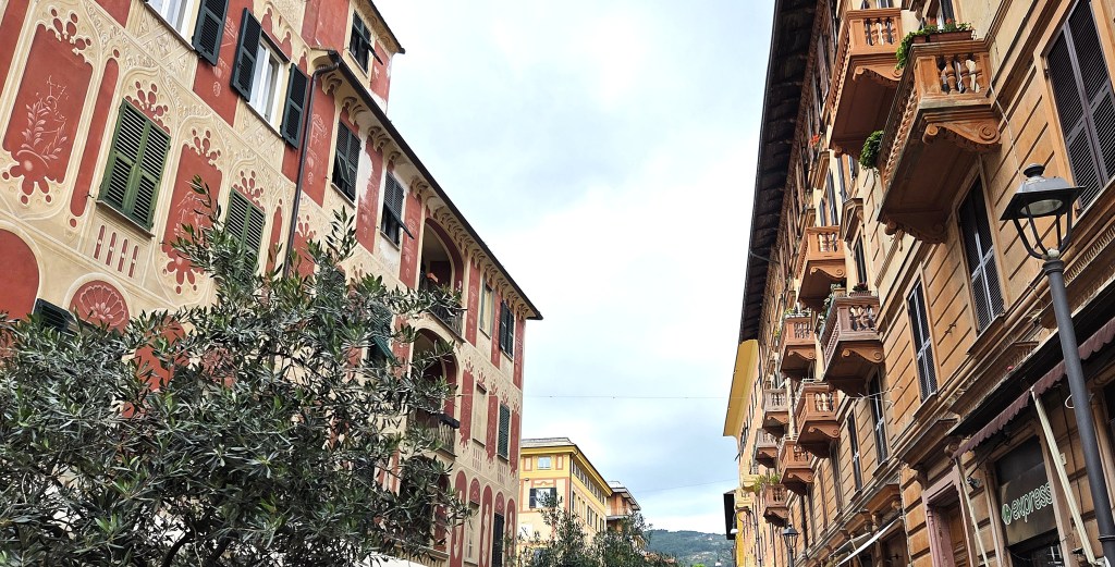
Then we had a look around Santa Margherita, a municipality about 20 miles south-east of Genoa with a population of 8,400.
It is not known whether there was a Roman settlement here, though a village, then called Pescino, was laid waste by the Lombards in the mid-Seventh Century and by Saracen pirates in the Tenth Century.
It belonged to the Fieschi family before transferring to Genoa in 1229. It was attacked by the navy of Venice in 1432 and, in 1549, by Saracen pirates.
Hence the Genoan Republic built the Castle in 1550
During the Napoleonic era, Pescino was unified with Coret and named ‘Porte Napoleone’. It became Santa Margherita two years later, when it transferred to the Kingdom of Sardinia.
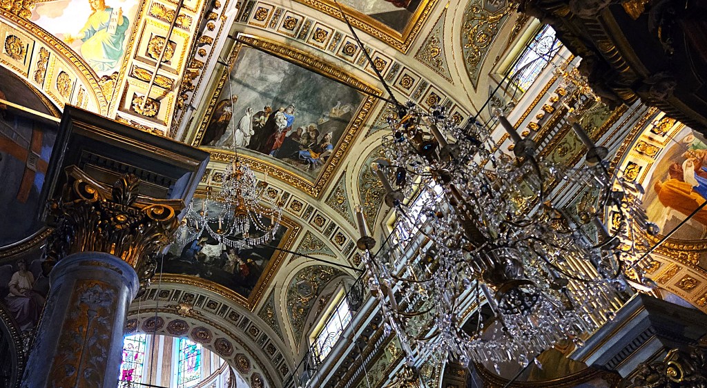
We spent some time looking round the Chiesa Di Margherita d’Antiocha, which was constructed from 1668 on the site of an earlier Thirteenth Century church.
A new facade and a bell tower were added in the mid-Eighteenth Century. A second bell-tower was added in 1927.
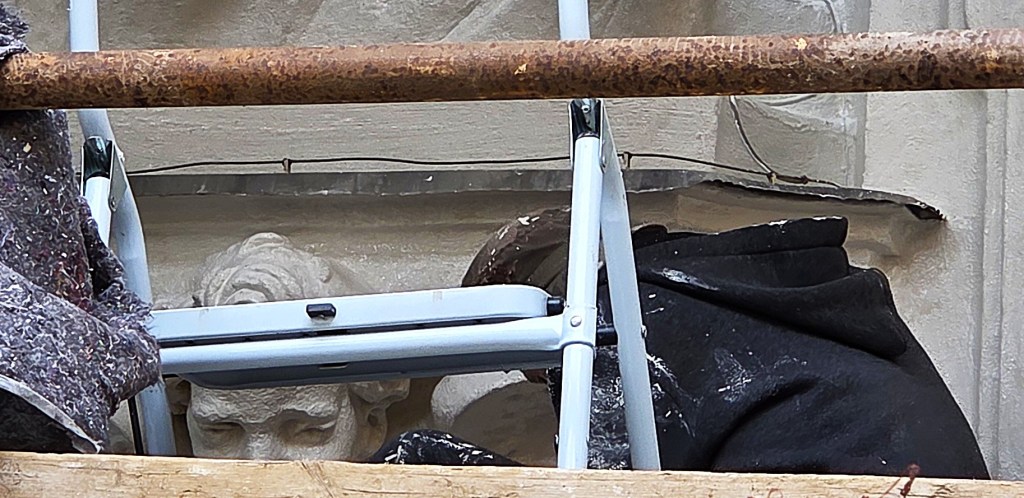
The facade was covered in scaffolding and undergoing restoration. The interior was extremely ornate.
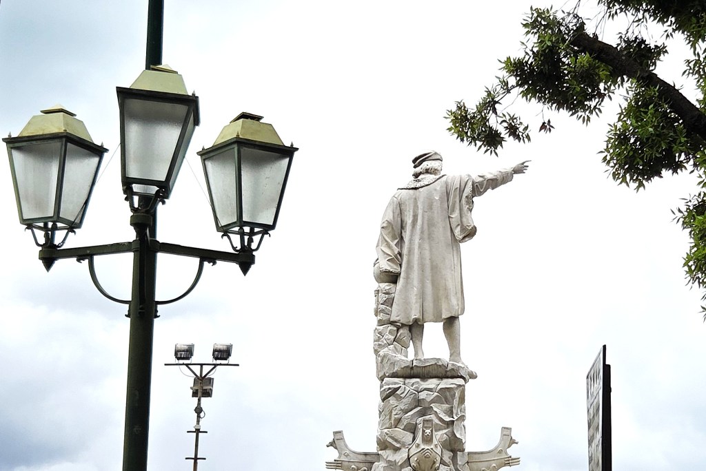
A statue of Columbus, dating from 1892, strives to dominate the harbour. King Victor Emanuele II, sculpted in 1894, contests his dominance.
We continued around the coastline until we reached the area immediately behind the Castle, and the gardens surrounding the Villa Durazzo.
The oldest sections were laid out in the Seventeenth Century, but the gardens date mainly from the Nineteenth Century. The Villa itself was built in the late Seventeenth Century, for the family whose name it carries.
We stopped briefly in front of the Chiesa di San Giacomo di Corte and Santuario di Nostra Senora della Lettera. The church was built in 1582.
I admired the Baroque facade, especially this cherub; far less so these holy toes peeping out from under a cassock.
We continued, climbing past the swish houses in the hills above the Town. I wondered how many were paid for by the proceeds of crime.
As we followed the path across towards the Bay of Paraggi, we discovered it was blocked by workmen, and so we had to find an alternative route higher up.
After a picnic lunch, taken by the side of the path, we pushed on into woodland, but again turned back when our guide considered the path was beginning to show signs of disuse.
We went deeper into the dense woodland, following a less obvious path, but eventually found ourselves off piste, close to the ruins of an old mill, not far above the road leading down towards Portofino.
Every rustle in the undergrowth betokened a potential wild boar!
Eventually we recovered the correct path, which lay on the other side of the mill, and soon reached civilisation.
Descending steadily towards Portofino, I eventually caught a glimpse of the harbour through the trees.
From this height the place seemed idyllic but, as I dropped lower, the crowds became more oppressive, removing much of the promised magic.
I reached the harbour by around 15:00 and, gaining a place on a vacant bench, waited for the others to catch me up.
Once they had done so, there was insufficient time to reach the lighthouse, so we contented ourselves with a tour around the harbour.
Portofino is thought to have been the location of an ancient settlement. During the Roman period, Pliny the Elder (AD23 – AD79) referred to it as ‘Portus Delphini’ (meaning port of the dolphin).
It was documented in 986 as belonging to the Abbey of San Frutuoso, before it too became part of Genoa in 1229.
The Chiesa del Divo Martino, dedicated to St Martin of Tours, is also said to have been built in 986. It has been extensively modified throughout its history, particularly in the Sixteenth and Seventeenth Centuries.
The Chiesa di San Giorgio sits on a promontory and is thought to date back to 1154, though it has been rebuilt at least four times, most recently after the Second World War.
Castello Brown also squats in the hills above the Harbour. The site has probably been fortified since Roman times. In 1190, Richard the Lionheart stayed in the medieval castle for several days, en route to the Third Crusade.
After a long and honourable history under the Genoese Republic, the Castle was abandoned in 1815 and fell into disrepair.
But, in 1870, it was bought from the Italian state by Montagu Yeats-Brown (1834-1921), a diplomat who became British Consul to Genoa in 1857, succeeding his father in the role.
Yeats-Brown junior commissioned an architect to transform the ruined castle into a family villa.
The novelist Elizabeth von Arnim (1866-1941) used it as the location for her 1922 novel ‘The Enchanted April’, which has been credited as helping to establish the area as a fashionable resort.
The lighthouse was built in 1917 at the extreme end of the promontory that juts out beneath Portofino. The white tower is just 3.7 metres high, but the light stands 40 metres above sea level. It is now fully automated.
Another nearby castle, San Giorgio, was bought and restored by Geman diplomat Alfons Mumm von Shwarzenstein (1859-1924) in 1911. He and his Scottish wife, Jane, nee Mackay-Watt, retired there in 1920, and he died there in 1924.
In December 1944, 22 partisan prisoners were executed near the Castle, by Lieutenant Reimers, German commander of Portofino, on the orders of Colonel Siegfried Engel.
Their bodies were weighted with stones and thrown into the sea. No reason for this apparent reprisal killing has ever been established.
The following year, when the Germans were evacuating Portofino in the face of the Allied advance, Baroness Mumm is said to have persuaded Ernst Reimers not to destroy the village, as had been ordered by his superiors.
At 16:15 we rendezvoused with our taxis, though there was a brief moment of drama when a group of Italians tried to snaffle one of them first.
We transferred back to Santa Margherita and into our coach, reaching Bonnasola by 18:15.
Then it was time to pack, before our final dinner.
Saturday: Home
We climbed aboard our coach at 06:30, equipped with ‘packed breakfasts’.
On reaching the airport at 08:00, we found enormous crowds waiting to clear security and our check-in desks not yet open.
Though two desks were opened within a few minutes, ours was exceedingly slow.
But, by the time we had arrived at the queue for security, it had largely cleared.
We all transferred early to our gate, fearing that biometric checks would be enforced at the last moment, but they did not materialise.
Our flight was slightly delayed but we arrived back on time.
Only to experience a delay at Heathrow while a flight of steps was found and wheeled to the door.
Baggage reclaim was also full to the brim with unclaimed luggage, owing to an earlier problem but, thankfully, ours arrived relatively quickly.
It took a while for us to find the right bus stop, since Terminal 5 is not directly served by the service back to our home.
As we transferred to Hatton Cross, my new suitcase decided to propel itself at speed across the bus, but fortunately failed to burst through the doors.
We reached home without further mishap.
TD
June 2026


Leave a comment