We completed this stage of the Coast Path in April 2024, some ten months after reaching Torcross in June 2023.
We were fairly flexible about our finishing point, not being quite sure of our fitness. It was an added bonus to reach Starcross, on the Exe Estuary, so completing the West Devon section.
On this occasion we experimented with a Monday-to-Monday programme, basing ourselves in Brixham.
Our schedule, excluding travel days, turned out as follows:
- Day 1 (Tuesday): Torcross to Dartmouth (10.3m)
- Day 2 (Wednesday): Kingswear to Brixham (10.9m)
- Day 3 (Thursday): Brixham to Torquay Harbour (8.5m)
- Day 4 (Friday): Torquay Harbour to Shaldon (11.1m)
- Day 5 (Saturday): Rest day
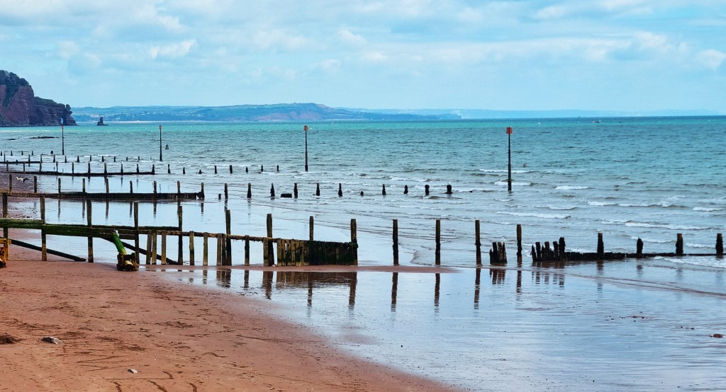
- Day 6 (Sunday): Teignmouth to Starcross (8.0m)
That’s a total of 48.8 miles for the week and a cumulative total of 513.7 miles completed, leaving just 115.8 miles still to go.
The transport links are excellent in this part of Devon, so we had no problem reaching start points or returning from end points. We debated buying a weekly ticket on Stagecoach Buses, but calculated that, with tickets held at £2 a journey, the saving would be negligible.
We were very lucky with the weather, since it was virtually rain-free, mostly bright and occasionally sunny.
Our principal obstacle was the deteriorating condition of my left little toe!
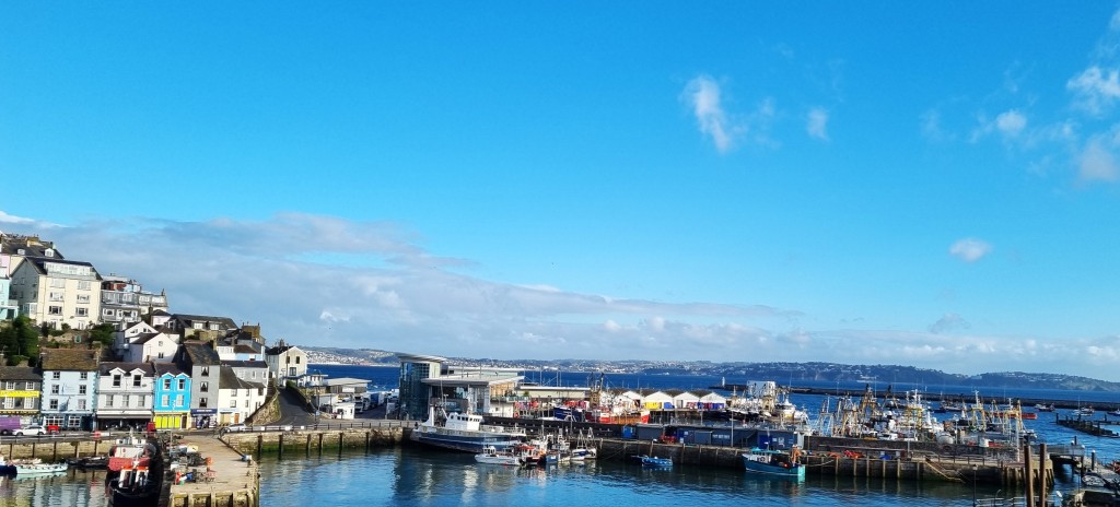
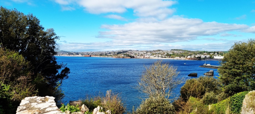
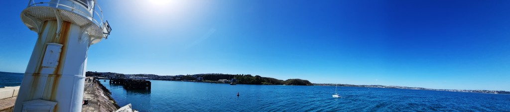
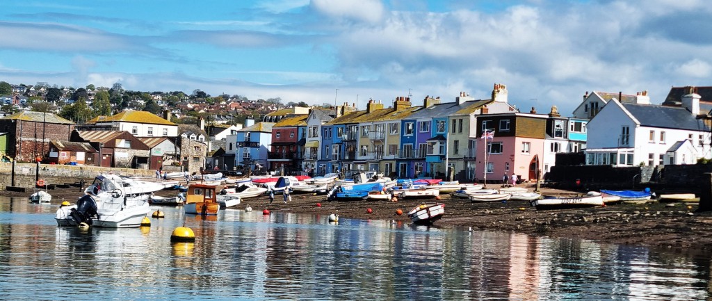
Brixham
For possibly the last time, we joined the 12:03 GWR service departing from London Paddington. It was a very windy morning and I had visions of trees across the line, but the journey was mercifully uneventful.
We had purchased our tickets in the GWR sale, paying £64 each for the return journey to Totnes. Consequently, we didn’t have the greatest seats. The outward journey was acceptable; the return less so.
Arriving in Totnes on time, we walked to a nearby bus stop to await the 15.10 Gold bus to Paignton Bus Station. Here we had our only delay, before the (usually frequent) 12 service to Brixham made its appearance.
We travelled with a group of female walkers, possibly from the WI, who clearly hadn’t exhausted all conversational topics during their walk!
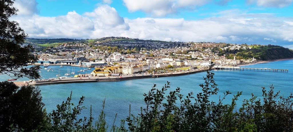
Arriving in Brixham shortly after four in the afternoon, we navigated around the Harbour to Rosemary Cottage, which we had booked through AirB’n’B.
This traditional ‘fisherman’s cottage’ has a living room and kitchen on the ground floor, the main bedroom and bathroom on the first floor, and a second bedroom above. There is a tiny courtyard garden.
The extremely thick walls made the building surprisingly chilly in the evenings, so we were grateful for the heaters.
Space is at a premium, the stairs precipitous and the furnishings fairly basic, but we found everything we needed, except perhaps a bath. There were biscuits, but sadly no milk in the fridge.
So, after unpacking, we went straight to the nearest Co-op to buy provisions. (Lower Brixham boasts two Co-ops and a Tesco Express.)
Following tea and biscuits, we ventured out a second time, for our customary ‘orientation walk’, which culminated in the purchase of fish, chips and mushy peas from Simply Fish.
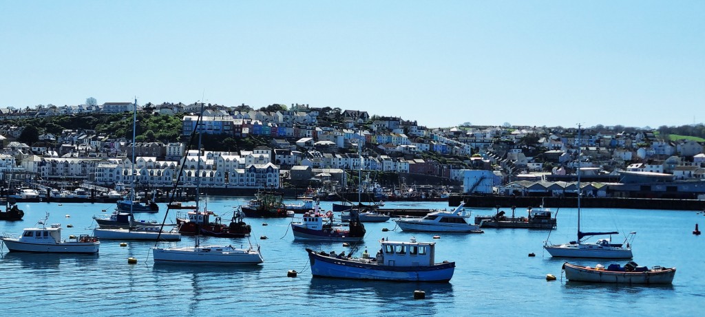
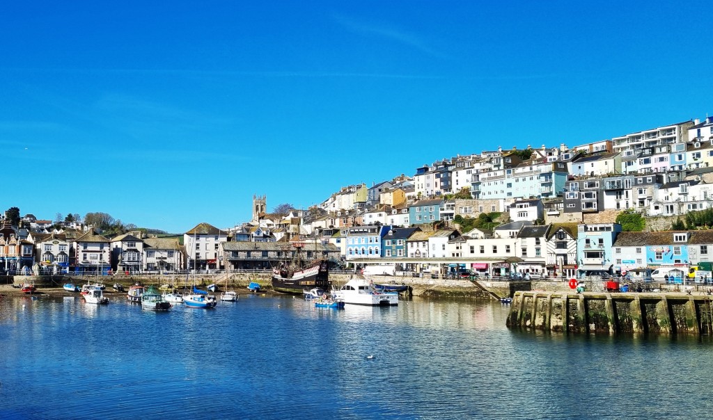
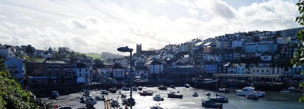
There is no shortage of fish outlets in Brixham for, though officially at one end of the so-called ‘English Riviera’, which stretches through Paignton and Torquay to Babbacombe, it is also a working fishing port.
It developed out of two distinct communities, whose no-nonsense names still survive today. The area surrounding the harbour is called Fishtown, while Cowtown is inland and uphill. The overall population is around 17,000.
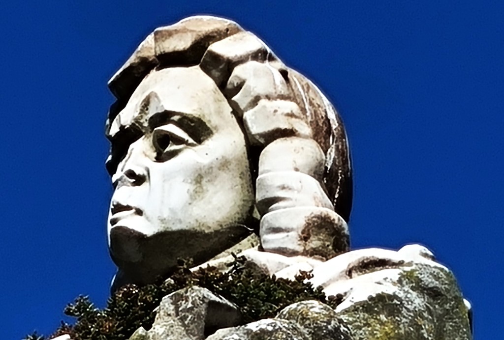
On 5 November 1688, William of Orange disembarked here, bringing about the Glorious Revolution and his ascent to the English throne. His statue graces the inner harbour.
For some reason, there is also a full-sized replica of the ‘Golden Hind’. Those wishing to rediscover their inner Elizabethan Adventurer can stay on board for a mere £225 per night.
By the mid-Nineteenth Century, Brixham boasted the largest fishing fleet in England – upwards of 250 boats – but it began to decline as sail gave way to steam. The Great War hastened this process until, by 1939, only six boats remained.
But after the Second World War there was a marked revival and, by 2000, Brixham was once again the country’s leading fishing port. During 2022, the fish sold here were collectively worth over £60m.
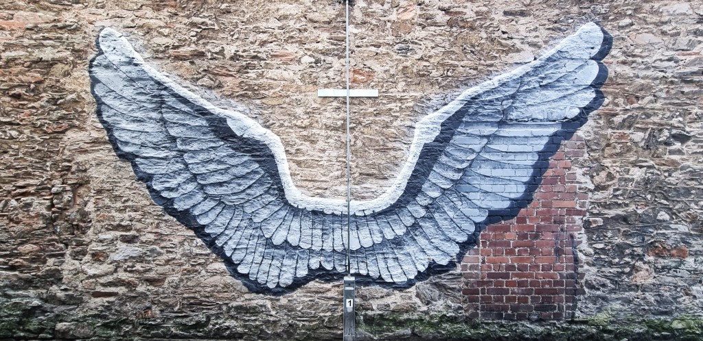
There is a local legend that, during a fierce storm in January 1866, the fishwives of Brixham made a large bonfire out of their furniture and bedding, at the end of the breakwater, to help guide their fishermen husbands back to land.
The storm destroyed fifty boats and more than 100 lives were lost. Some of the survivors reported that the flames from the bonfire resembled an angel in the storm, hence the allusion to ‘Brixham Angels’.
This painting, on a wall adjacent to the harbour, commemorates the fishwives.
There have been few famous residents. Flora Thompson, author of ‘Lark Rise to Candleford’ died here in 1947, while snooker legend Ray Reardon was also here for some years.
Brixham is a nice place, not overly genteel, with a real sense of community, despite the influx of tourists and the typical preponderance of holiday homes. It is neither impoverished nor indecently wealthy. Most of the shops and eateries are thriving, though a few seem to have gone to the wall.
There are some halfway decent pubs, though I could find none that is genuinely outstanding. Similarly, there is a comparatively wide choice of fairly good restaurants, but nothing that would trouble the Michelin Guide.
Details of the eateries and drinkeries we visited are included in the sections below.
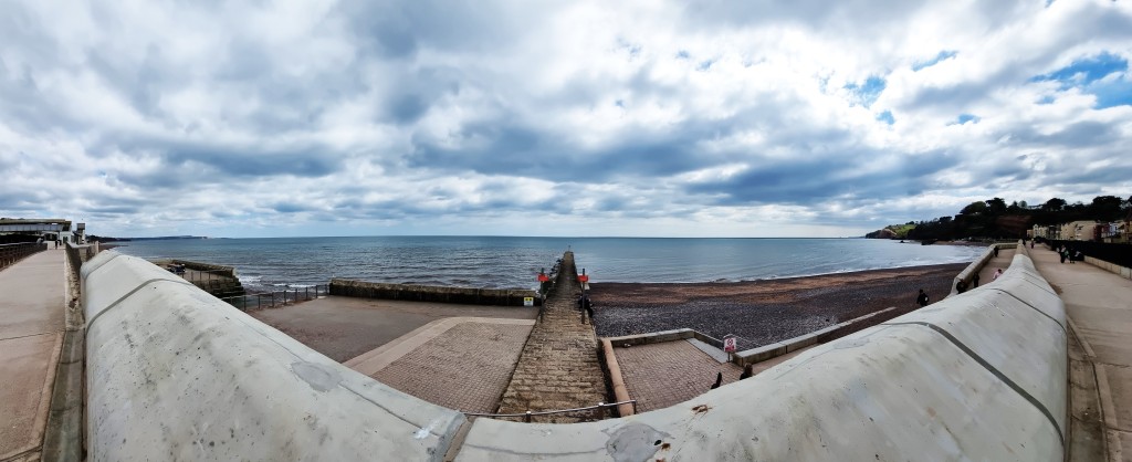
Day 1: Torcross to Dartmouth
It was an early start, as we needed to catch the 08:36 number 18 bus from the Town Square. This takes about 20 minutes to reach Kingswear, located on the eastern bank of the River Dart, opposite Dartmouth.
The Kingswear stop is called Banjo, which describes the shape of the turning circle constructed here by the local bus company in 1960.
We took a few photos across the Dart before striding down the road to the Lower Ferry Terminus.
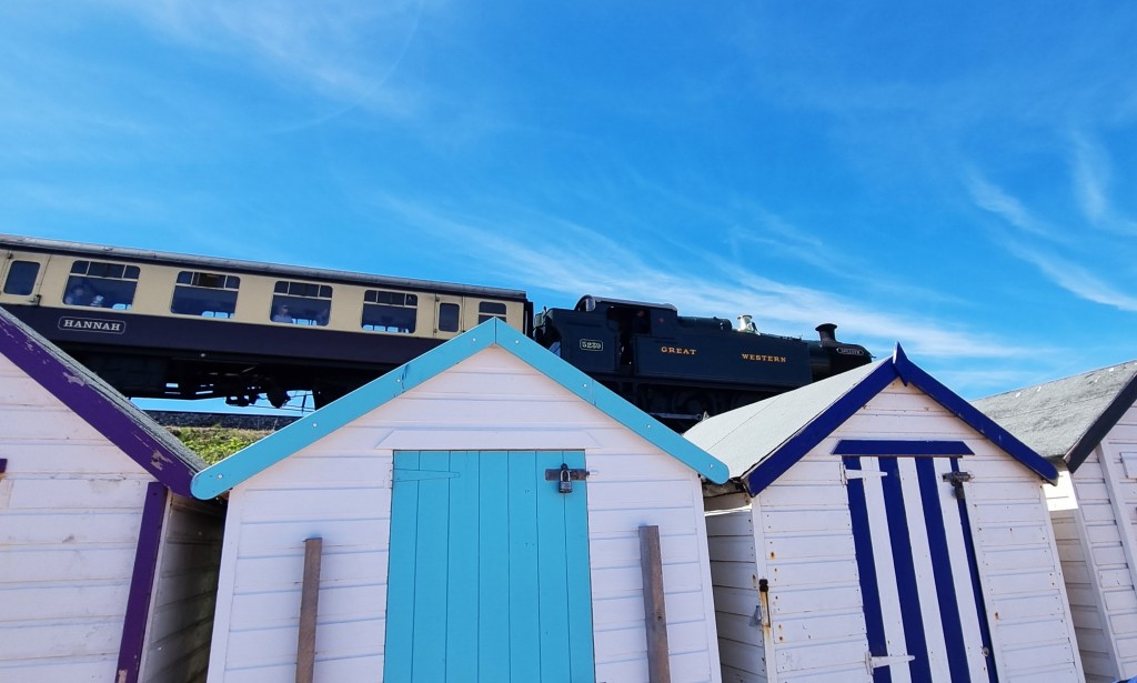
The Dartmouth Steam Railway service was sitting in the station beneath us, a carriage rather incongruously called ‘Lady Chatterley’ to the fore.
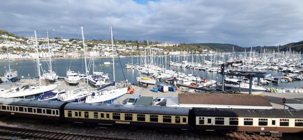
The Steam Railway uses the former GWR branch line between Paignton and Kingswear. Its trains have used this seven mile stretch since 1973. But, be warned, an adult return ticket plus booking fee will presently set you back over £25. No senior railcards here – though registered carers do get a 25% discount.
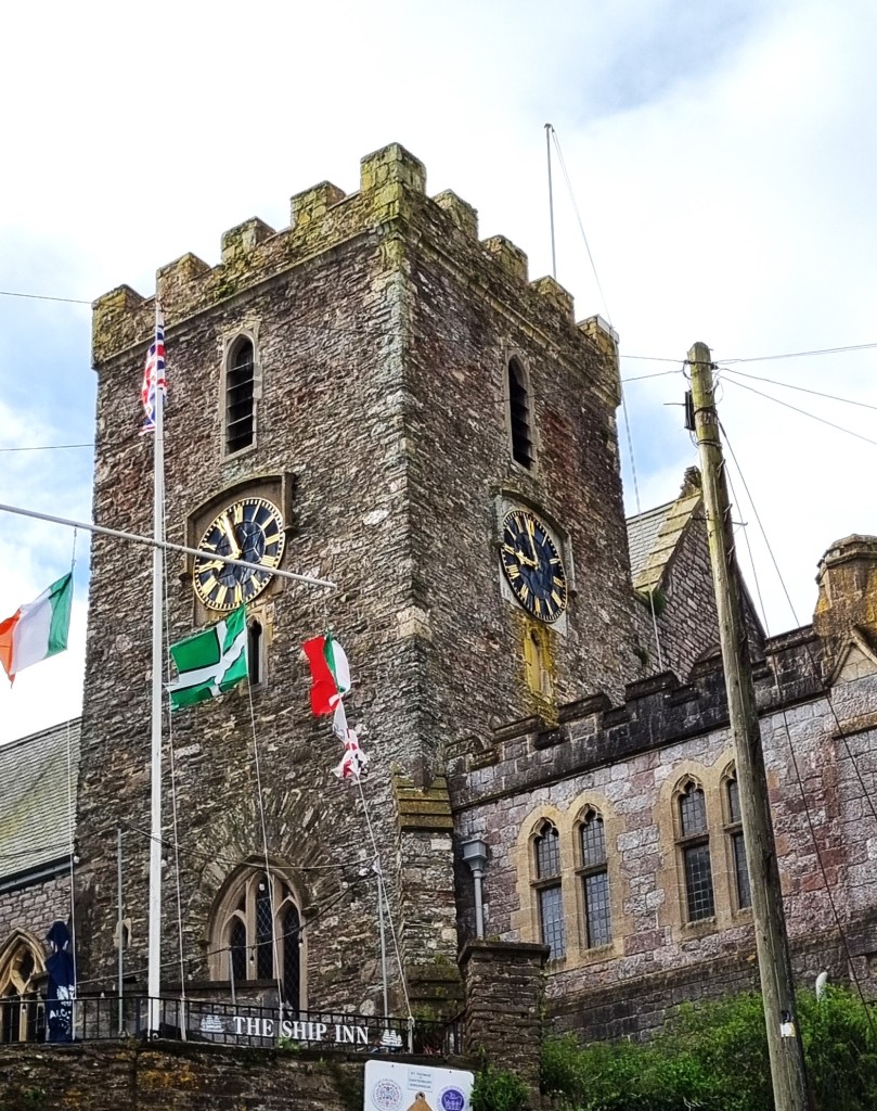
On the way down to the Terminus, we passed the Ship Inn and, immediately next door, the Church of St Thomas of Canterbury. The present church dates from 1847, but its predecessor was allegedly constructed to serve foreign pilgrims, on their way to visit the shrine of St Thomas a Beckett in Canterbury. Quite why they didn’t choose to land in Kent is beyond me, but perhaps it had something to do with the adjacent hostelry.
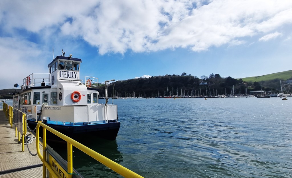
As we arrived, a car ferry was taking on a few last-minute foot passengers, but we could see a passenger ferry heading across the Dart, so we waited for that instead.
There has been a ferry service hereabouts since at least 1365.
In 2012, a woman on a drink and drugs bender stole a previous ferry, allegedly telling police ‘I’m Jack Sparrow’. Placed under arrest, she added that she ‘untied some ropes because she kept tripping over them’ and claimed they ‘would have ended up in St Tropez if they had not been caught’.
We crossed aboard the Kingswear Princess with a couple of other passengers. The rain clouds were breaking to reveal patches of blue sky above.
It was a stone’s throw to the bus stop on the Dartmouth side, though we had to wait some time for the 93 service, which took us along the coast to our starting point at Torcross Stores.
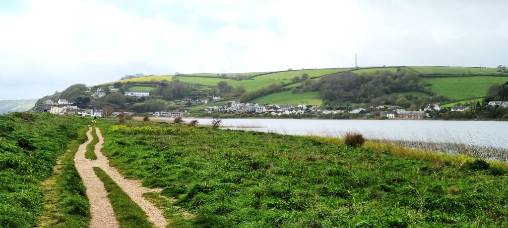
We began along the seafront, past the Start Bay Inn, before crossing over the A379 to reach the edge of Slapton Ley, the largest freshwater lake in South West England.
Stretching some 2.4km, it is only separated from Start Bay by the road and a narrow strip of shingle beach. There is reputedly a large population of the extremely shy Cetti’s warbler, but all we saw were a few swans.
At the Torcross end, close beside the handy toilets, one finds the Exercise Tiger Memorial.
Exercise Tiger was a full rehearsal for the D-Day Landings on Utah Beach.
Early in the morning of 28 April 1944, as eight large flat-bottomed landing craft were heading towards Slapton Sands, fully loaded with GIs, they were attacked by four German torpedo boats.
Although 639 men lost their lives, the incident was shrouded in secrecy, initially to avoid compromising D-Day. Most people forgot about it.
But a local man, Ken Small, learned of a Sherman tank lying on the seabed, 20 metres down, roughly a kilometre off shore. He purchased it from the American government for the princely sum of $50, although it took him ten more years to raise the tank and place it where it sits today.
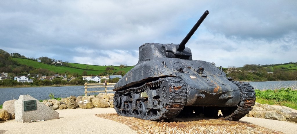
Annual memorial services are held here to commemorate the dead.
But there is still some mystery surrounding these events. The German attack took place some distance away, much further out in Lyme Bay, but rumours persist of a parallel ‘friendly fire’ disaster that happened here on Slapton Sands on 27 April, the day before.
Conspiracy theorists believe the former incident has been deployed as a smokescreen to obscure the latter, while others claim the loss of life here was negligible.
Interestingly, the Operation Tiger website refers to 749 casualties, 110 of which resulted from an unspecified number of ‘training accidents’.
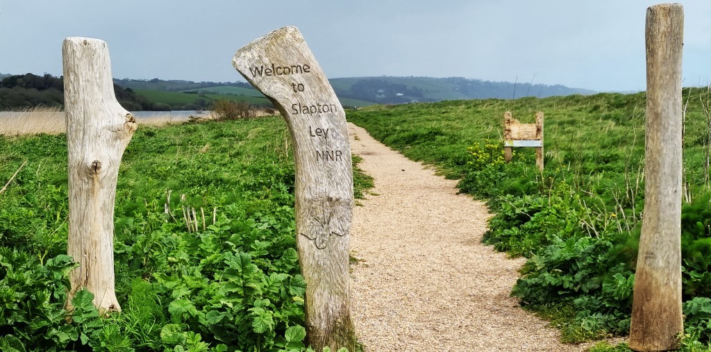
Having paused to reflect on the horrors of war, and visited the handy toilets, we entered the Slapton Ley nature reserve and began to walk its length.
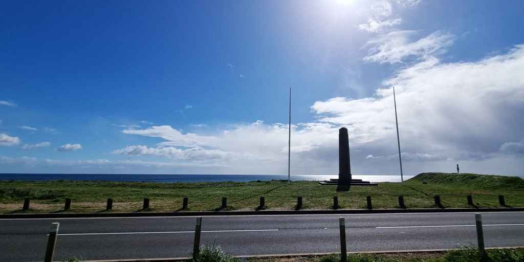
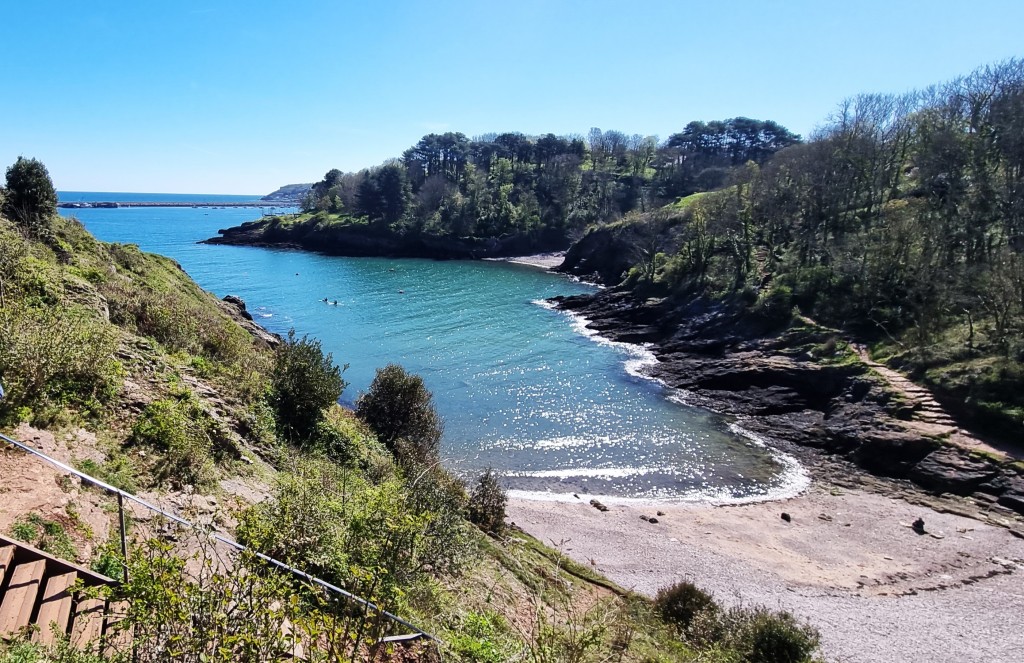
Towards the far end we passed the Slapton Sands Monument on the beach, silhouetted against the clearing sky. It was presented by the US Army to recognise the 3,000 civilians who had to be evacuated from this training area.
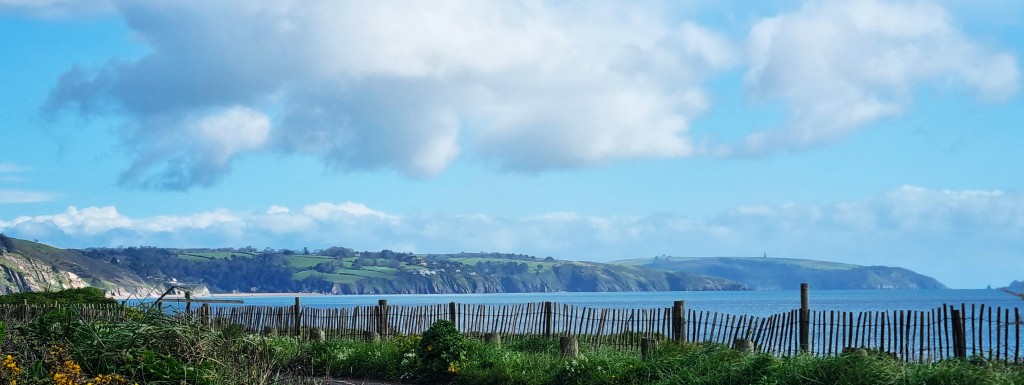
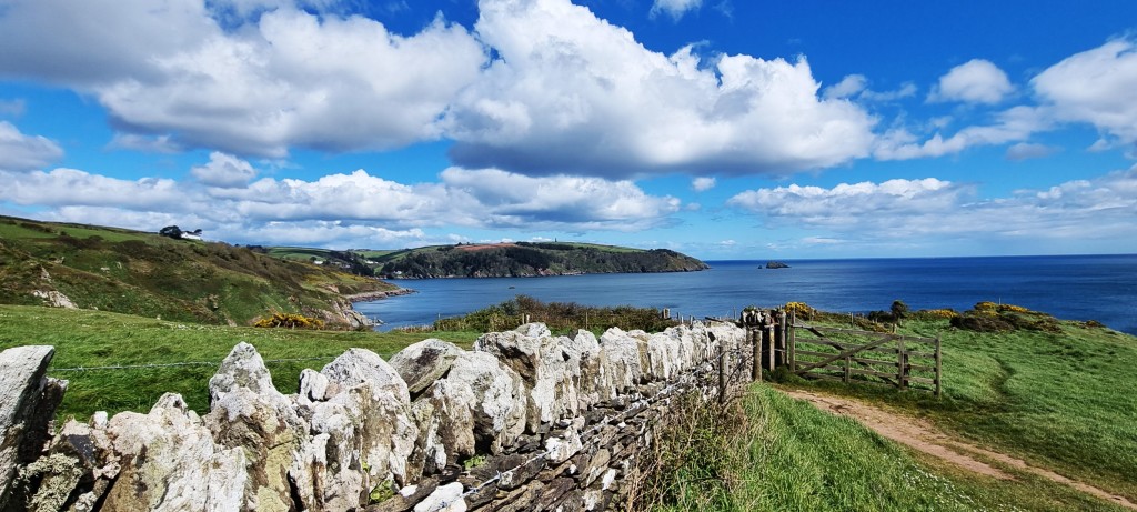
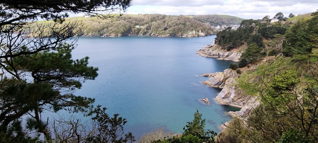
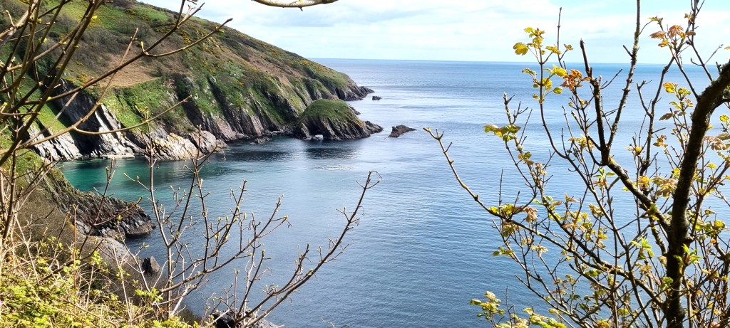
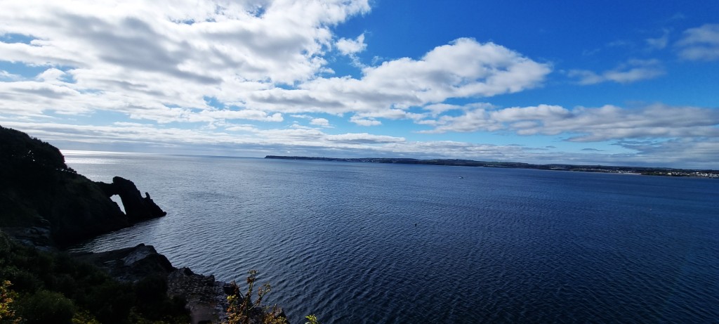
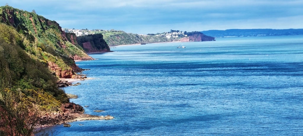
Before us we could see the coastline stretching round to Kingswear, with the Mew Stone just beyond.
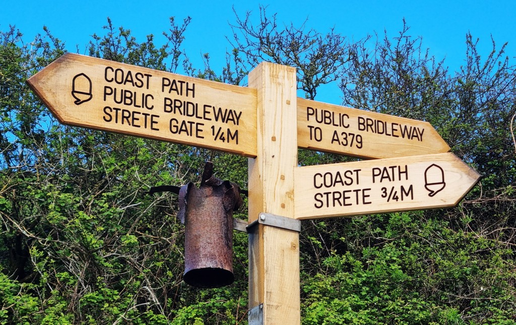
We decided against visiting the coffee shack at the near end of Strete Gate Beach, soon afterwards passing more toilets and this sign.

However, the naturists proved as elusive as Cetti’s warbler.
On the way towards Strete, some new coast path signs had been erected. For some unknown reason this one seemed to have part of its predecessor attached.
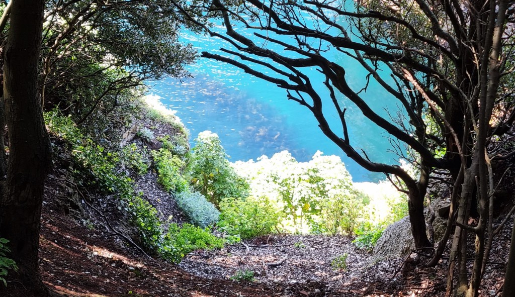
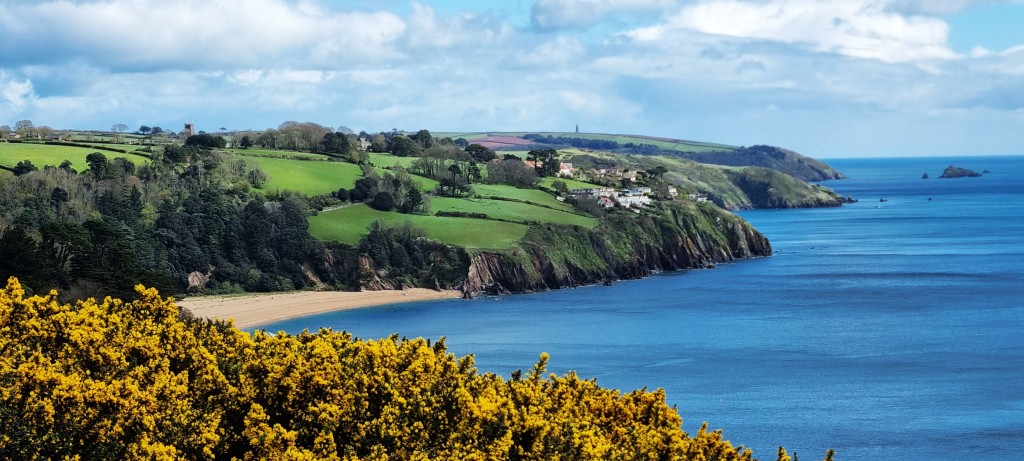
We passed through Strete, alongside the main road, before turning off into steep-sided green valleys, edged with yellow broom, overlooking the sandy beaches and blue waters below.
There was a particularly steep climb back up to the A379 before we crossed it to ascend and descend through cow pastures, reaching the junction with Blackpool Valley Road. Here there is a small collection of thatched cottages with a much larger house behind.
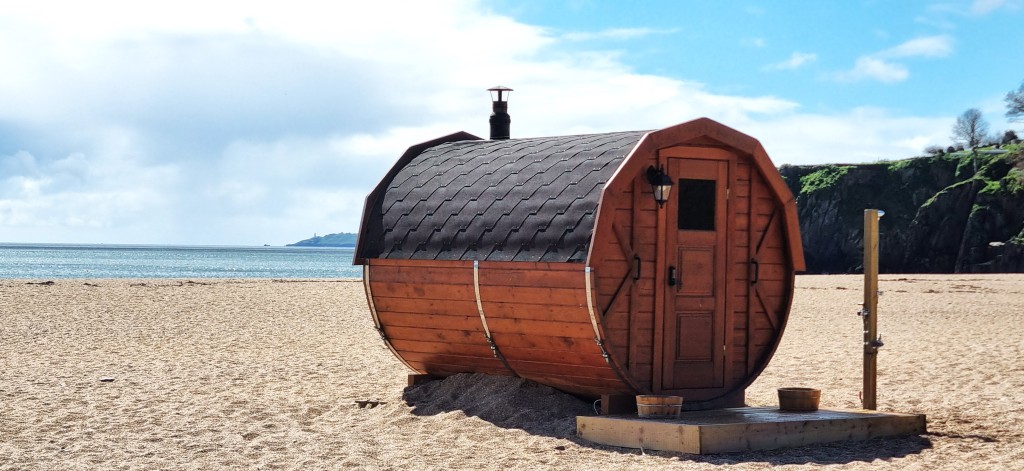
Through the trees we enjoyed tantalising views of Blackpool Sands, a private beach owned and managed by the Newman family.
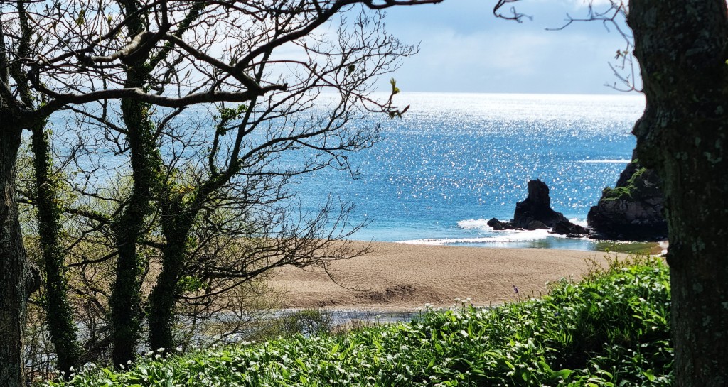
There’s been a café here since the 1950s, but now there is also a restaurant and even a wooden sauna which (in my view) rather blights the beautiful beach.
We very much enjoyed our coffee and extremely tasty flapjacks. Because they were crumbling, we were given one extra to share between us.
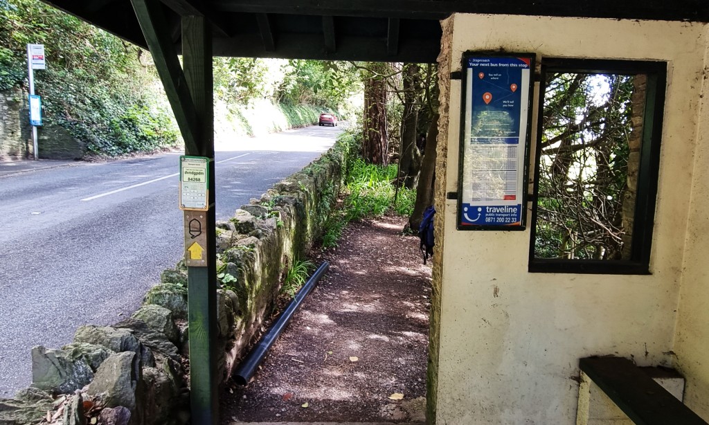
Resuming the path, I was slightly disconcerted to follow it directly through a bus shelter – undoubtedly a first!
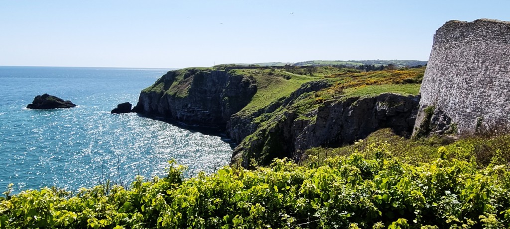
The previous section had been beautiful but, unfortunately, there is now an extended diversion away from the sea, through Stoke Fleming and beyond. The route follows Redlap Lane for roughly two kilometres, until it finally reaches National Trust Land at Little Dartmouth.
We enjoyed this colourful park gate, but I would have preferred a closer view of the sea.

No doubt the extended detour is partly to blame on Redlap House – a seven-bedroomed property in 30 acres of land with its own private cove. Back in 2013 it was on the market for £7.5m.
We lunched somewhere above Willow Cove, on a rickety bench with a view over the mouth of the Dart Estuary. A pheasant came to look at us while we enjoyed our sandwiches.
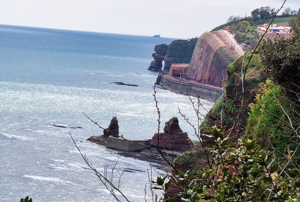
From here, the daymark on Froward Point above Kingswear is particularly prominent. Built in 1864 for the Dartmouth Harbour Commissioners, this octagonal beacon, 24 metres high, is a navigational aid for those at sea.
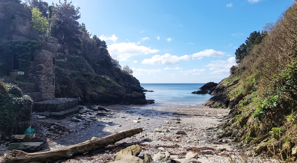
Descending to Dartmouth Castle, we stopped for a quick look round.
The approach is through an area called Sugary Green, just above Sugary Cove. There is a green plaque stating that it is officially a Town or Village Green, so protected against future development.
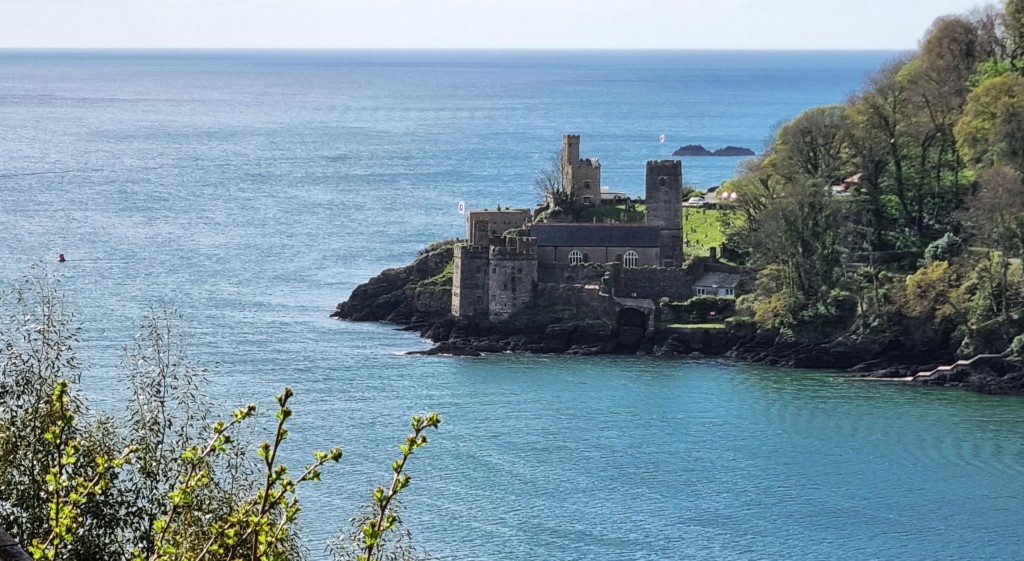
The Castle was built to protect Dartmouth Harbour, initially in the Fourteenth Century, but it has been expanded and updated many times since. There are corresponding fortifications on the Kingswear side of the Dart.
Just behind sits St Petrox Church. It may have been even older than the Castle, but was rebuilt completely in 1641.
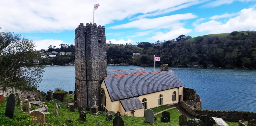
From here, the view across to Dartmouth features the huge Britannia Royal Naval College, built halfway up the hillside between 1902 and 1905. George V, George VI and Prince Philip were all naval cadets here.
It looks impressive from a distance, but appearances can be deceiving. A 2023 Ofsted inspection uncovered dire conditions inside:
‘For the second time in 2 years, inspectors judged the infrastructure at an establishment inadequate. At BRNC, there are long-standing failures to maintain and refurbish training areas and OCdt accommodation. This has resulted in some of the worst infrastructure that inspectors have ever seen. Window frames in current…accommodation blocks are rotten and windows are boarded over. Mould is growing in bedrooms, toilets and showers….Consecutive command teams have been unable to fix problems identified at the previous inspection because they are not given funds to do so. Consequently, the infrastructure has deteriorated further. Several areas are now out of bounds because they are unsafe for use.’

Some ugly building work was under way between the Castle and the approaches to Warfleet Creek. It is sometimes hard to understand how planning permission can be granted for residences that spoil a beautiful view for everyone else.
Shortly after Warfleet Creek we passed this plaque, reminding us that George Parker Bidder, ‘the calculating boy and famous civil engineer’, lived here from 1860 to 1878.
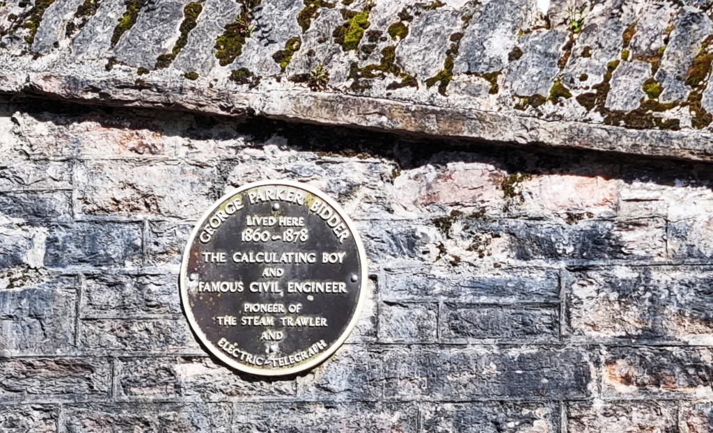
It turns out that, as a boy, Bidder was exhibited by his father at local fairs where people paid to see him show off his numerical talents. Eventually he was rescued and became a prominent railway engineer.
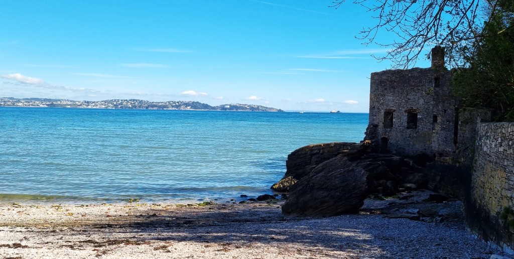
Next, we encountered the ruins of Bayard’s Cove Fort, an early Sixteenth Century blockhouse, designed to provide a last line of defence against vessels that succeeded in passing Dartmouth and Kingswear Castles.

On the way into the Town centre, we noticed another plaque celebrating the life of Sir Humphrey Gilbert (1539-83), the colourful Elizabethan explorer and adventurer. He was born at Greenway, a little further up the Dart, where Agatha Christie later lived.
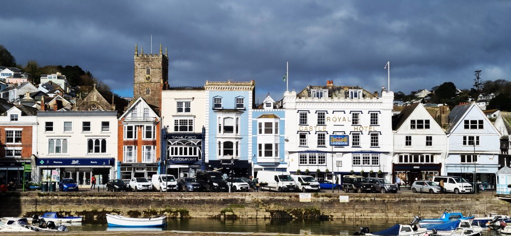
Some 5,000 people live in Dartmouth. Although there are some 16th and 17th Century buildings, much of the Town was built far later, on what were formerly mudflats.
The area’s extensive naval history dates back to the days of medieval privateers. During the steam age, many inhabitants lived in slums, scraping a livelihood loading by coal onto ships.
Feeling tired, we confined ourselves to walking along the main thoroughfare, before catching the ferry back over to Kingswear and returning to Brixham the way we had come.
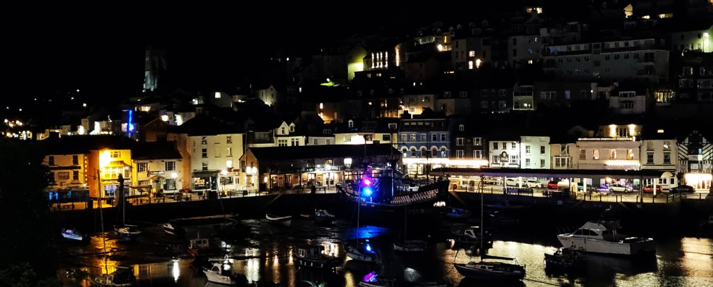
Back in Brixham, we stopped off in the New Quay Inn for a well-earned drink. There was a wake concluding upstairs. Dinner was at home.
Day 2: Kingswear to Brixham
We had an hour longer in bed, catching the 09:36 departure to Kingswear.
It was cooler, occasionally breezy, but with frequent sunny spells.
Almost from the outset, this section is hard going – officially described as ‘strenuous’ in the guides. The first eight miles or so are compensatingly stunning, but the approaches to Brixham are more nondescript.
We had an excellent view of Dartmouth Castle as we set off round the headland, soon finding ourselves climbing through Warren Woods. There is a plaque here dedicating this section of the coast path to the memory of Lieutenant Colonel Herbert Jones, VC, OBE.
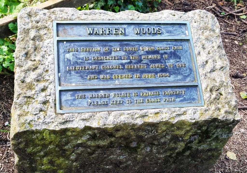
He was killed in action at the Battle of Goose Green during the Falklands War and posthumously awarded the Victoria Cross.
Though born in London, the family moved to Grange House in 1940 and Jones intended to live here after his retirement.
The path runs down to a narrow cove, Mill Bay, which has what seems like a small fortification built into the left hand side. According to the listing, it is in fact a ‘disused limekiln converted into a watermill and boathouse in the form of a sham castle’.
The next wooded section is beautiful and it brought us high above a secluded cove where two canoeists had drawn up their boats.
We stopped for coffee nearby, again looking back over the mouth of the Dart Estuary. (Our research failed to uncover any open cafes en route, so we had brought our flasks along.)
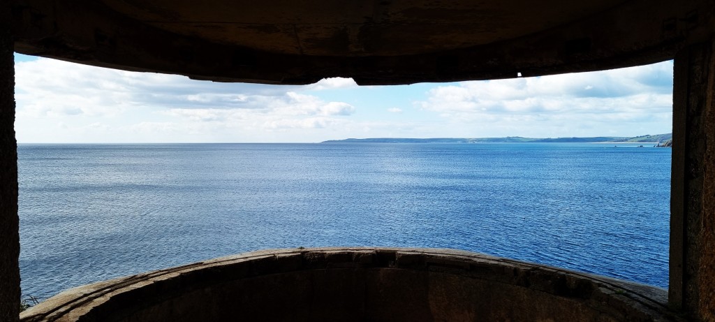
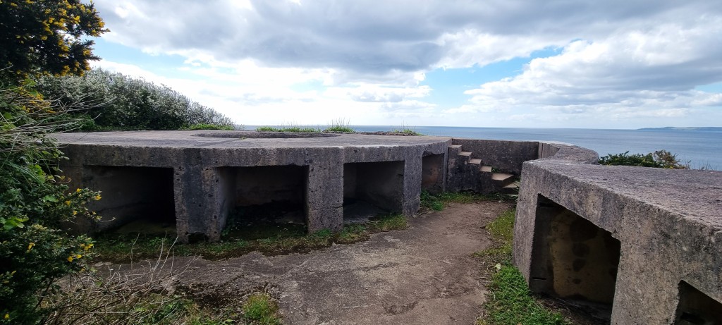
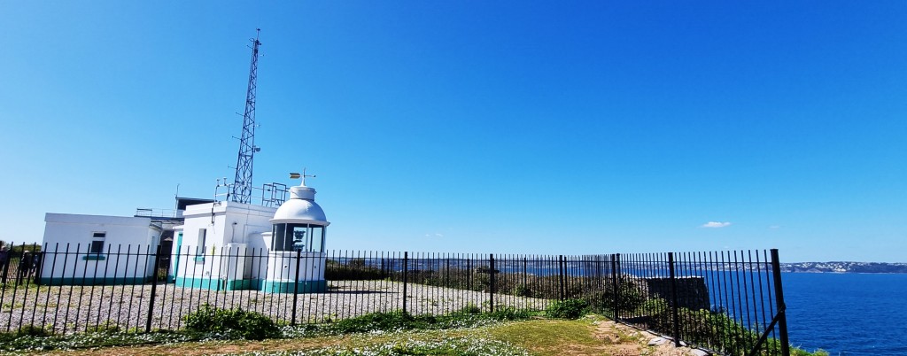
Soon we reached the National Coastwatch lookout alongside the fortifications of Brownstone Battery on Lower Froward Point. The lookout occupies the former battery observation post and there is an interesting visitor centre adjacent.
The Battery was constructed in 1940. Two six-inch guns and two searchlights were installed. Some 230 soldiers were stationed here from 1940 to 1942, but thereafter the Home Guard assumed responsibility.
As we left the fortifications behind, the Mew Stone hove into view once more, now much closer. And we began to see more patches of the vivid yellow Broom we had remarked the previous day.
(Tracy had to tell me that it was Broom – I thought it was Hawthorn!)

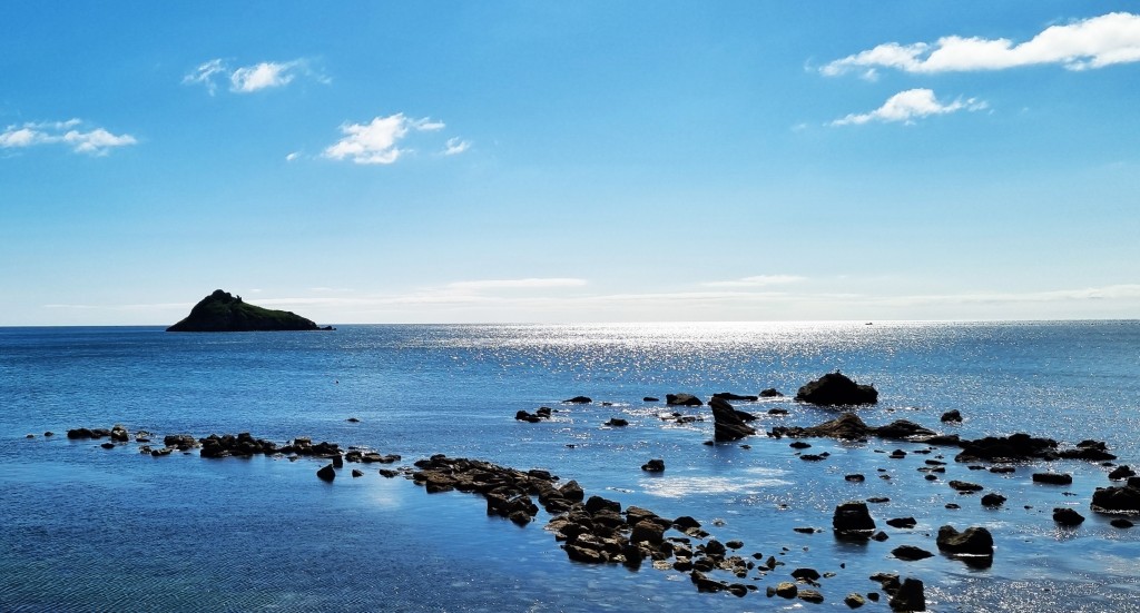
By the way, this isn’t the first Mew Stone we have encountered – there was an earlier one just off Wembury Point. This specimen is the larger of several jagged islets – two of its smaller companions are called Shag Stone and The Dragon’s Tail.
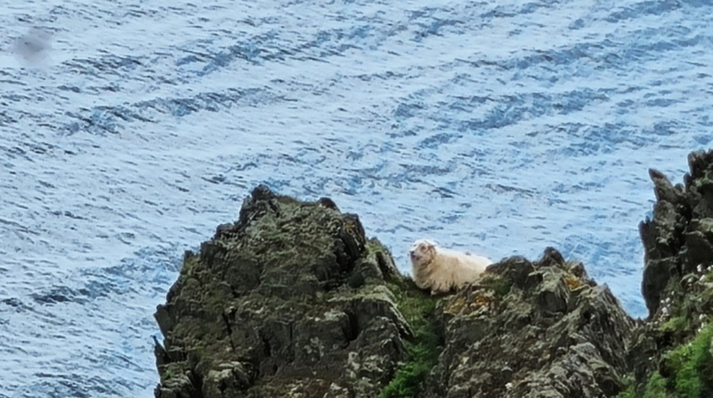
Continuing above Old Mill Bay, we saw a few sheep engaged in some risky rock climbing.
The cliffs in these parts have been carved into green fingers that stretch out into the sea. There is also this prototype for Durdle Door.
Soon we were abreast of Coleton Fishacre, a National Trust property with a tropical garden that stretches down to the sea.
It was originally the home of Rupert D’Oyly Carte (1876-1948), who owned the Savoy Hotel and the D’Oyly Carte Opera Company. He spotted the location while sailing along the coast with his wife, but the house wasn’t built until some 20 years later, the couple moving here in 1926.
We stopped to chat with a few of the visitors to the garden, who were enjoying the view from a lookout point. Shortly afterwards, we found a vacant bench where we had our picnic lunch.
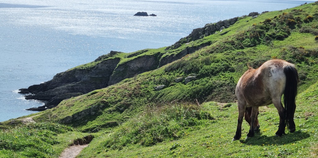
When we resumed, the cloud cover had increased, and it grew thicker as the afternoon progressed. There were still occasional sunny spells, including this one, while we passed a couple of wild ponies cropping the grass close to the cliff edge.
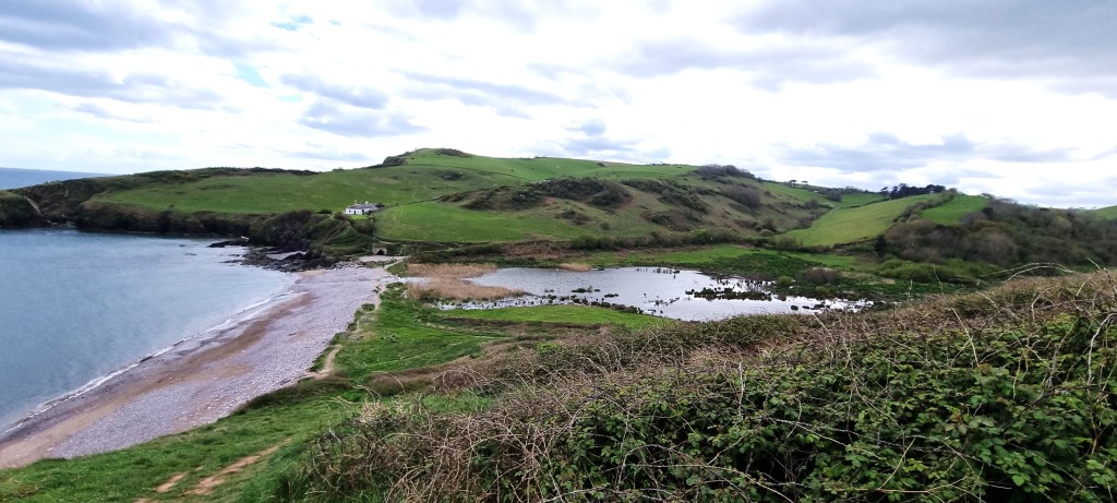
Shortly after two, we reached Man Sands, where there are three whitewashed coastguard cottages. They were allegedly built by Napoleonic prisoners of war, but the National Archives hold plans for their construction dated 1845.

The area of wetland behind the beach is enjoyed by ducks, waders and grass snakes.
The climb up from here to Southdown Cliff is particularly tough and, on top of all the preceding climbs, exhausted us completely.
We paused for a while to catch our breath, while I wondered what I could see floating some way out to sea. It turned out to be a pale blue container ship.
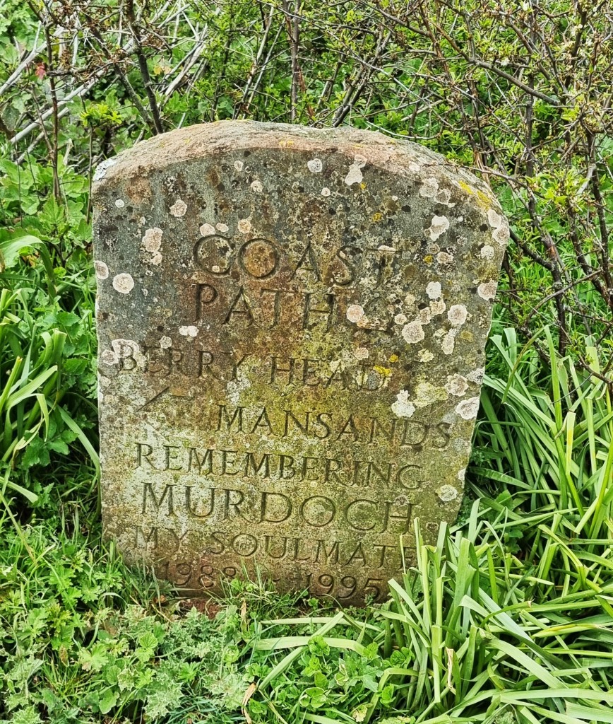
Shortly afterwards we passed this touching gravestone celebrating a canine called Murdoch.
As we closed in on Sharkham Point, the landscape behind contrasted sharply with the rather less beautiful prospect ahead.

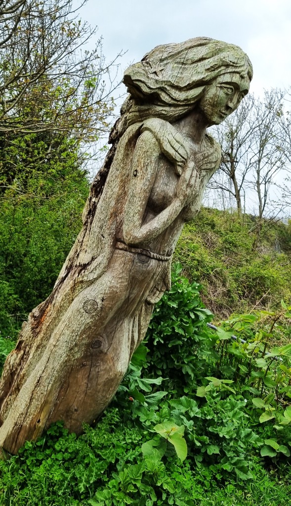
We enjoyed this wooden sculpture though.
Arriving at Berry Head, we only just missed the opening hours of the fabled Guardhouse Café, where we had hoped to find celebratory coffee and cake.
So we looked rather disconsolately round Berry Head before making the final descent into Brixham.
We passed this stone containing a line from ‘Abide With Me’, written by Rev Henry Francis Lyte in 1847. He had been attached to a Brixham church since 1824, but had contracted tuberculosis and was about to depart for warmer climes. He died in Nice later the same year.
Soon afterwards we reached the Lido, otherwise known as Shoalstone Seawater Pool. It was built here in 1896, on the site of a natural rock pool, and further enlarged in 1926.
I very much enjoyed the Time and Tide Bell on Breakwater Beach, installed in 2023, which is tolled by the sea. There are similar installations at Appledore and Par.

Arriving outside the Torbay RNLI Station, barely metres from home, we were waylaid by an enterprising young woman seeking a financial contribution. I pleaded that we had just walked eleven miles!
We finally made it home by 16:30, extremely tired.
That evening we dined at the Prince William, a modern gastropub on the harbourfront, close to our cottage. While we ate our steak and ale pies with cauliflower cheese, four boatbuilders conversed loudly a few tables away, displaying a Tourette’s-like addiction to the f-word.
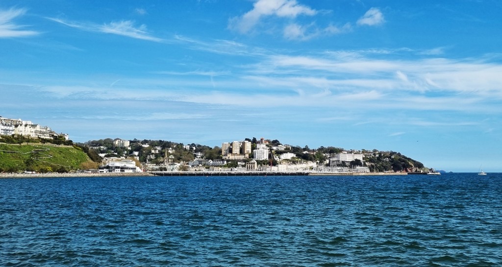
Day 3: Brixham to Torquay Harbour
By this stage I was in some need of a gentler walk, having developed a corn on the side of my fourth toe and a painful blister on the end of my fifth. Today would be given over to a predominantly urban seaside landscape
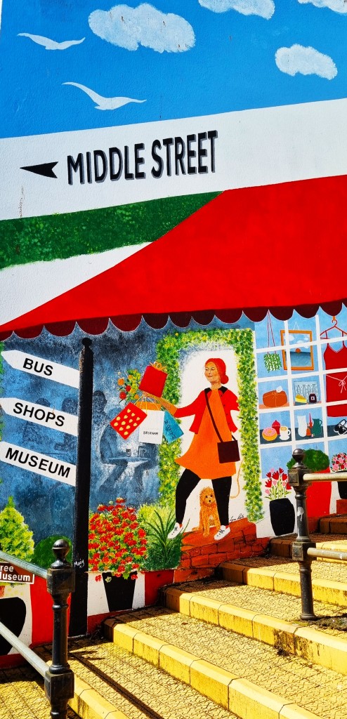
We began with a decent Breakfast Hash from Port Espresso on Middle Street, getting under way by around 10:30.
As we left Brixham, she sky was predominantly blue, with just a handful of clouds sitting in the middle distance.
Once we arrived at Fishcombe Cove, I began to recognise elements from a walk I had taken while staying in Torquay, circa 1987. I also recalled neighbouring Churston Cove, which looked picturesque in the morning sun.
We entered a lengthy wooded section, running alongside Churston golf course, which emerged on to the equally beautiful Elberry Cove.
On one side of the beach sit the ruins of a bath-house, built for one of the Lord Churstons at the beginning of the Nineteenth Century. In 1879, a subsequent Lord Churston brought the Prince of Wales ashore here, from his schooner ‘Hildegarde’.
Before long we had reached Broadsands Beach, with its long line of beach huts and a viaduct just behind. We stopped for coffee at the Venus Cafe, and spent some time watching the world go by. This included a man with a walking stick propelling himself backwards along the beach.

Resuming, we fell into conversation with a couple from Reading who were walking to Babbacombe, having completed the difficult stretch from Kingswear to Brixham the previous day.
They used walking poles, carried their clothes for the week in their rucksacks and were staying overnight in pubs along the way. Not for the first time, we discussed the pros and cons of poles.
We saw them again periodically throughout the day.
Almost immediately we reached a small arched bridge underneath the railway which I had photographed in 1987. An old silver lamppost was framed by the arch, with the blue sea and sky in the background. The enlarged photograph has been a fixture in our hall for almost 30 years.
The view was similar, but the lamppost had disappeared. Meanwhile, the Waterside Holiday Park, just behind, seemed to have expanded considerably.
At Goodrington Sands we made use of the Goodrington North Public Toilets, mercifully open to all comers, although the paraphernalia for collecting payment was installed.
Torbay Council has retained the annoying policy of charging people to urinate and defecate in privacy. Indeed, they demand an exorbitant 30p a go.
The Council claims that the charge is levied to cover the cost of a £1.7m modernisation programme. Why must public toilets pay for themselves? Will they revert to being free when the modernisation programme is complete?
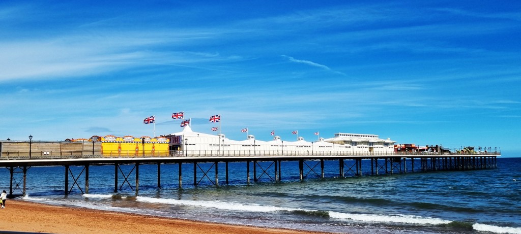
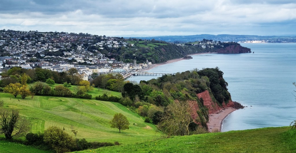
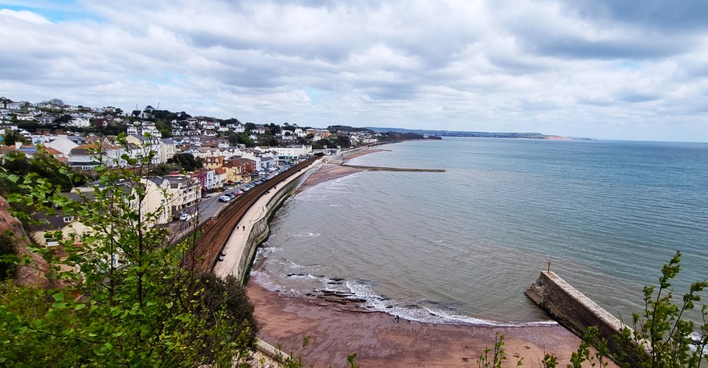
Having rounded Roundham Head, we arrived in Paignton and the beginning of almost uninterrupted urban English seaside, running all the way to Torquay Harbour.
Paignton was formerly the small fishing village of Paington, until a new harbour was built, just as Queen Victoria ascended the throne. The railway line arrived two decades later.
A pier, 240 metres long, was opened in 1879. It was flying multiple Union Jacks in someone’s honour as we passed by.
The libidinous American sewing machine magnate, Isaac Merritt Singer (1811-75), lived here for the last few years of his life with his final wife. He commissioned Oldway Mansion, but died before it was completed.
Sue Barker was also born in Paignton.
We admired a row of identical former villas next to the Esplanade Hotel, each painted a different pastel shade. I believe this is the former Adelphi Terrace, constructed in 1887.

We took our lunch overlooking Preston Sands, where the predatory seagulls seemed extremely keen to share it.
The walk concluded with the long drag through Torquay to the Harbour, an area that has been blighted by the closure of the Pavilion, which opened in 1912 but has been closed since 2013. A restoration project proceeds at snail’s pace.
One of Torquay’s attractions is Kent’s Cavern, a cave system that was inhabited in prehistoric times. It is privately owned and was recently sold to a hotel chain.
And, of course, Torquay is known universally as the real-life location of Fawlty Towers, inspired by the Gleneagles Hotel, since demolished.
The house where Agatha Christie was born has been demolished too.
Other former Torquay inhabitants include Peter Cook and Larry Grayson.
We said farewell to the couple from Reading, who had overtaken us while we were at lunch. Then we had ice cream.
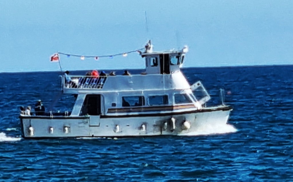
We had hoped to catch the Western Lady Ferry back across to Brixham, agreeing that the experience would be bracing but ‘good for the blog’. Sadly, it wasn’t running, presumably because of unfavourable winds out in the Bay.
These didn’t cause the cancellation of a smaller ferry, plying between Torquay and Paignton, but it was pitching about a fair bit, so it was probably wise for us to remain landlubbers.
Having resigned ourselves to the bus back to Brixham, we first had to fork out 30p each to empty our bladders. It was a dispiriting end to the day.
Once back home, I was fully intending to pop my blister, but Tracy forbade this, so I was forced to continue with it fully inflated, though protected by a plaster.
We dined that evening at La Petite Maison, which was very pleasant and restored my equanimity.
Day 4: Torquay Harbour to Shaldon
We caught the 09:20 number 12 bus to Torquay and set off about an hour later. It was another lovely morning.
Determined to avoid paying another 30p to the skinflint council, we were fortunate to find an alfresco setting with fine views somewhere in the vicinity of London Bridge Arch, another prototype of Durdle Door.
Above Daddyhole Cove we came upon our second National Coastwatch Institution of the week. Two men trimming the undergrowth kindly stepped aside to let us pass.
Descending by the Headland Hotel, we found ourselves overlooking Meadfoot, where our good friend Miriam had honeymooned in 1984. I tried my best to make some decent photographs that would evoke pleasant memories for her, most of them featuring Thatcher Rock, just offshore.
As we joined the Meadfoot Sea Road, we had to make way for a class of young men wearing boots and high viz jackets who were straggling from the beach to their coach.
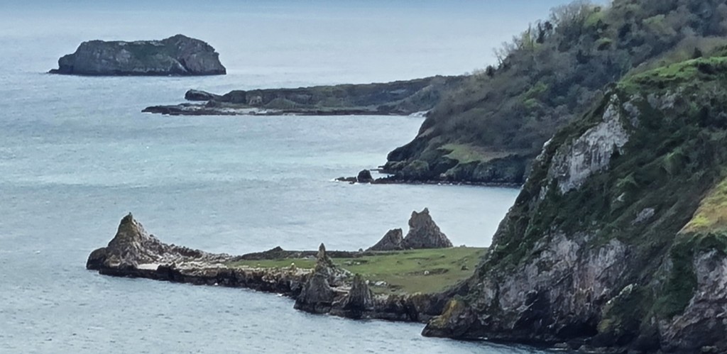
We followed a second coast road uphill, before heading off on to a path that took us to Thatcher Point, the closest spot to Thatcher Rock, only to be returned to the same road as it headed round to Hope’s Cove.
We didn’t take up the guide book’s suggestion that we explore the Hope’s Nose headland. Small deposits of gold were discovered here in the 1890s, but the veins were too small to justify a mine.
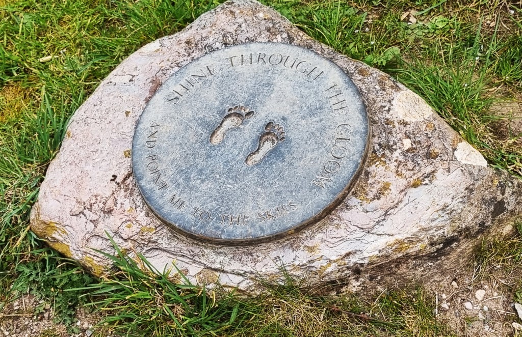
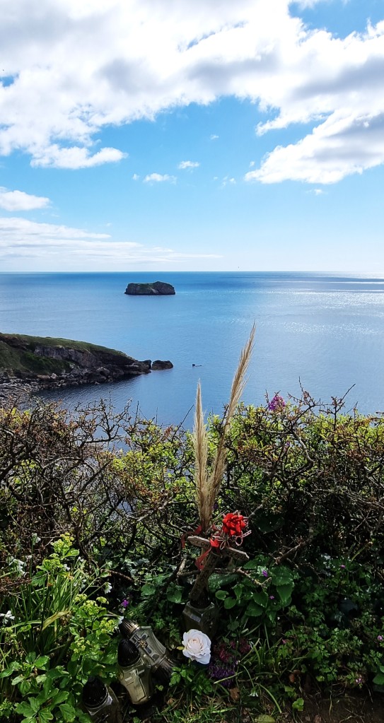
We found a small home-made memorial here, in a beautiful spot overlooking Mil’s Rock.
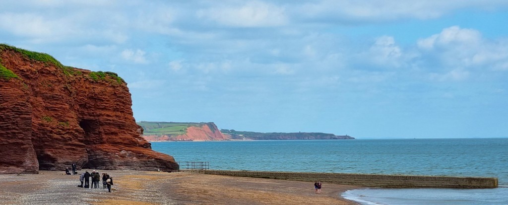
Looking ahead, we could see the transition from limestone to sandstone cliffs, a final limestone promontory – Long Quarry – in the foreground.
We didn’t make the steep descent to Anstey’s Cove, both because of the subsequent ascent and because we couldn’t establish whether the café was open!
Entering woodland, we noticed this fine old sign.
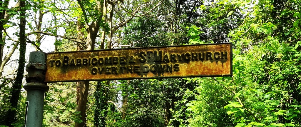
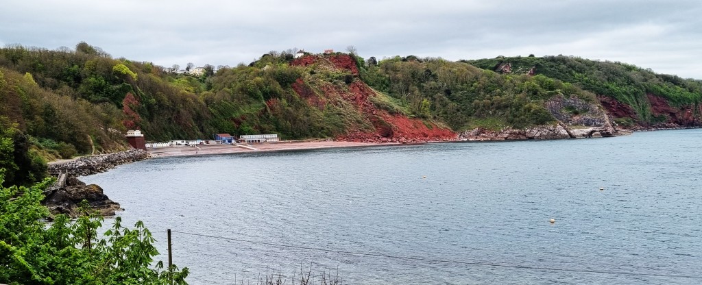
The route avoids built-up Babbacombe almost entirely, descending past Long Quarry Point to the Cary Arms and, beyond it, Babbacombe Beach.
We had hopes that the building we could spot at the far end of Oddicombe Beach, end on to Babbacombe Beach, was a café, but Tracy asked two local women to make sure. ‘Very good coffee’, we were assured.
On reaching Three Degrees West, we discovered that it couldn’t offer much in the way of cake, and wasn’t permitted to serve us coffee in our collapsible cups if we were drinking from them on the premises. Maybe they thought we would lower the tone.
The people at the next door table were discussing enemas.
Still, my need for coffee was great, and there was no viable alternative nearby.
We retraced our steps to the point where the Coast Path left the beach, and began the first of many climbs in this section, which is rated ‘severe’ all the way into Shaldon.
This first climb runs alongside the Babbacombe Cliff Railway, a funicular railway completed in 1926 and operated initially by the Torquay Tramway Company. The track is 200 metres long and there are two cars, each designed to carry 40 standing passengers.

However, the service was out of action as water had damaged an electrical component in the engine room. Persistent heavy rainfall was blamed.
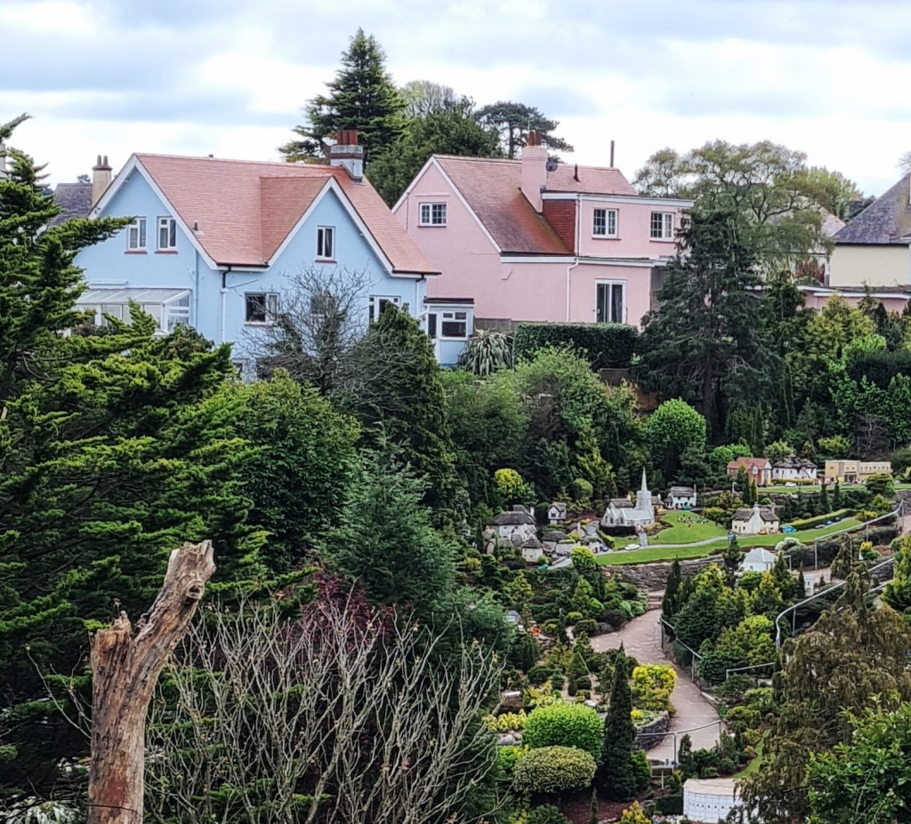
In any event, our route passed underneath the railway and across a steep green space before passing Babbacombe Model Village.
Soon we were heading along Petitor Road, past the Golf Club and several large residences.
Eventually the road terminates, not far from the cliff edge, continuing as a footpath through greenery.
Here we met two men, one of whom engaged us in conversation for a good ten minutes or so. He was a self-styled ’Big Cat Investigator’ who, after regaling us with lurid tales of pumas and black panthers residing in South Devon, kindly passed on his card.
His website suggests there may be at least 1,000 big cats, living and breeding in the wild, here in Great Britain. He believes most are descended from pets, released during wartime rationing or following the passing of the 1976 Dangerous Wild Animals Act.
I said I would mention our interaction here, but he was extremely concerned that I might inadvertently frighten other walkers and tourists away.
On no account must I imply that any big cats lived in the vicinity
Spotting the logical inconsistency here, I lost interest and, as hunger asserted itself, much more focused on identifying a suitable lunch spot.
We found an acceptable bench soon afterwards, above Petit Tor Beach, looking back on Long Quarry Point and Hope’s Nose behind it.
It was with some difficulty that I restrained myself from peering behind us each time there was an unexpected rustle in the undergrowth!
I also added a second plaster to my suffering toe.
The next section was heavily wooded though with several steep ascents and descents – not good for anyone with an overactive imagination after the conversation we’d just had.
We passed above Watcombe Beach – only recently reopened after storms destroyed the path down to it – and another Valley of Rocks, though the rocks here are now rather obscured by woodland.
It was much less wooded in Victorian times, when it formed part of the estate attached to Brunel Manor. Isambard Kingdom Brunel (1806-59) intended this as his retirement home, except that he died before it could be constructed.
More of him below.
Watcombe was the first possible ‘out’ in case my toe was problematic, but I was alright to press on.

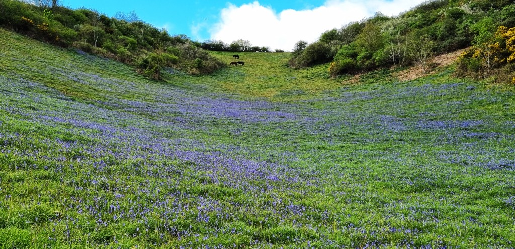
We passed some pyramidal wild orchids and then crossed a sloping field full of bluebells, with horses grazing just above.
By Maidencombe, I was quite tired, but dissuaded myself from using this ‘out’ because the route to the bus stop lay up a lengthy road called ‘Steep Hill’.
I didn’t feel any great urge to visit either the Beach or the Thatched Tavern, preferring to press on.
As we passed two younger people – late twenties perhaps – the man asked ‘are you alright’, as if doubting our capacity to continue. Tracy disputes this interpretation, so I must have been feeling vulnerable and oversensitive as I struggled with my increasingly painful toe.
The section from here into Shaldon was rather less attractive, the path running some way above several small rocky coves and beneath the nearby Teignmouth Road.
By 16:30, after what seemed interminable ups and downs, we arrived above Shaldon Pitch and Putt, with an excellent view of Ness Cove Beach and Teignmouth beyond.
Shaldon is Teignmouth’s smaller neighbour, once known as West Teignmouth.
It claims that, originally, the deep water channel along the Teign River was on the Shaldon side, and hence it was a lively port and shipbuilding centre. But then that side of the River silted up, while the other side deepened, causing the maritime traffic to switch across to East Teignmouth.
Limping down to Marine Parade,(well I was limping, anyway), we made our way – via the pleasingly free toilets – to the bus stop on Bridge Street.
We had a lengthy wait for the Number 22 bus. But we were soon joined by a lady from Torquay who had been to visit her sister’s grave. She had two extremely friendly rescue dogs called Jasper and Pip respectively. While she told us her life story, Pip jumped on to my lap.
The 22 wound through all the more and the less salubrious parts of Torquay before finally depositing us at Paignton Bus Station, where we caught the 12 back to Brixham.
Dinner was at home.
Day 5: Rest day
After enjoying a late breakfast, we strolled round Brixham, window-shopping and reprising some of its best features.
Towards midday we wandered along the breakwater, for a different view of the Town and Harbour. At the end we encountered an ex squaddie, translating for two listeners some of the finer points of military slang.
He revealed that ‘four clicks’ means ‘four kilometres’, while ‘I’ve got your six’ means ‘I’m covering behind you’. Who knew?
After a while we wandered back again, and then along to Berry Head, where we were fortunate to find a vacant outdoor seat at the Guardhouse Café, at which to polish off two of their lovely cream teas.
Then we looked around Berry Head more carefully. We sat for a while in the hide, watching seabirds on the cliff below – there are mainly guillemots, razorbills and kittiwakes here.
The lighthouse is apparently one of the shortest in the UK – standing only five metres – but also one of the highest, at 58 metres above sea level. It has been here since 1906.
That evening we visited the Liberty Tea Parlour and Cocktail Bar, where we each enjoyed a Fish Town Gin Fizz. Amongst the clientele we spotted an elderly man sporting a Rod Stewart haircut. It wasn’t the man himself!
Later we moved on to Beamers Restaurant for dinner. There was a large party in, so it was rather noisy, but enjoyable nevertheless. We were the last to leave and enjoyed a chat with the friendly staff.
Day 6: Teignmouth to Starcross
Given the toe, we discussed the possibility of finishing for the week at Teignmouth and having two rest days. I decided that I wanted to get at least as far as Dawlish, so we set out again on Sunday morning.
Changing at Paignton Bus Station, now so familiar, we caught the 22 service back out to Shaldon. The journey was enlivened by the company upstairs.
The man sitting behind us, on his way to Exeter, gave us a running commentary on some of the highlights along the route. Meanwhile, I explained to another gentleman, who was leading a small party of walkers from Babbacombe back to Torquay, that Tracy is a stickler for walking the coast path only in the right direction!
We agreed that, for left-handers like me, it may be more natural to walk the opposite way, with the sea on one’s left rather than on one’s right. Perhaps I should turn round when we get to Poole!
From Shaldon we crossed to Teignmouth on the tiny ferry, dodging the small yachts racing all around us. There is a bridge, slightly further up the Teign, should the ferry not be running.
By the Fourteenth Century, Teignmouth was Devon’s second port, after Dartmouth. It became an important centre for cod fishing off Newfoundland, where the menfolk were based for most of the year, as well as for shipbuilding, smuggling and local privateers.
But tourism was already gaining a foothold by the end of the Eighteenth Century, well before the arrival of the railway in 1846.
Fanny Burney was a frequent visitor, recording that she entered the sea here in 1773. John Keats visited in 1818, completing ‘Endymion’ here.
Other sometime local residents have included Charles Babbage, Clive Sinclair and Jonathan Edwards.
It was roughly 11.30 when we set out along Teignmouth’s Promenade, past St Michael’s Church and then beside the railway line to Holcombe Beach.
We stopped for coffee at the Salty Dog Kiosk. It was advertising free cake which, incredibly, I turned down!
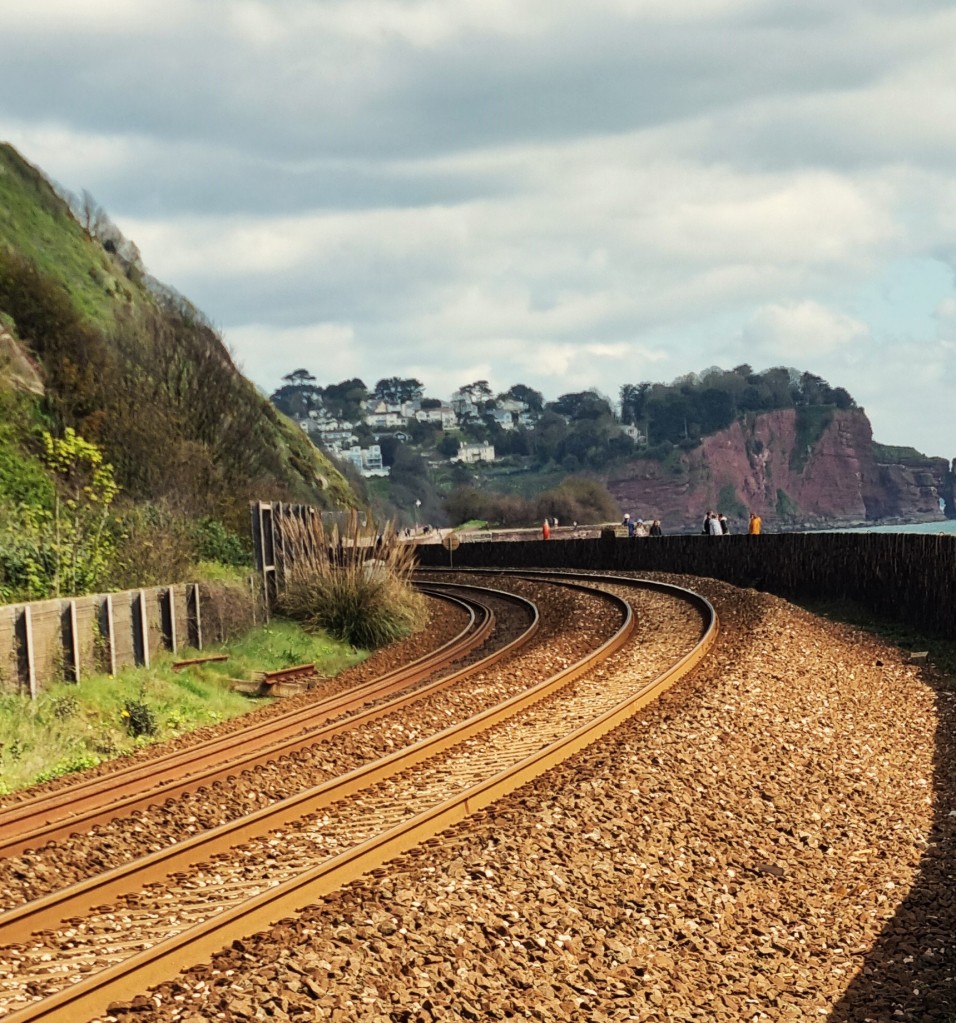
The path took us up the steep hill to Holcombe and then on round to Dawlish. The Parsons Tunnel North Portal Project, designed to shelter the railway line from falling rocks, is spoiling the view somewhat.
Just above Dawlish, we talked with a couple who were also walking the coast path, but had been forced to repeat this section because their previous attempt was thwarted by stormy weather earlier in the year.
The cloud was now drawing in, so we didn’t really see Dawlish at its best. It too became fashionable at the turn of the Nineteenth Century. Notably, Jane Austen holidayed here in 1802, complaining of the ‘particularly pitiful and wretched library’.
The seafront is dominated by the railway, the station being adjacent to the beach. The damage caused by storms and erosion has caused perennial problems since 1846, so concrete is predominant.
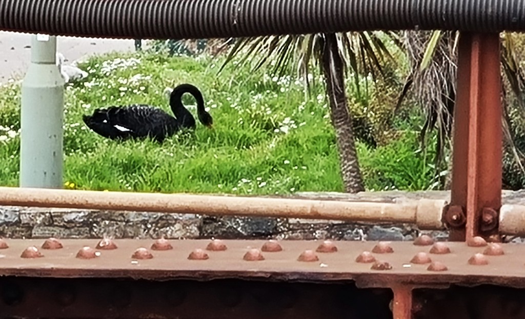
Dawlish likes to advertise its black swans, imported from Western Australia. We caught sight of one as we passed by.
We had our lunch sitting on a breezy bench on the approaches to Dawlish Warren, shortly after Langstone Rock.
Just behind us was a board dedicated to Brunel’s ill-fated Atmospheric Railway, which propelled carriages by means of changes in air pressure. It began operating along this stretch in September 1847 but, after running into technical difficulties, was abandoned in January 1849.
This final section of the walk, from Dawlish Warren, is also part of the Exe Estuary Trail. It runs 16 miles to Exmouth on the other side.
Confusingly, the coast path does not venture on to the Warren itself, which extends a spit of mud and sand almost all the way across to Exmouth, but follows Dawlish Warren Road north, past innumerable caravans and chalets.
It took us some time to spot the correct route, amongst the cavorting holidaymakers.
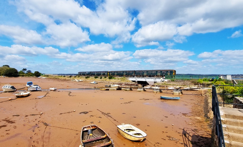
Eventually the road reaches Cockwood. Boats must gain its tidal harbour by passing underneath a bridge carrying the railway line. Just north of here, the coast path joins the A379 for the final stretch into Starcross, with its station and the ferry across the Exmouth.
Starcross is a beautiful name but, apart from hosting one of the pumping stations for Brunel’s ill-fated atmospheric railway project, there seems little else to say about it.
It has a thriving history society whose members would doubtless disagree.
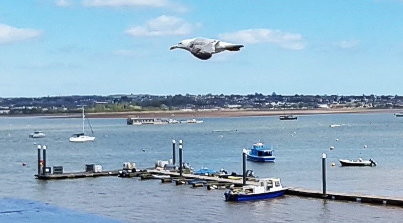
The ferry is moored down there, just beyond the pontoons – and underneath the seagull. It runs only once an hour, between 10.00 and 16.00 (17.00 in high season) and an adult single fare is £6 (cash only). Rather pricy and not too convenient.
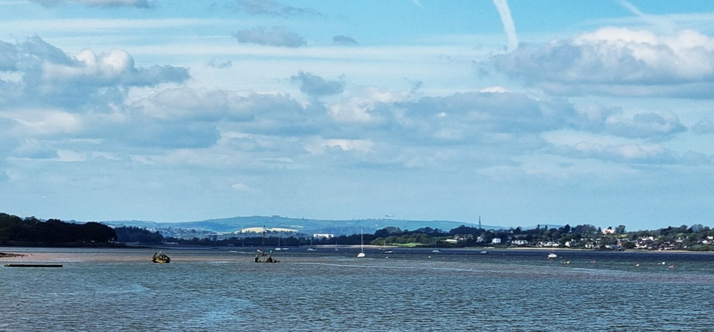
Fortunately we needed only to catch the train back to Paignton Station. We filled the time taking photographs across the Exe and booking our tickets on the GWR App.
There is a certain symmetrical poetry in walking from Torcross to Starcross.
I can’t resist pointing out that my 2018 edition of the official guide wrongly confuses one with the other – I do hope the editor spots that in time for the next edition.
On this final evening, we celebrated with wine, crisps and pizza at home. Unfortunately the pizza landed face down on the kitchen floor, after it had been removed from the oven.

We were too hungry to care.
Next morning we vacated the cottage shortly after nine, returning to Totnes the way we had come.
Our seats on the train back to London had no access to a window. And we were just behind a group of Camborne primary school children who were on their way to London – and therefore in a highly excitable condition!
Still, we reached Paddington on time and were home by mid-afternoon.
TD
May 2024
