
.
We were last on the Coast Path in March 2020, just prior to lockdown, when we walked from Clovelly to Bude.
This trip also felt as though it had been completed just in time. We were fortunate to catch Summer’s last hurrah – and more stringent lockdown restrictions seemed imminent.
Cornwall was busy with holidaymakers enjoying a final taste of freedom, soaking up the last dregs of warmth, compensating perhaps for a sense of chill foreboding.
I had scheduled a full week away this time, giving us greater flexibility to vary our walking timetable. That is particularly helpful in these parts, where short, flattish sections alternate with much more challenging terrain.
As it turned out, we used four of our six non-travelling days, keeping the fourth and sixth as rest days. We travelled down on Friday, so Saturday, Sunday, Monday and Wednesday were dedicated to the Coast Path.
Our four walking days were deployed as follows:
- Day One: Bude to Crackington Haven;
- Day Two: Crackington Haven to Boscastle;
- Day Three: Boscastle to Trebarwith Strand; and
- Day Four: Trebarwith Strand to Port Isaac.
It would have been feasible to condense this 30-mile segment into three sessions but – with the luxury of a full week and after six full months away – discretion seemed the better part of valour.

.
Travel and accommodation
We are now dependent on the GWR main line out of Paddington, having finally exceeded the reach of Barnstaple, our long-time destination, accessed via the Tarka Line from Exeter St Davids.
We travelled into London on a suburban service – the first time for both of us since lockdown was imposed – then took the Bakerloo line through to Paddington. Both train and tube were very quiet.
I had booked us on the 12:04 departure, which ran as a five coach unit to Plymouth before picking up a further five coaches for the Friday afternoon service down to Penzance.
GWR was operating an ‘all places reserved but no seat bookings’ policy. This worked well on the first part of the journey, the only stops prior to Exeter being at Reading and Taunton.
Though we were joined at Reading by a francophone couple who sat on the adjacent table seats, masks suspended from chins for the remainder of our journey.

Numbers in our carriage increased significantly on the way into Plymouth. The additional carriages made relatively little difference, probably because the passengers weren’t redistributed through the full length of the train.
It was a relief to alight at Bodmin Parkway after almost four hours on board, though our mask-wearing marathon continued as we now joined our pre-booked taxi, courtesy of local company Parnells.
They had phoned some hours earlier to inquire if we needed the ‘mobility’ that had been booked in for us. It took me several moments to understand that a ‘mobility’ is a wheelchair-friendly taxi.
The service was speedy and good value at £44, cheaper than Barnstaple taxis by some distance. But our driver, Sayeed, had been given the wrong address, so we enjoyed a brief supplementary tour of Boscastle.
We eventually arrived at 16:40, having worn our masks for six hours, barring the brief lapses necessary to eat and drink.
Because of Covid (and the welcome availability of public transport) we had reverted to our practice of staying at a single location mid-way along our route.
I had chosen a property located close to the coast path at Boscastle Harbour: Pencliffe Cottage lies at the lower end of Old Road and was once part of the stable block of the adjacent Wellington Hotel, originally a Seventeenth Century coaching inn.

Pencliffe is roomy and comfortable, boasting three double bedrooms, a sizeable kitchen, a living/dining room and a small bathroom. It would comfortably accommodate a party of five or six. There is a small seating area outside on the pathway, but no garden – the rear of the house is backed up against the cliff. We paid £564 to rent it for a week via Sykes Cottages.

There were a few minor quibbles: we found the heating in the living room permanently set to 23 degrees centigrade and struggled to turn it off (rebooting the wifi radiator attachment worked eventually). There was no hairdryer, the cooking equipment was fairly basic and I had a daily fight with the chest of drawers in our bedroom.
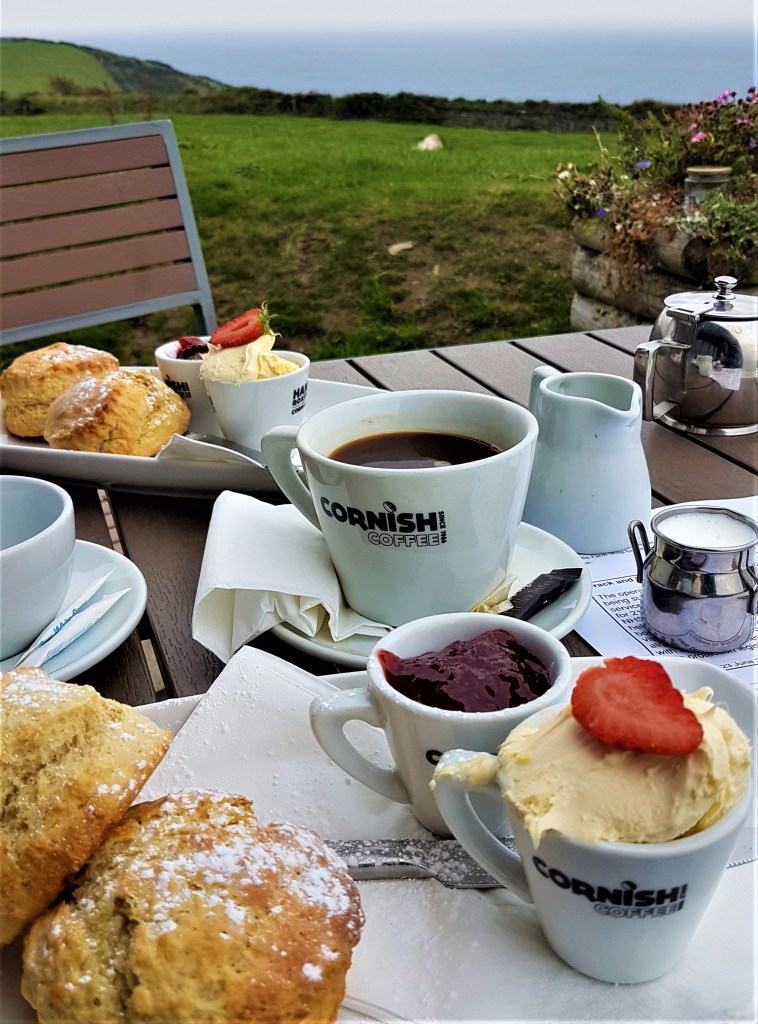
The kitchen was more important to us on this trip since, again owing to Covid, we had decided to self-cater rather than eating out at local restaurants as we have done in the past. I had pre-booked a Sainsbury’s delivery, but could only get one for Saturday evening.
.
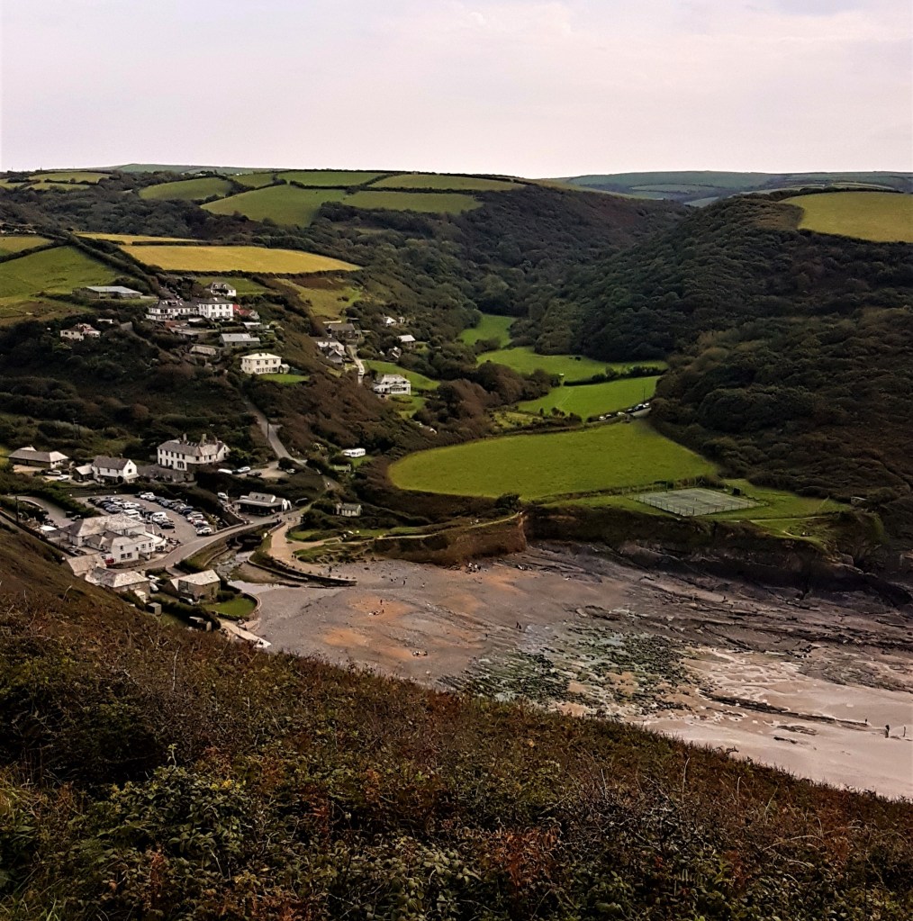
Boscastle, its Harbour and environs
Boscastle itself stands on a hillside, some way back from the sea. It grew up around Botreaux Castle, from which it took its name.
This was of motte-and-bailey construction, dating from the Twelfth Century. It was the seat of the de Botreaux family, elevated to the nobility when William de Botreaux (1337-1391) was summoned to Parliament in 1376 during the reign of Edward III.
The poet and antiquary John Leland, visiting around 1542, was less than impressed. He found the castle in a ruinous state:
‘The toun of Boscastelle lyith apon the brow of a rokky hille by south est, and so goith doun by length to the northe toward the se, but not even ful hard to it. It is a very filthy toun and il kept.
There is a chirch in it, as I remembre, of S. Simpherian. The Lorde Botreaux was lord of this toun, a man of an old Cornish linage, and had a maner place, a thing as far as I could heare of smaul reputation, as it is now, far onworthe the name of a castel. The people ther caulle it the Courte.
Ther cummith down a litle broke a from south est out of the hilles therby, and so renning by the west side of the towne goith into Severn se betwixt 2. hylles, and ther maketh a pore havenet, but of no certaine salvegarde.’
Two roads – imaginatively called Old Road and New Road – slope steeply down to the Harbour, following the route of the River Jordan, which joins the larger River Valency shortly before it reaches the sea.

The Harbour is built around the narrow estuary of the Valency, and probably dates originally from the 13th or 14th Century. Two stone harbour walls were constructed by Elizabethan sailor Sir Richard Grenville in 1584, a generation or two after Leland’s visit. Grenville had been elected MP for Cornwall that year, for a second time.
The only harbour on this stretch of coast, Boscastle became a significant maritime trading centre, linking with Bristol and other ports along the Bristol Channel. Small ships of up to 200 tons would be towed in through the highly dangerous approaches by rowing boats called ‘hobblers’, gangs of men ashore holding them straight by means of ropes.
Trade declined when the North Cornwall Railway, laid from Halwill in Devon to Padstow, was opened in stages during the 1890s, passing through nearby Camelford and Delabole.
There are strong local connections with Thomas Hardy, who was architect for the restoration of St Juliot’s Church in 1870.
While here he formed a relationship with Emma Gifford, the Vicar’s sister-in-law. Their courtship inspired his third novel A Pair of Blue Eyes (1873) and they were married in 1874.
More recently Boscastle has become synonymous with flooding. There were floods here in 1950, 1957, 1958, 1996 and, most notoriously, 2004.
On this last occasion river levels rose two metres in one hour, causing a three metre wave to surge against the buildings, six of which were washed into the sea, while many more were subsequently demolished. Some 100 people were rescued by helicopter but no lives were lost.
We strolled the length of the Harbour more than once, taking socially distanced coffee in the National Trust Café, admiring the very well-appointed youth hostel and the small though enticing Museum of Witchcraft and Magic which was sadly closed.
On our first evening we enjoyed excellent fish, chips and mushy peas, supplied through a serving hatch by Sharon’s Plaice, a murmuration of starlings swirling rhythmically above us as we queued.
Later in the week we joined the throng gathered on the headland to catch the sunset, beautifully serene but with a sense of sadness on perhaps the final day of this rather fleeting summer.

We also visited the tourist shops, finding little of interest, though Boho tried hardest. The Boscastle Pottery was disappointing and the Leather Shop tried in vain to flog belts for thirty quid apiece.
The Spar Supermarket also fell into my bad books. One late afternoon I donned my mask and strolled in for a stamp to send my mother a postcard. I was directed to use the hand sanitiser, only to be told that they couldn’t sell me a stamp because the post office counter was already closed. Absurd.
We used part of our first rest day to complete a figure-of-eight walk taking in Minster Church, the Valency Valley, Boscastle Farm Shop and a brief reprise of the final section of the Coast Path back down to Boscastle Harbour.
We climbed to the top of Old Road, following it round past the war memorial and the site of Botreaux Castle. We followed – but did not cross – the River Jordan (said to owe its name to the Castle’s ‘jardin’).
We came upon the Church hidden in a tranquil copse below the adjacent road. A small priory is said to have been founded here around 500AD by Madryn, a daughter of King Vortimer the Blessed of Gwent and a granddaughter of Vortigern.

On her death she was interred here and later sanctified under the Latin name Materiana (Merteriana). Somewhere around 1150, a new church was built to hold her relics, most likely by William de Botreaux, and tied to the Benedictine monastery at Anjou.
It was repaired and remodelled significantly over the centuries: the Historic England entry refers to a late Norman font, a 13th Century chancel and tower, the latter possibly rebuilt in the late 15th Century, and a south aisle and porch probably added in the early 16th Century.
It was once more extensively restored in 1870, after the roof collapsed, and now supports a Victorian ‘saddleback’ instead.
The churchyard hosts a roost of Greater Horseshoe Bats.
Our old friend Reverend Hawker celebrated it in verse:
‘The Minster of the trees! A lonely dell
Deep with grey oaks, and ‘mid their quiet shade
Grey with moss of years, yon antique cell!
Sad are those walls: The cloister lowly laid
Where passing monks at solemn evening made
Their chanted orisons: and as the breeze
Came up the vale, by rock and tree delay’d,
They heard the awful voices of many seas
Blend with the passing hymn – thou Minster of the Trees.’
The Boscastle Farm Shop is a local institution with a celebrated café. We sat in the garden, admiring the farm’s Red Ruby cows while cramming down our respective cream teas.
The jam jar coffins dotted around revealed that this spot is besieged by wasps in September, and we were not spared as a kamikaze fiend repeatedly tried to end it all in our own small pots of strawberry jam.
Regular readers will be disturbed to learn that there was no opportunity on this occasion to visit any of Boscastle’s three pubs – the Wellington, the Napoleon or the Cobweb – or to sample their beers. I hope normal service can be resumed at some point soon.
.
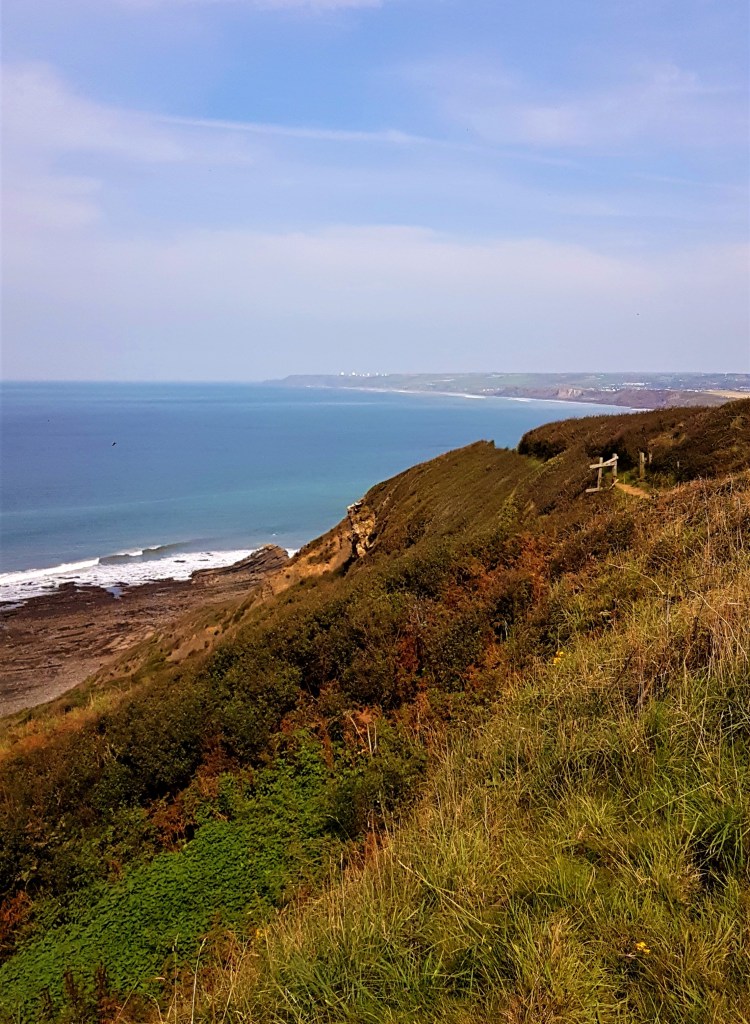
Day One: Bude to Crackington Haven
We walked the ten miles from Bude to Crackington Haven on a fine Saturday, so the path was fairly busy.
We caught the 95 bus, which handily serves the coastal settlements between Bude and Tintagel, from just round the corner. There were few other passengers, mostly walkers, and we reached Bude by 10:00, via our intended destination.
We emerged on The Crescent, close by the Tourist Information Centre, and headed along the Bude Canal in a seaward direction.
(Towards the end of the week we used part of our second rest day to complete a circular walk, following the Canal inland, then breaking for a tasty ploughman’s lunch at The Weir before crossing the fields to take the coast path in reverse, back down into Bude.)
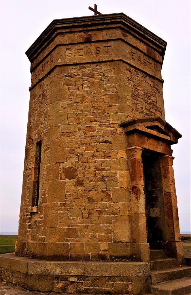
On this occasion we crossed over to Breakwater Road and then headed up the grassy slope to Compass Point. This octagonal tower was built in 1835 for Sir Thomas Dyke Acland (1787-1871), a regular visitor to Bude, by George Wightwick, who modelled it on the Tower of the Winds in Athens.
Referred to locally as ‘The Pepper Pot’, it was supposed to provide shelter for the coastguard. It had to be moved back from the cliff edge in 1900 when threatened by erosion.
This part of the route is relatively flat and, when taken in the right direction, passes initially along the cliff top by Efford Beacon, diverting briefly along the nearby coast road at Upton – where an enterprising householder has set up a bookshop – and then back on to the path proper through the Phillip’s Point Nature Reserve, known for its moths, birds and adders.
There were no grey seals in residence on the cliffs below when we passed by.

Approaching Widemouth Bay, I was disappointed to see so many people, cars and camper vans near the beachfront. There seemed to be some sort of surfing or body boarding event under way. We used the toilets and bypassed the crowded café where I’d hoped to grab a morning coffee.
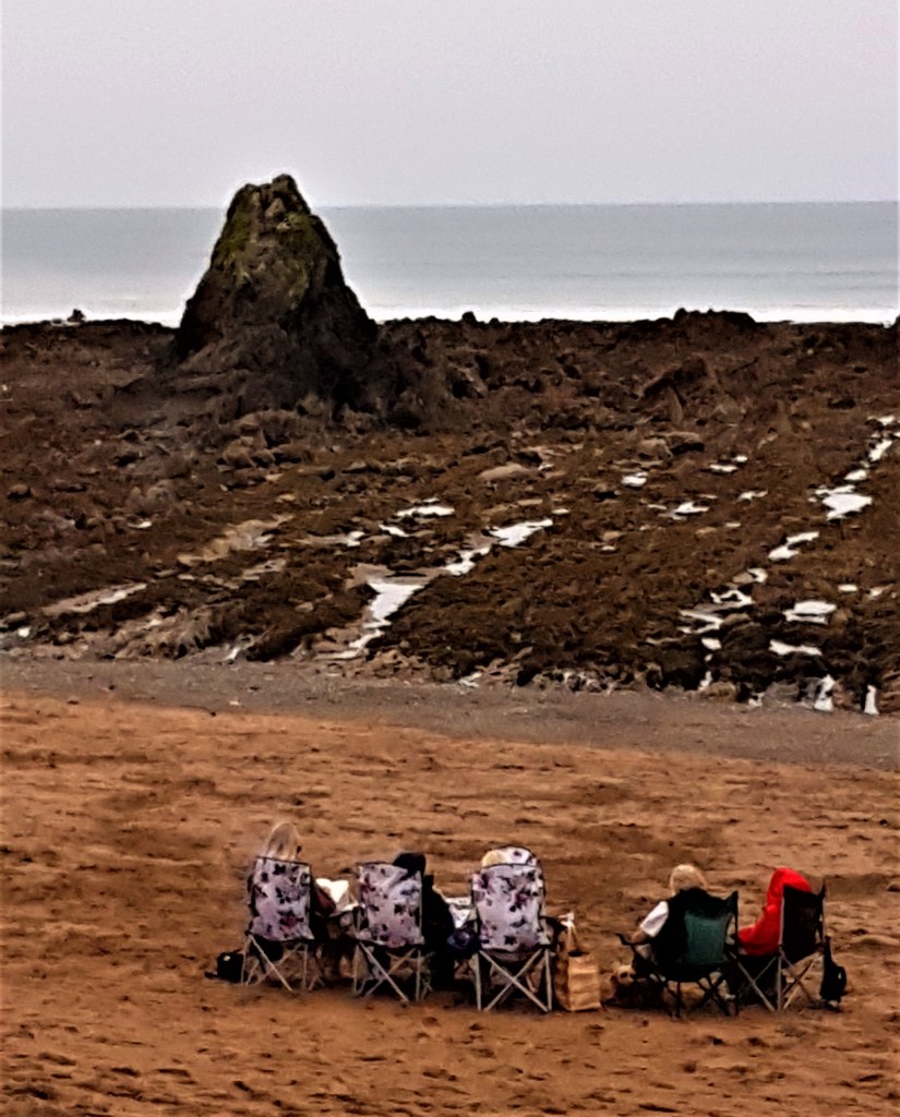
Five women were huddled in deckchairs opposite the Black Rock which gives the southernmost stretch of the beach its name.
We detoured inland alongside the coast road at Wanson Mouth, where erosion has eaten away the path, heading back to the cliff edge at Bridwill Point and then down almost to sea level at Millook, where a stream called Millook Water runs into the sea.
The ‘chevron folds’ in the cliffs hereabouts are apparently a geological wonder. We failed to appreciate them fully, though Millook Haven is undoubtedly a pretty spot.

The path briefly rejoins the road again at Millook, where there are a handful of houses and rental properties, before ascending back up to the cliff top at Raven’s Beak. Then it skirts round the seaward side of Millook Common where there is a Bronze Age barrow.
This general area is known as Dizzard, derived from the Cornish for ‘very steep’. Dizzard Wood is renowned for its lichens and dwarf oaks. Inland are the tiny hamlets of East, West and Old Dizzard, as the clifftop path snakes up from Cancleave Strand past Dizzard Point.
We paused for lunch on a carved bench marked for Bynorth Stream. Close to Chipman Point we came across another that carried the legend ‘Poole 500m’ on its side.

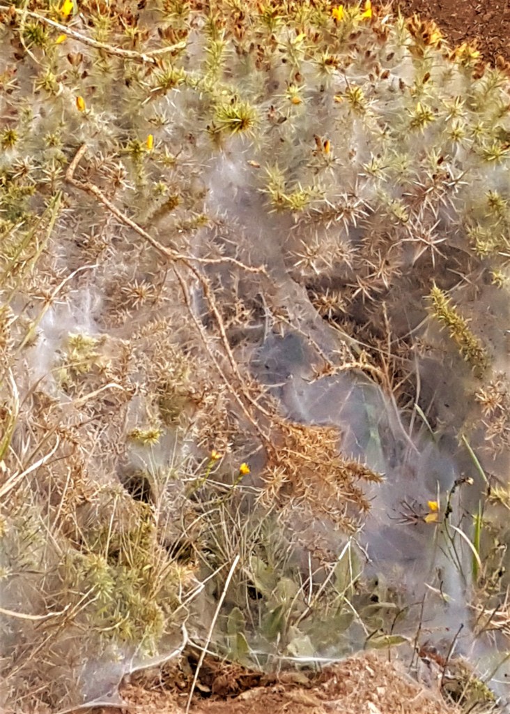
Climbing out of the depths of Chipman Strand, also known as Scrade, we found ourselves in an area where a filigree like dense spider’s web lay draped across extensive patches of heather. A parasite of some kind, maybe?
As ponies grazed beneath us, we entered a section of National Trust land called Lower Tresmorn. Just inland there are the remains of a sunken medieval village, midway between Higher and Lower Tresmorn.
Heading into Cleave there are signs to the effect that something – the kissing gate presumably – has been ‘given in memory of Bob and Joan Wilton of Kenya and Aldbrough St John Yorkshire’.
Approaching Castle Point one can see inland the Fifteenth Century church of St Gennys. An inhabitant of the village – one William Pearse, an 80 year-old farmer – was hanged as a wrecker in 1767.
He was just one of a hundred local people said to have plundered the French ship L’Adaldise which was wrecked on the rocks at Cambeak, a little to the south of Crackington Haven.
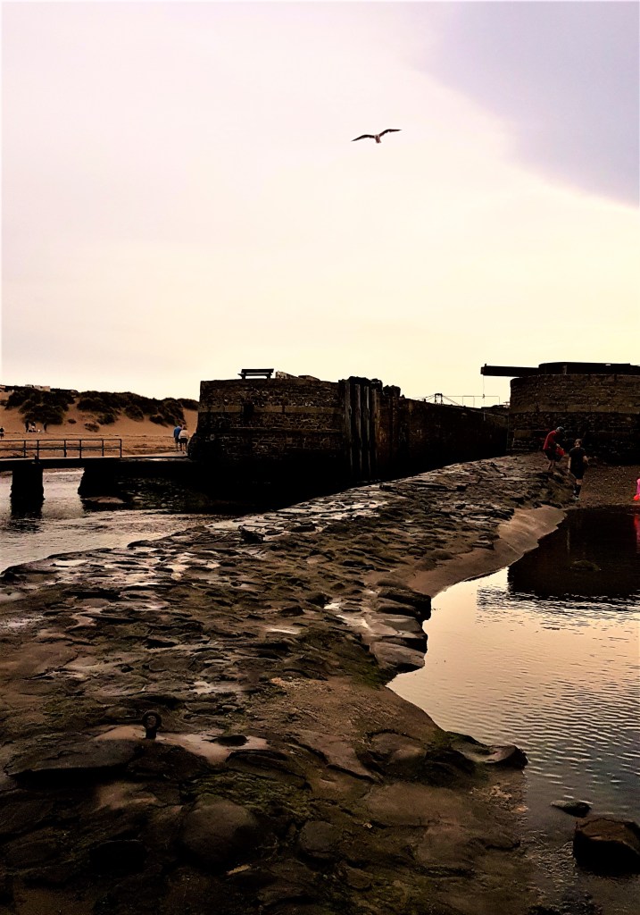
The path descends and ascends once more before finally dropping down steeply into Crackington Haven, which means ‘cove of the little crag’. It was once a small port dealing in limestone, coal and slate, but is now given over to beachcombers, surfers, sunseekers and walkers.

Even in its heyday the boats simply sailed up on to the beach. In 1836 a plan was approved to develop here a 12-acre port and dock complex called Port Victoria, with its own dedicated rail link to Launceston…
We celebrated the end of our walk with ice creams from The Cabin Café eaten on the beach. The 95 arrived at 16:00 to ferry us back to Boscastle Harbour, in good time to collect our Sainsbury’s delivery.
The evening was spent catching up on our latest book club choice – Star of the Sea by Joseph O’Connor – and the third series of Killing Eve. I fell asleep mid-episode, sadly.
Day Two: Crackington Haven to Boscastle Harbour
On Sunday we returned to Crackington Haven aboard the 95, ready to walk back home to Boscastle, a distance of only 6.7 miles but over some difficult terrain.
The path was again busy and we repeatedly overtook – or were overtaken by – others heading through to Boscastle, or else aiming for Tintagel beyond.
The severity of this section justified our choice of the shorter option. We were not alone in suffering by the later stages.
This was the anniversary of my father’s death in 2018, when we were based at Ilfracombe, and it seemed at first as though mortality might be the day’s prevailing theme.
Early on we passed the National Trust marker for Crackington Haven dedicated to:
‘Flight Lieutenant Denis Parnall RAF and all those who gave their lives in the Battle of Britain’
Then, during our initial ascent to the cliff-top, we passed a couple armed with binoculars who were busy phoning the coastguard. They had spotted what they thought was a man on a body board some way out to sea, who shortly after disappeared.
It was with great relief that we learned later it had been a false alarm – the dot in the ocean proved to be a man fishing from a tiny kayak.
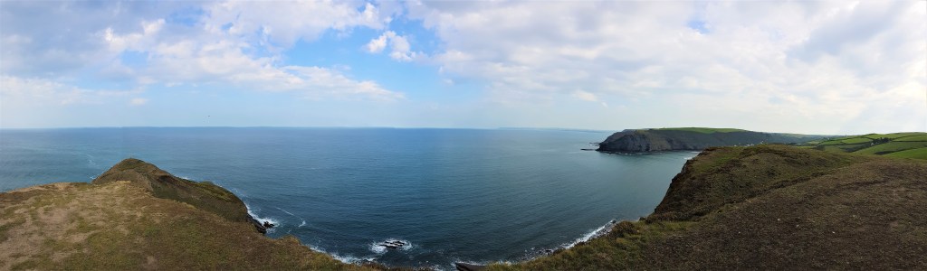
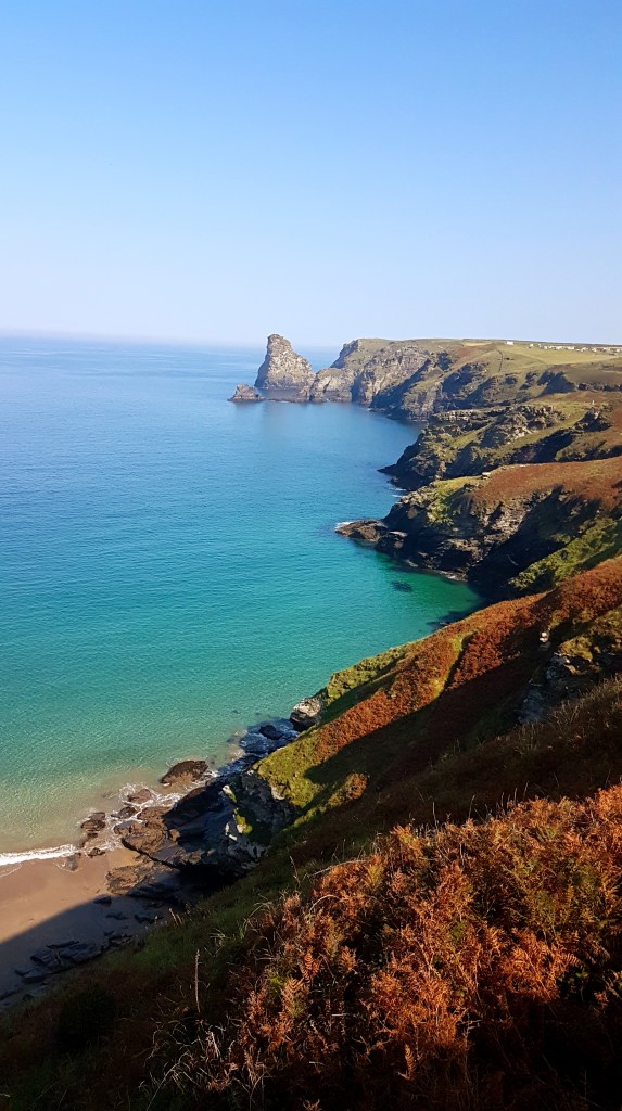
We headed first to Cambeak, meaning ‘crooked point’, which affords superb views along the coast, as far as Lundy in one direction and almost to Padstow in the other.
As we turned the corner and began to head south, a set of beaches unrolled below us.
First Little Strand, said to be favoured by naturists, with the rock archway of Northern Door at its near end. Then the Strangles, separated from Little Strand by the jutting Samphire Rock.
The Strangles is said to have acquired its macabre name from the rocky coastline and treacherous currents that have wrecked so many ships, though this seems tenuous. It was a favourite spot of Hardy’s while courting his wife-to-be.

Rock Samphire is an edible plant, most recently used as a lemony flavouring for gin. It was a delicacy in Shakespeare’s time, known for growing in the most inaccessible places.
This is from King Lear:
Come on, sir; here’s the place: stand still. How fearful
And dizzy ’tis, to cast one’s eyes so low!
The crows and choughs that wing the midway air
Show scarce so gross as beetles: half way down
Hangs one that gathers samphire, dreadful trade!
Methinks he seems no bigger than his head:
The fishermen, that walk upon the beach,
Appear like mice…’
There is also a third, smaller and much stonier beach called Alder Strand.
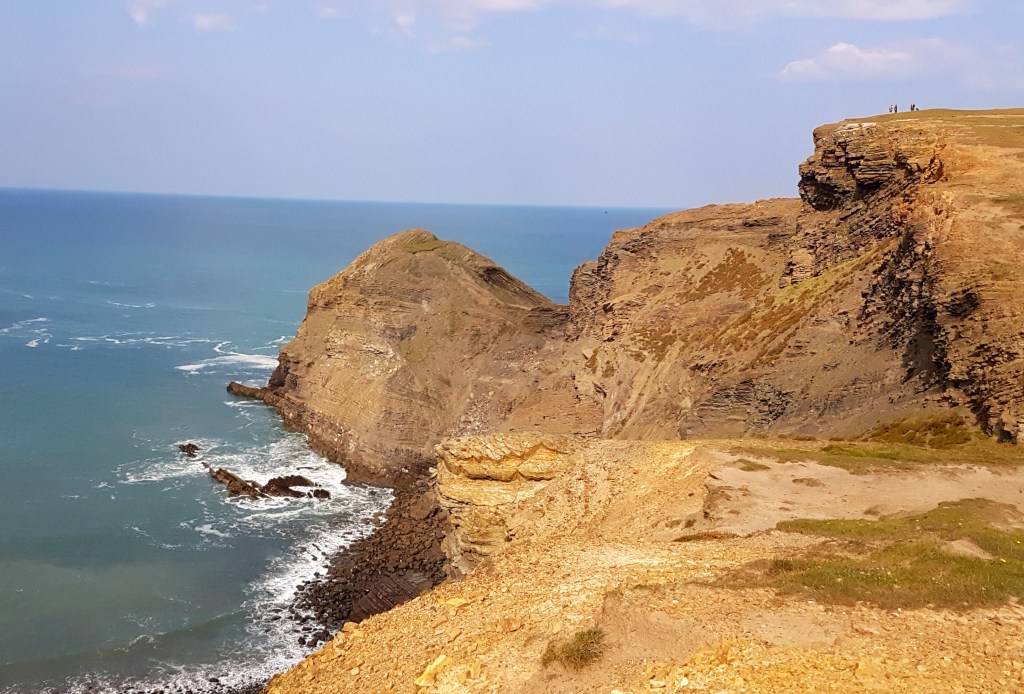
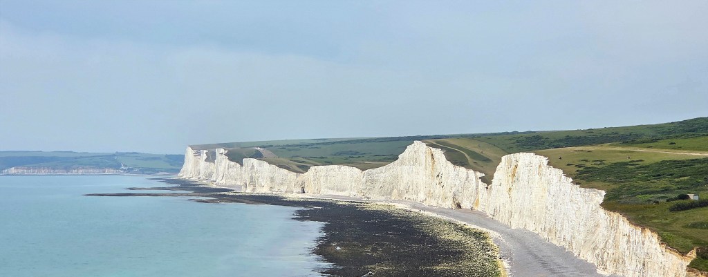
Shortly beyond, the path dips near Trevigue before climbing to the full majesty of High Cliff, 223 metres tall and the highest cliff in Cornwall, not much smaller than Devon’s huge Great Hangman.
Here we stopped for lunch, seated on a stone bench on a small headland just below the path, gazing back over Cambeak and the serried headlands beyond. The white satellite dishes perched on top of Hartland Point were still clearly visible in the late summer haze.
As we traversed the next valley, prior to Rusey Cliff, we spotted a handful of feral goats, grazing amongst the bracken and gorse while keeping a respectful distance. We cast a weather eye for the kestrels and peregrine falcons said to nest here, but failed to spot any of those.
The path now bends westward towards Buckator, over stepping stones, and then out to Fire Beacon Point, before a steepish descent around Beeny Cliff, past the Beeny Sisters rocks.
This area inspired one of Hardy’s poems, an elegy he wrote on revisiting in 1913, shortly after Emma’s death:
‘Still in all its chasmal beauty bulks old Beeny to the sky,
And shall she and I not go there once again now March is nigh,
And the sweet things said in that March say anew there by and by?
What if still in chasmal beauty looms that wild weird western shore,
The woman now is – elsewhere – whom the ambling pony bore,
And nor knows nor cares for Beeny, and will laugh there nevermore.’
Here we began to encounter small knots of people seal-spotting, and eventually saw a pair basking on the rocks below, their booming calls reverberating eerily between the cliffs.

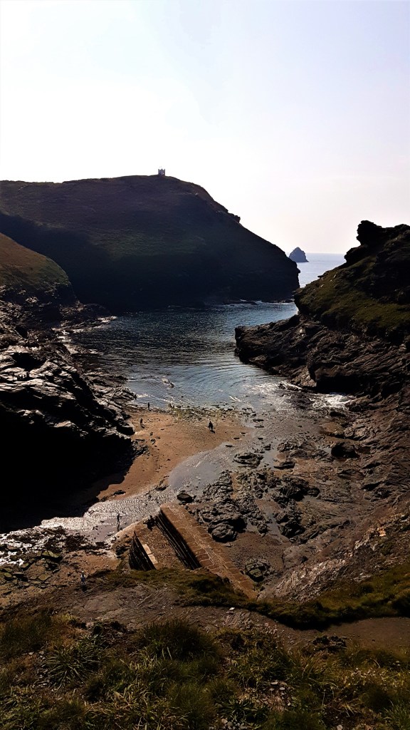
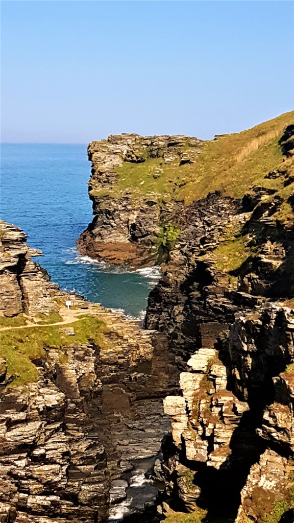
We crossed into the deep inlet of Pentargon, watching the waterfall spout down on to its rocky shelf, pierced with deep sea caves, then along Pentargon Cliff, before the final steep descent to Boscastle Harbour.

We set aside the climb of Penally Hill for another day (which never came) and concentrated instead on reaching sea level.
Eventually we rejoined the lazier holidaymakers and, resting our aching thighs, enjoyed even more celebratory ice creams before returning to the Cottage for a lazy evening.
.
Day Three: Boscastle Harbour to Trebarwith Strand
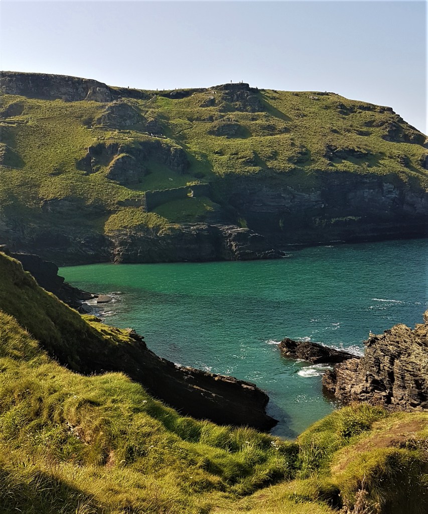
Monday morning saw us heading out of Boscastle in the opposite direction, bound for Trebarwith Strand, a distance of some seven miles. The sky was blue and the air warm but fresh as we looked back down on the Harbour and Meachard island just offshore.
We made a small detour to admire the Willapark Lookout Station at close quarters, bleached white against the rich morning sky.
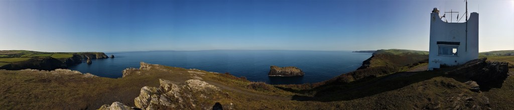
This squat tower was built in 1827 by local businessman Thomas Avery, who used it as a summer pleasure house and, according to local rumour, for all-night drinking and gambling parties serviced by the local prostitutes.
Avery is said to have led a double life. Ostensibly a respectable local merchant, businessman and magistrate, he is also believed to have been heavily involved in smuggling, wrecking and handling contraband.
He was most likely involved when the East Indiaman Jessie Logan was wrecked immediately below his lookout in January 1843.
This contemporary report is taken from the Royal Cornwall Gazette:
‘On Monday about 10pm, a very fine ship was seen off this place, with all her sails blown to pieces, except the mizzen topsail…and a trysail. She was nearing the coast very fast, and at 3 o’clock it was thought she would have come into this place; but she struck under a perpendicular cliff called Willow-Park. She was immediately dashed in pieces; and from boards seen afterwards, she was found to be the ship JESSIE LOGAN of Liverpool. The crew had deserted her…Parts of the ship and cargo are driving on shore; her cargo consists of buffalo horns and hides, cotton, shellac, raw sugar, flax, rice and dye etc…the latter coloured the water red for a considerable distance…’
Several local people stole from the cargo and some were imprisoned, but Avery was not amongst those convicted.
After his death in 1858, the tower was taken over by the Revenue men, who used it to combat smuggling.

Many centuries previously, there was an Iron Age promontary fort here, and there are Bronze Age tumuli inland. The farmland is still divided into long, narrow strips separated by raised grass beds – the so-called ‘Forrabury Stitches’. These are medieval in origin, but still used today for crop rotation.
Nearby is Welltown Manor, a Sixteenth Century manor house which Victorian novelist Sabine Baring-Gould used as the residence of his hero in the novel John Herring (1884).
There were slate quarries all along these cliffs in Victorian times, most heavily worked between the 1840s and 1880s. Men were lowered over the cliff by rope and pulley to set dynamite charges in the rocks below.
The slate was mined from the base of the cliffs and usually hauled up by the same means, the power provided by horses or donkeys pushing capstans as they circled platforms known as ‘horse whims’. Much of the slate mined here was used in local buildings down in Boscastle.

Climbing out of the steep valley of Grower Gut and crossing a field, we came upon a first stile built into the stone wall, highly reminiscent of those in the Yorkshire Dales. More followed in fairly short order.
As we headed south along the path towards the Trewethett Farm Caravan Site – which was still doing very good business – we stopped to watch stonechats perched amongst the clifftop gorse.
Shortly afterwards we began the descent into Rocky Valley, crossing the footbridge over the Trevillet River at its base and then rounding the headland beyond. This area was busy with tourists.
The valley stretches back inland to St Nectan’s Glen – Nectan was reputedly a hermit here in the Sixth Century who sited his hermitage close to St Nectan’s Kieve, the waterfall that bears his name.
Nearby there is also a church dedicated to St Piran, another holy man from this period, the patron saint of tin miners, and a holy well too. There is no reason to believe this is the well where he is supposed to have met his end, falling down it – aged 200 – while drunk!
There are two small labyrinthine carvings on the rocks hereabouts, first discovered in 1948, allegedly dating from the Bronze Age. They are much more likely to have been carved towards the end of the 18th Century at the earliest.
We climbed up and out of Rocky Valley, before descending once more to Bossiney Haven, where we resisted the temptation to join in a spot of skinnydipping underway, then skirted the second Willapark of the day.
Somewhere above Smith’s Cliff, on the approaches to Tintagel Castle, we paused for lunch, climbing up above the path to sit below a rocky outcrop.
Here tourist numbers increased again and we watched several groups pass below us while we chomped, looking out over the delightfully named Barras Gug.
Resuming our walk, we skirted the Camelot Castle Hotel, built in 1899, which was recently reviewed in The Spectator:
‘The Camelot Castle Hotel is a pebble-dashed late-Victorian excrescence on a cliff. It overlooks the ruins of Tintagel Castle. A baby-blue Rolls-Royce Wraith and a floral Aston Martin are parked outside. They are the owners’ cars. Everyone else is in a banger. This hotel played the lunatic asylum in the 1979 Dracula starring Frank Langella, and this is more apt than you can know.’
Approaching Tintagel Haven and the bridge over to Tintagel Castle, an English Heritage site, the crowd thickened still further and it was a relief to escape up on to Glebe Cliff.

There was a significant trading settlement located at Tintagel from roughly 450 to 650AD, shipping goods to and from ports throughout the Mediterranean.
It was not until the Twelfth Century that Geoffrey of Monmouth wrote his Historia Regum Britanniae, claiming it as the birthplace of the legendary King Arthur.
A castle was built here in the Thirteenth Century by Richard, Earl of Cornwall, the brother of Henry III but, within a century, it had already fallen into decay. Later medieval writers persisted in linking it with King Arthur, and those legends have also persisted ever since.
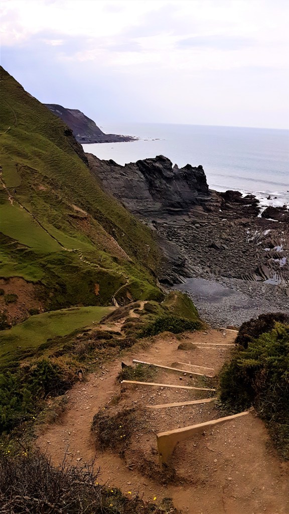
Navigating Glebe Cliff, we passed the Youth Hostel and followed the coastline to reach the cliff top at the northern end of Trebarwith Strand, half a mile long, with Gull Rock sitting offshore.
The path passes to the landward side of amazing rock formations. This area also supported several slate mines – Gillow, Long Grass, Lambshouse, Gull Point, Dria, Bagerlow, Lanterdan and West Quarry – the last of which survived until 1937.
We descended slowly to the Port William pub at the far end of the Strand, where we wrestled with the pub website and the Brewery’s app, courtesy of Covid social distancing. It took over twenty minutes to purchase our drinks.
Afterwards we wandered on to the beach below and enjoyed an invigorating paddle before heading inland to catch the bus home. Unfortunately Google Maps directed us to a closed bus stop and encouraged us to flag down a school special!
We walked round and back into Tintagel, hoping to pick up a 95 from the Visitor’s Centre, but arrived too late, so were forced to call a taxi. Bos Cars arrived within five minutes and took us quickly home.
We tried to book them to take us back out to Trebarwith for the final leg of our walk, but their car was in for repair.

.
Day Four: Trebarwith Strand to Port Isaac
So our driver recommended Tony instead, a loquacious ex-farmer who had turned to taxi-driving some 14 years earlier but was now semi-retired. He prided himself on being always busy, despite never advertising.
He picked us up on a dull, rainy morning, telling us his entire life story as he drove us over to Trebarwith Strand, depositing us next to the Port William just as a heavy shower passed through.
The tide was in, covering the Strand completely and giving the sea front an entirely different character.

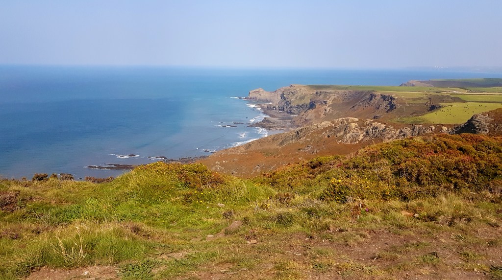
The rain began to clear as we climbed up to the cliff top, though the sky remained overcast for much of the day. The path was far quieter as a consequence, until we hit the outskirts of Port Isaac.
The signposts and the coast path distance calculator differ over how far we were walking, but it was certainly no more than seven miles.
We ascended to Dennis Point – probably a corruption of the Cornish word ‘dinas’ meaning ‘castle’ or ‘fort’, though no evidence has been found of one here – then immediately dropped down again to Backways Cove, our guide book warning that we faced seven steep valleys before we reached our destination.
There are further extensive slate workings along this stretch, while Backways Cove is said to be haunted by the spirits of drowned sailors.

The path continues along Treligga and Tregardock Cliffs. Inland there was once a wartime aerial bombing range, HMS Vulture II, initially staffed by the Women’s Royal Naval Service. Towards the end of the War it was made to resemble a Pacific island and used to train pilots heading East.
From Treligga we could see Port Isaac, already deceptively close. We descended again above Tregardock Beach, though the tide was in here as well.
There was once a lead and silver mine at Tregardock, active as early as 1580, when prospectors relied on flooding with water to expose the deposits. It had a reputation as a productive mine during the Seventeenth Century, relying on a shaft projecting thirty metres under the sea and was still busy in Victorian times, yielding some 60 tons of lead ore and 690 ounces of silver between 1853 and 1860.
Somewhere near here we encountered a very inquisitive cow, seated behind a wire fence. She seemed to apologise for her intimidating neighbour who had glared at us balefully throughout our approach.
After this, the valleys come thick and fast: the Tregragon Valley at Jacket’s Point is particularly steep, with a gurgling stream at its base; then the North Dinnabroad Valley and then a third at Delabole Point, on the approach to Barrett’s Zawn (the Cornish word for ‘sea inlet’).

Here there is a disused tunnel, once used by blindfolded donkeys who ferried up loads of slate from the beach below. The ground on the descent here was very slippery and I lost my footing.
The penultimate valley dips down on the other side of Barrett’s Zawn, near Lower Hendra. We broke here for lunch, sitting on the headland above Ranie Point.
The run in to Port Gaverne along Bounds Cliff was far less demanding. We passed above the onomatopoeic St Illickswell Gug before heading down to the tiny cove.
Once even busier than neighbouring Port Isaac, it once handled some 100 ships a year, each holding some 50-80 tons of slate taken from the huge Delabole Quarry inland which employed 1,000 men.
The larger ships struggled to turn in the tiny cove, so had to be pulled out from shore by ropes – a system called ‘warping out’.
Columns of waggons would pass six miles along the ‘great slate road’, the slates loaded on to ships by teams comprised mainly of women, who packed them in straw.
The port was also used by a substantial fleet of fishing boats which, at their peak, were landing between one and two million fish per week, mostly pilchards. Port Gaverne also sustained several boatbuilding yards.
But, with the arrival of the North Cornwall Railway, the slate trade disappeared, and the pilchards were soon fished out.

Neighbouring Port Isaac is just around the headland. It too was already a busy harbour in medieval times, its name derived from the Cornish for ‘corn port’. The harbour pier was constructed during Henry VIII’s reign.
The village grew prosperous during the Eighteenth Century, with several local merchants engaged in trading coal, limestone and pottery. Port Isaac had its own pilchard fleet, servicing 49 boats in 1850. A lifeboat station was built here in 1869.
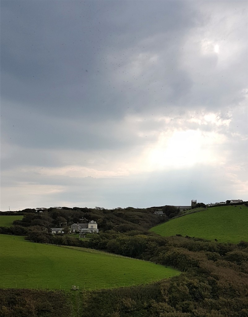
The day we arrived, the village was heaving with visitors, most eagerly spotting locations from the long-running television series Doc Martin, or trying to find a venue for lunch.
We decided to let things quieten down a little, so walked through the village and up beyond Roscarrock Hill. Here we sat on a bench looking down on the crowds milling around the harbour below. Dogs sported behind us and a local artist sketched the view.
Later we descended back to the Chapel Café, which now occupies the Wesleyan Chapel, built on Roscarrock Hill in 1836. We enjoyed some excellent cake before heading to our rendezvous with Tony, who we had pre-booked to drive us back.

.
Homeward
The following morning we were back with Bos Cars, who drove us to Bodmin Parkway, where we connected with the train back to Paddington. We found a peaceful coach at the rear of the train and enjoyed an uneventful return journey.
This time, though, the tube was far busier and the lackadaisical approach towards masks and social distancing caused slight consternation. It was with relief that we alighted at Waterloo to catch the far quieter train home.
With infection rates rising and a London lockdown threatened, who knows how long it will be before we venture westwards once more?
Sooner rather than later, I hope.

.
TD
October 2020


Leave a comment