.
Our previous segment of the Coast Path – from Barnstaple to Clovelly – had been completed back in June 2019 so, by March 2020, this next visit was more than overdue.
We only just managed to squeeze it in before the Coronavirus clampdown on non-essential travel. That will delay our next trip too. If we continue at this rate, we’ll be lucky to complete the Path before 2030!
.
.
Journey down and first night
The section between Clovelly and Bude is fairly remote for rail travellers, falling between two stools as far as route down and end destination are concerned.
We decided to use the more familiar South Western Rail service from Woking to Exeter St David’s, changing there on to the GWR Tarka Line to Barnstaple. We travelled down on Monday, so the trains weren’t too busy, and returned by the same route since cheap advance tickets were available in both directions.
This will be our final journey on the Tarka Line. Since we first came to rely on it, a much-needed modernisation of rolling stock has introduced air conditioning, working toilets, even WiFi. Sadly we shall no longer enjoy the splendid café at the Barnstaple terminus.
Our next visit – when it eventually happens – will involve heading further down the peninsula, via the GWR main line from Paddington, either to Liskeard or Bodmin parkway. Unless, that is, we succumb to the temptation of the two-hour bus trip from Exeter to Bude.
.

.
On this occasion a B-line Taxi ferried us from Barnstaple Station to Clovelly, as we had chosen to avoid the lengthy bus journey there. We paid £53.50 plus tip.
Given the remoteness of this section we had also decided to trial a luggage transfer service – Luggage Transfers Ltd. – so enabling us to stay in different places along the route. Previously we have relied on buses and taxis to return us to a single strategically-placed location, rented for the duration of the visit.
We stayed in three different places, paying £43.50 to have our two small suitcases moved twice, once between Clovelly and Hartland Quay; once between Hartland Quay and Morwenstow. This seemed to us good value.
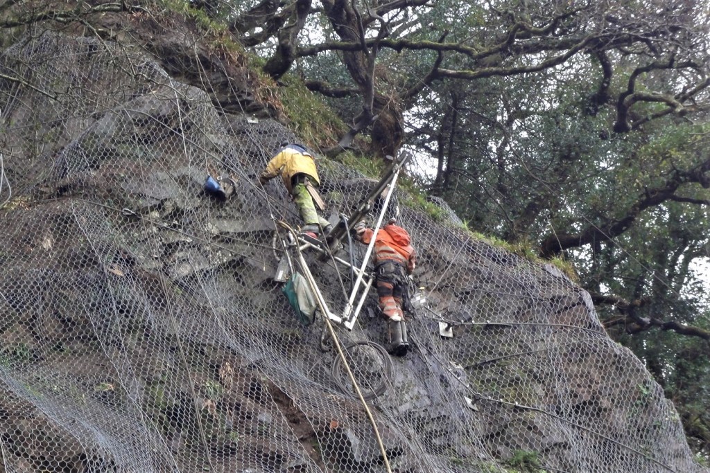
The service was excellent and we had no problems. Indeed, our carrier, Mike, went out of his way to help at Clovelly, very kindly carrying our cases uphill from the harbour to the Visitor’s Centre, rather than asking us to do so. (A landslip on the access road was preventing vehicles from driving down to our Hotel.)
.
.
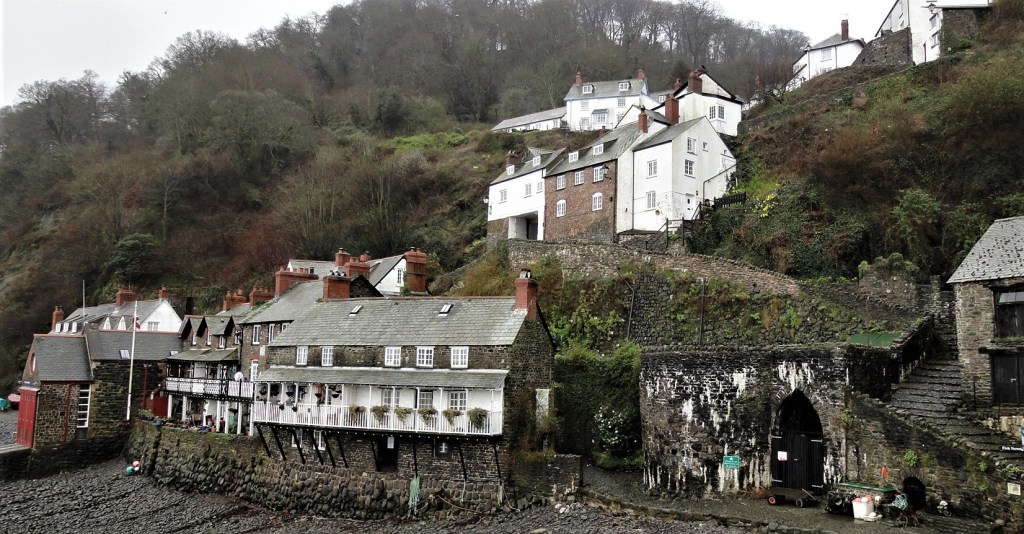
Because of the landslip our taxi had deposited us at the Visitor’s Centre the evening before, and it was hard work manoeuvring down the wet, cobblestoned slopes juggling cases and rucksacks together. Tracy also had her separate boot bag, whereas I’d managed to squeeze my boots into my rucksack.
It was almost eerily quiet.
The New Inn, towards the top of the village, had closed for the entire week for a boiler replacement. We found only a handful of guests at the harbourside Red Lion too.
.

.
It was, no doubt, because they were short of guests that we were given Room 17, one of the beautiful sail loft rooms behind the main building, just feet from the shoreline.
.

.
This was in effect a suite, including a substantial sitting area, a spacious lobby and a large bathroom, equipped with both bath and shower. The huge windows looked out on to a vista endlessly grey.
There are advantages and disadvantages to changing accommodation nightly. One of the disadvantages is that one is never quite sure whether it’s worth unpacking or not. On this first night I shovelled everything into a drawer, thinking that would make it easier to repack in the morning. Tracy kept her suitcase mostly intact.
.
.
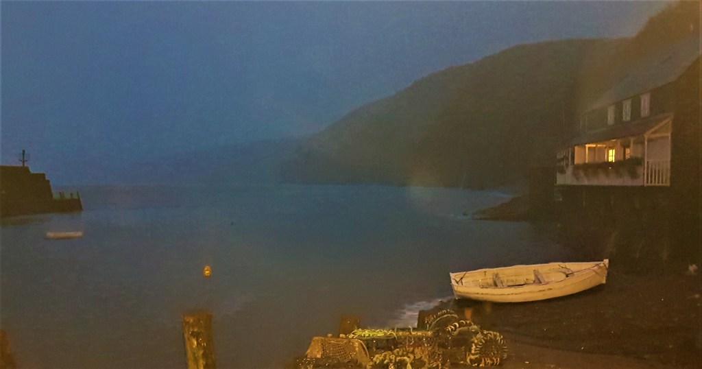
The landslip was just behind our room. A generator was noisy at first but was soon switched off. A couple of hours later we headed across to the Snug Bar for drinks and then dinner, chomping through a tasty fish pie with dessert to follow.
My sleep was periodically disturbed by the noise of the waves which, irrespective of the tides, seemed to fade in and out constantly as the night progressed.
.
Walking Day One: Clovelly to Hartland Quay
Light drizzle was still falling as we made our way across to breakfast, skirting the tractor drawn up on the shore.
We sat by a dining room window, admiring the coastal waterfall across the harbour – allegedly Merlin’s birthplace – as we delved industriously into our Full English Breakfasts. Only two more tables were occupied. At one a woman complained that her omelette was too peppery.
.

.
Crazy Kate’s Cottage was also just visible through the murk. Kate Lyall is said to have lost her mind on seeing her husband drown while fishing in the bay, and to have joined him in 1736 by walking into the sea in her wedding dress. Unlike Merlin, Kate really existed, but the story may be embroidered somewhat.
After collecting our pre-ordered packed lunches we made our way slowly back up to the top of Clovelly, in light rain, taking photographs as we went. We later discovered that Mike, the Luggage Transfer guy, was the man who greeted us cheerfully as he passed on the way down.
.

.
Clovelly has always been privately owned. It came into the hands of the Giffard family in 1242, descending from them to the Cary family in the Fourteenth Century, who sold it on to one Zachary Hamlyn in 1738.
It is still owned by descendants of the Hamlyn family through marriage. John Rous, aged 70, is one of two present directors and secretary of the Clovelly Estate Company Ltd. The 2018 accounts show it employed some 83 people and was worth around £3m.
There is normally a charge to enter the village, justified as covering essential maintenance costs. It is also supposed to pay for parking at the Visitor Centre, which presumably means that those arriving on foot or by taxi are entitled to a discount. We didn’t pay anyway.
The main street ascends 120 metres from the harbour – a major centre for mackerel and herring fishing until the mid-Nineteenth Century – and most of the cottages lining it are listed. So is The Red Lion itself, though that was substantively rebuilt for Christine Hamlyn in the 1920s.
This handy illustrated map provides information about some of the buildings.
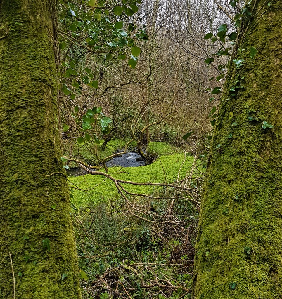
At the Visitor’s Centre we began our walk proper. The weather stayed damp but fairly settled at first, as we followed the acorn signs through fields and then into extensive woodland. The green-topped posts of the Clovelly Estate were still much in evidence.
We were much taken with the wooden shelter ‘The Angel’s Wings’ built for Sir James Hamlyn Williams (1765-1829). It too is listed, carrying the date 1826 (though it was also later restored, in the 1930s), and features ornate carving.
.


.
The listing text describes it thus:
‘Wooden structure with a pyramidal shingled roof which is bellcast, lead flashing at the angles and apex, capped by a large stone ball finial… Central tapering square pillar with floral carving on each face, at the base of the pillar a slatted wooden bench; the pillar supports the roof principally on four large curving struts carved like the wings of angels, further uncarved cusped struts set above; soffit with carved angel busts in relief.’
.

.
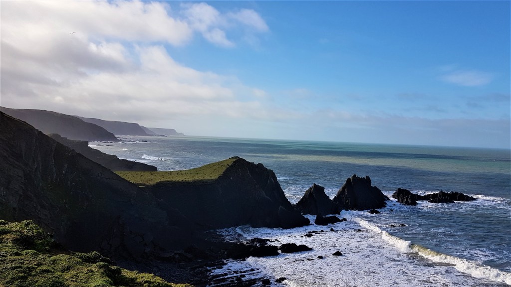
The path continues along wooded clifftops, soon arriving at a headland, charmingly named Gallantry Bower, which features a Bronze Age burial mound.
Continuing round the headland, the path eventually drops down a steep and muddy forest path to Mouthmill Beach. Here I slipped over, shortly before encountering a team of men clearing Rhododendron bushes. (I eventually won the day’s slipping over contest 2:1, though Tracy’s slip was by far the most balletic!)
.
.
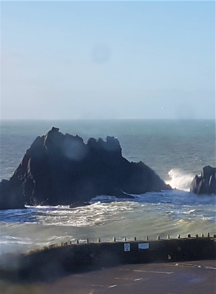
Mouthmill Beach has a limekiln, a ruined teahouse and triangular Blackchurch Rock, a superbly striking landmark, though on this day rather lost in the sea mist.
.

.
We were a little unsure whether the stepping stones, promised in the guide, would still be visible after the recent heavy rainfall, but fortunately a wooden bridge had been constructed alongside.
Climbing up the other side of the valley, we skirted Brownsham Cliff, then up and down again to reach Windbury Head. Here we passed the remains of an Iron Age hillfort, or at least that part of it which has not already slipped into the sea. A man passed us with binoculars, just as we were contemplating much-needed comfort breaks.
Then began a lengthy clifftop section across, in rapid succession: Beckland Cliff, Brownsham Cliff, Exmansworthy Cliff, Fatacott Cliff, Gawlish Cliff and East Titchberry Cliff.
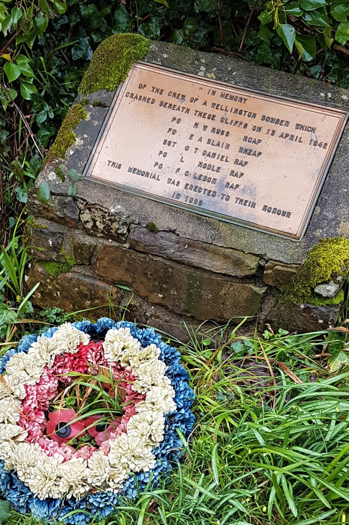
We paused beside a small memorial to the crew of a Wellington Bomber that crashed beneath the cliffs on 13 April 1942 with the loss of five lives. The plane had been based at RAF Chivenor , a Coastal Command Base from which it would have attacked U-boats, though it was on a non-operational flight to Cornwall at the time of the crash.
.
.
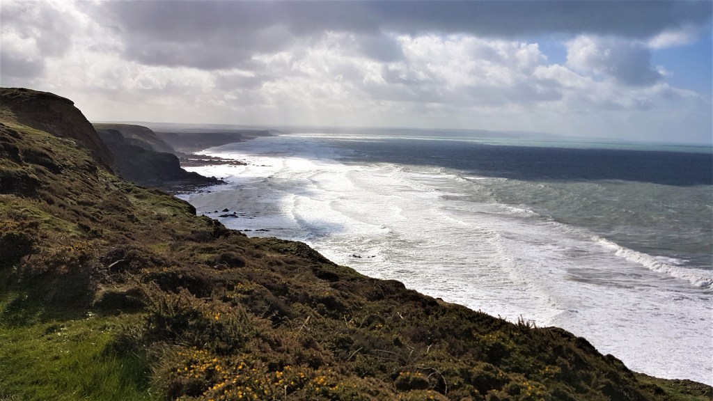
Conditions were still fairly good as we passed the trig point at Chapman Rock, though visibility over the Bristol Channel was negligible. We grabbed a quick lunch sitting on a relatively sheltered bench, though the wind was steadily strengthening.
Shortly afterwards the rain started and the wind reached maximum force, blowing the rain straight into our faces and bodies. We decided we’d get even wetter struggling into our waterproof trousers, and would have two layers of dampness to contend with into the bargain.
At long last the mushroom-shaped radar station at Hartland Point hove out of the mist, but visibility was so poor that we were only a few hundred metres away by that time. This golf ball on a stick is dedicated to air traffic control. Earlier wartime concrete foundations are also visible as one skirts the fence, close to the cliff edge.
.

.
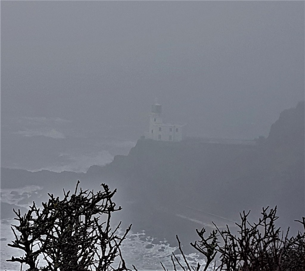
The path dallies with the coastguard station, which has the lighthouse nestled behind it. There seemed to be a big building site outside the former, while the latter was completely shrouded in cloud and rain.
We soon passed a memorial to those who died when a hospital ship, the Glenart Castle, was torpedoed and sunk by a U-boat in February 1918 some 20 miles seaward. There were 162 casualties and only 32 survivors, with some evidence that the U-boat had fired on defenceless survivors.
.

.
Several hospital ships were sunk in this way because the German navy believed they were also transporting able-bodied troops.
As we rounded Hartland Point, the cloud and mist finally began to clear, allowing us to catch brief glimpses of the lighthouse behind us.
.
.
It was built in 1874, but coastal erosion soon became a problem. The Trinity House History blog says:
‘Initially, it looked as if the future for the lighthouse would be short, because the lighthouse is sited on the extremity of the point and to the side there was a vein of loose rock which was being continuously undermined by the sea. It was decided that the solution to this problem, which was beginning to threaten the lighthouse itself, was to break away some of the rock from the upper cliff behind the lighthouse. This was done and the tons of boulders which fell to the beach formed an effective but only temporary barrier to the sea. Unfortunately, this procedure had to be repeated about every 12-18 months because the sea could not be halted from its natural process of erosion. In 1925, it was decided to solve this problem permanently, and a 130 feet long sea wall was built.’
The lighthouse was manned by four keepers well into the 1970s, though some of the keepers’ cottages were replace by a helipad in 1984. It was decommissioned in 2012 and the remaining three-bedroomed keeper’s cottage was sold. A solar-powered LED beacon continues to warn off local shipping.
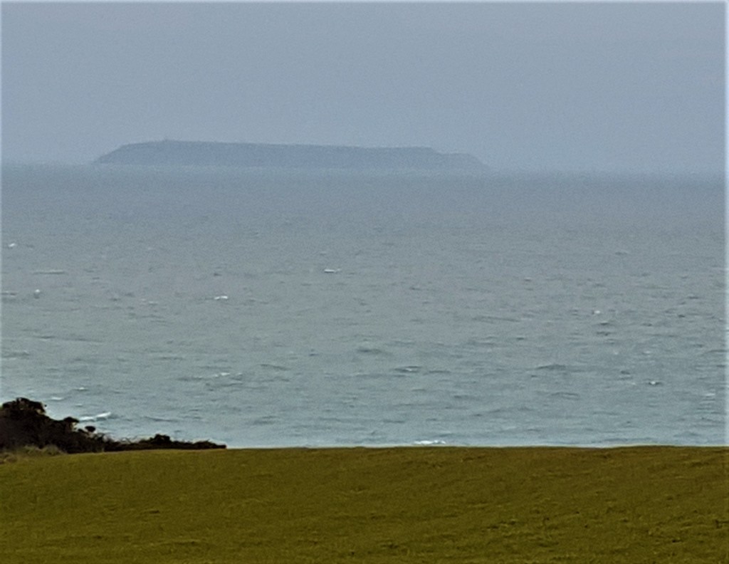
We even spotted the outline of Lundy Island, looming out of the Bristol Channel some 12 miles off the coast.
.
.
As we worked our way along, now in a broadly southerly direction, the various headlands between us and our destination were also now clearly delineated. But this final part of the hike was deceptive, taking us almost an hour longer than anticipated.
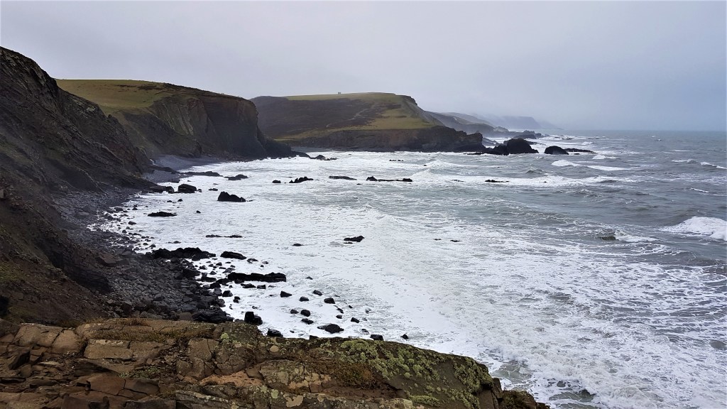
After Blagdon Cliff and Upright Cliff, we found ourselves descending again to Titchberry Water and its waterfall, crossing the bridge inland of the beach and climbing up the steps on the other side. Then there was a further descent past Smoothlands, into its dry, hanging valley – and on to the cove at Damehole Point.
.
.
Here we began to see the sharply striated rock pavements that are a regular feature of this coastline.
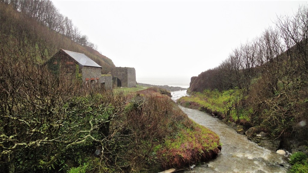
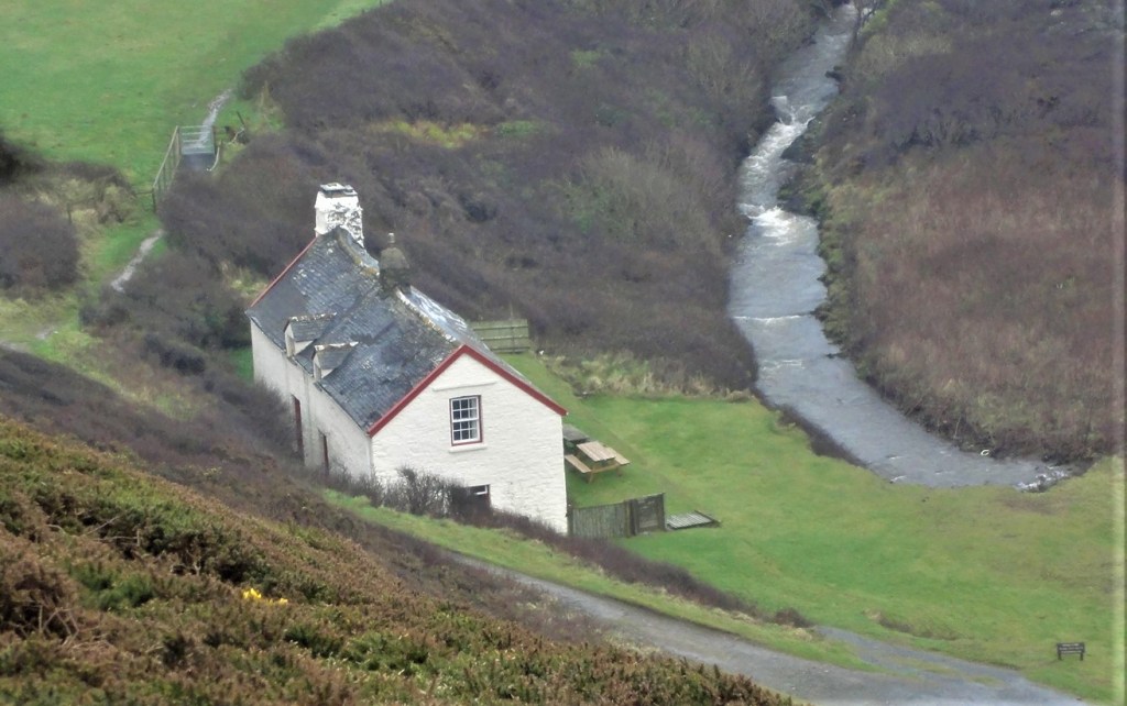
Then up again, and down again to Blegberry Water, and up yet again, and down steeply yet again into the valley that carries the Abbey River. Here there is an isolated white cottage, once Blackpool Mill. It featured in a TV mini-series called The Shell Seekers (2006) starring Vanessa Redgrave.
.
.
Hartland Abbey and its Gardens lie about a mile or so upstream, though it was still closed for the winter as we passed through. We followed the path behind the cottage, crossing another bridge before climbing up to Dyer’s Lookout and then on across Warren Cliff.
Here we came upon the ruined folly, now little more than a single large archway. Known as The Pleasure House, it dates from the Eighteenth Century, though may have older antecedents. Some think It might once have been a warrener’s house; others a lookout post.
.

.
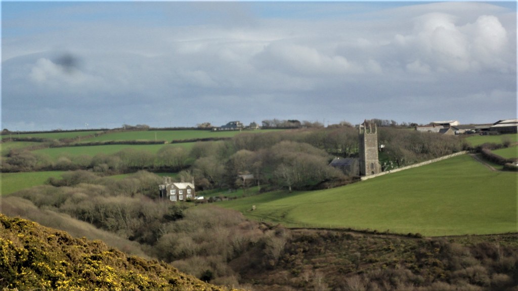
Like many before me, no doubt, I lined up the tower of St Nectan’s Church at Stoke, inland, so it was framed by the arch of the folly.
We continued across the cliff, towards Rocket House. Originally Rocket Apparatus House, it was built to accommodate the wagon and equipment of the Hartland Life Saving Apparatus Company, formed in 1890.
Most sources say this happened after the 2,203 ton Uppingham was wrecked off shore. But a contemporary newspaper account shows the apparatus was already in use:
‘During the heavy north-westerly gale on Sunday morning the steamer Uppingham, from Cardiff for Port Said, laden with coal, was driven within a mile of the Bude shore and subsequently struck the rocks off Hartland Point. The first mate, in attempting to swim ashore with the line, was drowned…Seven persons, including the Captain’s wife, were saved by the rocket apparatus.’
The rocket fired lines from the shore to ships wrecked on the rocks. The lines were used to haul ropes across with a breeches buoy suspended from a pulley. This contraption was then used to pull the shipwrecked ashore.
Rocket House is now a holiday cottage. Passing it, we picked our way slowly down the steep slope to the Hartland Quay Hotel. It was around 17:00 and, by this stage, a fairly balmy evening.
.

.
The Hotel was originally Hartland Quay’s custom house, converted in 1886. There was a pub here previously, but its licence was revoked because of drunkenness. The Wreckers Retreat bar occupies the former stables, while the hotel bedrooms were once the corn and hay lofts.
We dutifully dressed our very muddy boots in the thin blue plastic covers provided and booked into our accommodation – a double room with sea view.
These surroundings weren’t quite as palatial as in Clovelly, but very comfortable nevertheless. A small seating area on a low dais directly in front of the bay window gave a stunning view of the sea smashing on to the cliffs below.
.
.
Our first priority was to divest ourselves of our wet clothes and find radiator space for them, as well as our sodden boots. We tried desperately to avoid spreading mud around because the room and landing had both been freshly painted.
We drank hot tea and had a hot bath to ease our aching limbs. Once recovered, we headed down to the Wrecker’s Retreat below for a well-earned G&T apiece. There were relatively few guests in the bar – only two or three tables were occupied. We enjoyed a substantial dinner and retired for an early night.
Fortunately the sea was further away this time so I slept a little better.
.

.
Walking Day Two: Hartland Quay to Morwenstow
Our official guide books proposed that the next leg should terminate at Bude, well over 15 miles away and incorporating some 4,500 feet of ascent and descent. The grading is ‘severe’ and the recommended time allowance is an optimistic 8.5 hours.
We’d decided to break the leg in two, stopping overnight at Morwenstow, something over half way along. As we tucked in to this morning’s Full English we chatted to a man on the next table who was attempting the whole thing. I hope he didn’t regret that decision later.
The Hotel very kindly filled our coffee flasks and we had again pre-ordered packed lunches. After packing and depositing our cases for Mike to collect, we ventured outside, where the weather was clear, bright and bracing.
.

.
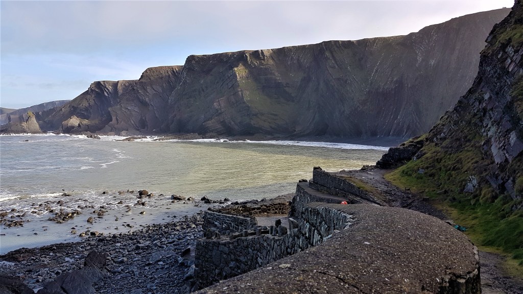
We devoted some time to wandering around the Quay, taking photographs.
It dates from the late Sixteenth Century when there was a lively trade across the Bristol Channel. Most of the boats were small sloops or smacks but, even for them, entering the Quay was a tricky procedure. Invariably, a small boat had to be sent out with a line, so that men ashore could swing them round to safety.
.
.
By late Victorian times the Quay had fallen into disuse, its maintenance increasingly neglected after the arrival of the railway in Bideford.
More recently, several films have used this location, not least Treasure Island (1950), Walt Disney’s first full live action film featured several British stage and screen actors, including the redoubtable John Laurie – subsequently Private Frazer in Dad’s Army – who played Blind Pew.
We climbed up to the higher car park, up along the clifftop and down again, skirting round the landward side of a lump called St Catherine’s Tor.
Shortly afterwards we began to follow a long track, pushing steadily uphill alongside a stream. Cattle had churned it to deep sticky mud and equally deep puddles. We tried our hardest to avoid swamping our boots so early in the day but it was a close run thing.
It took an age to reach the end, where we finally re-emerged on to the clifftop. The offending cattle grazed below us, blissfully unaware of the trouble they’d caused.
.

.
Next we descended steadily to enjoy the waterfall above Speke’s Mill Mouth. And, shortly after the turning for the Elmscott Youth Hostel, somewhere near Dixon’s Well, we broke for coffee, enjoying the reverse view of the coast back towards Hartland Quay.
At this point the coast path joins a narrow road which heads past a mobile phone mast before going back to the clifftop shortly before Nabor Point. We followed the cliff round to Embury Beacon and what remains of its Iron Age hill fort, most of that also having slipped into the sea.
Rounding Knap Head, we began the steep descent to Welcombe Mouth, a picturesque beach with a sandy section alongside the rocky outcrops. The recent rainfall had made the stream here a raging torrent, constantly feeding the waterfalls down to the beach.
.

.
But the stepping stones were large and dry and I crossed them without thinking, only to find Tracy – normally far more courageous than I am – still frozen on the other side. I did the chivalrous thing and returned to hand her over, stone by stone. She’d been spooked by the fear of falling and being washed over the waterfall.
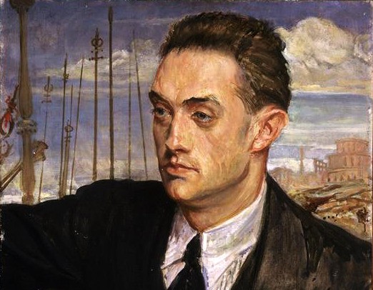
We were soon distracted by the steep climb up, and then almost immediately down again to Marsland Mouth. On the way down, we passed the hut where writer Ronald Duncan (1914-82) worked.
.
.
Duncan was born in Rhodesia, moving with his mother and sister to London when war broke out. The family changed their name from Dunkelsbuhler in 1920 and, the same year, holidayed at Welcombe. Duncan read English at Cambridge in the early 1930s, coming under the influence of Leavis.
By 1936 he had published the pamphlet ‘The Complete Pacifist’. And in 1937 he rented the farm at West Mill, just inland, along Old Mill Leat. He met his future partner, Rose Marie Hansom, an artist and musician, in London, persuading her to move with him here in 1939.
From 1938 to 1945 he produced a journal, Townsman, featuring the work of friends including Pound and Eliot.
Meanwhile, Duncan and Hansom, who he had married in 1941, had set up a pacifist farming community at West Mill which survived until the end of 1943. They were conscientious objectors, but farming was a reserved occupation anyway so Duncan avoided conscription.
After the war he published several plays and poetry collections and regular features for newspapers and periodicals. From 1958 to 1962 he conducted an affair with actress Virginia Maskell (1936-1968) perhaps best known for her role in Doctor in Love (1960).
There is a Facebook page dedicated to Duncan’s literary foundation and the hut. His papers were donated to Exeter University which maintains this website about him.
The footbridge across West Mill Leat also marks the coast path boundary between Devon and Cornwall.
.

.
On arrival in Cornwall, we decided it was time for lunch, enjoying our picnic overlooking the beach and, in my case, imagining which of Duncan’s many famous visitors had trod this way before me.
Poet John Moat (1936-2014) was a near neighbour of Duncan’s in later years, and I once met him in my youth. His ‘Welcombe Beach’ is pinned on the wall of Duncan’s hut:
‘The pebbles are out of order. Some man’s
been down to meddle with the stones again.
On the wide mindless beach this one thought
Breaks out to spoil the sea’s unthinkable design….’
We repacked our rucksacks and prepared for our first Cornish climb, up to the top of Marsland Cliff (our guide helpfully informing us beforehand that the ascent is 122 metres).
Almost immediately we plunged down again to the wonderfully-named Litter Mouth, then up again the other side to Cornakey Cliff and then Yeolmouth Cliff. We dutifully admired the Devil’s Hole, bored through Gull Rock behind us, before heading down and up again on to Henna Cliff.
.

.
We wanted to get a little further along the path before diverting to Morwenstow but misleading signage initially sent us some way along a footpath inland. We realised our mistake as the tower of the Church loomed into view and so retraced our steps.
There is a reference on the map hereabouts to St Morwenna’s Well, said in the listing text to be located about 14 metres down the cliff.
Morwenna is first mentioned in a Twelfth Century life of the aforementioned Saint Nectan, who is said to be her brother, both of them supposedly children of a (most probably mythical) Welsh king.
Trained in Ireland, she is believed to have established a hermitage on Henna Cliff, living there around 500AD. Nectan also lived nearby. The parish church of Morwenstow is dedicated to St Morwenna (after whom the village is named) and St John the Baptist.
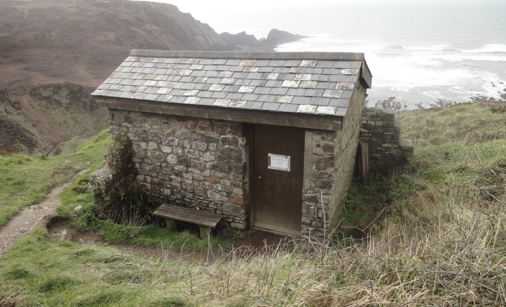
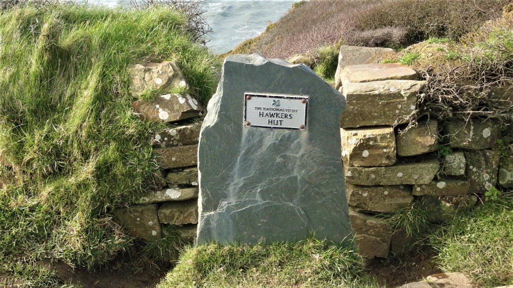
We scrambled up the steep path to Vicarage Cliff, finally making our way along to Hawker’s Hut, marked by a slate sign. Down a few muddy steps and we were firmly lodged inside, out of the wind at last.
.
.
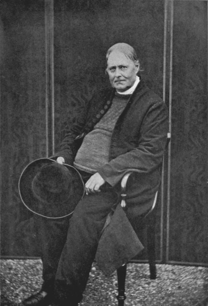
The Reverend Robert Stephen Hawker (1803-75) has left an indelible impression on these parts.
Born in Plymouth, he was educated at Liskeard Grammar School and Cheltenham Grammar School, publishing his first book of poetry ‘Tendrils’ in 1821, under the pseudonym ‘Reuben’.
In 1823 he was admitted to Pembroke College Oxford, though in November of that year he married Charlotte I’ans, some 20 years his senior and this, post honeymoon, gave him the wherewithal to continue his studies.
He returned to Oxford in 1824, winning the Newdigate Prize for poetry in 1827 and graduating in 1828. He was ordained in 1831 and, in 1834, accepted the post as Vicar of Morwenstow, where he was to remain for the rest of his life.
It is said that, on his arrival, the post had been vacant for over a century. Allegedly, smugglers and wreckers were still active along this coastline, but the stories of deliberate wrecking are probably exaggerated.
In 1837 he designed and built a new vicarage. The listing text describes the style as ‘Gothick’, noting that the chimney stacks are modelled on church towers which had meaning for Hawker, and on the tomb of his mother.
.
.
Charlotte died in February 1863 aged 80. In October, aged 60 himself, Hawker befriended Pauline Kuczynski, the 19 year-old governess of a visiting vicar, eventually marrying her the following year. She bore him three daughters.
Hawker died in 1875, converting to Roman Catholicism beforehand.
He was highly eccentric. Legend has it that he excommunicated one of his nine cats for mousing on a Sunday, though this and other stories are drawn from a rather colourful biography by Sabine Baring-Gould.
Charles Byles, who married one of his daughters and who edited his ‘Life and Letters’ describes his appearance:
‘His dress was unconventional and picturesque. He absolutely declined to follow the fashions of “the cloth,” and would not wear anything black. His usual garb in earlier years was a brown cassock. “A blushing brown,” he said, “was the hue of Our Lady’s hair, as typified in the stem of the maiden-hair fern.” In this cassock he even managed to clamber up and down the cliffs. Later it was exchanged for a long coat of purple shade. Instead of a waist-coat, he wore a fisherman’s blue jersey, in token that he was called a fisher of men. A small red cross was woven in the side, to mark the entrance of “the centurion’s cruel spear.” These jerseys were knitted for him by a fisherman’s wife at Clovelly. A broad carpenter’s pencil (chosen in reference to the Carpenter of Nazareth) usually dangled from his button-hole. Round his neck he wore a limp white cravat: he could never endure a stiff collar. He carried a cross-handled walking stick, somewhat resembling a wooden sword, which he called his “pastoral staff.” Hessian boots and a wide-awake beaver hat completed his out-of-door equipment.’
.
.
One of Hawker’s duties was to arrange the recovery, for burial, of the bodies of shipwrecked sailors. There were regular shipwrecks on the rocks below Morwenstow and the sailors’ bodies were often horribly mangled. Hawker employed men to collect the ‘gobbets’ found along the beach so that they could be interred.
In 1844 or thereabouts, Hawker used timbers from three recent wrecks – the Caledonia, the Phoenix and the Alonzo – to construct his Hut.
.

.
He and his wife would retreat there to read their letters, while Hawker would also occasionally smoke opium and compose his poetry. Visitors are known to have included Kingsley and Tennyson. The Hut is listed and the smallest property owned by the National Trust.
We decided it was the ideal place for an afternoon coffee break, so unscrewed our flasks and broke open the chocolate bars, enjoying the view out to sea.
Retracing our steps, we struck out along the next footpath heading directly towards Morwenstow, about a mile inland. Just before our destination we found a deep muddy ford which could not be skirted, so getting our feet wet at the very last.
We were staying at The Bush Inn for the next two nights and, on pulling off our boots and pulling open the door, received a very warm and friendly welcome. We arrived here around 16.00, so the complete leg would have been out of the question.
.

.
This room (501) was the smallest of the three we’d slept in, but comfortably the cheapest! The sea was considerably further from our window. Unfortunately though, now we had the leisure to unpack, there was no storage for our clothes.
We set our boots on top of a bag in the bathroom to dry. Our trousers and waterproof trousers festooned the bedroom radiator. Another long hot bath was called for.
The Bush Inn is nowadays a modern public house, operating as a thriving community hub. Although it has a long history, I could find no reliable source for much of what is related.
Said to date back to the Thirteenth Century, possibly far earlier, it does contain a ‘Celtic piscina’ or basin carved from serpentine rock and a monastic cross carved into a flagstone. There is a ‘leper’s squint’, a window through which the poor were fed scraps of food, which later stood service as a lookout window for smugglers evading the excisemen.
It is also allegedly haunted by the ghost of a drowned sailor and claims to have influenced Daphne Du Maurier’s Jamaica Inn (1936). She certainly lived nearby and is known to have visited.
In 1968 a fire destroyed the thatched roof and much of the building, though the pub still has an ‘olde worlde’ vibe, with plenty of exposed beams.
When we arrived downstairs the bar was already busy with local people. We had a drink or two and a fine meal before retiring. Despite the sea’s distance, the wind buffeted our room all night so my sleep was still intermittent.
.
Walking Day Three: Morwenstow to Bude
We had our customary Full English around 08:30, two very kind local ladies serving and cooking for us alone. They filled our flasks and gave us a first class packed lunch with personalised sandwiches.
We started out around 10:00, to be met immediately by a hailstorm, whipped into us by the sharp wind.
On the ladies’ advice we’d headed back down to the coast via a muddy footpath through the wooded Tidna Valley, attractive even in the morning drizzle. We emerged on to the Path on the approach to Higher Sharpnose Point., the wind now buffeting us with great force.
.
.
I suggested we should head back to where we’d turned off the night before, but was speedily overruled. Tracy, who is normally a stickler for these things, granted permission for us to omit that small stretch, which would have demanded a sharp, exposed climb and an equally sharp descent back down again.
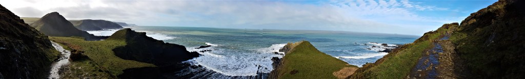
Instead we turned about and climbed up to Higher Sharpnose Point, past an old coastguard lookout shelter. It was too early for coffee, sadly. The view was partly obscured by heavy cloud, but it was beginning to clear in the stiff wind as we headed south, past Greenway Beach and Caunter Beach before dipping down to Stanbury Mouth and then up again.
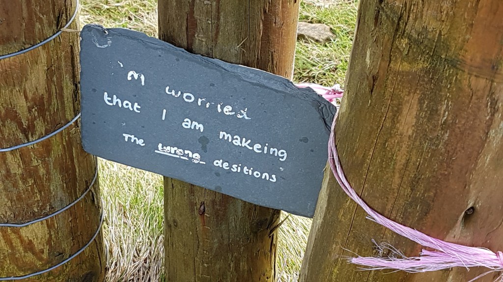
Somewhere around here we came upon this legend written in white on a slate:
‘I’m worried that I am makeing the wrong desitions’ [sic].
Who knows to what personal circumstances that referred, or whose!
.
.
We finally broke for coffee on a bench at the top of the cliff and, as we did so, patches of blue began to clear in the sky.
We were now close to the GCHQ Composite Signals Organisation Station, a huge infestation of satellite dishes surrounded by a double fence, futuristic but heavily redolent of a prison.
This was originally the site of a wartime military airfield, housing the aircraft that supported RAF target practice along this stretch of coast.
.

.
Construction of the present station began in 1969, when two large satellite dishes were installed, though it didn’t become operational until 1974. A third large dish was added in 2001 and there are now 20-something antennae collected here. The site is a joint project between GCHQ and the USA’s National Security Agency and so highly secretive.
I tried to work out what this red sign once said, but eventually gave up. Clearly I am not GCHQ material!
…

.
We followed the path round the perimeter fence, eventually diverting back to the clifftop above Lower Sharpnose Point.
Rounding the headland, we soon found ourselves suspended above the shallow sheltered green expanse of Coombe Valley, its river snaking back and forth as it disappeared inland.
We could just spot King William’s Bridge, constructed in 1836 with the aid of a subscription list organised by Robert Hawker, whose first contributor was King William IV. Hawker had lived in Combe for a while in the 1820s.
.

.
The path down took us on to Steeple Point, which was completely exposed to the elements. As we approached, the wind gusted with such violence that we were forced to stop, bend our bodies into the cliff and wait for it to subside.
We descended slowly in this manner, in short lulls between the gusts, rather shaken by the experience.
But, as we got lower, we saw a woman holding a small child by the hand just in front of us, so perhaps the danger was more imagined than real (or perhaps she was completely irresponsible).
.
.
Finally we arrived at sea level, at Duckpool, the mouth of Combe Valley. A National Trust sign told us that:
‘The river meandering down the valley swells to a pool where it meets a natural dam of pebbles, hence the name Duckpool, and forms the boundary between the parishes of Morwenstow and Kilkhampton.’
The next steep climb up to Warren Point required us to navigate through a small herd of sheep. Passing through Warren Gutter the wind was blowing spray across the path from the beach below.
Continuing along the Stowe Cliffs, we dropped down into Sandymouth, eating our sandwiches in the lee of the closed café. Afterwards, after three days of stiff walking, both of us found it hard to get our legs moving again.
.

.
We struggled across the lengthy approach into Bude, The final climbs were hard going for both of us, but especially for me. Tracy seemed to be sailing up the last one, but then had to lie down full length on the ground to recover.
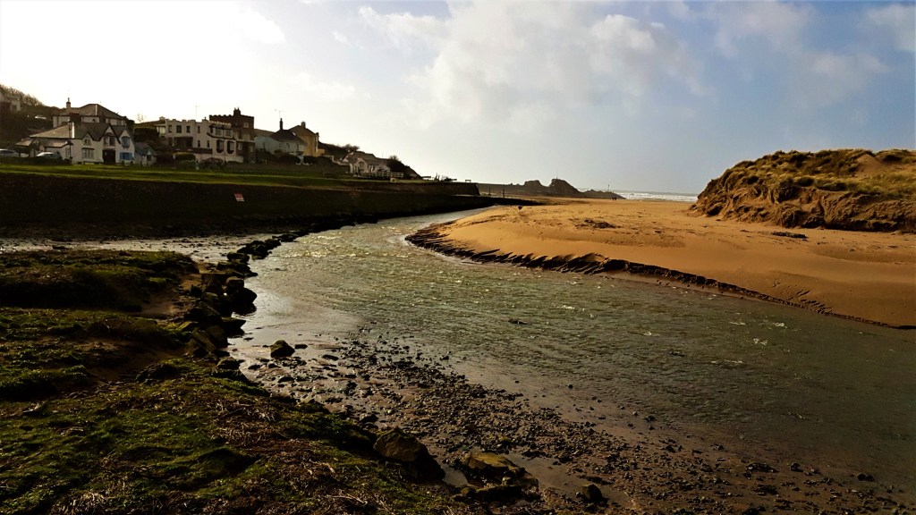
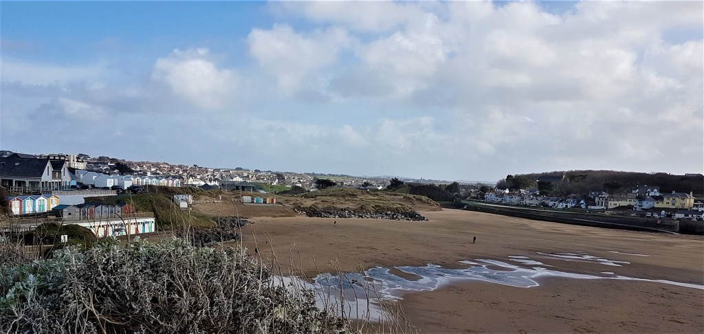
Finally, around 15:15, we arrived within sight of the huts at Crooklets Beach, pausing for photographs before continuing round the seafront, past Summerleaze Beach and its sea pool.
.

.
Arriving in the town proper, we followed the route round in the direction of Bude Canal, deciding that our official stopping point would be the Café Limelight in the Castle Heritage Centre.
Here we donned more of those embarrassing blue boot covers and ordered cream teas apiece, eating them overlooking Summerleaze, with the canal, the river and the sea all clearly visible from our viewpoint. (Incidentally, this seems to me the basis for a fine quiz question!)
.
.
The canal was completed in 1823, its primary purpose to transport sand inland for agricultural purposes. The main route was south-east to Druxton Wharf near Launceston and the full length over 35 miles.
A canal seems oddly out of place at the seaside and, indeed, the sea lock at the Bude end is one of only two in the country.
It was originally designed to admit sailing vessels of up to 100 tons but was enlarged in 1835 to accommodate those of 300 tons. The first two miles of the canal inland were intended for barges of up to 50 tons but, further along, smaller wheeled ‘tub boats’ were used, drawn by chains and driven by waterwheels .
Usage declined towards the end of the Nineteenth Century, as railways became more prevalent. A line from Okehampton to Bude was operating by 1898, but closed in 1966. The sea lock has been refurbished, is listed, and is still in use today.
.

.
After a short walk round the grounds and beside the Canal, during which we decided longer to explore Bude next time, we caught a Bayside Taxi from one of the stands in the town itself, and were driven back to the Bush Inn. At the door we engaged Bayside to return us to Barnstaple next morning.
We headed down to dinner a little earlier than the night before and found ourselves surrounded by conversation that wouldn’t have been out of place on The Archers, the principal topics being problems with lambing and the shortage of bookings for local holiday lets.
One woman described graphically how she’d had to untangle the legs of twin lambs inside the ewe, so it could safely give birth.
A group of quizzers entered – the home and away teams from the local quiz league – we heard that these were serious competitors, who disdained jokes or laughter and sometimes even alcohol! As we made ready for bed, we could hear the question master still firing away in a room below.
.
.
Homeward Bound
It was with some relief that we woke to a walk-free day, lounging abed until breakfast at 08:30. Once again the two ladies looked after us superbly.
Another couple had stayed the night – we’d seen them with their dog in the pub the evening before – but little conversation was exchanged.
We packed at a steady pace and were ready when the taxi arrived at 10:00. The trip across to Barnstaple took about 50 minutes, costing £65.00 plus tip, so we had ample time to say farewell to the Station Café before boarding the Tarka Line train back to Exeter St David’s.
Things at Exeter seemed to be fraught, with delays and broken down trains, but we transferred to our Woking train on time, without problems.
It was blissfully quiet at first but, from Crewkerne onwards, we were surrounded by school children who had been on an outward bound course somewhere. Their three teachers made a good job of controlling them until someone had the bright idea of handing round packs of sweets!
We emerged unscathed at Woking, catching our local service and arriving home by late afternoon. It was Friday the 13th, and the real Coronovirus shit was about to hit the fan…
.
.
TD (with photos by TD and TK-S)
March 2020


Leave a comment