Having spent the latter part of February 2025 at HF’s Monk Coniston country house in the Southern Lake District, we decided to repeat the experience in February 2026, this time further north.
When booking in late November, we anticipated few problems, beyond the ever unpredictable Lakes weather,
It was a bargain, too: we paid a heavily discounted £543 each for a six-night walking holiday in the Northern Lake District, at Derwent Bank, near Keswick.
But, immediately after Christmas, the health of Tracy’s father declined rapidly. He learned that secondary metastases had reached his brain, and his chemotherapy was halted.
We began a three-day walk on the South Downs Way to celebrate her birthday, expecting that the crisis would still be some weeks away.
But Tracy’s father has (had) a justified reputation for wanting everything done yesterday. As soon as her birthday was out of the way, he was keen to be gone.
Shortly after we arrived home, she sped up the motorway to her parents’ house in Stratford on Avon. She arrived in time to be with her Dad when he died that evening.
She spent the next fortnight with her mother, supporting her through the first stages of bereavement – stages we both know so well.
She finally returned on St Valentine’s Day afternoon, giving her just five nights at home before we departed for the Lakes.
Characteristically, she never mentioned her bereavement to our fellow walkers (though I confided in one or two while she was out of earshot). We knew that, immediately our holiday ended, we had just one day before heading up to Stratford for the funeral.
Since our Northern Lake District holiday began the day after my birthday, which falls less than three weeks after Tracy’s, we had decided to travel up the day before, spending part of my birthday in Penrith.
We were booked on to the 10:27 Avanti West Coast service from Euston, due to arrive in Penrith at 13:31.
Euston was busy, it being half-term, but we managed to beat the majority of our fellow passengers on to the train, finding space for our luggage and our pre-booked table seats unoccupied.
Day 1: Penrith
Alighting at Penrith Station almost on time, we navigated our luggage to the George Hotel, whose staff kindly agreed to store our cases until we could check in, after 15:00.
We began a preliminary orientation walk around Penrith, looking for a suitable lunch spot. Being my birthday, it was definitely my choice, and I plumped for the delightful Garden Tea Room where I ordered a panini and Tracy opted for soup with a scone.
Here we conversed with a rucksack-laden man we’d seen at the Station, thinking him a fellow walker. We were right, though it emerged that he was heading for an Air B’n’B out of town, awaiting his wife and son who were arriving by car later that afternoon.
On our way back to the Hotel I popped into Withnail Books, next-door-but-one to the Tea Room, but it was disappointing, with very limited stock.
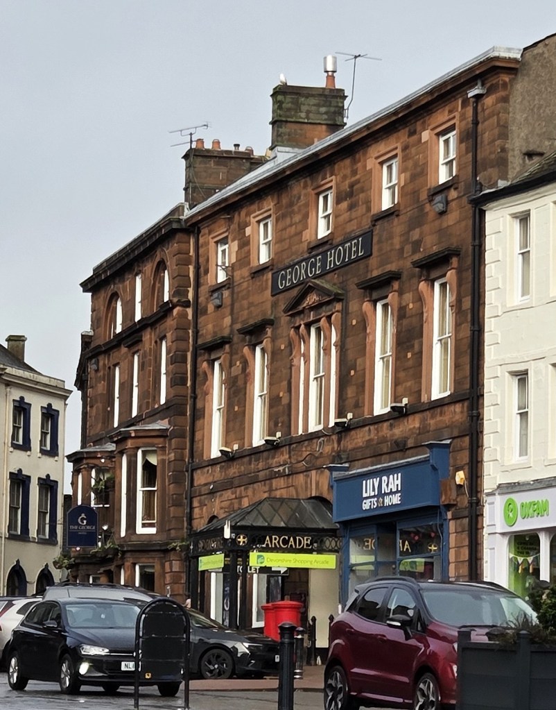
The George Hotel sits in a time warp, transporting its guests back some seventy years. It seems much beloved by guests who can still recall the 1950s, including several luncheoning ladies, some of whom continue to cultivate the twinset-and-pearls look that would have been compulsory for their grandmothers.
According to its Grade 2 listing parts of the George date from the early Eighteenth Century, parts from the mid-Nineteenth Century and parts from 1924.
The Hotel’s own publicity adds that it began life as the George and Dragon Inn, located next door to the current premises. Charles Edward Stuart (Bonnie Prince Charlie) stayed there from 21 to 22 November 1745, as the Jacobite army progressed southwards during the Uprising.
The Jacobite army reached Derby, but then retraced its steps, initially encountering government forces at Clifton, near Penrith, on 18 December. The Jacobites were victorious in the Clifton Moor Skirmish, reaching Scotland, but were ultimately defeated at Culloden in April 1746, Charles fleeing to the Hebrides and thence to France.
It was during ownership by the Duke of Devonshire, from 1792, that the George shifted to its present location. It has been sold several times since, especially post 1951, and was most recently acquired in 2108, by Everbright Hotels Ltd.
Despite all this, the staff are competent and the Hotel is efficiently run.
We had booked a ‘feature room’ and were allocated Room 5, which was spacious with a king-sized bed, ample storage and a generous bathroom. Our windows looked on to a small courtyard, protected by nets from marauding fowl.
On arrival, the radiators were blasting out tropical heat. Once I’d turned them off and opened the window, it was possible to enjoy a recuperative afternoon nap.
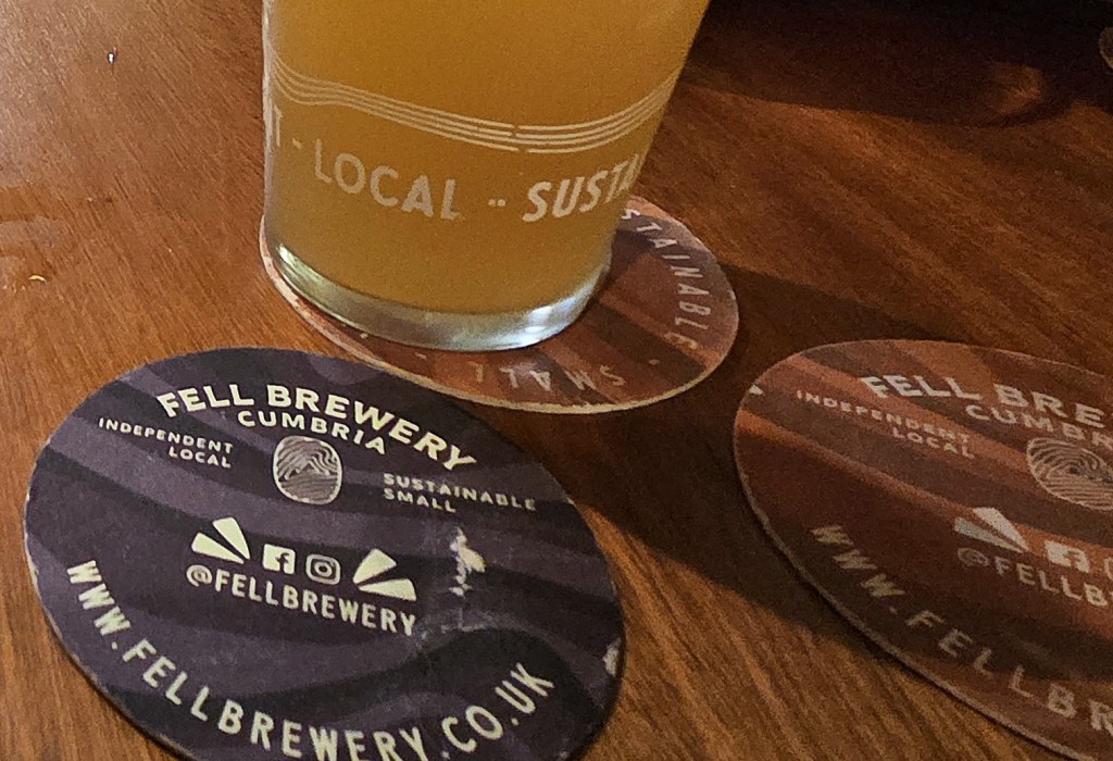
We hit the town again later, heading first to the Fell Bar, a craft beer outlet belonging to the Fell Brewery, founded in 2013. I ordered a very pleasant Fell Session IPA, while Tracy had a Smith & Sons Sahara Dry Cider.
It was Quiz Night and the place was heaving with 20- and 30-somethings from the Cumbrian hinterland. We managed to bag the last available table upstairs, successfully exchanging it for one downstairs when the quiz was imminent.
Here we made the acquaintance of an enthusiastic Bernese Mountain puppy with huge paws, very affectionate and completely fascinated by everything happening around him. The owners said they were trying to get him more used to people, by exposing him to such busy surroundings, but he was still anxious to make the acquaintance of everyone he met.
We stayed for one drink only, since Tracy had booked a table at Four & Twenty, just a few doors down. It was perhaps half-full – not bad for a Thursday evening these days.
It being my birthday, we chose from the a la carte menu, with paired wines alongside. I had soufflé, lamb and Bakewell tart; Tracy opted for duck, halibut and Bakewell tart. The food was excellent, as was the wine.
Back in our room, we caught up with the news that the former Prince Andrew had been arrested on his birthday, for he is exactly one year younger than me.
He’s not a particularly likeable man but, even so, I thought it a little mean-spirited for the police to take him in on that day in particular. Not only was it his birthday, but also the day on which he officially became an OAP!
Day 2: Penrith and the transfer to Derwentwater
We began the day with breakfast in the George – the Full Cumbrian for me and Eggs Benedict for Tracy.
Despite its traditional mien, the George follows the increasingly prevalent practice of supplying only machine-made coffee. It was passable, merely.
I became familiar with the old-fashioned rolling toaster. I had seen these contraptions before, but had never been called upon to operate one.
Having checked out, we left our bags again, and began a more systematic exploration of Penrith.
We’d already found an online walking tour, but picked up a slightly different version in a leaflet from the tourist information office. This piloted us around the principal sites of interest.
Penrith is part of the Westmoreland and Furness Unitary Authority, formed in April 2023, and sits just outside the Lake District National Park. It is in the Eden Valley, near the River Eamont, and has a permanent population of almost 17,000.
The local economy is dominated by tourism and agriculture. It is a market town, which formerly had a lucrative sideline in tanning, not to mention five breweries.
It still hosts the Queen Elizabeth Grammar School (QEGS), now co-educational but originally established as a boys’ school in 1564.
Aside from the future Richard III, who lived for a while at Penrith Castle (see below), notable residents have included John Macadam (1756-1836), Wordsworth’s mother Ann (nee Cookson) (1748-1778), author Fanny Trollope (1779-1863), Samuel Plimsoll (1824-1898) and Harold Wilson’s wife Mary (nee Baldwin) (1916-2018).
Penrith has an extensive history, admirably summarised in the Coronation Garden, established in 1938, an early stop on our walking tour.
There is abundant evidence nearby of Neolithic, Bronze and Iron Age settlement. The Romans built several forts roundabout, while Penrith sat on the Roman road between Manchester and Carlisle.
The Angles invaded in the Seventh Century, while Viking settlements were established from circa 870. In 927, a gathering of British Kings took place nearby, including King Athelstan. Some historians regard this event as marking the founding of England.
The northern border of England was then the Eamont River, with the land to the north, as well as the vestigial town of Penrith, under the control of the Kings of Strathclyde.
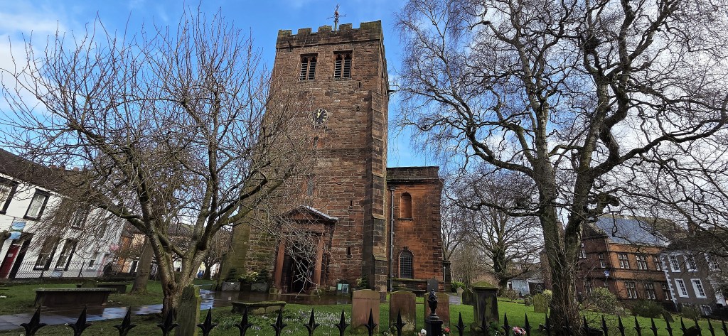
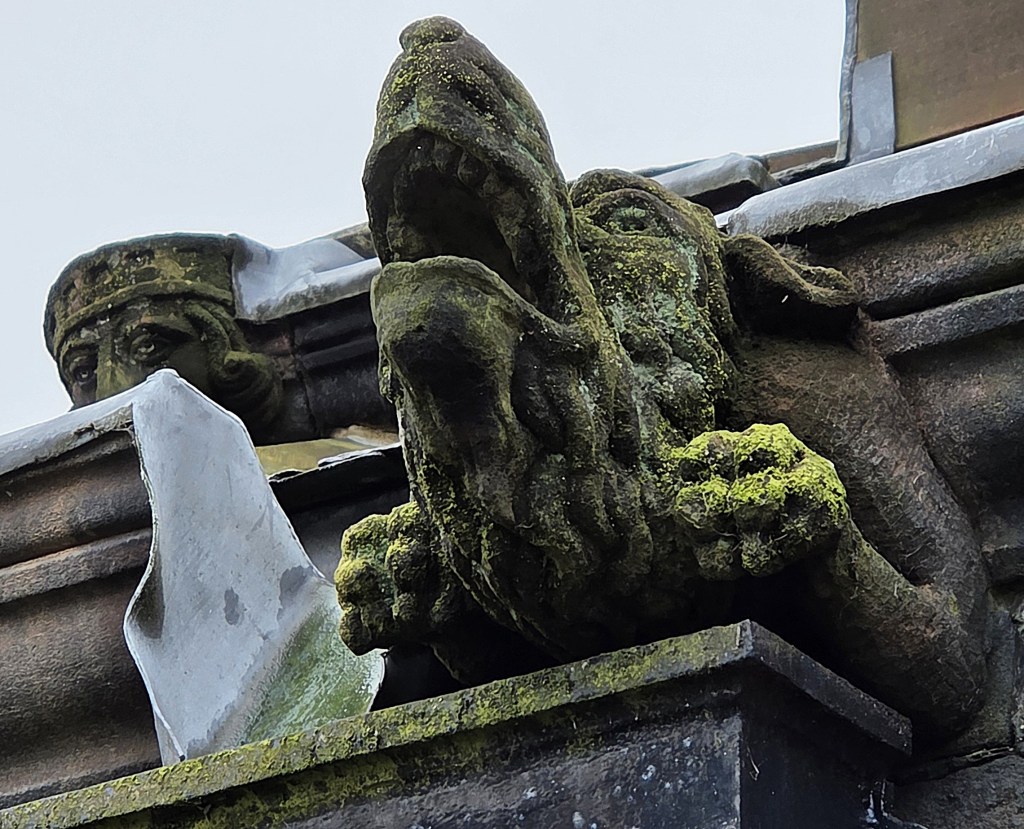
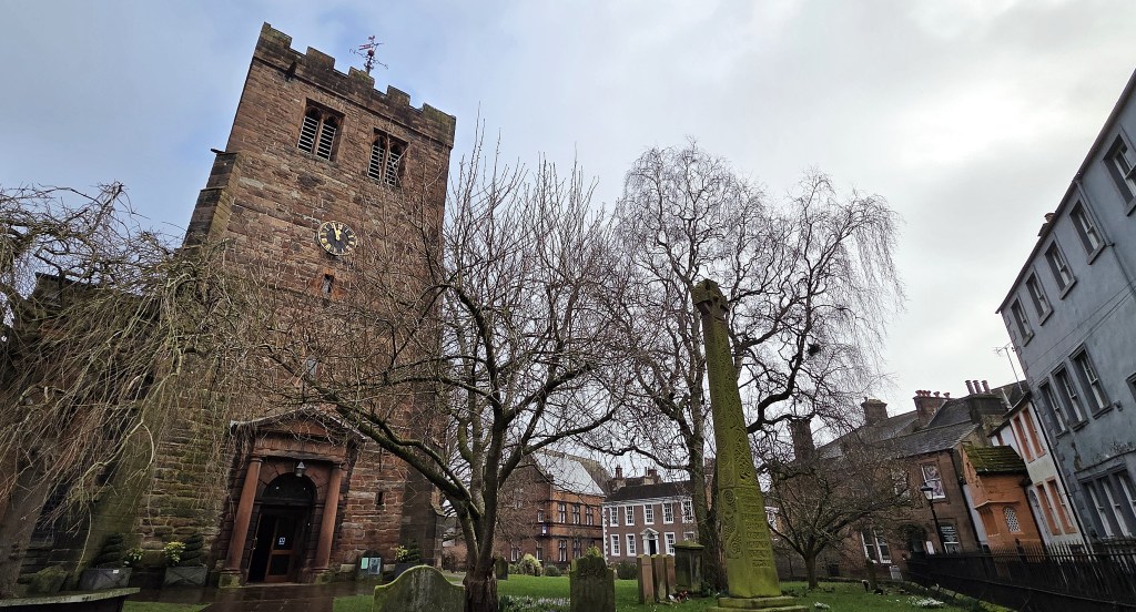
St Andrew’s Churchyard contains a mysterious ‘Giant’s Grave’ which synthesises Christian and Viking imagery, leading to speculation that it might be a contemporaneous commemoration of the Kings’ gathering.
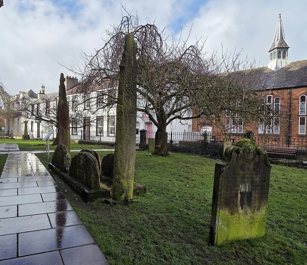
Alternatively, it may commemorate the Tenth Century King of Strathclyde, Owain ap Dyfnwal, who was King of Cumbria from 920 to 937. Or possibly one Sir Owen Caesarius (also known as Sir Hugh or Sir Ewan) who, according to legend, was a renowned hunter of wild boar.
Then again, these elements may have been assembled here at a later date by an enthusiastic antiquarian. No-one knows for sure.
The Norman Conquest did not reach these parts until 1092, when William Rufus (c.1057-1100) conquered the north of Cumbria. Several settlements, including Penrith, were incorporated into a Crown estate. By 1187, Penrith and a handful of its neighbours were being collectively described as ‘the Honour of Penrith’.
Henry III granted the Town its Charter in 1223. The tower of St Andrew’s Church dates from the Twelfth and Thirteenth Centuries, though the remainder was rebuilt from 1721.
Between 1242 and 1295, the ‘Honour of Penrith’ was transferred to the King of Scotland, as compensation for surrendering his claims to the remainder of Northumberland, Cumberland and Westmoreland.
King Edward I later brought the Honour back under the English Crown.
During the Wars of Scottish Independence (1296-1357), Penrith suffered repeated attacks, and began to be fortified, though further Scottish raids took place in the latter part of the Fourteenth Century.
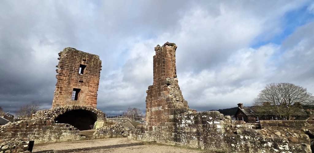
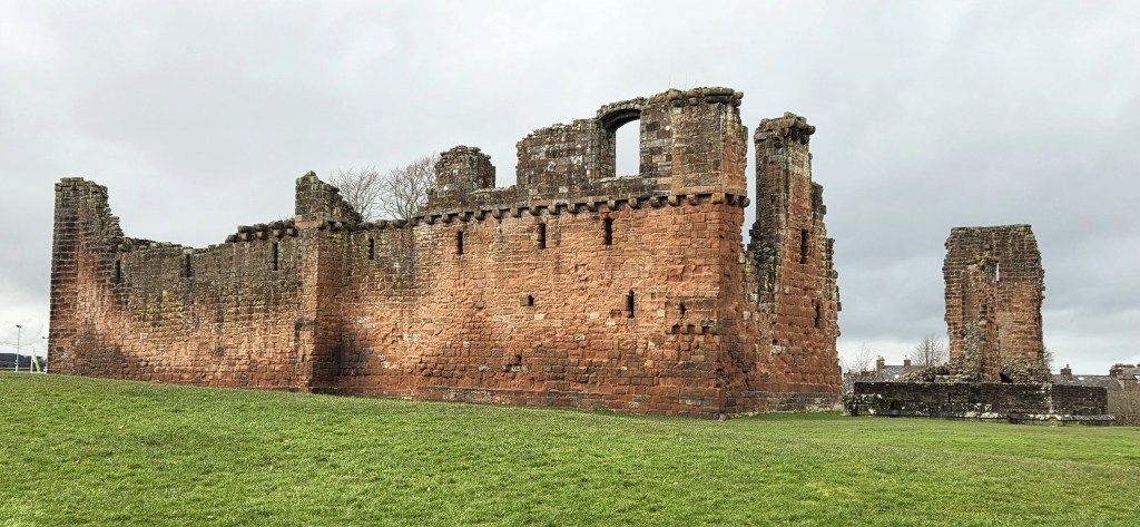
Penrith Castle was built between 1399 and 1470, most probably by Ralph Neville, First Earl of Westmoreland (c.1364-1425) and his son, Richard Neville, Earl of Salisbury (1400-1460).
Following the latter’s death, the Castle passed to Richard, Earl of Warwick (the ‘Kingmaker’) (1428-1471), but he died without a male heir, so King Edward IV granted the Castle to Richard, Duke of Gloucester, later King Richard III (1452-1485).
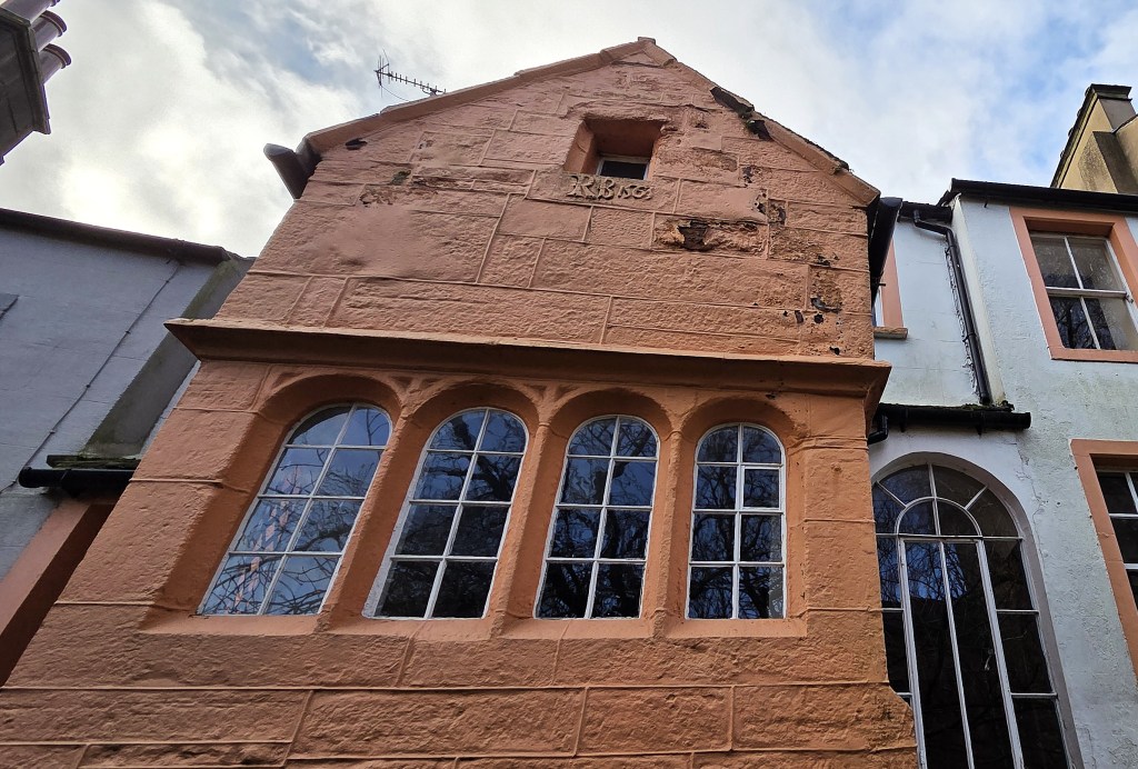
The founding of QEGS and the survival of the so-called Tudor House in St Andrew’s Place point to a growing prosperity, built upon the foundations of Penrith’s status as a long-established market town. But, from 1597 to 1598, the population was severely depleted by the Plague.
The Union of the English and Scottish Crowns under King James I finally brought an end to the activities of the Border Reivers who, for over two centuries, had exploited the lawlessness of the region, conducting raids and feuding endlessly with their rivals.
During the English Civil War, Penrith was neither strongly Royalist nor strongly Parliamentarian, but there was a skirmish when Parliamentarian General John Lambert (1619-1684) was forced from the Town by Scottish Royalists in 1648.
Both Jacobite risings – the former in 1715, the latter in 1745 – saw Jacobite forces pass through on their way southwards.
During the remainder of the Eighteenth Century there was comparatively little industrialisation, but embryonic tourism was aided by the significance of the Lakes to the Romantic Movement, as well as the fact that Penrith lay on the stagecoach routes between London and Scotland.
Several prominent Penrith buildings date from this period, during which the population increased to some 4,000.
At some point the Town also acquired a mile-long racecourse, its grandstand erected in 1814. The site was taken over by a golf course towards the end of the Nineteenth Century.
By 1829 there were 57 pubs in Penrith, allegedly because the quality of drinking water was so poor. The Town was badly affected by a county-wide outbreak of cholera in 1848, which led to the formation of a local Board of Health and the construction of a waterworks.
Penrith Station, built by the Lancaster and Carlisle Railway, opened in December 1846 and, by 1851, the population had soared to well over 7,000. Penrith Building Society was established in 1850, acquiring several acres on Beacon Hill for housing development.
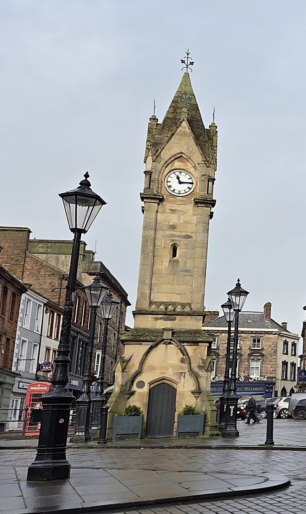
The Musgrave Clock Tower in the Town centre was erected in 1861, as a memorial to Philip Musgrave, eldest son of Sir George and Lady Musgrave, who had died aged 26 in Madrid two years previously.
In 1894 Penrith Urban District Council was formed, its Town Hall created from two Eighteenth Century houses in 1905-06.
Council housing estates were built in the 1920s and the late 1940s, when an industrial estate was also created. This benefited considerably from the construction of the Penrith bypass, part of the M6 motorway, which opened in 1968.
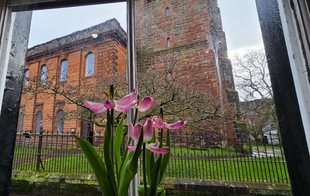
We paused mid tour to take coffee in Café Dawn Marie, adjacent to St Andrew’s Churchyard. We sat beside a window, looking out upon the Church, with a potted pink tulip in the foreground.
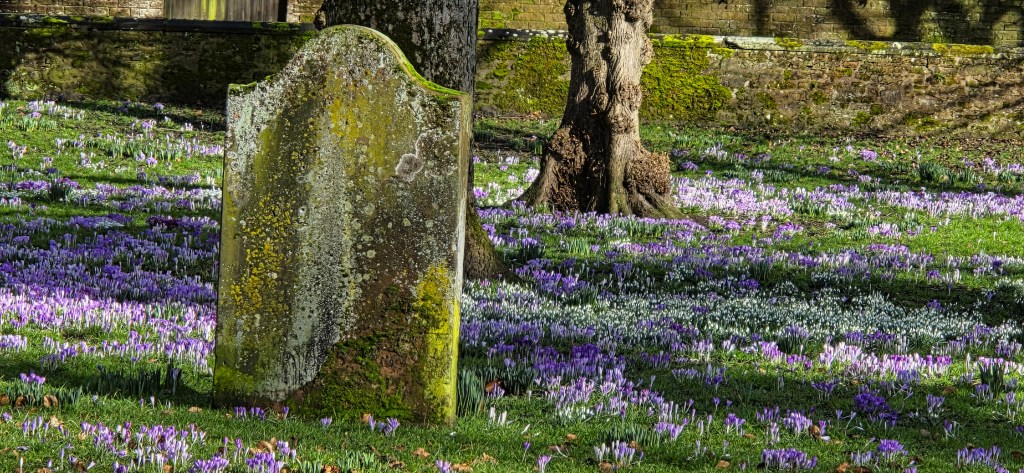
There were thousands of purple crocuses amongst the graves.
On the next table an elderly raconteur was regaling an equally elderly married couple with endless tales from his younger days, all of them delivered in a broad accent, more redolent of Lancashire than Cumbria.
Having completed our walking tour, we took a closer look at the Castle ruins.
After Richard III’s death, the Castle reverted to the Crown estate until, in 1696, King William III gave it to his favourite, William Bentinck, 1st Earl of Portland (1649-1709).
By this stage, the building was already in a poor condition.
Bentinck’s descendants sold it to the Dukes of Devonshire in 1787, who sold it on to the Lancaster and Carlisle Railway Company in the 1840s. They used it as stabling for horses before it was finally acquired by the District Council in 1912.
In the 1920s the Council established a park surrounding the Castle, which is now managed by English Heritage.
We returned to central Penrith for lunch in the Three Crowns Tea Shop before collecting our cases from the George.
A heavy shower forced us beneath the portico, but we were soon picked up by A-Cabs, who drove us the 20 miles or so to our destination for a fare of £60.
As we sped towards Derwent Water, we observed keenly the conditions up on the fells, where several patches of snow were still visible. The shower eventually passed and we even spotted a distant glimmer of sunlight!
Derwent Bank and Environs
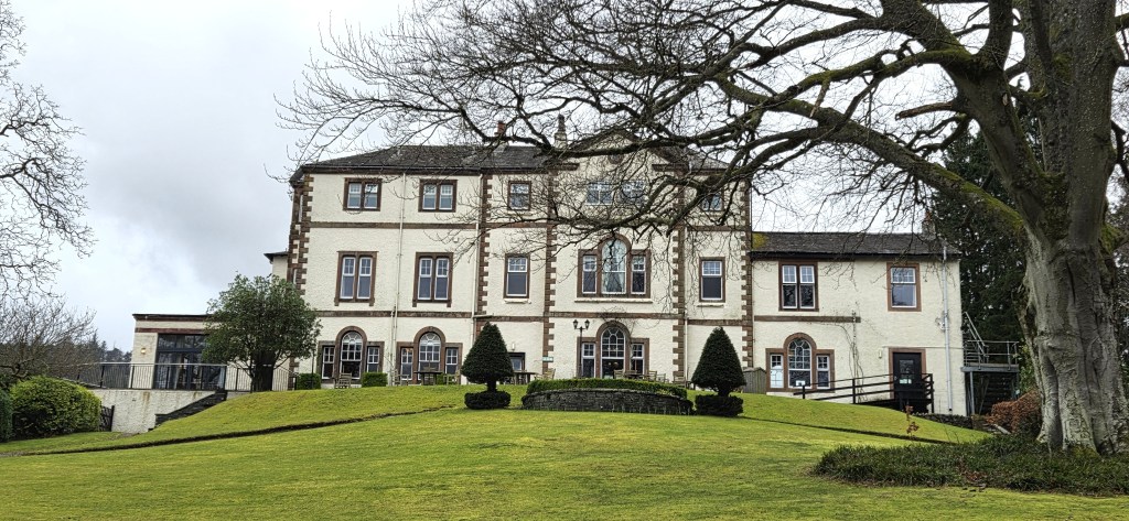
Arriving at Derwent Bank, HF’s country house, located on the north-east coast of Derwent Water, we were quickly processed and climbed up to our room.
We had been allocated Room 40, on the top floor of the main building, a little to the right of the entrance, almost immediately above the boot room.
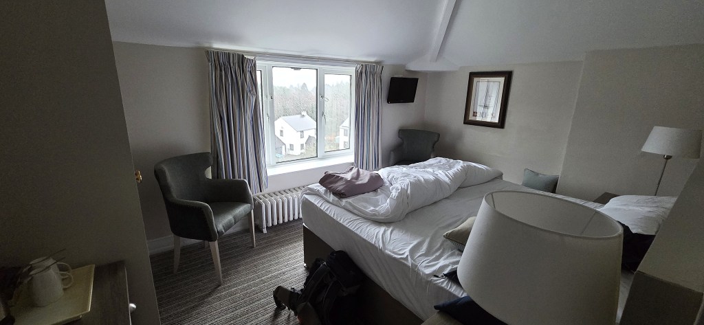
If the bedroom was a little poky, the bathroom was correspondingly generous. The wifi was distinctly dodgy, while the ancient pipes complained a little from about 04:00 each morning. On the other hand, our bathroom contained a bath, worth its weight in gold on a winter walking holiday in the Lakes.
We weren’t too bothered. We’d purchased the holiday at a large discount, and would be spending very little time in our room in any case.
Once unpacked, we hastened downstairs for the traditional cream tea welcome, where we chatted with other guests. Seventeen people were signed up for the guided walking holiday, plus many more who were self-guided. They would be eating breakfast and dinner with us, but we would see little of them otherwise.
Afterwards we joined two of our volunteer walk leaders and a handful of other guests for a walk in the locality.
Derwent Bank has 40 guest rooms and aside from the dining room, a sizeable bar and extensive lounge areas. These look out onto the lawn, which stretches down to the shores of Derwent Water.
The building was originally known as Finkle Street House (after a road in nearby Portinscale) and was built in 1785 for Joseph Pocklington (1736-1817), formerly the High Sheriff of Newark.
He was the eccentric son of a wealthy Nottinghamshire banker who had inherited a substantial fortune at the age of 26. He had first visited the Lake District in 1768 and, a decade later, purchased Derwent Island House, located on the northernmost island on Derwent Water.
Having constructed there various buildings of his own design, he sold the property to General William Peachey in 1796, moving to the newly-built Barrow House on the eastern side of Derwent Water.
Pocklington himself probably never lived at Derwent Bank, though he drew his own plans for that house too, resulting in a somewhat unconventional structure.
These architectural experiments did not escape criticism from his contemporaries and neighbours, who included the poets, Coleridge, Southey and Wordsworth.
In 1824, after Pocklington’s death, Derwent Bank was sold to Lady Gordon, widow of Lord William Gordon (1744-1823), second son of the Third Duke of Gordon.
Lord William had eloped in 1768 with his cousin, Lady Sarah Bunbury, formerly Sarah Lennox, daughter of the Second Duke of Richmond and Lennox. She had been married to one Charles Bunbury but had left him, having fallen pregnant with Lord William’s child.
Bunbury sued for divorce. But then Lady Sarah left Gordon too.
Finally, in 1781, he contracted a controversial marriage with Frances Ingram Shepheard, daughter and co-heir of the 9th Viscount Irvine. Shortly afterwards, he began to acquire estates on the western bank of Derwent Water, no doubt purchased with her inheritance.
After Lady Gordon’s death in 1841, the house passed in 1847 to David Ross Leitch (c.1809-1881) a Tyneside physician, poet, and regular correspondent of Wordsworth’s.
Emily Haigh Edmondson (nee Evans) (1859-1936) was the widow of Edward Ernest Edmondson (1858-1900), squire of Springfield Hall, Knowle, Warwickshire. She purchased Derwent Bank shortly after her husband’s death and, by the time of the 1911 Census, was living there with one daughter and six female servants.
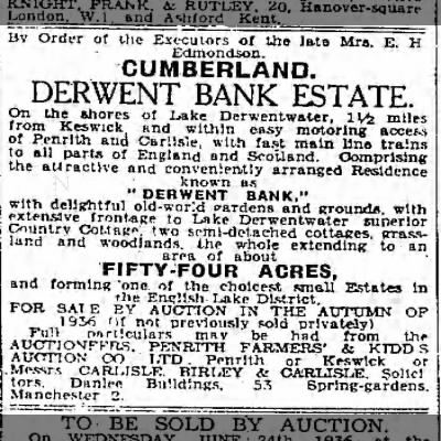
When she died in 1936, the property was advertised for sale, becoming part of the Holiday Fellowship portfolio at the end of that year, in readiness for the 1937 season.
Having listened to the rudiments of this history, we walked together into the nearby village of Portinscale, whose name means ‘the harlot’s hut’.
We began by scrutinising some of the houses in the private road opposite Derwent Bank, universally known as ‘Millionaire’s Row’, before heading on to the centre of the Village.
Portinscale had become a hotbed of Quakerism by the Seventeenth Century. It boasted a coaching inn called the Black Dog, which subsequently changed its name to the Marshall Blucher and is now the Derwentwater Hotel.
There is also a residential outdoor education centre, owned by Sunderland City Council since 1962. As we approached the Hotel, presently a shell encased entirely in scaffolding, a group of children descended from a coach and, collecting their luggage, began to form a crocodile that snaked towards the centre.
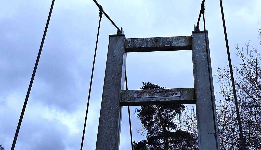
We walked beyond, soon arriving at the wobbly footbridge which leads to the fields between Portinscale and Keswick, known as the Howrahs. (Howrah was a suburb of Calcutta, so this may allude to a local landowner, Edward Stephenson (c. 1691-1768) who had formerly served in the East India Company.)
On the way back, we discovered that four of us had lost our partners and that all three men had lost their wives to breast cancer. It was a brief moment of male solidarity, for each of us had overcome a similar tragedy.
We retraced our steps to Derwent Bank in time to catch the ‘walks talk’, setting out our options for the next day. I accompanied this with a pint of Keswick Gold from the Bar.
Provided there is demand, HF country houses typically run three different walks each day: an easier route, a moderate walk and a more challenging option with substantial ascents and descents.
These are pre-arranged, but the volunteer walk leaders may vary them to suit the prevailing weather conditions. Guests choose their preferred option the evening before.
Immediately afterwards we were called to dinner: we had already submitted our choice of starter, main and dessert, as well as our selections for the packed lunch we would be carrying with us next day.
Back in our room, the television news was dominated by the Winter Olympics and Trump losing his Supreme Court case over the imposition of tariffs.
During the night the wind wrestled with the open window (secured by a wire fastening to prevent it from breaking) while hot water was noisily warmed for our morning showers.
Tracy slept peacefully the whole night through, as is her wont, while I woke prematurely, struggled to regain somnolence and eventually dozed till daylight.
Day 3: Cat Bells and High Spy
It was Saturday morning. The weather forecast was reasonable for the next several hours, but persistent rain was scheduled to set in from 14:00.
All three walking options featured the nearby fell known as Cat Bells, which sits above the western shore of Derwent Water.
- Option 1, a 7-mile walk along Cat Bells Terrace;
- Option 2, again 7 miles, visiting the summit of Cat Bells before descending to a path along the western shore of Derwent Water;
- Option 3, a 12-mile circuit over the summits of Cat Bells, Maiden Moor and High Spy, returning via the Newlands Valley.
We opted for the latter, though John, our volunteer leader, warned us that he might decide to descend and return on the Lake side of Cat Bells if the wind proved to be against us on the opposite slope.
The majority had selected this harder walk, 12 of us in all. We left Derwent Bank shortly after 09:30, in company with the far smaller group undertaking Option 2. Everyone would be able to switch to this easier walk following the summit of Cat Bells.
According to Alfred Wainwright (1907-1991), the high priest of Lakeland fell walking, the origin of the name ‘Cat Bells’ is uncertain, but it may be derived from the Old English word ‘catte’ and the Middle English word ‘belde’, together meaning ‘the habitation of the wild cat’.
According to James Clarke’s ‘Survey of the Lakes’ (1774), these animals were once prolific in the vicinity of Keswick. He described them thus:
‘The wild cats here are of different sizes, but all of one colour, (grey with black strokes across the back;) the largest are near the size of a fox and are the most fierce and daring animals we have; they seem to be of the tyger kind, and seize their prey after the same manner; they cannot be tamed; their habitation is amongst the rocks or hollow trees.’
Wainwright himself says of Cat Bells:
‘It is one of the great favourites, a family fell where grandmothers and infants can climb the heights together, a place beloved. Its popularity is well deserved: its shapely topknott attracts the eye offering a steep but obviously simple scramble.’
There are three former lead mines on the slopes of Cat Bells, though all ceased production during the 1890s and most of the shafts have been blocked off.
In 1924 the novelist Hugh Walpole (1884-1941) moved into a house called Brackenburn Lodge at the foot of Cat Bells, living there for the rest of his life. He is buried in the churchyard of St John’s in Keswick.
According to Beatrix Potter (see below), Mrs Tiggy Winkle also lived behind a ‘door into the back of the hill called Cat Bells’.
And someone has even written a villanelle about the place!
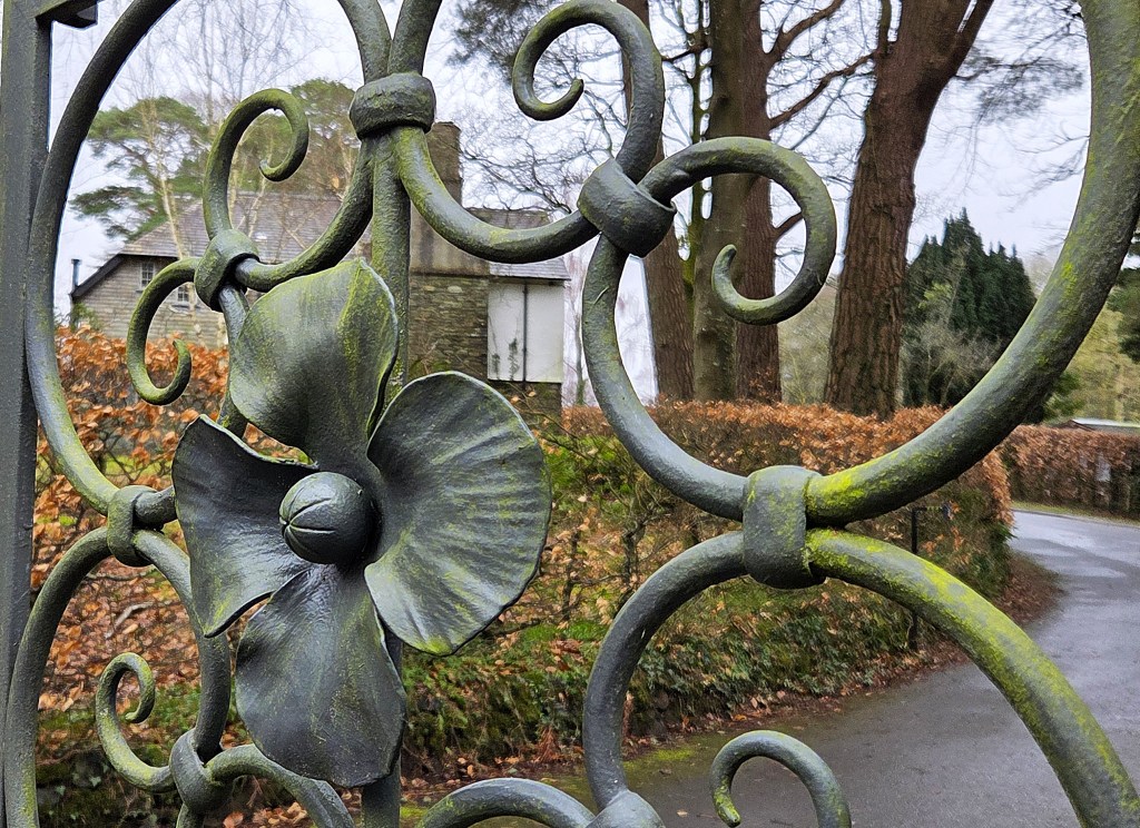
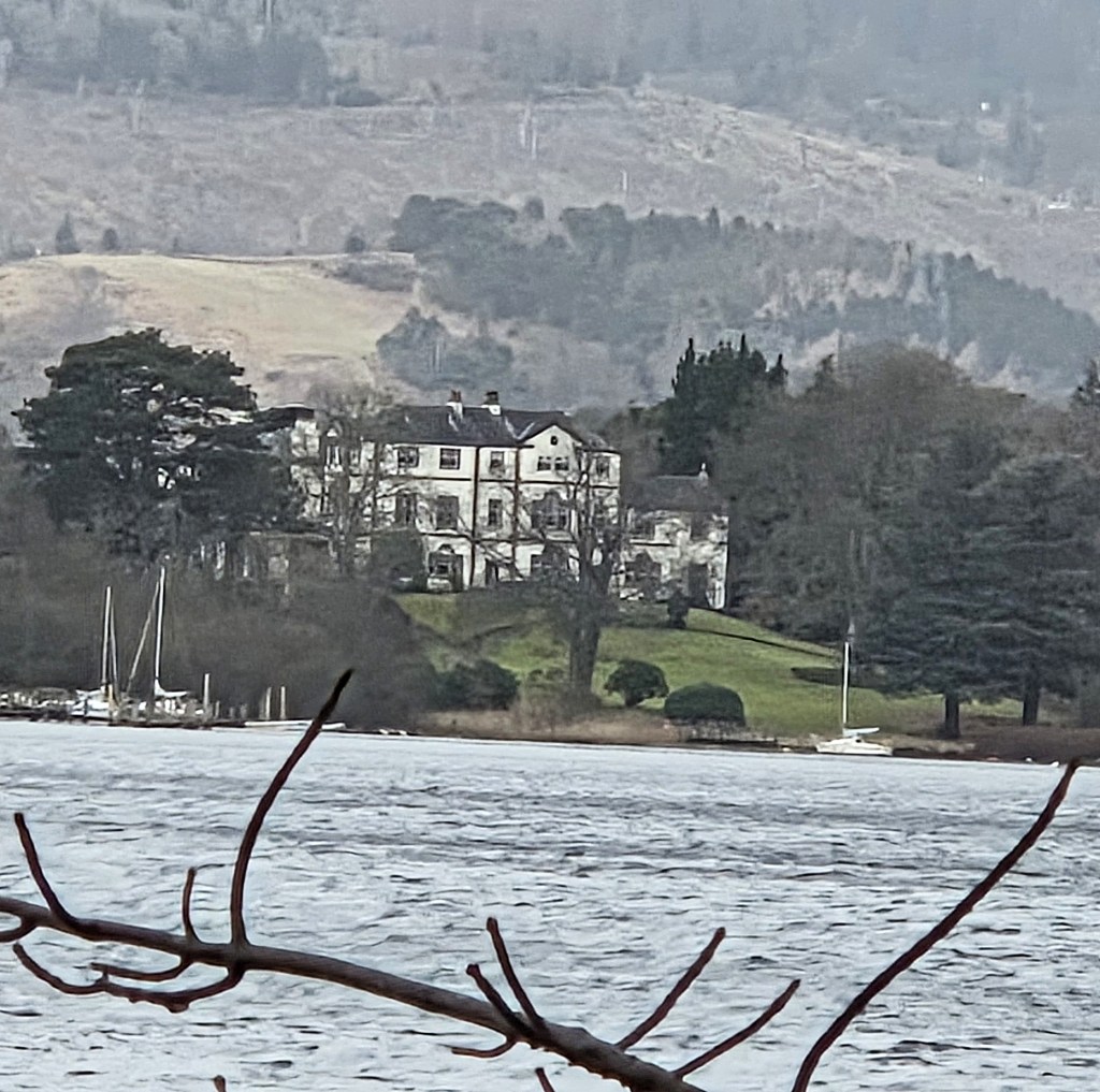
Our walk began through woodland, and brought us adjacent with Lingholm, a country house completed in 1875 for Lieutenant Colonel James Felton Greenall (1834-1899), part of the family behind Greenall’s Brewery.
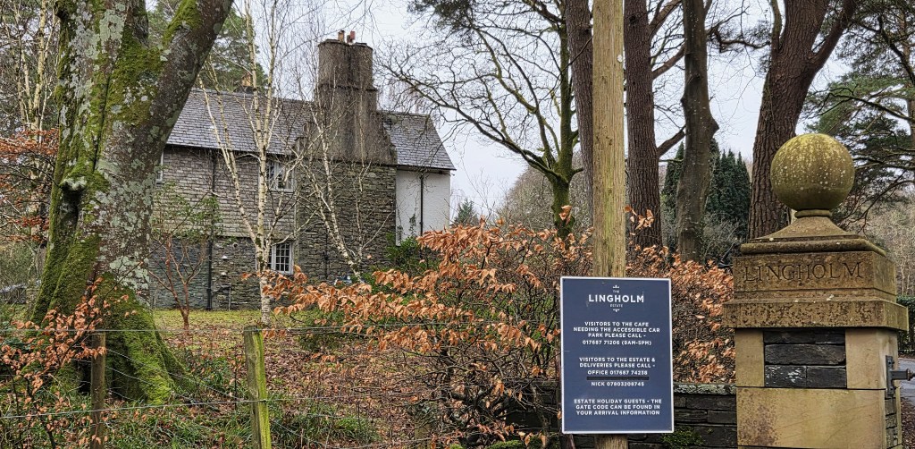
During the 1880s it was purchased by Colonel George Kemp, later First Baron Rochdale (1866-1945), owner and chairman of Kelsall and Kemp, a woollen goods manufacturer based in Rochdale. It remained in the possession of his descendants until 2013.
But it was often let out as a summer residence and Beatrix Potter (1866-1943) spent nine summers here between 1885 and 1907, often staying with family and friends.
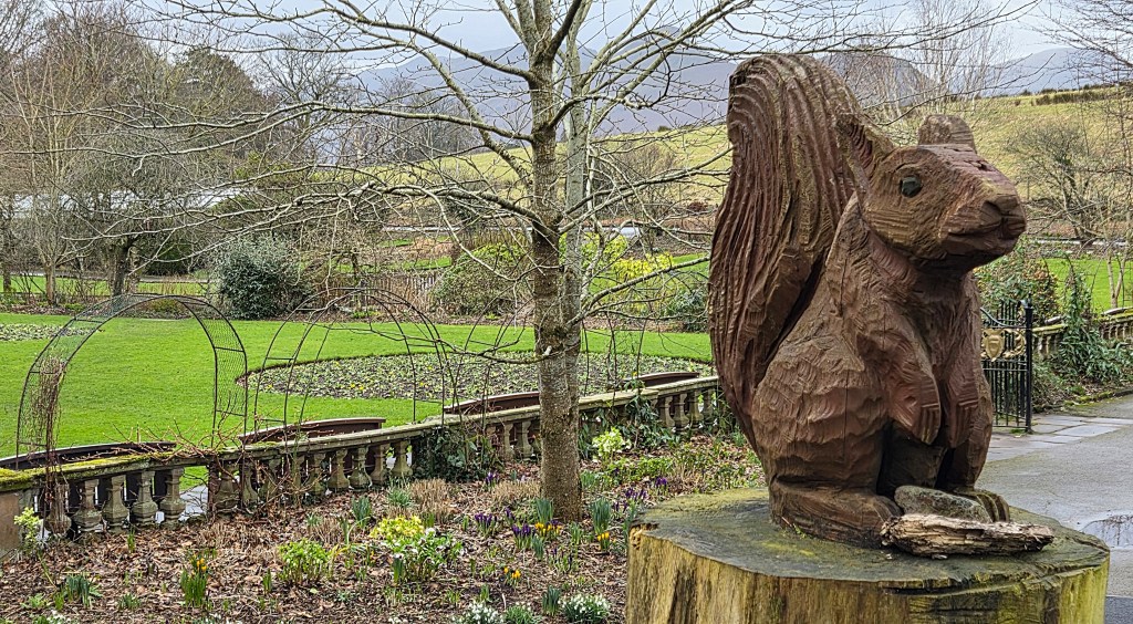
The red squirrel population in the surrounding woodland helped to inspire ‘The Tale of Squirrel Nutkin’ (1903).
During the summer of 1901, Potter had sketched the squirrels and the surrounding landscape, including St Herbert’s Island on Derwent Water, which Potter transformed into Owl Island, to which her squirrels sailed on rafts to gather nuts…
Lingholm’s kitchen garden had also provided the inspiration for Mr McGregor’s vegetable garden in ‘The Tale of Peter Rabbit’ (1901).
During the First World War the house became a convalescent home for injured military officers. During the Second World War it was briefly a boarding school for children evacuated from Newcastle.
The First Baron Rochdale died at Lingholm and his son, the First Viscount Rochdale, made it his family home, moving here in the late 1940s. The Estate, which had once exceeded 1,000 acres, now shrank, as much of the farmland was sold off.
In 1963 the daughter of the First Viscount, the Hon. Bryony Kemp, died in a horse-riding accident on the Estate, aged only 16. Her death was caused by acute meningitis following a skull fracture.
The family were Christian Scientists who believed in prayer as the basis of healing, rather than medical care. According to contemporary newspaper reports of the Inquest, the jury returned a verdict of Accidental Death after a local pathologist said he couldn’t be certain that the girl would have survived with medical treatment.
A memorial garden was planted in her memory.
The First Viscount died in 1993 and Lingholm was inherited by the Second Viscount, who was already resident upon the Estate. The gardens and tea rooms, which had been open to the public, were closed down.
In 2013 the Estate was purchased by the Seymour family, principally David Seymour, a Leeds businessman. He bought Lingholm for £6.5m after selling his company, Everbuild, which manufactured sealants, adhesives and fillers and accumulated an annual turnover of some £60m.
The Seymours restored the property, reopening the cafe and garden. Several apartments within the main building are now available as holiday accommodation, as are some adjacent properties.
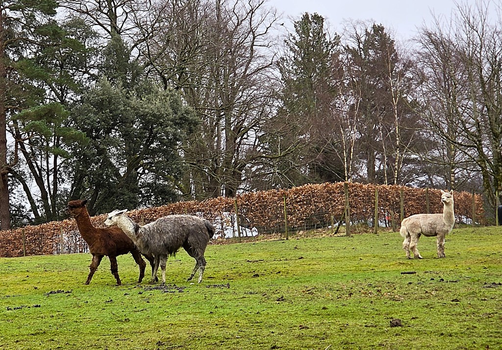
A field next to the footpath contains several Alpacas, cared for by a non-profit social enterprise called Alpacaly Ever After, an excruciating pun.
Based in nearby Braithwaite, they specialise in providing a home for unwanted Alpacas and Llamas. It isn’t quite clear from the website how many animals have benefited.
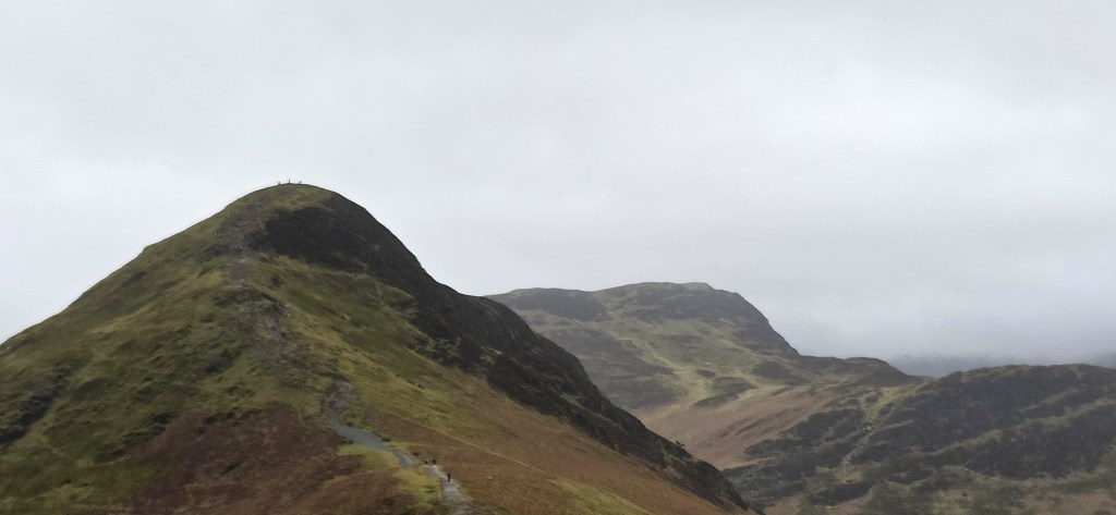
Emerging from the woodland, we crossed a flat meadow which gave a good view of Skelgill Bank, with the summit of Cat Bells beyond.
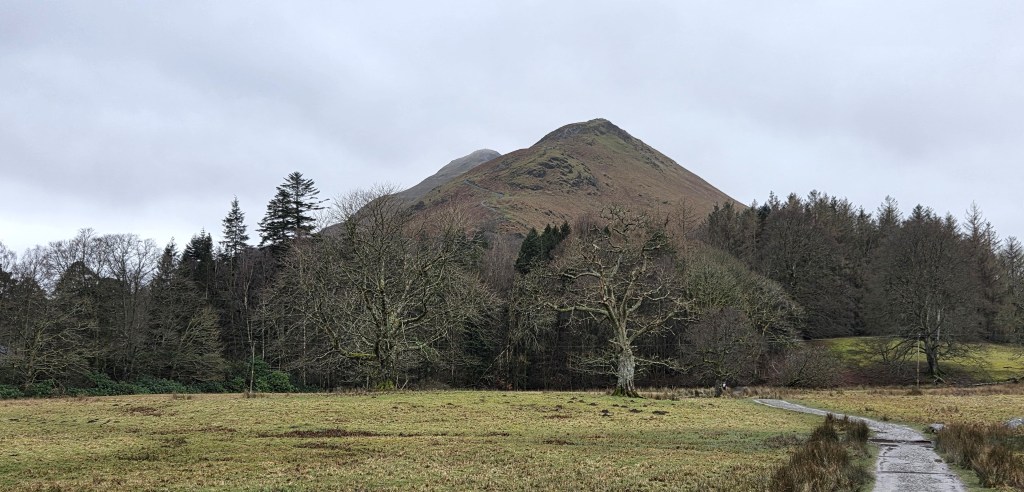
Skelgill Bank is itself 338 metres high. It is not a Wainwright, though it is a ‘Birkett’, (meaning it is one of the 541 fells listed in ‘Complete Lakeland Fells’ by Bill Birkett (1994)) and it is also a ‘Synge’ (meaning a hill over 1000 feet high included in ‘The Lakeland Summits’ by Tim Synge (1995)).
We began the ascent of Skelgill, our first serious action of the week.
Though it was before ten on a dull Saturday morning in late February, we were by no means alone, and the numbers only increased as we climbed higher.
Maybe it was the first dry morning there had been for some time.
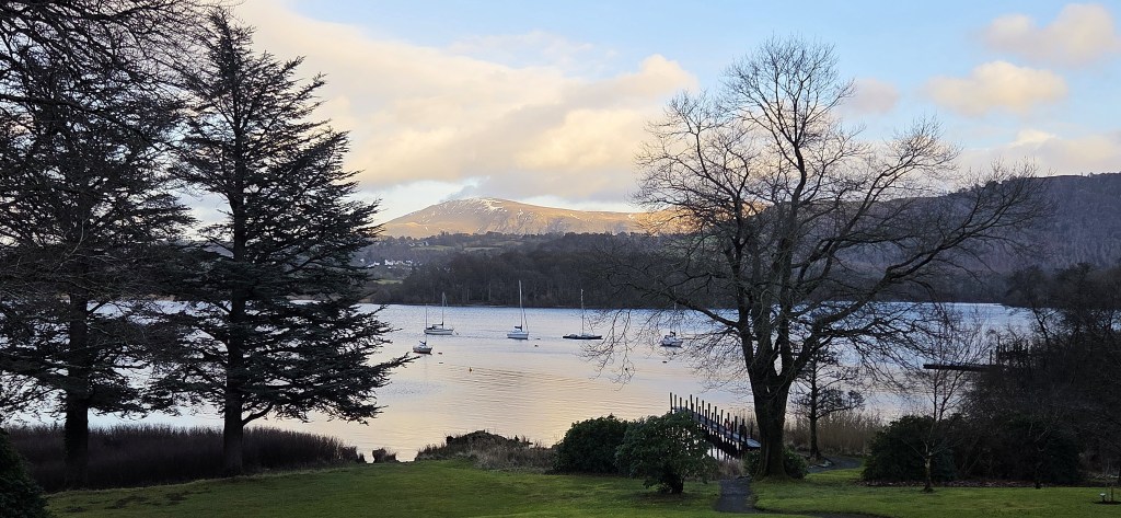
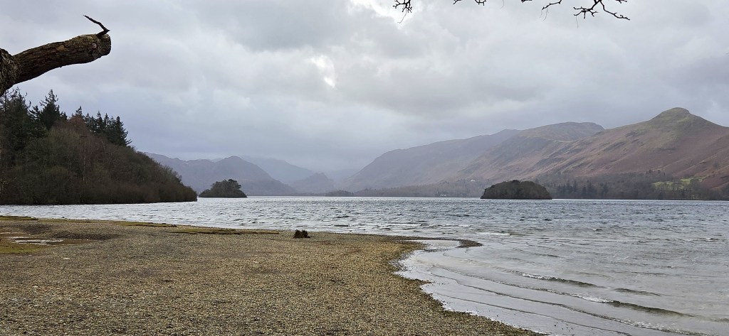
Soon we were above the treeline and could see Derwent Water spreading out below, the houses of Keswick clustering at the far end.
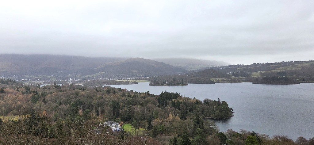
We were looking over Otterbield Bay and the tiny Otterbield Island, towards St Herbert’s Island, Derwent Water’s largest, covering more than four acres.
Long before it attracted Potter’s attention, this was once the home of St Herbert of Derwent Water. He was a friend and disciple of St Cuthbert, Bishop of Lindisfarne, who urged him to become an anchorite. So he took up residence here in a tiny cell, eating fish from Derwent Water and vegetables he grew on the Island.
Some claim that the ruins of the cell may still be seen, but they are most likely the remains of a summerhouse, or possibly a chapel erected here in medieval times, when indulgences were available to those who made the pilgrimage across the water on St Herbert’s Day – 20 March.
According to Bede, Herbert died on that day in 687, as did Cuthbert.
Wordsworth wrote a poem about Herbert, published in 1815. It begins:
‘This Island, guarded from profane approach
By mountains high and waters widely spread,
Is that recess to which St. Herbert came
In life’s decline; a self-secluded Man,
After long exercise in social cares
And offices humane, intent to adore
The Deity, with undistracted mind,
And meditate on everlasting things.
—Stranger! this shapeless heap of stones and earth
(Long be its mossy covering undisturbed!)
Is reverenced as a vestige of the Abode
In which, through many seasons, from the world
Removed, and the affections of the world,
He dwelt in solitude.’
Eventually we came to a substantial rocky outcrop, still damp from the previous night’s rain, where a little scrambling was required.
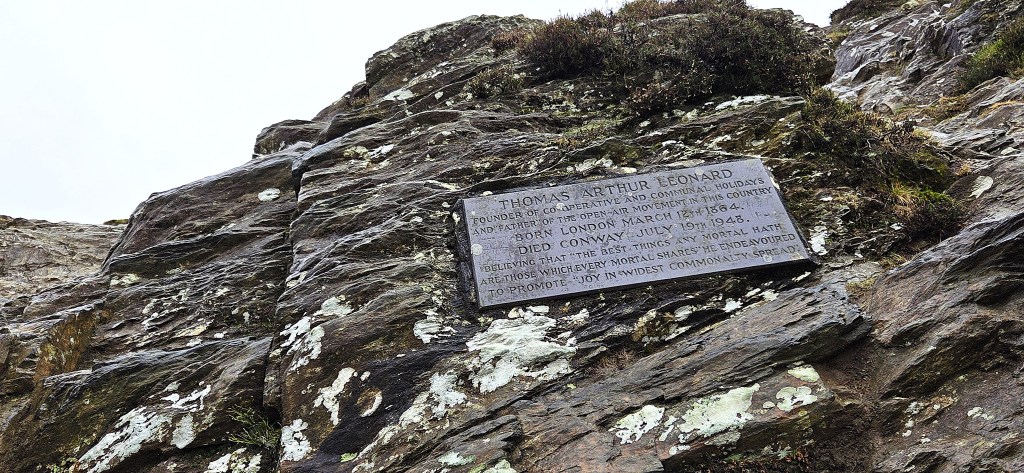
Fastened to the rock there is a large plaque recording Thomas Arthur Leonard (1864-1948):
‘Founder of co-operative and communal holidays and father of the open air movement in this country.
‘Believing that “the best things which any mortal hath are those things which any mortal shares”, he endeavoured to promote “joy in widest commonalty spread”’
Leonard co-founded the Co-operative Holidays Association in 1897 and, partly because he was concerned that its guests were becoming too middle class, followed up with the Holiday Fellowship in 1913, which today is known as ‘HF Holidays’!
A Quaker and a pacifist, he was also involved in establishing the Ramblers’ Association and the Youth Hostels Association.
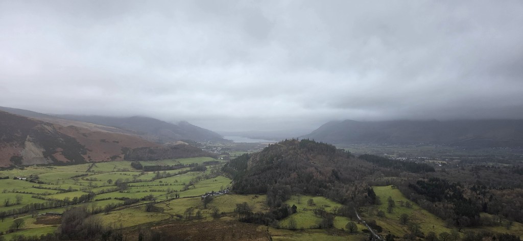
Miraculously, the summit of Skelgill Bank was clear of cloud and we could see across to Bassenthwaite Lake, officially the only lake in the Lake District (because the rest are either ‘waters’, ‘meres’ or ‘tarns’).
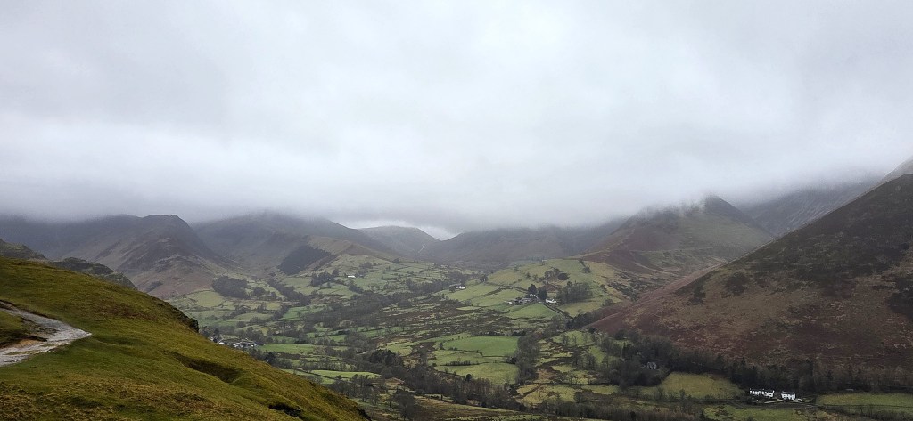
On gaining the ridge that connects Skelgill with Cat Bells, we could choose between the view down to the southern stretches of Derwent Water, now with the rusty red-brown of ferns in the foreground, or the prospect across the Newlands Valley, with Rowling End sitting in the foreground and the higher peaks behind, veiled by a band of thick white cloud.
The path was straightforward, with only easy scrambling required in the final stages, and we reached the summit of Cat Bells shortly before 11.15.
There is a sophisticated trig point at the top: a round pillar of slate topped by a large metal disc which shows the direction and distance of all the points of interest one can see from here.
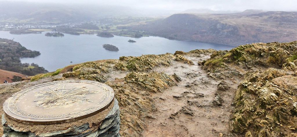
Round the circumference there is another quote from Wainwright:
‘Scenes of great beauty unfold on all sides, and they are scenes in a depth to a degree not usual.’
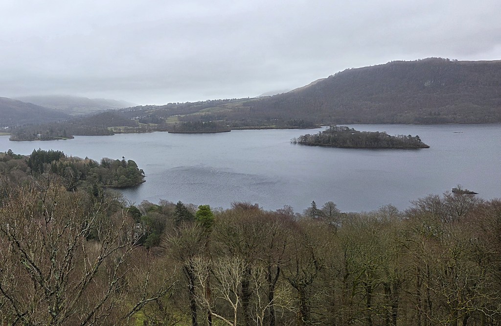
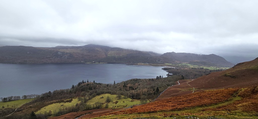
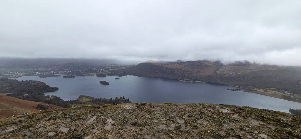
The cloud still relenting, we could now see the entirety of Derwent Water stretched below.
There were relatively few other people on the summit, but we could see several groups on the ridge below, not far behind.
We dropped down a little below the summit for a coffee break.
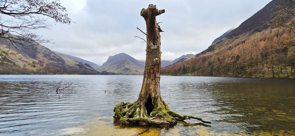
I was sizing up the best viewpoint when, lying upon the grass, I spotted a discarded lighter, emblazoned with a photograph of a naked woman clutching a tree trunk.
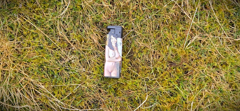
Naturally, it was my responsibility to pick up such litter and to dispose of it appropriately, so I made a souvenir of it.
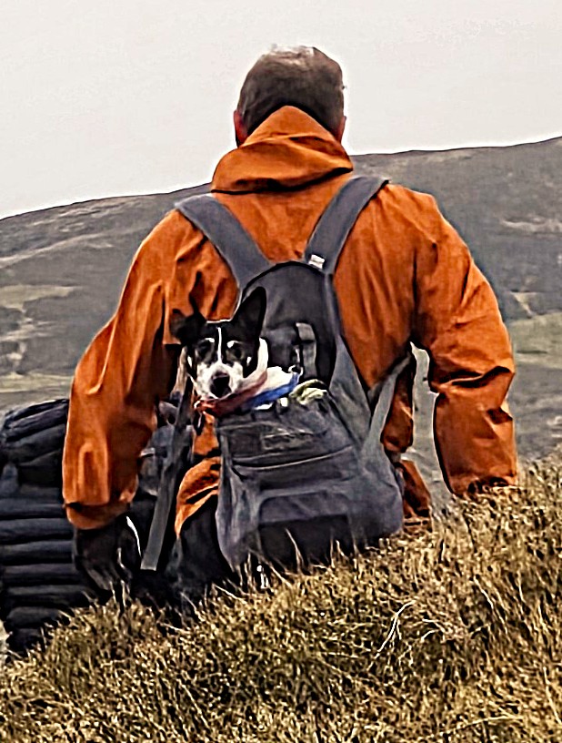
As we reclined, a man passed by with a dog in his backpack.
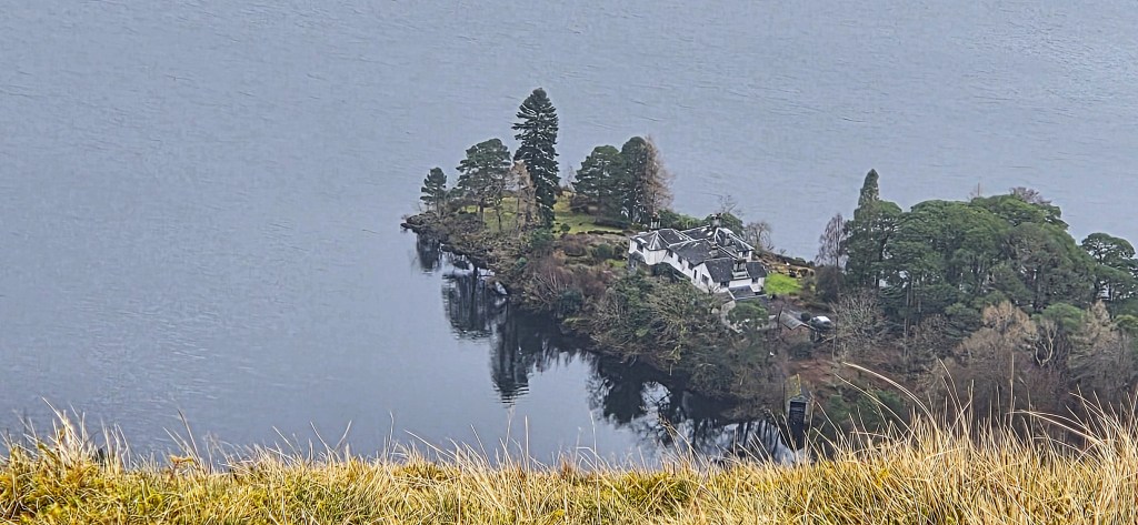
Far below we could see Brandelhow Point jutting into Derwent Water. The large white house squatting there must offer splendid views on three sides at least. I can find no details of the property online, so it is probably owned by someone extremely wealthy!
After coffee, the second and third groups went their separate ways, as two of our number began the descent down towards Derwent Water while the rest continued south, across Maiden Moor, towards High Spy.
Maiden Moor is a Wainwright in its own right, standing at 576 metres, though it is more a plateau than a peak. There is no obvious cairn marking the highest point and the origin of its name is unclear.
The depression at Yewthwaite Combe marks the location of Yewthwaite lead mine. It is believed to date from the Sixteenth Century, but there is no record of shafts being sunk before the late Eighteenth Century and the mine’s heyday only began in 1819. It closed just half a century later, because the ore proved too hard (and so too expensive) to extract.
There are several other old mines nearby, the best-known being Goldscope Mine, the earliest records of which date from the Thirteenth Century, during the reign of Henry III. For much of its life it was a copper mine, though lead was also extracted later.
During the Sixteenth Century this was one of the sites where Queen Elizabeth I employed German miners, considering no Englishmen sufficiently skilled in underground mining and smelting. The name is said to be a corruption of ‘Gottes Gabb’ (God’s Gift).
Elizabeth claimed Goldscope as a ‘Mine Royal’ and, by virtue of her status, was victorious in a legal battle with Thomas Percy, Earl of Northumberland, who owned the mineral rights.
Her German miners are said to have lived on Derwent Water’s islands, fearing persecution by locals, and one man was indeed murdered in 1566.
The copper ore was carried down to Derwent Water by packhorse, loaded on to barges at Copperheap Bay and taken to the smelting mills at Keswick.
Shortly afterwards, Percy led the 1569 Rising of the North, and was eventually beheaded at York in 1572, having refused to renounce Catholicism. He was beatified by Pope Leo XIII in 1895.
By the late Seventeenth Century the mine was being worked by Dutchmen, employed by the Duke of Somerset, but the copper seams were considered exhausted by 1715, when the mine entered a period of inactivity, only to reopen as a lead mine in 1847.
It closed once more during the latter part of the Nineteenth Century, but was briefly reopened from 1918 to 1923.
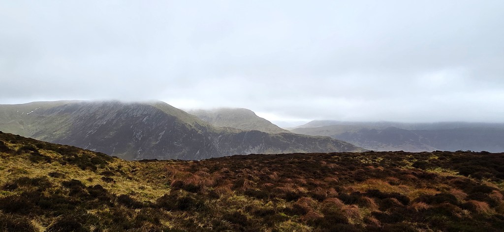
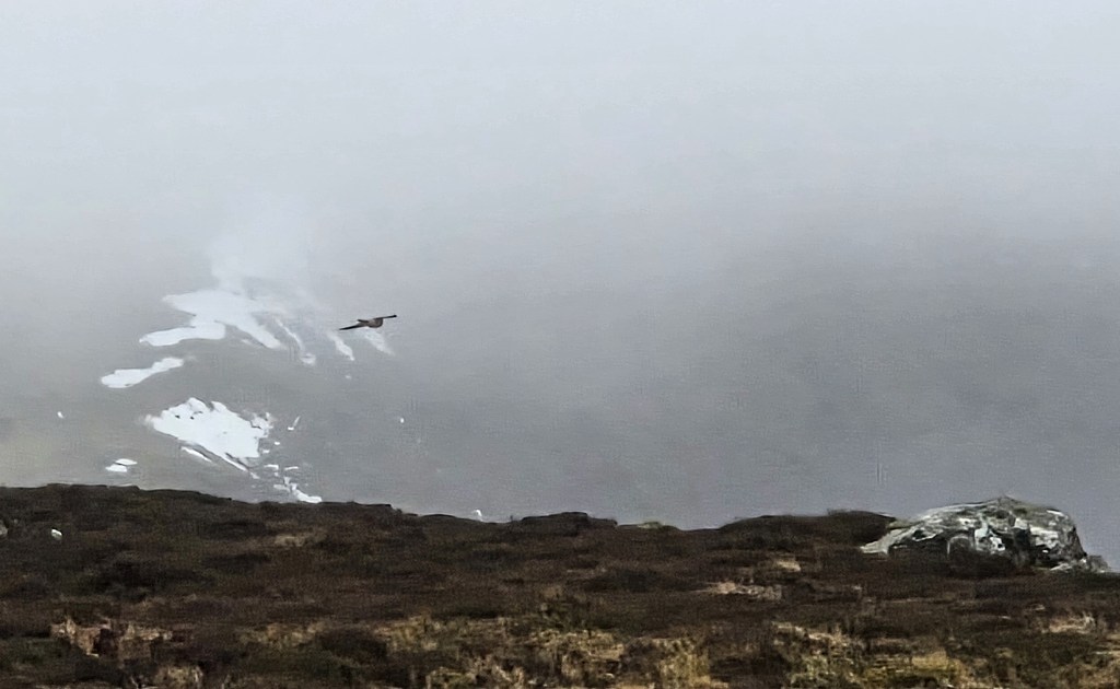
We were still just beneath the clouds and could see pockets of snow on one or two of the fells further west. As we looked across, a kestrel hovered in the foreground.
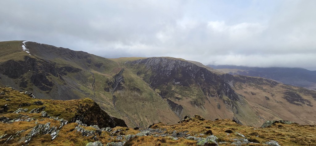
The different shades of yellow, green and brown were caught, for a minute or two, in a splash of brighter light which intensified the beauty of the view westwards.
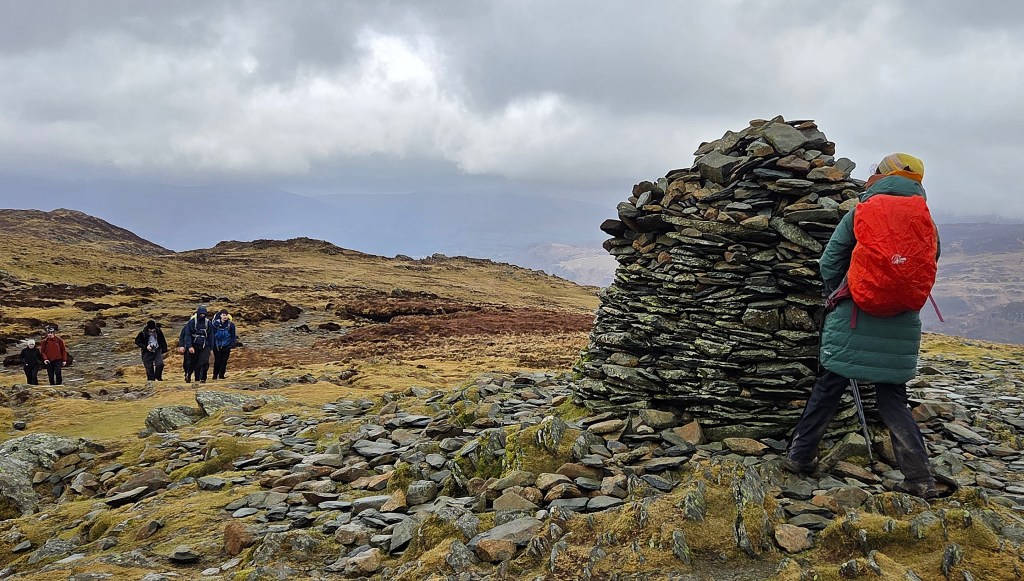
This lasted until we reached the cairn at the summit of High Spy, at 653 metres. The name is relatively recent – apparently it was previously known as both Scawdell Fell and Lobstone Band!
As we enjoyed our achievement, two groups of young men approached us from opposite directions, so we decided it was time to move on.
As he had warned, John decided that we would descend on the Borrowdale/Derwent Water side, rather than into the Newlands Valley.
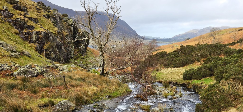
We began our descent past a small tarn – Dalehead Tarn, I think – arriving at the former Rigghead Slate Quarries where we stopped for our picnic lunch.
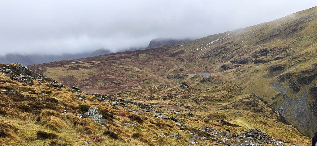
Rigghead was known for its high quality blue slate which, by the middle of the Eighteenth Century, was considered the best in England. Production increased from the 1830s, under the control of William Layland and his family, but declined in the Twentieth Century, stopping altogether during the 1940s.
Just as I had selected my seat, with my back against the ruins, a man emerged from the mine entrance, immediately behind us, exchanged a few words, then descended the slope.
And then it began to rain.
We hoped for a light shower at first, but the first hesitant drops soon became a relentless drizzle. Rapidly swallowing our pork pies, we had a quick swill of coffee and got underway once more. It was almost exactly 14:00.
Progress down hill was relatively slow, because the rain made both the slate and the stone treacherous. One or two of the party were also growing tired, so the number of falls increased. It took the best part of an hour before we were all on terra firma once more.
We had almost six miles to walk back to Derwent Bank, in increasingly unpleasant conditions.
One of our party took umbrage that I was the only one to keep my head and hair uncovered, open to the elements. I explained that I was naturally ‘hot headed’ but she complained that I was causing her to imagine unpleasant dampness upon her own (well-covered) head.
I pointed out that, such was my bloodymindedness, I would now be even less likely to put on a hat or raise my hood. And I threatened that this episode ‘would definitely go in the blog’!
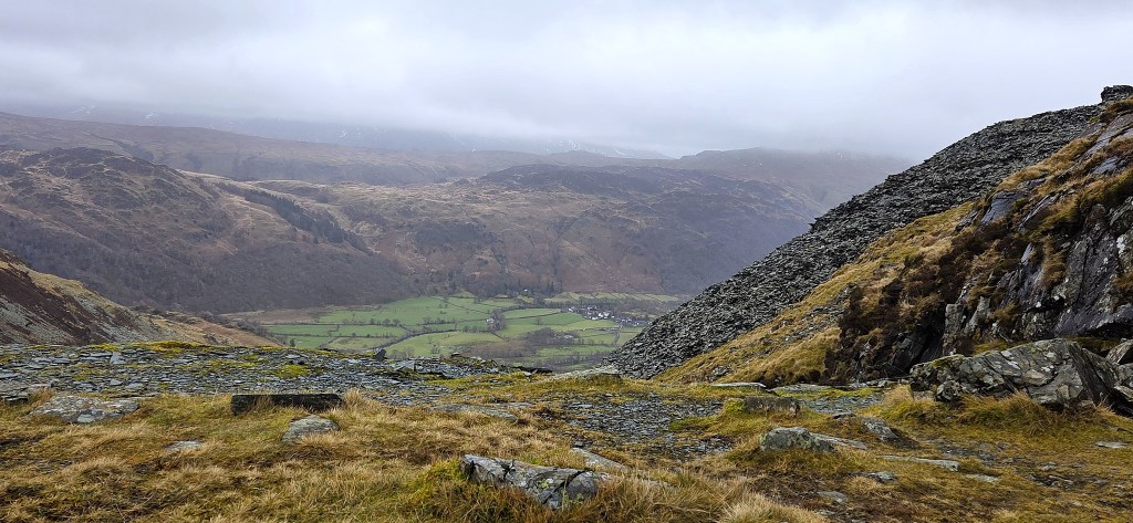
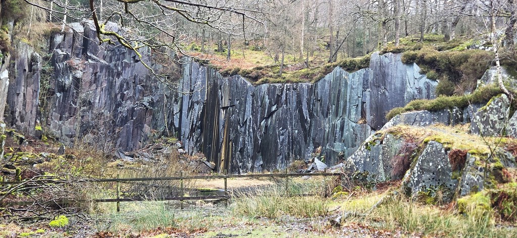
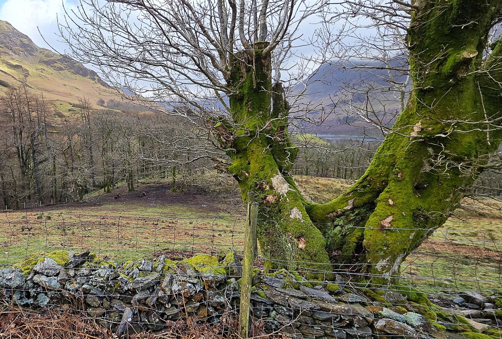
We were now in Borrowdale, close to Castle Crag, south of Grange. We passed the impressive remains of some ground-level slate workings, in the form of a slate cliff some eight to ten metres high.
The route, along the side of the valley, was relatively straightforward, but required concentration to avoid trip hazards, and all of us were now tired. Walking some distance apart, both Tracy and I slipped and fell on a large flat stone, rather like a gravestone. The ‘no hat’ lady told us later that she had also fallen at the same spot.
We encountered a young couple, heading in the same direction, the young woman looking particularly tired and unhappy. Somewhere between Grange and Manesty, both they and we decided to descend to the road. It was now pushing 16:00 and John was anxious to get us back before dark, in good time for the ‘walks talk’ at 18:00.
We passed by Brackenburn Lodge, Hugh Walpole’s house, a ‘for sale’ sign still prominently displayed outside the double garage, painted navy blue.
But I was too tired and wet to give it much attention.
Soon we were abreast of the southern shores of Derwent Water, which somehow made the miles pass more quickly. At Hawes End we left the road, continuing along the footpath through the woodland to Derwent Bank.
Here we caught up the young couple once more, who told us they came from Blackpool. The young woman complained that she was tired and needed a hot shower! We told her we all felt exactly the same, before pointing them on their way to Keswick.
We finally reached base at 17:35, just as the dusk was turning to darkness. We had exactly 25 minutes in which to strip off our wet clothes, shower (or bath) and present ourselves in good order downstairs!
After dinner we retired to bed early.
Day 4: Crummock Water, Rannerdale Knotts and Buttermere
Our three walking options for this day were:
- Option 1, a 6.5 mile walk from Squat Beck to the village of Buttermere;
- Option 2, a 9 mile walk along the shore of Crummock Water, followed by an ascent of Rannerdale Knotts and a circumnavigation of Buttermere;
- Option 3 was originally planned as an 8 mile walk ascending Whiteless Pike, following the ridge line to Wandope, Crag Hill and Sail before descending through the valley of Sail Beck into Buttermere village.
But, owing to the force and direction of anticipated wind gusts, Option 3 was amended so that, having ascended Whiteless to attain the ridge, there would be a descent into the Coledale Valley, following it back to Derwent Bank, a walk of around 9.5 miles.
Given the reputed beauty of Buttermere and environs, we decided that the revised Option 3 was far less attractive than Option 2, so we plumped for the latter.
At breakfast, the three of us widowed by breast cancer found ourselves sitting together.
There was some discussion of breakfast coffee etiquette. I had ordered more jugs of coffee so that there would be enough to top up our flasks. Tracy maintained that I should nevertheless give the others first dibs before doing so, whereas I held that I should have first dibs for the flasks! We argued the toss for a while, to the amusement of our fellow breakfasters.
The boot room was heaving, since all three groups were being transported by minibus to Buttermere. Volunteer leader John found that his waterproof trousers were missing from the hanger where’d he’d left them to dry the evening before.
This caused great consternation and, when ‘lost property’ failed to come up with a viable replacement, he had no alternative but to take a pair of size 14 women’s waterproofs still hanging in the boot room.
Though everyone was asked if they knew the location of the missing article, it had apparently disappeared into thin air.
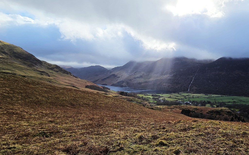
The coach delivered us to our destination by around 09:45. It was overcast, but there were occasional breaks in the cloud, promising the odd ray of sunshine.
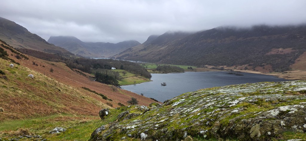
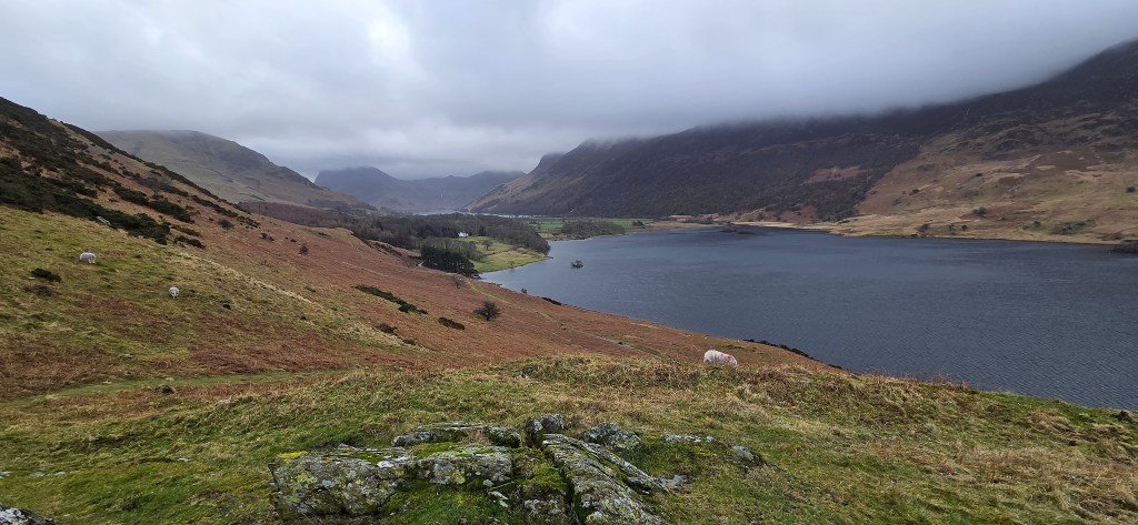
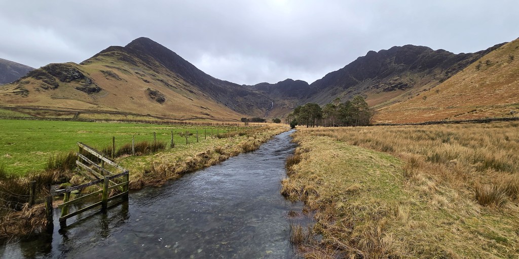
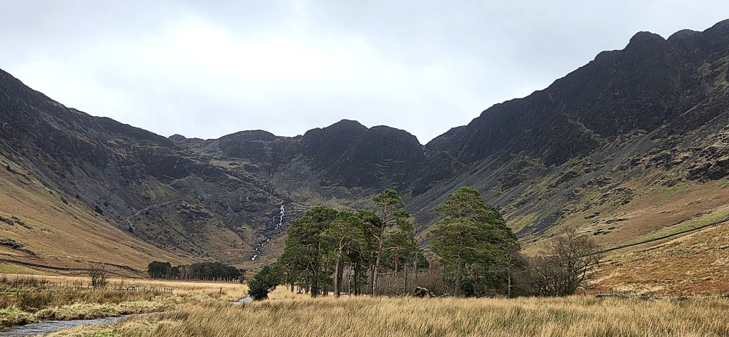
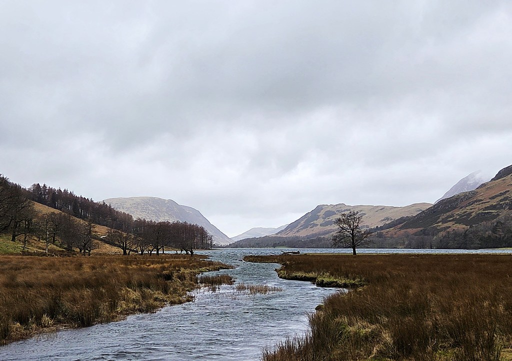
We began from a spot beside the B5289 roughly parallel with the northernmost tip of Crummock Water, initially making our way through Lanthwaite Wood to the shoreline.
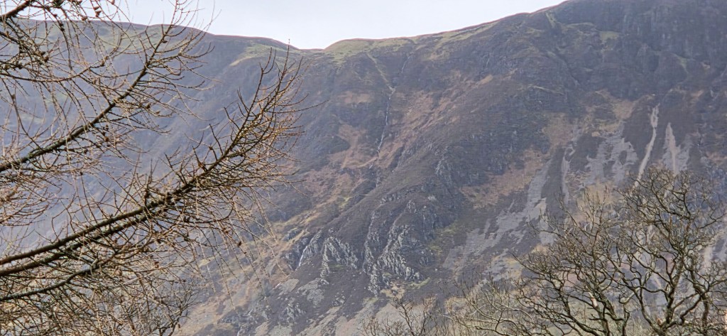
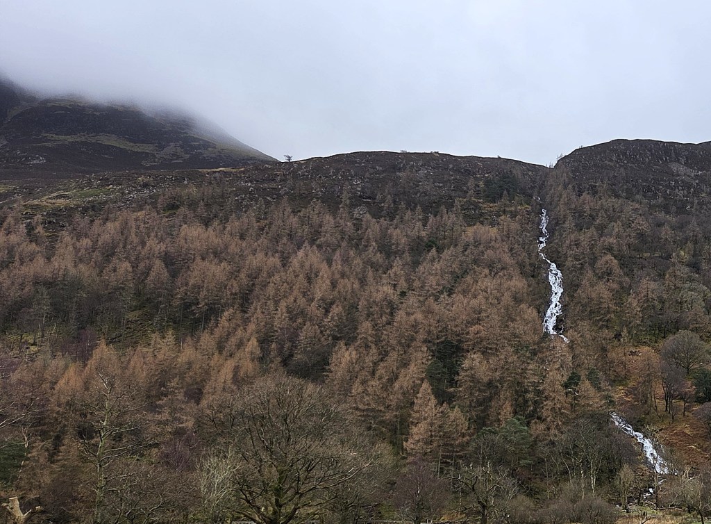
We could see Scale Force on the opposite side of the Water. Fed by Scale Beck, it is often cited as the highest waterfall in the Lake District, at 170 feet (51.8m).
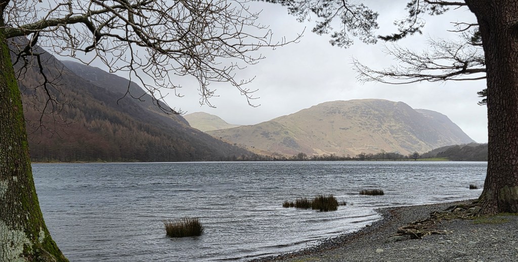
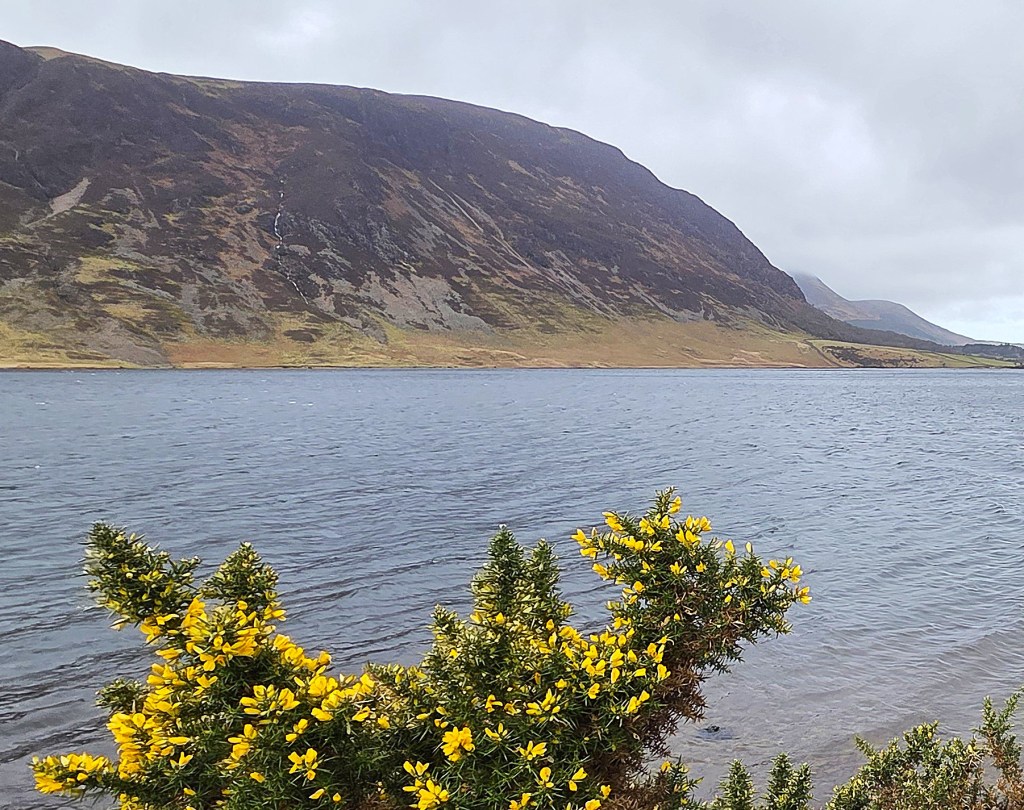
Crummock Water is roughly 2.5 miles long, 0.6 of a mile wide, with a maximum depth of 140 feet. The western side is bordered by Mellbreak, an extended hill which runs almost the full length of the Water.
The name ‘Crummock’ is probably derived from a word meaning ‘crooked’.
Prior to 2022, water from Crummock supplied several towns and villages in the locality, but they are now served by a pipeline from Thirlmere Reservoir.
In June 1988 the body of 41 year-old Sheena Owlett, from Wetherby, was discovered in Crummock Water by an amateur sub-aqua club undertaking a training exercise.
Her 32 year-old husband was charged with her murder. He had strangled her after she had taunted him sexually and claimed to be having an affair.
He drove the body to Crummock Water where he strapped it to a plastic barrel and the cylinder head of a car engine.
He swam with the body into the water before filling the barrel, causing the body to sink. As it did so, his foot became caught, dragging him down too, but he managed to free himself.
He was found guilty and sentenced to life imprisonment.
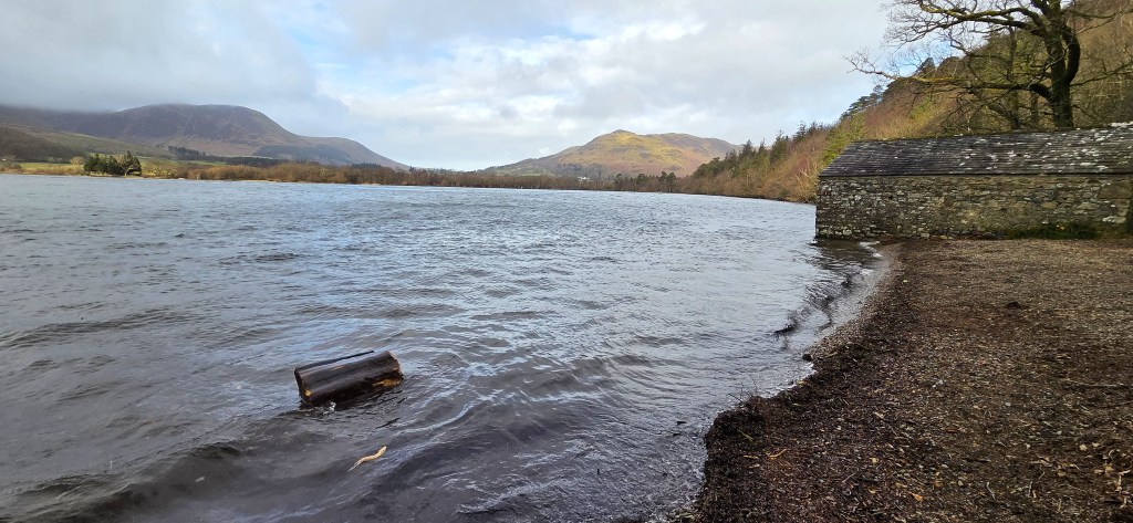
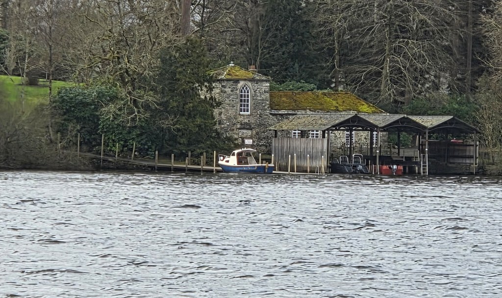
Blissfully unaware of this macabre story, we walked along the shore in a southerly direction, pausing to admire a small stone boathouse jutting out into the water.
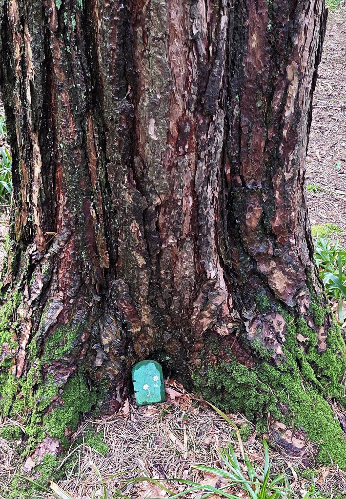
Shortly afterwards, eagle-eyed Tracy spotted a blue-green fairy door in the trunk of a tree.
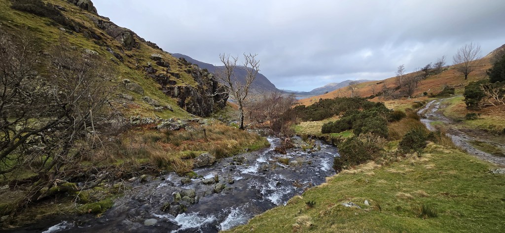
Arriving beside Cinderdale Beck, we followed a path away from Crummock Water which gave us an excellent view of our impending climb up Rannerdale Knotts.
The bubbling stream made a picturesque scene when set against the stillness of Crummock beyond.
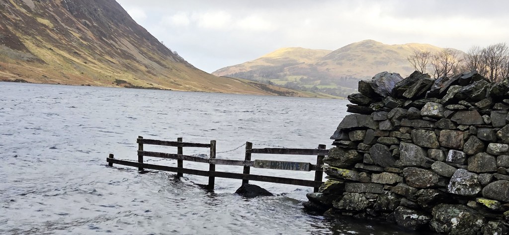
Arriving back beside Crummock Water close to Hause Point, we stopped for coffee on a tiny beach, the water lapping at our toecaps as we sat upon the rocks.
I marvelled at the pettiness of whoever had claimed privacy for a neighbouring stretch of water, by means of a fence, a notice and a single strand of barbed wire.
As we drank, the culprit in the case of the wrong trousers finally revealed himself, having failed to tune in to the earlier kerfuffle in and around the boot room.
It was none other than one of our own party who, when he came to divest himself of the article, revealed that he was unfamiliar with the process. So how had he known how to put them on?
This incident caused no little hilarity and became a recurrent theme throughout the day.
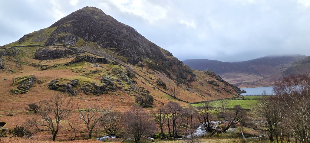
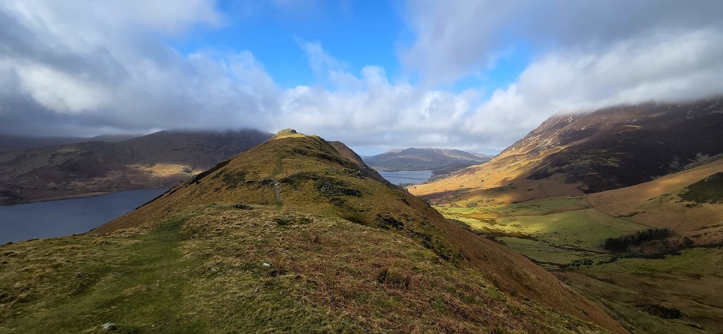
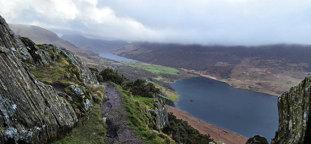
Soon we had begun the ascent of Rannerdale Knotts, stopping initially on an intermediate summit, about halfway up, which provided amazing views across Crummock Water with Buttermere beyond.
Rannerdale Knots reaches a height of just 355 metres, but the views from here are truly outstanding. As we reached the summit, shortly after midday, the clouds parted, giving a brief interlude of beautiful blue sky.
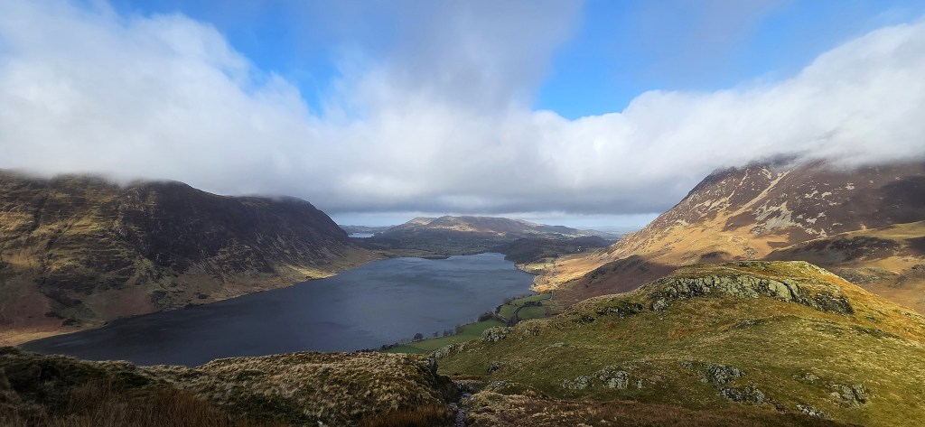
The Rannerdale Valley below (otherwise known as the Secret Valley) is famed for its display of bluebells in the spring, though we were far too early for that.
Unusually, they grow upon the lower slopes of the fell on both sides of the valley, creating a purplish shade alongside the prevailing yellows, greens and browns. According to legend, they have grown here because of the blood spilt by Norman soldiers.
It is historically correct that this area was not brought under Norman control until William Rufus seized Cumbria from Scotland in 1092.
However, John Nicholas Size (1866-1953), a Buttermere hotelier, wrote a booklet ‘The Epic of Buttermere’ which imagined the Secret Valley as a Norse stronghold, standing against the Norman invaders.
He made it the location of an imaginary Battle of Rannerdale Knotts, in which the Norman army was supposedly ambushed and defeated by the Norsemen who still lived in the area.
He expanded this myth into a short novel, first published in 1929, and Rosemary Sutcliff (1920-1992) later drew upon the story for her 1956 children’s novel ‘The Shield Ring’.
Quite why red blood should give rise to bluebells is nowhere explained.
Descending from the summit, we stopped for lunch in a sheltered spot overlooking Buttermere below.
Later, continuing our descent towards Buttermere village, Tracy slipped on the wet grass, very nearly taking out the lady walking in front of her. Immediately afterwards, the ‘wrong trousers’ culprit also slipped, causing us all to shift into the far less slippery margins of the path.
Making our way into the Village, which sits on the narrow strip of land between Crummock Water and Buttermere, we paused to admire a pair of Herdwicks cropping the grass outside Buttermere Old School.
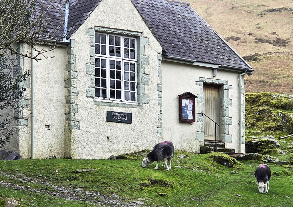
There is little in Buttermere that is truly old. St James’s Church was built in 1840, on the site of its predecessor, and contains a memorial to Wainwright. The Bridge Hotel, where Size was proprietor, was rebuilt in 1837, also replacing a predecessor.
For much more about ‘the Maid of Buttermere’, see the extended aside below.
We paused again, briefly, beside the public toilets, noting that the cost of using them had reached an exorbitant 60p.
This is the highest I have ever seen anyone have the temerity to charge for a universal natural function. Inevitably, it promotes more alfresco urination.
Shortly afterwards, I found myself in conversation with another of our party, complaining to her about the prevailing tendency to refer to all subjects of domestic abuse, however minor, as ‘survivors’.
I understand that this is a deliberate reaction against using the term ‘victims’ but, except in severe cases, it is an over-correction and so absurd. Far better to deploy a more neutral term, such as ‘target’ or even ‘recipient’.
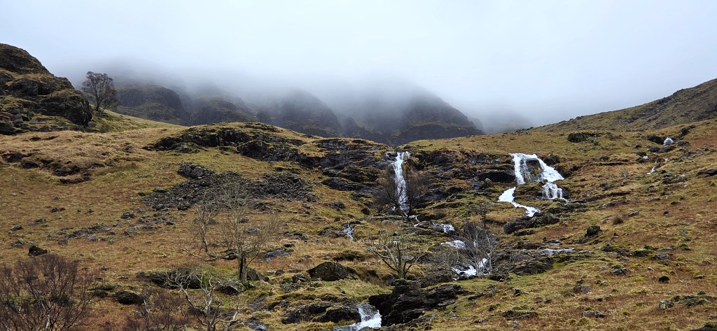
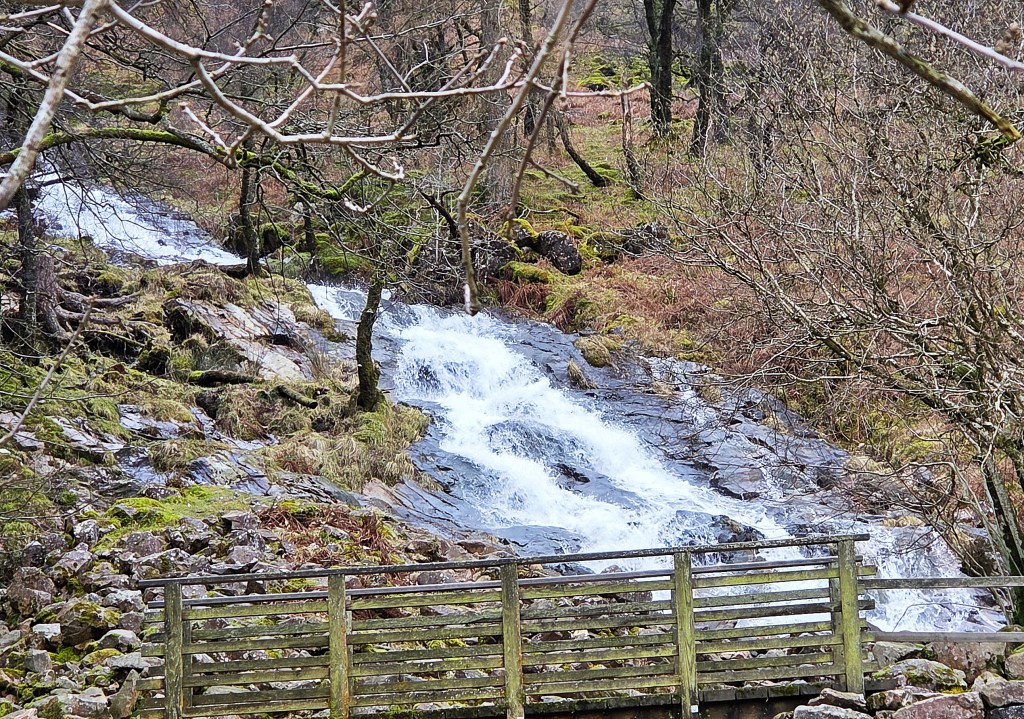
We walked around Buttermere widdershins, heading towards Sour Milk Gill. It originates in Bleaberry Tarn, some 400 metres above sea level, and descends, crashing through mossy rocks and gnarled tree roots to the valley floor.
Its name is probably derived from the milky white colour of the water as it churns downward. According to the National Trust, in 2009 it ferried numerous pink granite boulders down from above, depositing them beneath the footbridge here.
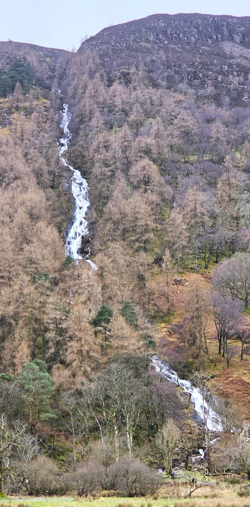
I revisited my frequent observation that it is particularly hard to capture the power and magic of a waterfall in a photograph.
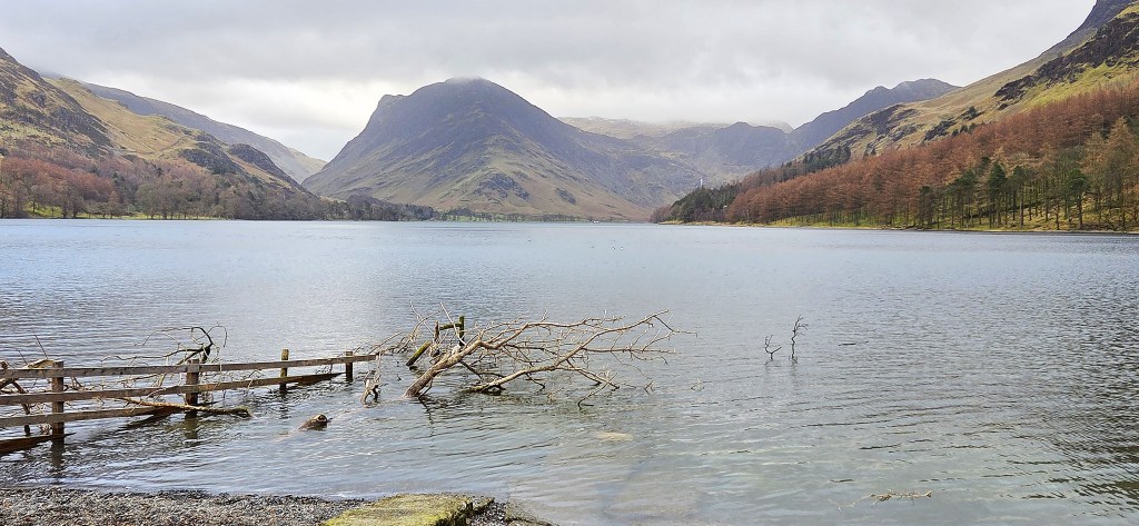
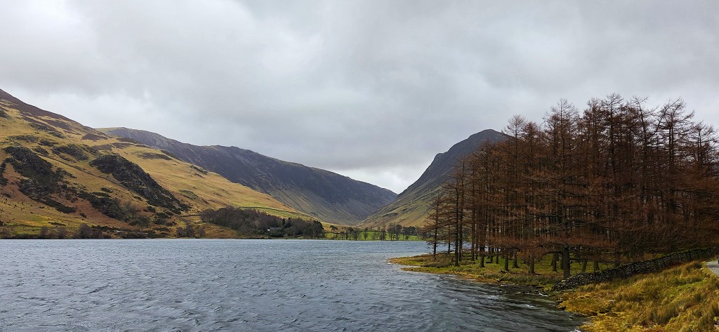
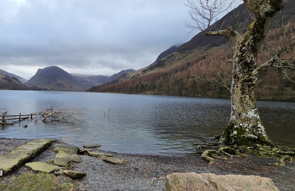
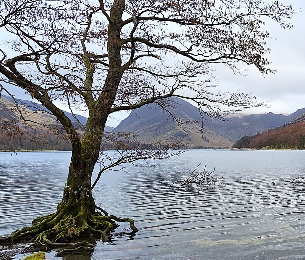
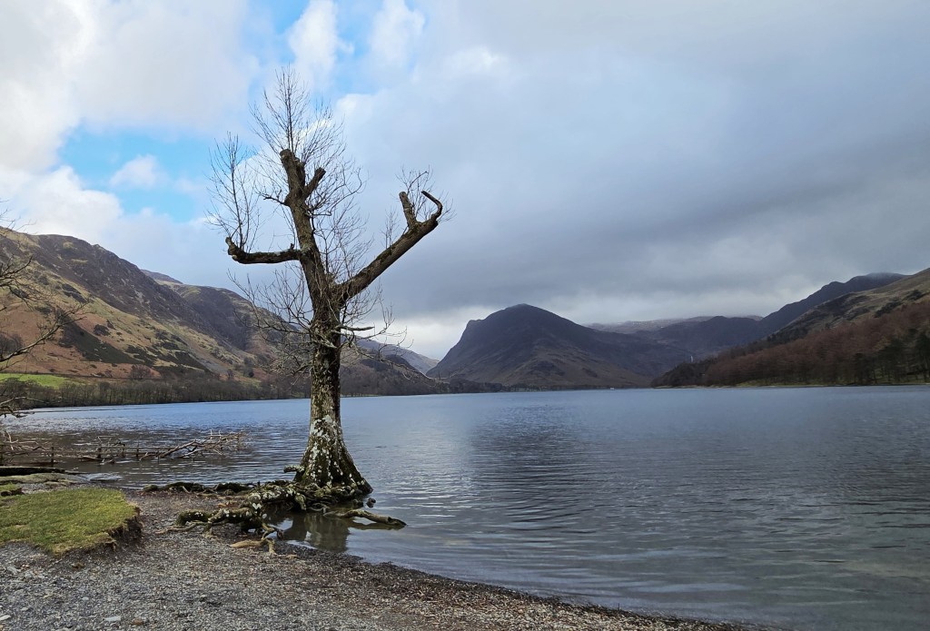
While walking towards the bottom of the waterfall, our attention was diverted by the view along the length of Buttermere, Fleetwith Pike towering 648 metres over its foot. Various photogenic trees and roots occupied the foreground.
There is a white cross on the side of Low Raven Crag, adjacent to Fleetwith Pike, which commemorates Fanny Mercer. She was a servant who accompanied the family for which she worked on holiday here. She and two fellow servants climbed to the top of Honister Crag but, during the descent, she fell and died of her injuries.
At the extremity of this northern shoreline, one crosses the stream known as Buttermere Dubs, connecting Buttermere with Crummock Water, before walking along the long western shoreline of Buttermere, initially through Burtness Wood, which stretches more than half its length.
Several other people seemed to be promenading around Buttermere in one direction or another, possibly working up an appetite for their Sunday lunches. And soon we came face-to-face with the group who had selected Option 3.
It seems they had been beaten back, during their ascent, by violently gusting winds. So they had opted instead for a clockwise circuit of Buttermere, culminating in a visit to the pub!
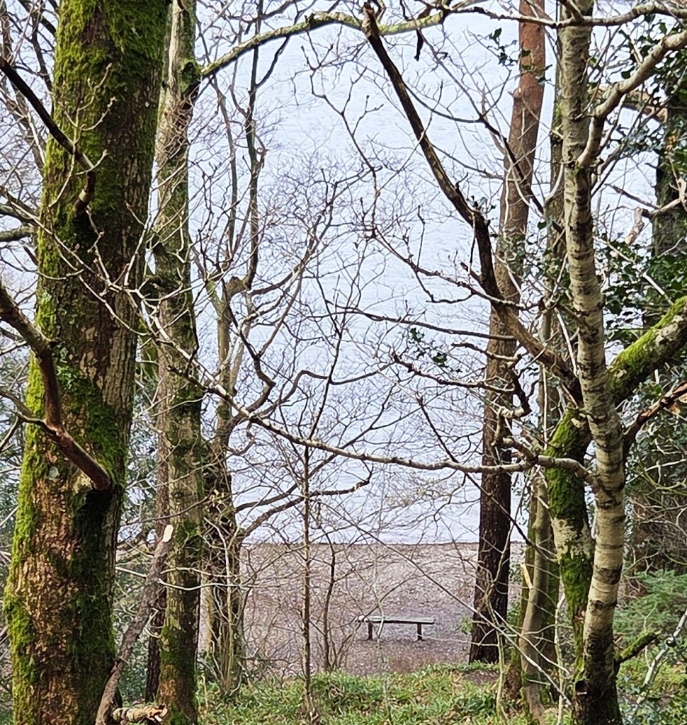
Our way continued past Comb Beck, bubbling down the fellside. There is a bench here marked:
‘For Stuart Elliott, 9.5.76 – 26.6.95, From his friends in BRL&MS’
Some sources claim that Stuart was a member of a mountain rescue team who died on a training mission, but my research suggests that he was a 19 year-old student from York, studying criminology at Teeside University. He was killed near his home when a police van driven by a dog handler collided with his car.
Standing back from Buttermere on the other bank, almost opposite, is Hassness House, an 11-bedroom property purchased by Ramblers Worldwide Holidays in 2016 as a base for its own Lake District walking holidays.
Hassness House has a complicated history. As far as I can establish, the original property was in a slightly different location. Its 40-acre estate was carved out of the Gatesgarth Estate, controlled by the Senhouse family, then later purchased by Thomas Benson (1742-1807), a Cockermouth lawyer and agent to Lord Egremont.
The property remained with the Benson family until it was bought by Frederick John Reed (1808-1888), a Somerset-born solicitor and magistrate, who made significant additions to both house and estate.
It was advertised for sale in 1900 as a 12-bedroom house with 141 acres of land. For a while it became a refuge for alcoholics, known as the Ghyllwoods Sanatorium, which operated until at least 1915. But the house was again offered for sale in 1920.
It was purchased the following year by Sidney O’Hanlon, a merchant, who envisaged it as a ‘gentleman’s sporting retreat’. But he soon decided to rebuild the house in a slightly different location on the estate. The new Hassness House was constructed in 1922, while an annex called Dalesgarth was built on the site of the original property.
O’Hanlon sold the estate on to Hubert Foster Clark, second son of a food manufacturer, who became Director of Music at the BBC. After the Second World War, while still owned by him, the house became a hotel. Following another change of ownership it was bought by the Lake District Planning board in 1955, who let it to the Ramblers’ Association.
Meanwhile, we rounded the southern extremity of Buttermere, crossing Warnscale Beck via Peggy’s Bridge and passing besides Gatesgarth Farm. There was a short section of road before a path led us down to the long eastern shore of Buttermere.
Having passed several trees lining the stony shore, one arrives at a rocky section, with a narrow path rising towards a short tunnel cut into the rock.
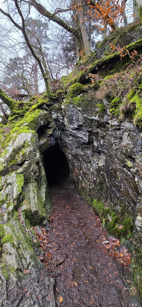
This is said to have been created on the orders of Thomas Benson, so he could walk all the way round Buttermere, but others date it to the 1880s, which would suggest Frederick Reed was responsible.
Somewhere around here I enjoyed learning of the myths surrounding the origin of the Isle of Man, and particularly Mannanan mac Lir, who still conjures up mist and gales to prevent people from visiting the Island.
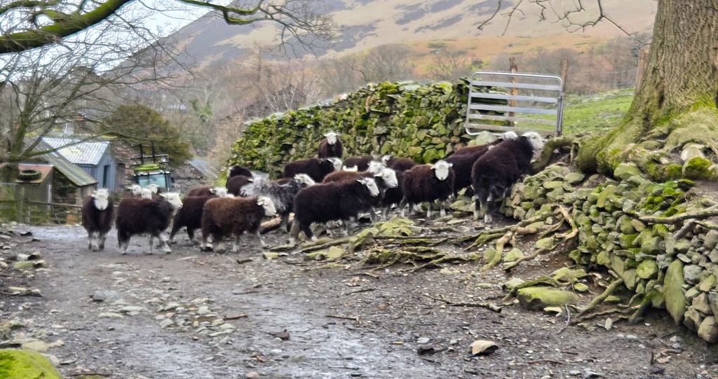
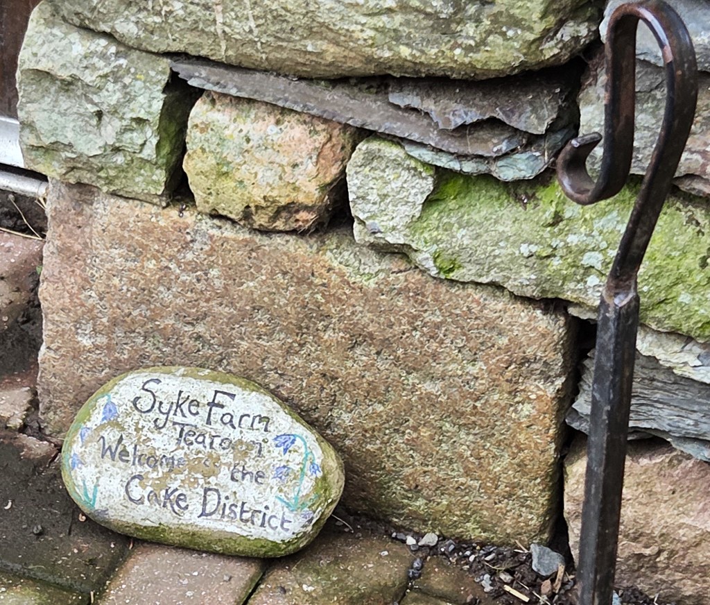
Our route took us directly through Sykes Farm, where we engaged with the Herdwicks before turning into the Tearoom (‘Welcome to the Cake District’) for well-earned coffee and cake.
Then it was back to the bus for the return trip to Derwent Bank.
There was no ‘walks talk’, the next day being our free day.
After dinner we took part in a music quiz, dredging up scraps of knowledge about pop music from the 1960s to the 1980s. There was much singing, as always in my case very out of tune.
Aside: The Maid of Buttermere
I’ve included this extended aside about the Maid of Buttermere because her story is both fascinating and intriguing. Moreover, when I consulted some of the primary sources I found a slightly more nuanced tale than the version typically shared online.
Buttermere Court Hotel was previously The Fish Inn, which became established as a coaching inn at some point in the Eighteenth Century.
In the final years of that century, the Robinson family were running The Fish Inn. Mary Robinson (1778-1837) was the landlord’s daughter, and she it was who became known as the Maid of Buttermere. She acted as barmaid and servant in the Inn and, according to some sources, was also a shepherdess.
In 1792 one Joseph Budworth (who was later known as Joseph Palmer) (c.1756-1815) stayed at the Fish Inn during a holiday tour of the Lakes. That same year he published an account of his adventures: ‘A Fortnight’s Ramble to the Lakes in Westmoreland, Lancashire and Cumberland’.
He described the landlady’s daughter, who he named ‘Sally of Buttermere’ [I have added extra paragraphing for clarity]:
‘Her mother and she were spinning woollen yarn in the back kitchen. On our going in to it, the girl flew away as swift as a mountain sheep, and it was not until our return from Scale Force that we could say we first saw her.
She brought in part of our dinner, and seemed to be about fifteen. Her hair was thick and long, of a dark brown, and though unadorned with ringlets, did not seem to want them; her face was a fine oval, with full eyes, and lips as red as vermilion; her cheeks had more of the lily than the rose; and although she had never been out of the village (and I hope will have no ambition to wish it), she had a manner about her which seemed better calculated to set off dress, than dress her.
She was a very Lavinia:
“Seeming, when unadorn’d, adorn’d the most.”
When we first saw her at her distaff, after she had got the better of her first fears, she looked an angel; and I doubt not but she is the reigning lily of the valley.’
The success of Budworth’s book resulted in a second edition, published in 1795. It helped to bring many more tourists to Buttermere, most of them eager to encounter this paragon of beauty who lived in equally beautiful natural surroundings.
A full ten years later, in 1802, Colonel Alexander Hope (later General Sir Alexander Hope GCB) (1769-1837) came to stay at the Fish Inn, ostensibly on a fishing expedition.
Hope was Member of Parliament for Linlithgowshire, and formerly the Member for Dumfries Burgh. He had been appointed Lieutenant Governor of Tynemouth and Hill Fort, Lieutenant Governor of Edinburgh Castle and Deputy Assistant Adjutant General to the Forces in Holland.
A few years earlier, in 1795, he had been severely wounded during the Flanders Campaign: he had lost an arm and now walked with some difficulty. He was, as yet, unmarried. One of his several siblings was Charles Hope (1768-1828), also an army officer and MP.
Later on in his career, Alexander Hope would be promoted to General and become Governor of the Royal Military College.
Hope courted Mary, still unmarried but now in her mid-twenties, and, following a whirlwind romance, they married at St Cuthbert’s Church in nearby Lorton.
The marriage was reported in several contemporary newspapers, including the Morning Post. Poet Samuel Taylor Coleridge (1772-1834) was living in nearby Keswick at this time, and sending several articles to the Post.
It has been confidently stated that Coleridge was the author of a series of five articles dealing with the marriage and its aftermath. But these articles do not carry Coleridge’s name and I have been unable to establish definitively that he wrote them. He probably did.
Nevertheless, both Coleridge and Wordsworth knew of the Maid of Buttermere, having encountered her themselves during their own tour of the Lakes in November 1799.
It is equally confidently stated that Coleridge’s first article appeared in The Morning Post of 11 October 1802, under the title ‘Romantic Marriage’. Yet the same story was apparently printed first in the 18 September edition of Felix Farley’s Bristol Journal.
(In 1803 a schoolfriend of Coleridge’s, John Matthew Gutch (1776-1861) became proprietor and printer of Felix Farley’s Bristol Journal, so it is reasonable to hypothesise that, even a year earlier, he had sufficient influence to secure publication of Coleridge’s article.)
If the article was published on 18 September, it must mean that the marriage between Mary and Hope took place on 2 September 1802, not on 2 October 1802, as was subsequently assumed.
This article was not entirely complimentary about either party involved in the marriage
[I have again divided the text into short paragraphs]:
‘[Romantic Marriage.] On the 2d. inst, a gentleman, calling himself Alexander Augustus Hope, Member for Linlithgowshire, and brother to the Earl of Hopetown, was married at the church of Lorten, near Keswick, to a young woman, celebrated by the tourists under the name of The Beauty of Buttermere.
To beauty, however, in the strict sense of the word, she has small pretensions, for she is rather gap-toothed, and somewhat pock-fretten. But her face is very expressive, and the expression extremely interesting; and her figure and movements are graceful to a miracle. She ought, indeed, to have been called the Grace of Buttermere rather than the Beauty.
She is the daughter of an old couple, named Robinson, who keep a poor little pot-house at the foot of the small lake of Buttermere, with the sign of the Char, and has been all of her life the attendant and waiter, for they have no servant.
She is now about thirty, and has long attracted the notice of every visitor by the exquisite elegance, and the becoming manner in which she is used to fillet her beautiful long hair; likewise by the uncommonly fine Italian handwriting in which the little bill was drawn out – Added to this, she has ever maintained an irreproachable character, is a good daughter, and a modest, sensible and observant woman.
That such a woman should find a husband in a man of rank and fortune, so very far above her sphere of life, is not very extraordinary; but there are other circumstances which add much to the interest of the story.
Above two months ago, Mr Hope went to Buttermere upon a fishing expedition, in his own carriage, but without any servants and took up his abode at the house kept by the father of the Beauty of Buttermere, in the neighbourhood of which he was called the Hon. Chas. Hope, Member for Dumfries.
Here he paid his addresses to a lady of youth, beauty, and good fortune; but, being afterwards struck with the graceful charms of this humble beauty, he married the maid of Buttermere.
The mistake in the name, the want of an establishment suited to his rank, and the circumstance of his attaching himself to a young lady of fortune, had excited much suspicion, and many began to consider him an imposter.
His marriage, however, with a poor girl without money, family, or expectations, has weakened the suspicions entertained to his disadvantage, but the interest which the good people of Keswick take in the welfare of the beauty of Buttermere, has not yet suffered them to entirely subside, and they await with anxiety the moment when they shall receive decisive proofs that the bridegroom is the real person whom he describes himself to be.
The circumstances of his marriage, however, are sufficient to satisfy most people that he is no imposter; and, therefore, they venture to congratulate the Beauty of Buttermere upon her good fortune.’
Unfortunately though, these suspicions were sensationally confirmed a month later.
This brief article is from the Hampshire Telegraph and Naval Chronicle of 18 October 1802:
‘We are desired to contradict the story of a marriage which had taken place on the second of this month, between the Hon. A. Hope and the Beauty of Buttermere. We are assured, from the best authority, that Colonel Hope has been some months, and still is, on the Continent.
We are likewise informed, that some time ago, an imposter appeared in the South of Scotland, using the name of the same Gentleman, and was for some time well received, but decamped on detection: so there is every probability that this man is the husband of the Beauty of Buttermere.’
A subsequent article, sent from Keswick, dated 15 October and published on 22 October, relates the circumstances in which the imposter was uncovered.
According to this, a certain Justice George Hardinge (1743-1816), also an MP and a friend of Hope’s, was in the vicinity and wished to visit him. Upon doing so, he realised that the man was not Hope.
The imposter was placed in the hands of the local constable, but was permitted to go for a sail on Buttermere. He was promptly smuggled away by a fisherman he had befriended, so deserting Mary.
A third article from Keswick, dated 30 October, relates how Mary, upon more closely examining the dressing box left behind by her husband, found that it had a double bottom. In the secret compartment were letters addressed to him under the name Headfield [sic], which were sent by his wife and children.
So he was a bigamist as well as an imposter.
By 8 November, an advertisement appeared in The Morning Post:
‘Notorious Imposter, Swindler and Felon – John Hatfield, who lately married a young woman (commonly called the Beauty of Buttermere), under an assumed name.
Height about five feet ten inches, aged about 44, full face, bright eyes, thick eye-brows, strong but light beard, good complexion with some colour, thick but not very prominent nose, smiling countenance, fine teeth, a scar on one of his cheeks near the chin; very long, thick, light hair, with a great deal of it grey, done up in a club; stout, square-shouldered, full breast and chest, rather corpulent and stout limbed, but very active, and has rather a spring in his gait, with apparently a little hitch in bringing up one leg…
…He was, on the 25 of October last, at Ravenglass, in Cumberland, wrapped in a sailor’s greatcoat and disguised, and is supposed to be now secreted in Liverpool, or some adjacent port, with a view to leave the country.’
By the middle of November, it was announced that a reward of £50 was offered for Hatfield’s apprehension, not on the grounds of desertion or bigamy, but because he had several times forged the signature of Alexander Hope.
Hatfield had been born, circa 1758, in Cheshire, and became a commercial traveller. He began his criminal career by convincing a soldier, Lord Robert Manners, that he would be a suitable husband for his daughter. Manners gave him £1,500 at the wedding, which he promptly blew in London. His abandoned wife died soon afterwards, allegedly broken-hearted.
In 1782 he was placed in the King’s Bench Prison because of unpaid debts, but was released at the request of the Duke of Rutland, having claimed to be related to him (presumably by virtue of his marriage).
He followed the Duke to Dublin when the Duke was made Lord Lieutenant of Ireland, but was eventually imprisoned in Dublin’s Marshalsea Gaol. The Duke again paid his debts and had him removed from Ireland.
In 1792 he was arrested in Scarborough over an unpaid hotel bill, and remained in Scarborough Gaol for seven years. His debts were finally paid by a Miss Michilli Nation, living opposite the Gaol, who immediately married him. It was now September 1800.
The couple went to live in Somerset, but Hatfield soon removed to London where he again lived extravagantly. He also attempted to become an MP for the rotten borough of Queenborough, which would have given him immunity from arrest. But, facing pressure from his creditors, he was forced to disappear.
He next appeared in Cumberland, where he assumed the identity of Alexander Hope (and occasionally that of his brother, Charles). Here he contracted his third marriage, with Mary.
Hatfield was finally apprehended towards the end of November 1802, in a place called Lamb and Flag, about 17 miles from Swansea. He was examined at Bow Street. In December it was announced in the Morning Post that Mary was pregnant and, later, that she had refused to prosecute Hatfield for bigamy.
At the end of May 1803, Hatfield was transferred to Carlisle Gaol, to stand trial there. Then, on 11 June it was announced that Mary had given birth to a stillborn child.
Hatfield’s trial began on 15 August. He was charged on three counts, all related to forging the signature of the true Alexander Hope. His plea was ‘not guilty’, but the jury took just ten minutes to find him guilty of forgery. He was sentenced to death by hanging.
He was executed on 3 September 1803. This account appeared in The Morning Chronicle of 7 September:
‘The gallows was erected last night between twelve and three. Improvements travel northwards slowly, and we have not yet arrived at the elegancy of a drop. The apparatus employed is of the most simple description. Two posts are fixed in the ground about six feet distant from each other. A bar is laid across them from which the criminal is suspended. He mounts a cart placed under it, and, when the horse moves on, he suffers the dreadful sentence of the law.
The place of execution is the island formed by the river Eden, on the north side of the town between the two bridges…
…A small dung cart, boarded over, had been placed under the gibbet. A ladder was placed to this stage which he instantly ascended…He seemed at least fifty, and there was something grave and reverend in his aspect which for a moment made one forget all the crimes laid to his charge. He was perfectly cool and collected…
…He immediately untied his neck handkerchief, and placed the bandage over his eyes. The Executioner was extremely awkward, and Mr H found it necessary to give various directions as to the placing of the rope, and the proper method of driving away the cart…
…Great apprehensions were entertained that it would be necessary to tie him up a second time. The noose slipped down twice, and he fell down above eighteen inches. His feet at last were almost touching the ground. But his excessive weight, which occasioned this accident, speedily relieved him from pain. He expired in a moment, and without any struggle…’
As for Mary, The Times announced in November 1804 that she had married a local young farmer from the Vale of Keswick, later named as Mr G Moore. But this was subsequently contradicted as ‘fake news’.
Then, in July 1807, the Morning Post reported that she had married a different Keswick farmer and. In addition:
‘…in the last lottery obtained the greater part of one of the Capital Prizes’.
Her husband was Richard Harrison and the couple had four children. She died in February 1837 at Calbeck in Westmoreland.
Day 5: Keswick and Derwent Water
We chose to spend our rest day in and around Keswick.
Following a relaxed breakfast, we left the house at around 09:45, walking round the northern extremity of Derwent Water, to reach Keswick on the other side.
On the way we had a nose around Derwent Water Marina, which was dormant, the path heading south along the western shore closed, presumably due to flooding.
We passed once more through Portinscale and over the wobbly bridge. On the other side, the normal route through the Howrahs was not available since workmen were resurfacing the path, so we had to follow an alternative route adjacent to the main road.
We followed the A5271 beyond the Pencil Museum and the Premier Inn, opposite, until we arrived in the Town Centre.
Keswick is a market town which received its charter in 1276, during the reign of Edward I. It now has a standing population of less than 5,000. Some believe that its name refers to a cheese farm, but there are alternative theories.
The Castlerigg stone circle, which adorns a hill on the eastern outskirts, indicates that this was an area of some significance in the later Neolithic period, circa 3200BC.
In 1181 it was recorded that Crosthwaite, which lies between Portinscale and Keswick, had acquired a new church dedicated to St Kentigern. It was probably built upon the site of an earlier wooden predecessor.
It was partially rebuilt in the Fourteenth and early Sixteenth Centuries, and restored internally during the Nineteenth Century. It contains a monument to poet Robert Southey (1774-1843), who is buried in the churchyard. Hardwicke Rawnsley (1851-1920), one of the founders of the National Trust, was appointed vicar here in 1883, remaining until 1917.
Meanwhile, despite establishing itself as a thriving market town, Keswick suffered as a consequence of the Dissolution, since both Furness and Fountains Abbey were influential landowners in the locality.
It had recovered somewhat by the latter part of the Sixteenth Century, owing to income derived from copper mining in the vicinity.
Though copper mining was in decline by the early Seventeenth Century, graphite was becoming an equally valuable resource, while slate mining was also growing in importance.
By the mid-Eighteenth Century, Keswick was also becoming established as a centre for Lakes tourism. Coleridge, who became a resident of the Town around this time, wrote in 1800:
‘It is no small advantage that for two-thirds of the year we are in complete retirement – the other third is alive and swarms with Tourists of all shapes and sizes.’
From 1865, the Cockermouth, Keswick and Penrith Railway began to ferry passengers into the area from the mainline between London and the North. Simultaneously, the manufacture of pencils became the most important local industry.
The Town acquired a civic infrastructure during the second half of the Nineteenth Century and, by the 1930s, had firmly established itself as the dominant hub of Lakes tourism.
Aside from Coleridge and Southey, there have been few other notable inhabitants, though Shelley was briefly resident in 1811-12 while visiting Southey.
Some 60% of the local population are now employed in tourism-related occupations. These days, central Keswick consists of wall-to-wall cafes, gift shops and outdoor clothing outlets. Several of the people one sees upon the streets belong to a group I might term ‘outdoor-fashionistas.’
I am definitely not of this group. I bought some cheap substitute waterproof trousers from George Fisher, just in case my trusty, baggy, mud-stained black Gelerts, now well over 30 years old, finally decide to give way. (No-one would want to purloin them from the boot room.)
We stopped for coffee in The Pocket Cafe Bar before exploring some of the eastern shore of Derwent Water.
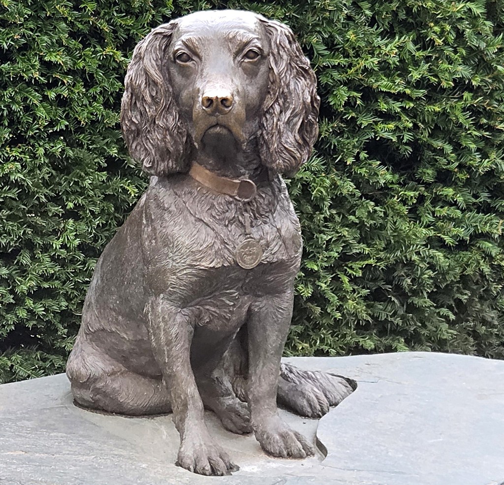
Our first stop was in Hope Park, where we encountered the only red squirrel we saw all holiday and, opposite him, ‘Max the Miracle Dog’.
This bronze sculpture by local artist Kirsty Armstrong was crowdfunded in 2021. It depicts Max, then a 13 year-old springer spaniel.
Max’s owner, Kerry Irving, was injured in a road traffic accident, leaving him unable to walk and suffering from severe depression.
Two years later, Kerry met Max, then a puppy and, in 2009, they climbed Ben Nevis together. Kerry posted about Max’s daily walks on Facebook, attracting hundreds of followers. Kerry had Max trained as a therapy dog and in 2018 Max received a PDSA Commendation for his work.
During the Covid pandemic he became a ‘virtual therapy dog’, when broadcasts of his daily walks helped many people struggling with depression and isolation. Max was subsequently awarded the PDSA Order of Merit in February 2021, but died in April 2022.
Passing through the park, we had a quick look at Theatre by the Lake. During the late 1940s, a mobile theatre – The Century Theatre – was created, touring for the first time in 1952. In 1961 it visited Keswick, staying for a summer season, then moved on.
But, by 1975, the ageing Century Theatre had come to rest in Keswick. Then it was badly damaged in 1981, during ‘Mod versus Skinhead’ violence. A restoration appeal was launched and, following extended fundraising activity, the present, permanent Theatre opened in 1999.
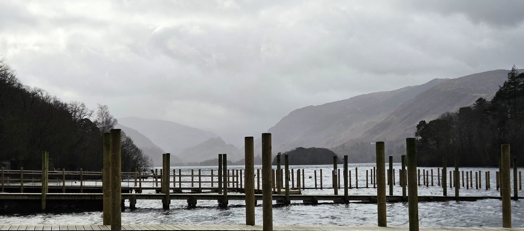
We descended to the Derwentwater Jetties, where the Keswick Launch Company is based. Because it was a winter weekday, the launches weren’t operating; only ‘Lakeland Mist’ was present, tied to one of the jetties.
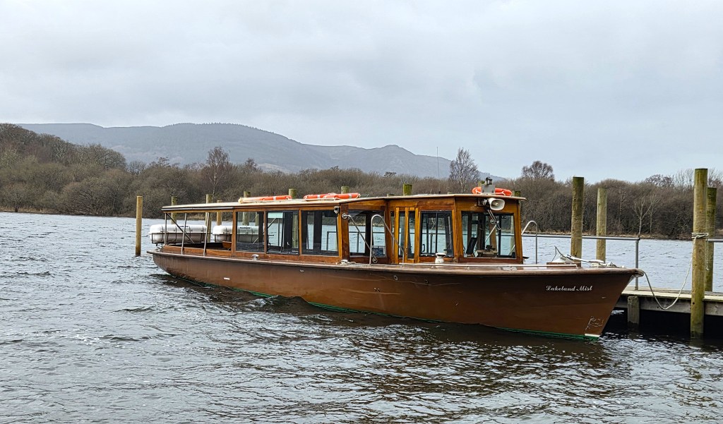
The Keswick Upon Derwentwater Launch Company was formed in 1935. It began with a single boat, but rapidly expanded to a fleet of six.
There are presently four in operation: ‘Annie Mellor’ (built 1932); ‘Lady Derwentwater’ (built 1926); ‘Princess Margaret Rose’ (built circa 1935); and ‘Lakeland Mist’, which began life in 1962 as an Amsterdam River Boat, transferring initially to Loch Lomond in 1990 before moving here in 1998.
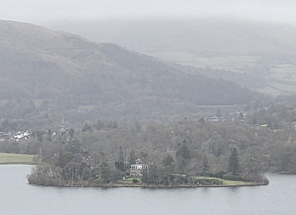
From the jetties one can see clearly across to Derwent Island which, in the medieval period, formed part of the estates of Fountains Abbey. It passed to the Crown upon the Dissolution of the Monasteries.
In 1569, it came into the possession of the Company of Mines Royal, and was used to house a community of the German miners mentioned above.
In 1778, the Island was purchased by the aforementioned Joseph Pocklington for the sum of £300.
Pocklington had seen and admired Windermere’s Belle Isle, upon which a circular house was built in 1774. He had his own Palladian Villa constructed upon the Island, then called Vicar’s Island, in 1781.
It was built to his own design and attracted some scorn.
In Wordsworth’s ‘Guide Through the District of the Lakes’, originally published in 1810, the poet grumbled:
‘At the bidding of an alien improver, the Hind’s Cottage, upon Vicar’s Island, in the same lake, with its embowering sycamores and cattle-shed, disappeared from the corner where they stood; and right in the middle, and upon the precise point of the island’s highest elevation, rose a tall square habitation, with four sides exposed, like an astronomer’s observatory, or a warren-house reared upon an eminence for the detection of depredators, or like the temple of Œlus, where all the winds pay him obeisance.’
Pocklington was not content with his house, also constructing a Gothic chapel (which later became a boathouse), a fort with an artillery battery, called Fort Joseph, and a druid’s circle. He organised annual regattas upon Derwent Water, typically featuring mock battles in which he fired cannons from Fort Joseph.
In 1796 Pocklington sold the Island to William Peachey, and it was subsequently purchased by Henry Cowper Marshall in 1844. He and his son John added two wings to the house, as well as a tower above the front entrance.
The Marshall family donated the Island to the National Trust in 1951, though the properties upon the Island remain tenanted. A notice on the Trust’s website says that it is no longer running open days on the Island ‘due to staff shortages’.
We continued along the shoreline.
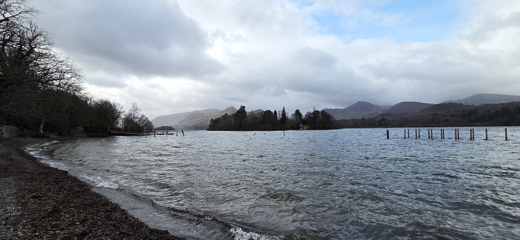
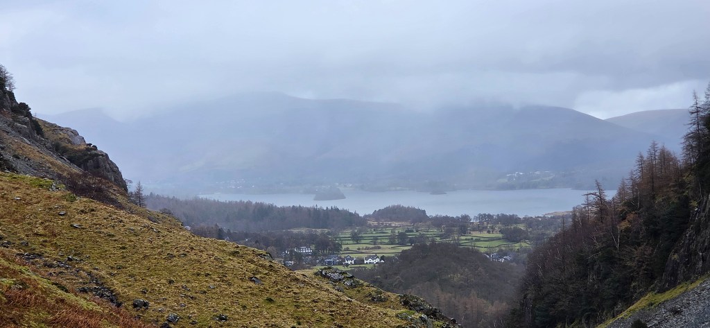
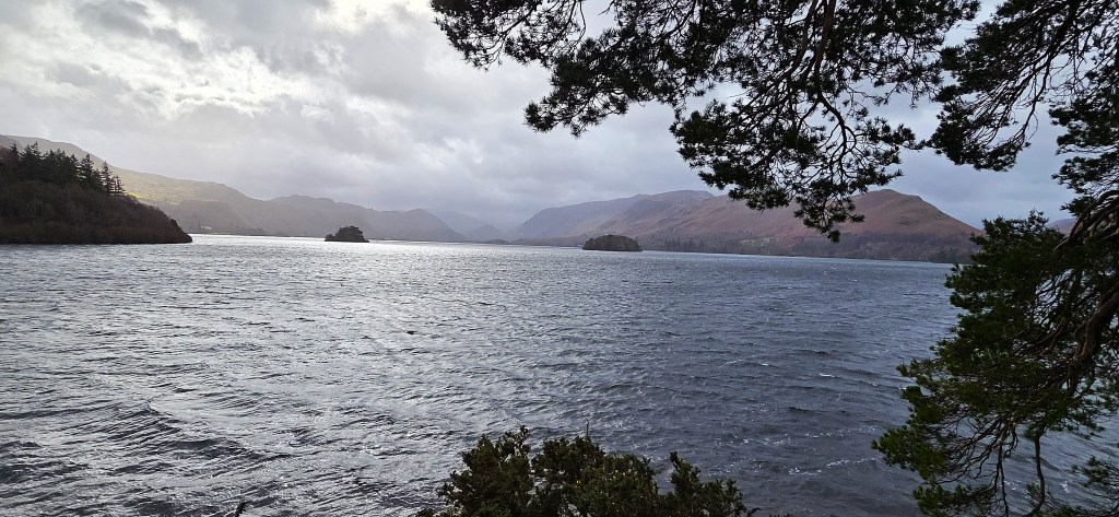
From the approaches to Friar’s Crag there was a good but distant view across the water to Derwent Bank, though we weren’t 100% certain that it was Derwent Bank.
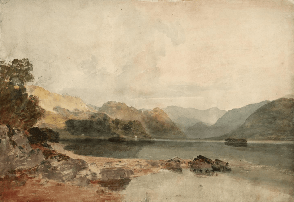
Friar’s Crag is said to be the spot from which pilgrims embarked to visit St Herbert’s Island. Its reputation as a local beauty spot dates back to the Eighteenth Century. Southey wrote of it and JMW Turner painted a watercolour from here, in either 1797 or 1801.
There is also a memorial to John Ruskin (1819-1900) who recalled that his earliest memory was being taken here by his nurse in 1824, and who regarded the view from this point one of the most beautiful in Europe.
I dutifully repeated the only ‘factoid’ I retain about Ruskin: that his marriage to Effie Grey was never consummated because he was revolted by her pubic hair (though menstruation might also have had something to do with it).
Effie eventually found solace with John Everett Millais, bearing him eight children in the process!
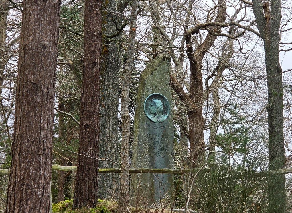
The memorial was erected some months after Ruskin’s death, primarily at the instigation of Hardwicke Rawnsley. When Rawnsley died, the Trust raised the money to purchase Friar’s Crag in his memory, and a memorial to him was placed here in 1922.
In ‘Swallows and Amazons’ (1930), Arthur Ransome (1884-1967) is said to have based the lookout point, the ‘Peak of Darien’, upon the Crag, though this is debatable.
It did, however, substitute for Darien in the 1974 film of the book.
We sat upon the bench kindly provided and admired the view for ourselves, outstanding even on this rather overcast day.
Moving on, we passed Strandshag Bay, drawing abreast of Lord’s Island (also known as Crow Island) where the Radcliffs, Lords of Derwentwater once lived in a manor house. It was built in the mid-Fifteenth Century, allegedly with a drawbridge between the Island and the mainland.
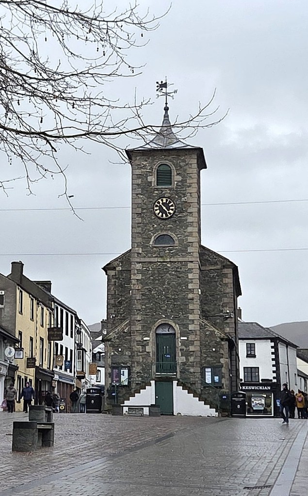
But the family moved elsewhere in 1623 and the house fell into disrepair. Stone from it was used to rebuild the Moot Hall in Keswick in 1695, but that was subsequently rebuilt a second time, the present building dating from 1813.
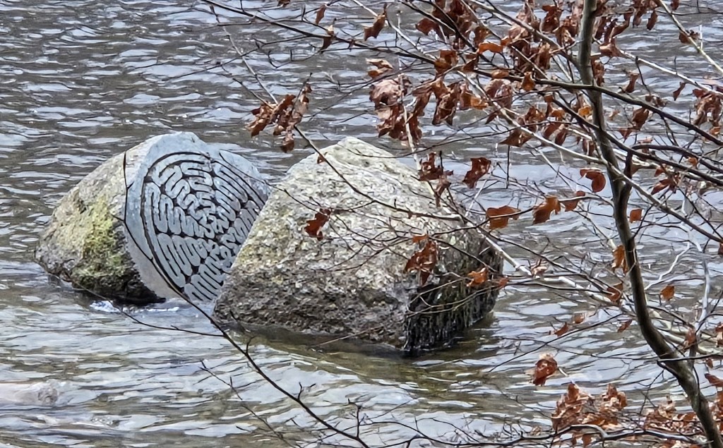
We arrived at Calfclose Bay, where we spotted the Hundred Year Stone, just offshore. It was commissioned in 1995 to mark the centenary of the National Trust. The rock is local andestite and was sculpted by Peter Randall-Page.
We were now broadly level with St Herbert’s Island (see above) and, nearer to us, Rampsholme, the smallest of the four principal islands. Its name means ‘wild garlic island’
We had advanced far enough to be able to see, with magnification, the Lodore Falls Hotel, built in 1870. We debated whether we should continue towards it, completing the full ten-mile circuit back to Derwent Bank, but decided that it would be wiser to save our legs for climbing the next day!
So we returned the way we had come, this time following a path further inland which passed through woodland, emerging beside the Theatre.
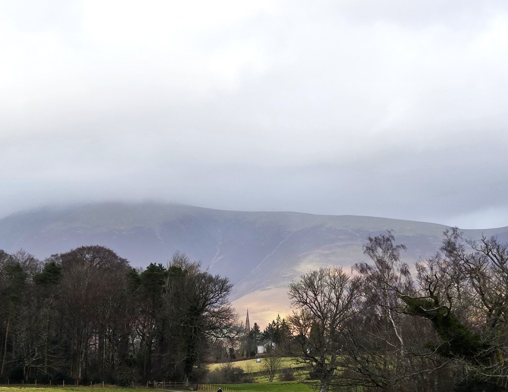
Strolling through parts of Keswick we had not yet explored, we came upon Jasper’s Coffee House, which we called into for fresh supplies of coffee and cake.
On the way back round to Portinscale, we passed an elderly couple walking one dog, each with a lead attached. Apparently, they normally use the route across the fields (still closed for resurfacing) because their dog has a mania for chasing cars!
It requires the strength of both to keep him under control.
Arriving back at Derwent Bank, we took a look at the front of the house, to make sure it was the one we’d spotted from across the water earlier. I took the opportunity to venture out upon the jetty for a few more photographs.
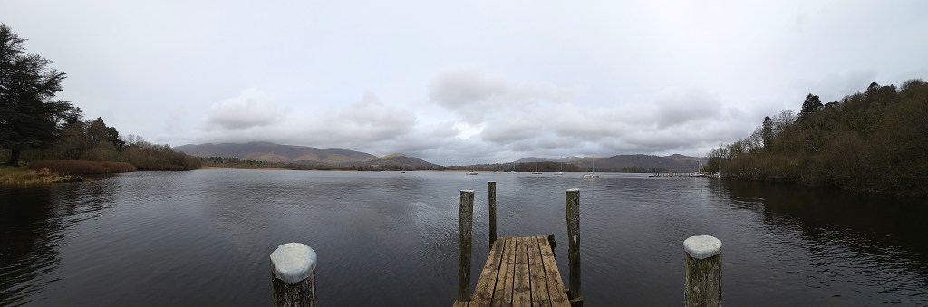
The forecast for the next day wasn’t too great. The most challenging walk would feature an ascent of Grisedale Pike but John (who wouldn’t be leading on this occasion) said he thought there was a 70% chance we’d be forced to turn back by powerful gusts of wind. He added that there might still be snow on the summit.
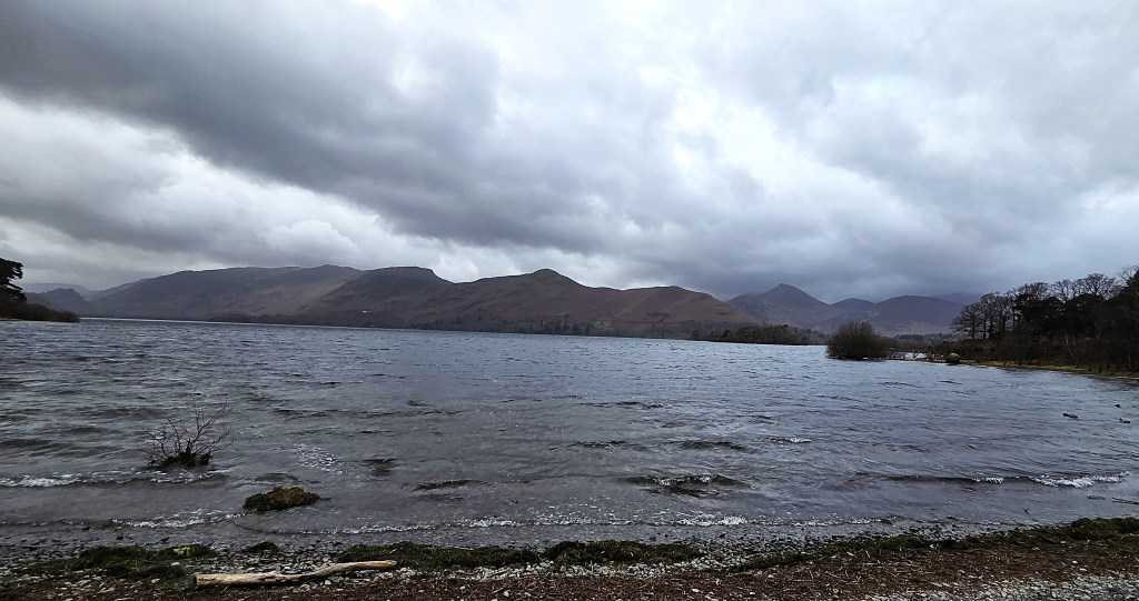
Day 6: Whinlatter Forest and Grisedale Pike
Our three choices of walk were:
- Option 1: a 6 mile walk from Thornthwaite through Whinlatter Forest, via its Visitor Centre, descending to the village of Braithwaite and from there back to Derwent Bank;
- Option 2: a 9.5 mile walk completing the first part of Option 1 in reverse (reaching the Whinlatter Forest Visitor Centre from Braithwaite) then following the ridge path from Grisedale Pike and returning back via Braithwaite;
- Option 3: a total of 11.5 miles, walking to Braithwaite and from there ascending the ridge path to the summit of Grisedale Pike, then descending via Hobcarton End to the Forest and its Visitor Centre before returning home via Braithwaite.
Ten of us assembled outside the boot room in readiness for option 3, including our new volunteer leader, Ed, who had first appeared the previous evening, replacing Ben at the ‘walks talk’.
The weather seemed comparatively benign at sea level, with little wind and light rain, so we all hoped for the best.
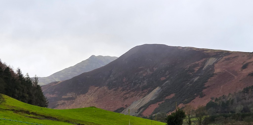
As we made our way across the fields between Portinscale and Braithwaite, the summit of Grisedale loomed above us, mostly clear of cloud. We bypassed the pleasantly named Ullock, a tiny place, not to be confused with the identical village on the way to Workington.
Following the path beside Newlands Beck, we passed an old hollow tree, with flowers placed beside it. There were two plates on the trunk, one a memorial to Laura Jane Head (1994-2022); the other saying: ‘La’ll Teds Tree, Never Forgotten, Last of the Summer Wine’.
I cannot discover to what this second cryptic reference refers, other than the television programme.
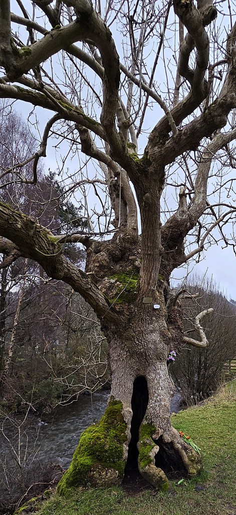
Laura Head was born in Blackpool and studied at Guildford School of Acting before beginning a career as a Sound Operator, often working on West End theatre productions.
Inside the Braithwaite Village Caravanning and Camping Club there were several large motorhomes and one, a good deal smaller, with a notice on the back naming the owners and adding, with some pathos, ‘living the dream’.
I would have captured this in a photograph, had not the owners been inside!
Braithwaite is located at the foot of the Whinlatter Pass, around Coledale Beck, a tributary of Newlands Beck, and its name means ‘broad clearing’.
Historically it was a mining village, to which miners returned daily from the nearby workings. Those employed further away would typically live in ‘bothies’ during the week, returning to their families only at weekends.
The School was built in 1842 and the church, St Herbert’s, in 1900, replacing an earlier mission room. There was also a Methodist chapel, originally built in 1850 and reconstructed in 1876. In 2007 it became part of the Orthodox Parish of Saints Bega, Mungo and Herbert.
This is part of the Greek Orthodox Archdiocese of Thyateira and Great Britain, founded in 1922, which overseas the United Kingdom, the Isle of Man and the Channel Islands. There are some 114 parishes and monasteries within the Archdiocese, the episcopal seat being at St Sophia’s Church in London.
The local priest is Father John Musther, who moved to the area in 2007 after visiting it on holiday. He was previously ordained an Anglican priest, but converted to Orthodoxy in 2003.
Braithwaite once had its own railway station, lying on the Cockermouth, Keswick and Penrith Railway. It opened in 1865, closing 101 years later in 1966.
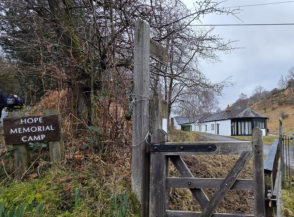
Climbing out of the Village, we passed the Hope Memorial Camp, a residential centre for young people created in 1923 by Mr Arthur Herbert Hope, Headmaster of the John Roan Boys’ School in Greenwich.
The original boys’ grammar school was founded in 1677, while a separate girls’ grammar school was opened exactly two centuries later, both funded by an endowment left by John Roan (c.1600-1644), who became Yeoman of His Majesty’s Harriers (and/or Greyhounds) to King Charles I. The School became a coeducational comprehensive in 1980.
Hope purchased 40 acres of land and built four huts with his own money, so providing a valuable educational facility for his pupils. When he died in 1930, the Roan School established the Camp permanently in his memory.
It is still managed by the A.H. Hope Memorial Trust, and is now available for anyone to hire, though there are preferential rates for schools and community groups. This, in turn, subsidises the cost of visits by pupils from the present Roan School. The original huts were replaced by the present building in 1989.
The Grisedale Pike Path begins a little further up the B5292 Whinlatter Pass. The first section skirts the woodland of the Hospital Plantation, so named because there was once an isolation hospital up here, now the Cottage in the Wood Hotel (with Michelin Star). The hospital closed in 1940.
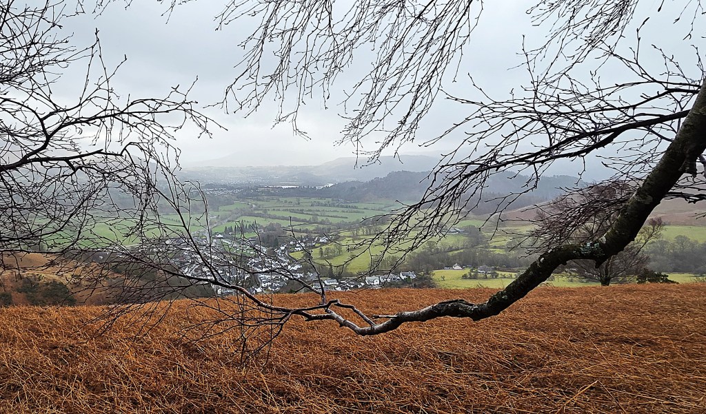
On reaching the top of this section, we stopped for a coffee break, aware that it would be the last shelter we would have against the elements for some considerable time. Braithwaite lay spread out, far below.
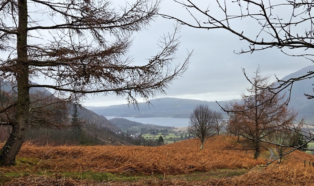
The next stage was long and arduous. I set myself a pace and stuck to it, recovering from the effort while the others caught me up. This subsidiary hill is known as Kinn. I stopped somewhere in the vicinity of a natural spring called Lanty Well, though I don’t remember spotting it.
I was focused instead on the view below, which now extended well beyond Keswick, towards what I believe is Skiddaw.
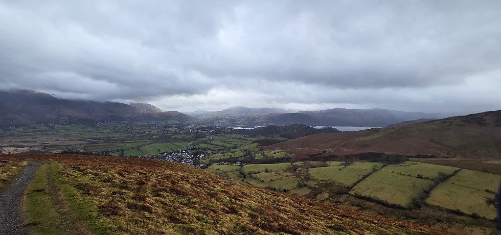
The path grew increasingly rocky as we climbed up Sleet How, and the occasional heavy gusts of wind required us to pause until they had subsided.
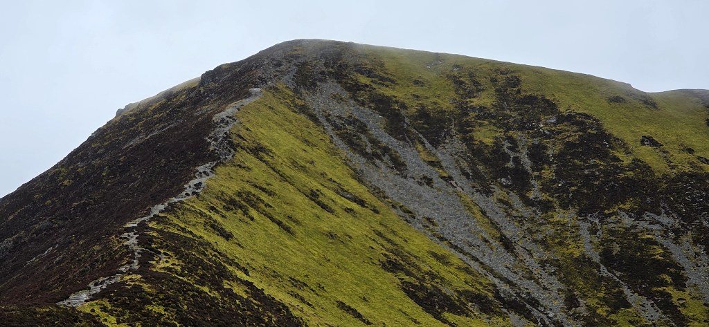
A particularly vicious blast attacked us just a few metres short of the summit but, immediately afterwards, we enjoyed a short period of comparative calm.
At the same time, visibility declined significantly as the low cloud wrapped around us.
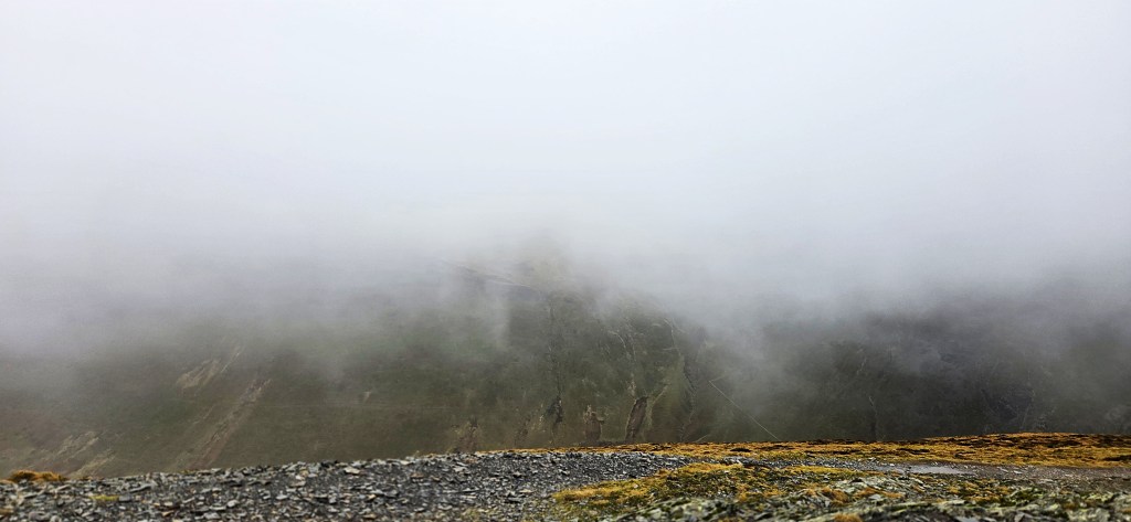
The summit of Grisedale Pike stands at 791m. Placed at number 40 in the league table of highest Wainwrights, it was the highest point we would reach on this holiday. On a good day, one can see the Isle of Man and Slieve Donard, the highest mountain in Northern Ireland.
But it was not a good day. My photographs are mainly of cloud. As the summit threatened to grow increasingly inhospitable, we dropped down slightly, setting out in a northerly direction, towards Hobcarton End.
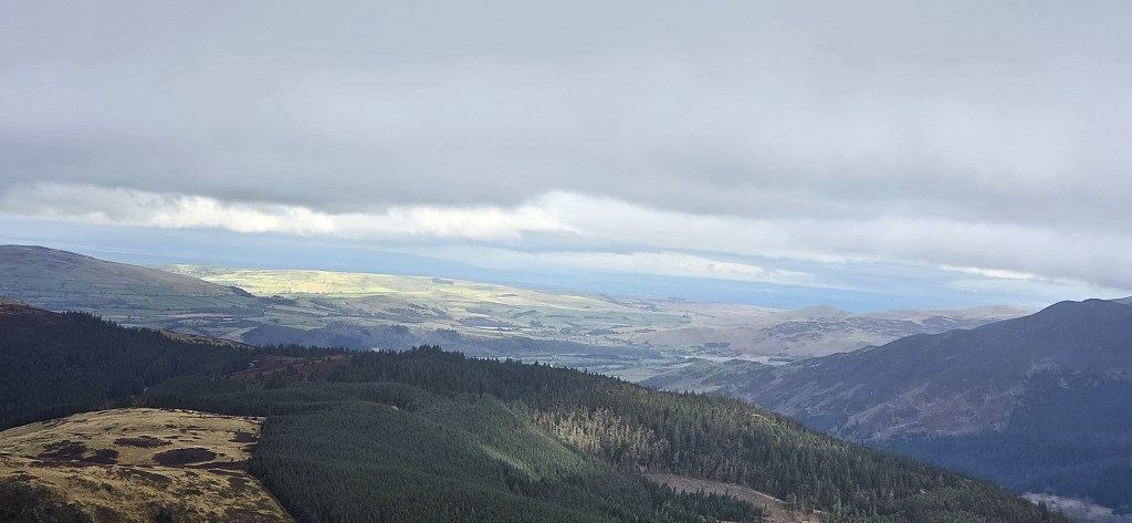
To the south of the summit lies Force Crag mine, the last in the Lake District to close, as recently as 1990. It produced lead, zinc and baryte (barium sulphate).
Though there was some activity during the Sixteenth Century, the mine was not significant until the early Nineteenth. Production reached a peak after 1860, but the mine was closed in 1865 when the price of lead declined. It soon reopened as a baryte mine, but closed once more in 1879.
From 1907 onwards it was reactivated, successively under the control of several different companies. Periods of relative success alternated with further closures. In 1984 the New Coledale Mining Company began to extract lead, zinc and baryte once more but, following a major collapse and flooding, the mine closed in 1990, probably for the last time.
It was a long and occasionally technical descent down to Whinlatter Forest and all of us grew very tired. I was even more grumpy than usual because my right boot had been scraping away at the heel of my (slightly smaller) right foot and was now painful.
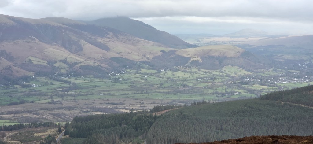
It took some time to find the Visitor Centre but, ultimately, we did so. The climb up the final slope to the building itself added insult to injury.
We sat at one of the tables on a viewing platform outside, despite the warnings that it was reserved for those purchasing food and drink from the Centre. One or two of our number bought coffees to provide a degree of cover, but the tables were otherwise completely empty, so only the most bloody-minded employee would have challenged us.
Round the corner, forest birds were ransacking huge bird feeders strung from nearby trees.
Whinlatter is England’s only mountain forest. The Forest Park includes Whinlatter Fell, its name meaning gorse-covered slope, and all the surrounding forest.
A finger of forest follows Hobcarton Gill up close to the summit of Grisedale, but the bulk is comprised of Hospital Plantation to the south of the Whinlatter Pass and Thornthwaite Forest to the north. The total area amounts to some 3,000 acres and the forest rises to a maximum height of some 1,600 feet.
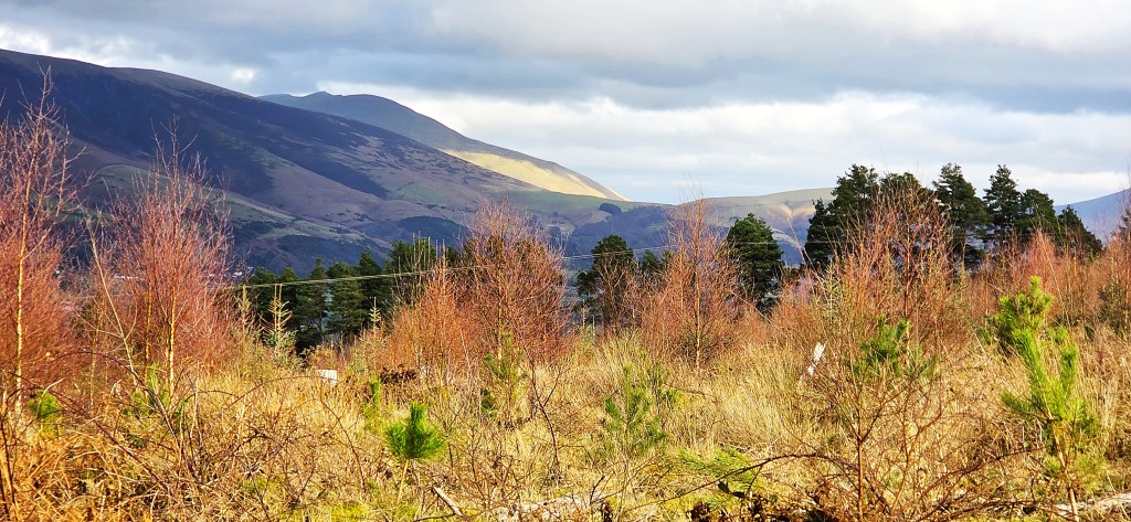
Confusingly, another area of forest to the east of Bassenthwaite Lake is also known as Thornthwaite Forest and, until recently, both areas seem to have been regarded as a single entity.
Most of the land was acquired in the inter-war period, from 1919 onwards, including an area of some 800 acres which had been mostly cleared of trees during the First World War. The land is entirely freehold and features some of the earliest areas planted by the Forestry Commission.
Mountain forests are not defined by elevation, which can vary according to latitude. In temperate climates they are typically coniferous or a mixture of conifer and broadleaf trees. Their climate is typically colder than lowland forests nearby.
The dominant species here is the Sitka spruce, particularly at the higher levels. Lower down there is more Douglas fir, larch and oak.
The Forest Park has evolved into a significant tourist attraction, providing walking, running and cycling trails, as well as adventure play activities for adults and children alike.
The Visitor Centre was once home to the Lake District Osprey Project. In 2001, following several years of encouragement, a pair of ospreys nested hereabouts, and successfully reared a chick.
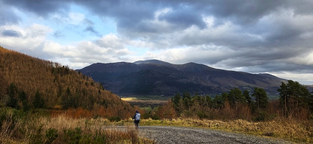
There was formerly a viewpoint, as well as a live feed of the nest in the Visitor Centre. However, it seems that the ospreys have now chosen to nest elsewhere, out of the limelight.
Somewhat refreshed after lunch, though with rapidly stiffening legs, I joined the rest of the party in descending eastwards through the Forest, back towards Braithwaite. The sky brightened somewhat, with occasional bursts of sunshine.
We stopped at one point to watch a toad crossing the path. He seemed in no hurry, and determined to stand his ground. I warned the oncoming couple with their dog off the lead. I hope the toad survived!
We reached the welcoming warmth of the Coledale Inn, formerly a pencil factory, and found Group Two already ensconced. The fire was so warm that I had to remove several layers during the course of my delicious pint of Force Crag Gold which is, apparently, brewed by Theakstons!
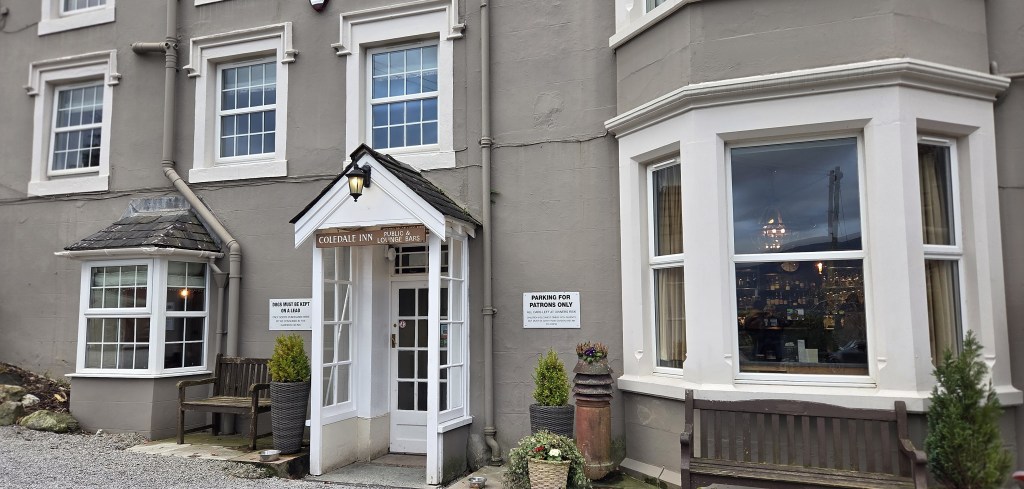
It was with some difficulty that we wrenched ourselves away from the fire to complete the remainder of the walk, back to Derwent Bank.
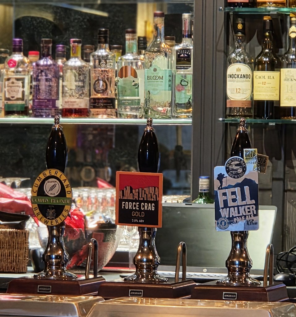
I was exhausted, lying in the bath and then upon the bed until it was time to convene once more downstairs.
Unusually, Tracy had come unequipped with antiseptic cream, so I went in search of some amongst the leaders and guests. I was hoping for germolene, the smell of which is heavily redolent of my childhood.
Amazingly, our leaders couldn’t rustle up any germolene, or any alternative for that matter, but the lady I had upset by not covering my head found some vintage balm which her granny used to swear by.
It stopped the throbbing, anyway.
But, overnight, I was disturbed by acid reflux and began to wonder whether I might need a quieter day tomorrow.
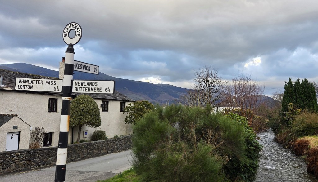
Day 7: Causey Pike
The options for our final day of walking all featured the Newlands Valley:
- Option 1: a 6-mile walk into the Newlands Valley via Portinscale and the outskirts of Braithwaite, arriving at Ghyll Bank, then a return journey via part of the Cumbria Way;
- Option 2: a 9-mile walk across the Newlands Valley to climb Outerside and Barrow, returning via the Coledale Valley;
- Option 3: a 9.5 mile circular walk along the Newlands Valley, ascending Causey Pike and Scar Crags, a little further along the ridge, descending and returning via the Coledale Valley.
We stuck with our choice of option 3, made the previous evening, me hoping that my heel, well-plastered, would stand up to the battering.
We left Derwent Bank around 09:10, and it was already spitting with rain. The forecast was for much more of the same throughout the day and, for once, it proved extremely accurate.
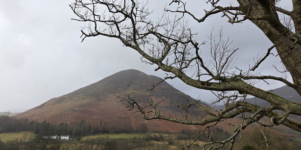
Conditions stayed relatively benign on the lower slopes, which we approached from Ghyll Bank, crossing Newlands Beck and passing close by the Rowling End Farm holiday cottages.
Initially we ascended a steady slope parallel with the road below, beneath Ellas Crag, before U-turning to climb over it, on to the flank of Rowling End (433 metres), heading in the direction of Sleet Hause.
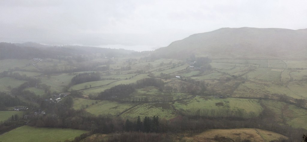
At least, I believe that’s the direction we went, since I could take precious few photographs and, for the few I have, my phone failed to record any location information.
Indeed, it seemed considerably confused by the rain, now being lashed into us by the rising wind. At one point it managed to pocket-call my brother, twice in succession! My home page mysteriously lost several of its settings and a different design was substituted in its place.
Having navigated Sleet Hause, we began the steep ascent towards the summit, occasionally buffeted by nasty gusts of wind. The wind-driven rain was discovering every tiny crevice in our waterproofs, while my sore heel was already sodden.
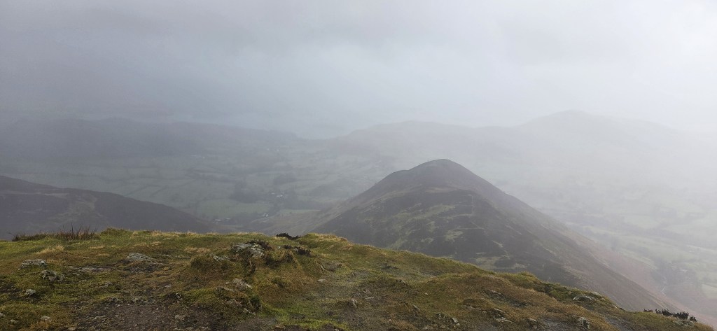
There is a substantial rocky knobble on the top of Causey Pike, often described as an easy scramble. But it is far harder in very limited visibility, while you are soaked and struggling to stay firmly upon the ground, rather than flying away; when much of the rock is rendered slippery and treacherous.
We made our way slowly, sticking close together, with John at our head, looking for the easiest route. About 30 metres short of the summit, he climbed over a large, almost horizontal stone, adjacent to a steep gully and a substantial drop. I was second in line.
The first in line belly flopped on to the rock and heaved her way up with John’s assistance.
My turn next, and I determined to follow her, only to have similar difficulty locating any firm handhold or foothold. So John extended a helping hand and pulled me up.
Meantime, those below had found an easier alternative to our left. We reconvened and climbed the final metres, reaching the summit at around 12:15.
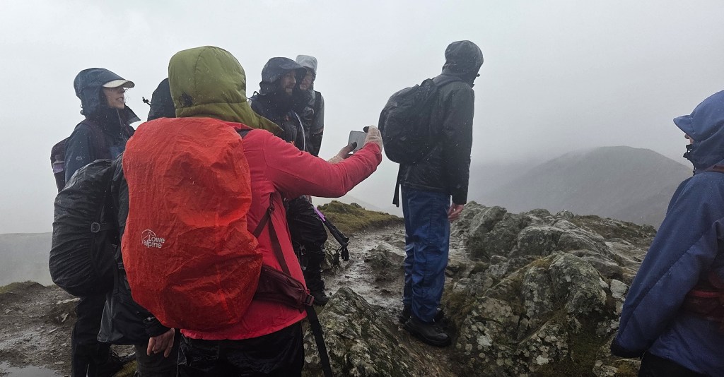
Causey Pike is 637 metres high. On a good day, the view from here is spectacular. The Pike hosts an annual fell race, starting and ending at Stair. The record is a little over 32 minutes.
We began our walk along the exposed connecting ridge towards Scar Crags (672 metres), almost due west but, ten minutes in, John was clearly having second thoughts. He tried finding shelter from the wind by dropping a few metres down the slope, but was still dissatisfied.
He proposed that we should instead climb Outerside, to the north-west, before returning via the Coledale Valley. In the dip between Causey Pike and Outerside, we found a very small Group Two, just completing their descent of the latter.
Asked why we didn’t simply cut our losses and join them heading back along the valley, to the welcoming Coledale Arms, John assured us that the route over the top of Outerside would be no more than ten minutes longer. So all but one of us decided to climb.
The ascent of Outerside (568 metres) was fairly straightforward, since we were sheltered from the worst of the wind. On the other hand, the descent was distinctly unpleasant with long sections of bog, narrow waterlogged paths operating as small streams, and treacherous rocky outcrops.
Part way down, more or less following the line of nearby Barrow Gill, we encountered several frogs disporting themselves in a stretch of puddled bogs. This little fellow was lucky not to get squashed!
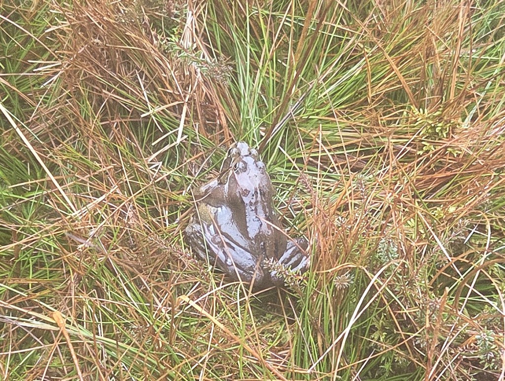
I came a cropper first, twisting to the ground having slipped and been unable to support my weight entirely on my right pole. A while later, Tracy executed her own spectacular fall, managing to damage both hip and shoulder.
By 14:00 I was very grumpy indeed, hungry and heel-sore. I staged a mini-protest because we still hadn’t stopped for lunch. I was ready to eat as soon as we reached the comparatively flatter, drier slopes, but John prevailed on us to walk on until we reached the comparative shelter of a dry stone wall, topped by a handful of stunted trees.
Afterwards, we made straight for the pub. Our clothes streaming, we clustered round the open fires, one in each bar. I bought John a hot chocolate by way of apology for my grumpiness and thanks for his helping hand on top of Causey Pike.
I had a pint of Keswick Gold and Tracy her trademark half of cider.
The route home seemed quicker than the previous day, maybe because we took a shortcut. By the time we reached the boot room at Derwent Bank, mine were waterlogged and I had to wring out my socks over the sink. My heel was angry and throbbing, the plaster washed away.
There hadn’t been too much pleasure in this final walk. It was more a character-building slog.
We sank, gratefully, into a hot bath. Tracy’s shoulder and elbow were both now sore, and for a while, we were worried that she’d damaged some tissue or tendons.
That evening, after dinner, we acquitted ourselves creditably in the traditional inter-house quiz, before returning to our room to get some of the packing done before morning.
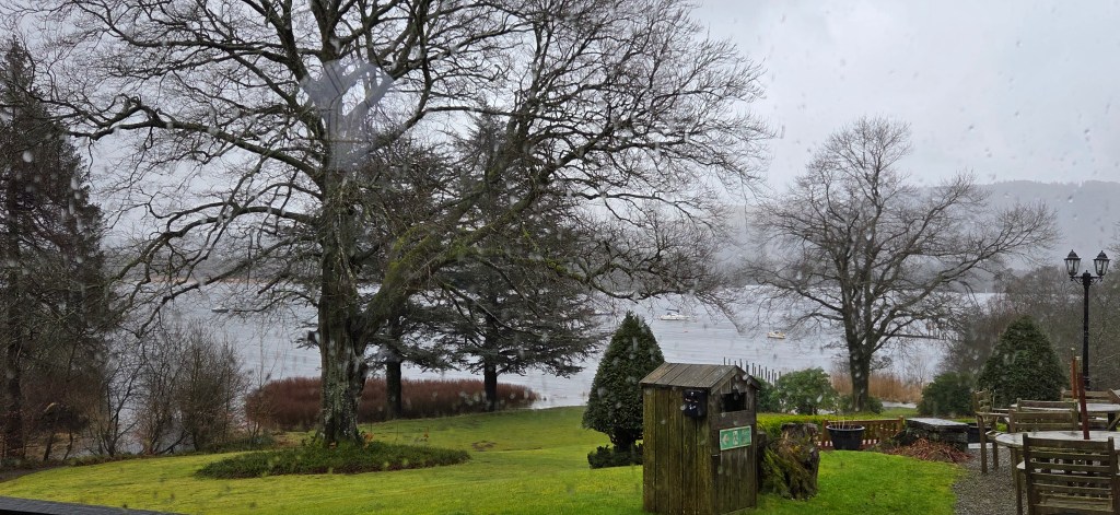
Homeward
We said the usual sad goodbyes at breakfast, enlivened by some talk (I forget what exactly) about ‘flopping loins’. I should take fuller notes on these occasions!
I promised to publish this post in ‘two to three weeks’ time. I’m afraid I’ve slipped a little, mainly because of the funeral.
It’s also turned out a magnum opus, longer than I’d anticipated, because there’s so much to write about this part of the Lake District.
Both our taxi and our train arrived on time, though our promised window seat in the latter proved windowless!
We were a few minutes late into Euston but, fortuitously, just missed a Victoria Line suspension, only for our train to be cancelled mid-journey because of trespassers on the line! We switched instead to the bus and finally made it home around 14:45.
The pile of dirty washing was substantial, but it was good to be back nevertheless.
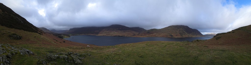
In Memoriam: Victor Raymond Knight (1945-2026).
TD
March 2026
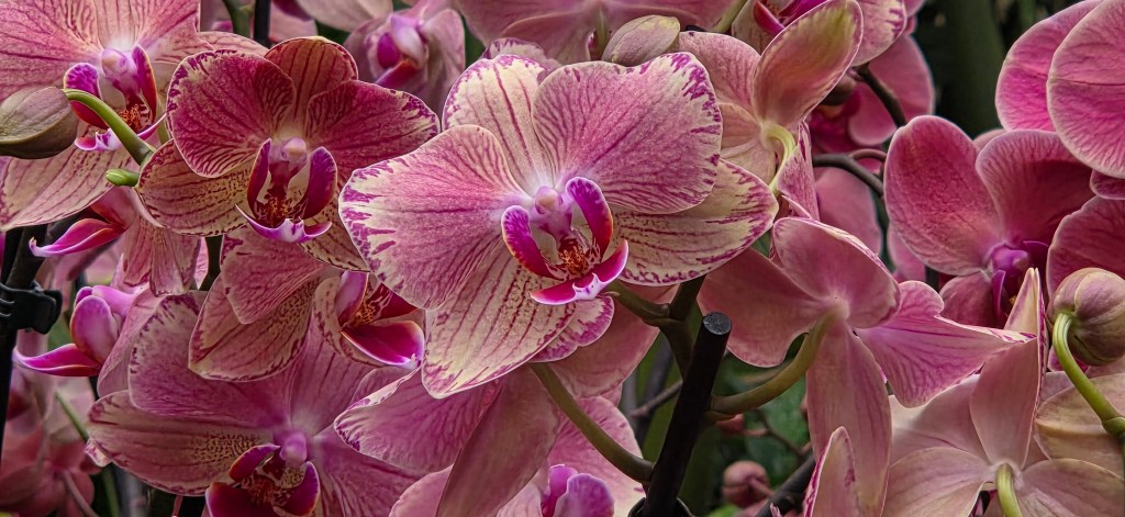


Leave a comment