Six months after our last visit we returned to the South Downs Way, continuing the tradition of celebrating Tracy’s birthday on this particular trail.
Despite threatened blizzards and deluges in the run-up to departure, the weather proved comparatively benign. Sun was in rather short supply, but we managed to dodge most of the showers and enjoyed comparatively mild temperatures for the time of year.
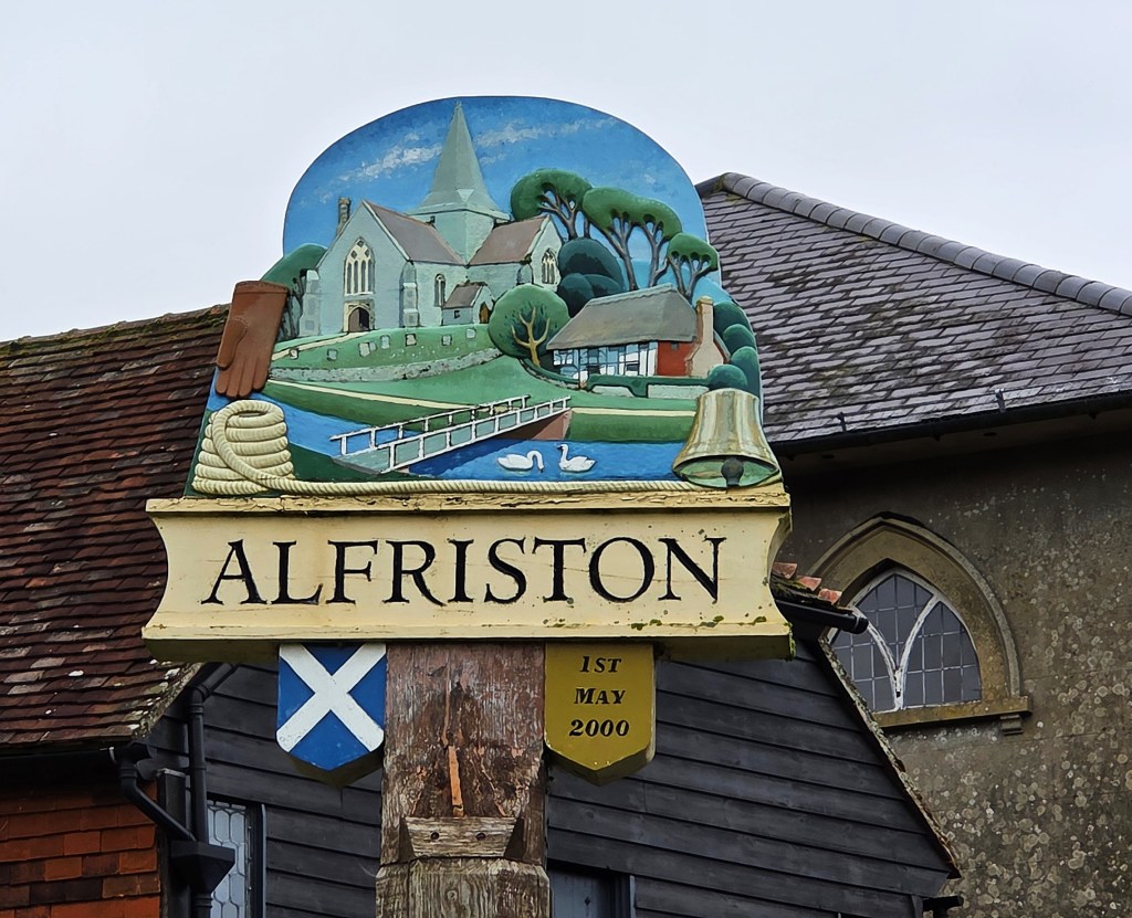
I had been worried about flooding at the points where we descended from the Downs but, checking on the morning of our departure, the only flooding was at Alfriston, our end point, and that was expected to recede before our arrival.
As usual we walked over two days, either side of an overnight stop. But, on this occasion, we decided to stay away for a second night, coinciding with Tracy’s birthday, returning home on our third morning away.
Our preparation hadn’t been the best. Tracy returned home belatedly from her parents’ house, where her father’s failing health was becoming a cause for concern.
Workmen decided to choose this very night to undertake some nocturnal tarmacking almost immediately outside and, to cap it all, Tracy’s phone notified us of a text arriving in the small hours.
I was assuming the worst, but it turned out to be a photo of the flooding at Alfriston.
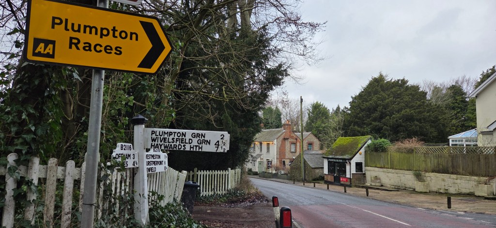
Despite all this, we set out for Plumpton reasonably early on Thursday morning, travelling via Clapham Junction to Haywards Heath.
We were boosted by black Americanos and almond croissants from Starbucks on the platform at Clapham; less so by the bill, which came to an eye-watering £15, even with our reusable cups.
We arrived on time at Haywards Heath where we promptly transferred to a nearby bus-stop.
We were expecting to pick up a 166 bus service to Plumpton Lane, departing at 10:18.
Unfortunately it was delayed by some 25 minutes, so we didn’t reach our destination until 11.15, giving us a tighter than expected schedule for our first day’s walk.
Even so, with five and three quarter hours of daylight remaining, I was confident that we would reach our destination well before darkness descended…and we had packed our Lidl head torches, just in case!
Day 1: Plumpton to Southease
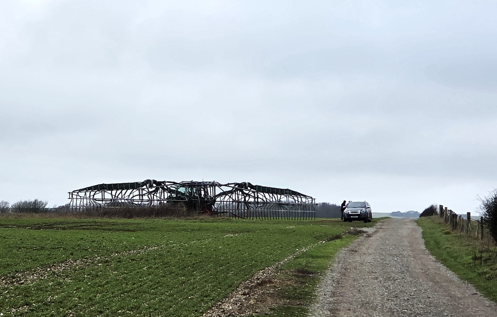
Our first task was to complete the extended and fairly arduous ascent of Plumpton Bostal. Both of us had stowed our walking poles in case of icy conditions here, but they proved unnecessary.
Just as we were about to begin, two small vehicles like covered quad bikes emerged at the foot of the slope, one emitting puffs of black smoke from a side exhaust. Several men were packed inside.
Some fifteen minutes later, on arriving at the summit, Tracy was just positioning for a comfort break when a larger truck emerged round the corner, just below.
It seemed to be the farmer, anxious for a conflab with two farmhands, their parked tractors stationed on grass beside this first stretch of trail.
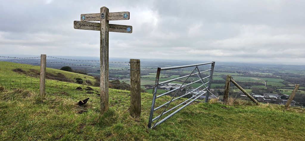
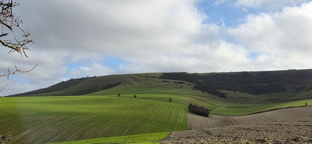
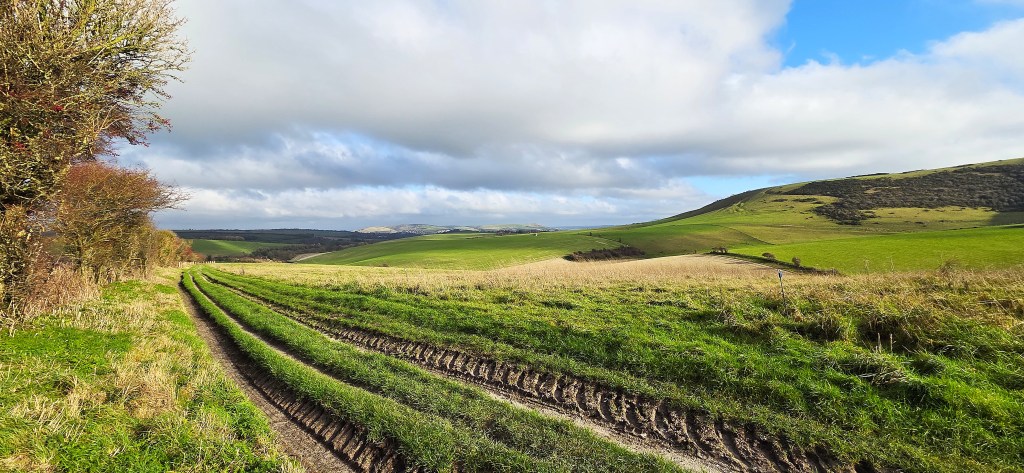
So we paused to admire the view, looking down upon Plumpton College, below, before setting off eastwards along the track.
The farmer dogged us along the full length of this section, all the way to a farm gate heralding the imminent Blackcap Nature Reserve, so the comfort break was much delayed.
Here we took a sudden dog-leg right, along a much narrower path, heading broadly south and skirting an area of woodland called Ashcombe Bottom.
The former Lewes horse-racing course was located here. The first known race took place in 1712 and the last in 1964. Originally the course was two-and-a-half miles long, but latterly only one-and-a-half miles.
In November 2024 it was up for sale, the asking price £2.45m. In July 2025 Lewes District Council rejected plans to build houses on land adjacent to the course, as a means of generating funds to develop it. In December 2025 the owners put it on the market once more, this time with additional buildings included, for a cool £3.75m.
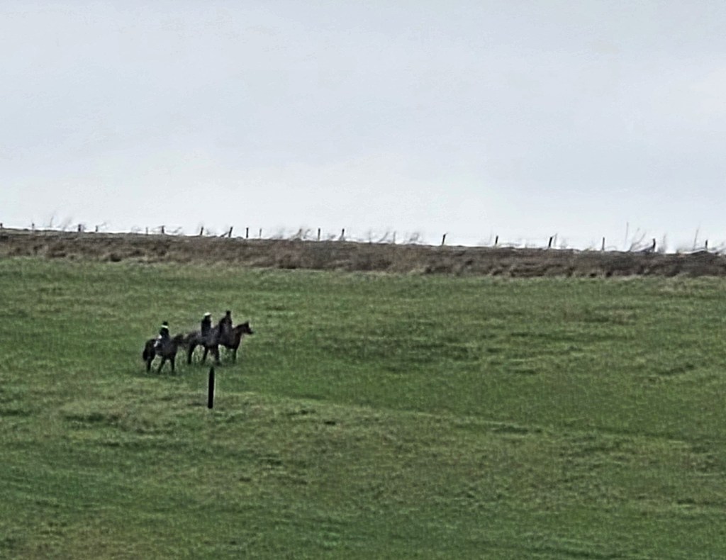
A little further on, and as if to confirm this, we spotted three horses being ridden side-by-side, some distance away.
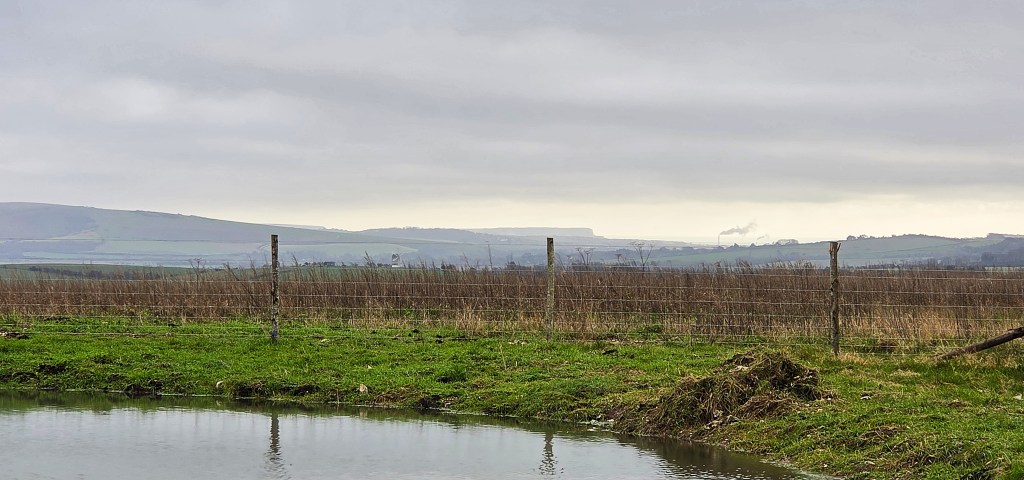
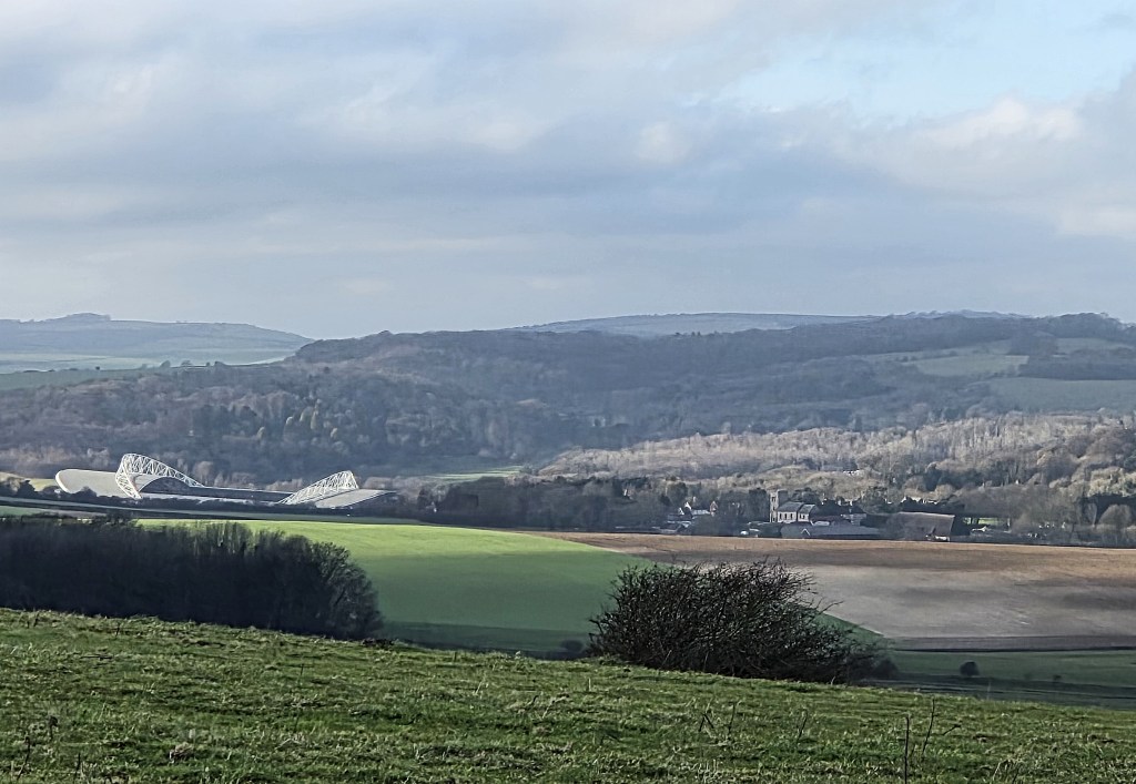
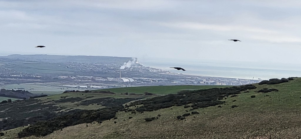
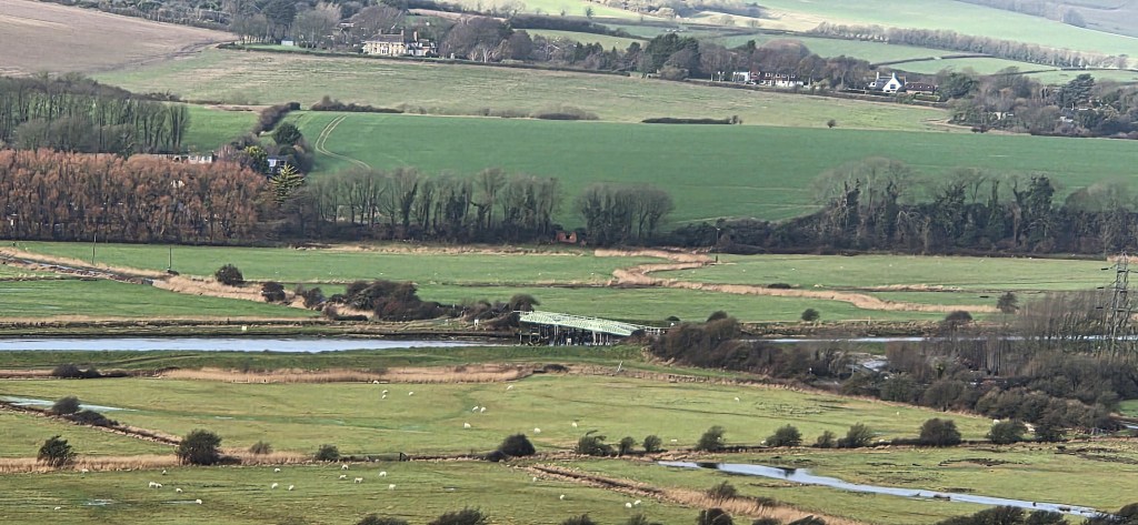
Shortly afterwards we passed a dew pond. In the background stood Newhaven, where two tall chimneys were smoking. These belong to the energy recovery facility, or ERF
It generates electricity from household waste that cannot be recycled, sufficient to power 25,000 homes. The twin chimneys are 65 metres tall.
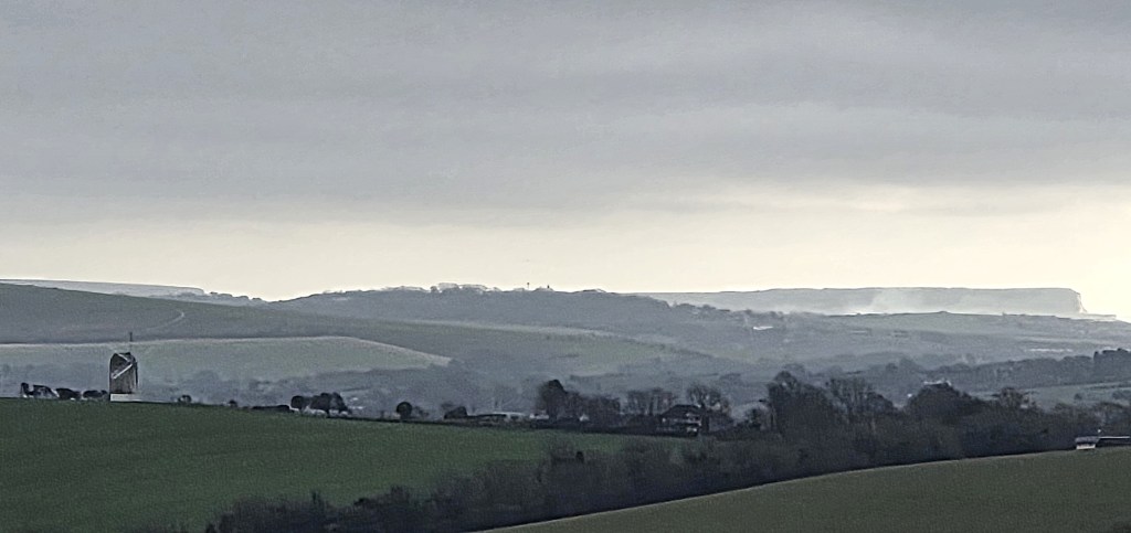
Beyond, the Seven Sisters loomed majestically beneath the clouds.
We were now skirting Balmer Down, known for its ancient field systems dating back to the Iron Age, but more recently associated with the lost medieval village of Balmer. It was abandoned at some point, its chapel known to have been demolished in 1550.
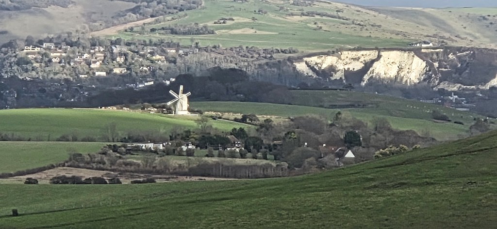
To our left we could see the Ashcombe windmill, on Kingston Hill. The original was built in 1828 but destroyed by a gale in 1916. This facsimile was completed in 2015.
The path changed direction once more as we skirted Bunkershill Plantation, part of the Parish of St Ann Without. It is named after the battle of Bunker Hill (1775) during the American Revolutionary War.
We descended towards the A27 at Housedean Farm, where the campsite was closed for the winter. Crossing the bridge, we continued on other side of this extremely busy road, parallel with the Brighton to Lewes railway line.
Eventually we passed through a tunnel beneath this and, immediately, the intrusive traffic noise was muted.
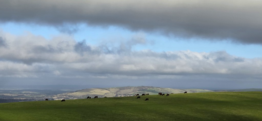
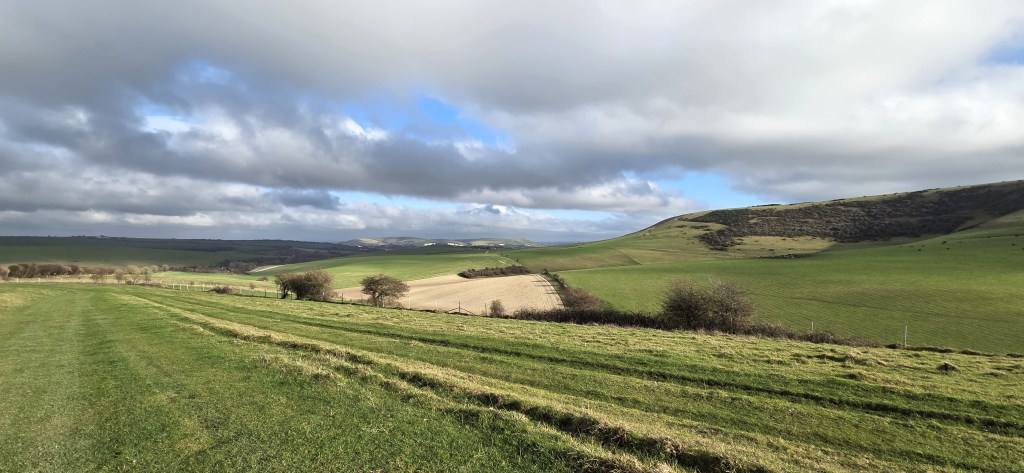
We decided to stop for lunch on a sheltered bank, just as the path began to open up on the ascent towards Newmarket Plantation. We sat looking across the undulating landscape, towards Scabby Brow, as the sun finally began pushing through the clouds.
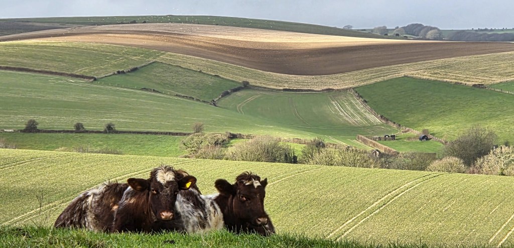
Climbing the slope after lunch, we arrived beside a group of cows. They eyed us curiously while we photographed them against the rolling landscape.
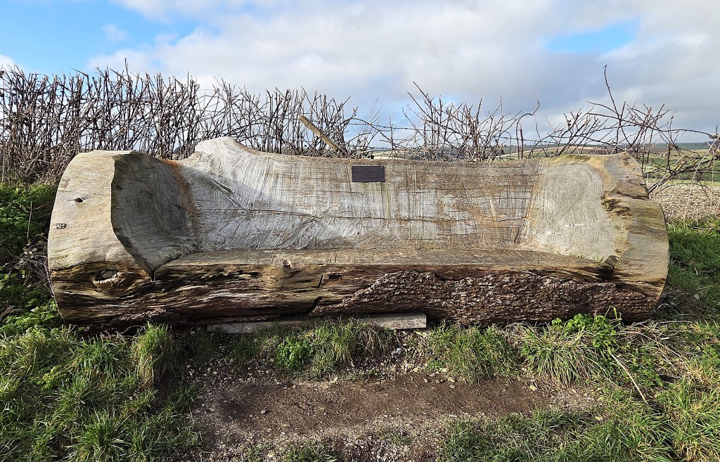
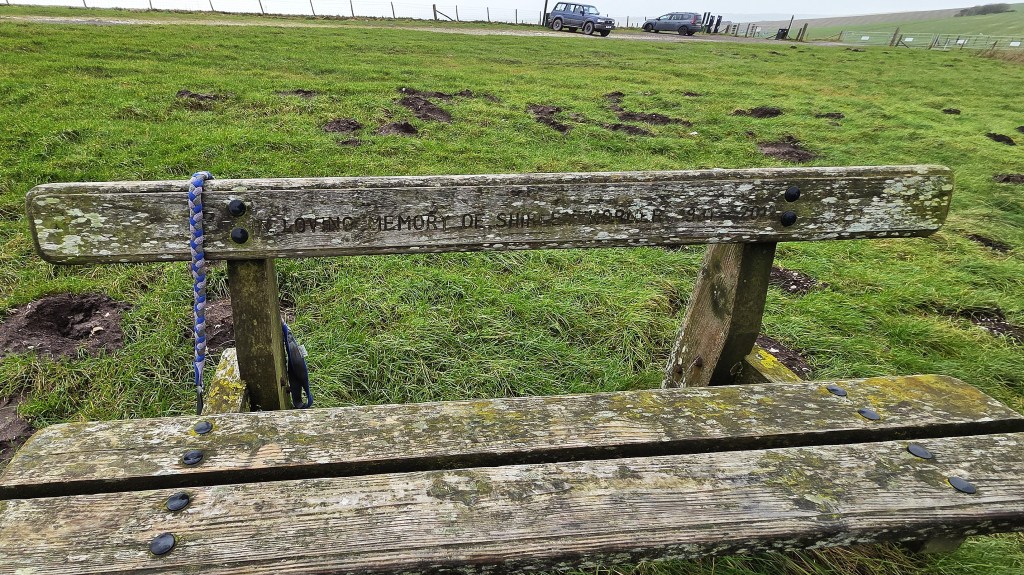
A little further on we found a bench carved in memory of farmers Peter and Tita Taylor. This was Peter Taylor of Housedean Farm and his first wife, who predeceased him. He married again after her death.
We consoled ourselves for missing out on this more comfortable lunch spot with the thought that it would have been far breezier here than below.
A USAAF Douglas Dakota crashed in low cloud on Newmarket Hill in November 1944, killing 25 of the 30 men on board. The flight was en route from Chateaudun Airport in France to RAF Greenham Common. It is unclear why, given the weather conditions, the pilot was flying at minimum altitude.
The path took a U-turn, so we were soon heading along the ridge we had been overlooking at lunch. We now had a better view of Ashcombe windmill and, in the other direction, of the American Express Stadium at Falmer, home of Brighton and Hove Albion since 2011.
It looks incongruous surrounded, as it is, by English countryside.
We were now on the stretch known as ‘Jugg’s Road’. Apparently, ‘Jugg’ was the dialect nickname applied to Brighton fishermen. Their fishwives would use this road to transport fish to Lewes market, typically by donkey
We passed a wind turbine and aerial which belong to a ‘pressure relieving station’. It certainly feels as though we could do with several more of those!
I have since learned that this refers to gas pressure and that this is:
‘…a Pressure Reduction Installation (PRI) used to step down high-pressure natural gas from the National Transmission System (NTS) to lower, usable pressures for local, industrial, or domestic supply.’
The wind turbine was installed when the previous supply failed. It had arrived via a cable some 1.5km long.
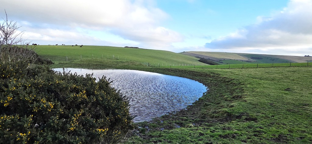
Turning off Juggs Road, we passed a selection of dew ponds, avoiding the outskirts of Kingston, a small village nearby. Newspapers have described it as one of England’s poshest, with property prices to match.
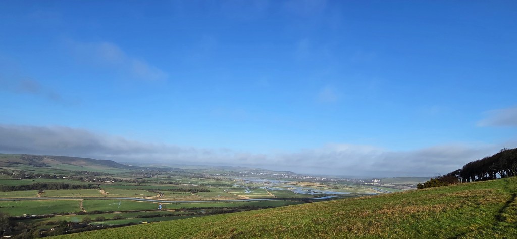
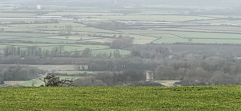
We could now observe the extensive flooding on the outskirts of Lewes, beyond.
By the time we were roughly parallel with Iford, south of Kingston, we could also see the futuristic Newhaven ERF more clearly. This shot also captures three crows which decided to fly by at that moment.
We stopped nearby to admire a kestrel on the wing.
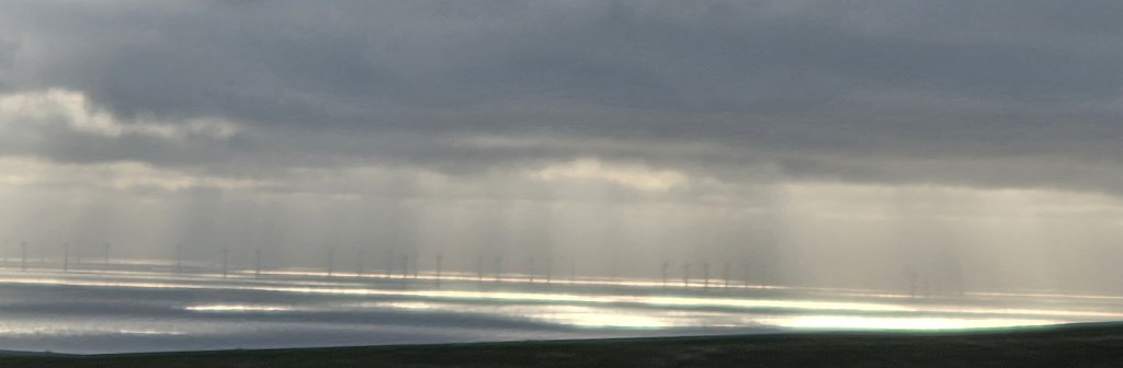
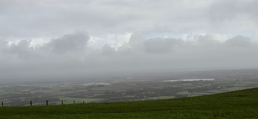
The mid-afternoon light supplied this shimmering long distance view of wind turbines, far out to sea.
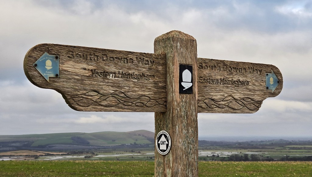
Continuing across Front Hill, we crossed a track called White Way, heading down towards Northease in the valley below. Shortly afterwards we drew alongside a post marking the Greenwich Meridian, which once divided the Western Hemisphere from the Eastern.
Thoughts of that awful Trumpian National Security Strategy sprang, unbidden, to mind.
I promptly dismissed them.
In 1884 the Greenwich Meridian was voted the world’s ‘prime meridian’, where the earth’s longitude is set at 0 degrees. But, since 1984, it has been replaced by the ‘IERS Reference Meridian’, very slightly to the east of its predecessor.
The post carries a marker for the Greenwich Meridian Trail, which runs 273 miles, from Peacehaven on the Sussex coast, via Greenwich, Hardwick and Boston, to Sand le Mere, adjacent to Hull, on the East Yorkshire coast.
We were now drawing abreast of Rodmell, below, best known for its Twelfth Century Church and Monk’s House, purchased by Leonard and Virginia Woolf in 1919.
They lived here permanently from 1940, after their London flat had been damaged in an air raid. Virginia wrote ‘Between The Acts’ here, her final novel.
She did not live to see it published, committing suicide in March 1941 by drowning herself in the River Ouse.
Leonard lived here until his own death in 1969 and the property is now owned by the National Trust.
On the opposite side is the delightfully named Breaky Bottom, containing the vineyard established by Peter Hall. He died recently, in October 2025, but his family continue to run the business.
We admired the beacon, one of many erected to mark the 80th anniversary of VE Day on 8 May 2025. A trio of local sheep were grazing round about.

We descended towards South Farm, where a blackboard informed us that Fred was thankful for our visit, before turning along the lengthy drive, which heads towards the Piddinghoe Road.
The route takes a sharp right turn just beforehand, sweeping round to a point much closer to Southease on the other side.
We could see an adult male badger, lying dead and bloodied on the opposite side. It had clearly been struck by passing traffic.
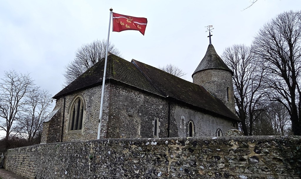
We followed the Southease Road past St Peter’s Church, with its Eleventh Century nave and chancel and Twelfth Century round tower.
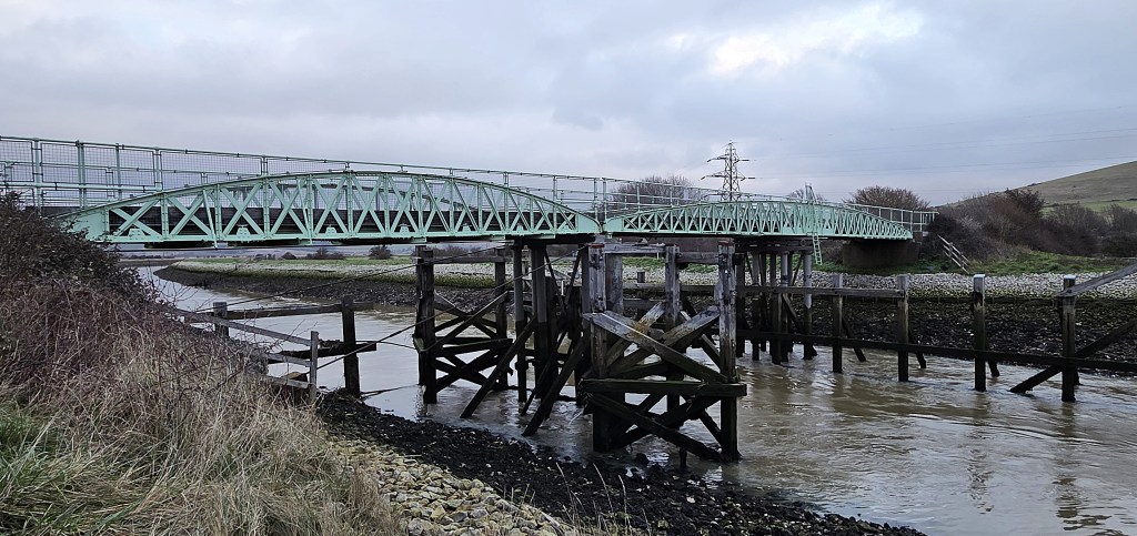
The road passes across the Southease Swing Bridge, just a little downstream from where Virginia Woolf ended her life. Her body was discovered at Asham Wharf, three weeks after the deed.
A warning sign tells vehicles to respect the bridge’s weakness. Just ahead of us, a small truck-full of sheep completed the crossing, a little bit faster than the ‘dead slow’ advised by the sign.
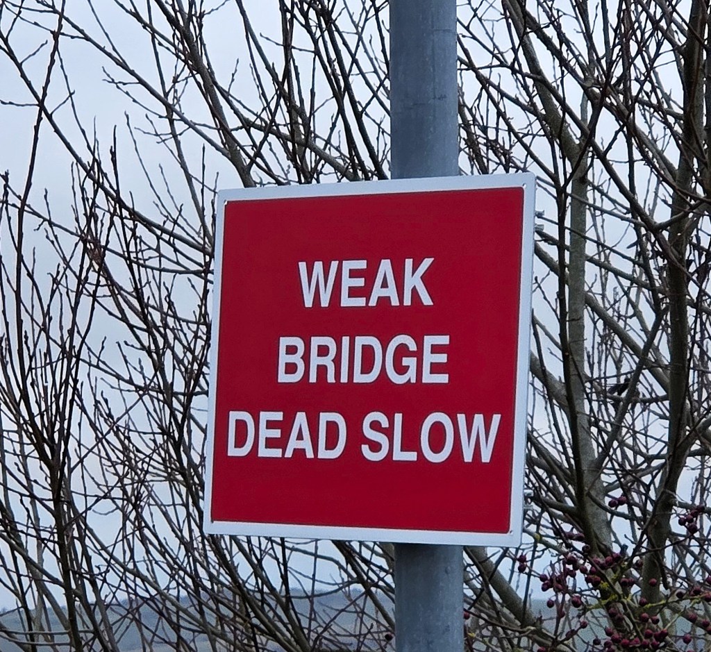
The bridge is iron, painted a fetching Cambridge blue, and was constructed in 1880, to allow masted vessels to pass beneath. But there was no more swinging after 1988, when it was fixed to prevent larger vessels from sailing further up river.
It was listed in 2009 and renovated the following year.
Having photographed the bridge from the river bank, we crossed to the other side, closing in on Southease Station where a train was about to depart.
Crossing the railway bridge, we found ourselves beside the South Downs Youth Hostel, our overnight accommodation.

Our first priority was to buy coffee and cake from the Café, which doubles as the Hotel’s restaurant. It was approximately 16:15.
Although check-in was officially 17:00, we were kindly shown to our room a little beforehand. Here we rested until dinner at 19:00.
The Hostel had few other guests and there was only one other person in the restaurant. I selected pie, mash and peas with a bottle of Spitfire; Tracy chose a YHA burger washed down by a bottle of low alcohol cider.
Following a nose around the communal kitchens, lounge and quiet room, it was time for an early night. I slept reasonably but fitfully, owing mainly to traffic on the A26, passing immediately behind our room.
Day 2: Southease to Alfriston
With a little over seven miles to walk, we faced no time pressure on this second day. And, it being Tracy’s birthday, we proceeded in leisurely fashion anyway.
We sat down for our ‘all you can eat’ breakfast at around 08:15, helping ourselves to granola, fruit, pastries and a full English apiece. We refilled our flasks from the coffee urn and our water bottles at the water station, leaving the Hostel at around 09:30.
Light rain threatened to become something stronger as we crossed the slippery wooden bridge over the A26 and began our ascent of Itford Hill.
But the shower instead gave way to temporary sunshine.
Itford Hill gives its name to a type of Bronze Age settlement comprising only a few households, potentially for a single family.
They consist of several small banked compounds, positioned back-to-back. Each compound contained a circular wooden building, from three to eight metres in diameter.
There are fewer than twenty examples nationally, most of them located on Sussex downland.
Itford Hill itself was excavated in the early 1950s. It was thought to have provided accommodation for a single family of farmers and their servants, some twenty people in all.
There was no sign of the downland flowers that are said to grow here in abundance during the spring, but we did encounter numerous skylarks, crows and a family of three red kites sporting in the stiffening breeze.
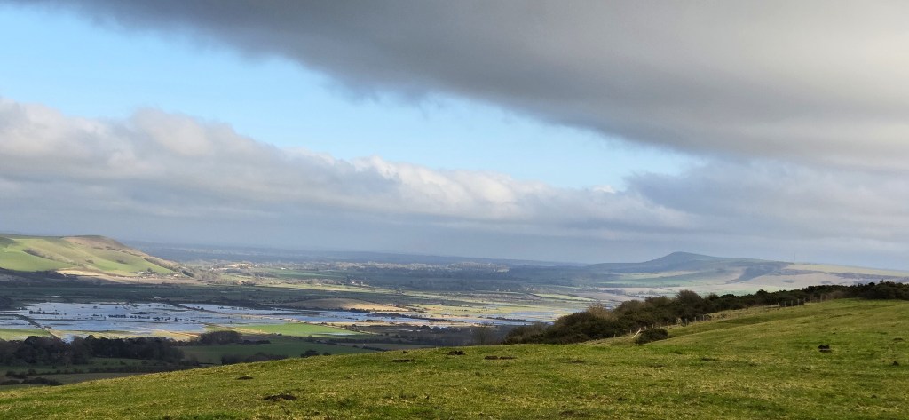
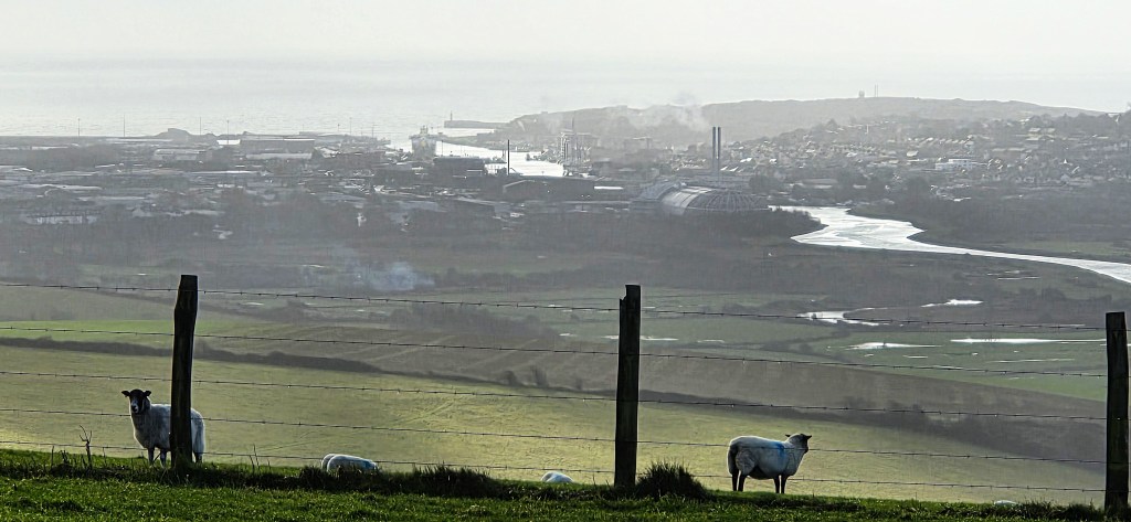
We now enjoyed clear views of the swing bridge, far below, and of the ubiquitous Newhaven ERF, the Ouse snaking past on its way to the sea. A large white ferry stood ready to depart the harbour, while oblivious sheep posed in the foreground.
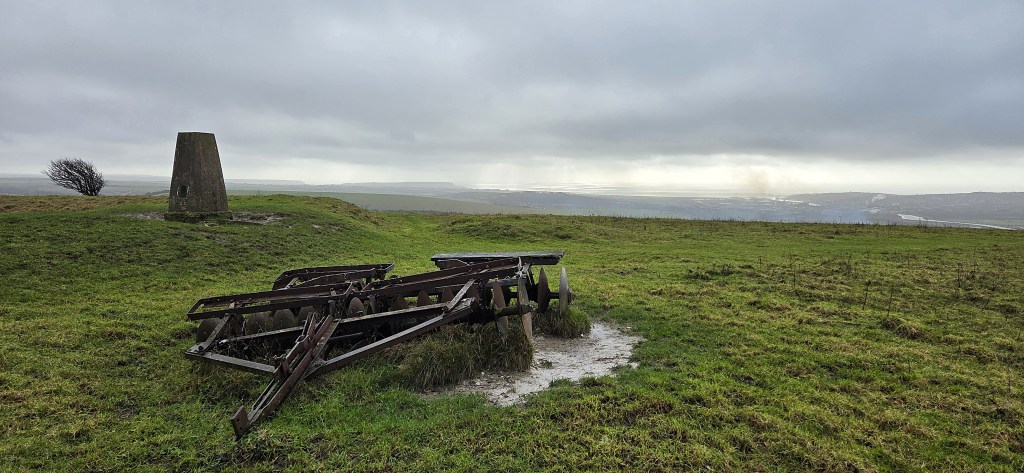
We stopped for an early coffee, sitting on a rusting vintage tractor attachment, parked next to a trig point.
The depression nearby was once Red Lion Pond. White Lion Pond lies a little further along the path.
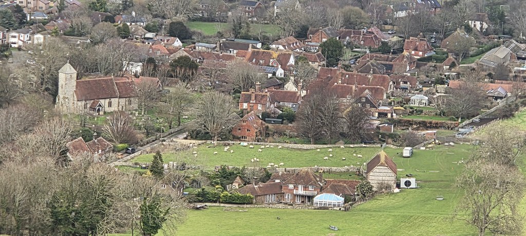
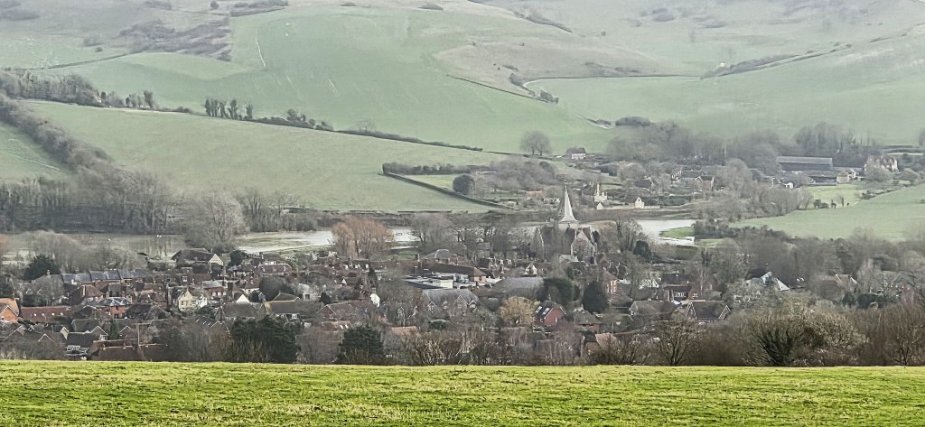
Below us we could see the adjacent villages of Beddingham and Glynde.
A Roman villa has been excavated at Beddingham. It was built towards the end of the First Century AD and occupied until the mid-Fourth Century.
The artist Peggy Angus (1904-1993) rented a cottage here from 1933. It became a magnet for several other artists, notably Eric Ravilious (1903-1942) who painted several pictures in this locality.
Glynde is inevitably associated with the country house, Glyndebourne, and its annual opera festival which began in 1934.
But Glynde also contains Glynde Place, an Elizabethan pile belonging to the Viscounts Hampden. Not to be outdone, it hosts the Love Supreme Jazz Festival.
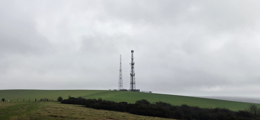
As we reached the twin radio masts on Beddingham Hill, the sun disappeared and it began to grow chill and dreary.
Arriving at the junction with Firle Bostal, which climbs up from below, we found a small car park serving Firle Beacon.
There are several Bronze Age barrows up here, and possibly a hill figure, almost invisible but apparently evident with infrared photography. It is said to resemble an ear of corn but is otherwise completely mysterious, possibly even verging on the imaginary.
The car park was distinctly odd in its own right. A coated man sat motionless in his car, directly in front of a whirring red generator, but what was it powering, exactly?
We sat on a bench overlooking West Firle. It had a dog’s lead draped over one end, platted and with a shiny pink collar. No self-respecting dog would be seen wearing that. We saw another, similar lead attached to the fence a few hundred metres further on.
I told Tracy it was a secret sign that the car park was a popular dogging site.
She might possibly have believed me!
West Firle is notable for its manor house, Firle Place, which has belonged to the Gage family since 1476 and, since 1720, has been the seat of the Viscounts Gage.
Firle Tower was built in 1819 by the Third Viscount, as a gamekeeper’s cottage. He wanted the gamekeeper to be able to signal the keeper of his deer park at Ringmer!
Pointz Hall in ‘Between the Acts’ is thought to be modelled on Firle Place.
Woolf rented a house in Firle for a time and, shortly afterwards, her sister, the artist Vanessa Bell (1879-1961), moved to Charleston Farmhouse nearby, along with her lover, Duncan Grant (1885-1978).
Bell and Grant are both buried in the churchyard at St Peter’s, Firle, adjacent to Firle Place.
Grant fathered Bell’s daughter, Angelica, born in 1918, but he subsequently embarked on a series of homosexual affairs. Meanwhile, Vanessa’s husband, Clive Bell (1881-1964) raised Angelica as his own.
One of Grant’s lovers, the novelist David Garnett (1892-1981), subsequently married Angelica and they had four children together.
The economist John Maynard Keynes died nearby in 1946, and (against his own wishes) his ashes were scattered on the Downs.
After Firle Beacon our direction changed from due East to South-East.
We stopped for another short coffee break at midday, overlooking the Arlington Reservoir at Berwick, and Drusillas [sic], now a theme park but originally opened in 1925 as a tea room by one Captain Louis Douglas Ann. It was named after his first wife, Drusilla, nee Appleby.
I have no idea when the name dropped its essential apostrophe, or why, for that matter.
We passed Bo Peep car park, served by Bo Beep Bostal, which runs down to Bo Peep Lane. There is also a disused chalkpit, a farm and a house, all called Bo Peep.
This is possibly an allusion to the secretive activities of local smugglers in the Eighteenth and Nineteenth Centuries.
‘King Lear’ includes a reference to ‘bo-peep’, thought to mean a children’s pastime, akin to ‘peek-a-boo’.
Earlier, during the Fourteenth Century, ‘playing bo peep’ was a term applied to standing in a pillory, doubtless while striving to dodge a variety of unsavoury missiles.
Shortly afterwards the sky began to clear, and the sun to emerge once more.
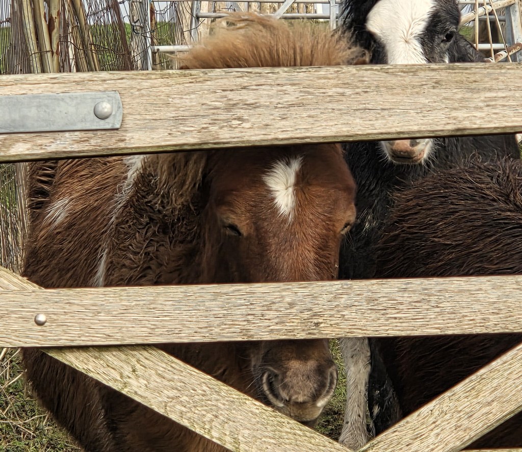
On the descent down to Alfriston we stopped to photograph some ponies. They seemed to be waiting patiently for something, possibly lunch.
There was also a sheep to identify. I think it is almost a Jacob sheep, but not quite, since it has apparently been bred to be hornless, so it cannot be a proper, pure-bred Jacob.
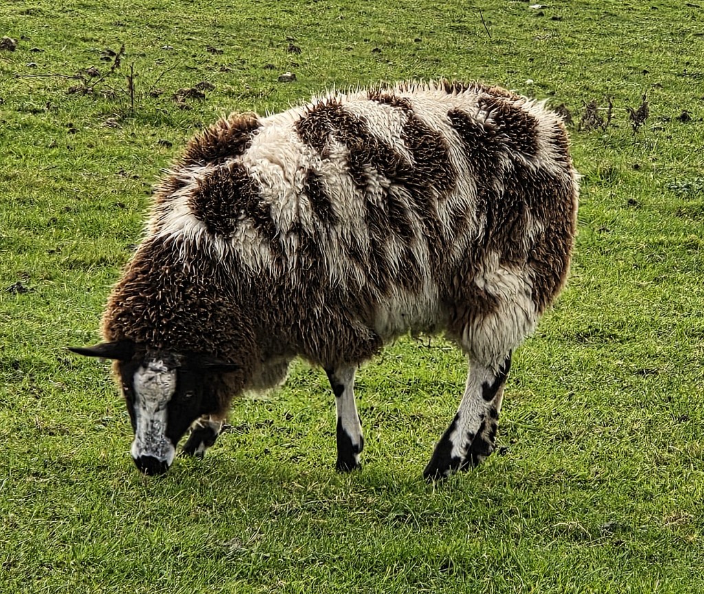
Its coat is still beautiful though.
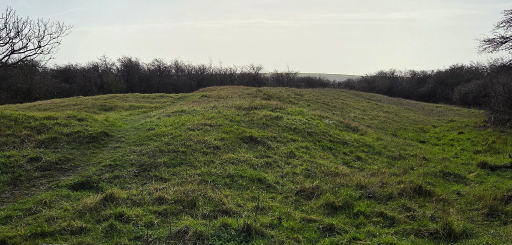
We stopped beside Long Burgh Long Barrow, one of up to fifty that sit on the Downs between Firle Beacon and Alfriston.
These Neolithic burial chambers were probably constructed between 3400BC and 2400BC. This one is unusually long, at approximately 56 metres.
We reached Alfriston by 13:45. Sitting on a bench in what was once the market square, we removed our muddy waterproof trousers while chatting to a cyclist who was lunching there, prior to continuing to Heathfield.
The market cross was probably erected early in the Fifteenth Century, but none of the surviving article dates definitely from that period.
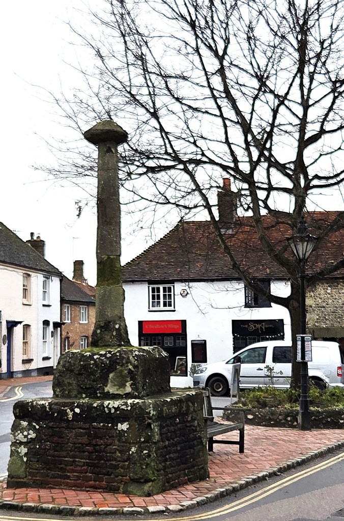
That’s because it has been repaired extensively, having suffered the attentions of drunken Canadian soldiers during WW1 and an encounter with a reversing lorry in 1955.
We sat outside the nearby Singing Kettle, where we both enjoyed their Welsh Rarebit, basking in the last sun of the day.
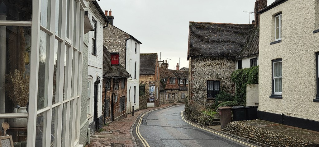
Alfriston is one of those villages that doesn’t seem quite real: more a clutch of elderly buildings maintained for the benefit of tourists.
Some 800 people live here, but you won’t find any useful shops, other than a ‘traditional village store’, which is essentially a gift shop and delicatessen masquerading as a museum.
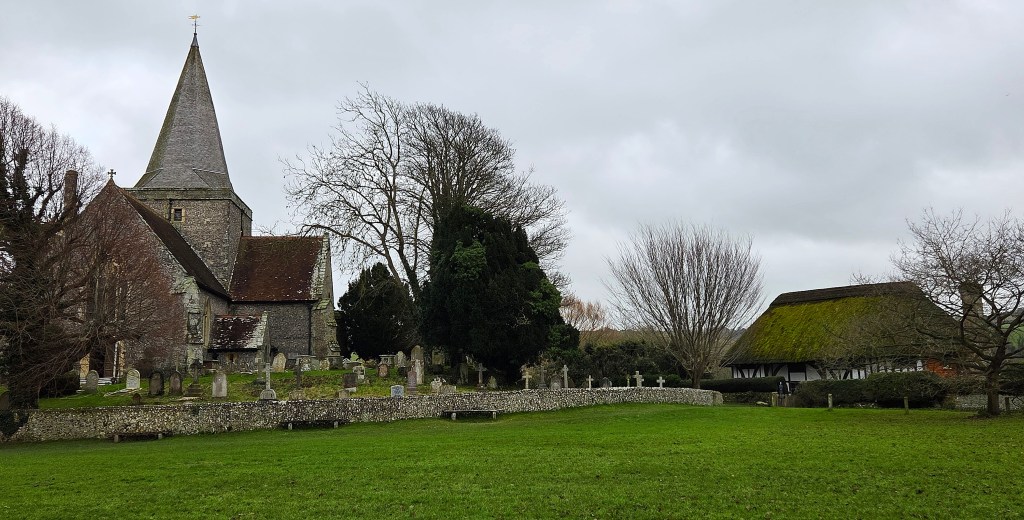
Behind the High Street there is a village green, known as the Tye, where sits St Andrew’s Church, built circa 1360. Its churchyard contains the remains of Dennis Healey.
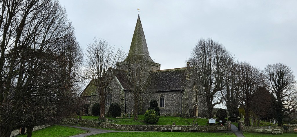
Nearby, the so-called Clergy House was the first property purchased by the National Trust, in 1896. It too is thought to date from the Fourteenth Century, though part was rebuilt in the Seventeenth.
There are four pubs along the High Street, though the Star Inn was closed for refurbishment. I’m not quite sure why since it was, apparently, renovated extensively for a Channel 5 television programme only five years ago.
‘Morning Has Broken’ is said to have been written in Alfriston by its author, Eleanor Farjeon (1881-1965). Considering the enviable reputations of its near neighbours, the literary pretensions of Alfriston are distinctly second rate, though Dame Jacqueline Wilson is now a resident.
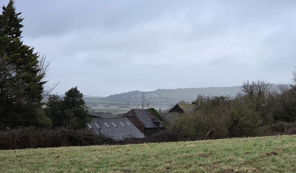
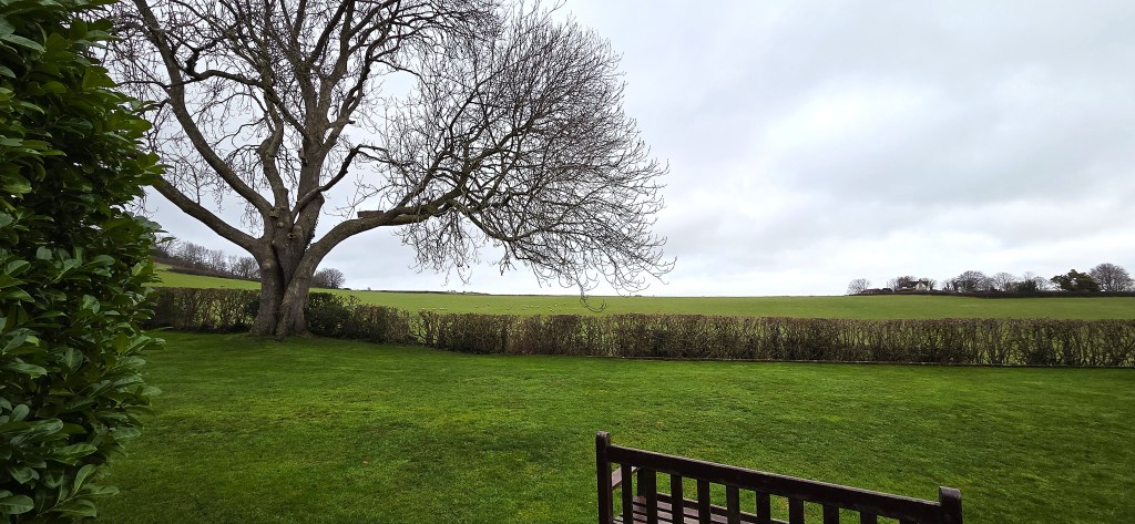
We walked to our Air B’n’B, Garden Lodge, which proved an outstanding choice, dead quiet, with a view over farmland to the Downs beyond.
Both of us needed a siesta to catch up on missed sleep, but woke refreshed and ready for the evening’s festivities, it being Tracy’s birthday and a Friday night to boot.
We began with a pre-dinner drink in ‘Ye Olde Smugglers Inne’, where several groups of elderly, well-spoken customers were mostly tucking into their evening meals.
The foursome nearby discussed precisely the topics you would expect to be of interest to elderly, well-spoken people.
Shortly before 20:00 we left for The George Inn, just down the road, where I had reserved a table for dinner.
Here the clientele seemed slightly more mixed, several sporting canine accessories. One middle-aged man wore his hat throughout proceedings.
I don’t quite know why, but I find this the epitome of unacceptably louche behaviour.
We both had chicken koftas to start, followed by pork belly with black pudding and spring onion mash. I concluded with toffee apple crumble and custard, accompanied by a pint of best bitter from the local Long Man Brewery. Yum.
The staff were friendly and welcoming, reassuring us that we could take our time when everyone else had left by 21:30. They were expecting the Alfriston Players, who would be particularly thirsty because they had been rehearsing their annual pantomime.
Having managed to pay the bill, calculating a sensible tip on top, I rejoined Tracy and we departed for our accommodation.
There was no need to concentrate on walking in a straight line because the High Street was completely deserted. We both wore our head torches without fear of embarrassment. (There are no street lights here.)
It seems that the fun stops early in Alfriston, unless you’re a Thespian.
Back in our Air B’n’B I sobered up by watching The Who’s 2006 Electric Proms gig, which was being aired on BBC4. Tracy watched too, until she fell asleep.
Next morning we both moved fast, aiming to catch the 09:30 bus to Lewes, and connect there with a train home.
We helped ourselves to the breakfast supplies very kindly supplied by our host.
Our plan was stymied at the last minute, when the friendly owner emerged from his house to engage us in conversation.
Still, this gave us a chance to tour the local sites.
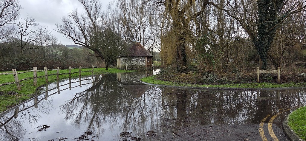
The next bus, another community service, turned up an hour later. Recent flooding of the Cuckmere River made the bus stop unreachable, but our driver successfully forded the water that had crept over the road. The Council had only just given the go-ahead for local services to resume.
We caught the 11:25 train from Lewes and were home by 14:00.
Having phoned her family, Tracy left almost immediately to see her father for the last time, his final decline having accelerated suddenly. It was a sad end to a lovely walk.
In Memoriam: Victor Raymond Knight (1945-2026).
TD
February 2026


Leave a comment