We returned to the South Downs Way in June 2025, having completed Cocking to Washington at the end of January.
Once again we were anxiously monitoring weather forecasts, though this time we were keen to avoid heatwave conditions rather than persistent wind and rain.
As it turned out, conditions on our first day were warm but not oppressively so. On the second, we made sure to finish before temperatures began nudging into the 80s.
We travelled from Clapham Junction to Horsham aboard the 09:12 Southern service, surrounded by four voluble students who were spending a day at the seaside. Eventually they took pity on us, moving further down the carriage.
Alighting at Horsham, we transferred to the 23 bus service to Worthing Pier, from the stop just outside the Station. We were dropped off at Washington Bostal, beside the A24, the driver kindly stopping alongside the sign marking the SDW.
It was exactly 11:00.

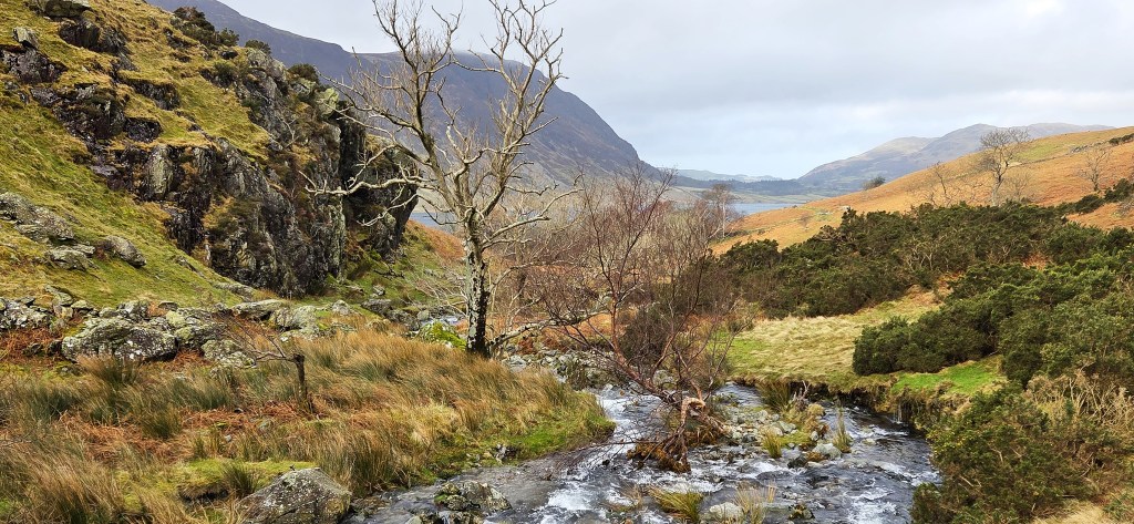
Day 1: Washington to Truleigh Hill
Having scrutinised the spot where Tracy took a birthday tumble last time out, we made a start, passing through the Wiston Estate car park, then heading uphill on a broad track. Almost immediately we passed a young man accompanied by a labrador who was adjusting his sizeable rucksack.
The Wiston Estate is associated with Wiston House, over towards Steyning. The present house was originally built in 1576 for Thomas Shirley (c.1542-1612) whose family seat it was.
A decade later, Shirley, a Member of Parliament, was appointed Treasurer to the English forces serving in the Netherlands during the Dutch Revolt.
It was normal for such office holders to speculate with the state funds that passed through their hands, and Shirley was in dire need, since his finances had already been severely compromised by his own mismanagement.
He failed so spectacularly that he was accused of fraud, his house and estate sequestered by the Crown, though he was permitted to continue living there until his death.
Wiston changed hands twice during the Civil War, before being purchased by Sir John Fagg (1627-1701) in 1649. He had fought on the Parliamentary side, serving as a Colonel in the New Model Army, but was pardoned during the Restoration and appointed the first Baronet Wiston.
Daniel Defoe visited in 1697, later recalling in his ‘Tour Through England and Wales’ (1720):
‘Near Steyning, the famous Sir John Fagg had a noble ancient seat, now possessed with a vast estate by his grandson, Sir Robert Fagg; but I mention the ancient gentleman on this occasion, that being entertained at his house, in the year 1697, he showed me in his park four bullocks of his own breeding, and of his own feeding, of so prodigious a size, and so excessively overgrown by fat, that I never saw any thing like them.’
Sir Robert Fagg (1673-1736) was the third Baronet Wiston, also briefly an MP. His son, also called Robert (1704-1740), died without issue, leaving the estate to his sister Elizabeth.
She subsequently married Sir Charles Matthew Goring (1743-1829) who became the fifth Baronet. The Estate remains in the hands of the Goring family to this day.
Tracy was now feeling the full impact of our coffee on the train. I encouraged her to execute a comfort break, but hadn’t quite accounted for either the speed of ascent of the young man behind us, or the extended nature of the break.
Indecency was only just avoided.
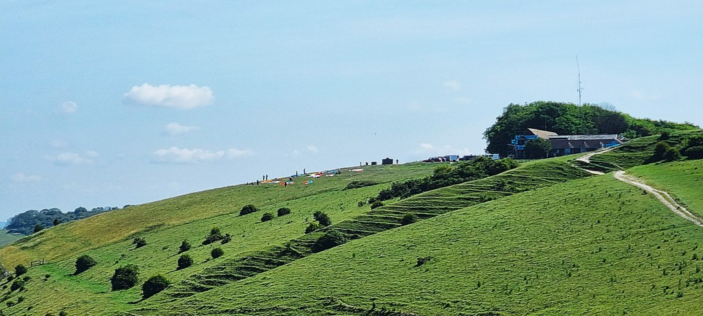
Arriving upon the Downs, we enjoyed the view in both directions: north towards the Surrey Hills, and then southwards, towards Goring, Worthing and Lancing.

This large bank of mauvish flowers had already attracted the cameras of two women walking in the opposite direction.

Eventually we arrived beside Chanctonbury Ring. This circular rampart, surrounded by a ditch, is thought to date either from the Late Bronze Age or Early Iron Age. No-one is quite sure of its original purpose.
It was abandoned after a few hundred years, only to be reoccupied in the Second Century AD when two Romano-British temples were constructed. Then, towards the end of the Fourth Century, it was abandoned once more.
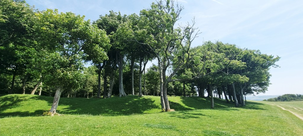
In 1760, 16 year-old Charles Goring, second son of the fifth Baronet, planted a circle of beech trees around the Ring. Some sources suggest that he carried up water on every visit, to help establish the trees; others that he delegated the task to several burly footmen.
There have been four archaeological excavations of the Ring, the first in 1869. The temples were discovered in 1909, when the Goring family decided to plant more trees. Most of them were destroyed during the Great Storm of 1987, only to be replanted since. Betweentimes, four gun emplacements were sited here during WW2.
The Devil is allegedly responsible for Chanctonbury Ring and may be summoned by running around it seven times in an anti-clockwise direction.
I didn’t bother.
The Charles Goring of tree-planting fame was three times married, eventually siring two sons by his third wife. The second of these, the Reverend John Goring (1824-1905), expanded the Estate to some 20,000 acres, but crippling death duties were levied in 1905 and 1924, amounting to some 40% of its value so, in 1926, the family vacated Wiston House.
It has been leased to the Foreign, Commonwealth and Development Office (FCDO) since 1951 and houses Wilton Park, a global discussion forum that evolved out of German re-education after WW2.
Leaving Chanctonbury Ring, the route curves southwards, offering a distant view of Wiston House below.

It then crosses the Monarch’s Way and passes to the west of Steyning, where Charles Stewart Parnell (1846-1891) married Kitty O’Shea (1846-1921) after the lengthy adulterous affair that brought about his political downfall. Their wedding took place on 25 June 1891 and Parnell died less than four months later.
The novelist E M Delafield (1890-1943) was also born in Steyning.
We could now see the hazy outline of the wind turbines belonging to Rampion Wind Farm, located off the coast of Worthing and Shoreham. There are 116 turbines, each 140 metres high to the tip of the blade, giving a total capacity of 400 Megawatts.
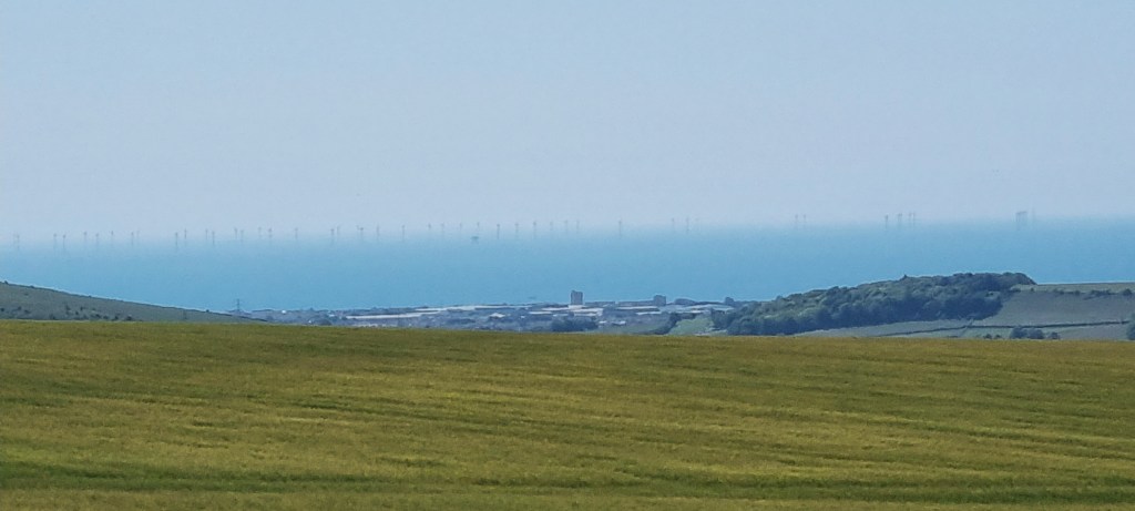
Rampion 2 will be located to the south-west of the existing installation and is expected to include up to 90 even larger turbines.
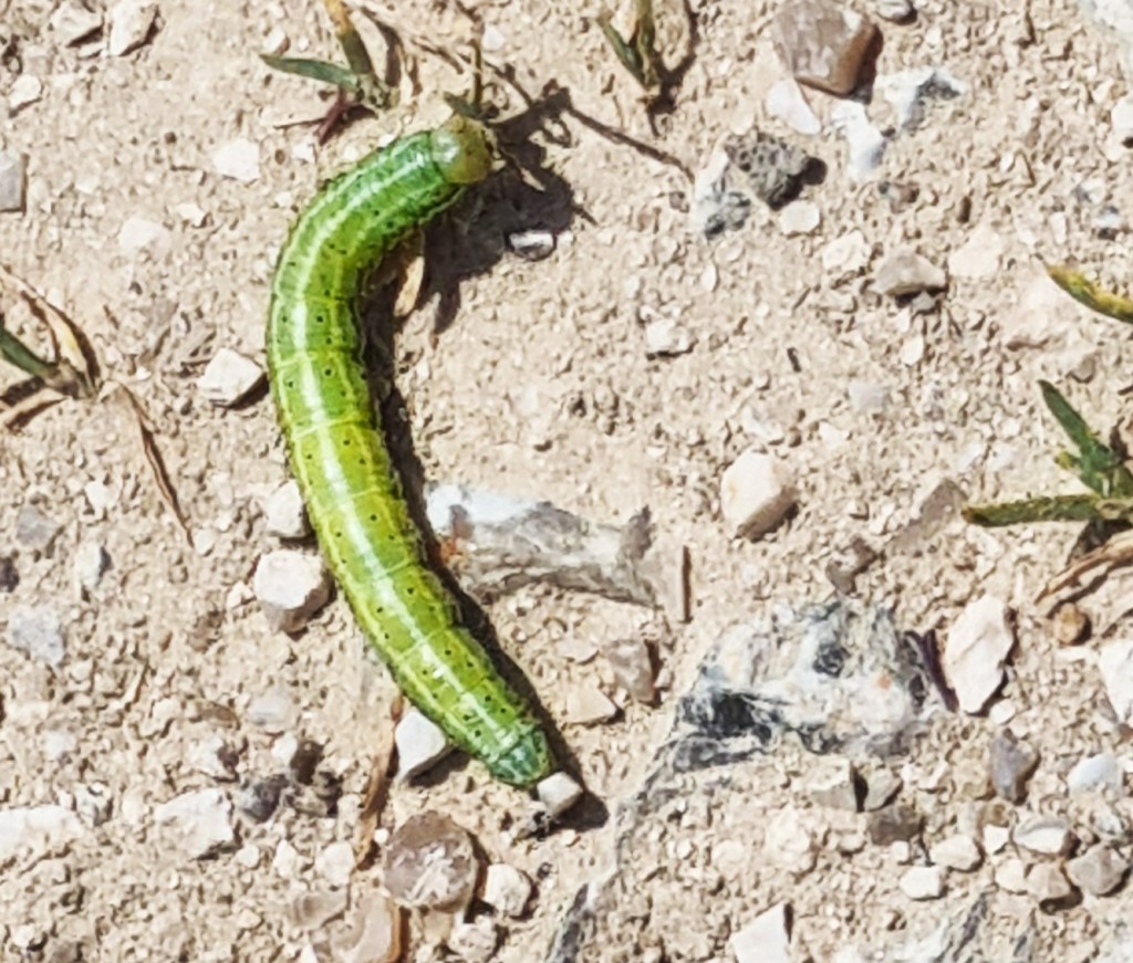
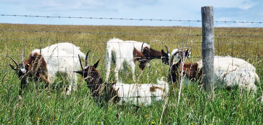
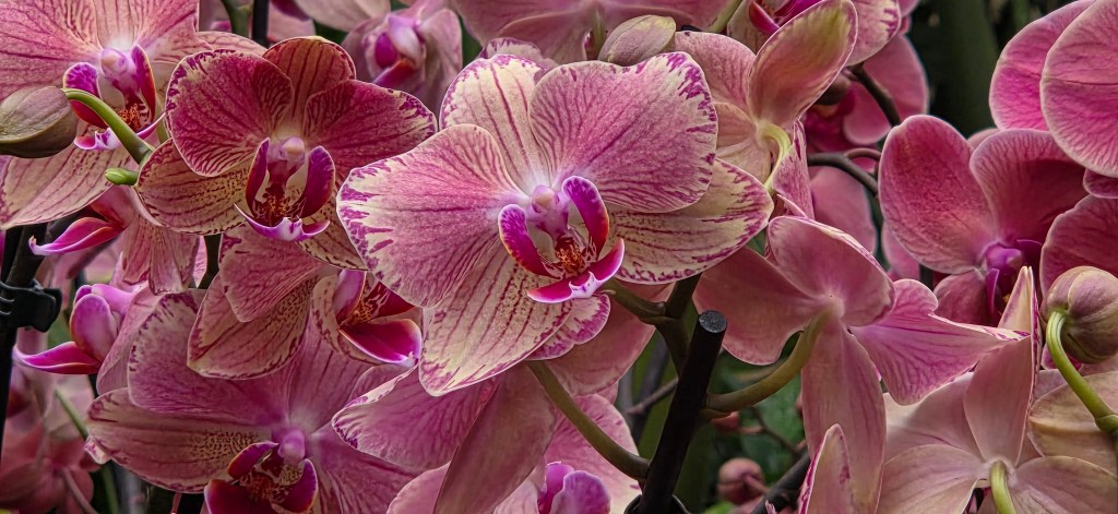
A small green caterpillar crossed our path as we stopped to admire a wild orchid and, shortly afterwards, a small herd of goats chomping through their brunch.

Rounding Steyning, far below, we began to spot several former quarries, cut into the hillside ahead. Chalk quarries and, subsequently, cement works, have long been major employers hereabouts.
We stopped for lunch at a hill-top memorial to Walter Langmead (1905-1989), Thelma Mollie Langmead (1909-1996) and Bridget Langmead (1933-2021), all local farming folk.
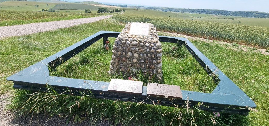
It was surrounded by a broad green metal barrier, which had to make do in place of the hoped-for bench. I trust they weren’t offended.
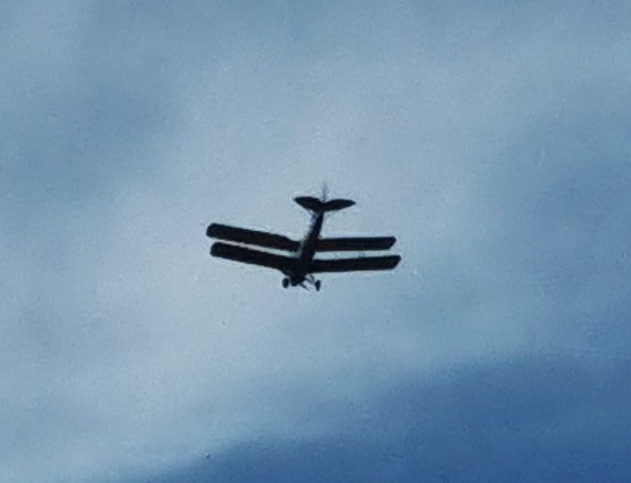
While we were eating, two men came up behind us and began a conversation with a third, a stranger, about the respective pubs they were visiting that day. A biplane flew over, meanwhile.
Resuming, we skirted the road for a while. From a distance, one of the quarries looked as though it had been converted into a chalet or caravan park – until we realised that the accommodation was a collection of pigsties.

We passed above a field in which a good deal of shooting was going on. Zooming in, I could see a man in a hide with a hat, a gun and a somewhat willing dog. Fortunately he was firing in the other direction.
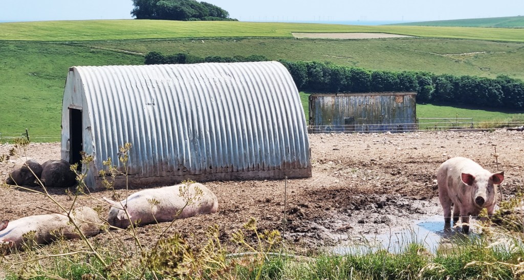
Then we were walking through another pig farm, the barbed wire and corrugated iron roofs heavily redolent of a concentration camp.
But fear not, Red Gate Farm rears free range pigs on fallow land that is covered with ragwort, poisonous to sheep. That helps to explain why they live on a hill-top.

Eventually we arrived in the vicinity of Botolphs. It acquired its name from the nearby Saxon church of St Botolphs, though it’s unclear why it dropped the hagiographic prefix.
Botolphs once housed men who worked boats along the River Adur and others employed in salt extraction, but both industries declined when the River began to silt up.

We passed some distance from the Church, but in close proximity to the Adur, which is some 20 miles long, with western and eastern branches.
The name ‘Adur’ may be derived from the name of the Roman fort ‘Portus Adurni’ which, though located near Portsmouth Harbour, was once mistakenly thought to have been closer to Shoreham. The River has also been called the Bramber and the Sore.
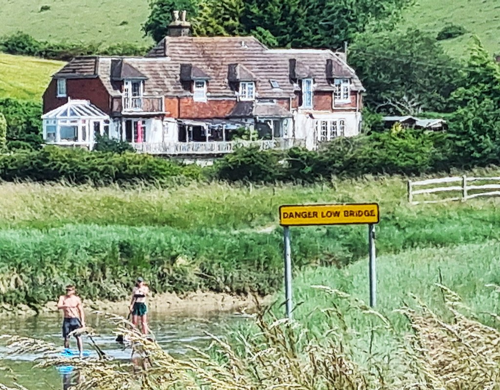
Two people, a man and a woman, were paddling boards upstream.
Walkers have to be wary hereabouts, because the route joins briefly with the Downs Link, connecting the North Downs Way with the SDW and Shoreham beyond.
Several cyclists whizzed past as we crossed the bridge over the Adur, followed by the A283 Steyning bypass, near Upper Beeding.
Some historians believe that King Aethelwulf of Wessex, father of Alfred the Great, may have died here in 858, though he was buried elsewhere, initially in Steyning and eventually Winchester.
There is a nunnery in Beeding, housing the Sisters of the Blessed Sacrament. The Order was founded in France around 1715, but moved here towards the end of the Nineteenth Century, setting up a girls’ convent school in The Towers, a mock French chateau.
The convent school closed in 2020, but the building has now been taken over by Steyning Grammar School. The nuns continue to work in the local community.

We were now climbing Beeding Hill, which eventually morphs into Truleigh Hill.
As we tackled the steep lower slopes, I began to outpace Tracy. I passed an elderly man descending, our conversation limited to:
‘It’s a tough climb’(him) and
‘Thanks!’(me, somewhat out of breath).
His subsequent conversation with Tracy apparently ranged over several related topics – she must have needed a rest.
I waited patiently.
An information board up here relates that, during archaeological excavations preceding the building of the Rampion Wind Farm, an Eleventh Century grave was found alongside the SDW. The man, aged 25-35, had most likely been executed by sword blows to the neck.
It also reports the presence of several species of wild flowers, including three wild orchids: the bee orchid, the pyramidal orchid and ‘autumn lady’s tresses’.

We reached the YHA Truleigh Hill Hostel by 15:45, rather earlier than expected, so enjoyed coffee, cake and an extended period of relaxation.
The Hostel is perfectly located, right on top of the SDW. We had booked one of their two Landpods, essentially a halfway house between camping and glamping.
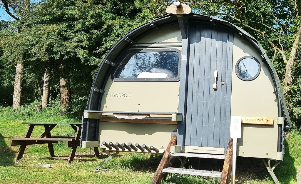
These have a waterproof roof that can be propped open for added air conditioning, two small raised double beds with duvets and pillows, plus solar-powered LED lights and phone chargers.

We had to Google a little before we worked out exactly how to adjust the roof, but mastered it eventually.
I had also reserved a towel and two ‘all you can eat’ morning breakfasts, the total bill coming in at roughly £60. We paid for dinner separately.
There was a private house here, built in the 1930s. It remained in private ownership until the inhabitants moved to New Zealand, but was then acquired by the local council. The YHA was invited to run the Hostel when the SDW was created. It opened in 1974, occupying the house and a new accommodation block besides.
At first we thought there would be few other guests but, within a few hours, much of the accommodation was occupied and several tents were pitched on the adjacent campsite.
Tracy had smuggled in gins and tonic and Thai Sweet Chilli crisps, so we enjoyed this aperitif on the bench beside our pod before heading in for dinner.
Dinner was both tasty and good value. Tracy opted for scampi and chips with a cider accompaniment, while I had sweet potato and chickpea curry alongside a local bottled beer. We both chose chocolate brownie sundaes for dessert.
We were in bed by 21:00, well before the dark descended. I woke for a brief comfort break at 00:45 but otherwise slept through to 04:30, then dozed until 06:00: just enough sleep to function on our second day.
Tracy, as usual, slept soundly.

Day 2: Truleigh Hill to Plumpton
We had breakfast at 08:00: granola, pastries, fruit and a full English apiece. I drank plenty of coffee, filling my thermos besides.
Having swiftly repacked, we were under way by 09:00, heading out onto the crest of Truleigh Hill. The sky was blue and the sun already warm.
We were immediately overtaken by two of the three men who had been conversing about pubs the previous day. Wishing them good morning, we continued on our way.
A pair of white horses seemed particularly keen to say hello, though one was spooked when he caught his foot. He managed to shake himself loose.

We passed the remains of the Radar Station, originally one of 20 so-called Chain Home Low stations, designed to spot low flying aircraft and shipping, which became operational in July 1940.
Initially it had a staff of 40 but, as additional radar systems were added to the site, this rose to a maximum of 177, the majority of them WAAFs.
During the Cold War, in the early 1950s, the installation was upgraded to combat potential Eastern Bloc aggression. Underground rooms were built, the new system becoming operational late in 1952. It had ceased operations by August 1956.
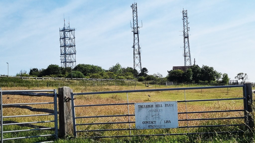
Several large aerials remain on site, principally supporting mobile phone communications.
We passed above Fulking, remarking rows of paragliders lying on the hill, their pilots no doubt waiting for a suitable breeze.
Fulking is known for its Victorian water supply system, constructed in 1886. It relies on a hydraulic ram pump, which takes water from the Hill into a reservoir at one end of the Village, supplying a drinking fountain and water trough. Two more handpumps, further along the street, are fed by gravity.
A Brighton brewer, Henry Willett, was the benefactor, and John Ruskin also seems to have had some sort of role, but the prime mover was apparently a rector from nearby Edburton, Reverend Gell.
We discussed pylons again. I like a good pylon, but Tracy thinks they tend to spoil the landscape.

We were soon beside Devil’s Dyke, the longest, deepest and widest dry valley in the United Kingdom, most likely formed during the last Ice Age.
An Iron Age hill fort was once located here, as well as a Norman motte and bailey castle and a medieval village called Perching. Few signs remain.
In 1887 a rail link with Brighton was opened, for tourists keen to visit the funfair and adventure park established by James Henry Hubbard. He had been born in Toronto in 1847, one of nine children, to freed slaves who had left Virginia some years previously.

He bought the Devil’s Dyke estate in 1892, soon installing the country’s first cable car, which ran 300m across the valley, and a funicular railway besides.
But, though briefly very popular, interest in his adventure park soon declined. Facing mounting debts, Hubbard eventually returned to Canada in 1907. The branch line from Brighton closed in 1938.
Nowadays, there are as few signs of the adventure park as there are of the fort, castle or village.
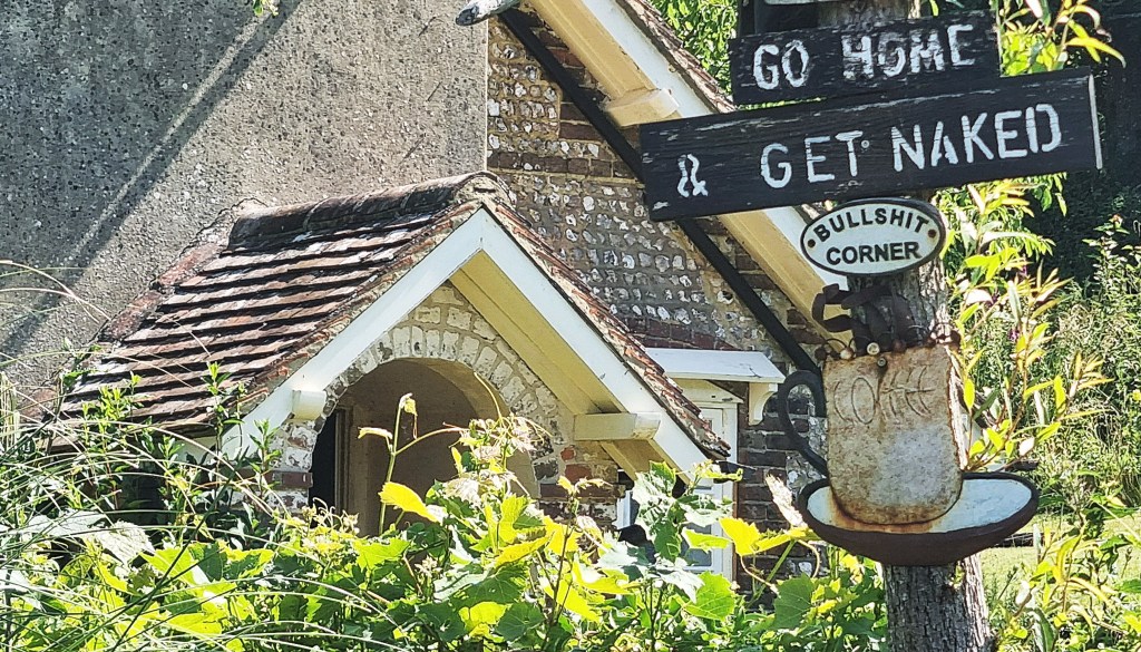
Continuing beside Devil’s Dyke Road, this sign in a garden attracted our attention.
We were also momentarily attracted by the Wildflower Cafe at Saddlescombe Farm, which boasts a donkey wheel, formerly used to raise water from the well…
…But opted instead to enjoy our YHA coffee beside a shady track a little way beyond.
Here we encountered, for the third time, the two men from yesterday and earlier in the morning, though how we had overtaken them was unclear.
They told us they were cousins, one from Epsom the other from Andover. They, too, were walking the South West Coast Path, and also began in 2017, though they had started in Poole rather than Minehead, and had some distance still to complete.
I gave them details of this blog, in case it might be of use to them as they head into the remoter parts of North Cornwall and North Devon.
A little while later we were clambering up West Hill, the steepest climb of the day. Four cyclists were struggling up the slope beside us. They were aiming to cycle the full SDW over two days, this being the second.
They passed us later on a downhill stretch, looking far happier.

Behind us, paragliders were now aloft.
Arriving in the vicinity of Pyecombe, we descended towards the Equestrian Centre, crossing the bridge over the A23. A mysterious van, plastered with warning signs, had just drawn up on the slip road, immediately in our path. The driver was up to no good, and therefore oblivious.
We paused before the Church of the Transfiguration, an attractive building with a Twelfth Century nave and a Thirteenth Century tower. Pyecombe is also known for the Pyecombe Hook, a distinctive shepherd’s crook, first made by the local blacksmith here in the first half of the Nineteenth Century.

Half-an-hour later, having detoured around most of Pyecombe Golf Course, we arrived beside the Jack and Jill Windmills, above Clayton.
Jill is a post mill (the mill being mounted on a vertical post), with a two-storey roundhouse. She was built in 1821, but not moved to her present site until 1852. She was a working mill until 1906, is now restored to working order, owned by the local district council and open for inspection on most summer Sundays.
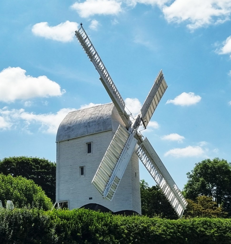
In contrast, Jack is a tower mill, five storeys high, built in 1866. He is privately owned and inhabited.
We sat on a bench and contemplated finishing here, then descending to the station at Hassocks, just beyond Clayton. Eventually we decided to continue on to Plumpton, though already tiring in the mounting heat.
Following a lengthy trek across a nondescript section, we climbed up to Ditchling Beacon which, at 248m, is the highest point in East Sussex and the third highest on the SDW. Another Iron Age hill fort was located here.
A woman passed us with ten different dogs in tow, but she seemed to have them all under control.

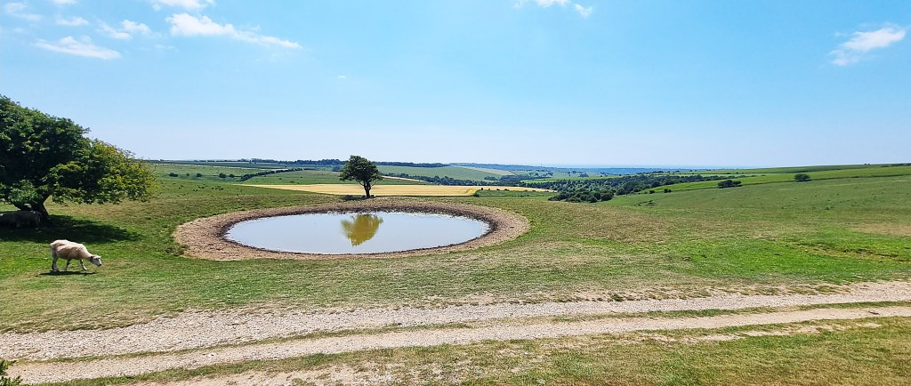
We passed a scenic dew pond, then a mysterious stone containing the legend ‘T. D.’ (my initials) where we stopped for a drink and a rest.
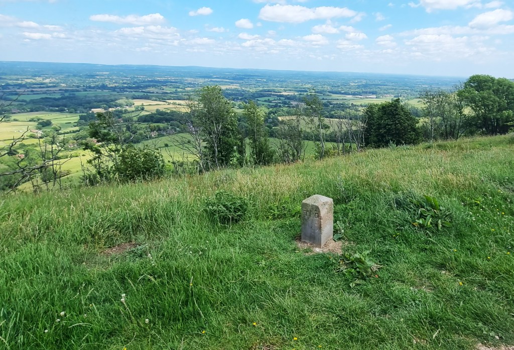
Seawards, we could see the Brighton FC stadium at Falmer, completed in 2011. Soon afterwards we were entertained by a long line of cows, all standing with their faces towards the fence.

Westmeston, immediately below, contains a stone marking the burial of King Eadwulf of Sussex in 765 or thereabouts. Raymond Briggs (1934-2022), of ‘Snowman’ fame, lived there in his final years.
Finally, we reached the turning for Plumpton Bostall and began the surprisingly long descent to the Village below. We could see the grounds of Plumpton College, which specialises in land-based course of further and higher education, the degrees provided in association with the University of Greenwich.
Next door is Plumpton Place, an Elizabethan manor house with a moat and water mill. It was built for the Mascall family in 1568. One Leonard Mascall is said to have introduced carp into England, keeping them in the moat.
The house was extensively restored in 1928 by Edward Hudson, the founder of ‘Country Life’ magazine, who hired Sir Edwin Lutyens for the purpose.
It is said that the owner, a doctor, refused to sell to George Harrison in 1969, but did allow Jimmy Page to buy it from him in 1972. Page sold up in 1985. The house was recently used as the location for a film of Sheridan Le Fanu’s ‘Carmilla’ (1872).

Before catching the 166 bus to Haywards Heath, we stopped off for a drink in the garden of the Half Moon pub, which we reached shortly after 14:00. It was now growing extremely warm.
The bus arrived on time and, from Haywards Heath, we caught a fast train back to Clapham Junction.
TD
July 2025


Leave a comment