In September 2024 we returned to Kent to complete the North Downs Way, having reached Etchinghill the preceding April.
This final leg is relatively demanding and feature-packed, some 12 miles in length. We decided to split it into two roughly equal sections, to reflect Jacqui’s fitness level and increase our collective enjoyment of this final stretch into Dover.
Our plan, which we implemented faultlessly, was as follows:
- Travel to Etchinghill on our first morning, carrying our overnight gear;
- Walk from Etchinghill to Capel-le-Ferne, catching a bus from there into Dover where we would stay overnight;
- Next morning, catch another bus back to Capel-le-Ferne, walking from there to the finish in Dover, returning home late that afternoon.

We decided to stay at the Best Western Premier Dover Marina Hotel, principally because of its seafront location, pleasingly close to the end of the North Downs Way. Sharing equally the cost of two prepaid twin rooms cost £77 each.
The weather was bright and sunny throughout, if a little breezy at times.

Day 1: Etchinghill to Capel-le-Ferne
We travelled into London on a busy commuter train, then on a much quieter Victoria Line Tube to St Pancras. A woman sleeping in one of the priority seats woke to beg a pear from a man carrying a tray of them. He refused her.
Arriving in good time we found Jacqui, who had already purchased her breakfast from Benugo. We bought our coffee and almond croissants from Starbucks before joining the 10:07 Southeastern high speed departure to Folkestone West, scheduled to arrive at 10:59. Our single tickets had cost roughly £28 apiece.
We arrived on time in Folkestone and found our way to a bus stop on the Cheriton Road, from where we caught the 11:26 Number 17 bus to Etchinghill.
Having adjusted our kit in the bus stop, we were under way by 11.45, initially negotiating this occasionally busy stretch of Beachborough Road, back to the point where the NDW crosses it.
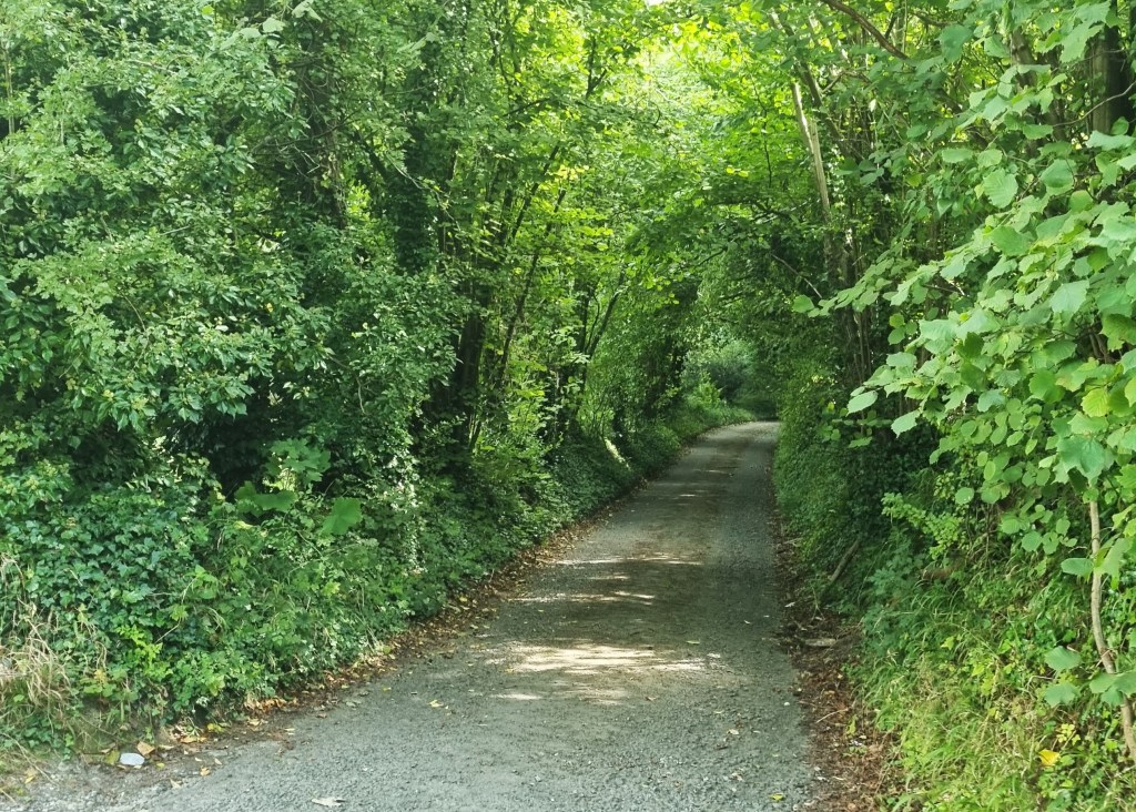
Immediately we were transferred into a peaceful country lane, which slopes down to a farm before the route heads out across fields. After climbing three stiles and crossing a footbridge, we passed beneath the graffiti-adorned bridge that once carried the Elham Valley Railway.

Open between 1887 and 1947, this once connected Folkestone with Canterbury. During the Second World War it carried three heavy mounted guns. The largest of these, known as the ‘Boche Buster’, was an 18-inch howitzer that could fire a shell 20 kilometres. It did so only three times.

Having admired the graffiti, now guarded by a watchful sheep, we began to climb steeply. A NDW sign beside a gate directed us into a narrow wooded section, but it soon became apparent that this path was little-used and we returned to a clearer route along the field edge.
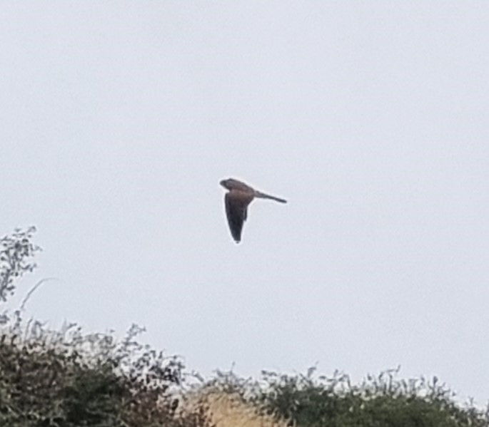
We were guided upwards by a kestrel which flew from tree to tree ahead of us and, on reaching the top, found ourselves with a distant view back to the Tolsford Hill Radio Station.

Continuing through a small field, sloping seawards, a notice informed us that it was used by troops for training purposes. We were also warned not to touch suspicious objects, and spent some time pondering whether the white spots we could see some distance away were large mushrooms, or something far more sinister.

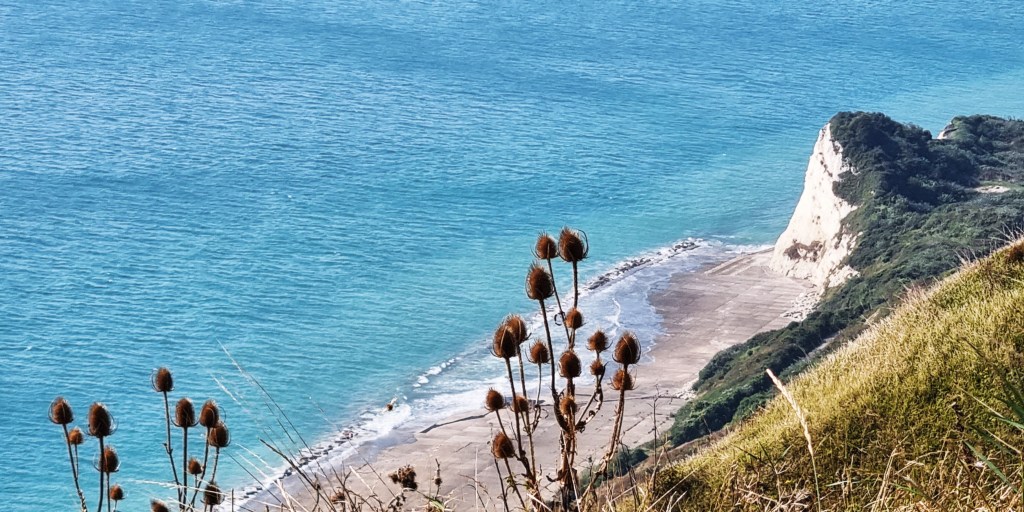
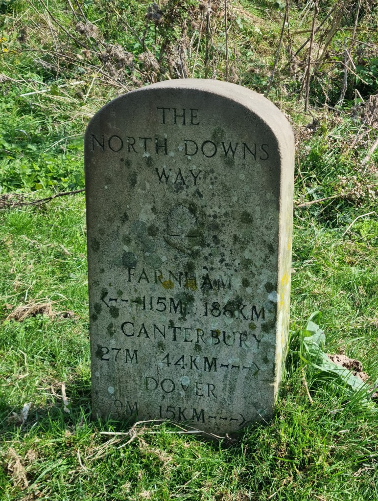
We passed an ivy-clad NDW signpost and the first of many pill-boxes, eventually reaching a NDW milestone. We had completed 186km with only 15km still to go.
Skirting the former Peene chalk quarry, we were soon within sight of the immense Channel Tunnel Terminal complex, below. Apparently it covers a mere 350 acres, much smaller than the French equivalent at Coquelles. A tiny hamlet called Danton Pinch was demolished to make way for it.

We had to pass through a field containing resident livestock, though there was a ditch between us and them. Quite clearly, someone objects to their presence here.

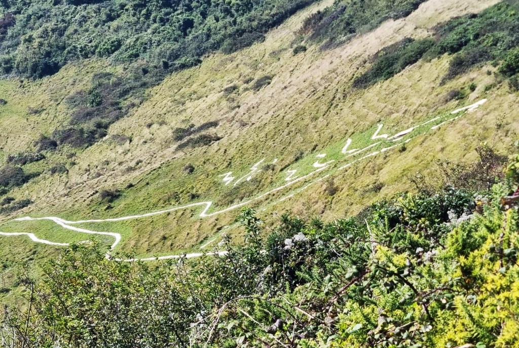
We skirted further pill-boxes before reaching Cheriton Hill, where the Folkestone White Horse was marked out on the slope beneath. This was completed in June 2003, despite opposition from English Nature, concerned about possible environmental damage.
Eventually the Green Party and Friends of the Earth appealed to the European Commission, which declared the project illegal under European law. It went ahead regardless.
We were now looking for a lunch spot with some urgency, having waited until the Terminal finally disappeared behind us.
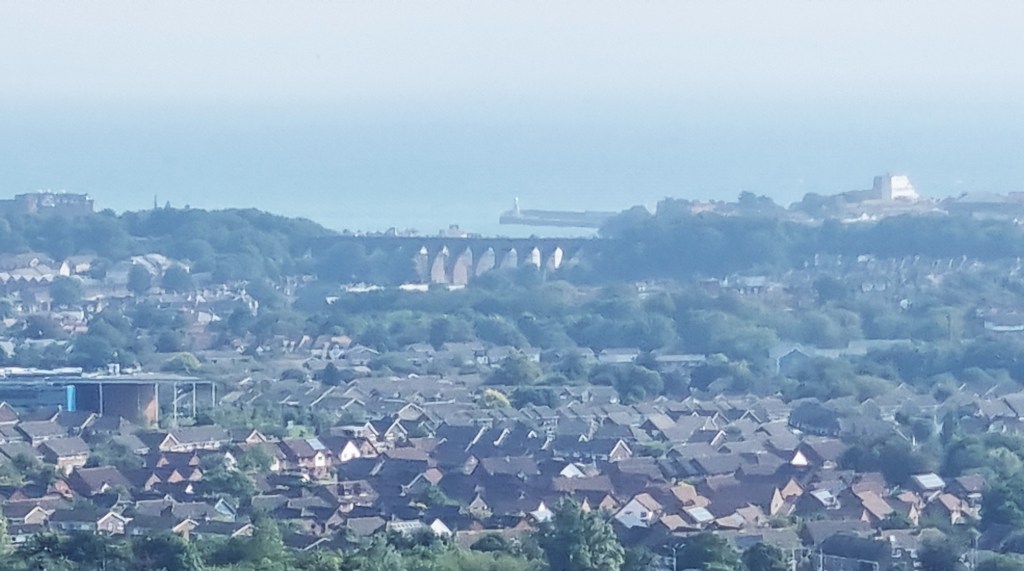
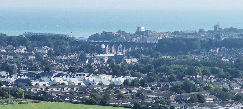
We were beginning to focus on a viaduct in the distance, but was it the 19-arch Folkestone Railway Viaduct or the 13-arch Folkestone Harbour Viaduct? Both were constructed in 1843.
Following the footpath beside Crete Road West, the guide book suggested we were skirting an invisible reservoir. Soon it instructed us to:
‘Pass some rusty iron bollards to a finger post, then turn right along a footpath.’
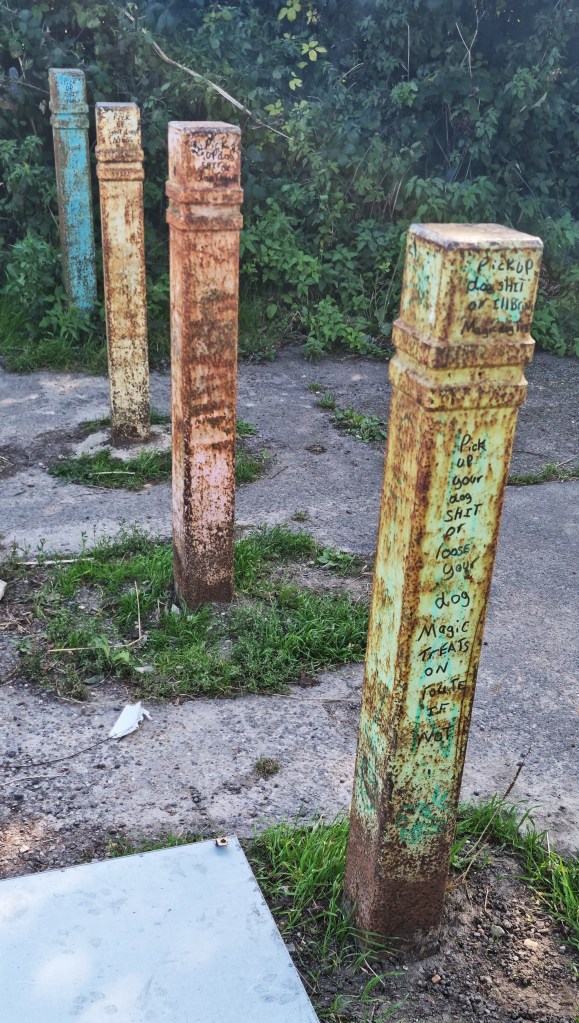
We debated for some minutes whether we were supposed to pass by these bollards or pass through them. There was no fingerpost in sight but, beyond the bollards, we did find a NDW display board facing the road.
We wondered whether our footpath might be found further down this road, but eventually decided to pass to the rear of the display board instead.
This proved the correct decision. We soon found an ill-kept plaque commemorating the award of a ‘Millennium Marque Award for Environmental Excellence’, alongside another information board that told us we were on Castle Hill, where adders like to roam!
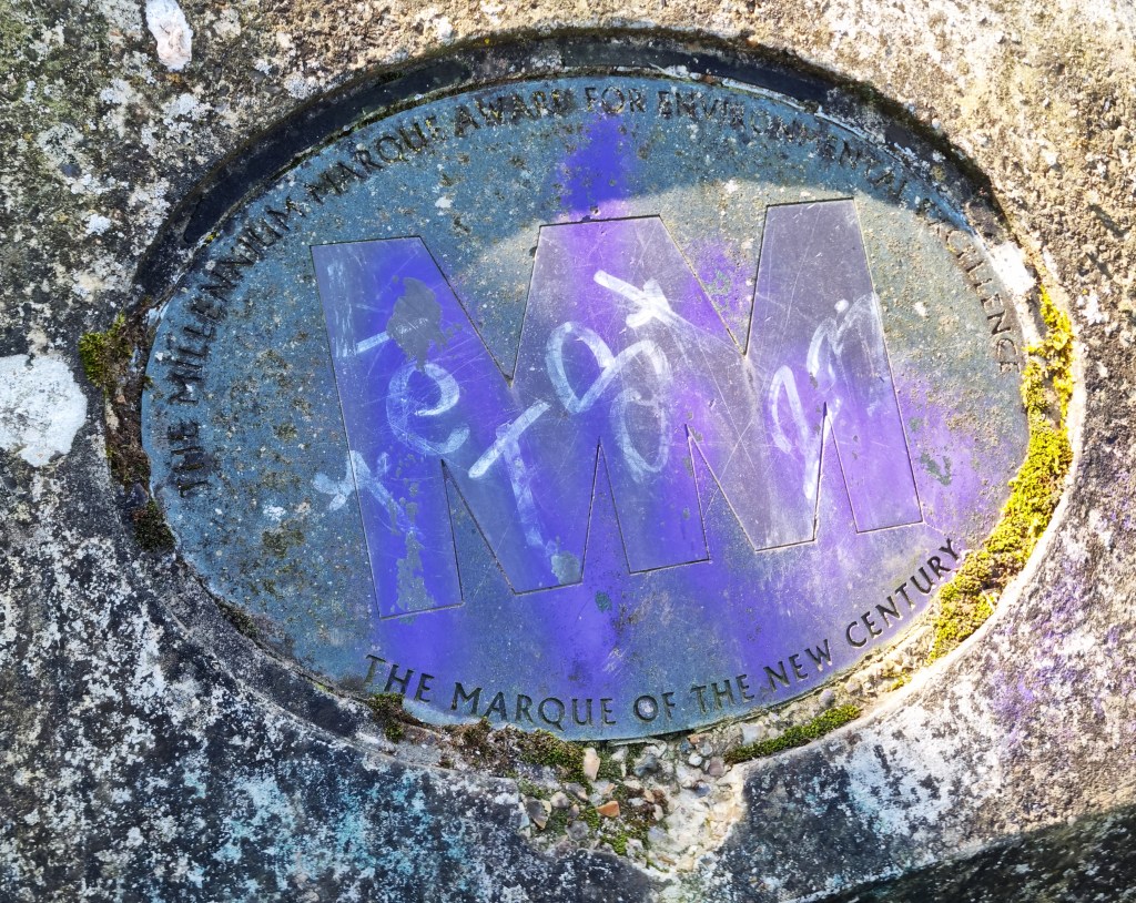
Folkestone Castle was situated here during the early middle ages. For some strange reason, it has become known locally as ‘Caesar’s Camp’, though there is no Roman connection.
The prospect of sitting in a nest of vipers really didn’t go down too well with any of us, especially Tracy. But, on climbing to the top of the Hill, welcomed by a stiff breeze, we eventually found a relatively sheltered dip in which to eat our sandwiches.
We were now in full view of the Viaduct, which definitely boasted more than 13 arches.
On resuming, we encountered an enthusiastic puppy called Max, whose owner was trying – unsuccessfully it seemed – to control him with the aid of a whistle.

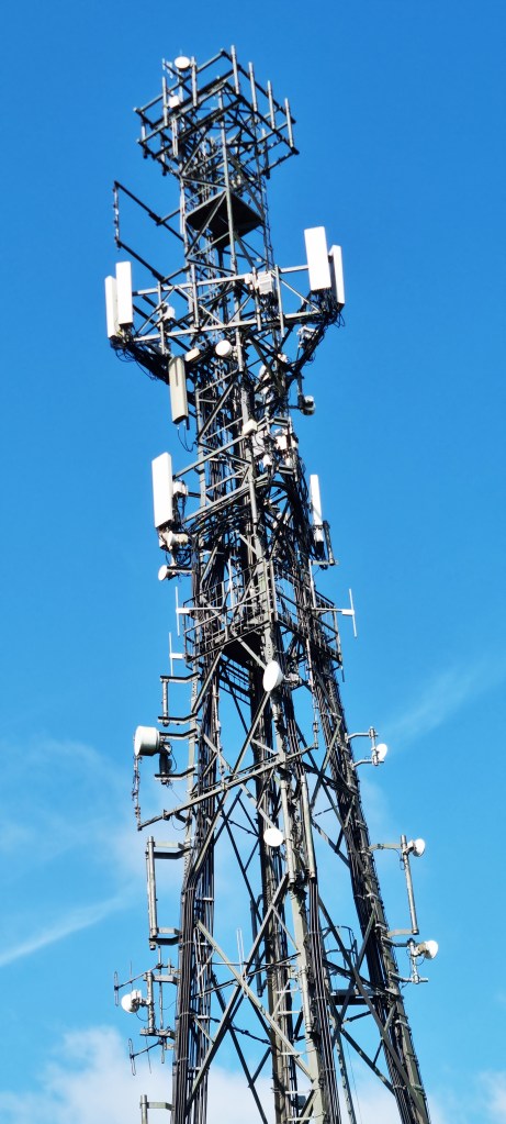
We could see Sugarloaf Hill ahead as we made our way over the A20, buried beneath us, then across the A260 to reach Crete Road East. At the foot of the hill Jacqui encountered her post-lunch dip, but we eventually made it to the top and past the Arqiva radio mast, silhouetted against a vivid blue sky.
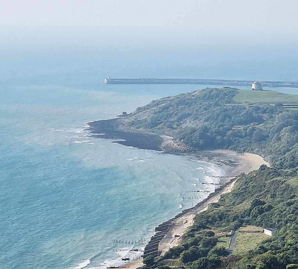
We now had an excellent view of Folkestone’s Harbour Arm and the nearby Martello tower.
The Harbour Arm, once known as the Horn Pier, was constructed in 1844 and elongated sixty years later. It was designed to enable larger ships to dock, even at low tide.

Folkestone possesses five Martello Towers, and there are several more in neighbouring Sandgate. This one is Number 3, located above Copt Point. It was built in 1806 but, from 1850 or thereabouts, was used as a coastguard lookout.
We arrived at the top of Dover Hill, opposite the Valiant Sailor pub, just as the stragglers in the Hospices to Holland charity cycle ride were gaining the summit. Unfortunately we had narrowly missed Tracy’s sister, who had passed through half an hour earlier.

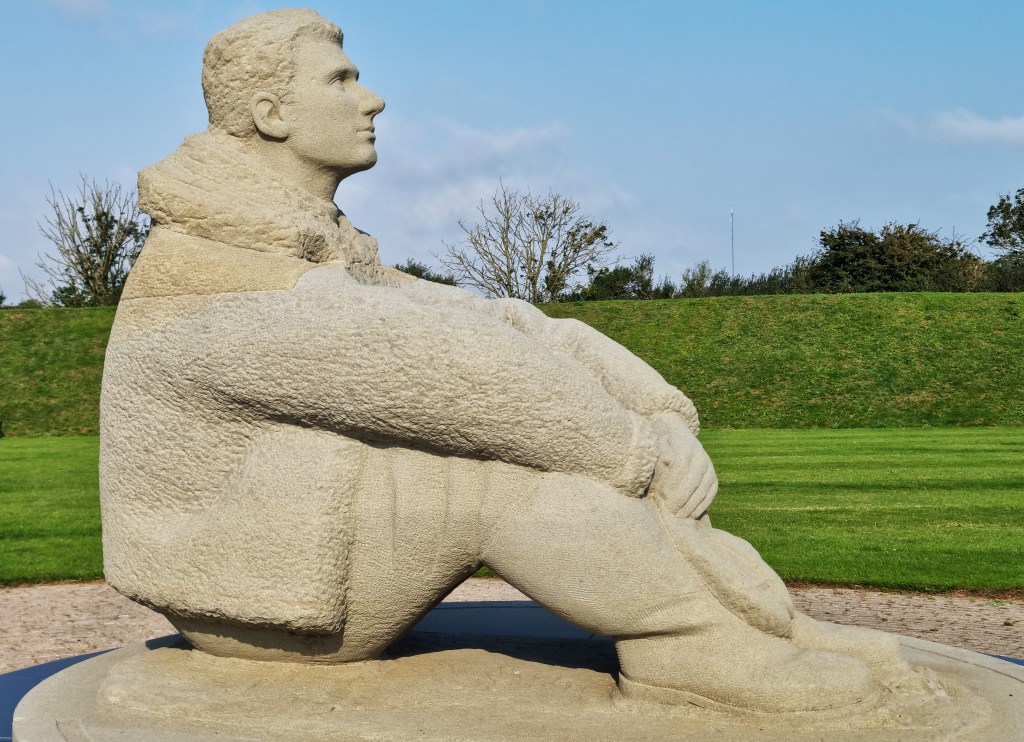
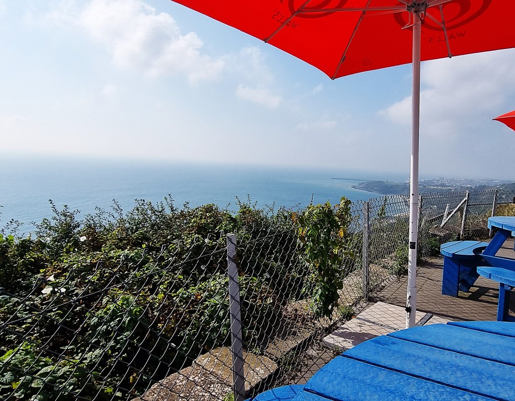
We had also hoped to reach the Cliff Top Café at the far end of Capel le Ferne, but it seemed increasingly likely that our arrival would be after closing time. So we slackened our pace and took a brief tour of the Battle of Britain Memorial instead.
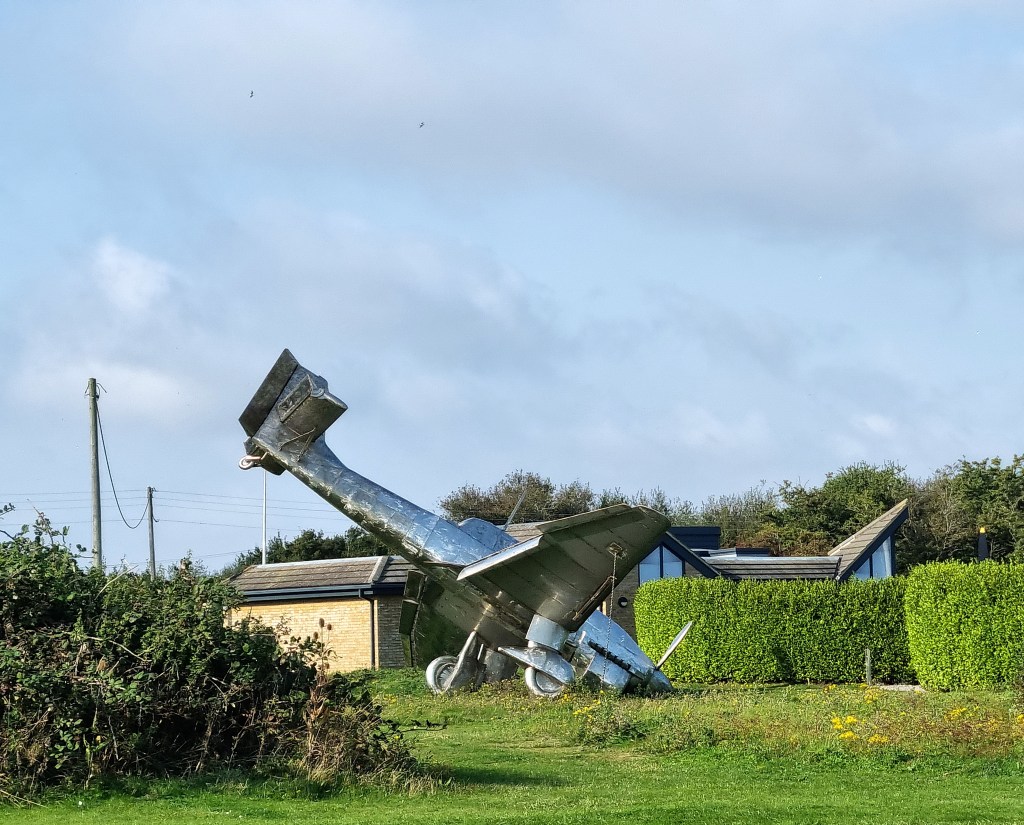
This proved to be well worth a visit. It is located on the site of a WW2 gun battery and the centrepiece – a statue of a seated pilot staring thoughtfully out to sea – is both striking and moving.
We soon found the cafeteria, on the first floor of the visitor centre behind, consuming our coffee and Victoria sponge cake on its windswept balcony. A volunteer attendant very kindly confirmed that ‘Capel’ rhymes with ‘papal’, rather than ‘chapel’.
Afterwards we picked up a 102 bus heading into Dover, where Tracy rushed off to attempt another rendezvous with her sister, but to no avail. It had been a day of near misses, unfortunately.
Meanwhile, Jacqui and I walked to our hotel. On finding a coachload of Scandinavian pensioners just ahead of us, we bought drinks and sat outside to await Tracy, who eventually drowned her sorrows with a half of cider.
That evening we crossed to the seafront for dinner at Bella Vita, an Italian restaurant. Dover has relatively few restaurants for a place of its size, but we enjoyed our meals here. I had polpette to start, followed by linguine with clams and king prawns in a creamy sauce, then affogato to finish.
Back in the Hotel, Jacqui was fortunate in being upgraded to a seafront room, while we had little more than concrete and a noisy road to enjoy from our window out back. It was a warm night, even in late September, so in the early morning we switched from traffic noise to aircon.
Day 2: Capel le Ferne to Dover
Next morning we checked out at 08:30 before making our way over to the Sunrise Café on Snargate Street. We could see this from our room, roughly 100 metres distant but, so unfriendly is Dover to pedestrians that it took us a good ten minutes to walk there.
Sunrise is a community café, run as a social enterprise, with a ‘pay what you can afford’ policy. The entire operation is frankly amazing, and the food is excellent too! We took advantage of the ‘create your own breakfast’ option, excellent value with five items costing only £5.95.
Every town needs a café exactly like this one.
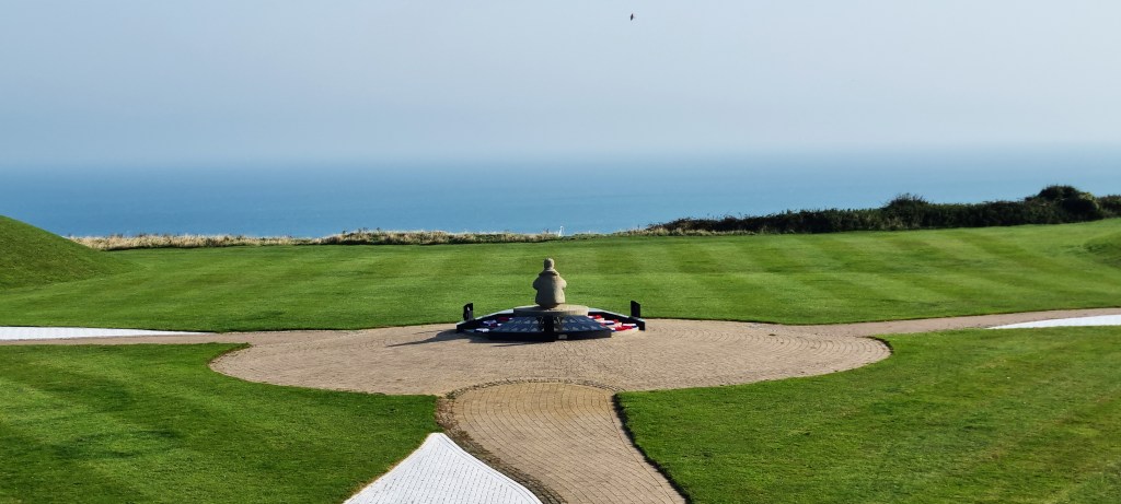
Now replete, we made our way to the bus stop on Priory Street, from where we caught a 102 service back to the Battle of Britain Memorial, arriving just after it opened at 10:00.

It was a fresh morning, but warming rapidly, the sky completely blue. We took a few more photos around the Memorial before heading across to the footpath. The prospect, over the Channel, was still slightly hazy.
After descending into a small chine and ascending the other side, we found ourselves in close proximity to the houses along the Old Dover Road. We discussed the challenges of planting in such windswept gardens.
We paused to chat with an elderly man, a plaster on his chin, who was simultaneously picking litter and blackberries.
He picked litter for the parish council. They equipped him with a hi-vis vest and a timesheet, requiring him to carry a mobile phone. He and his wife were very particular to blackberry and apple, but only added crumble when the grandchildren came to visit.
He had been born in the area, learning to swim in the sea just below.
We learned that one of the houses, opposite, was torn down by the 1987 hurricane and had to be rebuilt. Once called ‘Hurricane House’, it had since lost that moniker and was up for sale.
Thanking him for his time, we passed on to the Cliff Top Café, already doing good business. We chose the last available cliff-side table at which to enjoy a mid-morning coffee in the sun. I barely managed to find space for some delicious, home-made Millionaire’s Shortbread.
Resuming, I was rather taken with London House on the Old Dover Road. It just predates the First World War, but has now been split into three apartments.

Continuing along above Abbotscliffe Beach, we arrived at a point where the NDW abandons the precarious cliff-top path in favour of National Cycle Network 2. This runs roughly parallel with the main A20 road into Dover, chock-a-block with juggernauts.

There are several wartime structures dotted alongside this path, as well as various poems and artworks.
I was particularly struck by the Abbott’s Cliff sound mirror.

This early Twentieth Century technology was designed to give early warning of approaching aircraft, by detecting the sound of their engines. The large square block of concrete contains a shallow concave depression with a 20-foot diameter. A wooden operator’s shed, located alongside, has long since disappeared.

This was one of a pair of sound mirrors, linked to an acoustic research station at Hythe and was constructed in 1928. Such primitive listening devices became redundant when radar technology was introduced.
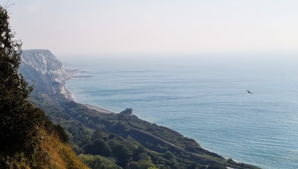
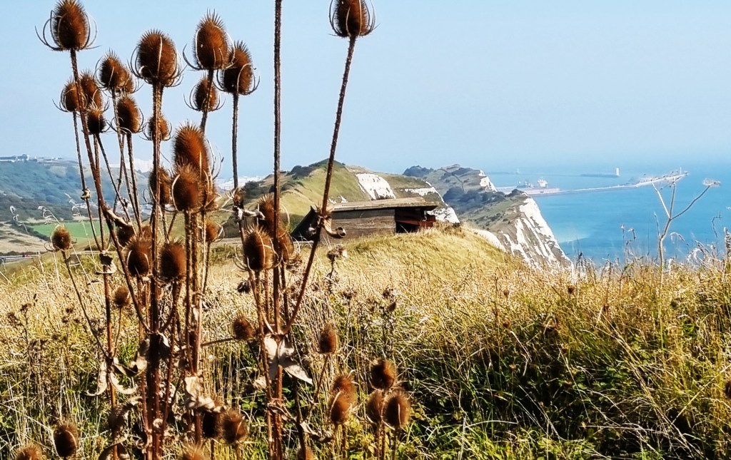
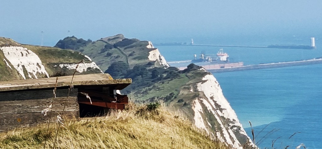
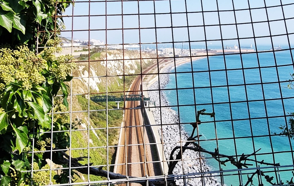
After passing a round gun emplacement, a huge white toadstool and a random rusty padlock on a fence, we drew abreast of Samphire Hoe, laid out far below.


This 30 hectare nature reserve was created from spoil excavated during the construction of the Channel Tunnel and has been fully reclaimed from the sea. The park, which opened in 1997, also hosts the Tunnel’s cooling station on the English side.


Soon we had Dover Harbour in view, teasels and a wartime shed in the foreground; Shakespeare Cliff in the middle distance.
Having passed the shed and admired three horses grazing in a field to our left, I suddenly found myself face-to-face with a small adder, sunning himself in the middle of the path. Fortunately, I was in front.
Having vaulted him like a spring lamb, I tried vainly to photograph him as he slithered away into the undergrowth. You can just see the tip of his tail!

Soon we had drawn abreast of another NDW milestone informing us that we had only two miles left. Then we were climbing Shakespeare Cliff, so named because it features in ‘King Lear’.
The Earl of Gloucester asks Edgar to convey him to the spot, so he can end it all:
‘There is a cliff
whose high and bending head
Looks fearfully in the confined deep
Bring me to the very brim of it…’
A little later, Edgar describes the scene:
‘Come on, sir; here’s the place: stand still. How fearful
And dizzy ’tis, to cast one’s eyes so low!
The crows and choughs that wing the midway air
Show scarce so gross as beetles: half way down
Hangs one that gathers samphire, dreadful trade!
Methinks he seems no bigger than his head:
The fishermen, that walk upon the beach,
Appear like mice; and yond tall anchoring bark,
Diminished to her cock; her cock, a buoy
Almost too small for sight: the murmuring surge,
That on the unnumbered idle pebbles chafes,
Cannot be heard so high. I’ll look no more;
Lest my brain turn, and the deficient sight
Topple down headlong.’
On October 7, 1980, a man was found at the foot of Shakespeare Cliff, having jumped from the top. His identity is still unknown.
Sadly, it remains a popular suicide leap.
Descending on the Dover side, we passed a weathered wooden seat, supposedly a close relation of the one near Farnham upon which we sat in April 2021.
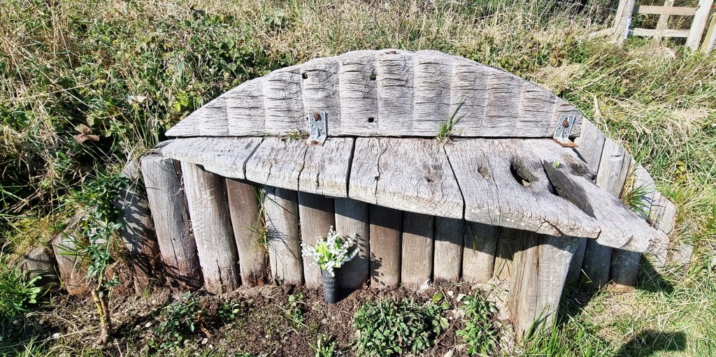
No-one seems quite sure what this one represents, but someone had placed a small vase of flowers underneath, in memory of ‘Mum’.
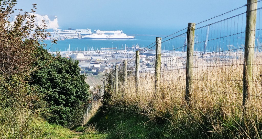
As we crossed above the railway line, the proximity of the Harbour suggested we had only a short distance left to walk, but we hadn’t counted on an extended tour of the hind parts of Dover.
We could see the frontage of the Citadel squatting above us on the so-called Western Heights. There are 54 buildings on this site, the oldest dating from 1779, but we seemed to be appreciating the Officers’ Quarters, constructed in the 1860s.

In the 1950s the War Office tried to offload the Citadel on to Dover Council, but they refused, so in 1955 it became a Borstal. From 2000 to 2015 it was Dover Immigration Removals Centre. In 2020 it was purchased by a company that is converting it in to a hotel, leisure and arts complex.
The guide book instructed us to turn underneath the A20 at a NDW fingerpost which also marks two European long-distance paths: E2 and E9.

Sadly, such is a minority’s hostility to all things European, these have been prised away.
After an extended trek through scrubland beneath the Citadel, we emerged beside the final remains of an early Twelfth Century church built by the Knights Templar. The site was abandoned before that century was out, but these traces were uncovered in the Nineteenth Century, during the construction of the fortifications above.

We passed the cavernous entrance to something called the Detached Bastion, crossed the road and climbed up to the even more impressive (and oppressive) Drop Redoubt, the second fortification built upon the Western Heights.

The original pentagon-shaped redoubt was constructed from 1804 to 1808, but was improved between 1859 and 1864, when additional defences were added on four of the five corners, along with gunrooms, officers’ quarters and cells (in which a U-boat crew was imprisoned in 1917).

We also had an excellent view of Dover Castle, sitting above the Town on the opposite cliff. It was begun in the 1180s, during Henry II’s reign, and withstood two sieges under King John before being modernised by Henry III.

Having descended the 129 steps from the Heights, we navigated our way through the streets of Dover to the Start/Finish line on Dover Promenade.

After a few minutes of feeling rather nonplussed we decided to celebrate with an alcoholic lunch at Cullins Yard, a nearby gastropub which looks out on to the Wellington Dock.
Braving vicious seagulls and importunate seagulls, we sat outside, Jacqui’s sticks at the ready. However, the local wildlife was remarkably well-behaved.
We fancied an ice cream dessert on the prom but, sadly, all the outlets had closed by 15:45.
Reluctantly, we headed instead for Dover Prior Station, from where we returned home via Waterloo East.
For part of the journey we were accompanied by a thirsty woman, equipped with a large jug of Pimms and a particularly loud ringtone.
Having struggled through Octordle, hamstrung by the ringtone and the effects of my lunchtime pint, I played her one of mine, which she said she rather liked.
And so ends the North Downs Way.
It has been an interesting experiment, teaming up with a friend to walk a long-distance trail.
For Jacqui, this has been a major achievement, given her typical fitness level across this period. During the middle section she came close to ‘getting the distance’, but sadly fell away a little in the latter stages.
Conversely, we have sometimes struggled to hold a slower-than-normal pace, finding that more fatiguing than maintaining our usual speed. I have also had to feign more patience than I possess.
Which has probably been good for me…I think.
TD
October 2024


Leave a comment