
Just two months after completing the section from Torcross to Starcross, we returned to Devon, resuming in Exmouth, on the opposite side of the Exe Estuary.
Having pushed ourselves perhaps a little too hard last time, we were fairly relaxed about our end point.
In the event, we were compelled, by the weather and increasingly complex travel arrangements, to walk on four days only, taking an additional rest day.
We traveled down on Wednesday, reverting to South Western Trains, having used the GWR service out of Paddington for the final time.
We boarded the SWR service to Exeter St David’s at Woking, alighting at Honiton, from where we caught a number 9 bus to Sidmouth, our base for the week.

Our schedule, excluding travelling days, was as follows:
- Day 1 (Thursday): Exmouth to Budleigh Salterton (5.4m);
- Day 2 (Friday): Budleigh Salterton to Sidmouth (7.1m);
- Day 3 (Saturday): Sidmouth to Seaton (10.3m);
- Day 4 (Sunday): Rest day;
- Day 5 (Monday): Seaton to Charmouth (10.1m)
- Day 6: Tuesday: Rest day.
So our total distance for the week was just 32.9 miles. That results in a cumulative total of 546.6 miles since Minehead, leaving just 83 miles to complete.
Weather conditions were surprisingly changeable for mid-June.
On Day 1, an afternoon forecast of heavy winds and rain dissuaded us from attempting Exmouth to Sidmouth in a single day.
In the event, neither wind nor rain was quite as bad as predicted, though visibility would have been seriously compromised. We prefer to enjoy the natural beauty around us.
On day 5, we were fully prepared to walk beyond Charmouth, at least as far as West Bay or Burton Bradstock, but the return journey involved a three hour journey via four buses. We decided that was beyond acceptable limits.

By and large, Sidmouth has good public transport links with the rest of the East Devon coastline, but multiple changes may be necessary for those wishing to travel into Dorset.
We rented Cheddar Cottage, on Cheese Lane, a quiet location some way back from the seafront. It cost us £785 for the week.
It had a large reception room and galley kitchen on the ground floor, with a small outside patio. Upstairs there were two good-sized bedrooms and a decent bath, always welcome to the stiff walker. We were very comfortable.
On arrival I struggled with the keysafe, but Tracy came to the rescue.
After unpacking and reconnoitering, we headed to The Prospect to buy fish and chips in what has become our first night ritual. Unfortunately though, the Prospect was closed, so we went to the White Horse Café instead.

Sidmouth
Unsurprisingly, Sidmouth sits at the mouth of the River Sid, which runs down the Sid Valley. The Sid is just six miles long, rising in the vicinity of Ottery St Mary before passing through Sidbury and Sidford respectively.
Sidmouth is listed in the Domesday Book as ‘Sedemuda’. Originally a fishing village, it had expanded into a market town by the Thirteenth Century.
A fort was built in 1628, on what is now the cricket field but, apart from that, not too much happened before the final years of the Eighteenth Century when, like several other East Devon coastal communities, it began to develop into a fashionable resort.

In 1819, Queen Victoria’s father, Edward Duke of Kent, came with his wife and newborn daughter to spend Christmas at what is now the Royal Glen Hotel. Unfortunately he died there on 23 January 1820.
During the 1830s, in an attempt to make Sidmouth more attractive, a concerted effort was made to build a harbour. In order to transport the stone needed, the Sidmouth Harbour Railway was laid along the seafront, across a small viaduct over the Sid and through a tunnel in the cliffs. For whatever reason – some say the steam locomotive was too big to fit in the tunnel – the project did not succeed.
But Sidmouth joined the railway network in 1874, via a branch line laid from Feniton, and this significantly boosted tourism, only for Beeching to strike in the 1960s.
The Town has several literary connections:
Elizabeth Barratt Browning (1806-61) lived here from 1833 to 1835, enjoying a romance with the local Congregational Minister, prior to her marriage with Robert, of course.
William Thackeray converted Sidmouth into ‘Baymouth’ in his novel ‘Pendennis’, serialised from 1848 to 1851, while Thomas Hardy refers to ‘Idmouth’ in his short story ‘The Romantic Adventures of a Milkmaid (1883).
Beatrix Potter visited several times at the turn of the 20th Twentieth Century, later featuring ‘Stymouth’ in ‘The Tale of Little Pig Robinson’ (1930).
JRR Tolkien also had a holiday home from 1934 to 1938 and is reputed to have written some early parts of ‘The Lord of the Rings’ here. Novelist R.F. Delderfield (1912-1972) also lived and died here.
The Sid Vale Association has placed 64 of its own ‘blue plaques’ around Sidmouth, marking places of historical interest.
There is a preponderance of attractive buildings: almost 350 are listed, most prominent being the Royal Glen Hotel (see above) and the Old Chancel on Coburg Terrace. This was rescued during the 1860s restoration of the parish church by local antiquary Peter Orlando Hutchinson, who re-erected it in his garden.
One of the most impressive properties is Peak House, built from Beer limestone in 1904, on the slopes of Peak Hill, just to the west of Sidmouth. Its first owner was Sir Thomas Charles Dewey, President of the Prudential Insurance Association, though it is now divided into four handsome flats.

Sidmouth today has a population of some 4,400 (14,500 in the wider Sidmouth area). There are about 2,300 households, roughly 60% of residents are aged over 60 and almost 1 in 7 is aged over 85.
The population is 96.1% White: there is comparatively little deprivation and some conspicuous wealth.
But it seemed to me a fairly relaxed and tolerant place, with a thriving local community. The shopping streets are fairly lively, with relatively few empty properties, though there are several charity shops and a vast number of cafes.
Details of the restaurants, pubs and cafes we visited are included is the sections below.

Day 1: Exmouth to Budleigh Salterton
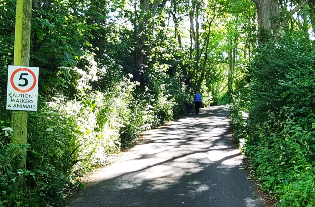
It looked cold and threatening as we caught the 09:11 157 bus service to Exmouth.
En route, and not for the last time, we enjoyed the leftover exhibits from the annual East Budleigh Scarecrow Festival.
Alighting near Exmouth Station, we strode down towards the Marina, to start from the point at which the ferry from Starcross would have dropped us. The Estuary looked a little choppy, with lowering clouds suspended above.
Tracy had her gloves on.
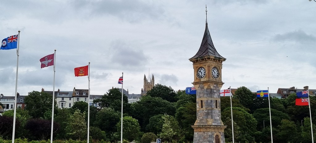
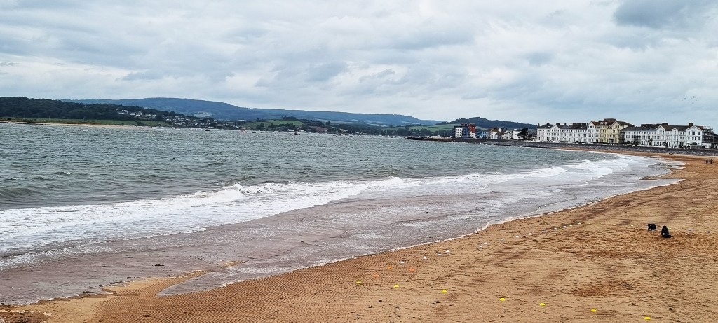
As we joined the promenade, the beach was almost deserted. Flags were flying around the Jubilee Clock Tower, constructed in 1897 for Queen Victoria’s Diamond Jubilee. Otherwise, the seafront seemed rather drab and uninviting.
With a population of 35,000, Exmouth is a substantial settlement in its own right, but has suffered from the proximity of Exeter, its much larger neighbour.
Although the harbour is comparatively shallow, Sir Walter Raleigh embarked on several of his voyages from here.
Like Sidmouth, Exmouth came into its own at the turn of the Nineteenth Century, once the fashion for salt water bathing took hold. Lady Byron visited in 1828, some four years after Byron’s death, spending the autumn here with her daughter. Lady Fanny Nelson, Lord Nelson’s widow, was also resident during the 1820s.
Other notable residents have included DJ Ed ‘Stewpot’ Stuart (1941-2016), actress Pauline Collins (b. 1940) and poet Patricia Beer (1919-99), all of whom were born here.
Shortly before reaching the public toilets, we encountered a large group of morose schoolchildren so, after commiserating with their teachers, we left them to enjoy the facilities undisturbed.
One or two particularly resilient groups were to be found on the beach, learning to surf, despite the wintry conditions.
And, beyond one group of trainee surfers, a brave kiteboarder had launched himself upon the waves.

At the eastern end, the sea wall was undergoing repairs, following storms at the end of 2023. The work was scheduled for completion before the 2024 tourist season began in earnest.
Shortly afterwards, I was pulled up by a shocking spelling mistake on a sign near a large brown tent-like structure, seemingly connected with the children we had passed earlier.

Turns out the same error is repeated on a local Facebook page.
Pausing briefly at an information panel about Orcombe Red Rocks, we decided to stop for coffee at Bumble and Sea, perched on the cliffside, beside the coast path as it begins to ascend.
I completely disregarded the queuing instructions, but there was no one around to complain.
We took our coffees and berry crumble cakes slightly further up the slope, to a sheltered bench, as rain had just begun to fall. Five D-Day flags were billowing, back-to-frontedly, just below.

Fortunately, it was only a shower, so we were dry as we emerged on to the cliff-top path heading towards Orcombe Point. We were following a not particularly friendly woman with a child and two dogs in tow.
Passing by a small red tent, pitched behind a bank in a field, we noticed two young men wrestling, while a third, squatting, looked on.
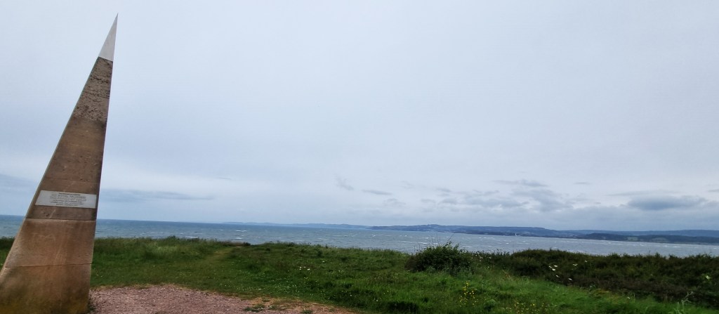
We admired the Geoneedle from a distance, and then at closer quarters.

I tried my hand at an arty ‘reflection shot’ in this information board, but failed dismally to pull it off.
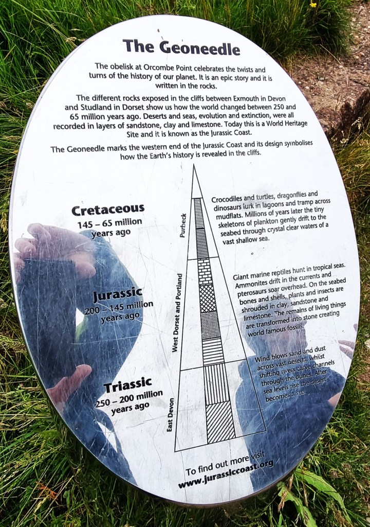
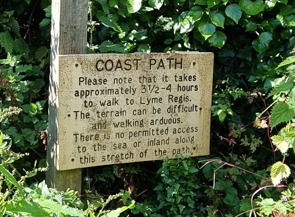
This 95-mile stretch of the Coast Path is a UNESCO World Heritage Site, with its own Jurassic Coast Trust.
According to the Trust’s website, this is the only place on earth where rocks from the Triassic, Jurassic and Cretaceous periods can be found alongside each other.
The Geoneedle marks the western end of the Jurassic Coast. Designed by sculptor Michael Fairfax, it was erected in 2002 to mark the UNESCO designation.
Almost immediately, our attention was drawn by the strange sight ahead, where a veritable caravan city sat cheek-by-jowl with a MoD firing range. The Devon Cliffs Holiday Park is owned by Haven Holidays. As far as I can see, the website doesn’t bother to mention the firing range just next door!
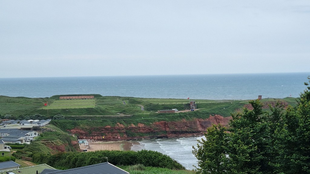
This is the Straight Point Range Complex, here since immediately after WW2. Now in the hands of the Defence Infrastructure Organisation (DIO), it was formally operated by the Royal Marines and still has a close relationship with the Marine training centre at Lympstone Commando.
There are six ranges here and, on the day we were passing, both day and night firing was in prospect. The latter may continue until fifteen minutes before midnight!
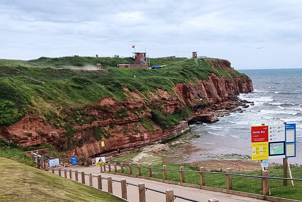
There is also a PT area, where recruits are regularly ‘encouraged’ to climb up 30-foot ropes in full kit.
Desultory firing was in process as we approached. Sandy Bay, the pristine beach just below, was completely deserted.

Eventually we emerged above Littleham Cove, on the other side of Straight Point, and could see Budleigh Salterton ahead. The weather forecast was still resolutely predicting both heavy rain and wind gusts of above 40 kmh.

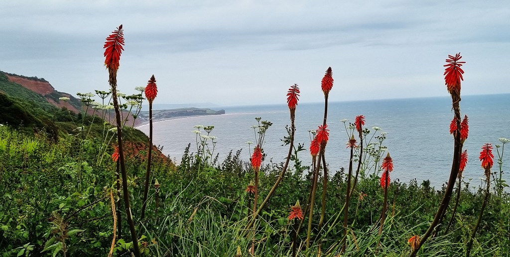
We paused to admire some red hot pokers and later some wild irises beside the path.
Then, arriving at the West Downs Beacon trig point, we met a young woman who was resting on a seat nearby. She told us she intended to push on to Sidmouth, so we shared our forecast with her.
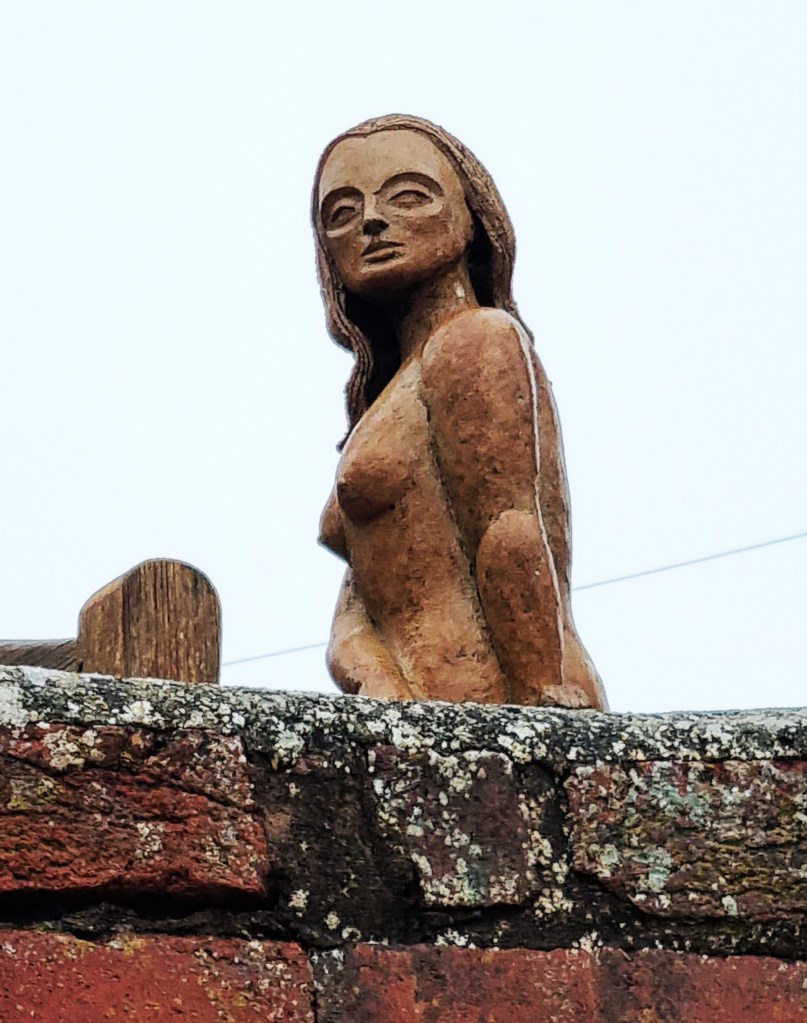
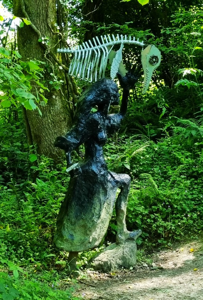
Arriving on Budleigh seafront, steady drizzle was falling. We called in to some unusual public conveniences, with the high tides marked on the wall outside, before spotting this bewitching mermaid.
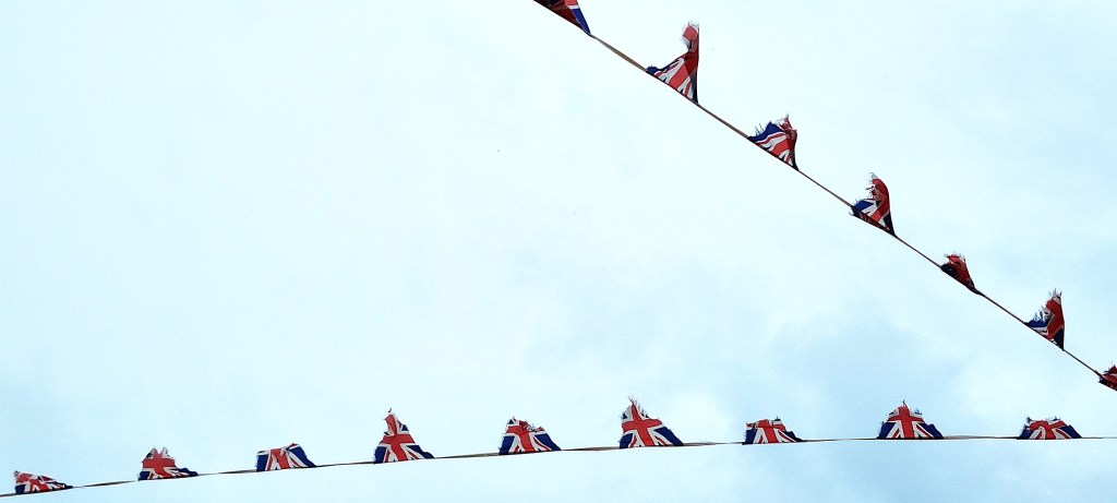
We finally came to rest in the shelter adjacent to the Longboat Café. The Union Jack bunting, much frayed by the elements, was fluttering above as we ate our sandwiches. Beyond the empty pebble beach, the brown sea looked inhospitable.
Budleigh lies immediately to the west of the Otter Estuary. Salterne, as it was once known, was isolated and mainly given over to salt workings.
Though Sir Walter Raleigh (1553-1618) was born in nearby East Budleigh, in ‘The Boyhood of Raleigh’ (1870), Millais posed his hero on this very seafront, just opposite a house called ‘The Octagon’ where he was staying.
Budleigh also became a fashionable watering place at the turn of the Nineteenth Century. By Millais’ time, it was thriving, enjoying the arrival of a branch line in 1897.
Hilary Mantel lived here until her death in 2022.
After lunch, we walked up the High Street, killing time by visiting charity shops before our bus arrived. The unseasonable gale had blown a carpet of leaves into the Oxfam Shop, but the heavy rain was not forthcoming.
At the bus stop, we met the young woman, who had decided to heed the weather forecast. She explained that she was planning to walk the entire Jurassic Coast in a week, and had pre-booked her overnight stays along the way.
I assumed she would head back to Budleigh next day, but she felt she would be unable to complete the additional distance so, sadly, would have to miss out this beautiful stretch.

As I have oftentimes explained, Tracy has been a stickler for walking in the right direction, taking each leg in the right order, with zero omissions.
Yet she seemed completely relaxed about this infringement – not even batting an eyelid!
On reaching Sidmouth, we headed straight to The Anchor Inn, to compensate for the poor weather and foreshortened walking day. Before leaving we booked a table for dinner the following evening.

Day 2: Budleigh Salterton to Sidmouth
The weather forecast was again distinctly iffy but, almost miraculously, we escaped with no more than five minutes of light rain.
While waiting for our morning bus to Budleigh Salterton, we met a couple from Harrogate who had been walking the Coast Path for the previous fortnight.
Arriving in Budleigh by around 10.00, we found the scenery noticeably improved under some blue sky.
We began with coffee at Fifty Degrees North, near the remains of the old lime kiln. A seagull tried to seize Tracy’s half of our morning snack, but just came up short.
We followed the Otter inland, through part of the Otter Estuary Nature Reserve. Its salt marsh and mudflats make it a veritable twitchers’ paradise.
We tried very hard to spot something unusual and, in desperation, I switched on Merlin, which managed to decipher the song of a Cetti’s Warbler – described as ‘elusive but noisy’ and precisely the bird we had been seeking at Slapton Ley.

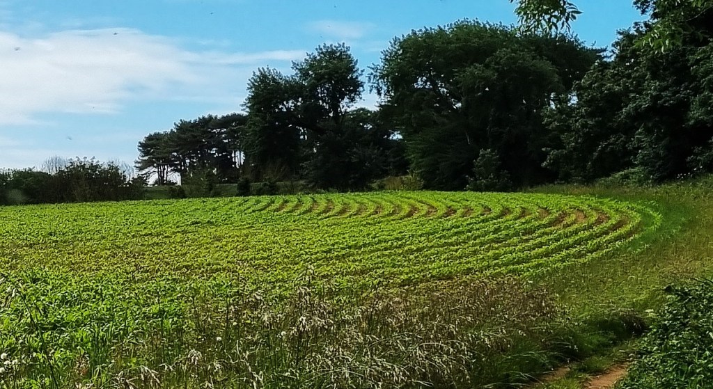
Crossing the Otter at South Farm Road, we doubled back on the opposite side, towards Otterton Ledge, past a beautiful sweep of furrows. The view over the mouth of the Otter towards Straight Point was stunning.
As I photographed across the final bank of pebbles – the point where the beach meets the River – a couple spontaneously embraced there.

Enjoying the beauty all around us, we shortly arrived at the Brandy Head Observation Post, which now doubles as holiday accommodation.
A gunnery research range was established here in July 1940, and placed at the disposal of the Gunnery Research Unit, As well as testing experimental ammunition, gun turrets, firing mechanisms and the like, it was also instrumental in developing the gyroscopic gun sight.

Nearby we met a local man who was walking his border collie – still young and not yet fully trained, but full of energy and enthusiasm.
Approaching Ladram Bay, a group of seven picnickers seated in the foreground made for a stunning photograph. But they didn’t bother to say hello.

There was a short diversion in place at Ladram Bay, following a significant cliff fall down on to the beach in May. Luckily no-one was hurt.
Continuing on our way, we passed an Australian walker who remarked that the weather was closing in. We had been looking for High Peak, but had to double back once we realised that the route up to the top wasn’t signposted.

We climbed up to the viewing platform, perched above the remains of another Iron Age hill fort. We decided to take our lunch here, but were disturbed by a runner who climbed to the top, took a photograph and promptly ran back down again.
By this stage, heavy clouds were fast approaching from inland, and we had a grandstand view as they did so. We decided to get under way before the deluge but, surprisingly, the deluge never arrived.

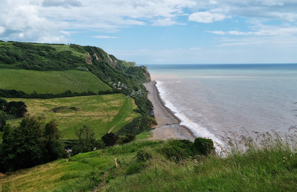
Soon we were on the approaches into Sidmouth. Passing Peak House, we made for Connaught Gardens and Jacob’s Ladder Beach, named after the wooden staircase that climbs from the sea wall up to the Gardens above. Although the original was built in the 19th Century, this is a modern replacement.
We found our way in to the Clock Tower Café for coffee and cake, though I was disappointed not to receive the ‘buzzer’ promised on the notice at the door.

Completing the section along the sea wall, we were back at our base by around 14:20.
That evening we returned to The Anchor – I had a very pleasant liver and bacon casserole, followed by cheesecake, while Tracy had fish pie and an ice cream sundae.
A customised mobility scooter, complete with ‘carriage’ for the owner’s wife, was stowed just behind us, next to the fish tank. During our dessert course, owner and wife took their leave, involving some careful steering on his part.
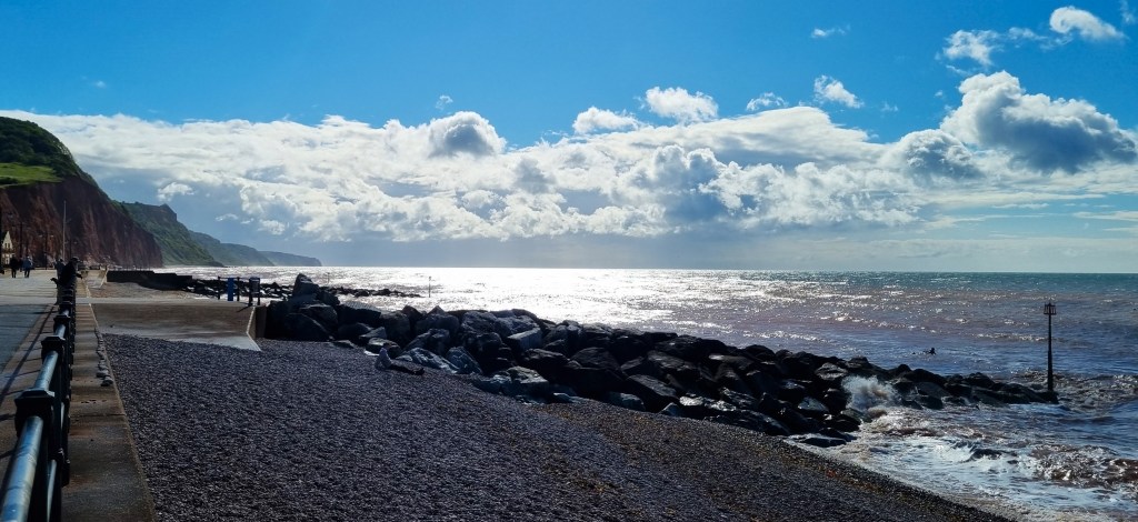
Day 3: Sidmouth to Seaton
We selected The Courtyard Café to provide our breakfast before departing Sidmouth. Both Tracy’s Half Courtyard and my Mushrooms on Toast with Bacon and Stilton were superb.
We spoke with an elderly lady who had recently lost both her dog and her husband. I had trouble hearing her over the noise of the coffee machine, and was anxious not to put my foot in it by accidentally confusing one with the other!

It was a bright, sunny morning. Striding along the esplanade, we encountered yesterday’s Australian, heading for breakfast.
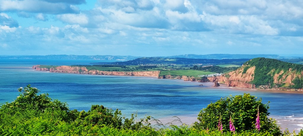
Reaching the cliffs above Sidmouth, the view behind us was exceptional.
We passed a marker stone informing us that:
‘South Combe Farm, including the summit of Salcombe Hill is dedicated by the owner as a permanent open space.
Vaughan Cornish, AD 1937’
Cornish (1862-1948) was a prominent geographer. Amongst his many books is one describing ‘The Scenery of Sidmouth’, published in 1940.

We came upon a small congregation of walkers next to the Frog Stone, allegedly taking the shape of a frog and said to have been placed here by a Royal Navy helicopter during an exercise in 1964.
The stone sits above the steep descent to Salcombe Mouth, which is followed by an equally steep ascent. At this point we overtook a small man with a big hat who we saw several more times during the course of the day.
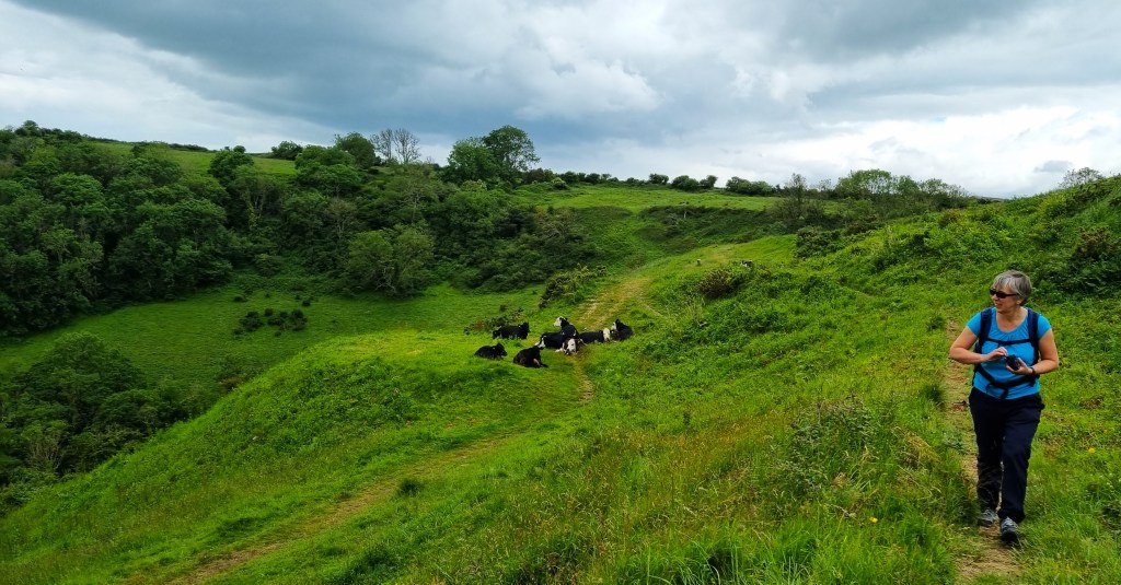
Continuing along the Dunscombe Cliffs, we were directed inland at Lincombe, passing through several fields that previously contained lime pits. The cows had chosen to sit on the path, but we were able to pass round them.
Before long we had arrived at the Weston Plats, previously market gardens worked by the people from Branscombe, nearby. The last Plat was abandoned in the mid-60s.
We descended steeply to the shingle beach at Weston Mouth, almost deserted, then made our way up again to Weston Cliff. Here we met for the first time a lady from Seaton, formerly a resident of Porlock, and her gentleman friend from Grassington.
Beneath us was the hidden pebble beach of Littlecombe Shoot, but we didn’t make the detour.
We passed the site of Berry Cliff, yet another Iron Age hill fort, and were soon facing the steep descent to Branscombe Mouth, passing Branscombe itself inland.

Branscombe has a church and two pubs. Parts of St Winifred’s Church may be Saxon, including the base of the tower, though the upper reaches date from the early 12th Century.
Branscombe supported the beer stone quarries nearby and was also a lace-making centre: Branscombe Point lace was popular in the mid-Nineteenth Century.

We stopped for a while on a bench overlooking Branscombe Mouth, eating part of our lunch there before using the facilities below. Then we sat for a while with coffee, overlooking the beach, and were joined there by the Seaton/Grassington pair.
The damaged container ship MSC Napoli was beached nearby in January 2007. Several sea containers were washed up on the beach and had their contents scavenged, including 17 BMW motorbikes.
The vessel was broken up in 2007, the final sections removed by 2009. The ship’s huge anchor now sits on the beach.
Before we had finished our coffees, the rain clouds had rolled in, blotting out the sun.
We had assumed that our route lay up the steep ascent to the cliff top, only to find that the coast path took us first through a smattering of chalets, then through thick vegetation along the Hooken Undercliff.

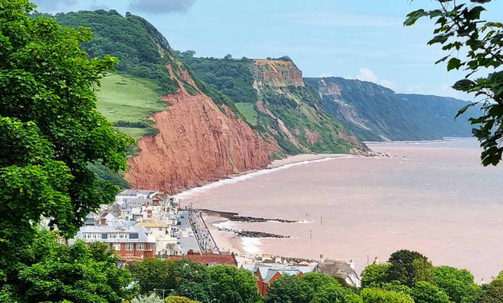
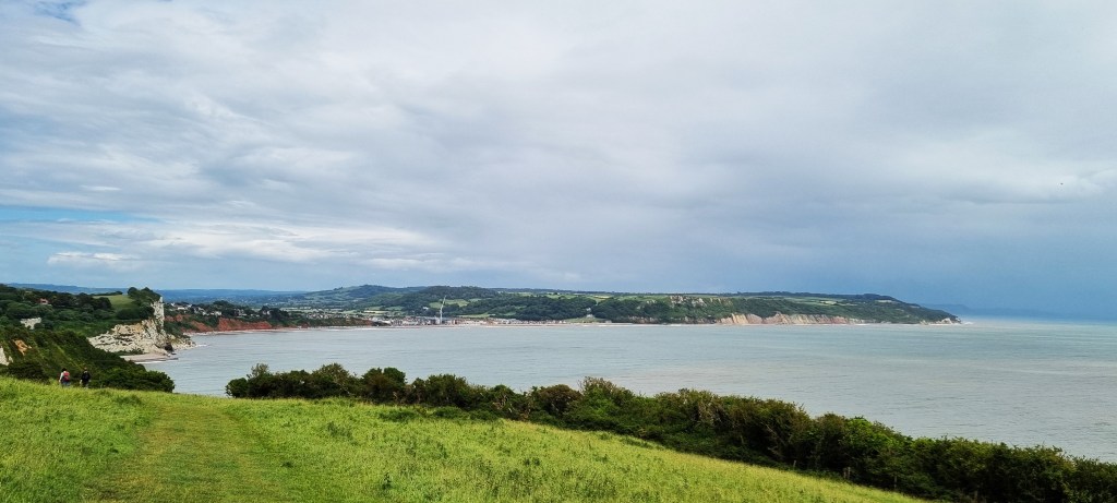
We finally made the ascent beside an outcrop of limestone cliffs. Arriving on the grassy uplands, we could see Beer and Seaton stretched out ahead, a large crane prominent on Seaton’s seafront.
Reaching Beer shortly after 14:00, we took the second part of our lunch overlooking the beach below.
Beer is an attractive village, notable for the allotments perched on a cliff immediately above the beach. Its name is probably derived from the Old English for ‘grove’ or ‘wood’.
The fishing industry is still alive here, but the boats must be hauled up on to the beach as there is no harbour.

The Beer Quarry caves have been mined for two millennia, though in the last century mining has shifted to a different quarry nearby.
Traversing the small gap between Beer and Seaton, we were taken in by the poor signage, finding ourselves on the original coast path route which was terminated by landslips in 2012.
Meeting the Harrogate couple again, we were together reassured by a local dog walker that the alternative route along the beach was safe, stumbling into Seaton slowly across the pebbles.

Then we stopped for ice cream at Scoops, only for Tracy’s to be attacked by a huge and vicious seagull.
The East Devon seagulls had it in for Tracy.
We took our cornets to the water’s edge, where the gulls were less predatory, before catching the 16:00 bus home.

Rest Day 1: Sidmouth
This was mainly given over to eating, though we began with a visit to Connaught Gardens, dating from the 1930s. They are named after the Duke of Connaught, Queen Victoria’s third son, who opened them in November 1934.
After touring the shops, we stopped for coffee at 14 Miles East where the cake stocks were unfortunately low.
But we made up for that in the afternoon, gorging on splendid cream teas at The Fort Café, its huge curved glass windows looking out upon the sea. I deployed the Devonian Variant – jam on top; scone sliced twice – Tracy the Orthodox Cornish approach.
As we watched, a crow pilfered a mayonnaise sachet from an outside table. I wondered if he would find it any easier to open with a beak.
That evening we dined on beer and curry at The Marine, also on the seafront. It was very quiet, and the staff had effectively clocked off before we were ready to leave.

Day 4: Seaton to Charmouth
We arrived in Seaton at about 10:00 the next morning. The sun made the place seem slightly more attractive, but only slightly.
For Seaton suffers by comparison with Beer to the west and tiny Axmouth to the east. High rise apartments have been permitted along the seafront, while the other, lower buildings seem ugly and ill-assorted.
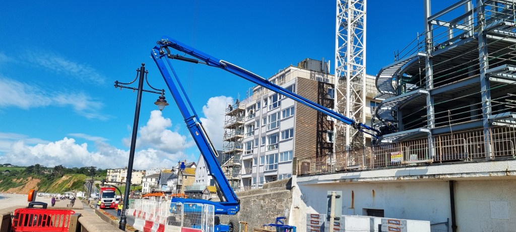
We had a close-up of a subsidiary blue crane in action as we passed by.
Seaton also used to have its own branch line, opened in 1868, which naturally helped its growth as a seaside resort. A Warner’s holiday camp was opened here in 1935 but closed in 2009.
In 1939, it was requisitioned as an internment camp for enemy aliens, including several Jewish refugees from Germany.
Today, Seaton hosts a narrow gauge electric tramway, opened in 1970, which runs three miles inland to Colyford and Colyton, using part of the old branch line.
We noted a plaque on the sea wall:
‘To commemorate the beginning of the third millennium AD, Seaton Town Council, in conjunction with the Axe Vale Runners, has placed distance markers every 100 metres along the 1160 metre Sea Front. “Seek, strive, attain” is the official Town aphorism for lifes [sic] journey. May you enjoy the walk and respect Seaton’s environment. May peace and goodwill be your constant companions in the new age.’
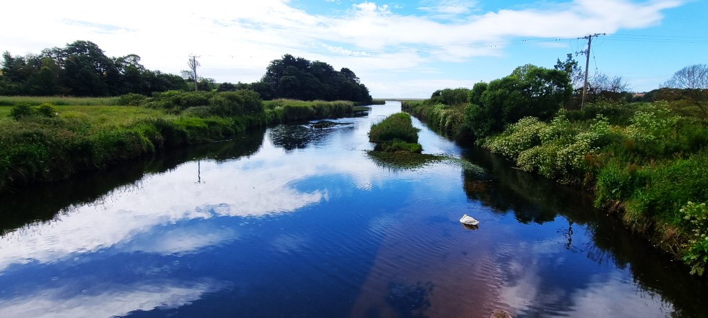
Natural beauty is restored upon reaching the Axe Estuary, after one crosses the oldest concrete bridge in England, built in 1877 to carry the railway.
Although a significant port in medieval times, Axmouth sits almost a mile back from the seafront. Substantial vessels could once sail along the Axe but, by the 14th Century, the shingle beach had begun to encroach. As the river mouth narrowed, salt marshes began to develop inland.
The coast path bypasses Axmouth, beginning a stiff climb up Squire’s Lane towards the Axe Cliff Golf Club. We passed a woman with a wolfhound on the way up, before briefly crossing the golf course and entering the approaches to the dreaded Undercliffs.
This noticeboard warns of the trials ahead.
The Undercliffs form a 13-kilometre stretch of dense woodland covering a long sequence of landslips, several of which occurred in the 18th and 19th centuries.
Much of the land was once grazed by sheep but is now too inaccessible.

The Great Landslip of Christmas 1839, at Bindon, created the feature known today as Goat Island. The incident caught the public imagination. Queen Victoria came to visit in the Royal Yacht, pleasure steamers brought thousands to see the upheaval and a (lost) musical composition – the Landslip Quadrille – was written by one Ricardo Linter (1818-86).
At Rousden Cliffs there are the remains of a steam pumping station, built by Sir Henry Peek (1825-1898) to service the mansion he was building near the village of Rousdon, above.

The only other feature of note was a preserved sheepwash. But, since this had very little to commend it, we passed straight by.
As one emerges on to Ware Cliffs, above Lyme Regis, there is an inscribed wooden fence celebrating Mary Anning (1799-1847), Mary Buckland (1797-1857) and Sarah Woodruff, the heroine of John Fowles’ 1969 novel, ‘The French Lieutenant’s Woman’, famously set in Lyme Regis.

We saw perhaps half a dozen walkers during the entire passage through the Undercliffs, so it was quite a shock to emerge into the crowds thronging Lyme Regis.
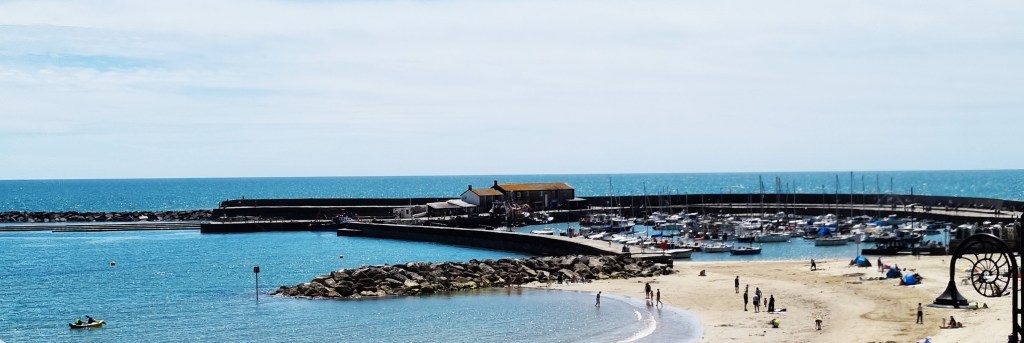
Lyme was once a notable port, earning its Royal Charter and its epithet ‘Regis’ in 1284, from King Edward I.

During the Civil War, it was besieged by Royalist forces, but relieved after eight weeks. On 11 June 1685, the Duke of Monmouth, illegitimate son of King Charles II, landed here, marking the launch of the Monmouth Rebellion.
Lyme Regis was another early tourist destination, benefiting from the Napoleonic Wars, which restricted the gentry’s movement abroad.
Jane Austen famously visited at least twice, basing part of ‘Persuasion’ (1817) here. Fowles was resident until his death in 2005 while Ian Gillan still has a home nearby.
Descending at Monmouth Beach, we fought our way along Marine Parade, looking for a café with space. Eventually, we found Beach and Badger, whose coffee restored me to equanimity.
I applied more sun cream.
We took our picnic lunch on a bench above Church Cliff Beach, watching the marauding gulls carefully.
Then, climbing up to reach the Charmouth Road Car Park, we tried our best to follow the guidebook’s instructions, which proved hopelessly misleading. (In fact, the turning off is a few hundred metres uphill, some way past the car park.)
Crossing fields, we had a great view down upon Lyme Regis.

Soon afterwards we passed this sculpture. It turns out that both this and the fence are markers for the parish boundaries.
This also celebrates palaeontologist Mary Anning and is by Greta Berlin.
There is still a potential route along the cliff top to Charmouth, but the land belongs to Lyme Regis Golf Club. Following cliff falls, the Club has been unwilling to allow walkers along this route, because they might encroach upon the sacred 16th hole.
So one must now walk across the golf course, braving the stick-wielding toffs and their little white balls, then for some way along its edge, until one reaches Old Lyme Hill.
To be fair, this is an improvement on the previous diversion, which took walkers on to the A3052, but the golfers have undoubtedly preserved the best views for themselves.

Descending through Charmouth, we were stopped by a couple with dog enquiring about the aforementioned route to Lyme Regis. I waited impatiently, because the Beach Café was advertising a 16:00 closure and I desperately wanted an ice cream!
We made it with a few minutes to spare, taking our ice creams to a bench while two paragliders passed overhead.

Moving to the beach, we enjoyed a rejuvenating paddle. It was heavily nostalgic of my childhood holiday in Charmouth, aged 10.

Then it was time for our three-bus marathon back to Sidmouth. On the way, we spotted advertisements for the imminent World Nettle Eating Competition. This year’s male winner managed to chomp through 116 feet of them.

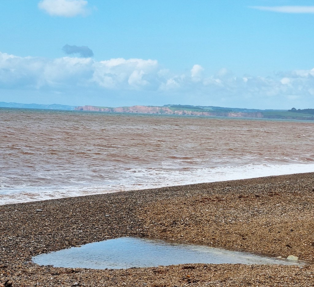
Fortunately each of our buses ran to time and we made it home by 19:00. As an added bonus, Holm Bush Car Park gave us a spectacular view of Lyme Bay far below.

Rest Day 2: Sidmouth and Otterton
After a late start we walked west out of Sidmouth, then inland to reach the village of Otterton, on the east bank of the Otter.
After visiting the celebrated café at Otterton Mill, we followed the river back to the coast, unsuccessful in our efforts to spot a beaver or a rare ornithological specimen.
Arriving once more at Budleigh, we had lunch in the Longboat Café on the seafront, before catching the bus back to Sidmouth.
Our traditional final evening meal was at Neil’s Restaurant where we both enjoyed hake and spinach. There were many regular customers in attendance, including the second homers behind. The lady wore a single yellow marigold glove, apparently to protect a hand injury.
Next day we left Cheddar Cottage by 10:00, returning home the way we had come, via Honiton and Woking.
TD
July 2024


Leave a comment